On North High Street at Plum Street, on the left when traveling north on North High Street.
We honor the churches of Duncannon that served the community over 100 years ago. Our Christian tradition began in 1804 with the Presbyterian Church at the Mouth of the Juniata and continues to this day.
"Sabbath Day" by Scotty . . . — — Map (db m242162) HM
On Cumberland Street at Water Street, on the left when traveling east on Cumberland Street.
The Clark's Ferry Bridge was part of the Main Line Pennsylvania Canal built in 1828. Mules walked on a cantilevered walkway outside the structure and towed canal boats across the river. The dam below the bridge was known as Green's Dam and . . . — — Map (db m119917) HM
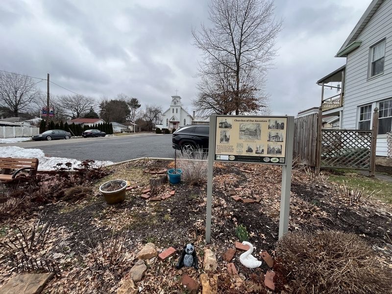
On North Market Street at Clark Street, on the left when traveling north on North Market Street.
The Clark's Ferry Tavern, the oldest building in Duncannon, was originally built by John or Daniel Clark as early as 1788 and later enlarged. It served vital roles as a docking point for the ferry crossing the Susquehanna River, an inn, tavern, . . . — — Map (db m119883) HM
On Cumberland Street at High Street, on the right when traveling west on Cumberland Street.
Built in 1889, this was the first building in Perry County to be devoted exclusively to banking. The Duncannon National Bank was the first National Bank established in the county and started operations January 1, 1890. Its president was John . . . — — Map (db m119949) HM
On High Street just south of Maple Street, on the right when traveling south.
The two-story brick schoolhouse was built in 1873 at the corner of High and Maple Streets at a cost of $9275. The cupola contained a two-hundred pound bell from VanDusen and Tift of Cincinnati. All grades used the four-room school until it closed . . . — — Map (db m242160) HM
On South Market Street south of Cumberland Street, on the left when traveling south.
Once lined with shade trees and featuring a public fountain in the town green, the Duncannon Square has been the center of activity since the very beginning.
The square featured the National Hotel in the northwest corner and the Laird Hotel in . . . — — Map (db m119912) HM
On South Main Street at US 11/15 Northbound Access Ramp, on the right when traveling south on South Main Street.
The Wister Mansion was at the intersection of New Bloomfield Road and Main Street, now the location of the American Legion. It was the home of John Wister who at age 14 became an errand boy at the Duncannon Iron Works and rose to become its . . . — — Map (db m119906) HM
On South Main Street at US 11/15 Northbound Access Ramp, on the left when traveling north on South Main Street.
On February 4, 1887 a charter was granted by the Commonwealth for the construction of the Perry County Railroad from Duncannon to New Bloomfield. On September 12, 1889 the first locomotive entered New Bloomfield. The Duncannon Station sat just to . . . — — Map (db m119908) HM
On Cumberland Street at Water Street, on the left when traveling east on Cumberland Street.
The railroad steamed into Duncannon in 1848 and was a major factor in the growth and development of the area. In the mid-1800s the railroad ran through the center of town on Apple Tree Alley. Around 1865 the earliest station was built at the corner . . . — — Map (db m119919) HM
On Shermans Valley Road (Pennsylvania Route 274) 0.4 miles east of Veterans Way (Pennsylvania Route 74), on the right when traveling west.
1972: Little Buffalo State Park dedicated.
1982: Perry County Council of the Arts formed.
1995: First McDonald's opened in Howe Township.
2010: First county traffic light installed in Marysville.
2020: . . . — — Map (db m242126) HM
Near Shermans Valley Road (Pennsylvania Route 274) 0.4 miles east of Veterans Way (Pennsylvania Route 74), on the right when traveling west.
ca. 1842: African American settlement near Millerstown.
1850: Fugitive Slave Act enacted; Compromise of 1850.
1852: First fair by the Agricultural Society of Perry County
Near Shermans Valley Road (Pennsylvania Route 274) 0.4 miles east of Veterans Way (Pennsylvania Route 74), on the right when traveling west.
1756: French & Indian War began.
1756-1763: Indians drove settlers form Shermans Valley.
1766: Donegal Presbytery authorized Perry County congregations.
Scotch-Irish settlers moved north from Carlisle . . . — — Map (db m242040) HM
On Shermans Valley Road (Pennsylvania Route 274) 0.4 miles east of Veterans Way (Pennsylvania Route 74), on the right when traveling west.
1929: Stock market crash.
1932: PA unemployment at 35%. Banks fail nationwide.
1933: President Franklin D. Roosevelt initiated New Deal.
1935: Social Security enacted.
After WW I ended, industrial . . . — — Map (db m242106) HM
On Shermans Valley Road (Pennsylvania Route 274) 0.4 miles east of Veterans Way (Pennsylvania Route 74), on the right when traveling west.
1961-1963: PA law required school district consolidation.
1969: First men on the moon.
1983: First mobile phone cost $4000.
1989: International protocol enabled the World Wide Web
Near Shermans Valley Road (Pennsylvania Route 274) 0.4 miles east of Veterans Way (Pennsylvania Route 74), on the right when traveling west.
1775: Revolutionary War began.
1776: Independence declared.
1781: Battle of Yorktown ended the fighting.
1783: Treaty of Paris recognized US independence.
Many Perry Countians served in the . . . — — Map (db m242042) HM
Near Shermans Valley Road (Pennsylvania Route 274) 0.4 miles east of Veterans Way (Pennsylvania Route 74), on the right when traveling west.
1862-1863: Prominent Perry Countian A. L. McClure advised President Lincoln.
1863: Emancipation Proclamation issued.
1865: Robert E. Lee surrendered and Civil War ended.
As the end of June 1863, . . . — — Map (db m242079) HM
Near Shermans Valley Road (Pennsylvania Route 274) 0.4 miles east of Veterans Way (Pennsylvania Route 74), on the right when traveling west.
① Adair's Bridge, 1864, Shermans Creek, refurbished 2007.
② Bastline Bridge, 1871, Shermans Creek, refurbished 2007.
③ Book's Bridge, 1884, Shermans Creek, rebuilt 2004.
④ Clay's Bridge, 1890, Little Buffalo Creek, . . . — — Map (db m242041) HM
Near Shermans Valley Road (Pennsylvania Route 274) 0.4 miles east of Veterans Way (Pennsylvania Route 74), on the right when traveling west.
1866: First bank organized in New Bloomfield.
1869: First water company organized in Blain.
1891: First telephone line strung between Newport and Loysville.
1898: Newport Square lit by electricity.
Near Shermans Valley Road (Pennsylvania Route 274) 0.4 miles east of Veterans Way (Pennsylvania Route 74), on the right when traveling west.
1821: Harrisburg & Millerstown Turnpike chartered.
1829: Pennsylvania Canal opened through Perry County.
1849: Pennsylvania Railroad completed through Perry County.
The building of turnpikes, . . . — — Map (db m242054) HM
Near Shermans Valley Road (Pennsylvania Route 274) 0.4 miles east of Veterans Way (Pennsylvania Route 74), on the right when traveling west.
16,000 years ago: Native Americans arrived in North America
11,000 years ago: Paleoindians settled in Perry County
1,000 years ago: Maize farming villages . . . — — Map (db m242037) HM
Near Shermans Valley Road (Pennsylvania Route 274) 0.4 miles east of Veterans Way (Pennsylvania Route 74), on the right when traveling west.
David Gring, builder of the Newport and Sherman's Valley Railroad, installed these lions in front of his East Newport mansion in the 1880s. They were carved by Adolph V. and William David Hombach at their Marble and Granite works on South Front . . . — — Map (db m242084) HM
On Shermans Valley Road (Pennsylvania Route 274) 0.4 miles east of Veterans Way (Pennsylvania Route 74), on the right when traveling west.
Made possible in part from the generous gifts of:
Allen E. Hench, Esq. of Newport Borough | Connie L. Hench Houch of Penn Township
Kirk R. Hench of Saville Township
In honor of the Hench and associated families . . . — — Map (db m242036) HM
On Green Park Road at Veterans Way (Pennsylvania Route 74), on the right when traveling south on Green Park Road.
While quiet today, Green Park once bustled with energy. Thanks to abundant clay and sand for brickmaking, reliable water power from Montour Creek and entrepreneurship residents, the area presented an ideal location for early industry. . . . — — Map (db m242133) HM
On Green Park Road, 0.2 miles north of Shermans Valley Road (Pennsylvania Route 274), on the right when traveling west.
The present Green Park School is the third building on this property and is the forerunner of the current West Perry school complex. A log subscription school building was first constructed west of the present site at Green Park as early as 1815. . . . — — Map (db m242139) HM
Near South Carlisle Street south of Sheaffers Valley Road (Pennsylvania Route 233), on the right when traveling south.
Henry Fetter (1793-1863) constructed this Federal Period home in 1848. One of the first settlers, Fetter served as prothonotary, founding director of two schools, a captain of the Landisburg Artillery, a director of the never-built Duncannon and . . . — — Map (db m242156) HM
On North Carlisle Street (Pennsylvania Route 233/850) at Sheaffers Valley Road (Pennsylvania Route 233), on the left when traveling north on North Carlisle Street.
1752 - First legal settler, Andrew Montour
1799 - First physician, Dr. John Creigh
1820 - First Perry County Court House
1821 - First agricultural fair
1822 - First Newspaper, The Perry Forester . . . — — Map (db m242142) HM
On East Water Street just east of South Carlisle Street (Pennsylvania Route 850), on the left when traveling east.
The coursed sandstone Dunbar-Creigh House on Water Street was completed in the early 1800s. It best exemplifies the Georgian style with its symmetrical façade, central door, multi-pane windows and molded cornice.
Built in 1896 by . . . — — Map (db m242149) HM
On South Carlisle Street (Pennsylvania Route 850) at Kennedy Valley Road, on the right when traveling south on South Carlisle Street.
The early years: From 1777 to 1819, pastors from the Reformed congregation in Carlisle preached among German Reformed families in Sherman's and Fishing Creek valleys. Residents established the first churches of what became known as the . . . — — Map (db m242144) HM
On North Carlisle Street at Shaeffers Valley Road (Pennsylvania Route 233), on the left when traveling north on North Carlisle Street.
On March 22, 1820, Perry County was formed out of part of Cumberland County, and Landisburg was named the temporary county seat by an impartial panel of three people selected by Governor William Findlay.
Reflecting the pioneer beginnings of . . . — — Map (db m242140) HM
On East Water Street just east of South Carlisle Street (Pennsylvania Route 850), on the left when traveling east.
Constructed between 1794-1809 of Pennsylvania stone, this 'bank' house has served as a residence, a legal and law office, an inn and a stage coach stop. John Dunbar purchased a lot measuring 150 feet by 60 feet from borough founder Abraham Landis . . . — — Map (db m242148) HM
On Market Street at Race Street, on the right when traveling north on Market Street.
"The Leading Merchants" - In 1847, Jacob and Michael B. Holman founded a mercantile business in Liverpool, PA on the Kerstetter property on Front Street. Michael early left the partnership, and Jacob later brought his two sons Park and . . . — — Map (db m119870) HM
Near West Juniata Parkway (County Road 1015) north of Perry Valley Road, on the right when traveling south.
Millerstown, founded in 1790 as the first borough in Perry County, has long served as a transportation hub. From the time of settlement river arks and flatboats navigated the Juniata River. As early as 1822 a stage road, called a turnpike, . . . — — Map (db m241856) HM
On West Juniata Parkway (County Road 1015) at Route 22/322, on the right when traveling south on West Juniata Parkway.
By the early 20th century, local farms began to offer dairy products that gradually replaced the need for a family cow. Fertile Pfoutz and Raccoon valleys provided ideal grazing conditions. Enterprising farmers stored winter ice . . . — — Map (db m241866) HM
On West Juniata Parkway (County Road 1015) north of U.S. 22/322, on the right when traveling south.
From its beginning, Millerstown residents have enjoyed leisure activities with a community focus, including sports, music, theater, and outdoor recreation. Hunting and fishing provided family food as well as many tall tales. The Juniata River . . . — — Map (db m241865) HM
On West Juniata Parkway (County Road 1015) north of Perry Valley Road, on the right when traveling south.
Situated at the intersection of major roads, a railroad, and a canal, Millerstown flourished in the 19th and 20th centuries. Stage coaches, horse-drawn wagons and carriages gave way to automobiles by 1913, when some Millerstown residents owned . . . — — Map (db m241860) HM
Near West Juniata Parkway (County Road 1015) south of U.S. 22, on the right when traveling south.
From its beginnings in the 18th century, Millerstown has been an important transportation hub for the area. By 1830 a stage road from Liverpool passed through Millerstown to points west, and the Juniata River canal connected the Borough to the . . . — — Map (db m241863) HM
Near East Sunbury Street (Pennsylvania Route 17) west of Nace Street, on the right when traveling west.
In 1808, the Presbyterian Church served as the first School house in Millerstown. It was adjacent to the church cemetery on "Grave Street." The Borough enlarged the school in 1834 and combined it and a Juniata River school into one . . . — — Map (db m241816) HM
On North Market Street (County Road 1015) north of Mulberry Alley, on the right when traveling north.
The Cochran-Anspach House was built in 1821 by Isaiah Clark for Thomas Cochran, one of the first settlers of Millerstown. Cochran and his three brothers, Protestants, were forced to leave their native Ireland. After disposing of their land . . . — — Map (db m241846) HM
On North High Street, 0.1 miles north of Apple Street, on the right when traveling north.
Early settler, tavern keeper, Indian fighter, and founder of Millerstown all describe the life of David Miller. By 1763, Miller had settled in Rye Township, Perry County, on a tract at the present-day location of Donnally Mills, where he . . . — — Map (db m241811) HM
On North Market Street (Route 1015) just south of Spring Street, on the right when traveling north.
Born of two prominent Millerstown families on October 21, 1837, James Beaver led a distinguished career in many areas of public service. His paternal grandfather, The Rev. Peter Beaver, was an itinerant Methodist minister who settled . . . — — Map (db m241852) HM
On North Market Street (County Road 1015) at East Sunbury Street (State Route 17), on the right when traveling north on North Market Street.
Surrounded by highly productive farmland and served by good roads, the Pennsylvania Canal and the Pennsylvania Railroad, Millerstown became a commercial hub for northeastern Perry County during the 19th century.
On Cluck's Corner, at the . . . — — Map (db m241820) HM
On North Market Street (County Road 1015) just north of Spring Street, on the right when traveling north.
Millerstown's first postmaster, Thomas Cochran who arrived in 1801, built many of the fine stone houses which still stand. The Millerstown borough was officially created and a town council formed in 1848. The chief burgess was Abraham Addams and . . . — — Map (db m241854) HM
On North High Street at Greenwood Street, on the right when traveling south on North High Street.
Reverend Simon Pile, a circuit rider within The Juniata Circuit of the Methodist Episcopal Church, first brought Methodism to Millerstown in 1784. Early gatherings probably were in private dwellings or the open air.
In 1832, services moved . . . — — Map (db m241804) HM
On North High Street, 0.1 miles north of Apple Street, on the right when traveling north.
For thousands of years, Native Americans built villages along the fertile Cocolamus Creek and Juniata River—lands with havens for hunting and rich land for agriculture. Likewise, early pioneers, recognizing opportunities here, warranted land in . . . — — Map (db m241815) HM
On North Market Street (County Road 1015) just north of Spring Street, on the right when traveling north.
On this site in 1800 brothers William, Caleb and Joshua North of a prominent local family, constructed the Rock Oak Tannery the town's first industry. After a business sojourn in Thompsontown, the brothers returned in 1814, enlarged the . . . — — Map (db m241853) HM
On West Main Street (Pennsylvania Route 274) just west of Spring Alley, on the left when traveling west.
In 1832, a Governor's commission tasked with establishing a centrally located, permanent seat for Perry County government, accepted George Barnett's donation of eight acres in what became New Bloomfield. With the construction of a courthouse in . . . — — Map (db m242035) HM
On West Main Street (Pennsylvania Route 274) west of North Carlisle Street, on the right when traveling west.
In early 1837, educator Robert Finley began a Latin Grammar School in a second floor room of Dr. Jonas Ickes' tavern on the Square in New Bloomfield. While Finley had filed papers creating the school in 1836, it was formally incorporated by the . . . — — Map (db m242026) HM
On East Main Street (Pennsylvania Route 34) west of Printers Alley, on the right when traveling west.
Since 1825, Perry County has constructed numerous buildings for judicial and legal services. The most prominent is the County Court House, the oldest in Pennsylvania and, since 1975, on the National Register of Historic Places.
After World . . . — — Map (db m241986) HM
On West Main Street (Pennsylvania Route 274) west of South Carlisle Street (Pennsylvania Route 34/274), on the left when traveling west.
In 1898, a generation after the Civil War (1861-1865), Perry County citizens dedicated in New Bloomfield a monument to those soldiers and sailors who participated in that conflict to secure the Union and advance the freedom of all Americans. . . . — — Map (db m242029) HM
On Big Spring Road (Pennsylvania Route 274), on the right when traveling south.
The township's population was much larger in the 19th century than it is today, with many of the 2,000 residents engaged in farming, tanning, milling, timbering, and other industries. The church was used from 1857 until just after World War II, . . . — — Map (db m163548) HM
On Dix Hill Road south of Keystone Way (Pennsylvania Route 34), on the right when traveling north.
The Perry Historians began in 1976 as a grass-roots organization, largely through the efforts of Harry A. Focht and Jerry A. Clouse, to preserve the oral and genealogical history of Perry County that was slowly slipping away. The group set out to . . . — — Map (db m241985) HM
On State Park Road, 0.1 miles south of Little Buffalo Road (Pennsylvania Route 4010), on the right when traveling south.
This tavern operated as early as 1798. The tavern's name refers to a large blue ball suspended from a pole; when raised, it announced to travelers and teamsters that overnight accommodations were available. Blue Ball Tavern played an important . . . — — Map (db m241984) HM
On South 2nd Street south of Market Street (Pennsylvania Route 34), on the right when traveling north.
Some of the following structures are no more; some have had their original uses altered by time and circumstance. They are part of Newport's past where citizens lived, worked and played.[Captions:]
The Old Town . . . — — Map (db m241964) HM
On Oliver Street west of North Spruce Street, on the right when traveling west.
William 'Billy' Richard Cox (1919-1978) was by all accounts one of the best fielding infielders whoever played in the Major Leagues. A 1939 graduate of Newport High School he started his career at shortstop for Harrisburg in the . . . — — Map (db m241931) HM
On Mulberry Street west of South 3rd Street, on the left when traveling east.
Since 1925, the Newport Citizen's Fire Company No. 1 has provided Newport and surrounding township with an ever increasing level and safety efficiency and service. During the past century, the Company has occupied three fire halls, each new . . . — — Map (db m241974) HM
On Mulberry Street west of South 3rd Street, on the left when traveling west.
The 1956 Fire Hall
To house augmented equipment and vehicles, the present Company twice has moved to larger quarters — in 1956 to 50 South 3rd Street and in 1999 to 301 Mulberry Street.
The 1956 fire house was constructed on a lot . . . — — Map (db m241979) HM
On Mulberry Street west of South 3rd Street, on the left when traveling west.
Commitment and Courage
Over the decades, dedicated volunteers have invested countless hours in training, practice and responding to thousands of fires and accidents. This involves long hours away from family, employment and relaxation. On . . . — — Map (db m241982) HM
On South 2nd Street, 0.1 miles south of Mulberry Street, on the right when traveling south.
In 1762, David English, Sr., a yeoman farmer from what is now Dauphin County, began to claim land that in time became part of Miller and Oliver Townships and Newport Borough. With an eye for business, he constructed grist mills on the Little and . . . — — Map (db m241968) HM
On Market Street (Pennsylvania Route 34) at 4th Street (Pennsylvania Route 849) on Market Street.
Newport began as a river community, a shipping center for the farm and forest products of the county's interior. By the 1790s flatboats floated goods down the Juniata to markets in the Susquehanna Valley. In the 19th century the canal and . . . — — Map (db m220368) HM
On Market Street (Pennsylvania Route 34) west of South 2nd Street, on the left when traveling west.
In 1988 the National Park Service listed the Newport Historic District on the National Register of Historic Places in recognition of its splendidly preserved examples of 19th and 20th century architecture. Over 400 structures dating from 1817 to . . . — — Map (db m241955) HM
On Market Street (Pennsylvania Route 34) at South 2nd Street, on the left when traveling west on Market Street.
The last decades of the 19th century and first decades of the 20th century were the high mark of Newport and Oliver Township industrialization and manufacturing. This pen and ink drawing by T.M. Fowler, Morrisville PA, portrays a prosperous river . . . — — Map (db m241946) HM
Near Oliver Street west of North Spruce Street, on the right when traveling west.
On April 6, 1917, the United States declared war on Germany and began the arduous task of recruiting and training an army for battle in France. From May 2 to August 14, 1917, Company F, 3rd Regiment of the Pennsylvania National Guard gradually . . . — — Map (db m241926) HM
On North 2nd Street just north of Market Street (Pennsylvania Route 34), on the left when traveling north.
During the first two decades of the 20th Century, a new type of business and social association developed in the nation. Generally founded in the mid-west, these clubs promoted good citizenship, civic benevolence and ethical business practices. . . . — — Map (db m220377) HM
On Market Street (Pennsylvania Route 34) just west of South 2nd Street, on the right when traveling east.
For over two centuries, the square has been the central business district, a major thoroughfare and a gathering place for parades, politicians and celebrations. When the Paul Reider family surveyors designed what became Newport in the . . . — — Map (db m220393) HM
On Market Street (Pennsylvania Route 34) at 4th Street (Pennsylvania Route 849), on the right when traveling west on Market Street.
The motor vehicle both altered and saved the local economy. In 1903 businessman W. H. Gantt owned one of the first automobiles in the borough. By 1925 the livery stables and carriage manufacturers in Newport were out of business. The town . . . — — Map (db m220375) HM
On Market Street (Pennsylvania Route 34) 0.1 miles west of North Spruce Street, on the left when traveling east.
At the hub of Newport's four historical transportation arteries — the Juniata River, the 1829 Pennsylvania Canal, the 1849 Pennsylvania Railroad (now Norfolk Southern), and State Highway 34, stands a tribute to the men and women who have provided . . . — — Map (db m220578) HM WM
This Newport Heritage Park location was made possible in 2015 by the generous community spirit of the congregation of St. Paul’s Lutheran Church.
First recorded Lutheran services were held in Newport homes and school houses by the Rev. John W. . . . — — Map (db m89726) HM
On Oliver Street west of North Spruce Street, on the right when traveling west.
On this site from 1871 to 1931 the Bechtel Tannery operated a large industrial complex that produce leather sold throughout the United States and Europe. The leather received numerous industry awards for high quality including a medal at the . . . — — Map (db m241904) HM
On Market Street (Pennsylvania Route 34) at 4th Street (Pennsylvania Route 849) on Market Street.
In November 1829, a canal boat loaded with elected officials arrived in Newport from Mifflintown. The boat was drawn by two white horses. An American flag was flying, a cannon roaring and a band playing! Thus, the canal era officially opened . . . — — Map (db m175051) HM
On South 2nd Street, 0.1 miles south of Mulberry Street, on the right when traveling north.
Built in 1889, The Church of the Nativity was constructed by prominent Newport contractor John W. Hetrick in mock Tudor style. The adjacent 1893 facility served as the rectory until converted in 2004 to office and meeting space.
The first . . . — — Map (db m241966) HM
On Market Street (Pennsylvania Route 34) just west of Shrub Street when traveling west.
The Demareee/Hench building epitomizes the town's growing affluence after 1865. Several of the community's leading citizens have resided here during the past 150 years.
Newport businessman/attorney and Civil War Capt. Albert B. Demaree . . . — — Map (db m241958) HM
On Market Street (Pennsylvania Route 34) at 4th Street (Pennsylvania Route 849), on the right when traveling west on Market Street.
After the Civil War manufacturers and businesses continued to grow. The Marshall Iron Furnace and Bechtel Tannery were founded in 1871. By the late 1800s manufacturers and businesses in Newport and Oliver Township had grown considerably including . . . — — Map (db m220306) HM
On North 4th Street (Pennsylvania Route 849) just north of Caroline Street, on the right when traveling north.
In the spirit of the early 20th century American Progressivism Newport's Civic Club led the creation of the Newport Free Library dedicated November 1915. The School Board provided space in the new Fourth Street School, and club members solicited . . . — — Map (db m241889) HM
On Market Street (Pennsylvania Route 34) at 4th Street (Pennsylvania Route 849) on Market Street.
The Pennsylvania Railroad (PRR) reached Newport in 1849 and connected with Pittsburgh by 1857. As with the 1829 Pennsylvania Canal, Newport area business and population increased. By the late 1800s as many as seven passenger trains a day . . . — — Map (db m175062) HM
On Market Street (Pennsylvania Route 34) at 4th Street (Pennsylvania Route 849) on Market Street.
Three hundred million years ago tectonic plates smashed together and created the Pennsylvania Ridge and Valley Region. Over the eons tributaries fashioned the Juniata River. In what is now Newport an alluvial plain developed between two . . . — — Map (db m175044) HM
On Market Street (Route 34) just east of North 2nd Street, on the right when traveling west.
Pre and Post Civil War prosperity brought business, housing and industrial expansion to Newport. Between 1857 and 1876, on each corner of the Square, three-story brick buildings were constructed which stand to this day. The Gantt Hotel — 1875 2 . . . — — Map (db m241929) HM
On Fairground Road at Sheck Drive on Fairground Road.
Perry county has had at least five separate fairs over two centuries. The first was in Landisburg in 1821, only decades removed from frontier society. New Bloomfield hosted the fair from 1852 to 1859. With 68% of the county involved in . . . — — Map (db m241887) HM
On Fairground Road west of Sheck Drive, on the right when traveling west.
Wheat, oats and rye were the mainstay of early 19th century agriculture. By the 21st century corn was the largest field crop, producing twice as many bushels on 10% less acreage than in 1954. Wheat, oats and rye were grown on just 15,800 acres. . . . — — Map (db m241878) HM
On Fairground Road west of Sheck Drive, on the right when traveling west.
The First Settlers, the Mid-18th Century
When the Scotch-Irish and German settles entered Perry County in the 1750s, they found fertile limestone valleys, such as Pfoutz and Shermans Creek, along what are now Route 17 and 274. They . . . — — Map (db m241874) HM
On Fairground Road west of Sheck Drive, on the right when traveling west.
As the century began almost all farms had a flock of chickens usually tended by women. Young chicks grew up in a brooder house kept warm by a stove on cool nights. When older, the chicks moved into the chicken house. Every day eggs were . . . — — Map (db m241877) HM
Near Landisburg Road (Pennsylvania Route 850) at Spring Road (Pennsylvania Route 34).
The tract of land containing the Dromgold Farm was initially settled by Benjamin Cunningham in 1828. It remained in the Cunningham/Dromgold family until 2009, when it was bequeathed by Benjamin's great-great-granddaughter Gladys Dromgold Shaffer to . . . — — Map (db m109885) HM
On Shady Lane, 0.1 miles south of Camp Ground Road, on the right when traveling south.
Around 1891, Charles C. and Emma Lupfer, from Gibson's Rock near Dromgold's Corner, bought four tracts of farmland along the east side of Sherman's Creek. As early as 1912, they allowed local groups to picnic in a grove of trees not far from the . . . — — Map (db m242159) HM