1248 entries match your criteria. The first 100 are listed. ⊳
Hispanic Americans Topic
By Jason Irick, July 15, 2019
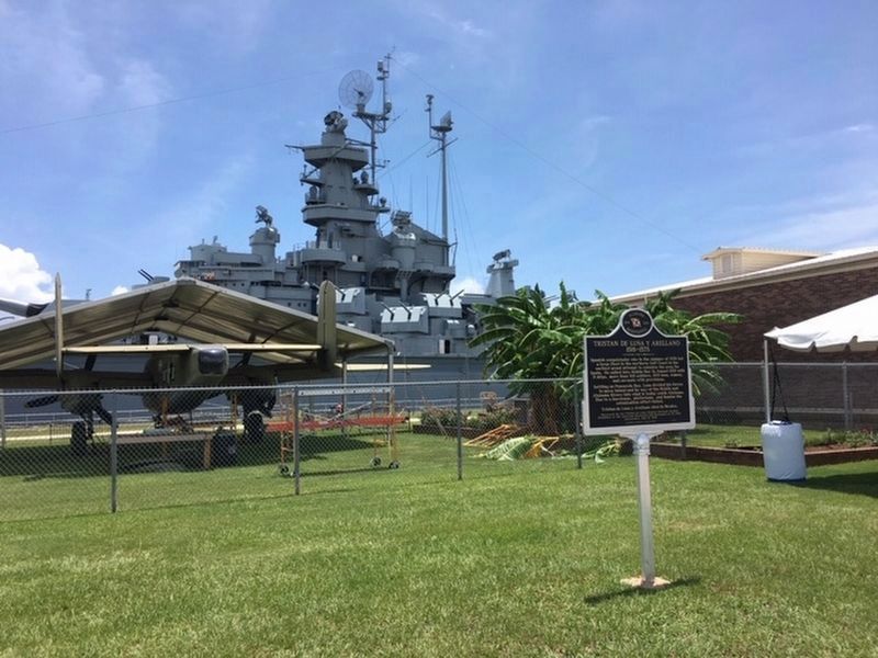
Tristan de Luna y Arellano Marker
| 1 ► Alabama, Mobile County, Mobile — Tristan de Luna y Arellano — 1519–1573 — |
| Near Battleship Parkway (U.S. 98) 0.7 miles south of Interstate 10, on the right when traveling east. | |||
| 2 ► Arizona, Apache County, Springerville — 22 — Baca Home — |
| On Apache Street at Supai, on the left when traveling east on Apache Street. | |||
| 3 ► Arizona, Coconino County, Grand Canyon National Park — El Tovar Hotel — Begun 1903, Completed 1905 — |
| 4 ► Arizona, Coconino County, Marble Canyon — Dominguez y Escalante Expedition — 1776 - 1976 — Treacherous Descent |
| On U.S. 89A at milepost 557, on the left when traveling east. Reported missing. | |||
| 5 ► Arizona, Coconino County, Page — Crossing of the Fathers — Dominguez y Escalante Expedition 1776-1976 — |
| On Lake Powell Boulevard at Navajo Drive, on the right when traveling north on Lake Powell Boulevard. | |||
| 6 ► Arizona, Gila County, Miami — Bullion Plaza School — |
| On Turner Street, on the right when traveling south. | |||
| 7 ► Arizona, Mohave County, Littlefield — 121 — The Old Spanish Trail — 1829 - 1848 — |
| On County Highway 91 at Old Pioneer Road on County Highway 91. | |||
| 8 ► Arizona, Navajo County, Winslow — 3 — The Railroads Build a Town: Early Days — Journeys to Winslow — |
| Near East 2nd Street, 0.1 miles east of North Kinsley Avenue. | |||
| 9 ► Arizona, Navajo County, Winslow — 4 — The Railroads Build a Town: Early Industry — Journeys to Winslow — |
| Near East 2nd Street, 0.1 miles east of North Kinsley Avenue. | |||
| 10 ► Arizona, Pima County, Tucson, Armory Park — Carlos Ygnacio Velasco House — |
| On South Stone Avenue, on the left when traveling south. | |||
| 11 ► Arizona, Pima County, Tucson, Barrio Viejo — El Parque de Orlando y Diego Mendoza — |
| On South Convent Avenue at West 18th Street, on the right when traveling south on South Convent Avenue. | |||
| 12 ► Arizona, Pima County, Tucson, Barrio Viejo — El Tiradito — (The Wishing Shrine) — |
| On South Main Avenue, on the right when traveling south. | |||
| 13 ► Arizona, Pima County, Tucson, Barrio Viejo — One Story from the Barrio Viejo — The History of Room 6 — |
| On West 18th Street at South Convent Avenue, on the right when traveling west on West 18th Street. | |||
| 14 ► Arizona, Pima County, Tucson, Barrio Viejo — Teatro Carmen — |
| On South Meyer Avenue, on the right when traveling south. | |||
| 15 ► Arizona, Pima County, Tucson, Downtown — August 20th Park — |
| On West Broadway Boulevard at North Church Avenue, on the left when traveling east on West Broadway Boulevard. | |||
| 16 ► Arizona, Pima County, Tucson, Downtown — Garcés Footbridge — Puente de Garcés — Historic Site — |
| 17 ► Arizona, Pima County, Tucson, Downtown — Jácome’s — |
| On North Stone Avenue at East Pennington Street, on the right when traveling south on North Stone Avenue. | |||
| 18 ► Arizona, Pima County, Tucson, Downtown — Ochoa Street — |
| On South Church Avenue at West Ochoa Street, on the right when traveling south on South Church Avenue. | |||
| 19 ► Arizona, Pima County, Tucson, Downtown — Plaza de la Mesilla — |
| Near West Broadway Boulevard. | |||
| 20 ► Arizona, Pima County, Tucson, Downtown — Plaza de las Armas — |
| 21 ► Arizona, Pima County, Tucson, Downtown — Presidio Wall Camino Real — |
| On West Pennington Street, on the right when traveling west. | |||
| 22 ► Arizona, Pima County, Tucson, Downtown — Sosa-Carillo-Frémont House — |
| Near South Granada Avenue. | |||
| 23 ► Arizona, Pima County, Tucson, El Presidio — Leonardo Romero House — |
| On West Washington Street near North Meyer Avenue, on the right when traveling east. | |||
| 24 ► Arizona, Pima County, Tucson, El Presidio — Plaza Militar — |
| On West Alameda Street, on the right when traveling west. | |||
| 25 ► Arizona, Pima County, Tucson, El Presidio — Presidio Wall — |
| On North Main Avenue at West Washington Street, on the right when traveling north on North Main Avenue. | |||
| 26 ► Arizona, Pima County, Tucson, Old Fort Lowell — Chapel of San Pedro at Fort Lowell — |
| Near East Fort Lowell Road. | |||
| 27 ► Arizona, Pinal County, Florence — Elena Llescas House — |
| On North Baily Street, on the right when traveling north. | |||
| 28 ► Arizona, Pinal County, Florence — Jesus Martinez House — |
| On North Baily Street, on the right when traveling north. | |||
| 29 ► Arizona, Pinal County, Florence — Manuel Robles House — |
| On North Baily Street north of East Butte Avenue, on the right. | |||
| 30 ► Arizona, Pinal County, Kearny — Sonora, Arizona — |
| Near Arizona Route 177 at milepost 156. | |||
| 31 ► Arizona, Pinal County, Picacho — Juan Bautista de Anza National Historic Trail / Camp 21: El Aquituni — |
| 32 ► Arizona, Santa Cruz County, Nogales — Montezuma Hotel — |
| On North Morley Avenue, on the right when traveling south. | |||
| 33 ► Arizona, Santa Cruz County, Tumacacori — 87001437 — Tumacacori Museum — National Historic Landmark — |
| Near Interstate 19 Frontage Road, on the right when traveling north. | |||
| 34 ► Arizona, Yuma County, Yuma — Crossing Into History — Juan Bautista de Anza National Historic Trail — |
| Near Prison Hill Road. | |||
| 35 ► Arkansas, Conway County, Winrock — Cement Sculptures by Dionicio Rodriguez — |
| On Petit Jean Mountain Road, on the left when traveling west. | |||
| 36 ► Arkansas, Montgomery County, Caddo Gap — De Soto at Caddo Gap — |
| On Indian Valley Road at Vaught Street, on the right when traveling east on Indian Valley Road. | |||
| 37 ► California, Alameda County, Emeryville — Emeryville’s Mexican Heritage — |
| Near Hubbard Street. | |||
| 38 ► California, Alameda County, Livermore — Brushy Peak Regional Preserve — |
| On West Side Loop Trail west of Laughlin Road, on the right when traveling west. | |||
| 39 ► California, Alameda County, Livermore — Joaquin Murrieta and Murrieta's Well — |
| Near Mines Road. | |||
| 40 ► California, Alameda County, Pleasanton — 510 — Francisco Solano Alviso Adobe |
| Near Foothill Rd, 0.8 miles south of Old Foothill Rd.. Reported missing. | |||
| 41 ► California, Alameda County, San Leandro, Farrelly Pond District — De Anza Expedition 1775 - 1776 — |
| Near East 14th Street (State Highway 185) near Toler Avenue. | |||
| 42 ► California, Alameda County, San Leandro, Old San Leandro — Casa Peralta — |
| On West Estudillo Avenue at Clarke Street, on the right when traveling west on West Estudillo Avenue. | |||
| 43 ► California, Alameda County, San Leandro, Old San Leandro — 279 — Estudillo Home — |
| On West Estudillo Avenue near San Leandro Boulevard, on the right when traveling west. | |||
| 44 ► California, Amador County, Ione — Quincy - Ione's Sister City — |
| Near Michigan Bar Road (California Route 104) 1.5 miles East Plymouth Highway (California Route 124). | |||
| 45 ► California, Calaveras County, Calaveritas — 255 — Calaveritas — |
| On Calaveritas Road at Costa Road, on the right when traveling east on Calaveritas Road. | |||
| 46 ► California, Contra Costa County, Clayton — Joaquin Murrieta — |
| On Main Street at Morris Street, on the right when traveling west on Main Street. | |||
| 47 ► California, Contra Costa County, Concord — About Don Salvio Pacheco — |
| On Willow Pass Road near Grant Street, on the right when traveling west. | |||
| 48 ► California, Contra Costa County, Concord — De Anza Expedition 1775-1776 — |
| On Grant Street south of Olivera Road, on the left when traveling north. | |||
| 49 ► California, Contra Costa County, Concord — Dedicated to the Founders of Todos Santos — 1994 — |
| On Willow Pass Road near Grant Street, on the left when traveling east. | |||
| 50 ► California, Contra Costa County, Concord — Francisco Galindo Home — |
| Near Amador Avenue, on the right when traveling south. | |||
| 51 ► California, Contra Costa County, Martinez — Dedicated to the Family of Don Ignacio Martinez — |
| On Carquinez Scenic Drive, 0.1 miles west of Talbart Street. | |||
| 52 ► California, Contra Costa County, Martinez — 511 — The Vicente Martinez Adobe - 1849 — |
| Near Alhambra Avenue, on the right when traveling north. | |||
| 53 ► California, Contra Costa County, Martinez — 511 — Vicente Martinez Adobe — |
| Near Alhambra Avenue, on the right when traveling south. | |||
| 54 ► California, Contra Costa County, Oakley — "...What we see and have before us is not a river, but much water in a pond" — Anza Expedition of 1776 — |
| Near Bridgehead Road. | |||
| 55 ► California, Contra Costa County, Oakley — Anza Expedition Campsite 101 — |
| Near Bridgehead Road. | |||
| 56 ► California, Contra Costa County, Oakley — Stopped by Impenetrable Marshes — Anza Expedition of 1776 — |
| 57 ► California, Contra Costa County, Rodeo — The De Anza Expedition in Rodeo — |
| On Parker Avenue south of 4th Street, on the right when traveling north. | |||
| 58 ► California, Fresno County, Coalinga — 344 — Arroyo de Cantua — 14 Miles — |
| On California Route 33, 0.1 miles south of Dorris Road (California Route 198), on the left when traveling south. | |||
| 59 ► California, Fresno County, Coalinga — 344 — Arroyo de Cantua — 14 Miles — |
| On Dorris Avenue (State Highway 198) 0.1 miles east of State Highway 33, on the left when traveling east. | |||
| 60 ► California, Fresno County, Fresno — Honoring the Ex-Braceros and Their Contributions — Honoramos los Ex-Braceros y Sus Contribuciones — 1942 - 1964 — |
| On Tulare Street near Van Ness Avenue, on the right when traveling west. | |||
| 61 ► California, Imperial County, Imperial — 944 — Site of Fort Romualdo Pacheco — (1825 - 1826) |
| On West Worthington Road (County Highway S28), on the right when traveling east. Reported missing. | |||
| 62 ► California, Imperial County, Ocotillo — De Anza Overlook — |
| On Anza Trail Road. | |||
| 63 ► California, Kern County, Arvin — 371 — Francisco Garces O.F.M — |
| Near Bear Mountain Boulevard. | |||
| 64 ► California, Kern County, Delano — The Forty Acres — |
| On Cesar Chavez Lane, 2.6 miles west of U.S. 99, on the right. | |||
| 65 ► California, Kern County, Keene — A Humble Home — Cesar E. Chavez National Monument — |
| On Woodford-Tehachapi Road, 0.5 miles east of Keene, on the left when traveling east. | |||
| 66 ► California, Kern County, Keene — 1056 — Cesar E. Chavez National Monument — La Paz — Refuge — |
| Near Woodford-Tehachapi Road, 0.5 miles east of Keene, on the left when traveling east. | |||
| 67 ► California, Kern County, Keene — Helen's Park — Cesar E. Chavez National Monument — |
| On Woodford-Tehachapi Road, 0.5 miles east of Keene, on the left when traveling east. | |||
| 68 ► California, Kern County, Mettler — 291 — Fages-Zalvidea Trails — California Historical Landmark — |
| On Maricopa Highway (Highway 166), on the right when traveling west. | |||
| 69 ► California, Kern County, Tehachapi — Avelino Martinez — Died at Age 112 on August 7, 1936 — Last Known Member of the Joaquin Murrieta Horse Gangs — |
| On Burnett Road. | |||
| 70 ► California, Kern County, Tehachapi — The Legend of Avelino Martinez — |
| On East F Street, on the right when traveling east. | |||
| 71 ► California, Los Angeles County, Agoura Hills — Morrison Ranch House — Witness to a Changing World — |
| Near Chesebro Road, 0.5 miles north of U.S. 101, on the right when traveling north. | |||
| 72 ► California, Los Angeles County, Agoura Hills — Reyes Adobe Historical Site — |
| On Rainbow Crest Drive at Reyes Adobe Road, on the left when traveling west on Rainbow Crest Drive. | |||
| 73 ► California, Los Angeles County, Bell Gardens, South Montebello — 984 — Casa de Rancho San Antonio — Henry Gage Mansion — |
| Near East Gage Avenue, 0.7 miles west of U.S. 5. | |||
| 74 ► California, Los Angeles County, Compton — 152 — Domínguez Ranch House — |
| On South Alameda Street, on the right when traveling north. | |||
| 75 ► California, Los Angeles County, Culver City, Studio Village — 8 — The Lugo Ranch — |
| On Jefferson Boulevard east of Cota Street, on the right when traveling north. | |||
| 76 ► California, Los Angeles County, Duarte — Andres Avelino Duarte — 1805-1863 — |
| On Huntington Drive at Calle Andres, on the right when traveling west on Huntington Drive. | |||
| 77 ► California, Los Angeles County, Glendale, Montrose — The Crescenta-Cañada Valley — |
| On Honolulu Avenue at Ocean View Boulevard, on the right when traveling west on Honolulu Avenue. | |||
| 78 ► California, Los Angeles County, Glendale, Tropico — Glendale Station Clock — Oak of Peace — |
| Near West Cerritos Avenue at El Bonito Avenue. | |||
| 79 ► California, Los Angeles County, Glendale, Verdugo Woodlands — 2 — Oak of Peace — |
| Near Bonita Drive south of Opechee Way, on the right when traveling south. | |||
| 80 ► California, Los Angeles County, La Verne — 7 — Lomeli Adobe — Last Adobe Built in La Verne - 1957 — |
| On Magnolia Avenue north of 5th Street, on the left when traveling north. | |||
| 81 ► California, Los Angeles County, Long Beach, Bixby Hill — Rancho Los Alamitos — Honoring the Indians — |
| On Bixby Hill Road east of Palo Verde Avenue, on the right when traveling east. | |||
| 82 ► California, Los Angeles County, Long Beach, Carson Park — Ranchos Los Alamitos - Los Cerritos - Los Coyotes — |
| On East Parkcrest Street, on the right when traveling west. | |||
| 83 ► California, Los Angeles County, Long Beach, Los Cerritos — 978 — Rancho Los Cerritos — |
| Near North Virginia Road north of East San Antonio Road. | |||
| 84 ► California, Los Angeles County, Long Beach, Waterfront — Ranchos — Los Alamitos • Los Cerritos — |
| On Ocean Boulevard at Shoreline Drive, on the right when traveling east on Ocean Boulevard. | |||
| 85 ► California, Los Angeles County, Los Angeles, Boyle Heights — Chicano Arts Movement — |
| On Soto Street south of Cesar E Chavez Avenue, on the right when traveling south. | |||
| 86 ► California, Los Angeles County, Los Angeles, Boyle Heights — Mariachi Plaza — |
| On 1st Street just east of Boyle Avenue, on the left when traveling east. | |||
| 87 ► California, Los Angeles County, Los Angeles, Boyle Heights — Mexican American All Wars Monument — In Memoriam — |
| On Cesar E Chavez Avenue at Indiana Street, on the right when traveling east on Cesar E Chavez Avenue. | |||
| 88 ► California, Los Angeles County, Los Angeles, Boyle Heights — Ruben Salazar — March 3, 1928 - August 29, 1970 — |
| On Whittier Boulevard at Hicks Avenue, on the right when traveling east on Whittier Boulevard. | |||
| 89 ► California, Los Angeles County, Los Angeles, Chinatown — 425 North Los Angeles Street — |
| On Los Angeles Street north of U.S. 101, on the right when traveling south. | |||
| 90 ► California, Los Angeles County, Los Angeles, Chinatown — Castelar School — |
| On Yale Street south of College Street, on the left when traveling south. | |||
| 91 ► California, Los Angeles County, Los Angeles, Chinatown — 5 — Zanja Madre — “Mother Ditch and the History Slugs” — Los Angeles State Historic Park — |
| On Spring Street at Sotello Street, on the left when traveling north on Spring Street. | |||
| 92 ► California, Los Angeles County, Los Angeles, Downtown Los Angeles — Antonio Aguilar — May 17, 1919 – June 19, 2007 — |
| On North Alameda Street at Los Angeles Street, on the right when traveling south on North Alameda Street. | |||
| 93 ► California, Los Angeles County, Los Angeles, Downtown Los Angeles — Avila Adobe — circa 1818 — El Pueblo de Los Angeles — |
| On Olvera Street south of Cesar E. Chavez Avenue, on the right when traveling north. | |||
| 94 ► California, Los Angeles County, Los Angeles, Downtown Los Angeles — 145 — Avila Adobe — |
| Near Olvera Street north of Paseo De La Plaza, on the right when traveling north. | |||
| 95 ► California, Los Angeles County, Los Angeles, Downtown Los Angeles — Camero — Los Pobladores — The Founders of the City of Los Angeles — |
| On Paseo de la Plaza at Olvera Street on Paseo de la Plaza. | |||
| 96 ► California, Los Angeles County, Los Angeles, Downtown Los Angeles — Carlos III — 1759–88 — |
| On Los Angeles Street west of North Alameda Street, on the right when traveling south. | |||
| 97 ► California, Los Angeles County, Los Angeles, Downtown Los Angeles — El Camino Real — |
| On North Main Street at Paseo Luis Olivares, on the left when traveling north on North Main Street. | |||
| 98 ► California, Los Angeles County, Los Angeles, Downtown Los Angeles — Father Junipero Serra — 1713–1784 — |
| On Los Angeles Street just north of Arcadia Street, on the right when traveling north. | |||
| 99 ► California, Los Angeles County, Los Angeles, Downtown Los Angeles — Felipe de Neve, 1728–84 — Spanish Governor of the Californias, 1775–82 — |
| Near Main Street north of U.S. 101, on the right when traveling north. | |||
| 100 ► California, Los Angeles County, Los Angeles, Downtown Los Angeles — Forced Removal of Mexican Americans — During The Great Depression — |
| Near Main Street north of California Route 101, on the left when traveling north. | |||
1248 entries matched your criteria. The first 100 are listed above. Next 100 ⊳