On Main Street (New Brunswick Route 114) just south of Legion Street, on the left when traveling south.
Near this town on 3rd September 1755, a detachment of Major Frye's troops, sent from Fort Cumberland to destroy Acadian settlements on the river and compel the people to surrender for deportation, was defeated by a French force under Charles . . . — — Map (db m106630) HM
On Main Street (Route 105) at Maple Street, on the right when traveling south on Main Street.
(English:) Historic salmon harvesting area of First Nations People and Loyalists. In the first half of the 20th century, the pool became internationally renowned as a sport fisherman's paradise.
(Français:) Zone . . . — — Map (db m138996) HM
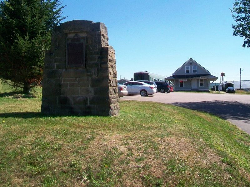
Near Main Street (Route 105) south of Mill Street, on the right when traveling south.
• Settled 1802 by William Orser United Empire Loyalist near where the Becaguimac Stream flows into the St. John River
• Originally known as Mouth of the Becaguimac
• Becaguimac — Abekaquimek — Maliseet for salmon bed
• . . . — — Map (db m138999) HM
Near New Brunswick Route 127, 9 kilometers south of New Brunswick Route 1, on the right when traveling south.
English:
In 1984, the United States Congress designated Saint Croix Island an international historic site in recognition of the historical significance of the Island to the United States and Canada.
The majestic Saint Croix . . . — — Map (db m144503) HM
Near New Brunswick Route 127, 9 kilometers south of New Brunswick Route 1, on the right when traveling south.
English:”Having found no place more suitable than this island... Sieur de Monts… allowed me to draw up the plan of our settlement."
Seventy-nine men, including noblemen, artisans, labourers, Catholic and . . . — — Map (db m144499) HM
Near New Brunswick Route 127, 9 kilometers south of New Brunswick Route 1, on the right when traveling south.
English:
Sieur de Monts named the island Saint Croix Island, and Champlain recorded that: "The island is covered with fir, birch, maple, and oak. It is naturally well located... and is easy to fortify... We considered this the . . . — — Map (db m144498) HM
Near New Brunswick Route 127, 9 kilometers south of New Brunswick Route 1, on the right when traveling south.
English:”It was difficult to know the country without having wintered there... Winter came upon us sooner than we had expected..."
Could you survive a winter on Saint Croix Island if...
• dangerous ice cut you . . . — — Map (db m144501) HM
Near New Brunswick Route 127, 9 kilometers south of New Brunswick Route 1, on the right when traveling south.
English:"In order to escape the cold and dreadful winter we experienced on Saint Croix Island, Sieur de Monts decided to move the settlement to another location. Having… found no port that was acceptable to us... we outfitted . . . — — Map (db m144502) HM
Near New Brunswick Route 127, 9 kilometers south of New Brunswick Route 1, on the right when traveling south.
English:
Welcome On Saint Croix Island in 1604, French nobleman-courtier Pierre Dugua Sieur de Monts established a settlement. This outpost was the first attempt by the French at year-round colonization in the territory they . . . — — Map (db m144495) HM
Near New Brunswick Route 127, 9 kilometers south of New Brunswick Route 1, on the right when traveling south.
English: Samuel de Champlain, explorer and geographer on Sieur de Monts' expedition, recorded in late June 1604 that:
”...we entered a river... wherein...we found two islands — one very small and near the western . . . — — Map (db m144496) HM
Near New Brunswick Route 127, 9 kilometers south of New Brunswick Route 1, on the right when traveling south.
English:
The Micmac, Maliseet, and Passamaquoddy hunters and traders provided a commercial lifeline for Sieur de Monts' colony. Their first-hand knowledge of the territory allowed these entrepreneurs to control the supply of furs. . . . — — Map (db m144497) HM
On Montague Street at Edward Street, on the right when traveling west on Montague Street.
English: This elegant church marks the growth of Presbyterianism and the Kirk of Scotland in New Brunswick. Built in 1821-1824, the structure successfully combines the American meeting house form with the British Palladian style. The . . . — — Map (db m137515) HM
On Water Street close to King Street, on the right when traveling east.
English
Founded by Loyalists in 1783, St. Andrews is a fine and rare surviving example of a Canadian town whose plan and character clearly reflect its 18th-century origins. The town retains the four key elements of a British colonial . . . — — Map (db m77398) HM
Although visitors had been coming to the island since 1855, Campobello's summer trade did not really prosper until the 1880s - years of long summer vacations and great resorts. A group of Boston and New York businessmen bought most of the . . . — — Map (db m63639) HM
Friar's Head takes its name from the stone pillar or stack (photo 1) that rises from the beach directly below the observation deck. While occupying Eastport, the British navy was said to have used the stone pillar for target practice, . . . — — Map (db m63629) HM
About 1840, a canal connecting Johnson and South Bays was dug in North Lubec and a dam constructed there to harness tidal energy to power plaster mills. Gypsum (the raw product used to make plaster) and grindstones from the Maritimes were important . . . — — Map (db m54995) HM
Lubec's known history began at a Passamaquoddy Indian encampment at Mill Creek in what came to be called Seward's Neck (now North Lubec). French settlers later came to those shores in the early 1700s, but shortly afterward were driven away by the . . . — — Map (db m55023) HM
Built in 1885, the Mulholland Point Lighthouse (photo 1) served as a guide for the many small coasters and freighters taking the shorter and more foul weather-protected route through the Lubec Narrows. Steamships, such as the . . . — — Map (db m63593) HM
Two of the Campobello Company's founders, Alex S. Porter and Samuel Wells, and several of the luxury hotel visitors, including James Roosevelt and families by the name of Sturgis, Cochrane, Prince, and Pell purchased land and refurbished or . . . — — Map (db m63641) HM
The Roosevelt Campobello International Park is a unique example of international cooperation - jointly administered, staffed, and funded by the peoples of Canada and the United States. Established by international treaty in 1964, the . . . — — Map (db m63591) HM
This collection of historic buildings creates a community representing an evolution of rural New Brunswick society from the Loyalists to the late Victorians.
Cette collection de bâtiments
historiques forme une . . . — — Map (db m230388) HM
On New Brunswick Route 134 just north of Chemin Lovers Lane, on the right when traveling north.
Français:
À l'automne 1767, les familles Gueguen, Arseneau, Hébert et Bourg reçoivent les premières concessions de terres accordées à des Acadiens après le Grand Dérangement.
En novembre, Cocagne devient la première communauté . . . — — Map (db m139701) HM
Near North Street, 0.3 kilometers east of Rue Main (New Brunswick Route 134), on the right when traveling east.
Connue à l'origine comme « the Yard », la communauté fut fondée en 1825 alors que John Jardine, un constructeur de navire reconnu et respecté, y construisit la première demeure. L'imposante maison se tient encore fièrement debout, rendant hommage au . . . — — Map (db m150502) HM
On Rue Main (New Brunswick Route 134) just north of Bonner Law Avenue (New Brunswick Route 116), on the left when traveling north.
MacNarin Family History (left panel) In 1817, a Canadian ship, The Dykes, set sail from Scotland for Canada with Capt. Simon Graham in command: On board were lads and lassies from the Scottish towns of Dumfriesshire, Gallowayshire . . . — — Map (db m150643) HM
On Rue Main (New Brunswick Route 134) just north of Cail Court, on the right when traveling north.
English: Originally built as the manse for St. Andrew's Church, the imposing house was constructed in 1880 on a half-acre of land donated by William and Margaret Bowser. Church Trustees' minutes of July 6, 1881 record that the . . . — — Map (db m150506) HM
On Queen Street just north of Rue Main (New Brunswick Route 134), on the right when traveling north.
English: Built in 1884 on land given by the Brait family, its construction was under the direction of the community's first Anglican families, the Forsters and the Palmers. The church was consecrated on September 3rd of that year by . . . — — Map (db m150499) HM
On Rue Main (New Brunswick Route 134) north of River Street, on the right when traveling north.
English:The BridgesIn the beginning it was the river and the abundance of natural resources in the area that brought the settlers here; but, years later, it would be the building of the bridge across the Richibucto that would . . . — — Map (db m150500) HM
Near North Street, 0.3 kilometers east of Rue Main (New Brunswick Route 134), on the right when traveling east.
Originally known as "The Yard", the community was established in 1825 when the widely known and well respected shipbuilder John Jardine built the first home here. The stately house still stands as a memorial to the founder of the village. The . . . — — Map (db m150503) HM
Near North Street, 0.3 kilometers east of Rue Main (New Brunswick Route 134), on the right when traveling east.
English:The MastsIn partnership with the Richibucto River Historical Society, the Kingston Maritime Association was organized in 2003 for the purpose of establishing a means of recognizing and preserving the shipbuilding history . . . — — Map (db m150501) HM
On Rue Main (New Brunswick Route 134) just north of Cail Court, on the right when traveling north.
English: The village of Rexton was founded in 1825 and officially incorporated, as a village, in 1966. Rexton's population had reached 908 according to the 1996 census. Rexton is located in Southeastern New Brunswick, near the mouth . . . — — Map (db m150507) HM
Near North Street, 0.3 kilometers east of Rue Main (New Brunswick Route 134), on the right when traveling east.
English:Wooden Ships and Iron Men During the nineteenth century, New Brunswick's booming shipbuilding industry brought great prosperity to the Richibucto River. More than seventy ships of 500 tons and over were built and . . . — — Map (db m150504) HM
On Rue Principale (Main Street) (New Brunswick Route 134) at Chemin Desherbiers (Desherbiers Road), on the right when traveling south on Rue Principale (Main Street).
Français:
Né à Saint-Louis-de-Kent et ordonné prêtre en 1870, Mgr Richard fut l'une des figures de proue de la renaissance acadienne. Il stimula la colonisation afin de centrer l'exode yeti les États-Unis, fonda des écoles, des . . . — — Map (db m139702) HM
On Main Street (New Brunswick Route 121) east of Peter Street, on the left when traveling east.
This property, as with so many in the area, once belonged to the estate of George Leonard who arrived in New Brunswick as a Loyalist with the spring fleet of 1783.
Although Mr. Leonard had been raised in Plymouth, Massachusetts and owned a home . . . — — Map (db m137651) HM
Near Main Street (New Brunswick Route 8) 0.3 kilometers north of Campbell Road (New Brunswick Route 118), on the right when traveling north.
Henry Reid leased stone quarry sites in the area in the 1870s and 1880s. These unused millstones came from the quarry in Indiantown (now Quarryville). Another Reid stone quarry operated at Blackville during the same period. In addition to . . . — — Map (db m139703) HM
On rue Canada (New Brunswick Route 17) just south of rue Deschênes, on the left when traveling south.
La fontaine fut érigée en 1957 en l'honneur des fondateurs de Saint-Quentin, elle est un don de M. Patrick Jean, entrepreneur prolifique de la paroisse. Elle fut construite par. M. Andréas Coulombe.
Le dévoilement du monument . . . — — Map (db m125684) HM
On Water Street just west of Prince William Street, on the left when traveling south.
English:
Look out to the head of the harbour, and you'll see Partridge Island, a major point of entry for European immigrants during the 19th and 20th centuries, almost 100 years before Ellis Island.
Many of our ancestors . . . — — Map (db m145397) HM
On Prince William Street at Saint James Street, on the left when traveling north on Prince William Street.
English:
Partridge Island has been home to natural and human communities for a long time.
It began about 300 million years ago when ash from an ancient volcano created the island. Sand and soil slowly built up, seeds took . . . — — Map (db m145599) HM
Near Lancaster Avenue, 0.2 kilometers east of Bridge Road (New Brunswick Route 100), on the left when traveling east.
English:
Born to a wealthy American family in 1736, Gabriel Ludlow grew up a supporter of the King. When the American Revolution came Ludlow raised a battalion for General DeLancey's Brigade. He was commissioned colonel of the . . . — — Map (db m141992) HM
Near Fort Latour Drive at Navy Way when traveling east.
Fort La Tour was built on this site in 1631 by Charles de La Tour, a historical crossroads for First Nations peoples, French settlers and British traders. La Tour’s wife, Francoise-Marie Jacquelin defended the Fort against rival Charles de Menou . . . — — Map (db m138888) HM
Near Fort Latour Drive at Navy Way, on the right when traveling east.
English:
In 1631, Charles de Sainte-Étienne de La Tour built a fort here on ground traditionally used by First Nations people, for some 4000 years. The fort became one of the earliest centres of the French fur trade with the . . . — — Map (db m139998) HM
Near Fort Latour Drive at Navy Way, on the right when traveling east.
Français: Les peoples des Premières nations ont utilisé cet endroit comme lieu de rassemblement et de cérémonie pendant plus de 4000 ans. En 1631, Charles de Sainte-Étienne de La Tour a établi un poste de traite fortifié. Alors que . . . — — Map (db m152385) HM
On Sydney Street close to Kings Square North, on the left when traveling north.
English
The increase of population consequent upon the large influx of Loyalists in 1783 and 1784 convinced the British government of the desirability of creating the Province of New Brunswick. This was done on 16 August 1784. Brigadier . . . — — Map (db m77519) HM
Near Lancaster Avenue, 0.2 kilometers east of Bridge Road (New Brunswick Route 100), on the left when traveling east.
English:
In 1640 Françoise Marie Jacquelin from France stepped onto the shores of Acadia to marry Charles de Saint-Étienne, Sieur de La Tour, the 46 year-old Governor of Acadia. With her marriage the young bride joined the war for . . . — — Map (db m141988) HM
On Union Street just west of Germain Street (Wellington Row), on the right when traveling east.
English:
This gracious building is a well-preserved example of the homes built by prosperous United Empire Loyalists and their descendants. Constructed before 1820 by the merchant David Merritt, this house was maintained with . . . — — Map (db m139999) HM
Near Fort Latour Drive at Navy Way when traveling east.
As the people of the Saint John River/Walastakok River, Maliseets are known to have lived on this river for nearly 12,000 years. When The Europeans first came here in 1604 we were living in a village on an island in this harbor. Maliseets referred . . . — — Map (db m138887) HM
Near Smythe Street at North Market Wharf, on the right when traveling south.
English:
Look toward the mouth of the harbour and you'll see Partridge Island, an official National and Provincial Historic Site. Only 600 metres (654 yards) long by 300 metres (327 yards) wide, the rocky island was home to . . . — — Map (db m145596) HM
Near Lancaster Avenue, 0.2 kilometers east of Bridge Road (New Brunswick Route 100), on the left when traveling east.
English:
Partnership at Portland Point
In August 1775 the 140 residents of Portland Point were attacked. A Machias war sloop burnt Fort Frederick, carried off its four soldiers and a ship full of supplies from the upriver . . . — — Map (db m141990) HM
Near Lancaster Avenue, 0.2 kilometers east of Bridge Road (New Brunswick Route 100), on the left when traveling east.
English:
On March 7th 1604, Samuel de Champlain, map-maker for Henry IV of France, sailed for L'Acadie with its newly appointed Lieutenant-General, Pierre du Gua de Monts. A second ship followed with Pont-Gravé who had explored . . . — — Map (db m141299) HM
On Market Square at Water Street, on the right when traveling east on Market Square.
English
Saint John has a strong Scottish presence. The breakup of the clan system in the late 18th century caused massive emigration from the Highlands. As a result, some 25 percent of the population has Scottish ancestry. Scottish . . . — — Map (db m77458) HM
Near Lancaster Avenue, 0.2 kilometers east of Bridge Road (New Brunswick Route 100), on the left when traveling east.
English:
In 1762 three young ex-officers of provincial regiments (units of Americans within the British army) joined in a trading venture. The Boston friends - James Simonds, James White and William Hazen - were attracted to the . . . — — Map (db m141991) HM
Near Market Square at Water Street, on the right when traveling east.
English
On 10 May 1783 the Spring Fleet, carrying over 2,000 Loyalists, arrived at the Saint John River mouth. The exiles, mostly civilians from the Middle Colonies, established themselves in the newly-surveyed townsites of Parr and . . . — — Map (db m77432) HM
Near Lancaster Avenue, 0.2 kilometers east of Bridge Road (New Brunswick Route 100), on the left when traveling east.
English:
With the rebels controlling the New England timber trade in 1779, Hazen and White secured a contract to supply the Royal Navy with essential masts and spars. Their lumber camps fought battles with those of rival traders . . . — — Map (db m141989) HM
Near Lancaster Avenue, 0.2 kilometers east of Bridge Road (New Brunswick Route 100), on the left when traveling east.
English:
The American Civil War had a significant impact on young Thomas Stockwell Simms. A native of Maine, he tried to enlist in Lincoln's Republican army at age 16 when he was too young. At 18 he was accepted by the Seventh . . . — — Map (db m141996) HM
Near Lancaster Avenue, 0.2 kilometers east of Bridge Road (New Brunswick Route 100), on the left when traveling east.
English:
Wolastoq Park The Name
Wolastoq means "the Beautiful River" in the language of the Maliseet people who lived beside it. Today, we know it as the beautiful St. John River. For many centuries before Europeans arrived . . . — — Map (db m141298) HM
On Saint Martins Road (New Brunswick Route 111) just east of Base Road/Howell Road, on the right when traveling east.
”One of the Black Refugee Tract Areas” Grants of 55 acres of land was issued to the black settlers in Willow Grove in 1836. On September 7, 1836, the grants were finally issued and 74 black refugees received titles to lots in . . . — — Map (db m144129) HM
On Broadway Boulevard at Church Street, in the median on Broadway Boulevard.
This sculpture was erected
in memory of our ancestors
who were the founders of
Acadia of the Lands and Forests.
Commemorating the
2014 Congrès mondial acadien
which was held in our region. . . . — — Map (db m125346) HM
On Broadway Boulevard (New Brunswick Route 130) at Court Street, in the median on Broadway Boulevard.
In 1791, Thomas Carleton, first Governor of New Brunswick, ordered the erection of a military post at Grand Falls, which bore his name. The Fort protected the route followed by postal couriers between Halifax and Quebec. It also affirmed the . . . — — Map (db m125312) HM
On Main Street (New Brunswick Route 940) 0.2 kilometers south of Walker Road, on the left when traveling north.
The first Methodist chapel
in the Sackville area was
dedicated in July 1790 by
the Rev James Mann. It[']s
first trustees were
John Fawcett • William Fawcett
John Fawcett Jr • Andrew Wheldon
Robert Atkinson
The stone foundations . . . — — Map (db m106339) HM
On Bendview Court just south of Main Street (New Brunswick Route 106), on the left when traveling south.
The Moncton 100 Monument honours Joseph Salter, shipbuilder, entrepreneur and first mayor of the Township of Moncton in 1855.
Local entrepreneurs, whose names are inscribed on this monument, undertook funding of the project as their gift to the . . . — — Map (db m106613) HM
Near Champlain Street (New Brunswick Route 106) 0.1 kilometers east of Wheeler Boulevard, on the right when traveling east.
Français: Les Acadiens sont les premiers colons européens à s'établir à la baie de Fundy, au début du 17e siècle. Ils transforment le paysage en asséchant des marais salés et en construisant des levées et des aboiteaux pour créer . . . — — Map (db m150975) HM
Near Champlain Street (New Brunswick Route 106) 0.1 kilometers east of Wheeler Boulevard, on the right when traveling east.
English: The Grand Dérangement L’Acadie, established by France in 1604, was a strategically located and highly coveted colony. In 1713, it was handed over to England and renamed Nova Scotia. The foundation of Halifax, in 1749, . . . — — Map (db m150940) HM
On Main Street (New Brunswick Route 106) just north of Woodlawn Road, on the right when traveling north.
English:400th anniversary celebration of the 1st Acadian settlement. Dedicated to those Acadians who were part of the history of the Village of Dorchester and area. Français:Fêtes du 400e anniversaire de . . . — — Map (db m193196) HM
Near Main Street (New Brunswick Route 106) just north of Penitentiary Road, on the right when traveling north.
The first Methodist Church in this area was built here in 1783, on land donated by John Weldon. Rebuilt after a fire in 1839, a larger church was built in 1882, now Dorchester United Church. The first burial in this cemetery was of John Weldon’s . . . — — Map (db m193199) HM
Near Main Street (New Brunswick Route 106) 0.1 kilometers west of Wheeler Boulevard, on the right when traveling east.
English: The Settlers of the Township of Monckton reached their destination after 44 days at sea, on June 3, 1766. Captain Jonathan Hall guided the sloop along Pennsylvania's Schuylkill River to the New England coast, then entered . . . — — Map (db m151002) HM
On Downing Street at Assomption Boulevard, on the right when traveling north on Downing Street.
English: Downing Street is the namesake of Johanna Downing, a Moncton resident from 1840 until 1876. She and her husband, Peter McSweeney, moved from Ireland to Hillsborough, New Brunswick, in 1832. Peter later became a farmer, real . . . — — Map (db m150995) HM
On Main Street (New Brunswick Route 106) at Bendview Court, on the right when traveling east on Main Street.
This part of "Le Coude" (The Bend) was in earlier times called Terre-Rouge. Three families from the Grand-Prée region first settled here:
Jean Babineau & Isabelle Breau, circa 1733,
followed by Joseph Breau & Isabelle Thibodeau
and Charles . . . — — Map (db m106603) HM
Near Main Street (New Brunswick Route 106) 0.1 kilometers west of Wheeler Boulevard, on the right when traveling east.
English: 1 • This journey began in Europe where eight families, seven of German origin, and one of Welsh origin, set out to seek a new homeland. It ended here, on these muddy Banks of the Petitcodiac River, when the families of . . . — — Map (db m151001) HM
Near Main Street (New Brunswick Route 106) 0.1 kilometers west of Wheeler Boulevard, on the right when traveling east.
English: In honour of the permanent settlers of the Monckton township, the Stief, Lutz, Treitz, Jones, Sommers, Copple, Ricker and Wortman families who came up the Petitcodiac River from Pennsylvania and landed on the bank of this . . . — — Map (db m151000) HM
Near Main Street (New Brunswick Route 106) 0.1 kilometers west of Wheeler Boulevard, on the right when traveling east.
English: When they first arrived, the settlers lived together in small, rough cabins. But soon, each family built its own home, as stipulated in the Articles of Agreement. Initially, all livestock was housed in a communal shed. The . . . — — Map (db m151003) HM
Near Queen Street (New Brunswick Route 102) west of Sainte Anne's Point Drive, on the right when traveling west.
English: The wife of the last British Officer stationed in New Brunswick, Mrs. Juliana Horatia Ewing wrote and published an impressive 32 children's books and numerous articles during her brief life, dying at age 44. Fredericton was . . . — — Map (db m152397) HM
On Route 105, 0.5 kilometers north of Route 615, on the left when traveling north.
This commemorative stands on land granted to Daniel Jewett in 1799. Here the village of Jewett’s Mills grew and prospered around a water-powered mill built by Daniel on the Mactaquac Stream. Over the years the mill sawed long lumber, shingles, . . . — — Map (db m137469) HM