After filtering for New Brunswick, 73 entries match your criteria.
Settlements & Settlers Topic
By William Fischer, Jr., July 29, 2017
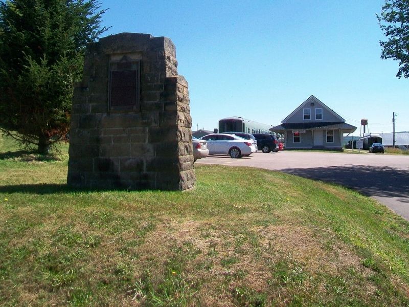
Combat of the/du Petitcodiac Marker
| 1 ► New Brunswick, Albert County, Hillsborough — Combat of the/du Petitcodiac — |
| On Main Street (New Brunswick Route 114) just south of Legion Street, on the left when traveling south. | |||
| 2 ► New Brunswick, Albert County, Riverside-Albert — Early Irish Families to Albert County — As Éirinn go dtí an áit seo — |
| On King Street (New Brunswick Route 114) at Maple Street, on the right when traveling west on King Street. | |||
| 3 ► New Brunswick, Carleton County, Hartland — Hartland Salmon Pool / Fosse à saumon de Hartland — |
| On Main Street (Route 105) at Maple Street, on the right when traveling south on Main Street. | |||
| 4 ► New Brunswick, Carleton County, Hartland — Town of Hartland — |
| Near Main Street (Route 105) south of Mill Street, on the right when traveling south. | |||
| 5 ► New Brunswick, Charlotte County, Bayside — A Checkered History / Une historie mouvementée — |
| Near New Brunswick Route 127, 9 kilometers south of New Brunswick Route 1, on the right when traveling south. | |||
| 6 ► New Brunswick, Charlotte County, Bayside — A French Colony in Acadie / Une colonie française en Acadie — |
| Near New Brunswick Route 127, 9 kilometers south of New Brunswick Route 1, on the right when traveling south. | |||
| 7 ► New Brunswick, Charlotte County, Bayside — A Place to Settle / Un endroit où s’établir — |
| Near New Brunswick Route 127, 9 kilometers south of New Brunswick Route 1, on the right when traveling south. | |||
| 8 ► New Brunswick, Charlotte County, Bayside — A Winter of Despair / Un hiver de désespoir — |
| Near New Brunswick Route 127, 9 kilometers south of New Brunswick Route 1, on the right when traveling south. | |||
| 9 ► New Brunswick, Charlotte County, Bayside — Moving on / Le déménagement — |
| Near New Brunswick Route 127, 9 kilometers south of New Brunswick Route 1, on the right when traveling south. | |||
| 10 ► New Brunswick, Charlotte County, Bayside — Saint Croix Island International Historic Site / Lieu historique international de l'Île Sainte-Croix — |
| Near New Brunswick Route 127, 9 kilometers south of New Brunswick Route 1, on the right when traveling south. | |||
| 11 ► New Brunswick, Charlotte County, Bayside — The River Flows On... / La rivière poursuit son cours... — |
| Near New Brunswick Route 127, 9 kilometers south of New Brunswick Route 1, on the right when traveling south. | |||
| 12 ► New Brunswick, Charlotte County, Bayside — Where Two Worlds Met / Rencontre de deux mondes — |
| Near New Brunswick Route 127, 9 kilometers south of New Brunswick Route 1, on the right when traveling south. | |||
| 13 ► New Brunswick, Charlotte County, St. Andrews — Greenock Church / L’Église Greenock — |
| On Montague Street at Edward Street, on the right when traveling west on Montague Street. | |||
| 14 ► New Brunswick, Charlotte County, St. Andrews — St. Andrews Historic District — Arrondissement Historique de St. Andrews — |
| On Water Street close to King Street, on the right when traveling east. | |||
| 15 ► New Brunswick, Charlotte County, Welshpool — Campobello Company and Hotels — Le Campobello Company et les Hôtels — |
| 16 ► New Brunswick, Charlotte County, Welshpool — Friar's Head / Le Cap Friar — |
| 17 ► New Brunswick, Charlotte County, Welshpool — Lubec, Maine — |
| 18 ► New Brunswick, Charlotte County, Welshpool — Lubec, Maine — |
| 19 ► New Brunswick, Charlotte County, Welshpool — Mulholland Point / La Pointe Mulholland — |
| 20 ► New Brunswick, Charlotte County, Welshpool — Panoramic View of Cottages — Vue Panoramique des Résidences d'Éte — |
| 21 ► New Brunswick, Charlotte County, Welshpool — Roosevelt Campobello International Park — Le Parc International Roosevelt de Campobello — |
| 22 ► New Brunswick, Harvey, Prince William — Kings Landing Historical Settlement 1790-1890 — Village Historique du Kings Landing 1790-1890 — |
| Near New Brunswick 102, in the median. | |||
| 23 ► New Brunswick, Kent County, Cocagne — Cocagne — 1767-2017 — |
| On New Brunswick Route 134 just north of Chemin Lovers Lane, on the right when traveling north. | |||
| 24 ► New Brunswick, Kent County, Rexton — Le Village Historique de Rexton — |
| Near North Street, 0.3 kilometers east of Rue Main (New Brunswick Route 134), on the right when traveling east. | |||
| 25 ► New Brunswick, Kent County, Rexton — MacNarin Family History — The MacNarin Sisters — MacNarin Park — |
| On Rue Main (New Brunswick Route 134) just north of Bonner Law Avenue (New Brunswick Route 116), on the left when traveling north. | |||
| 26 ► New Brunswick, Kent County, Rexton — Old Kingston Hall — |
| On Rue Main (New Brunswick Route 134) just north of Cail Court, on the right when traveling north. | |||
| 27 ► New Brunswick, Kent County, Rexton — Saint John's the Evangelist Anglican Church — |
| On Queen Street just north of Rue Main (New Brunswick Route 134), on the right when traveling north. | |||
| 28 ► New Brunswick, Kent County, Rexton — The Bridges / Les Ponts — |
| On Rue Main (New Brunswick Route 134) north of River Street, on the right when traveling north. | |||
| 29 ► New Brunswick, Kent County, Rexton — The Historic Village of Rexton — |
| Near North Street, 0.3 kilometers east of Rue Main (New Brunswick Route 134), on the right when traveling east. | |||
| 30 ► New Brunswick, Kent County, Rexton — The Masts / Les Mâts — |
| Near North Street, 0.3 kilometers east of Rue Main (New Brunswick Route 134), on the right when traveling east. | |||
| 31 ► New Brunswick, Kent County, Rexton — Village Historique de Rexton / Rexton Historic Village — |
| On Rue Main (New Brunswick Route 134) just north of Cail Court, on the right when traveling north. | |||
| 32 ► New Brunswick, Kent County, Rexton — Wooden Ships and Iron Men / Navires en Bois et Hommes de Fer — |
| Near North Street, 0.3 kilometers east of Rue Main (New Brunswick Route 134), on the right when traveling east. | |||
| 33 ► New Brunswick, Kent County, Saint-Louis-de-Kent — Marcel-François Richard — (1847-1915) — |
| On Rue Principale (Main Street) (New Brunswick Route 134) at Chemin Desherbiers (Desherbiers Road), on the right when traveling south on Rue Principale (Main Street). | |||
| 34 ► New Brunswick, Kings County, Sussex — Leonard's Gate — |
| On Main Street (New Brunswick Route 121) east of Peter Street, on the left when traveling east. | |||
| 35 ► New Brunswick, Northumberland County, Blackville — Millstones — |
| Near Main Street (New Brunswick Route 8) 0.3 kilometers north of Campbell Road (New Brunswick Route 118), on the right when traveling north. | |||
| 36 ► New Brunswick, Restigouche County, Saint-Quentin — Le monument aux fondateurs / The Founders Monument — Haltes à travers le temps / Steps in History — |
| On rue Canada (New Brunswick Route 17) just south of rue Deschênes, on the left when traveling south. | |||
| 37 ► New Brunswick, Saint John County, Saint John — A Portal to the New World — La porte du Nouveau Monde — Harbour Passage Trail — |
| On Water Street just west of Prince William Street, on the left when traveling south. | |||
| 38 ► New Brunswick, Saint John County, Saint John — An Island Abounding With Life — Une île pleine de vie — Harbour Passage Trail — |
| On Prince William Street at Saint James Street, on the left when traveling north on Prince William Street. | |||
| 39 ► New Brunswick, Saint John County, Saint John — Colonel Gabriel G. Ludlow — First Mayor of Saint John | Premier maire de Saint John — |
| Near Lancaster Avenue, 0.2 kilometers east of Bridge Road (New Brunswick Route 100), on the left when traveling east. | |||
| 40 ► New Brunswick, Saint John County, Saint John — Fort La Tour — |
| Near Fort Latour Drive at Navy Way when traveling east. | |||
| 41 ► New Brunswick, Saint John County, Saint John — Fort La Tour — Le Fort La Tour — |
| Near Fort Latour Drive at Navy Way, on the right when traveling east. | |||
| 42 ► New Brunswick, Saint John County, Saint John — Fort La Tour — |
| Near Fort Latour Drive at Navy Way, on the right when traveling east. | |||
| 43 ► New Brunswick, Saint John County, Saint John — Founding of New Brunswick — La Fondation du Nouveau-Brunswick — |
| On Sydney Street close to Kings Square North, on the left when traveling north. | |||
| 44 ► New Brunswick, Saint John County, Saint John — Françoise Marie Jacquelin — and the Battle for Fort La Tour / et la lutte pour le fort La Tour — |
| Near Lancaster Avenue, 0.2 kilometers east of Bridge Road (New Brunswick Route 100), on the left when traveling east. | |||
| 45 ► New Brunswick, Saint John County, Saint John — Loyalist House — La Maison Loyaliste — |
| On Union Street just west of Germain Street (Wellington Row), on the right when traveling east. | |||
| 46 ► New Brunswick, Saint John County, Saint John — Menahkwesk "Saint John" — |
| Near Fort Latour Drive at Navy Way when traveling east. | |||
| 47 ► New Brunswick, Saint John County, Saint John — Partridge Island — L’île Partridge — |
| Near Smythe Street at North Market Wharf, on the right when traveling south. | |||
| 48 ► New Brunswick, Saint John County, Saint John — Rebels Attack — Les attaques des rebelles — |
| Near Lancaster Avenue, 0.2 kilometers east of Bridge Road (New Brunswick Route 100), on the left when traveling east. | |||
| 49 ► New Brunswick, Saint John County, Saint John — Samuel de Champlain — Names St. John River on June 24, 1604 / Il nomme le fleuve Saint-Jean le 24 juin 1604 — |
| Near Lancaster Avenue, 0.2 kilometers east of Bridge Road (New Brunswick Route 100), on the left when traveling east. | |||
| 50 ► New Brunswick, Saint John County, Saint John — Scottish Strength — La puissance écossaise — |
| On Market Square at Water Street, on the right when traveling east on Market Square. | |||
| 51 ► New Brunswick, Saint John County, Saint John — Simonds, Hazen and White — A Partnership / Un partenariat — |
| Near Lancaster Avenue, 0.2 kilometers east of Bridge Road (New Brunswick Route 100), on the left when traveling east. | |||
| 52 ► New Brunswick, Saint John County, Saint John — The Landing of the Loyalists — Débarquement des Loyalistes — |
| Near Market Square at Water Street, on the right when traveling east. | |||
| 53 ► New Brunswick, Saint John County, Saint John — The New Community of Saint John — La nouvelle localité de Saint John — |
| Near Lancaster Avenue, 0.2 kilometers east of Bridge Road (New Brunswick Route 100), on the left when traveling east. | |||
| 54 ► New Brunswick, Saint John County, Saint John — Thomas Stockwell Simms — T.S. Simms & Co., Brush Makers to the World / fabricant de brosses pour le monde entier — |
| Near Lancaster Avenue, 0.2 kilometers east of Bridge Road (New Brunswick Route 100), on the left when traveling east. | |||
| 55 ► New Brunswick, Saint John County, Saint John — Wolastoq Park — Le parc Wolastoq — |
| Near Lancaster Avenue, 0.2 kilometers east of Bridge Road (New Brunswick Route 100), on the left when traveling east. | |||
| 56 ► New Brunswick, Saint John County, Willow Grove — The Black Refugees Arrived in Saint John — on May 25th, 1815, aboard the British warship Regulus — (371 people) — |
| On Saint Martins Road (New Brunswick Route 111) just east of Base Road/Howell Road, on the right when traveling east. | |||
| 57 ► New Brunswick, Victoria County, Grand Falls — Acadia of the Lands and Forests / l'Acadie des terres et forêts — |
| On Broadway Boulevard at Church Street, in the median on Broadway Boulevard. | |||
| 58 ► New Brunswick, Victoria County, Grand Falls — Fort Carleton — 1791 — |
| On Broadway Boulevard (New Brunswick Route 130) at Court Street, in the median on Broadway Boulevard. | |||
| 59 ► New Brunswick, Westmoreland County, Middle Sackville — Methodist Chapel 1790 — |
| On Main Street (New Brunswick Route 940) 0.2 kilometers south of Walker Road, on the left when traveling north. | |||
| 60 ► New Brunswick, Westmoreland County, Moncton — Joseph Salter Moncton 100 Monument — |
| On Bendview Court just south of Main Street (New Brunswick Route 106), on the left when traveling south. | |||
| 61 ► New Brunswick, Westmorland County, Dieppe — Les Acadiens / The Acadians — Riviére Petitcodiac River — |
| Near Champlain Street (New Brunswick Route 106) 0.1 kilometers east of Wheeler Boulevard, on the right when traveling east. | |||
| 62 ► New Brunswick, Westmorland County, Dieppe — The Grand Dérangement — Resistance on the Petcoudiac / La Résistance sur la Petcoudiac — |
| Near Champlain Street (New Brunswick Route 106) 0.1 kilometers east of Wheeler Boulevard, on the right when traveling east. | |||
| 63 ► New Brunswick, Westmorland County, Dorchester — 400th Anniversary of 1st Acadian Settlement — |
| On Main Street (New Brunswick Route 106) just north of Woodlawn Road, on the right when traveling north. | |||
| 64 ► New Brunswick, Westmorland County, Dorchester — Methodist Church — |
| Near Main Street (New Brunswick Route 106) just north of Penitentiary Road, on the right when traveling north. | |||
| 65 ► New Brunswick, Westmorland County, Middle Sackville — Yorkshire 2000 — |
| On Main Street (New Brunswick Route 940) 0.2 kilometers south of Walker Road, on the left when traveling north. | |||
| 66 ► New Brunswick, Westmorland County, Moncton — Arrival and Survival — Arrivée et survie — Ankunft und Überleben — |
| Near Main Street (New Brunswick Route 106) 0.1 kilometers west of Wheeler Boulevard, on the right when traveling east. | |||
| 67 ► New Brunswick, Westmorland County, Moncton — Downing Place — |
| On Downing Street at Assomption Boulevard, on the right when traveling north on Downing Street. | |||
| 68 ► New Brunswick, Westmorland County, Moncton — First Settlers / Premiers Colons — |
| On Main Street (New Brunswick Route 106) at Bendview Court, on the right when traveling east on Main Street. | |||
| 69 ► New Brunswick, Westmorland County, Moncton — Journey to a New Country — Voyage vers un nouveau pays — Reise in ein neues Land — |
| Near Main Street (New Brunswick Route 106) 0.1 kilometers west of Wheeler Boulevard, on the right when traveling east. | |||
| 70 ► New Brunswick, Westmorland County, Moncton — Settlers Landing — |
| Near Main Street (New Brunswick Route 106) 0.1 kilometers west of Wheeler Boulevard, on the right when traveling east. | |||
| 71 ► New Brunswick, Westmorland County, Moncton — The Moncton Settlement — Le peuplement de Moncton — Die Siedlungsgemeinde Moncton — |
| Near Main Street (New Brunswick Route 106) 0.1 kilometers west of Wheeler Boulevard, on the right when traveling east. | |||
| 72 ► New Brunswick, York County, Fredericton — Juliana Horatia (Gatty) Ewing — An Important Early Storyteller / Une des premières chroniqueuses d’importance — 1841-1885 — |
| Near Queen Street (New Brunswick Route 102) west of Sainte Anne's Point Drive, on the right when traveling west. | |||
| 73 ► New Brunswick, York County, Mactaquac — The Village of Jewett's Mills — 1799-1966 — |
| On Route 105, 0.5 kilometers north of Route 615, on the left when traveling north. | |||