After filtering for California, 592 entries match your criteria. The first 100 are listed. ⊳
Railroads & Streetcars Topic
By Syd Whittle, March 14, 2010
The 1st Transcontinental Railroad Main Marker
| 1 ► California, Alameda County, Alameda — 440 — Alameda Terminus of the 1st Transcontinental Railroad — |
| On West Mall Square, on the right when traveling north. | |||
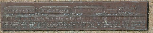
| 2 ► California, Alameda County, Alameda, West Alameda — 440 — First Transcontinental Railroad — Alameda Terminal — |
| On Lincoln Avenue at Webster Street, on the right when traveling west on Lincoln Avenue. | |||
| 3 ► California, Alameda County, Alameda, West Alameda — History of the Alameda Belt Line — |
| Near Atlantic Avenue. | |||
| 4 ► California, Alameda County, Albany — Albany Waterfront History (Pre-1900) — |
| On Buchanan Street, on the right when traveling west. | |||
| 5 ► California, Alameda County, Berkeley, Downtown Berkeley — Barker Building — A.W. Smith, Architect — 1905 — |
| On Shattuck Avenue near Dwight Way, on the right when traveling south. | |||
| 6 ► California, Alameda County, Berkeley, Downtown Berkeley — Francis Kittredge Shattuck Building — City of Berkeley Landmark, designated in 1995 — |
| On Shattuck Avenue at Addison Street, on the right when traveling south on Shattuck Avenue. | |||
| 7 ► California, Alameda County, Berkeley, Downtown Berkeley — Site of John Hinkel Livery Stable, 1900 — Berkeley Farm Creamery Complex — F.E. Armstrong, Contractor, 1910 — |
| On Allston Way east of Shattuck Avenue, on the right when traveling east. | |||
| 8 ► California, Alameda County, Berkeley, Poets Corner — Garden History — |
| On Bancroft Way west of West Street, on the left when traveling west. | |||
| 9 ► California, Alameda County, Berkeley, Poets Corner — Santa Fe Railway Depot — Charles Frederick Whittlesey, Architect — 1904 — |
| On University Avenue east of Bonar Street, on the right when traveling east. | |||
| 10 ► California, Alameda County, Berkeley, South Berkeley — Davis-Byrne Building — 1895 — City of Berkeley Landmark - Designated 1991 — |
| On Dwight Way, on the right when traveling east. | |||
| 11 ► California, Alameda County, Berkeley, Southwest Berkeley — Santa Fe Railroad Tracks — |
| On Sacramento Street at Ashby Avenue, on the right when traveling south on Sacramento Street. | |||
| 12 ► California, Alameda County, Berkeley, Upper Telegraph — Historic "Lorin District" — |
| On Adeline Avenue at Alcatraz Avenue, on the right when traveling north on Adeline Avenue. | |||
| 13 ► California, Alameda County, Dublin — Iron Horse Regional Trail — |
| On Tassajara Road, on the left when traveling north. | |||
| 14 ► California, Alameda County, Emeryville — California & Nevada Railroad — 1884 – 1903 — |
| Near Horton Street near 59th Street, on the left when traveling north. | |||
| 15 ► California, Alameda County, Emeryville — Northern Railway — |
| Near Horton Street. | |||
| 16 ► California, Alameda County, Emeryville — 335 — Shell Mound Park — |
| Near Horton Street. | |||
| 17 ► California, Alameda County, Emeryville — Welcome to the Emeryville Greenway — |
| On Halleck Street, on the right when traveling north. | |||
| 18 ► California, Alameda County, Fremont, Niles — California Nursery Historical Park — |
| Near Nursery Avenue near Niles Avenue. | |||
| 19 ► California, Alameda County, Livermore — Livermore Southern Pacific Depot — |
| Near Railroad Avenue near 1st Street. | |||
| 20 ► California, Alameda County, Newark — Carter Brothers — |
| On Thornton Avenue near Sycamore Street, on the left when traveling west. | |||
| 21 ► California, Alameda County, Niles — Completion of the Transcontinental Railroad — Niles, California — |
| Near Niles Boulevard near J Street. | |||
| 22 ► California, Alameda County, Oakland — Crossing the San Francisco Bay — |
| Near Burma Road. | |||
| 23 ► California, Alameda County, Oakland — Moving Shoreline — |
| On Mandela Parkway near Horton Street, on the right when traveling west. | |||
| 24 ► California, Alameda County, Oakland — Western Pacific Mole — |
| Near Middle Harbor Road near 7th Street. | |||
| 25 ► California, Alameda County, Oakland, Downtown Oakland — Crossroads — |
| On Telegraph Avenue at Broadway, on the left when traveling south on Telegraph Avenue. | |||
| 26 ► California, Alameda County, Oakland, Montclair — The Railroad History of Shepherd Canyon — Sacramento Northern — |
| Near Montclair Railroad Trail. | |||
| 27 ► California, Alameda County, Oakland, Oakmore Highlands — 40 — Leimert Bridge — |
| On Leimert Boulevard east of Park Boulevard, on the right when traveling east. | |||
| 28 ► California, Alameda County, Oakland, Piedmont Avenue — Key Route Train Station — |
| On 41st Street near Piedmont Avenue, on the left when traveling south. | |||
| 29 ► California, Alameda County, Oakland, Produce and Waterfront — Oakland Railroad History — |
| Near Water Street near Broadway. | |||
| 30 ► California, Alameda County, Oakland, Produce and Waterfront — Oakland Rails |
| On Second Street near Alice Street, on the right when traveling east. Reported permanently removed. | |||
| 31 ► California, Alameda County, Oakland, Produce and Waterfront — Western Pacific Railroad Depot — 1910 – 1975 — Oakland Landmark — |
| On 3rd Street near Washington Street, on the left when traveling east. | |||
| 32 ► California, Alameda County, Oakland, Produce and Waterfront — Western Pacific RR — Oakland Waterfront Warehouse District |
| On Third Street at Harrison Street, on the right when traveling north on Third Street. Reported permanently removed. | |||
| 33 ► California, Alameda County, Oakland, Trestle Glen — Trestle Glen — |
| On Trestle Glen Road near Brookwood Road, on the left when traveling west. | |||
| 34 ► California, Alameda County, Oakland, Upper Rockridge — The Railroad History of Lake Temescal — |
| Near Broadway Terrace. | |||
| 35 ► California, Alameda County, Oakland, Waterfront Warehouse District — Oakland’s Waterfront Warehouse District — A National Register Historic District — |
| On Jackson Street at 4th Street, on the right when traveling north on Jackson Street. | |||
| 36 ► California, Alameda County, Oakland, Waterfront Warehouse District — Waterfront Warehouse District — |
| On 3rd Street at Harrison Street, on the right when traveling east on 3rd Street. | |||
| 37 ► California, Alameda County, Oakland, Waterfront Warehouse District — Waterfront Warehouse District — |
| On 3rd Street at Jackson Street, on the right when traveling east on 3rd Street. | |||
| 38 ► California, Alameda County, Oakland, Waterfront Warehouse District — Waterfront Warehouse District — |
| On 5th Street at Jackson Street, on the right when traveling east on 5th Street. | |||
| 39 ► California, Alameda County, Oakland, Waterfront Warehouse District — 33 — Western Pacific Freight Depot — |
| On 3rd Street at Harrison Street, on the right when traveling east on 3rd Street. | |||
| 40 ► California, Alameda County, San Leandro, Davis Tract — San Leandro Depot — No. 2 — |
| Near West Estudillo Avenue near Orchard Avenue. | |||
| 41 ► California, Alameda County, Sunol — Niles Canyon Railway — |
| Near Kilkare Road near Main Street, on the left when traveling north. | |||
| 42 ► California, Alpine County, Bear Valley — Reynold’s House — Point of Historical Interest — |
| Near Ebbetts Pass Scenic Byway (State Highway 4). | |||
| 43 ► California, Alpine County, Markleeville — 318 — Ebbetts Pass — Historical Landmark — |
| On Ebbetts Pass Scenic Byway (State Highway 4), on the left when traveling east. | |||
| 44 ► California, Amador County, Ione — Iron Ivan — |
| On North Church Street, on the right when traveling north. | |||
| 45 ► California, Amador County, Jackson — Martell Stage Station |
| On Golden Chain Highway (California Route 49) at Martell Road, on the left when traveling north on Golden Chain Highway. Reported missing. | |||
| 46 ► California, Amador County, Sutter Creek — Leland Stanford, Sr. — 1824 – 1893 — |
| On Gopher Flat Road, on the left when traveling east on Gopher Flat Road. | |||
| 47 ► California, Butte County, Magalia — “Magalia Depot & Butte County Railroad” |
| Near Old Skyway Road near Old Depot Road. Reported missing. | |||
| 48 ► California, Butte County, Oroville — Completion of 4th Railroad in California — Middletown — |
| On Myers Street (Business California Route 70) at Kitrick Avenue, on the right when traveling south on Myers Street. | |||
| 49 ► California, Butte County, Paradise — Butte 011 — Old Paradise Depot — |
| On Black Olive Drive north of Pearson Road, on the right when traveling north. | |||
| 50 ► California, Butte County, Paradise — Town of Paradise Memorial Trailway — SPRR Milepost 198.2 – Site of the Paradise Rail Yard — |
| Near Pearson Road near Black Olive Drive. | |||
| 51 ► California, Calaveras County, Rail Road Flat — 286 — Rail Road Flat — |
| On Railroad Flat Road north of Summit Level Road, on the right when traveling north. | |||
| 52 ► California, Calaveras County, Valley Springs — 251 — Valley Spring — |
| On State Highway 12, on the right when traveling east. | |||
| 53 ► California, Contra Costa County, Alamo — The Railroad Put Alamo on the Map — |
| On Danville Boulevard at Hemme Avenue on Danville Boulevard. | |||
| 54 ► California, Contra Costa County, Antioch — Old Antioch's Railroads — |
| Near West 4th Street. | |||
| 55 ► California, Contra Costa County, Byron — Byron — Est. 1878 — |
| On Main Street near Holway Drive, on the right when traveling north. | |||
| 56 ► California, Contra Costa County, Clyde — The Only Train Stop in Clyde — |
| On Sussex Street at Port Chicago Highway, on the right when traveling north on Sussex Street. | |||
| 57 ► California, Contra Costa County, Danville — San Ramon Branch Line — |
| On West Prospect Avenue near Railroad Avenue when traveling north. | |||
| 58 ► California, Contra Costa County, El Cerrito — Santa Fe Railway — |
| On San Pablo Avenue at Ohio Avenue, on the right when traveling north on San Pablo Avenue. | |||
| 59 ► California, Contra Costa County, El Cerrito — Streetcars in El Cerrito — |
| On San Pablo Avenue at Portrero Avenue, on the left when traveling north on San Pablo Avenue. | |||
| 60 ► California, Contra Costa County, El Sobrante — California & Nevada Railroad — |
| On San Pablo Dam Road near El Portal Drive. | |||
| 61 ► California, Contra Costa County, El Sobrante — California and Nevada Railroad — |
| Near San Pablo Dam Road. | |||
| 62 ► California, Contra Costa County, Martinez — Martinez Train Depot — Dedicated September 22, 2001 — |
| Near Marina Vista Avenue near Castro Street, on the right when traveling west. | |||
| 63 ► California, Contra Costa County, Martinez — 6 — Southern Pacific R.R. Depot — |
| On Ferry Street near Marina Vista, on the right when traveling north. | |||
| 64 ► California, Contra Costa County, Moraga — Moraga Station — |
| Near Camino Pablo. | |||
| 65 ► California, Contra Costa County, Moraga — Moraga Train Station — |
| On Vlader Drive, on the left when traveling west. | |||
| 66 ► California, Contra Costa County, Orinda — Bryant Station Site — |
| On Moraga Way at Vashell Way, on the right when traveling south on Moraga Way. | |||
| 67 ► California, Contra Costa County, Orinda — Did You Know that Orinda Once Had a Railroad? — The California and Nevada Railroad — Landmarking Orinda's History — |
| Near Orinda Way. | |||
| 68 ► California, Contra Costa County, Orinda — The de Laveaga Station — 1880s — |
| On Bates Boulevard at Davis Road, on the right when traveling south on Bates Boulevard. | |||
| 69 ► California, Contra Costa County, Orinda — The deLaveaga Station — Landmarking Orinda's History — |
| On Davis Road at Bryant Way, on the left when traveling east on Davis Road. | |||
| 70 ► California, Contra Costa County, Pleasant Hill — Hookston Station Historic Exibit — San Ramon Branch Line of the Southern Pacific — |
| Near Bancroft Road south of Hookston Road. | |||
| 71 ► California, Contra Costa County, Richmond — By Land and By Sea — |
| On Doran Drive near Western Drive, on the right when traveling south. | |||
| 72 ► California, Contra Costa County, Richmond — Ferries and Frieght on San Francisco Bay — |
| Near Dornan Drive at Brickyard Cove Road. | |||
| 73 ► California, Contra Costa County, Richmond — Welcome to Richmond — |
| Near Nevin Plaza. | |||
| 74 ► California, Contra Costa County, Somersville — Eureka Slope — |
| 75 ► California, Contra Costa County, Walnut Creek — 184 — Oakland, Antioch & Eastern Railway — California at Civic Drive — 1911 — |
| On Civic Drive near North California Boulevard, on the left when traveling east. | |||
| 76 ► California, Contra Costa County, Walnut Creek — 102 — Southern Pacific Railroad Depot — 850 S. Broadway — 1891 — |
| On North Broadway near Mt. Diablo Boulevard, on the right when traveling south. | |||
| 77 ► California, El Dorado County, Latrobe — Latrobe — Est. 1864 — |
| On South Shingle Road near Elvira Street, on the left when traveling east. | |||
| 78 ► California, El Dorado County, Pollack Pines — In Memory of the Bravery of Our Pioneer Officers — |
| On Pony Express Trail, on the left when traveling east. | |||
| 79 ► California, Fresno County, Clovis — Tarpey Depot — |
| On South Clovis Avenue at 4th Street, on the right when traveling north on South Clovis Avenue. | |||
| 80 ► California, Fresno County, Clovis — 14 — The San Joaquin Valley Railroad — |
| Near South Clovis Avenue (State Highway 168) near Villa Avenue, on the left when traveling north. Reported missing. | |||
| 81 ► California, Fresno County, Coalinga — Coaling Station A — |
| On West Elm Street just east of 7th Street, on the left when traveling west. | |||
| 82 ► California, Fresno County, Coalinga — Coalinga’s First Rail Station – 1891 — |
| On South 5th Street just south of East Forest Street, on the right when traveling north. | |||
| 83 ► California, Fresno County, Fowler — Fowler's Switch — |
| On East Merced Street at South 7th Street, on the right when traveling north on East Merced Street. | |||
| 84 ► California, Fresno County, Fresno — "100th Anniversary of the Arrival of the Railroad to the San Joaquin Valley" — 1872 - 1972 — Z.S. Leymel Park Mayor - City of Fresno 1929-37 1941-47 |
| On Divisadero Street at Broadway, on the right when traveling east on Divisadero Street. Reported missing. | |||
| 85 ► California, Fresno County, Fresno — French Merci Train Boxcar — |
| Near North First Street. | |||
| 86 ► California, Fresno County, Fresno — French Merci Train Boxcar Cover — Dedicated July 9, 2021 — |
| 87 ► California, Fresno County, Fresno — Fresno — |
| 88 ► California, Fresno County, Fresno — 27 — Fresno Traction Company — 1903 - 1939 — |
| On Huntington Boulevard near First Street, on the left when traveling east. | |||
| 89 ► California, Fresno County, Fresno — 6 — Green Bush Spring — |
| Near Mariposa Street just south of Fulton Street. | |||
| 90 ► California, Fresno County, Fresno — Honoring the Ex-Braceros and Their Contributions — Honoramos los Ex-Braceros y Sus Contribuciones — 1942 - 1964 — |
| On Tulare Street near Van Ness Avenue, on the right when traveling west. | |||
| 91 ► California, Fresno County, Fresno — Via Liberation — Voie de la Liberte 1944 — |
| On Fresno Street near L Street, on the right when traveling east. | |||
| 92 ► California, Fresno County, Sanger — 32 — Sanger — |
| Near Hoag Avenue east of Jensen Street. | |||
| 93 ► California, Humboldt County, Blue Lake — 842 — Arcata and Mad River Rail Road Company — |
| On Railroad Avenue at F Street when traveling north on Railroad Avenue. | |||
| 94 ► California, Humboldt County, Fields Landing — Fields Landing Hotel — |
| On Fields Landing Drive at Railroad Avenue, on the left when traveling south on Fields Landing Drive. | |||
| 95 ► California, Imperial County, Jacumba — 939 — Desert Tower — |
| Near In-Ko-Pah Park Road west of Interstate 8. | |||
| 96 ► California, Imperial County, Ocotillo — The Impossible Railroad — |
| On Mortero Canyon Road just south of Highway S-2, on the right when traveling south. | |||
| 97 ► California, Inyo County, Big Pine — Zurich Station — |
| On California Route 168, 1.9 miles east of U.S. 395, on the right when traveling east. | |||
| 98 ► California, Inyo County, Bishop — 953 — Laws Station — |
| Near Silver Canyon Road at Joe Smith Road. | |||
| 99 ► California, Inyo County, Bishop — Slim Princess — |
| On Pine Street east of U.S. 395, on the left when traveling east. | |||
| 100 ► California, Inyo County, Death Valley Junction — 51 — Death Valley Junction — |
| On State Highway 127, 0.2 miles south of State Highway 190, on the right when traveling south. | |||
592 entries matched your criteria. The first 100 are listed above. Next 100 ⊳