After filtering for Minnesota, 201 entries match your criteria. Entries 101 through 200 are listed.⊲ Previous 100 — The final 1 ⊳
Parks & Recreational Areas Topic
By McGhiever, April 19, 2020
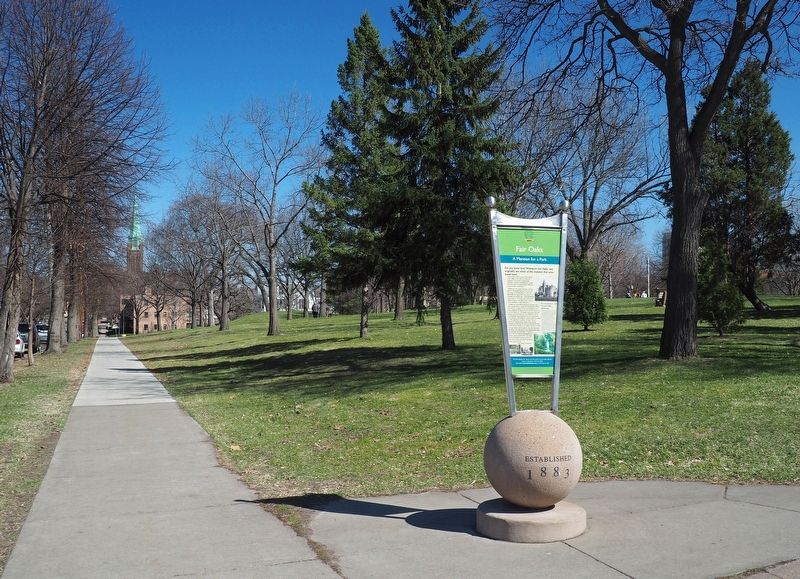
Marker at the northwest corner of Washburn Fair Oaks Park
| 101 ► Minnesota, Hennepin County, Minneapolis, Powderhorn — Fair Oaks — A Mansion for a Park — |
| On Stevens Avenue at East 22nd Street, on the right when traveling north on Stevens Avenue. | |||
| 102 ► Minnesota, Hennepin County, Minneapolis, Powderhorn Park — Powderhorn Oval — Olympic Proportions — |
| Near 10th Avenue South north of East 33rd Street when traveling north. | |||
| 103 ► Minnesota, Hennepin County, Minneapolis, Saint Anthony Main — Lucy Wilder Morris — and Father Hennepin Bluffs Park — |
| Near 6th Avenue Southeast just south of Southeast Main Street. | |||
| 104 ► Minnesota, Hennepin County, Minneapolis, Seward — 8 — Bridging the Mississippi — Midtown Corridor — C M & St P Short Line — |
| Near Midtown Greenway at Dorman Avenue. | |||
| 105 ► Minnesota, Hennepin County, Minneapolis, Sheridan — Sheridan Veterans Memorial — |
| On Water Street NE north of 13th Avenue NE, on the left when traveling north. | |||
| 106 ► Minnesota, Hennepin County, Minneapolis, Southwest Minneapolis — Harriet Bandshells — Music, Wind and Fire On the Lake — |
| On East Lake Harriet Parkway at West Minnehaha Parkway, on the left when traveling north on East Lake Harriet Parkway. | |||
| 107 ► Minnesota, Hennepin County, Minneapolis, University — Mulford Q. Sibley Grove — |
| Near S. 19th Avenue. | |||
| 108 ► Minnesota, Hennepin County, Minneapolis, Waite Park — Bicycle Paths — Pedaling the Parkways — |
| On Polk Street NE at 32nd Avenue NE, on the left when traveling north on Polk Street NE. | |||
| 109 ► Minnesota, Hennepin County, St. Louis Park, Triangle — In 1939, this was more than just a park. — It was a Destination — |
| Near Minnesota 7 Service Rd. | |||
| 110 ► Minnesota, Itasca County, Deer River — Upper Mississippi River Headwaters Project — Lake Winnibigoshish Dam and Reservoir — Constructed and operated by the U.S. Army Corps of Engineers, St. Paul District — |
| On County Highway 9, on the right when traveling west. | |||
| 111 ► Minnesota, Kandiyohi County, Atwater — Diamond Lake Community Park — |
| On County Highway 4, 0.4 miles north of 60th Avenue Northeast (County Highway 26), on the left when traveling north. | |||
| 112 ► Minnesota, Kandiyohi County, New London — This Historical Inclosure — |
| Near 3rd Avenue Southwest east of Oak Street South, on the right when traveling east. | |||
| 113 ► Minnesota, Lake County, Silver Bay — Palisade Head — |
| On North Shore Scenic Drive (State Highway 61) 0.2 miles north of Midbrod Drive, on the right when traveling north. | |||
| 114 ► Minnesota, Lake County, Silver Bay — Welcome to the Silver Bay Safe Harbor/Marina — |
| On Marina Drive, 0.3 miles east of Bayside Park Road, on the left. | |||
| 115 ► Minnesota, Lake County, Two Harbors — "C.C.C. Worker" — Civilian Conservation Corps — 1933-1942 — |
| 116 ► Minnesota, Lake County, Two Harbors — A Castle in the Park — |
| 117 ► Minnesota, Lake County, Two Harbors — Agate Bay Breakwater — |
| Near 3rd Street, 0.4 miles south of South Avenue. | |||
| 118 ► Minnesota, Lake County, Two Harbors — Building the Wall — |
| 119 ► Minnesota, Lake County, Two Harbors — CCC Camp Site — Civilian Conservation Corps Legacy Self-guided Tour — |
| 120 ► Minnesota, Lake County, Two Harbors — Cooperation Helps Build a Park / We Built this Park. — |
| 121 ► Minnesota, Lake County, Two Harbors — Geology Complicates Bridge Foundation — |
| 122 ► Minnesota, Lake County, Two Harbors — Gooseberry Falls CCC Historic District — Civilian Conservation Corps Legacy Self-guided Tour — |
| 123 ► Minnesota, Lake County, Two Harbors — Having Fun on the North Shore / Cruisin' on the Shore — |
| 124 ► Minnesota, Lake County, Two Harbors — Thomas Owens Memorial Park — |
| On 6th Street (County Route 20) at 2nd Avenue, on the right when traveling north on 6th Street. | |||
| 125 ► Minnesota, Lake County, Two Harbors — Welcome to Paul H. Van Hoven Park — |
| Near Waterfront Drive, 0.1 miles south of South Avenue, on the left when traveling west. | |||
| 126 ► Minnesota, Lake of the Woods County, Williams — Welcome to Garden Island State Recreation Area — |
| Near 54th Avenue Northwest (County Road 34) 3.4 miles north of County Road 8NW, on the right when traveling north. | |||
| 127 ► Minnesota, Morrison County, Little Falls — James Green Park — |
| 128 ► Minnesota, Morrison County, Little Falls — Lindbergh State Park — |
| On Lindbergh Drive South, on the left when traveling south. | |||
| 129 ► Minnesota, Morrison County, Little Falls — The Boyhood Farm of Charles Lindbergh — |
| 130 ► Minnesota, Morrison County, Little Falls — The WPA Builds a Park in the Rustic Style — |
| 131 ► Minnesota, Morrison County, Little Falls — WPA Water Tower & Shelter Building — |
| 132 ► Minnesota, Morrison County, Little Falls, Green Prairie Township — Interesting Names — Charles A. Lindbergh State Park — Little Elk/Schoessling Unit — |
| Near Grouse Road. | |||
| 133 ► Minnesota, Mower County, Austin — Jon W. Erichson — Pillars of the City — |
| On Main Street North just north of 5th Place Northwest, on the right when traveling north. | |||
| 134 ► Minnesota, Mower County, Austin — Larry L. Dolphin — Pillars of the City — |
| On Main Street North just south of 7th Place Northwest, on the right when traveling north. | |||
| 135 ► Minnesota, Mower County, Austin — Lyman D. Baird — 1857-1921 — Pillars of the City — |
| On Main Street North just south of 7th Place Northwest, on the right when traveling north. | |||
| 136 ► Minnesota, Murray County, Currie — Slaughter Slough Waterfowl Production Area — |
| Near 225th Avenue, 0.4 miles north of 161st Street, on the left when traveling north. | |||
| 137 ► Minnesota, Murray County, Fulda — Fulda Memorial Bathhouse — |
| Near East Lake Avenue east of South St. Paul Avenue, on the right when traveling east. | |||
| 138 ► Minnesota, Nicollet County, Fairfax — A New Deal for Fort Ridgely State Park — The New Deal and Fort Ridgely State Park — United States Civilian Conservation Corps — |
| Near County Highway 30, 0.7 miles west of State Highway 4, on the right when traveling west. | |||
| 139 ► Minnesota, Nicollet County, Fairfax — CCC Camp Life is a Healthful One — The New Deal and Fort Ridgely State Park — United States Civilian Conservation Corps — |
| Near County Highway 30, 0.7 miles west of State Highway 4, on the right when traveling west. | |||
| 140 ► Minnesota, Nicollet County, Fairfax — Fort Ridgely State Park's Buildings Today — The New Deal and Fort Ridgely State Park — United States Civilian Conservation Corps — |
| Near County Highway 30, 0.7 miles west of State Highway 4, on the right when traveling west. | |||
| 141 ► Minnesota, Nicollet County, Fairfax — Working Year-Round to Develop the Park — The New Deal and Fort Ridgely State Park — United States Civilian Conservation Corps — |
| Near County Highway 30, 0.7 miles west of State Highway 4, on the right when traveling west. | |||
| 142 ► Minnesota, Olmsted County, Rochester — Central Park Plaza — Dedicated July 30, 2004 — |
| Near 1st Avenue Northwest at 2nd Street Northwest, on the right when traveling south. | |||
| 143 ► Minnesota, Olmsted County, Rochester — History of Silver Lake — Stormwater Trail — |
| Near East Silver Lake Drive, 1.7 miles north of 12th Street Southeast (U.S. 14), on the right when traveling south. | |||
| 144 ► Minnesota, Olmsted County, Rochester — Mayo Clinic Site — Saint Marys Park — |
| Near 4th Street NW east of 10th Avenue SW, on the left when traveling east. | |||
| 145 ► Minnesota, Olmsted County, Rochester — The Mayo Memorial — |
| On 6th Avenue Southeast at 3rd Street Southeast, on the right when traveling south on 6th Avenue Southeast. | |||
| 146 ► Minnesota, Otter Tail County, Brandon — Inspiration Peak — |
| Near 120th Street (County Highway 38) north of 435th Avenue when traveling east. | |||
| 147 ► Minnesota, Pine County, Hinckley — A Room With A View — |
| 148 ► Minnesota, Pipestone County, Pipestone — Prairie: Past and Present — |
| On West Reservation Avenue, 0.7 miles west of North Hiawatha Avenue. | |||
| 149 ► Minnesota, Pipestone County, Pipestone — Sustaining the Sacred — |
| On Reservation Ave. | |||
| 150 ► Minnesota, Ramsey County, Maplewood — Destination Lake Phalen — |
| On E. Shore Drive, on the left when traveling west. | |||
| 151 ► Minnesota, Ramsey County, Maplewood — Frost Avenue — Gateway to Gladstone — Transportation • Economy • Community • Recreation — |
| Near Frost Avenue. | |||
| 152 ► Minnesota, Ramsey County, Maplewood — Gladstone Savanna's Natural History — |
| On English Street south of Frost Avenue, on the right when traveling south. | |||
| 153 ► Minnesota, Ramsey County, Maplewood — Phalen Regional Park Waterfall — |
| 154 ► Minnesota, Ramsey County, Maplewood — Ramsey County Cemetery — |
| Near White Bear Avenue north of Frost Avenue, on the right when traveling north. | |||
| 155 ► Minnesota, Ramsey County, Saint Paul, Battle Creek — Battle Creek Regional Park — |
| Near Point Douglas Road South, 0.6 miles north of Lower Afton Road. | |||
| 156 ► Minnesota, Ramsey County, Saint Paul, Cathedral Hill — McQuillan Park — |
| On Laurel Avenue at Mackubin Street, on the right when traveling west on Laurel Avenue. | |||
| 157 ► Minnesota, Ramsey County, Saint Paul, Cathedral Hill — Thomas Cochran Park — |
| On Western Avenue N. at Summit Avenue, on the right when traveling north on Western Avenue N.. | |||
| 158 ► Minnesota, Ramsey County, Saint Paul, Como Park — A Glasshouse Becomes a Reality — Como Park Zoo & Conservatory — A Proud Heritage — |
| Near Estabrook Drive. | |||
| 159 ► Minnesota, Ramsey County, Saint Paul, Como Park — Como Park Begins — Como Park Zoo & Conservatory — A Proud Heritage — |
| Near Estabrook Drive. | |||
| 160 ► Minnesota, Ramsey County, Saint Paul, Como Park — Como Park's Early Years — |
| Near Lexington Parkway north of Horton Avenue. | |||
| 161 ► Minnesota, Ramsey County, Saint Paul, Como Park — Como Zoo Today — Como Park Zoo & Conservatory — A Proud Heritage — |
| Near Estabrook Drive. | |||
| 162 ► Minnesota, Ramsey County, Saint Paul, Como Park — Sparky Show & Toby the Tortoise — Como Park Zoo & Conservatory — A Proud Heritage — |
| Near Estabrook Drive. | |||
| 163 ► Minnesota, Ramsey County, Saint Paul, Como Park — Streetcars to Como — |
| Near Lexington Parkway north of Horton Avenue. | |||
| 164 ► Minnesota, Ramsey County, Saint Paul, Como Park — The Early Years — Como Park Zoo & Conservatory — A Proud Heritage — |
| Near Estabrook Drive. | |||
| 165 ► Minnesota, Ramsey County, Saint Paul, Como Park — The Picturesque Landscape — |
| Near Lexington Parkway North. | |||
| 166 ► Minnesota, Ramsey County, Saint Paul, Como Park — The Zoo Expands — Como Park Zoo & Conservatory — A Proud Heritage — |
| Near Estabrook Drive. | |||
| 167 ► Minnesota, Ramsey County, Saint Paul, Dayton's Bluff — A time of environmental and cultural change — Bruce Vento Nature Sanctuary — |
| Near 4th Street East west of Commercial Street. | |||
| 168 ► Minnesota, Ramsey County, Saint Paul, Dayton's Bluff — Preserving history on the land — Bruce Vento Nature Sanctuary — |
| Near 4th Street East west of Commercial Street, on the left when traveling west. | |||
| 169 ► Minnesota, Ramsey County, Saint Paul, Dayton's Bluff — Remnants of a Former Rail Yard — Bruce Vento Nature Sanctuary — |
| 170 ► Minnesota, Ramsey County, Saint Paul, Highland Park — Hidden Falls — and Early Preservation of the Mississippi River Gorge — |
| On Hidden Falls Drive south of Mississippi River Boulevard S, on the right when traveling south. | |||
| 171 ► Minnesota, Ramsey County, Saint Paul, Highland Park — Mississippi River Gorge — |
| On Mississippi River Boulevard south of Hartford Avenue, on the right when traveling south. | |||
| 172 ► Minnesota, Ramsey County, Saint Paul, Highland Park — The West End Landscape / The Changing West End Landscape — |
| On Shepard Road at Elway Street, on the right when traveling east on Shepard Road. | |||
| 173 ► Minnesota, Ramsey County, Saint Paul, Macalester - Groveland — Shadow Falls — |
| On Mississippi River Boulevard at Summit Avenue, on the right when traveling south on Mississippi River Boulevard. | |||
| 174 ► Minnesota, Ramsey County, Saint Paul, Northwestern Precinct — Rice Park — |
| Near West 4th Street west of North Market Street, on the right when traveling west. | |||
| 175 ► Minnesota, Ramsey County, Saint Paul, Payne - Phalen — In Memory of Civilian Conservation Corps Personnel — |
| Near Phalen Drive north of Wheelock Parkway, on the right when traveling north. | |||
| 176 ► Minnesota, Ramsey County, Saint Paul, Payne - Phalen — Tallest Ice Structure in History — |
| On Phalen Drive north of E. Wheelock Parkway, on the right when traveling north. | |||
| 177 ► Minnesota, Ramsey County, Saint Paul, Riverview — Justus Ohage, M.D. — |
| On Water Street W. north of Plato Boulevard, on the left. | |||
| 178 ► Minnesota, Ramsey County, Saint Paul, Summit Hill — Summit Lookout Park — |
| On Summit Avenue at Ramsey Avenue, on the right when traveling east on Summit Avenue. | |||
| 179 ► Minnesota, Ramsey County, Saint Paul, West Seventh - Fort Road — Irvine Park / Irvine Park Historic District — |
| On N. Walnut Street at Irvine Park when traveling south on N. Walnut Street. | |||
| 180 ► Minnesota, Saint Louis County, Duluth — Duluth Japanese Peace Bell Garden — |
| Near Enger Tower Drive, 0.2 miles east of Hank Jensen Drive. | |||
| 181 ► Minnesota, Saint Louis County, Duluth, Canal Park — Duluth Legacy — Artist: Donna Dobberfuhl / Medium: brick (ironstone) / 1992 — |
| On Canal Park Drive, 0.1 miles south of Railroad Street, on the right when traveling south. | |||
| 182 ► Minnesota, Saint Louis County, Duluth, Canal Park — Fountain of the Wind — Artist: Douglas Freeman / Medium: bronze, stainless steel, glass / 1993 — |
| On Canal Park Drive at Buchanan Street, on the right when traveling south on Canal Park Drive. | |||
| 183 ► Minnesota, Saint Louis County, Duluth, Canal Park — Great Lakes Medallions — Artist: Cynthia Harper / Medium: ceramic, concrete, bronze inlay / 1993 — |
| On Buchanan Street at Canal Park Drive, on the right when traveling west on Buchanan Street. | |||
| 184 ► Minnesota, Saint Louis County, Duluth, Canal Park — Man, Child & Gull — Artist: Sterling Rathsack, Jr. / Medium: bronze / 1992 — |
| On Canal Park Drive south of Railroad Street, on the right when traveling south. | |||
| 185 ► Minnesota, Saint Louis County, Embarrass — Alma Norha Playhouse — |
| Near Salo Road at County Highway 21. | |||
| 186 ► Minnesota, Saint Louis County, Embarrass — Nelimark Sauna — |
| Near Salo Road at Highway 21. | |||
| 187 ► Minnesota, Saint Louis County, Orr — Voyageurs Forest — |
| Near Mead Wood Road, 0.7 miles north of Ash River Trail, on the right when traveling north. | |||
| 188 ► Minnesota, Saint Louis County, Soudan — The Soudan Mine — |
| Near McKinley Park Road, 0.5 miles north of Main Street. | |||
| 189 ► Minnesota, Scott County, New Prague — Greenway Park — The City of New Prague — Est. 1990 — |
| On Main Street East (State Highway 13/19) at Rising Moon Alley, on the right when traveling west on Main Street East. | |||
| 190 ► Minnesota, Scott County, New Prague — Northside Park — The City of New Prague — Est. 1975 — |
| On Lexington Avenue North at 3rd Street Northeast, on the right when traveling north on Lexington Avenue North. | |||
| 191 ► Minnesota, Scott County, New Prague — Philipp's Park — The City of New Prague — Est. 1992 — |
| On 4th Avenue Northwest (State Highway 21) just north of Main Street West (Colvill Memorial Highway) (State Highway 13/19), on the right when traveling north. | |||
| 192 ► Minnesota, Stearns County, Avon — Charles Lindbergh’s Minnesota Roots — |
| Near Interstate 94, on the right when traveling north. | |||
| 193 ► Minnesota, Steele County, Claremont — Explore Minnesota's Hardwoods at Rice Lake State Park — Minnesota State Parks — Windows on Minnesota's Landscapes — |
| On County Highway 40, 0.2 miles south of Rose Street (County Highway 19), on the right when traveling south. | |||
| 194 ► Minnesota, Wabasha County, Lake City — Patton Park — Named in Memory of George Patton and Eliza Kellogg, His Wife — |
| On U.S. 63 just south of High Street, on the right when traveling north. | |||
| 195 ► Minnesota, Waseca County, Waseca — Trowbridge Park Bandstand — 1915 — |
| Near North State Street (State Highway 13) just north of 4th Avenue Northeast, on the right when traveling north. | |||
| 196 ► Minnesota, Washington County, Grant — From Rails to Trails — Brown's Creek State Trail — |
| Near Dellwood Road (State Highway 96) west of Kimbro Avenue N. | |||
| 197 ► Minnesota, Washington County, Lakeland — The St. Croix River Valley / Welcome to Minnesota — |
| Near Interstate 94 at milepost 256,, 1.3 miles west of Stagecoach Trail, on the right when traveling west. | |||
| 198 ► Minnesota, Washington County, Marine on St. Croix, William O'Brien State Park — Lake Alice — Riverside Trail — |
| Near O'Brien Trail North (County Road 33) east of State Route 95, on the right when traveling south. | |||
| 199 ► Minnesota, Washington County, Marine on St. Croix, William O'Brien State Park — William O'Brien State Park — |
| Near Saint Croix Trail North (State Highway 95) 1.5 miles north of Chestnut Street, on the left when traveling north. | |||
| 200 ► Minnesota, Washington County, Oak Park Heights — Lake St. Croix Overlook — |
| On Lookout Trail at Peadbody Avenue N, on the left when traveling south on Lookout Trail. | |||
201 entries matched your criteria. Entries 101 through 200 are listed above. ⊲ Previous 100 — The final 1 ⊳