On California Avenue Southwest south of 5th Street Southwest, on the left when traveling south.
The Campbell Park Historic District is a residential neighborhood located immediately south of downtown.
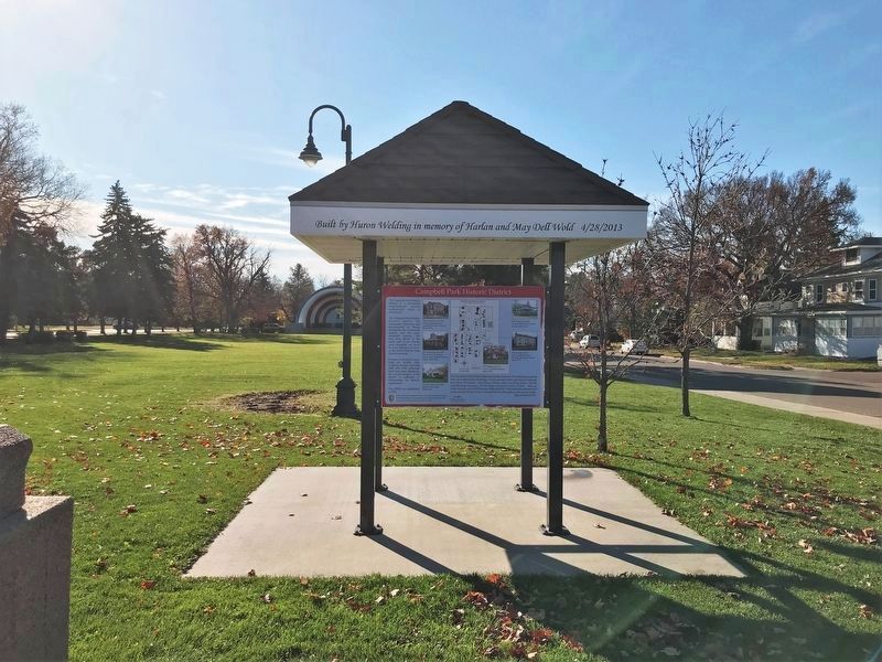
The Campbell Park Historic District reflects the community planning and development of Huron during the late nineteenth century and the . . . — — Map (db m185450) HM
On Kansas Avenue at 5th Street Southeast, on the right when traveling north on Kansas Avenue.
This park was created in 2007 by leaders in the regional healthcare community. It is intended to be a place of peace and reflection, and honors those individuals whose legacy of caring left a permanent impact on the well-being of our community. . . . — — Map (db m205749) HM
Near 1st Avenue at West 6th Street (U.S. 14), on the left when traveling north.
Originally owned by Jacob Olson Dahl, who was issued a land patent for eighty acres in 1884, the land that became Pioneer Park was the home of the Brookings County Fair from 1907 until 1922. The city purchased the land for $10,000 in 1923 and for a . . . — — Map (db m213618) HM
Near 32nd Street South, 0.5 miles west of 22nd Avenue South, on the right when traveling west.
Today, a grassland mound rises above the nature park, providing a natural setting for people to enjoy. But this has not always been a pretty sight.
In 1960, the City bought this property, a former gravel pit, for the city landfill. For the . . . — — Map (db m237169) HM
Near Oakwood Drive, 1.7 miles north of 204th Street (County Highway 6).
Scout Island was named for the annual Boy Scout encampment once held here. The island is now a peninsula bordered on the east and south by Tetonkaha Lake and on the west by Johnson Lake.
At the flagpole is a plaque dedicated to D.C. Mackintosh, a . . . — — Map (db m237236) HM
On West Mott Avenue at North Courtland Street (South Dakota Highway 50), on the right when traveling west on West Mott Avenue.
Orrion & Edith Barger
Orrion Russell Barger was born August 23, 1913 at Paynesville, MN and Edith M. Meyer was born November 22, 1913 at Howard, SD. Orrion and Edith (Meyer) Barger were married on November 1, 1941. On June 2, . . . — — Map (db m242613) HM
America's Shrine of Democracy, Mount Rushmore
National Memorial, is located near Keystone in
the Black Hills National Forest. The 60-foot
faces of four great American presidents
represent the birth, growth, development
and preservation of our . . . — — Map (db m161871) HM
On North Plum Street at East Main Street, on the right when traveling north on North Plum Street.
Vermillion's third city park was created in 1923 when Charles E. Prentis donated ten acres of land for that purpose in memory of his late wife. The land was originally part of the A. A. Carpenter homestead, including an apple orchard and nursery, . . . — — Map (db m179293) HM
This sundial and this park are dedicated to time.
Time is a paradox. . . we never seem to have enough.
Yet we have all the time there is.
We chose the sundial the oldest known device for
Measuring time as a means of taking time to say . . . — — Map (db m113356) HM
On Skyline Drive at 7th Avenue North West on Skyline Drive.
This area overlooking the Sioux River and river plains is known as Mellette Hill; named in honor of South Dakota's first governor, whose residence is near this site.
Over the last century, the land has been privately owned. However, in 1973 . . . — — Map (db m169944) HM
Throughout his life, Charles Badger Clark found that he disliked hectic urban areas. He craved the freedom and solitude offered by nature. For this reason, Badger chose to build his home in Custer State Park. Surrounded by ponderosa pines, solace, . . . — — Map (db m215802) HM
On State Highway 87, 0.5 miles north of Lame Johnny Road, on the left when traveling north.
Camp SP-3 (DSP-1 in 1934): NE 2 miles, end of CSP road on French Creek. Company: 2757 - 7/28/34-10/1/41.
The Civilian Conservation Corps was a federal work-relief program during the Great Depression. From 1933 to 1942, the CCC provided work for . . . — — Map (db m124589) HM
Near South Playhouse Road east of Needles Highway (State Highway 87).
Camp SP-4 (DSP-2):
Lodge: located in the buildings seen here.
Companies:
2755–7/16/34 - 10/21/35 795–10/29/35 - 1/13/36 1793–4/27/36 - 7/30/42
The Civilian Conservation Corps was a federal relief program during
1933 - 1942 gave jobless . . . — — Map (db m203658) HM
Near U.S. 385 south of Avenue of the Chiefs, on the left when traveling south.
The Crazy Horse mountain carving will be the world’s largest sculpture, measuring 563 feet high by 641 feet long, carved in the round. The nine-story-high face of Crazy Horse was completed on June 3, 1998. Work began on the 22-story-high horse’s . . . — — Map (db m155650) HM
In 1874, George Armstrong Custer led a force of more than 1,000 men on an expedition to the Black Hills to explore and map this little-known area. The photographer with Custer, William H. Illingworth, was the first to take glass-plate photographs in . . . — — Map (db m155656) HM
South Dakota
Game, Fish & Parks
This Property Has
Been Placed On The
National
Register of
Historic Places
By The United States
Department of the
Interior — — Map (db m137127) HM
On Stockade Lake Drive, 1 mile east of Lower French Creek Road, on the left when traveling east.
Originally Constructed by the
Civilian Conservation Corps (CCC)
Completed in April 1937
South Dakota National Guard
Completed in August 1988
The Bridge is 76 feet, 4 inches long and 26 feet wide. Three spans, each constructed of 10 . . . — — Map (db m121402) HM
On U.S. 385, 0.6 miles south of Medicine Mountain Road, on the left when traveling south.
Benefit You The landscape before you has been logged several times since the early 1900's. Besides the obvious benefits of timber for building many products, timber harvesting benefits the forest community. Benefit . . . — — Map (db m234599) HM
On U.S. 385, 3.5 miles north of 7-11 Road (County Road 101), on the right when traveling north.
Between 350 and 500 bison roam the grasslands of the national park — a token of the herds numbering 30 to 60 million that once inhabited the prairies of North America. The American bison, commonly called buffalo, became nearly extinct as settlers . . . — — Map (db m234632) HM
On U.S. 385, 1.9 miles north of 7-11 Road (County Road 101), on the right when traveling north.
Camp NP-1 (DNP-1): located southeast of the cave entrance
in Wind Cave Canyon.
Companies: 2754 -- 7/16/34 - 11/1/39
2757 detachment -- 4/18/40 - 8/1/40
The Civilian Conservation Corps was a federal relief program during 1933-1942 that . . . — — Map (db m134564) HM
He laid the foundation of the National Park Service, defining and establishing the policies under which its areas shall be developed and conserved unimpaired for future generations. There will never come an end to the good that he has done. — — Map (db m234600) HM
On U.S. 385, 3.9 miles north of 7-11 Road (County Road 101), on the right when traveling north.
Wind Cave National Park harbors a fragment of an endangered ecosystem, a remnant of the native grasslands that once stretched from Indiana to the Rocky Mountains, from southern Canada to the Gulf of Mexico. In fewer than 100 years, the Great Plains . . . — — Map (db m234694) HM
On State Highway 89, 0.7 miles north of Prairie Schooner Road (County Road 318), on the right when traveling north.
Left Panel:
National Forests ~ An American Legacy
In 1891, Congress passed legislation to establish Forest Reserves (now called National Forests) to restore eastern lands damaged by deforestation and disastrous floods; and to . . . — — Map (db m184800) HM
On U.S. 385, 1 mile north of State Highway 87, on the right when traveling north.
The valley in front of you is the site of the Wind Cave National Game Preserve, which was established in 1912 to reintroduce bison to the area. About 4,000 acres were enclosed to receive 20 bison from the New York Zoological Society and Yellowstone . . . — — Map (db m234681) HM
On 2nd Avenue (State Highway 471) north of G Street, on the right when traveling north.
Welcome to Edgemont, the beginning of the Burlington Northern George S. Mickelson Trail! This winding trail follows the abandoned Burlington Northern Railroad route 114 miles through the heart of the Black Hills and ends at Deadwood.
The . . . — — Map (db m123925) HM
On State Highway 71, 0.1 miles south of Cascade Trail.
You are Standing in the Middle of a Community Meeting!
This area is the meeting place of three distinct plant communities ~ the ponderosa pine woodland, the mixed grass prairie, and the Cascade warm springs ecosystem. Their boundaries . . . — — Map (db m184457) HM
On Mellette Street north of 1st Avenue, on the left when traveling north.
Bonesteel
South Dakota
Quasquicentennial
1892 - 2017
Pride in the Past Faith in the Future
Legacy Park was built in observance of the State Centennial in 1989 and the City of Bonesteel Centennial in 1992. In 2017, Bonesteel celebrated . . . — — Map (db m235029) HM
Near Stone Church Drive east of Toe Road West, on the right when traveling east.
The parade ground was the heart of the frontier fort. Here soldiers gathered for roll call, drills, and dress parades beneath the stars and stripes flying high on the towering flagstaff.
The parade ground was also used for recreation, including . . . — — Map (db m188312) HM
Lat 43° 3' 15" N
Long 98° 33' 21" W
You are just downriver from Ft. Randall Dam, the first dam in South Dakota completed under the Pick-Sloan Plan by the US Army Corps of Engineers in 1956.
The Missouri River remains . . . — — Map (db m235011) HM
On East 3rd Street (198th Street) at Carney Avenue, on the right when traveling east on East 3rd Street (198th Street).
Ree Heights Roadside Park
The railroad beat the settlers into this area where farms are giving way to cattle ranches, now as it was then. Ree Heights first postmaster was Wm. H. Love 8 June 1882. Three miles South are the Ree Heights, . . . — — Map (db m185461) HM
The surrounding hills became part of the Custer National Forest July 2, 1908. The cliffs you see on three sides are the Tongue River Member of the Fort Union Geological Formation. The formation, about 56 million years old, is massive sandstone . . . — — Map (db m113212) HM
Near Farm Island Road, 1 mile south of South Dakota Highway 34, on the right when traveling south.
The CCC camp was established on this island during the summer of 1933 and provided work for 250 men. Work project plans were twofold: to convert Farm Island into a state recreation area and to build an 850-foot causeway between the northwest point . . . — — Map (db m225030) HM
On West Oak Street at West Broadway Avenue, on the right when traveling west on West Oak Street.
This rock weighing 14,700 pounds serves as a
memorial to the Mateer Family. The triangle
property upon which it rests was given to the
City of Pierre by Curtis B. and Verna S. Mateer
on March 3, 1964. They later completed it with
sod, . . . — — Map (db m169227) HM
Near Farm Island Road, 1 mile south of South Dakota Highway 34, on the right when traveling south.
The State Division of Forestry supervised CCC men at the Farm Island camp. These hardworking men:
• Developed Farm Island Recreation Area
• Erected the Lewis and Clark monument (not accessible due to high water)
• Built the Arikara . . . — — Map (db m225032) HM
Improved By
City of Parkston
and
Works Progress Administration
Project Number 2974
1938
City Officials
Mayor - W.A. Koehn
Councilmen
M. Hohenthaner
Fred Ceidel
H.K. Meisenhoelder
Edward E. . . . — — Map (db m119555) HM
This trail features seven types of animals that once lived in the area now known as Badlands National Park. Each of these lineages met a different fate as the climate changed. Some moved, some adapted to the changes, and some are now extinct. . . . — — Map (db m114175) HM
In the days when oreodonts walked this land, the rock layer before you was not rock but the muddy bottom of a streambed. Over time, those sediments hardened into the thick horizontal band of grayish red stone you see here.
Thin ribbons of . . . — — Map (db m137007) HM
Water is scarce in the Badlands, which get less than 16 inches of precipitation per year. The bowl-like Cliff Shelf where you stand provides more moisture than commonly found in this desolate land.
Drawn to this spot for more than 11,000 . . . — — Map (db m137125) HM
Rock layers in Badlands National Park contain fossils that show a dramatic cooling and drying of global climate over millions of years. The oldest rock layers contain marine fossils, roughly 70 million years old, from when this area was . . . — — Map (db m113124) HM
Oredonts were common throughout the Badlands, but became extinct. Their fossil remains provide evidence of their lives and habitat. Fossils can develop over time when animal or plant remains are quickly covered in sediment and replaced by . . . — — Map (db m113122) HM
Dogs have changed and adapted over millions of years. Members of the dog lineage gradually evolved in to the wolf by growing longer, stronger legs and a shorter tail. This increased size led to increased strength and power to hunt food and . . . — — Map (db m113177) HM
Mako sica - Lakota
Les mauvaises terres - French
The Badlands - English
When the Lakota looked on the land around you, they saw the Paha ska (white hills)-a place of bountiful hunting. Historically used for . . . — — Map (db m137121) HM
These rocks were deposited millions of years ago when rivers and wind spread silt, sand, and ash across the landscape. About 500,000 years ago, ancient rivers began eroding this area, leading to the present day landscape. Modern rivers, rain, . . . — — Map (db m113126) HM
Prehistoric alligators lived in swampy conditions, as they do today.
Physically, alligators have changed mostly in size over the last several million years. Modern alligators are larger, growing up to 14 feet long. Ancient alligators grew . . . — — Map (db m113092) HM
A few hundred yards to the west, turn left on the sage Creek Rim Road for Roberts Prairie Dog Town and the Sage Creek Primitive Campground. Wildlife, particularly bison, is often seen near this gravel road.
The Sage Creek Rim Road . . . — — Map (db m113127) HM
The discovery of this specimen led to the golden age of paleontology in North America. After acquiring this fossil from fur traders, Dr. Hiram Prout wrote about it in 1846. His description captured the attention of scientists. At that time, . . . — — Map (db m113176) HM
Ammonite fossils found in the park are evidence that this area was under water 75 million years ago. Some ammonites could grow to more that three feet across and served as a food source for giant mosasaurs and other predators.
The Western . . . — — Map (db m113115) HM
Your fossil discovery begins a scientific process. Every detail is important, even the area around the find. A fossil and its surroundings reveal what types of plants and animals existed and how they lived, died, and changed.
The . . . — — Map (db m113123) HM
Fossils can reveal how animals lived and died, and what their environment was like. Evidence from one of the park's nimravid fossils offers crime-scene clues. The size and location of the holes in the forehead of this fossil match the knife-like . . . — — Map (db m113121) HM
Horses have adapted in North America over millions of years. As woodlands changed to grasslands, the dog-sized, primitive horses gradually evolved into the lineage that led to the modern-day horse.
Mesohippus was the first three-toed . . . — — Map (db m113091) HM
On 2nd Street Southwest, 0.1 miles east of Dakota Avenue South, on the right when traveling west.
The Field House was built by the W.P.A. in 1936. The government formed the W.P.A. (Works Progress Administration) to create jobs during the Great Depression. Native stone was hauled from local fields to keep the costs down. The building features a . . . — — Map (db m180706) HM
On 228th Street (South Dakota Route 34) 0.3 miles west of Dakota Avenue South.
A.J. Gebhart designed and built the ski lift assisted by Lloyd Marken. The electric powered apparatus was installed in February of 1956 and kept a 1,200 foot circle of rope rotating to safely pull sled, ski, toboggan, or scoop shovel users back to . . . — — Map (db m113045) HM
In 1916 Foster Stratton erected a two-story brick building on this site. It held a garage and machine shop on the lower level, with a photography studio and living quarters on the second floor. When the building was razed in 1989, the Stratton . . . — — Map (db m113050) HM
On State Highway 248, 0.8 miles west of Business Interstate 90, on the right when traveling east.
Reading Brands
Two old cowpokes reading twenty brands wont agree on all of them but generally speaking this is how to read a brand.
A letter like this (image of backwards letter F) is a reverse F. But this (image of letter F leaning . . . — — Map (db m134569) HM
On State Park Drive, 0.4 miles west of 234th Street (State Highway 236), on the left when traveling west.
In 2004, Lake Herman State Park received funding from the South Dakota State Historical Society through a Deadwood Fund Grant to restore this structure. Built in 1871, it was originally the home of the Herman Luce family. Through the years it housed . . . — — Map (db m205238) HM
On U.S. 385 at Galena Road (Forest Road 534), on the right when traveling north on U.S. 385.
Camp F-20 Park Creek: located 3 mi E on FH 534;
2.75 mi N on FH 180; W of creek
Companies: 2759V – 11/2/34-7/30/41; 792 – 10/11/41-12/14/41
The Civilian Conservation Corps was a federal relief program during 1933-1942 that gave . . . — — Map (db m124592) HM
By the mid-1890s Deadwood city officials deemed it necessary to purchase a tract of land to be used for recreation and enjoyment by its citizens. Almost fifteen years elapsed before Deadwood's first city park was created. The park surrounding . . . — — Map (db m120232) HM
Near Charles Street (CanAm Highway) (U.S. 85) at Cedar Lane, on the right when traveling south.
After using a long stretch of track that went through the scenic Black Hills for almost a century, the Burlington Northern & Santa Fe (formerly Chicago Burlington & Quincy Railroad Company) quit running in 1983. The idea to turn the railroad into a . . . — — Map (db m121055) HM
Near Charles Street (CanAm Highway) (U.S. 85) at Stewart Street, on the right when traveling south.
Deadwood's viewshed is an integral component that truly makes this community unique to the visitors who come here annually. Poised in the center of the downtown core district is McGovern Hill, an erosional feature carved by Whitewood and Deadwood . . . — — Map (db m234699) HM
On Charles Street (U.S. 85) at Stewart Street, on the left when traveling south on Charles Street.
On October 27, 1937, a group of twenty-one business and professional men gathered at the Franklin Hotel and
organized the Deadwood Rotary Club. According to the local newspaper, the new Rotary Club would
“…unite Deadwood with more than . . . — — Map (db m183429) HM
Near Charles Street (CanAm Highway) (U.S. 85) at Cedar Lane, on the right when traveling south. Reported missing.
It took about a thousand people just 255 days to build the 114-mile Chicago, Burlington and Quincy Railroad between Edgemont and Deadwood using primitive methods. It took more than 15 years to complete the George S. Mickelson Trail on the . . . — — Map (db m183281) HM
On Englewood Road at Brownsville Road on Englewood Road.
Englewood, once called Ten Mile, began as a stop along the Cheyenne-Deadwood Stage. Every 10 miles along the route there was a stoop where horses could be changed and riders could rest.
The town came to life when the railroad was built in . . . — — Map (db m168894) HM
On Englewood Road at Brownsville Road on Englewood Road.
Originally known as Ten-Mile ranch, this area served as a stagecoach stop on the Cheyenne to Deadwood trail in the 1870s. The name was changed to Englewood in 1891 when the railroad came through. It was easier for the telegraphers to tap out . . . — — Map (db m168893) HM
On West Main Street (CanAm Highway) (U.S. 85) at Siever Street, on the left when traveling east on West Main Street (CanAm Highway).
Medical services at the Homestake Mining Company, one of the pioneers in the United States in the field of industrial health services, first began in 1877, when the company contracted with Dr. D. K. Dickinson to furnish medical and surgical . . . — — Map (db m121497) HM
On Interstate 90, 1 mile west of Red Hill Road, on the right when traveling east.
South Dakota's rich western heritage has been remembered along the inter-state highway system at safety rest areas and tourist information centers.
The eight pillars which thrust skyward here merge in the framework of a tipi, the Plains . . . — — Map (db m202618) HM
On CanAm Highway (U.S. 85) north of U.S. 385, on the left when traveling north.
South Dakota's George S. Mickelson Trail is a 109 mile, multiuse recreational trail that runs through the heart of the Black Hills. The Mickelson Trail is one of the United States premier "Rails to Trails" projects that began in 1983 after the . . . — — Map (db m121089) HM
On U.S. 14A, 6 miles south of Business 90, on the left when traveling south.
"But how it is that I've heard so little of this miracle and we, toward the Atlantic, have heard so much of the Grand Canyon when this is even more miraculous? All the better eventually… (that the Dakotas are not on the through line to the . . . — — Map (db m124130) HM
On North Broadway Street at East 4th Street, on the right when traveling south on North Broadway Street.
Whereas, the Honorable John J. (Jack) Fox, Mayor of the City of Canton, South Dakota, has served the community of Canton in many ways, thus resulting long ago in Mayor Fox being designated citizen of the year in the City of Canton; and . . . — — Map (db m227911) HM
Near 480th Avenue (County Highway 135) 0.2 miles south of 269th Street (County Highway 102).
For approximately 150 years, this region has been intensively farmed. By clearing rocks from fields and plowing over the mounds, some destruction and erosion of cultural assets occurred. Yet, many farming families also played a role in site . . . — — Map (db m210630) HM
Near 480th Avenue (County Highway 135) 0.2 miles south of 269th Street (County Highway 102), on the left when traveling south.
With abundant bison herds and control over the
valuable pipestone quarries 52 miles to the north,
Blood Run/Good Earth was well positioned to
become a trading center. Hides and scapula hoes from
bison were two important products for trade. . . . — — Map (db m204025) HM
Near 480th Avenue (County Road 135) north of 270th Street, on the right when traveling north.
Naming the first South Dakota state park created in over 40 years was an
important task. Names and titles matter. They hold meanings and stories more significant than the words alone. The park's name would need to define this place while . . . — — Map (db m195078) HM
On Shoreline Drive, 0.6 miles north of East Highway 16 (Interstate 90BL), on the right when traveling north.
Roland Dolly, son of Leroy and Delores Dolly, was born and raised in Lyman County, SD. His public career included serving U.S. Senator James Abonor, the Reagan Administration in Washington, D.C. and the state of SD on the Economic Development . . . — — Map (db m242614) HM
Near Adventure Drive east of North Drive, on the left when traveling east.
The dam was constructed and completed in 1958. Water flowed over the spillway for the first time on March 29, 1960, creating the lake. During this same time frame the Department of Game Fish and Parks purchased 1,540 acres of land to create the . . . — — Map (db m242213) HM
On State Highway 10, 1 mile east of 350 Ave, on the right when traveling west.
Disappearing Waterfowl Habits
The prairies of the Great Plain once stretched from horizon to horizon-a rolling, grass-covered landscape filled, spring through fall with millions of birds. Starting in the 19th century, this habitat began . . . — — Map (db m120528) HM
Entered into the National
Register of Historic Places
June 19, 1973
Under the National Preservation
Act of October 15, 1966
Bear Butte was placed in the National
Register Because of its Spiritual value
To the Plains Indians . . . — — Map (db m172497) HM
Born in Ohio in 1876, he came to South Dakota in 1907. With scant education, he achieved college degrees, taught for 25 years, his last school at 86, to afford him time for summer research.
He wrote "Mato Paha", the story of Bear Butte, a . . . — — Map (db m180977) HM
Near Bear Butte State Park Drive, 1 mile north of U.S. 79, on the left when traveling north.
"Give us a blessing so that our words and actions be one in unity, and that we will be able to listen to each other. In doing so, we shall with good heart walk hand in hand to face the future."
Frank Fools Crow in prayer . . . — — Map (db m154913) HM
On 254th Street (County Road 122) at Scandia Drive, on the left when traveling east on 254th Street.
John Thompson, Pioneer
(1841-1913)
John Thompson arrived in America in 1854. He was a 13-year-old orphan who had lost his parents and sister to cholera during the long journey from Meraker, Norway. He was raised by an aunt in . . . — — Map (db m181288) HM
Near South McHardy Road, 0.1 miles south of East Aspen Boulevard, on the right when traveling south.
In 1870, Thorsten Lee homesteaded what is now part of McHardy Park. In 1972, owners Dr. Bryson and Hazel McHardy donated 35.85 acres of that land to Brandon Lions Club for park development. In 1973, lacking funds, the Lion's turned the property over . . . — — Map (db m198825) HM
On Beach Avenue, 0.2 miles south of East 3rd Street, on the left when traveling south.
whose vision and industry led to the establishment of the Dell Rapids Bathing Beach in 1917, this building is respectfully dedicated this 4th day of July, 1934
Built by the Dell Rapids Park Board and the city council in co-operation with the . . . — — Map (db m208405) HM
Side 1 The Reconstruction Finance Corporation (RFC) granted a $410,000 relief loan to South Dakota in 1932, the third year of the Great Depression, Garretson became one of five towns in the county allotted funds.
Its City Council then . . . — — Map (db m188833) HM
Palisades State Park
Palisades State Park began with an initial gift of 20 acres from Mrs. Winona Axtell Lyon in 1947. During the next twenty years, smaller tracts were added to the park as money to purchase them became available. In 1969, . . . — — Map (db m208240) HM
On Park Access Road, 0.6 miles west of South Minnesota Avenue, on the left when traveling south.
Manfred Georg Sigismund Szameit was born in Madüsee, Pomerania, Germany, on September 10, 1936. Three years later, Fuehrer Adolph Hitler ordered Nazi Germany armies to invade Poland. This action greatly worried Manfred's father Heinrich. Concerned . . . — — Map (db m187263) HM
Near South Cliff Avenue, 0.2 miles south of East 41st Street, on the right when traveling south.
After a strong coalition of civic organizations urged the city to build Falls Park and to set up a City Specification Committee within the Chamber of Commerce, such a study was conducted in 1967-68. The subsequent transformation of the appearance . . . — — Map (db m197452) HM
Near South 4th Avenue west of East Park Drive, on the right when traveling south.
A Park Born in Controversy
Helen McKennan's will, gifting 20 acres of land for a new park, became the center of intense public debate after her death in 1906. She also gave her home, the former residence of Col. Melvin Grigsby, to be sold to . . . — — Map (db m186530) HM
(side one)
Settlers arrived in this area in the 1860s. Later they began quarrying its vast deposits of quartzite. East Sioux Falls, a rough-and-tumble quarrymen's town, began in 1887 and flourished for several years. The financial . . . — — Map (db m131971) HM
On East 24th Street, 0.1 miles east of South Bruce Road, on the right when traveling east.
At age 11, William F. Cody was forced to find work after his father died. During his colorful life (1846--1917) Cody was a messenger, Pony Express rider, Civil War soldier, army scout, guide, and Indian fighter. He earned his nickname, "Buffalo . . . — — Map (db m206792) HM
On South 2nd Avenue, 0.2 miles north of East 26th Street, on the right when traveling north.
Melvin Grigsby enlisted in the Union Army at the age of 16. Captured by the Confederates, he was confined in four different prisons, including the infamous Andersonville prison. After escaping in 1865, he joined Gen. W. T. Sherman's army. Later he . . . — — Map (db m186531) HM
E.A. Sherman is recognized as the father of the Sioux Falls park system. To commemorate his work, J.K. Daniels & the Roman Bronze Works of New York was commissioned to create this bronze portrait in 1917. It was rededicated in Honor of the Park . . . — — Map (db m131976) HM
An early pioneer and land
speculator in Sioux Falls,
Helen McKennan
recognized a need for
city parks. She donated
her home and 20 acres of
adjacent land in 1906 to
become what is now
known as McKennan Park.
Martin . . . — — Map (db m113432) HM
Lady Liberty first graced McKennan Park in 1942 although the statue was not formally dedicated until August 1, 1943. As several thousand watched, twins Thelma and Elma Iverson unveiled a wood carving of the Statue of Liberty. The statue had been . . . — — Map (db m113437) HM
With World War II threatening the tranquility of the United States in 1940, Oscar Ellefson, caretaker and builder of many early McKennan Park attractions, proposed a new project. Ellefson envisioned designing and building two pillars made of . . . — — Map (db m113450) HM
On South Perry Place, 0.1 miles north of State Highway 42, on the right when traveling north.
to plant an area by sowing seeds; to encourage new ventures
header:Historic Bur OakThe Land
In 1997, the Perry family agreed to sell 55.07 acres of land to the City of Sioux Falls and made an additional . . . — — Map (db m199108) HM
Near West 53rd Street east of South Oxbow Avenue when traveling east.
Sertoma Park is located in an old oxbow of the Sioux River. This urban site, with its tree-lined oxbows and river environment, offers an opportunity for increased public awareness and understanding of the outdoors. It can also offer an increase in . . . — — Map (db m208524) HM
With pioneer spirit, the 28 year old Mr. Sherman arrived in Sioux Falls in June of 1873. He invested in real estate, milling, banking, an electric plant, and a railway company.
E.A. Sherman was involved in the community as County . . . — — Map (db m131984) HM
(South Side)
E.A. Sherman Devoted his life to creating and promoting a park system in Sioux Falls. After unsuccessfully lobbing for the creation of a park commission, Sherman began his legacy with a 1907 election to the city council. . . . — — Map (db m131978) HM
Near North Grange Avenue south of West 2nd Street, on the right when traveling south.
The Renovation and Restoration of the
Shoto-Teien Japanese Gardens
Terrace Park at Covell Lake
Sioux Falls, South Dakota
The Terrace Park Japanese Gardens were originally created from 1926 to 1936. In 1984, after years of neglect, a . . . — — Map (db m207213) HM
142 entries matched your criteria. The first 100 are listed above. The final 42 ⊳