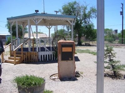
From 1857 to 1860 Lt. Edward F. Beale and a crew of 100 men built the first federal highway in the southwest. The 1857 Beale Expedition used 22 camels and dromedaries for pack animals. This road went from Fort Smith, Arkansas to Los Angeles, . . . — — Map (db m32206) HM
Recordando a Brian O'Dwyer In 1994 Brian came to Gowan to build a business in Mexico that would provide growth and opportunity for the company and his employees. Walking the fields with farmers, Brian and his Tribe were men with muddy boots. They . . . — — Map (db m191696) HM
A Positive Impact Starting in 1905, dams were constructed along the Colorado River that brought positive change to the Southwest. Dams and canals brought a safe and secure source of water and power and enhanced the ability of people to live in . . . — — Map (db m158380) HM
Named for resident William Finley Crockett, son of frontiersman Davy Crockett, this community was once a flourishing river port during the second half of the 19th century and into the early years of the 20th century. Steamboats loaded with cotton, . . . — — Map (db m201389) HM
From the 19th century to present day, the economy of Arkansas County has been based on agriculture, especially rice farming. An essential part of rice farming
is having enough water at the right time to flood the fields. Natural water sources . . . — — Map (db m192660) HM
Following the sneak attack on Pearl Harbor on December 7, 1941, the massive American production might was mobilized. After that attack the production of most non-essential consumer goods was halted or curtailed, and manufacturing facilities were . . . — — Map (db m92187) HM
The Arkansas & Oklahoma Railroad, owned by John Bayless and William Felker, was the train route west from Bentonville to Gravette from 1898 to 1900. Besides transporting passengers, this route played a major role in the growth of the Ozark fruit . . . — — Map (db m266017) HM
January 1936, Tom Farish & Joe Steele started building a canning factory using a lot of donated labor. The first run of green beans was June 26, 1936, tomatoes July 22, 1936, followed by spinach and other products later on.
After Tom Farish . . . — — Map (db m93283) HM
The words "esto perpetua" emblazoned upon a stone above the entrance to Grotto Spring declare the prevailing belief that these healing waters would flow forth forever. Early townspeople discovered the spring under an overhanging rock ledge, a . . . — — Map (db m80121) HM
In 1895 Austin Corbin, a New York banker and land developer, working with immigration officials brought 100 families from north central Italy to grow cotton at Sunnyside, a plantation located between the Mississippi River and Lake Chicot. These . . . — — Map (db m89774) HM
Side 1
The Lakeport Plantation house was constructed circa 1859 for Lycurgus and Lydia Taylor Johnson. The skilled craftsmanship and lasting character are testaments to those who built the house. It is preserved in remembrance of all who . . . — — Map (db m90491) HM
The legacy of the Mississippian culture lives forever through the Three Sisters Garden, like the one you see planted here.
The American Indians who lived here over 500 years ago were expert farmers whose most important crops were corn, beans, . . . — — Map (db m116605) HM
The dam seen here was constructed in 1887 & 1888 for the Mammoth Spring Milling Company. Each stone was hand-quarried and fit into place using no mechanical equipment. The concrete structure, to your left on the far side of the dam, is all that . . . — — Map (db m192074) HM
Established in 1855, the Independence County poor farm provided those in need with a place to live, medical care, and the opportunity to grow their own food in the garden patch. These houses were the community’s way of providing care to the poor . . . — — Map (db m226571) HM
A founder of Lafayette County
First governor of Arkansas
In 1823 James Sevier Conway began a successful plantation in the rich soils near the Red River. In 1826 he married Mary Jane Bradley, a beautiful young women who had moved to the . . . — — Map (db m181517) HM
Marianna named in honor of
Maryann Martin Harland
Town established 1858 A.D.
Incorporated Oct. 24, 1870 A.D.
1870 Agriculture, Timber
Population 165
1970 Agriculture, Industry
Population 6215 — — Map (db m117262) HM
(side 1)
The first tracts of South Bend Plantation, originally known as the Jordan Place, were purchased in 1840 by Dr. John Augustus Jordan. In 1852, Jordan and Irene Johnson married and built a stately southern Georgian mansion on the . . . — — Map (db m285063) HM
In the fall of 1851, three Mills brothers
headed west, one by water, one by land and
one to Texas. This brought Joel Mills wife,
Kitura Burke Bird and family from Henderson Co., Tennessee to Sevier County, now known as Little River County. . . . — — Map (db m121361) HM
In 1897 on the NW 1/4 Sect. 8 1N 7W Fuller planted the first rice on the Grand Prairie. The venture failed. Having learned about rice production in Louisiana, he returned for more information. In 1903 he returned to Lonoke County. The citizens of . . . — — Map (db m96636) HM
Just as pottery, stone tool, mounds are critical for understanding the Plum Bayou culture, so too are plants.
Through specialized techniques archeologist recover and analyze plant remains from archeological sites like Toltec Mounds. One . . . — — Map (db m213797) HM
Long before domesticated maize and beans were introduced into the Southeast, Indians of Arkansas had begun tending and caring for native plants.
The archeological record of Arkansas demonstrates that by 3000 years ago, people's use of some . . . — — Map (db m213828) HM
Plants of the past rooted early people to this land. European farmers were not the first to cultivate plants
here on these lands. People were here long before who
survived, told stories about, and even celebrated these
humble resources around . . . — — Map (db m215880) HM
1541 - When Desoto brought his Spanish conquistadores to this area in 1541, he found an industrious Caddo Indian tribe who inhabited and enjoyed the area that was later to become Miller County, Arkansas. Along the Red River the Caddo farmed, . . . — — Map (db m173500) HM
Before 1776 this area was inhabited by Indian Mound builders, bayous were the only drainage and there was no flood control, there was an immense forest that consisted mostly of hardwoods and cypress, in the early 1900's drainage districts began to . . . — — Map (db m212074) HM
Established in 1934 by President Roosevelt, Dyess Colony, named for W.R. Dyess of Luxora, became home to 500 families stricken by the Great Depression. Selected on the bases of need, farming knowledge, and physical fitness, these pioneers each . . . — — Map (db m207238) HM
The 10,000-acre Sans Souci plantation established in 1854 by John Harding McGavock, served as a Civil War hospital as the Union fleet docked across from the home. In addition to farming cotton, much acreage was devoted to hunting deer, bear, and . . . — — Map (db m36298) HM
The Lake View Community began in 1938 as a government resettlement project. It was one of three New Deal farm communities established for Arkansas' black farmers during the Great Depression.
Homesteaders were selected from 11 Arkansas . . . — — Map (db m299929) HM
The Central Arkansas & Eastern (CA&E) began in 1901 as a short line railroad for transporting timber products from Lonoke County to the Little Rock market. It expanded to Stuttgart and Hazen in 1911 as rice became a major export of the Grand . . . — — Map (db m294945) HM
Hazen began in the early 1870s as a small refueling station at William Hazen’s place on Arkansas’s oldest railroad line, the Memphis & Little Rock. The settlement grew as the station became a regional transportation hub for agricultural goods, like . . . — — Map (db m294944) HM
John Kocourek was born in 1862 in Bohemia. He immigrated to Chicago in 1881, where he married and had three children. Around 1890, the family moved to Hazen, Arkansas, where Kocourek established himself as a land agent. Through his promotional . . . — — Map (db m294941) HM
Frank Moore, a WWI veteran buried at Little Rock National Cemetery in 1932, moved to Phillips County, Arkansas, after being honorably discharged in December of 1918 from service as a private in the 162nd Depot Brigade, There he worked on a farm and . . . — — Map (db m210364) HM
Plants affect every aspect of our lives. Without them, life would not be possible.
Crews working for the University of Arkansas Museum recovered this bag in the 1930s from a bluff shelter in Benton County, Arkansas.
Filled to the . . . — — Map (db m213906) HM
"Pocahontas is beautifully situated on the west bank of Black River… As a trading point, it is unsurpassed by any town of its size in the state."
J. C. Martin of Pocahontas
1857
As agriculture in Randolph . . . — — Map (db m170298) HM
The railroad depot was donated to the City of Pocahontas by Michael Parker to honor the memory of his Grandfather,
Mr. Earney L. Dickson
He was a prominent businessman in Randolph County from 1920's until his death in 1974, During his . . . — — Map (db m174944) HM
"We have a large quantity of vacant land in this country … and have room for one thousand good and industrious families, and bread and meat to feed them."
A Pocahontas resident
Jan. 2. 1852
The contemporary riverbank you see here barely resembles the site that fishers, hunters, farmers, and traders visited for 10,000 years. Some native trees are visible, however. Look for black willow and silver maple.
Farmers still grow crops, . . . — — Map (db m170361) HM
"This … region [is] annually covered by water and at all seasons by a heavy growth of timber [and] thick can-brakes."
U.S. Rep. A. H. Sevier of Arkansas
Feb. 21. 1838
The Black River flows through . . . — — Map (db m170376) HM
Archie Leonard Reed is a life-long Cane Hill resident. As a Cane Hill Harvest Festival committee member and longtime festival volunteer, Archie helped train the next generation of sorghum cookers. In 2024, Historic Cane Hill dedicated this sorghum . . . — — Map (db m311416) HM
Stone fruit cellars, like this one, were once popular in the Ozarks. They were designed to keep food cool in the summer months and above freezing in the winter months.
Most were constructed in the 1920s and early 1930s as home canning was . . . — — Map (db m240312) HM
Newly recruited Confederate troops gathered at Elm Springs in 1861 for training. After driving Confederate troops from their winter quarters at Cross Hollows, U.S. pickets occupied the area. Confederates camped here on a bitter cold March 5, 1862, . . . — — Map (db m167935) HM
In 1932, the Arkansas Council of Home
Demonstration Clubs established the
first Women's 4H House in America at the
University of Arkansas. Nine students lived in
the house during its first year, but it proved
so popular that the council . . . — — Map (db m224754) HM
From 1962-71, UA Agricultural Engineering Professor Xzin McNeal designed, built, tested and developed the nation's first successful pallet trailer system of stacking and storing cotton. His system solved the temporary storage problem created by the . . . — — Map (db m224263) HM
“Arksoy,” the first Arkansas soybean variety,
was developed by agronomy professor
Chalmers K. McClelland and released by the
Arkansas Agricultural Experiment Station in
1928. Agronomist Charles E. Caviness and
plant pathologists H.J. “Jack” . . . — — Map (db m224344) HM
University of Arkansas plant pathologists George Templeton, Roy Smith (USDA), David TeBeest and graduate student Jim Daniels conducted research in the early 1970s that led to Collego™, the first biological herbicide for weed control in a field crop. . . . — — Map (db m224721) HM
In 1951, through what is now the Dale
Bumpers College of Agricultural, Food and
Life Sciences, the University of Arkansas
became the first land-grant institution in
the nation to assemble an agricultural
foreign mission. Developed in concert . . . — — Map (db m224749) HM
City of Berkeley Landmark
designated in 1998
By 1900, downtown Berkeley had developed around Shattuck Avenue, its main street. On this site, owned by John Hinkel, stood a brick livery stable run by John Fitzpatrick, the early operator of the . . . — — Map (db m54346) HM
(Rehabilitated and Partially Reconstructed in 1986. William Coburn, Historic Architectural Consultant)
In the 1850s, Gold Rush-era farmers and merchants began settling in this rural bayside area. Delaware Street connected Jacob’s . . . — — Map (db m52299) HM
Margaret Tehan Dobbel, the granddaughter of Jeremiah and Ellen Fallon. She was born in Jeremiah Fallon’s home, Dublin, 1874. She married Julius Dobbel and had 13 children. They raised cattle and sheep at Rice, Camel, Dougherty and Donlon Ranches. — — Map (db m201556) HM
The Kolb Family settled in Dublin in the 1870’s. George Kolb operated the General Store and farmed. His sons, Edwin and Harold, also ranched and farmed. Harold (H.W. Kolb) was a trustee for the Murray School District for 17 years and was a noted . . . — — Map (db m201563) HM
Peter A. Rasmussen a native of Langeland, Denmark, married Wilhemina Lausten of Slesvig, Denmark whom he met at a local Danish gathering, settled in Dublin in 1871. He worked on the Dougherty Ranch before he bought his own farm on San Ramon Road, . . . — — Map (db m201568) HM
The Kolb’s purchased their first tractor 1943. The introduction of tractors to mechanize agriculture resulted in a reduction of the heavy efforts of plowing and harrowing before planting, which were often backbreaking tasks for human and draft . . . — — Map (db m201560) HM
Originally from Denmark, Peter Nielsen settled in Dublin in the late 1800’s leasing a large tract of land from Dougherty on what is now called the Camp Parks, Dougherty Valley area. His son, Tom, (1865-1956) purchased land in the Silvergate Dublin . . . — — Map (db m201561) HM
When Paul and Louise de Vaux sold their vineyard and winery in 1918 (shortly before Prohibition went into effect), a large part of it was purchased by Otto Hirsch, a locally prominent businessman. He leased the property to dairy farmers for over . . . — — Map (db m212641) HM
The first vineyards in the East Bay were planted at Mission San Jose in the late 18th century, tended by Spanish missionaries and Native Americans. Around 1850, after the Mission was secularized, landowners expended vineyards and began . . . — — Map (db m212653) HM
Boxed Tree Forest
These oak trees were planted in boxes waiting to be sold when the Roedings operated California Nursery Company. Eventually the trees rooted into the ground creating a unique forest of boxed trees. Over the years, local . . . — — Map (db m208707) HM
The historic buildings on the property – the Vallejo Adobe, President’s House, Office Building and Packing Shed - make up the historic core of the site, and were the center of the nursery operation; the place where orders were placed, materials . . . — — Map (db m208904) HM
The primary purpose of the California Nursery Historical Park Master Plan is to tell the story of the California Nursery Company to current and future generations through the sharing of the site’s remaining historic buildings, majestic . . . — — Map (db m208557) HM
For many years the California Nursery was one of the state’s leading nurseries. Established in 1884 by John Rock, the nursery originally covered 463 acres. Through constant experimentation, including the introduction of new fruits, Rock made a . . . — — Map (db m208908) HM
The California Nursery is closely associated with John Rock and George C. Roeding. In 1884, a German immigrant named John Rock purchased 463 acres on a site that is today known as the community of Niles in Fremont. He moved his start-up nursery . . . — — Map (db m208919) HM
James and Lucy Shinn established a nursery and ranch here in 1856. Joseph Clark and Florence Mayhew Shinn and their children carried it on until 1978. In 1962, Florence Shinn gave the City of Fremont this park with the 1876 ranch house and office, . . . — — Map (db m194709) HM
This winery was founded in 1869 by Leland Stanford, railroad builder, Governor of California, United States Senator, and founder of Stanford University. The vineyard, planted by his brother Josiah Stanford, helped to prove that wines equal to any in . . . — — Map (db m100554) HM
Henry Curtner, an enterprising American, arrived at Mission San Jose in 1852. He worked for farmers in the area. In 1856 Curtner returned home to Indiana to marry Lydia Kendall. By 1868 he was able to purchase the portion of Rancho Agua Caliente . . . — — Map (db m211572) HM
Between 1860 and the 1920s, the Meeks grew grains, green peas, corn, sugar beets, cucumbers, blackberries, and currants. Most of their land was in orchards of almonds, oranges, apricots, peaches, prunes, plums, and cherries. Meek’s land was . . . — — Map (db m210340) HM
As part of the City of Hayward’s commitment to sustainability, we promote healthy, environmentally-sound landscape practices.
Since 2009, the City required that large civic landscape projects be verified as Bay-Friendly Rated Landscapes. This . . . — — Map (db m208210) HM
This park is dedicated to the Hunt Brothers Cannery and the people of Hayward whose industry and loyalty made the cannery a success.
Established on this site in 1896 by Will and Joseph Hunt. By the mid 1940's, Hunt Brothers Cannery became the . . . — — Map (db m195817) HM
In 1869, William Meek’s success and expanding family motivated him to build a house worthy of his standing in the community. The resulting mansion is almost 7,000 square feet and has 19 rooms spread out over three floors. The house became the . . . — — Map (db m210988) HM
Built in 1869 by William Meek, a pioneer of commercial agriculture, the mansion is characteristic of the affluent agricultural society of the Victorian era in California.
The estate is on the site of the former Rancho San Lorenzo. This area . . . — — Map (db m149204) HM
There were many outbuildings on the Meek Property. In the early 1890s, the family built the carriage house for carriages and horses. The interior of the carriage house has been restored to replicate how the original building might have looked when . . . — — Map (db m210345) HM
>nr>Olivina is the name of the estate Julius Paul Smith built in the Livermore Valley. He and other local entrepreneurs recognized the similarities in climate and soil to the fine wine regions in Europe. The wines produced from their Valley . . . — — Map (db m196904) HM
Here, in 1883, James Concannon founded the Concannon Vineyard. The quality it achieved in sacramental and commercial wines helped establish Livermore Valley as one of America’s select wine growing districts. Grape cuttings from this vineyard were . . . — — Map (db m100553) HM
Here, Charles A. Wetmore planted his vineyard in 1882. The Cresta Blanca wine he made from its fruit won for California the first international award, the highest honor at the 1889 Paris Exposition, first bringing assurance to California wine . . . — — Map (db m315859) HM
Julius Paul Smith was born in Wisconsin in 1842. After fighting in the Civil War, he tried his hand in the farm machinery business and the grocery business. He married Miss Sarah Barker of New York in 1870 and soon headed west.
Julius joined . . . — — Map (db m196907) HM
The Livermore Rodeo exemplifies the City's western heritage. Early rodeos were held at the site of Los Vaqueros Reservoir and at the site of the present-day civic center.
The first modern Livermore Rodeo was held in 1918, located north of . . . — — Map (db m196959) HM
Born in England 1799 – Died Rancho Las Positas 1858. Arrived in Monterey 1822. Married Josefa Higuera y Puentes 1830. Settled on Rancho Las Positas 1835.
“Next to the Mission Fathers, he was the first man to engage himself in the culture of . . . — — Map (db m199846) HM
The Edward R. Campbell Bridge is a physical testament to the power of elected officials building bridges that benefit not only their constituents, but all future generations. Alameda County Supervisor Edward R. Campbell, having spent most of his . . . — — Map (db m204561) HM
Here the first Wente Vineyards of 47 acres was established by C.H. Wente in 1883. In 1935 his sons, Ernest and Herman, introduced California’s first varietal wine label, Sauvignon Blanc. The efforts of the Wente family have helped to establish the . . . — — Map (db m100563) HM
Designer: H.C. Baumann
Construction Date: 1929
Architectural Style: Early 20th century utilitarian with Art Deco elements
1926 was a profitable year for the Poultry Producers. Pooled resources created “orderly marketing” to . . . — — Map (db m228121) HM
Built in 1854, the Alviso Adobe is one of the few adobe structures remaining in the Bay Area. Declared a California Historic Landmark in 1954, the building stands relatively unmodified since the 1920s.
The adobe was in continuous use from 1854 . . . — — Map (db m24616) HM
was founded at this site in 1919 by Walter M. Briggs. His wife, Mary Phillips Briggs, named the dairy after the meadowlark birds that were commonly seen perched on fence posts.
Benches donated by the Takens family
Dedicated to the . . . — — Map (db m196200) HM
There were once many buildings on the Meadowlark Dairy complex. One important building was a place for the ranch hands and workers to sleep and socialize. This bunkhouse is a smaller version of the one that was at the dairy. The current Foothill . . . — — Map (db m196199) HM
These low boundary walls show the approximate location of the Meadowlark Dairy manager’s house. The dairy manager played an important role in day-to-day operations. His house had a kitchen, living room, office and bedrooms. A half-cellar under the . . . — — Map (db m196198) HM
Families living here planted fruit and nut trees in this area to the west of the building.
In the 1920s the Dana's, managers of the Meadowlark Dairy, planted walnut trees along the property edges and a small fruit orchard north of the . . . — — Map (db m196203) HM
At roughly 45 feet high, the Meadowlark Dairy silo was a distinctive visual landmark. This circular paving marks the silo’s approximate location. The original silo and barn were much larger. Silage, fodder for animals, is created by partially . . . — — Map (db m196197) HM
This home was built in the late 1870’s by Joseph Demont, a San Leandro pioneer who was active in industry and politics. Daniel Best bought the property in 1886. Best established Daniel Best Agricultural Works, which later became Caterpillar . . . — — Map (db m26380) HM
West side of marker:
San Leandro’s farmers expected a bumper crop of cherries in 1909. Why not celebrate and promote the city and one of its wonderful crops? The first cherry festival took place that spring. The Oakland . . . — — Map (db m26458) HM
West side of marker:
San Leandro’s first industries served the needs of farmers. In 1886, Daniel Best bought San Leandro Plow and formed Daniel Best Agriculture Works to manufacture tractors, combines, and harvesters. Best’s son . . . — — Map (db m26437) HM
The factory was built in 1870 by E. H. Dyer, “Father of the American Beet Sugar Industry.” Located on a corner of Dyer’s farm, the small factory began processing sugarbeets on November 15, 1870, and produced 293 tons of sugar during its . . . — — Map (db m100556) HM
Long before the structure pictured above was built, Ione's most notable civic building was
leveled by fire on June 10, 1923. The original building was constructed in 1893 by the
26th Agricultural District Fair Association and was known as the . . . — — Map (db m193551) HM
Property settled by J. P. Martin in 1848. Home built circa 1852. Purchased in 1882 by William Scully, who arrived from Ireland in 1854. The Scully family has owned and operated the ranch for five generations. Present owners are Robert and Etta . . . — — Map (db m42398) HM
Two German orphaned immigrant brothers come to the United States of America. One of them, John Hermann Deutschke finds his way to California and marries Maria Agnes Winter who was widowed on the journey west. In 1862, he purchases the first of . . . — — Map (db m176165) HM
The Foothill Station became the first University of California qualifying outlying station funded jointly by federal, state and local county sources in March 1888. The station was developed under the patronage of Senator A. Caminetti of Jackson. . . . — — Map (db m72065) HM
Chaw’se is the Miwok word for a mortar hole. The cup-shaped depression in a grinding rock was used to process acorns and other seeds into food by pounding and grinding with a cobblestone pestle.
The hole or chaw’se began as a . . . — — Map (db m71895) HM
Dedicated to the early Shenandoah Valley pioneers & their descendants. They mined gold & produced grain, livestock, orchards & vineyards in these rolling hills. Nearby are the old school, used for 100 years, and now a social center, and the cemetery . . . — — Map (db m10639) HM
A vast expanse covering 26,000 acres, Rancho Chico was purchased in 1849-50 by John Bidwell. In 1865 he began construction of the mansion nearby, which in time became the social and cultural center of the upper Sacramento Valley. It was through . . . — — Map (db m230785) HM
Judge Joseph Lewis planted this Mediterranean Sweet Orange seedling near the toll bridge at Bidwell’s Bar, Butte County, California in 1856. It has survived hard times and is the oldest living orange tree in California. “From its example and . . . — — Map (db m143395) HM
Imported from Mazatlan, Mexico, the Mother Orange Tree was purchased on the streets of Sacramento when it was only a 2 to 3 year-old seedling in a tub. She was planted in 1856 and quickly grew into a California legend. The leafy greens of her robust . . . — — Map (db m62787) HM
In deep appreciation of those who had the foresight to plan, design, and construct the Oroville Dam Project and to those who have been operating and maintaining it for the State Water Project and the people of California.
Since its . . . — — Map (db m101447) HM
8543 entries matched your criteria. Entries 201 through 300 are listed above. ⊲ Previous 100 — Next 100 ⊳