After filtering for Ontario, 277 entries match your criteria. Entries 101 through 200 are listed.⊲ Previous 100 — The final 77 ⊳
Waterways & Vessels Topic
By William Fischer, Jr., October 7, 2022
The Canal Evolves / l'Évolution du canal Marker
| 101 ► Ontario, Lanark County, Perth — The Canal Evolves / l'Évolution du canal — |
| On Basin Street at Tay Street, on the right when traveling north on Basin Street. | |||
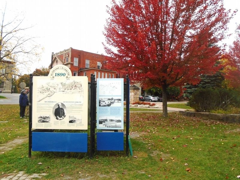
| 102 ► Ontario, Lanark County, Perth — The First Canal/ Le premier canal Tay — The Tay Canal / Le canal Tay — 1834 — |
| On Basin Street at Tay Street, on the right when traveling north on Basin Street. | |||
| 103 ► Ontario, Lanark County, Smiths Falls — Automated Lock / Une écluse automatique — |
| On Beckwith Street South (Provincial Highway 15) just south of Canal Street, on the right when traveling south. | |||
| 104 ► Ontario, Lanark County, Smiths Falls — Crossroads of the Rideau / À la croisée des chemins — |
| On Canal Street just west of Beckwith Street South (Provincial Highway 15), on the left when traveling west. | |||
| 105 ► Ontario, Lanark County, Smiths Falls — HMCS/MHCS Smiths Falls — |
| On Beckwith Street South (Provincial Highway 15) at Canal Street, on the right when traveling south on Beckwith Street South. | |||
| 106 ► Ontario, Lanark County, Smiths Falls — Smiths Falls — |
| On Beckwith Street South (Provincial Highway 15) just south of Canal Street, on the right when traveling south. | |||
| 107 ► Ontario, Lanark County, Smiths Falls — Smiths Falls and the Dam / Smiths Falls et le Barrage — |
| On Confederation Drive at Old Mill Road, on the left when traveling west on Confederation Drive. | |||
| 108 ► Ontario, Lanark County, Smiths Falls — The Rideau Waterway — |
| On Lombard Street at Aberdeen Avenue, on the left when traveling east on Lombard Street. | |||
| 109 ► Ontario, Lanark County, Smiths Falls — The Rideau Waterway / Voie navigable du Canal Rideau — The Canadian Heritage Rivers System — Le Réseau de rivières du patrimoine canadien — |
| On Confederation Drive. | |||
| 110 ► Ontario, Lanark County, Smiths Falls — The underwater view / La vue sous l'eau — |
| On Beckwith Street South (Provincial Highway 15) just south of Canal Street, on the right when traveling south. | |||
| 111 ► Ontario, Lanark County, Smiths Falls — To Commemorate the Opening of the Rideau Canal 1832 — |
| On Beckwith Street South (Provincial Highway 15), on the right when traveling south. | |||
| 112 ► Ontario, Lanark County, Smiths Falls — Water Works / Station de Production d'Eau Potable — |
| On Confederation Drive at Old Mill Road, on the left when traveling west on Confederation Drive. | |||
| 113 ► Ontario, Lanark County, Smiths Falls — Welcome to Combined Locks — Bienvenue à l'écluse combinée — |
| On Canal Street just west of Beckwith Street South (Provincial Highway 15), on the left when traveling west. | |||
| 114 ► Ontario, Lanark County, Smiths Falls — Wood's Mill / Moulin de Wood — The Heritage Trail / Le sentier du patrimoine — Remembering Our Historic Past / Nous souvenant de notre passé historique — |
| On Beckwith Street South (Provincial Highway 15), on the right when traveling south. | |||
| 115 ► Ontario, Leeds and Grenville United Counties, Athens — Jeffrey Boats — |
| On Henry Street north of Wellington Street, on the left when traveling north. | |||
| 116 ► Ontario, Leeds and Grenville United Counties, Brockville — 5 Sunken Treasures in the Brockville Area — To Preserve Our Marine Heritage — |
| On Block House Island Road, 0.2 kilometers south of Water Street, on the left when traveling south. | |||
| 117 ► Ontario, Leeds and Grenville United Counties, Brockville — Aerial View of Water Street East and the surrounding area — Brockville Historic Area: Our Past — 1919 — |
| On Water Street East east of Market Street, on the left when traveling east. | |||
| 118 ► Ontario, Leeds and Grenville United Counties, Brockville — Blockhouse Island — Brockville Historic Area: Our Past — |
| On Block House Island Road, on the right when traveling south. | |||
| 119 ► Ontario, Leeds and Grenville United Counties, Brockville — Brockville Ferry Depot — Brockville Historic Area: The Brock Trail — |
| Near Ferry Street. | |||
| 120 ► Ontario, Leeds and Grenville United Counties, Brockville — Brockville Rowing Club — Brockville Historic Area: The Brock Trail — |
| On Ferry Street just south of Water Street, on the left when traveling south. | |||
| 121 ► Ontario, Leeds and Grenville United Counties, Brockville — Brockville Rowing Club Regatta — ca. 1895 — Brockville Historic Area: The Brock Trail — |
| On Block House Island Road, on the right. | |||
| 122 ► Ontario, Leeds and Grenville United Counties, Brockville — Centeen Memorial Dive Park — |
| On Water Street East east of Orchard Street, on the right when traveling east. | |||
| 123 ► Ontario, Leeds and Grenville United Counties, Brockville — Fun on the River — c.1900 — |
| 124 ► Ontario, Leeds and Grenville United Counties, Brockville — McCrady Tannery / Brockville Yacht Club — ca. 1909 — Brockville Historic Area: The Brock Trail — |
| 125 ► Ontario, Leeds and Grenville United Counties, Brockville — Saint Lawrence, the Martyr — Laurentius or Lorenzo, Archdeacon of Rome — Brockville Historic Area: The Brock Trail — |
| 126 ► Ontario, Leeds and Grenville United Counties, Brockville — SS Kingston — Brockville Historic Area: The Brock Trail — |
| On Block House Island Road, 0.2 kilometers south of Water Street, on the right when traveling south. | |||
| 127 ► Ontario, Leeds and Grenville United Counties, Brockville — Steven Delbert Ring — March 3, 1962 - April 18, 1982 — Dedicated to the Memory of — |
| On Parkedale Avenue just east of Stewart Boulevard (County Highway 29), on the left when traveling east. | |||
| 128 ► Ontario, Leeds and Grenville United Counties, Brockville — Tall Ships 1812 Tour — |
| On Broad Street just south of Flint Street, on the left when traveling south. | |||
| 129 ► Ontario, Leeds and Grenville United Counties, Brockville — The Bluenose Visit, 1933 / La visite du Bluenose, 1933 — Brockville Historic Area: The Brock Trail — |
| On Block House Island Road, on the right. | |||
| 130 ► Ontario, Leeds and Grenville United Counties, Brockville — The Wreck of the Robert Gaskin — GPS location co-ordinates: latitude N44 35.358 longitude W75 40.625 — Brockville Historic Area: The Brock Trail — |
| On Block House Island Road, on the right when traveling south. | |||
| 131 ► Ontario, Leeds and Grenville United Counties, Brockville — Timber Rafts on the River — |
| On Henry Street just south of Water Street West, on the left when traveling south. | |||
| 132 ► Ontario, Leeds and Grenville United Counties, Darlingside — Darlingside — |
| On Thousand Islands Parkway at Darlingside Drive, on the right when traveling east on Thousand Islands Parkway. | |||
| 133 ► Ontario, Leeds and Grenville United Counties, Darlingside — The Darling Store / Le magasin Darling — Canada's National Parks and National Historic Sites |
| On Thousand Islands Parkway at Darlingside Drive, on the right when traveling east on Thousand Islands Parkway. Reported permanently removed. | |||
| 134 ► Ontario, Leeds and Grenville United Counties, Darlingside — The Thousand Islands — Canada's National Parks and National Historic Sites — |
| On Thousand Islands Parkway at Darlingside Drive, on the right when traveling east on Thousand Islands Parkway. | |||
| 135 ► Ontario, Leeds and Grenville United Counties, Gananoque — A Brief History of Half Moon Bay — Mural by Pierre Hardy — |
| On King Street East (County Highway 2) at Park Street, on the right when traveling west on King Street East. | |||
| 136 ► Ontario, Leeds and Grenville United Counties, Gananoque — River Traffic / Affluence sur la Rivière — The Garrison Settlement at Gananoque ca: 1815/16 — |
| On Water Street just west of Market Street, on the left when traveling west. | |||
| 137 ► Ontario, Leeds and Grenville United Counties, Gananoque — Site of Thousand Islands Railroad Station — |
| On Water Street just west of Main Street, on the left when traveling west. | |||
| 138 ► Ontario, Leeds and Grenville United Counties, Gananoque — Taming the Wilderness / Domestiquer la Nature — The Garrison Settlement at Gananoque ca: 1815/16 — |
| On Water Street just west of Market Street, on the left when traveling west. | |||
| 139 ► Ontario, Leeds and Grenville United Counties, Lansdowne — Thousand Islands International Bridge — |
| On Provincial Highway 137, 0.3 kilometers north of Benson Park Road, on the right when traveling north. | |||
| 140 ► Ontario, Leeds and Grenville United Counties, Maitland — Pointe Au Baril — |
| On Provincial Highway 2, 0.1 kilometers west of Maitland Road, on the right when traveling west. | |||
| 141 ► Ontario, Leeds and Grenville United Counties, Mallorytown — Chimney Island (Bridge Island) — |
| On Thousand Islands Parkway, 2 kilometers east of Mallorytown Road, on the right when traveling east. | |||
| 142 ► Ontario, Leeds and Grenville United Counties, Merrickville — Blockhaus de Merrickville Blockhouse — |
| On St. Lawrence Street (Provincial Highway 15/43) at Rideau Canal, on the right when traveling south on St. Lawrence Street. | |||
| 143 ► Ontario, Leeds and Grenville United Counties, Merrickville — Canal Twins / Les canaux jumelés — Canal Rideau Canal / Canal Caledonian Canal — |
| On Main Street just west of St. Lawrence Street (Provincial Highway 15), on the right when traveling west. | |||
| 144 ► Ontario, Leeds and Grenville United Counties, Merrickville — Dr. Jim Connor — |
| On Main Street just west of St. Lawrence Street (Provincial Highway 15), on the right when traveling west. | |||
| 145 ► Ontario, Leeds and Grenville United Counties, Merrickville — Founding of Merrickville — |
| On Main Street (Provincial Highway 43) at Elgin Street, on the left when traveling east on Main Street. | |||
| 146 ► Ontario, Leeds and Grenville United Counties, Merrickville — Merrickville — |
| On St. Lawrence Street (Provincial Highway 15/43) at Rideau Canal, on the right when traveling south on St. Lawrence Street. | |||
| 147 ► Ontario, Leeds and Grenville United Counties, Merrickville — Merrickville Blockhouse 1832 — |
| On St. Lawrence Street (Provincial Highway 15/43) at Main Street, on the left when traveling north on St. Lawrence Street. | |||
| 148 ► Ontario, Leeds and Grenville United Counties, Merrickville — The Merrickville Blockhouse / Le blockhaus de Merrickville — |
| On St. Lawrence Street (Provincial Highway 15/43) at Rideau Canal, on the right when traveling south on St. Lawrence Street. | |||
| 149 ► Ontario, Leeds and Grenville United Counties, Merrickville — Twin Canals / Les canaux jumelés — |
| On Main Street just west of St. Lawrence Street (Provincial Highway 15), on the right when traveling west. | |||
| 150 ► Ontario, Leeds and Grenville United Counties, Prescott — Prescott, Ontario — |
| On King Street West (County Highway 2) at George Street, on the left when traveling east on King Street West. | |||
| 151 ► Ontario, Leeds and Grenville United Counties, Prescott — The Forwarding Trade at Prescott |
| On Water Street West, 0.1 kilometers west of Centre Street, on the left when traveling west. Reported missing. | |||
| 152 ► Ontario, Leeds and Grenville United Counties, Prescott — The Rothesay — |
| On County Road 2, on the right when traveling east. | |||
| 153 ► Ontario, Leeds and Grenville United Counties, Spencerville — Spencerville Riverside Park — Why This Place Matters — |
| On Water Street south of Spencer Street (County Highway 44), on the left when traveling south. | |||
| 154 ► Ontario, Leeds and Grenville United Counties, Township of Rideau Lakes — Blockhaus de Narrows Blockhouse — |
| On Narrows Lock Road (County Highway 14) at the Rideau Canal, on the right when traveling north on Narrows Lock Road. | |||
| 155 ► Ontario, Leeds and Grenville United Counties, Township of Rideau Lakes — Narrows — |
| On Narrows Lock Road (County Highway 14) at the Rideau Canal, on the right when traveling north on Narrows Lock Road. | |||
| 156 ► Ontario, Leeds and Grenville United Counties, Township of Rideau Lakes — Rivers, Lakes and Locks / Rivières, Lacs et Écluses — |
| On Narrows Lock Road (County Highway 14) at the Rideau Canal, on the right when traveling north on Narrows Lock Road. | |||
| 157 ► Ontario, Leeds and Grenville United Counties, Township of Rideau Lakes — The Enemy to the South / l'Ennemi du Sud — |
| On Narrows Lock Road (County Highway 14) close to the Rideau Canal, on the right when traveling north. | |||
| 158 ► Ontario, Leeds and Grenville United Counties, Township of Rideau Lakes — Two Lakes from One / d'Une Pierre Deux Coups — |
| On Narrows Lock Road (County Highway 14) at the Rideau Canal, on the right when traveling north on Narrows Lock Road. | |||
| 159 ► Ontario, Lennox and Addington County, Bath — The First Steamship on Lake Ontario — Le Premier Vapeur du Lac Ontario — |
| On Loyalist Parkway (Provincial Highway 33), on the right when traveling east. | |||
| 160 ► Ontario, Lennox and Addington County, Greater Napanee — Escape of the Royal George 1812 — |
| On Loyalist Parkway (Provincial Highway 33) close to County Route 21. | |||
| 161 ► Ontario, Muskoka District, Baysville — Explorers of Muskoka & Haliburton — |
| On Baysville Terrace just east of Bay Street (Bridge Street), on the right when traveling east. | |||
| 162 ► Ontario, Muskoka District, Huntsville — Brunel Locks — 1873 — |
| Near Brunel Road (Muskoka District Road 2), 1.5 kilometers south of West Browns Road, on the right when traveling south. | |||
| 163 ► Ontario, Muskoka District, Huntsville — Historic Brunel Lift Locks — |
| Near Brunel Road (Muskoka District Road 2), 1.5 kilometers south of West Browns Road, on the right when traveling south. | |||
| 164 ► Ontario, Niagara Region, Allanburg — The Old Welland Canal — |
| On Canboro Road (Provincial Highway 20) just east of Holland Road, on the right when traveling east. | |||
| 165 ► Ontario, Niagara Region, Chippawa — The Destruction of The Caroline, 1837 — |
| On Niagara Parkway at Service Road 30, on the right when traveling north on Niagara Parkway. | |||
| 166 ► Ontario, Niagara Region, Fort Erie — Bertie Street Ferry Landing — c. 1796 - 1950 — |
| On Niagara Parkway, 0.08 kilometers south of Bertie Street. | |||
| 167 ► Ontario, Niagara Region, Fort Erie — Fort Erie Ferry Landings — |
| On Niagara Parkway, 0.08 kilometers south of Bertie Street, on the right when traveling north. | |||
| 168 ► Ontario, Niagara Region, Fort Erie — Freedom Park — |
| On Niagara Boulevard, 0.08 kilometers south of Bertie Street, on the right when traveling north. | |||
| 169 ► Ontario, Niagara Region, Grimsby — Fisheries in Grimsby — |
| 170 ► Ontario, Niagara Region, Grimsby — Forty Mile Creek — |
| Near Elizabeth Street. | |||
| 171 ► Ontario, Niagara Region, Niagara Falls — Burch’s Mill — |
| On Niagara Parkway just north of Dufferin Isle Road, on the right when traveling north. | |||
| 172 ► Ontario, Niagara Region, Niagara Falls — Niagara Falls Park and River Railway Powerhouse — |
| On Niagara Parkway. | |||
| 173 ► Ontario, Niagara Region, Niagara Falls — Stranded Scow — |
| On Niagara Parkway close to Dufferin Isle Road, on the right when traveling north. | |||
| 174 ► Ontario, Niagara Region, Niagara Falls — The Boundary Waters Treaty — |
| On River Road, 0.2 kilometers south of Hiram Street, on the right when traveling north. | |||
| 175 ► Ontario, Niagara Region, Niagara Falls — Zimmerman Fountain Pond — |
| On Falls Avenue at Niagara Parkway, on the right when traveling south on Falls Avenue. | |||
| 176 ► Ontario, Niagara Region, Port Colborne — The Welland Canal — |
| On West Street at Clarence Street, on the right when traveling north on West Street. | |||
| 177 ► Ontario, Niagara Region, St. Catharines — Bollard — |
| Near Welland Canals Parkway. | |||
| 178 ► Ontario, Niagara Region, St. Catharines — Bollards & Fairleads — Mooring — |
| Near Welland Canals Parkway. | |||
| 179 ► Ontario, Niagara Region, St. Catharines — Cannon Barrel — |
| Near Welland Canals Parkway. | |||
| 180 ► Ontario, Niagara Region, St. Catharines — Early Welland Canals — |
| Near Welland Canals Parkway. | |||
| 181 ► Ontario, Niagara Region, St. Catharines — Lock 24 - First Welland Canal — Welland Canals Society — |
| Near Merritt Street just east of Glendale Avenue, on the right when traveling east. | |||
| 182 ► Ontario, Niagara Region, St. Catharines — Louis Shickluna 1808-1880 — |
| On Yates Street, 0.2 kilometers west of St. Paul Street West (County Route 81), on the left when traveling west. | |||
| 183 ► Ontario, Niagara Region, St. Catharines — Shipbuilding in Niagara — |
| Near Welland Canals Parkway. | |||
| 184 ► Ontario, Niagara Region, St. Catharines — Shipbuilding in St. Catharines 1845 — Our Heritage — St. Catharines Heritage Corridor — |
| On St. Paul Street (County Route 81) at Westchester Avenue, on the right when traveling north on St. Paul Street. | |||
| 185 ► Ontario, Niagara Region, St. Catharines — The First Welland Canal 1824-1833 — |
| Near Gale Crescent just south of Calvin Street, on the right when traveling east. | |||
| 186 ► Ontario, Niagara Region, St. Catharines — The Fourth Welland Canal — An Outstanding Canadian Engineering Achievement — |
| Near Welland Canals Trail. | |||
| 187 ► Ontario, Niagara Region, St. Catharines — The Welland Canals and the St. Lawrence Seaway System — |
| Near Welland Canals Parkway. | |||
| 188 ► Ontario, Niagara Region, St. Catharines — This Statue of the Honourable William Hamilton Merritt — |
| On St. Paul Street West (County Route 81) at McGuire Street, on the right when traveling north on St. Paul Street West. | |||
| 189 ► Ontario, Niagara Region, St. Catharines — Vertical Lift Bridges — |
| Near Welland Canals Parkway. | |||
| 190 ► Ontario, Niagara Region, St. Catharines — Welland Ship Canal — |
| Near Welland Canals Parkway. | |||
| 191 ► Ontario, Niagara Region, St. Catharines — William Hamilton Merritt 1793 - 1862 — |
| Near Welland Canals Parkway. | |||
| 192 ► Ontario, Niagara Region, St. Catharines — William Hamilton Merritt 1793 - 1862 — |
| On St. Paul Street West (County Route 81) at McGuire Street, on the left when traveling south on St. Paul Street West. | |||
| 193 ► Ontario, Niagara Region, Thorold — The Founding of Thorold — |
| Near Sullivan Avenue just south of Towpath Road. | |||
| 194 ► Ontario, Niagara Region, Welland — Main Street Bridge (Bridge 13)/Pont de la Rue Main (Pont 13) — |
| On King Street (Road 68) at East Main Street (Road 27), on the right when traveling south on King Street. | |||
| 195 ► Ontario, Nipissing District, Mattawa — Canoe Route to the West — |
| On Water Street at Main Street (County Highway 533), on the left when traveling north on Water Street. | |||
| 196 ► Ontario, Nipissing District, Mattawa — The Mattawa Route — |
| On Water Street at Main Street (County Highway 533), on the right when traveling north on Water Street. | |||
| 197 ► Ontario, Nipissing District, North Bay — 400 Years of Francophone Presence / 400 ans de présence francophone — |
| On Premier Road at Champlain Park Road when traveling south on Premier Road. | |||
| 198 ► Ontario, Nipissing District, North Bay — P17 — Commerce on Lake Nipissing — North Bay Heritage Site — |
| Near Memorial Drive, 0.6 kilometers south of Main Street West, on the right when traveling south. | |||
| 199 ► Ontario, Nipissing District, North Bay — Jean Nicolet — |
| On Memorial Drive at Colgan Avenue, on the right when traveling north on Memorial Drive. | |||
| 200 ► Ontario, Nipissing District, North Bay — La Vase Portages — |
| On Trans-Canada Highway (Provincial Highway 17) 3.5 kilometers east of Provincial Highway 11, on the right when traveling east. | |||
277 entries matched your criteria. Entries 101 through 200 are listed above. ⊲ Previous 100 — The final 77 ⊳