Few points along the route of the Lewis and Clark Expedition have the significance of this site, now beneath the waters of Clark Canyon Reservoir. Noted on their maps as "Fortunate Camp", the Lewis and Clark Expedition journeyed here hoping to . . . — — Map (db m124302) HM
Lewis and Clark Trail 1806. First Important Gold Camp 1862. Scene of Vigilante Activities 1863. First Capital Territory of Montana 1864-1865. First County Seat of Beaverhead County 1864-1881. In grateful memory of the early pioneers who founded our . . . — — Map (db m145711) HM
The prominent geological feature to the west is called Beaverhead Rock. On the afternoon of August 8, 1805, members of the Lewis and Clark Expedition pulled its canoes up the Beaverhead River toward the Continental Divide. They sighted what . . . — — Map (db m193249) HM
By the time the Corps of Discovery passed through here, the "Valley of the Beaverhead" was already common ground for many Indian tribes. The Beaver's Head was a well-known landmark not only to the Shoshone but other Rocky Mountain tribes who passed . . . — — Map (db m193247) HM
This monument design is taken from the small pocket compass carried by William Clark on the expedition. Clark’s compass was made by Thomas Whitney in Philadelphia.
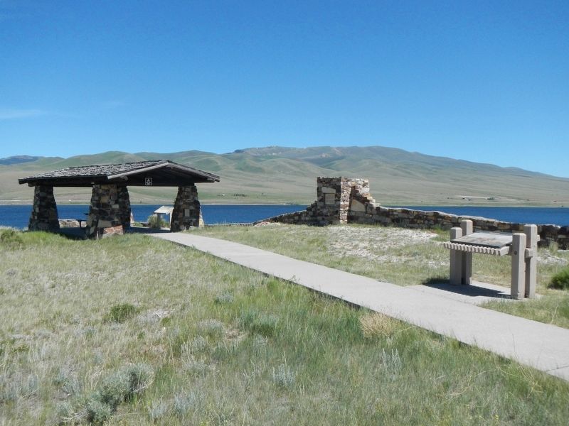
Fortunate Chapter of the National Lewis and Clark Trail Heritage Foundation . . . — — Map (db m128185) HM
Your observations are to be taken with great pains & accuracy, to be entered distinctly & intelligibly for others as well as yourself, to comprehend all the elements necessary —President Thomas Jefferson
On August 13, 1805 William . . . — — Map (db m128184) HM
This site was the pivotal point in the success of the Lewis and Clark Expedition. The party camped here in August 1805. They cached their boats and aided by the influence of Sacajawea obtained horses from her people the Shoshone Indians
The Great . . . — — Map (db m124304) HM
The Lewis and Clark Expedition passed this way going west August, 1805 and returning July, 1806.
‘Though the Pathfinder may die, the paths remain open.’
Beaverhead Chapter Daughters of the American Revolution. June 14, 1928 — — Map (db m145710) HM
Instruments for ascertaining, by celestial observations, the geography of the country through which you will pass, have been already provided. —President Thomas Jefferson
The data collected by Lewis and Clark is a striking indicator . . . — — Map (db m128183) HM
”…you will take careful observations of …objects distinguished by such natural marks & characters of a durable kind…”
—President Thomas Jefferson
There is a remarkable view from the crest of Clark's Lookout and it is . . . — — Map (db m128182) HM
In Commemoration of
Sacajawea
who guided Lewis and Clark through this
the land of her childhood and capture
On August 17th, 1805 she rejoined her tribe near this site. The services she rendered the expedition were invaluable. . . . — — Map (db m124293) HM
The waters of the Beaverhead River opened this southern gateway to Montana through which have passed:
Ancient Indian Trail
Lewis and Clark Expedition 1805-1806
First Missionary, Father DeSmet 1840
Great Beaverhead Wagon Toll Road . . . — — Map (db m145713) HM
In 1804-06, Captains Meriwether Lewis and William Clark led about 40 soldiers and boatmen on an epic journey. President Thomas Jefferson commissioned this “Corps of Discovery” to find a route to the Pacific Ocean through the newly acquired Louisiana . . . — — Map (db m124305) HM
William Clark was central to the success of the Corps of Discovery expedition not only during the two years spent crossing the continent but also because he produced maps of the west long after his return.
His three maps of the Western United . . . — — Map (db m128181) HM
"two miles below McNeal had exultingly stood with a foot of each side of this little rivulet and thanked his god that he had lived to bestride the mighty & heretofore deemed endless Missouri." - Meriwether Lewis, August 12, 1805
Hugh . . . — — Map (db m109500) HM
In 1806, Captain William Clark and his crew traveled through here on horseback moving quickly on their return trip to St. Louis. Arriving at present day Jackson Hot Springs in the afternoon of July 7th, they stopped to experiment with cooking in the . . . — — Map (db m124223) HM
On their return journey, the Corps of Discovery divided into two groups at Traveler's Rest, near present day Lolo, Montana. Captain William Clark and his party traveled through today's Big Hole Valley on their way to Camp Fortunate to recover their . . . — — Map (db m124260) HM
Meriwether Lewis is hardly the only person ever to have found himself evaluating the meaning and purpose of his own life. But the words he wrote on the evening of August 18, 1805 - when camped about 35 miles southeast of where you stand now - have . . . — — Map (db m124227) HM
On a clear day, the sweeping views from here take in more than 400 square miles. Most of these lands look much as they have for centuries. Human travel routes haven't changed much either. Highway 278 mirrors very closely that Captain Clark and his . . . — — Map (db m124222) HM
(Two panels are on this interpretive stand:)
July 8, 1806
The Way It Used To Be... Way Back
Just over two hundred years ago...
We proceeded down Willards Creek on the S.W. Side about 11 miles...The Country . . . — — Map (db m124268) HM
(Three panels make up this informational marker:)
Natural Travel Corridor
Clark's 1806 Route
Captain Clark and his party found great quantities of camas just beginning to bloom when they passed here on Sunday July 6, 1806. . . . — — Map (db m123738) HM
The Lewis and Clark Expedition passed this way on their westward trek across the continent. Expedition members camped on the west side of the Missouri River on July 25, 1805, a short distance upstream from present day Toston Dam.
It was near this . . . — — Map (db m192879) HM
York (ca. 1770-1831) is the only name given for Captain William Clark's slave in the journals of Lewis and Clark (Moulton, 1988).
Lewis and Clark's journals frequently refer to York, a black slave to Captain William Clark. York played an . . . — — Map (db m141726) HM
(Three historical panels are located at this informational kiosk:)(Panel 1:)
Winston - A Town with Dreams of Striking it Rich
Winston History
Welcome to the community of Winston and this area of the . . . — — Map (db m188668) HM
Jim Bridger arrived in Montana in 1822 as a member of a Rocky Mountain Fur Co. brigade. For years he had no more permanent home than a poker chip. He roamed the entire Rocky Mountain region and often came through this part of the country. A keen . . . — — Map (db m96630) HM
Jim Bridger arrived in Montana in 1822 as a member of a Rocky Mountain Fur Co. brigade. He roamed the entire Rocky Mountain region and often came through this part of the country. A keen observer, a natural geographer and with years of experience . . . — — Map (db m167010) HM
Lieutenant General Philip Sheridan and 124 men forged the first documented passage over the Beartooth Mountains in 1881. Once thought impassible, the route was later modified by E. E. Van Dyke - a miner from coal rich Red Lodge, Montana. His route . . . — — Map (db m45244) HM
The entire expedition first camped in this area on their journey westward in July of 1805. Exactly a year later, Sergeant Ordway and a party of nine men retuned to this site.
Where were Captain Lewis and Captain Clark? Meriwether Lewis was . . . — — Map (db m245462) HM
In the area of present day Cascade, Montana Lewis and Clark had not seen any American Indians. In fact, they had not seen any Indians since entering Montana. However, there were signs of their presence in the form of "boothes" or leather . . . — — Map (db m245461) HM
Hidasta informants described a fall of water on the Missouri River near the mountains, so the Captains expected a short portage. Instead of one waterfall, Lewis happened upon a succession of five, and their hope for a short portage faded. Look . . . — — Map (db m80319) HM
The uppermost of the Great Falls of the Missouri bears west of this point. The name is a modern one derived from an entry for June 14th, 1805 in the journal of Capt. Meriwether Lewis of the Lewis and Clark Expedition. He discovered the falls on that . . . — — Map (db m80427) HM
The plains surrounding Great Falls were crowded with immense herds of deer, elk, antelope and buffalo. Buffalo was a staple diet item for plains Indians and became a favorite meal for the members of the Lewis and Clark Expedition.
Lewis and Clark . . . — — Map (db m126498) HM
excerpt from the journals of Captain Meriwether Lewis
I scelected a fat buffaloe and shot him very well
Robert M. Scriver, Sculptor
, through the lungs ... expecting him to fall ...
...a large white, or reather brown bear ... crept on me . . . — — Map (db m141981) HM
... the rocks seems to be most happily fixed to present a sheet of the whitest beaten froath for 200 yards in length and about 80 feet perpendicular. — Meriwether Lewis, June 13, 1805
The Great Falls of the Missouri . . . — — Map (db m82766) HM
Lewis and Clark
On their historic Expedition to the Pacific Coast
discovered this
Giant Fountain
June 18 - 1805
In honor of the courage, fidelity and
patriotism of the explorers
this tablet is here
placed and . . . — — Map (db m148969) HM
To avoid the series of waterfalls along the Missouri River north of this point, the Expedition portaged their canoes and several tons of baggage, crossing the highway right here. At the lower camp, some 12 miles NE, the crew made crude wagons, the . . . — — Map (db m143667) HM
Regimented Routine
The men followed military protocol, receiving orders from the captains and sergeants. The daily chores became second nature and never-ending.
They hunted, cooked for today, or dried meat for tomorrow.
They prepared . . . — — Map (db m143874) HM
Meriwether Lewis recorded the first scientific observations of the westslope cutthroat trout while he ate one for dinner. Once abundant, the fish has been listed as a species of special concern since 1979.
"These trout...precisely resemble our . . . — — Map (db m143908) HM
The narrowleaf cottonwood, a tree "with a leaf like that of the wild cherry" was first described for modern science by Lewis on June 12, 1805. Other expedition first near Great Falls include documenting the cutthroat trout, thirteen-lined . . . — — Map (db m143875) HM
Over 150 million gallons of water flow from Giant Springs everyday and cascade into the Missouri River.
The springs occur where cracks in the rocks above the Madison Limestone allow water to leak upward to the land surface. It is similar to a . . . — — Map (db m127798) HM
On July 3, 1984 this island was named in honor of Sacajawea, the Shoshoni Indian girl who accompanied the Lewis and Clark expedition from the Mandan villages to the Pacific Coast.
Sacajawea was born about 1788 in southwest Montana, At 12 years . . . — — Map (db m143877) HM
On his way down the Ohio River in 1803, Captain Meriwether Lewis purchased a Newfoundland dog for twenty dollars. It was a perfect choice of breed for the impending exploration; powerful swimmer, strong guarding instinct, gentle disposition and a . . . — — Map (db m143860) HM
Lewis and Clark Trail markers follow today's highways, but rivers actually determined most of their route. By the Great Falls, over 2500 miles of Missouri "roadway" had been navigated.
Keeping the Expedition Afloat
During three seasons . . . — — Map (db m143674) HM
Designed to be Portable
In 1803, Captain Meriwether Lewis led an expedition to map a water route west to the Pacific Ocean. Along the way, the Lewis and Clark Expedition uses 26 different boats, but one deserves special mention. . . . — — Map (db m143669) HM
For Meriwether Lewis in 1805, the falls were an obstacle on the journey to the Pacific. To Paris Gibson (near right) the falls were a source of great opportunity. As Gibson laid out the townsite of Great Falls he envisioned dams to harness the falls . . . — — Map (db m126545) HM
On June, 13, 1805 Captain Meriwether Lewis confirmed the existence of what had been just a legend to many - the Great Falls of the Missouri River. Earlier that day, Lewis, who as suspected the falls were in the area based on what the Minnetaree . . . — — Map (db m141983) HM
”…the men has to haul with all their Strength Wate & art, catching grass & knobes and Stones with their hands to give them more force in drawing on the Canoes & Loads, at every halt, those not employed in repairing the Course, are asleep . . . — — Map (db m126558) HM
Native American tribes followed the buffalo through this area and camped at Giant Springs. The temperature of the spring water stays a consistent 54 degrees all year long, making this a good site for winter camps.
Lewis and Clark Corps of . . . — — Map (db m127799) HM
You stand now in an area that was one of the first to feel the rapid growth of immigration that began about 60 years after Lewis and Clark camped here. Steamboats in the late 1800s chose this area as a key stopping point, because the trees needed . . . — — Map (db m161840) HM
On July 16, 1806, Captain Lewis gave instructions to Sgt. Ordway to finish the portage at the Great Falls and wait for him at the month of Maria's River. After their wild encounter with the Blackfoot on the Two Medicine and a twenty-hour ride, . . . — — Map (db m142214) HM
This stream flow monitoring station is part of a nationwide system of approximately 7,000 streamflow stations operated by the U.S. Geological Survey (USGS). The USGS has principal responsibility for evaluation of the Nation's water resources by . . . — — Map (db m142410) HM
On the evening of June 2, 1805 the Corps of Discovery arrived at the mouth of an unknown river flowing from the north. The river had not been mentioned by the Hidatsa nor was it noted on their maps. The two rivers were equal is size. Which was the . . . — — Map (db m142527) HM
The Lewis and Clark Expedition camped at the confluence of the Marias and Missouri rivers on June 2-12, 1805. The long stay allowed the group to rest and contemplate a dilemma. Which river flowed over the "Great Falls" described by the Mandan . . . — — Map (db m161801) HM
The Lewis and Clark Expedition camped at the confluence of the Marias and Missouri rivers on June 2-12, 1805. The long stay allowed the group to rest and contemplate a dilemma. Which river flowed over the "Great Falls" described by the Mandan . . . — — Map (db m161805) HM
Meriwether Lewis climbed up the drainage for their camp at the mouth of the Marias, where he reached a "commanding eminence" (where you are standing) and described the North Mountains (Bears Paw Mountains) and "the Barn Mountain (Square Butte). He . . . — — Map (db m142528) HM
The Lewis and Clark Expedition camped at the mouth of the river just east of here June 3, 1805. The Piegan people called it "The River that Scolds at all Others," but Lewis named it Maria's River in honor of his cousin, Miss Maria Wood (over time . . . — — Map (db m142488) HM
This is the river that many claim is a mile wide, an inch deep, and runs uphill. That statement may be exaggerated, but Captain Clark of the Lewis and Clark Expedition commented on its color and called it "disagreeably muddy." Clark named it the . . . — — Map (db m164270) HM
This is the river that exuberant parties claim is a mile wide, an inch deep, and runs up hill. The statement is exaggerated. Captain Clark, of the Lewis and Clark Expedition, named it the Redstone in 1806 and afterwards found out that the Indians . . . — — Map (db m155578) HM
Captain Wm. Clark and ten others camped near the mouth of the Tongue River on July 29, 1806. Clark noted the great number of buffalo in the area and reported that the river was so muddy and warm that it was "very disagreeable to drink." Clark . . . — — Map (db m163877) HM
"On our return we shal probably pass down the yellow stone river, which from Indian informations, waters one of the fairest portions of this continent." — Captain Meriwether Lewis, letter to President Thomas Jefferson, dated April . . . — — Map (db m202998) HM
Horses, Canoes and Bull Boats Clark and his party traveled by horse along the north side of the Yellowstone River until July 24, when nine members began a float in two lashed-together canoes built from cottonwoods they found along the river. . . . — — Map (db m202999) HM
A yachting party consisting of Capt. Wm. Clark, of the Lewis and Clark Expedition, six of his men, Sacajawea and her child flood by here August 1, 1806, navigating a craft made by lashing together two hollowed-out cottonwood logs. It was Clark's . . . — — Map (db m163815) HM
July 28, 1806 "Set out this morning at day light and proceeded on glideing down this Smooth Stream passing maney Isld...." July 29, 1806 "in the fore part of the day, I saw great numbers of Buffalow on the banks, … great . . . — — Map (db m203054) HM
The Lewis and Clark Expedition was sailing when it passed by here!
We set out at a early hour this morning and proceed on principally by the chord untill about 9 A.M. when a fine breeze sprung up for the S.E. and enabled us though . . . — — Map (db m161037) HM
Captains Meriwether Lewis and William Clark arrived at the mouth of the Judith River on May 29, 1895 and named it for Clark's sweetheart, Julia Hancock. Lewis described it as a "handsome river" and noted the recent evidence of Indian encampments . . . — — Map (db m161907) HM
Hudson Bay Company (HBC) agent Joseph Howse built a trading post just north of here in 1810, the first European settlement in the valley north of Flathead Lake. Described as “adventurous, tough, and intelligent,” Howse joined the . . . — — Map (db m127682) HM
Jim Bridger (1804-1881), the infamous mountain man, was a celebrated trapper, explorer, outdoorsman, and guide. Extensively traveling and mapping the Rocky Mountain West, Bridger's explorations established many of the trails and passages in . . . — — Map (db m206116) HM
Built in 1886, the Nelson and Ellen Story Mansion stood at the corner of West Main and 5rh Avenue. The Story residence was dismantled in 1838 as part of the Gallatin High expansion. Salvaged porch columns and balustrades now mark the Story family . . . — — Map (db m192059) HM
Sacajawea, the Shoshone woman who guided portions of the Lewis and Clark Expedition led Captain Wm. Clark and his party of ten men over an old buffalo road through this pass on July 15, 1806. They were eastward bound and planned to explore the . . . — — Map (db m162423) HM
"from the three forks of the Easterly fork of the Galletines River to the river Rochejhone is 18 miles on an excellent high dry firm road the very incoiderable hills." William Clark, July 15, 1806
Captain William Clark, of the Lewis . . . — — Map (db m206115) HM
For centuries distant and diverse tribes visited the Gallatin Valley to hunt. They stampeded buffalo over cliffs during the "dog days" before the acquisition of horses and guns. They hunted animals for food, clothing and shelter. They also mined . . . — — Map (db m29075) HM
Conflicts along the Bozeman Trail between Lakota, Northern Cheyenne, and Arapaho Indians and settlers escalated with the establishment of forts along the route in 1866. After Indians killed John Bozeman, in the Yellowstone Valley in 1867, the . . . — — Map (db m29079) HM
Established as a military post August 27, 1867 by order of
President Andrew Johnson and General U.S. Grant
the post was abandoned in December 1886
Captain Wm. Clark
of the Lewis and Clark Expedition
encamped here July 14, 1806 with his . . . — — Map (db m98279) HM
An abundance of beaver encouraged Corps of Discovery members John Colter and John Potts to return to the headwaters. In 1808, Blackfeet Indians killed Potts in a confrontation and stripped Colter bare, giving him a chance to run for his life. In one . . . — — Map (db m29077) HM
Lewis and Clark's Corps of Discovery reached the headwaters of the Missouri River and named the three tributaries in July, 1805. With great difficulty the Corps of Discovery fought rapids and troublesome mosquitoes as they pulled their boats . . . — — Map (db m29072) HM
This boulder marks the Trail of the Lewis and Clark Expedition 1805. Erected by the Mt. Hyalite Chapter Daughters of the American Revolution 1923. — — Map (db m145672) HM
On July 14, 1806 Captain William Clark accompanied by 11 members of the expedition party camped about a mile east of here on the flat at the mouth of Kelly Canyon. The next day, Sacajawea guided the party up the canyon on an old buffalo trail to a . . . — — Map (db m98296) HM
First Peoples utilized the valley for over 11,000 years before the arrival of Lewis & Clark, and the others that would follow. Trails brought cattle and homesteaders to an agricultural paradise. The military followed, defending settlers, consuming . . . — — Map (db m29084) HM
Settlers came to the Gallatin Valley on the heels of the first Montana gold strike at Grasshopper Creek near Bannack, Montana, in 1862. As Meriwether Lewis had predicted, farmers found the valley well suited for agriculture. They planted crops and . . . — — Map (db m29078) HM
One of Montana’s most amazing historical events occurred near here in 1809. In
September of that year, John Colter and John Potts, former Lewis and Clark Expedition
members, were trapping beaver on the Jefferson River near the headwaters when a . . . — — Map (db m98317) HM
The Headwaters Region was the setting for the legend of
Colter’s Run
1808
In the fall of 1808 John Colter and John Potts,
both former members of the Lewis and Clark
Expedition, were trapping on the Jefferson
River. Angered by previous . . . — — Map (db m98438) HM
Throughout the 16th and 17th centuries, England, France and Spain competed in the search for a water route across North America. Explorers such as DeSoto, La Salle and de la Verendrye believed that the Mississippi-Missouri was the fabled Northwest . . . — — Map (db m192728) HM
The original townsite of Gallatin City, north of here on the
west side of the combined Madison and Jefferson Rivers,
was selected in 1862. In Feb., 1863 sixty cabins were being
constructed. The river was forded when it was low and a
ferry was . . . — — Map (db m127042) HM
George Drouillard, the son of a Shawnee mother and French-Canadian father, was one of the most valued members of the Lewis and Clark Expedition. Meriwether Lewis noted in a letter to Secretary of War Henry Dearborn that Drouillard was "a man of much . . . — — Map (db m206126) HM
(Three panels are located at the Three Forks Chamber of Commerce kiosk:)
Lewis and Clark Corps of Discovery Sites Along this Portion of the Missouri River Valley
Crimson Blufffs
July 24, 1895 (Lewis Journal) . . . — — Map (db m192877) HM
In Patriotic Memory of
Sacajawea
an Indian woman whose heroic courage
steadfast devotion and splendid loyalty
in acting as guide across the Rocky Mountains
made it possible for the
Lewis and Clark Expedition
1804 - . . . — — Map (db m98495) HM
“The object of your mission is to explore the Missouri river, & such
principle stream of it, as, by its course & communication with the
waters of the Pacific ocean… may offer the most direct & practicable
water communication across . . . — — Map (db m99217) HM
Lewis and Clark explored the Missouri River in search of the "Northwest Passage."
"The object of your mission" wrote President Thomas Jefferson to Meriwether Lewis and William Clark "is to explore the Missouri River and such principal . . . — — Map (db m192786) HM
You are standing at the headwaters of the great Missouri River. The Jefferson and Madison Rivers converge with the Gallatin joining one mile downstream to become the Missouri River. Here, the famed explorers accomplished a major goal of their . . . — — Map (db m73542) HM
Approx.. 2 miles north on the Trident Road (#286) is the
confluence of the Jefferson and Madison Rivers. A mile
further downstream you can view the Gallatin River
merging to form the headwaters of the Missouri River, the
longest U.S. river. . . . — — Map (db m99206) HM
This statue was erected to commemorate Sacajawea and the Bicentennial of the Lewis and
Clark Expedition of 1803- 1806. She was a member of the Corps of Discovery and was invaluable as an interpreter in obtaining horses from her Shoshone people, . . . — — Map (db m98496) HM
Clad in buckskin, the trapper carried with him his knives, gunpowder and lead. a Hawken rifle, perhaps a pipe and a book. Except for flour and salt, he lived entirely off the land. He did his trapping in the spring and fall. During the summer, . . . — — Map (db m192788) HM
Many nations traveled and lived along these banks, giving their own names to
the river. “Missouri” is the official name given by the U.S. Geological Survey. It
dates back to French explorer Jacques Marquette’s journal and 1673 map of . . . — — Map (db m99215) HM
This region was alive with beaver, otter and game before the white man came. It was disputed hunting territory with the Indian tribes. Sacajawea, the Shoshone squaw who guided portions of the Lewis and Clark Expedition, was captured near here when a . . . — — Map (db m126978) HM
On their upstream journey in 1805, Lewis and Clark traveled through this area in two groups. On his return journey in 1806, Clark's group passed through the Headwaters area on their way to the Yellowstone River.
Sites depicted on this map . . . — — Map (db m206117) HM
This basin was settled by ranchers and homesteaders.
Bannock Indians had encampments here as late as 1913. Near
here is the west entrance to Yellowstone Park, the nation’s
first National Park(1872). West Yellowstone was founded in
1908 with the . . . — — Map (db m100066) HM
The 1804-1806 Lewis and Clark Expedition named this area "Phlosopher's River." Later it was called Windville. As a girl, Sacajawea, a Shoshone Indian, was captured near here by Minnataree Indians. Later she accompanied and interpreted for the Lewis . . . — — Map (db m193005) HM
The monument on the hill above was erected by the Great Northern Railway in 1925 to commemorate the farthest point north reached by the Lewis and Clark Expedition, 1804-1806. Captain Meriwether Lewis, with three of his best men, left the main party . . . — — Map (db m161235) HM
226 entries matched your criteria. The first 100 are listed above. Next 100 ⊳