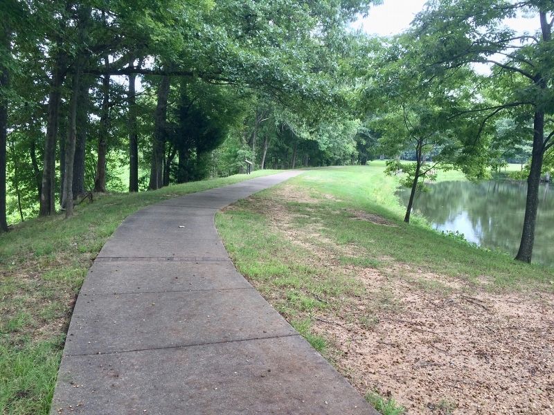
Spanish Explorer Hernan de Soto passed this way in 1542. Nearly
130 years later Father Marquette, the French missionary and explorer,
reached the nearby mouth of the Arkansas. In 1682 Robert Cavelier,
Sieur de la Salle, claimed this territory for . . . — — Map (db m108407) HM
The Lewis & Clark Expedition was accomplished by Captain Meriwether Lewis, Captain William Clark, and their fellow explorers, and was the visionary journey of President Thomas Jefferson. The journey was to become one of America’s greatest . . . — — Map (db m91477) HM
It was built in 1929 and was occupied by Ward's for 50 years. Notice the attractive facade that was added featuring the Goddess of Liberty and adopted as the corporate symbol. Fraley's Furniture and Appliances currently occupies the building. In . . . — — Map (db m225269) HM
The Arkansas River below you has a long history and continues to flow through time.
Bernard de La Harpe, the first European known
to explore the Arkansas River, arrived here in
1722. His expedition was commissioned by France
to establish . . . — — Map (db m233664) HM
One of the most captivating legends in Arkansas folklore
is the romantic tale of the mountain's namesake.
According to local legend, during the 18th century, a French
nobleman named Chavet was granted an expedition to explore
uncharted . . . — — Map (db m233666) HM
Using advanced technology to understand the past.
Like the methods of Crime Scene Investigators, science provides a variety of ways to look beneath the surface of the Drennen House grounds for evidence of the past. Techniques like . . . — — Map (db m120491) HM
In 1673, another European expedition arrived in Arkansas. Canoeing down the Mississippi River from the Illinois country (the upper Mississippi River Valley), Father Jacques Marquette, Jesuit missionary, and Louis Joliet, a coureur de bois . . . — — Map (db m234417) HM
On June 18, 1541, Hernando de Soto's Spanish expeditionary force crossed the Mississippi River and became the first Europeans to enter Arkansas. For the next two years, the Spaniards explored through Arkansas with a large number of captive Indians. . . . — — Map (db m234415) HM
In North America, the Indians
were building mounds such as
these from before the time
of Christ until after DeSoto
explored this area. These are
believed to be villages of
the Aquixo or Pacaha, 1541. — — Map (db m221347) HM
In 1541 Chief Casqui
greeted Hernando
de Soto not far from.
where you are standing.
This trail highlights the unique
history of the archeological site.
The fully accessible 1/4 mile trail
will take you approximately 30
minutes to walk. . . . — — Map (db m233181) HM
Accompanied by Henri de Tonti on their way down the Mississippi River in 1682. Landed near the mouth of the Arkansas River. They spent several days at a nearby village of Quapaw or Arkansas Indians. — — Map (db m299688) HM
The Arkansas Indians (the down stream people), a branch of the Quapaw tribe, lived in Desha County. Their presence was first recorded by Marquette and Joliet, French explorers, in 1673. They were known as les Beaux Hommes. La Salle while . . . — — Map (db m107809) HM
The Hernando De Soto expedition is believed to have passed near Cadron en route to points west. Some researchers think the expedition crossed the Arkansas River
(River of Cayas) near what is now Dardanelle. — — Map (db m96641) HM
A 15-man party, dispatched by President Thomas Jefferson to investigate the Ouachita River area, arrived at the hot springs in December of 1804 and found “… an open log cabin and a few huts of split boards, all calculated for summer encampment.” — — Map (db m211119) HM
This valley, long known by the Indians as "Tah-Ne-Co," "The Place of the Hot Waters" and according to tradition regarded by the different tribes as neutral ground, was first visited by white men on September 16, 1541, when Hernando De Soto and his . . . — — Map (db m170754) HM
Military Road
The Military Road, following part of the route of the old Southwest Trail, passed through the heart of Hot Spring County and the Midway community. Now known as Midway Road, the primitive pathway served as a major thoroughfare . . . — — Map (db m178623) HM
Beginning 10 miles northwest of Pine Bluff, this storied bayou flows 300 miles through 6 Arkansas counties and 2 Louisiana parishes before emptying into the Ouachita River in north Louisiana. Indian mounds dotted its banks. Immigrants travelled it . . . — — Map (db m30581) HM
Before Lewis and Clark explored the Louisiana Territory in 1804, little was known about the land or the animals of this vast region. President Jefferson, interested in America's natural resources, instructed the expedition to collect specimens and . . . — — Map (db m155194) HM
This point was established by survey on November 10, 1815 by U.S. Government survey teams led by Prospect Robbins and Joseph Brown. Recognizing the national significance of this Initial Point, the L'Anguille Chapter of the DAR sought placement of a . . . — — Map (db m155200) HM
The official Survey of the Louisiana Territory was ordered in 1815 by President Madison to establish a system for distributing this land as payment to veterans of the War of 1812. Commissioned by the United States Government, Prospect K. Robbins . . . — — Map (db m155197) HM
The stone marker behind you marks the 'Initial Point' for the survey of the Louisiana Purchase Territory. The east-west Baseline and the north-south line, the Fifth Principal Meridian, are fundamental in land transactions throughout the western . . . — — Map (db m155199) HM
In this area in 1541 a Spanish expedition from Florida commanded by Hernando De Soto encountered fierce resistance from the Indians, whom they described as the best fighting men they had met. De Soto then turned to the southeast and descended the . . . — — Map (db m201572) HM
Four maps drawn during the Civil War show Battery C. On each, the size and shape of the battery is different. Archaeological investigations conducted in 2011 and 2013 uncovered some surprising facts about this battery.
— — Map (db m107964) HM
1541-1931
June 18, 1541
Hernando De Soto
Crossed the Mississippi River
near Friar's Point to Aquixo
an Indian Village
south of
Helena, Arkansas — — Map (db m51917) HM
The Delta represents a “melting pot” of diverse cultures. And most of them got here by canoe.
Canoeing is the oldest form of water transportation on the Mississippi River-at least 2,000 years old! In the Quapaw tribal history, they arrived from . . . — — Map (db m229322) HM
'The Arkansea' was a land of mystery, wonder and riches...
Back east rumors grew of the Arkansea, a land of vast swamps, gators, buffalo, elk, beaver, and more bear than could be imagined. There were huge flocks of green and yellow . . . — — Map (db m142029) HM
The first definite account of the site we call the "little rock" is from Benard de la Harpe, a French officer sent in 1722 to explore the Arkansas River. He identified "some rocky country" and a league further upriver to the right, a rock which he . . . — — Map (db m117089) HM
A section of the "Little Rock" located at the foot of Rock Street forming the south pier of the railroad bridge over the Arkansas River, being the first rock seen by the French explorer, Bernard De La Harpe, on his voyage from the mouth of the . . . — — Map (db m102141) HM
The famed African Explorer, Stanley trekked into
unexplored east Africa in 1869 in search of the
long lost English missionary, Dr. David Livingston.
On finding him in 1871, Stanley uttered the now
famous line "Dr. Livingston, I presume?" . . . — — Map (db m170294) HM
"This … region [is] annually covered by water and at all seasons by a heavy growth of timber [and] thick can-brakes."
U.S. Rep. A. H. Sevier of Arkansas
Feb. 21. 1838
The Black River flows through . . . — — Map (db m170376) HM
Traveling mostly on foot, Stephen H. Long explored over 25,000 miles of the mid-west and northern United States. His team included artists and scientists to document natural resources. In 1817, he selected the location for the first Fort Smith. When . . . — — Map (db m156996) HM
The emigrant train of Forty-Niners, 5,000 strong, set out from Fort Smith in April, 1849, with an escort of United States [Army] Regulars under the command of Captain R. B. Marcy. — — Map (db m92353) HM
Hernando de Soto
Wintered on this Ridge
November, 1541 - March 6, 1542
The Spanish Explorer with his Conquistadores used the slough,
now part of the lake, to enter the Ouachita River to visit the Indians
along the banks. Here Juan . . . — — Map (db m305043) HM
On January 10th, 1921, shortly after 4:00 P.M., on a cold January day, a
deafening roar from a drilling rig one mile west of El Dorado announced the
discovery of oil in Arkansas. Dr. Samuel Busey brought in the Armstrong #1
as an earthshaking, . . . — — Map (db m121350) HM
This marker designates the area where on March 27, 1772 a scientific team under the auspices of the Empire of Spain stopped on Strawberry Creek to include an observation of is now known as Golden Gate. According to Juan Crespi, diarist, the first . . . — — Map (db m42034) HM
In 1775 and 1776, Lt. Colonel Juan Bautista de Anza and
Father Pedro Font led an expedition of 240 settlers, soldiers,
and others 1,800 miles from Sonora, Mexico to Monterey,
California to colonize the Bay Area. Anza and Font then led
a much . . . — — Map (db m176327) HM
Lt. Colonel Juan Bautista de Anza by decree of Carlos III of Spain led an expedition to this site – The mission being to colonize the San Francisco Bay Area.
In the center of the marker is a circular motif, designed by Doris . . . — — Map (db m26666) HM
After the missions were secularized by Mexico, their lands were divided into ranchos, which were granted to the “Californios” who had served the Spanish and Mexican governments.
In 1836 the lands around this park were granted to Fulgencio . . . — — Map (db m211569) HM
Near this site, an Ohlone man traveling along a well-worn path encountered a group of armed men riding large four-legged beasts. The man, having never seen such men or horses, was startled. To show that he would not resist or threaten them, he lay . . . — — Map (db m207584) HM
Lt. Colonel Juan Bautista de Anza by decree of Carlos III of Spain led an expedition to this site – The mission being to colonize the San Francisco Bay Area
In the center of the marker is a circular motif, designed by Doris Birkland . . . — — Map (db m28815) HM
Try to imagine what Anza’s expedition saw when it first arrived in the East Bay. The creeks teemed with salmon and trout, grizzlies and elk roamed free, shore birds flocked by the millions, and it was home to dozens of communities of Ohlone/Bay . . . — — Map (db m208204) HM
”The plague of long-billed mosquitos…bite us and pursued us all the way to the place where we camped”
- Padre Pedro Font
Padre Font was not happy. Setting up camp that March 31, 1776, he had come over a thousand miles from his home in . . . — — Map (db m208140) HM
[Side 1:]
William M. Mendenhall
1823 – 1911
Pioneer settler, a descendant of Quakers who emigrated from England with William Penn. He crossed the plains on horseback in 1845. Was a member of Fremont’s Battalion in 1846 and . . . — — Map (db m196958) HM
Chinese Explore the World in Junks
Before Christopher Columbus there was
Zheng He. From 1405 to 1433 Zheng He
led seven treasure fleets halfway around
the world. From the eastern coast of China, the
explorers sailed south through the . . . — — Map (db m157288) HM
Capt. Don Pedro, Father Fray Juan Crespi, fourteen soldiers, and a Christian Indian, camped here and took a latitude sighting of the Golden Gate.
Agalanes • John Rutledge • Ann Loucks • Mount Diablo • Berkeley Hills • Oakland Campanile • . . . — — Map (db m72138) HM
1855 Presbyterian pastor
Columbia, San Jose, Oakland
Founding minister of the First Presbyterian Church of Oakland
Mt. Hamilton bears his name — — Map (db m220691) HM
This marker consists of two duplicate plaques, one in English and the other in Spanish.
The Peralta Family Legacy
Luis Maria Peralta was just 17 when he and his family set off for the Bay Area in September 1775m from the town of . . . — — Map (db m71330) HM
Over time, different groups of people changed the landscape to meet their needs. The once wide open valley and its large lagoon have been transformed into smaller parcels with new uses for a growing population. Today’s seven acre park is a vestige . . . — — Map (db m217071) HM
Lt. Colonel Juan Bautista de Anza by decree of Carlos III of Spain led an expedition to this site – The mission being to colonize the San Francisco Bay Area.
In the center of the marker is a circular motif, designed by Doris Birkland . . . — — Map (db m26459) HM
Íyyanu ja sultáawukma mak ínnutka (Chocheño, the local Ohlone dialect)
Literal English translation: There come the white people on our trails.
Translation by Catherine Callaghan, Ph.D. (linguist)
Near this site on . . . — — Map (db m154062) HM
"Thence over a high sloping stony hill (sloping to the river) and down a steep hill to a canon or pass creek, where comes the first tug of war! Through the first range of the Sierra Nevada mountains" - Giles S. Isham, Aug 5, 1850 — — Map (db m211139) HM
This Sierra Crossing used by Jedediah Smith 1821 - Major John Ebbetts 1850 - Snowshoe Thompson 1856-76 - Gold Seekers 1850's. Old road left Carson Pass Road in Hope Valley, crossed Border Ruffian Pass to Hermit Valley, Pacific Summit and through . . . — — Map (db m10730) HM
On this spot, which marks the summit of the Kit Carson Pass, stood what was known as the Kit Carson Tree on which the famous scout Kit Carson inscribed his name in 1844 when he guided the then Captain John C. Fremont, head of a government exploring . . . — — Map (db m100568) HM
In February of 1844, John C. Fremont led a group of men over these mountains as they struggled to reach Sutter’s Fort. Little did they know that the pass, which lay 20 to 30 feet under the snow beneath them, would be a major route for the Gold Rush . . . — — Map (db m21278) HM
“…there ought to be a shaft raised to Snow-Shoe Thompson: Not of marble; Not carved and not planted in the valley, but a rough shaft of basalt or of granite, massive and tall, with top ending roughly as if broken short, to represent a life . . . — — Map (db m12028) HM
Summer after summer the Washoe Indian people visited the valley. Eventually their idyllic retreat was discovered.
During the winter of 1844 Captain John Fremont may have seen this place during his crossing of the Sierra. Fremont’s diary of his . . . — — Map (db m11001) HM
Named after Major John Ebbett and pointed out in 1853 to surveyor G.H. Goodard who referred to it as a “route of great promise – probably the best one for a transcontinental railway.”
No emigrant train used this route but a . . . — — Map (db m11444) HM
Telltale signs of geologic activity surround Grover Hot Springs State Park. Bold granite peaks to the northwest are the work of immense mountain building forces. Old lava flows cover hundreds of square miles to the east, giving the Markleeville area . . . — — Map (db m13239) HM
[The first paragraph of the marker is unreadable]
One of the most popular passes through the Sierras along the Emigrant Trail was Carson Pass. This Pass was discovered by Kit Carson, a guide to the Fremont Party.
The Fremont Party, led by John . . . — — Map (db m223952) HM
This campsite on the Kit Carson Emigrant Trail was a resting place for California settlers. It was named by members of the Mormon Battalion enroute to Salt Lake Valley. Three of their men, serving as advance trail scouts, were murdered here by . . . — — Map (db m21273) HM
Associate of Leland Stanford, Pioneer, Miner, Legislator, Businessman. Sailed around Cape Horn on clipper ship Tahamaroo in 1849. Established the first deep quartz mine, The Union, with E.B. McIntyre, S. Hanford & N. Drew in 1851. Became . . . — — Map (db m29829) HM
Born in Bucks County Pennsylvania, Neal a blacksmith by trade came to California with John Fremont’s second expedition in 1844. After working for John Sutter briefly at New Helvetia, obtained a land grant and established Rancho Esquon. After . . . — — Map (db m61826) HM
Member of Fremont’s Battalion during Mexican War. Established Indian trading posts throughout Central San Joaquin Valley. Leader of the first expedition of the Mariposa Battalion into Yosemite Valley, 1851
Dr. Lewis Leach described Savage as . . . — — Map (db m34057) HM
Named by famous scout Kit Carson while searching for pass over Sierras. One emigrant road forked at Big Meadows, and north branch came directly to West Point. A thriving trading post prior to gold discovery. Bret Harte, famous author, lived here for . . . — — Map (db m44371) HM
Miwok Indians inhabited this valley at the base of Mt. Diablo when Spanish explorers came in the 1770’s. Scouts, trappers, prospectors and settlers followed.
In 1857 Clayton was founded by Joel Clayton, a miner, farmer, and wagonmaster from . . . — — Map (db m59954) HM
first settler of this valley
born Cherokee Nation, Alabama – 1818
died Morgan Territory, California – 1906
Traveled to California gold country in 1849, soon discovering that he could earn more money hunting wild game to feed fellow miners . . . — — Map (db m250474) HM
Lt. Colonel Juan Bautista De Anza by decree of Carlos III of Spain led an expedition near this site - the mission being to colonize the San Francisco Bay Area — — Map (db m155569) HM
"We called to these Indians, hoping to buy their fish from them."
From Father Pedro Font's Diary, April 2, 1776
In 1775 and 1776, Lt. Colonel Juan Bautista de Anza, Father Pedro Font, along with 240 settlers, soldiers, . . . — — Map (db m91652) HM
Fages, Commandante at Monterey, vainly looked for a way across San Francisco Bay. With Juan Crespi, Franciscan missionary, 14 soldiers, a muleteer and an Indian servant, he trekked along Carquinez Strait, thence eastward nearly to Antioch. Turning . . . — — Map (db m91703) HM
Mount Diablo, sacred to Native Americans who lived and worshipped there for over 5,000 years became a critical reference point for Spanish explorers in the 18th century, and American trappers and early California settlers in the 19th. In 1851 . . . — — Map (db m17541) HM
Juan Bautista de Anza National Trail passed through present day El Cerrito April 1, 1776 Homeland of the Huchiun-Ohlone Tribe of American Indians
The fields are green with grass and thickly covered with various . . . — — Map (db m91843) HM
This monument erected in honor of his contributions as a soldier, mountain man, and explorer who through his efforts and those of his breed such as Jim Bridger, Thomas Fitzpatrick, Jedediah Smith, helped explore and open the way to the West. There . . . — — Map (db m93508) HM
Ranch home of John Muir 1838- 1914, explorer, naturalist, author and foremost advocate of forest protection and of national parks. The John Muir Trail through the High Sierra, Muir Woods National Monument and Muir Glacier in Alaska are named for . . . — — Map (db m51132) HM
Grandfather of the co-grantee of Rancho Laguna de los Palos Colorados, he founded San Francisco by establishing there the Mission and Royal Presidio of St. Francis in 1776. In 1777 he founded the Mission Santa Clara and the Pueblo of San Jose. . . . — — Map (db m91803) HM
"...what we see and have before us is
not a river, but much water in a pond."
In the spring of 1776, Lt. Colonel Jaan Bautista de Anza,
Father Pedro Font, and a small group spent four days
exploring the East Bay. They wished to . . . — — Map (db m190712) HM
The 1775-76 expedition of Juan Bautista de Anza
made this site their one hundred first camp from
Horcasitas, Sonora, Mexico. Anza brought 198
colonists, located for Spain the Presidio of San
Francisco and Mission Dolores, and explored . . . — — Map (db m190721) HM
The Juan Bautista de Anza Expedition of 1775-1776 traveled with
240 settlers, soldiers, and others 1,800 miles from Sonora, Mexico
to Monterey, California. Anza then traveled with a much smaller
group to San Francisco and the East Bay to discover . . . — — Map (db m190230) HM
In 1775 and 1776, Lt. Colonel Juan Bautista de Anza, Father
Pedro Font, along with 240 settlers, soldiers, and others traveled
1,800 miles from Sonora, Mexico to Monterey, California. Anza
and Font, with a small group passed through by horseback . . . — — Map (db m145988) HM
Lt. Colonel Juan Bautista de Anza by Decree of Carlo III of Spain led an expedition near this site — the mission being to colonize the San Francisco Bay Area
In the center of the marker is a circular motif, designed by Doris Birkland . . . — — Map (db m24728) HM
Take a walk down the path and imagine what life might have been like here 200 years ago. Oak Creek would have provided fresh water and an abundance of plant material and wildlife for food and shelter. Houses would have been built with willow . . . — — Map (db m202104) HM
If you had stood on this spot in 1769, 1823, and 1848, you would have been in three different countries! Each time California switched hands, life changed for its people.
Spanish Province
“California” was a Spanish province in 1769. For the . . . — — Map (db m214606) HM
In the years leading up to the Gold Rush, life changed dramatically for the Nisenan who called this valley home.
Cullumah
To the Nisenan, “Cullumah” was home. For generations, they thrived in the valley and mountains, building large . . . — — Map (db m214607) HM
John Sutter and James Marshall came to California with dreams of a brighter future, but they never imagined their future would hold gold!
New Beginning
For both Sutter and Marshall, California was a land of opportunity. A persuasive . . . — — Map (db m214608) HM
Panel One:
New Jersey-born James Wilson Marshall came to John Sutter’s fort at Sacramento in July 1845, just a year before the American conquest of California. Trained as a carpenter and wheelwright by his father, Marshall quickly found . . . — — Map (db m215533) HM
For a brief moment, Coloma was the destination for anyone seeking their fortune in California’s gold fields.
Gold Rush Town
Almost overnight, migrants from around the world turned Coloma into a town of tent dwellings, hotels, and stores. . . . — — Map (db m214630) HM
In 1946, President James K. Polk authorized the Army to enlist Mormons to fight in the Mexican War. 496 men joined the Mormon Battalion in Council Bluffs, Iowa on July 16, 1846. They marched over 2,000 miles, building a wagon road from Santa Fe to . . . — — Map (db m215525) HM
Caught up in the frenzied news about the gold discovery, thousand of gold seekers from all corners of the world flooded into Coloma.
Fortune Seekers
California’s gold fields offered boundless opportunity and the hop of a brighter future. . . . — — Map (db m214879) HM
Shortly after James W Marshall discovered gold at Sutter's Mill, his Mormon laborers were re-called to the Great Salt Lake Valley, Utah. On April, 9, 1848, a plan was devised to cut a wagon trail through the uncharted Sierra Nevada frontier. The . . . — — Map (db m94636) HM
Fremont passed within sight of this spot on April 7, 1844. He was crossing from the San Joaquin River to the Kings River with his mountain men guides, Thomas "Broken Hand" Fitzpatrick, Kit Carson and Alex Godey. Fremont described a vast prairie with . . . — — Map (db m229460) HM
After finding Humboldt Bay from the sand dunes near Fairhaven on December 20, 1849, the Dr. Josiah Gregg exploring party reached the present site of Eureka. December 26, passing an open area near this point, to camp by an Indian village close to . . . — — Map (db m91923) HM
Here on September 23, 1849, Lieut. Cave J. Couts, Escort Commander, International Boundary Commission, established Camp Salvation. From September till the first of December 1849, it served as a refugee center for distressed emigrants attempting to . . . — — Map (db m50586) HM
On Friday January 15, 1847 the Mormon Battalion, a volunteer unit of the Army of the West, crossed Interstate Highway 8 approximately seven miles west of this point. Lieutenant Colonel Philip St. George Cooke commanded this battalion when the . . . — — Map (db m191654) HM WM
Known as Santa Rosa De Las Lajas (Flat Rocks), this site was used on March 8, 1774 by the Anza exploring expedition, opening the land route from Sonora, Mexico, to Alta California. On December 11 to 15, 1775 the three divisions of Anza's colonizing . . . — — Map (db m62074) HM
A 1533 expedition sent by Hernan Cortes discovered Baja California,
leading to the name "California" and the belief that it was the famed
Island of California which then appeared on maps of the era.
Exploration and Cartography
. . . — — Map (db m165827) HM
Juan Bautista De Anza led two groups of Spanish explorers and settlers across this portion of the Colorado Desert from Northern Mexico to San Francisco Bay. During each tortuous passage, the Spanish camped below here in Yuha Wash. The passage in . . . — — Map (db m50683) HM
Used by the Kamias Indians who showed it to Anza's scouts on March 8, 1774. The second Anza Expedition passed here on December 11, 1775. Later an important water source on the trail from Yuma to San Diego. — — Map (db m50363) HM
4923 entries matched your criteria. Entries 201 through 300 are listed above. ⊲ Previous 100 — Next 100 ⊳