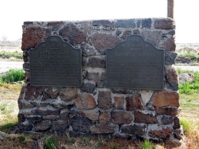
From this fortress Captain Jack and his Indian forces successfully resisted capture by U.S. Army troops from December 1, 1872 to April 18, 1873. Other nearby landmarks of the Modoc Indian War are Canby's Cross, No. 110 and Guillam's Graveyard, No. . . . — — Map (db m154347) HM
Two Warm Springs Indians, acting as scouts with the U.S. Army were killed at the Battle of Dry Lake. That final battle of the Modoc War was fought about 10 miles S.E. of here May 10, 1873. They were brought to the Peninsula Camp, just south of here, . . . — — Map (db m87893) HM
A graduate of West Point, his gallantry on the fields of battle earned him commendations; from the Seminole War in Florida, to the Mexican War, to the Indian Campaign in the Pacific Northwest. His unwavering loyalty to the Union would prompt . . . — — Map (db m10766) HM
Near here in May 1820 Estanislao, the Indian chief of whom the river and county were named, defeated Sgt. Sanchez in a battle. Later the same month Gen. Vallejo returned with infantry cavalry and artillery burned the woods and routed the Indians. . . . — — Map (db m151170) HM
Battle of the Crags was fought below Battle Rock in June 1855. This conflict between the Modoc Indians and the settlers resulted from miners destroying the native fishing waters in the Lower Soda Springs area. Settlers led by Squire Reuben Gibson . . . — — Map (db m69857) HM
In Commemoration of
Captain Dick and Richard Pugh
The 1850's saw tension and turmoil between the early settlers and the native peoples of the Fall River Valley.
Richard Pugh, a native of Wales, was chosen by Lt. George Crook to be his . . . — — Map (db m10287) HM
The Mountain Howitzer is a short barreled, large caliber cannon designed on such a small scale that the entire piece can be taken apart and carried on pack animals. Mountain Howitzers were mostly used on small skirmishes, scouting expeditions and . . . — — Map (db m101426) HM
On Aug. 8, 1853 Captain Alden led 10 men of the 4th U.S. Infantry from Fort Jones and 80 volunteers from Yreka over these mountains to the assistance of the Rogue River Valley.
This force augmented by 100 volunteers from Oregon defeated the . . . — — Map (db m70216) HM
Forced to flee the stronghold, the Modoc took cover amid the craggy lava features in this area. A group under Scarface Charley watched from the Schonchin Flow as Army troops marched from Gillems Camp toward their concealed position.
Officers . . . — — Map (db m87906) HM
It was April 11, 1873, the middle of the Modoc War. Though greatly outnumbered, Modoc warriors had easily defeated the Army in the first battle for the Stronghold in January, and soldiers had waited through the winter while peach talks dragged on. . . . — — Map (db m87916) HM
Over the years, various individuals and group have made efforts to memorialize the death of General E.R.S. Canby, the only general to be killed in an Indian War. This wooden cross is a replica of an original erected by a U.S. soldier in 1882, just . . . — — Map (db m87909) HM WM
This was the shoreline of Tule Lake in 1872-73. The Modoc Indians occupying the Stronghold obtained water at this point.
Once nearly 100,000 acres, the lake was drained between 1912 and 1958 to make fertile land available for homesteads. — — Map (db m87914) HM
Thousands of years ago, flowing lava cooled forming a natural fortress. The surrounding area later became the center of the Modoc Indian homeland. A series of events made this lava stronghold a focal point in the war to remove the Modoc from their . . . — — Map (db m87917) HM
“When I was a child…I played around Tule Lake where the tules and grass grow thick… We used to go out in the tall grass… and look for chub fish… and shoot at (them) with our arrows.”
Peter Schonchin, last surviving . . . — — Map (db m63249) HM
By April 1873, months of peace talks to end the Modoc War had gone nowhere. General E.R.S. Canby found himself caught between President Grant’s Indian Peace Policy and the desire of some settlers to have the Army eliminate the Modoc band. The . . . — — Map (db m63211) WM
“Peaceable if you can, forcibly if you must,” ordered Indian Agent T. B. Odeneal. The U.S. Army garrison’s task was to bring the Modocs and their leader, Captain Jack, back to the reservation. His refusal started the Modoc War in the . . . — — Map (db m63213) WM
It is difficult today to trace the disposition of all those killed in action during the Modoc War. This site was first consecrated January 17, 1873, when two soldiers were buried here. It became an official cemetery in April when thirteen enlisted . . . — — Map (db m63670) HM
Through the winter of 1872-1873, a vastly outnumbered group of Modoc Indians resisted attempts by the U.S. Army to remove them from their homeland. Driven from Captain Jack's stronghold, the Modoc moved into this area in mid-April. Intimate . . . — — Map (db m63270) WM
From this command post, the U.S. Army directed part of a frustrating campaign against a small band of Modoc Indians. Determined to defend their homeland, the Modoc consistently outmaneuvered the Army, who at times outnumbered them ten to one. Just . . . — — Map (db m154350) HM
A long period of unrest between the settlers and Indians of Tulare County erupted in war during the Spring of 1856. Untrue reports that five hundred head of cattle had been stolen in Frazier Valley and the burning of Orson K. Smith's sawmill aroused . . . — — Map (db m173122) HM
On October 6, 1862 Capt. Moses McLaughlin and Lt. Col. George S. Evans commanding 57 men of Company D, 2nd Cavalry, California Volunteers arrived in Visalia. They had come from Camp Independence, Owens Valley over the newly completed Coso Trail. . . . — — Map (db m141739) HM
The canyon to your right was the scene of the last battle between Indians and whites in Tuolumne County. On February 10, 1858, a band of Piutes attacked a group of employees of the Columbia & Stanislaus River Water Co. In the fight which followed . . . — — Map (db m78075) HM
Front
The Soldier’s Life
Fort Garland housed infantry and cavalry units. During the 1870’s the famed Buffalo Soldiers—African-American cavalrymen—were also posted here. For all soldiers—and their . . . — — Map (db m71032) HM WM
(West side):
Colorado Territory - Organized
February 28, 1861
Colorado Admitted as a State
August 1, 1876
Census of Territory in 1861 - 23,331
War Governors
William Gilpin
Richard Ed Whitsitt Adjutant General
1861-1862
John . . . — — Map (db m4745) HM
At this location on April 23, 1865, assassins shot and killed 1st Colorado Cavalary Officer Capt. Silas S. Soule. During the infamous Sand Creek Massacre of November 29, 1864, Soule had disobeyed orders by refusing to fire on Chief Black Kettle's . . . — — Map (db m67133) HM
This tablet is the property of the State of Colorado ——— This is the southwest corner of Camp Weld Established September 1861 for Colorado Civil War Volunteers. Named for Lewis L. Weld, first Secretary of Colorado . . . — — Map (db m203499) HM
Erected by Pioneer Women of Colorado 1939 A.D. in memory of pioneers massacred by Indians. 1864 A.D. Hungate, Nathan W. and Ellen and Children Laura V., Florence V. 1868 A.D. Dietemann, Henrietta and son John, Louis Alma, Joseph Bledsoe — — Map (db m45748) HM
Trail Under Siege Indians of Colorado’s High Plains
Kiowa and Comanche Indians migrated to these prairies in the 1700s, followed by Cheyennes and Arapahos in the early 1800s. The region’s vast grasslands, thick bison herds, and brisk fur . . . — — Map (db m45756) HM
The Ute Indians who inhabited what is now Colorado, Utah, and northern New Mexico were organized into small family bands. They migrated seasonally between the mountains and the deserts and foothills in search of game and wild plants and to . . . — — Map (db m177848) HM
For many years, the Ute Indians lived in the mountains west of the mouth of Clear Creek Canyon, hunting and trading with area travelers. The Arapaho, refugees from the Great Lakes region, and the Cheyenne arrived in the area during the mid-18th . . . — — Map (db m49899) HM
(Upper Plaque)
In Memoriam
Colonel William Frederick Cody
"Buffalo Bill"
Noted scout and Indian fighter
Born February 26, 1846 Scott County, Iowa
Died January 10, 1917 Denver, Colorado
(Lower Plaque)
William F. Cody . . . — — Map (db m152718) HM
Chief's Village at Sand Creek
The Cheyenne and Arapaho Village at Sand Creek was a
Chief's village with 33 chiefs and headmen present. To be
a chief in the Cheyenne and Arapaho Tribes is to undertake
a responsibility so vast only . . . — — Map (db m181887) HM WM
Sand Pits Offer Life and Death Chief Black Kettle and George Bent sought shelter in
a sand pit with almost one hundred others. South of
them another hundred survivors sheltered in two other
sand pits, but soldiers brought up the . . . — — Map (db m181071) HM
Cheyenne Peace Chief Black Kettle As the soldiers' gunfire increased, and artillery began
firing deadly salvos toward the village, Black Kettle
remained in camp. In a final show of desperate hope,
the chief hoisted an American and . . . — — Map (db m182290) HM WM
Activity in the Villages
As the attack moved toward the northern-most Cheyenne
and Arapaho encampments, tribal members sought to
escape, even as artillery shells exploded overhead.
Within the first hour of the attack command and . . . — — Map (db m181252) HM WM
A Camp at Sand Creek
Along the northern edge of the Pónoeo 'hé'e (Dry River) or
Sand Creek, sit about 156 lodges or tipis, with hoóxé’e or
tipi poles rising into the sky. Traditionally positioned with
their entrances open toward . . . — — Map (db m181240) HM
Some Soldiers Refuse to Fight Shortly after opening fire on the village, 1st Regiment
soldiers moved along both sides of the village. Cpt. Soule
and Lt. Cramer led their men west, around the fighting,
and purposefully did not . . . — — Map (db m181873) HM
Captain Silas S. Soule and Lieutenant Joseph A. Cramer of the 1st Colorado (U.S.) Volunteer Cavalry put their military
careers - and lives - at risk by refusing to fire during the attack against a peaceful Cheyenne and Arapaho village at
Sand . . . — — Map (db m180846) HM
In the Cheyenne and Arapaho camps, the early hours of
November 29, 1864 started like any other day – people up
before sunrise greeted the day cautiously, but with little
trepidation. “Heap of Buffalos Coming!”
Always alert to . . . — — Map (db m180915) HM
Women at Sand Creek
During the soldiers' attack, men in the village put up the
best defense they could. But displays of bravery were not
exclusive to warriors; many women risked their lives to
protect their families as well. Women . . . — — Map (db m181477) HM
Accountings of a Massacre
Captain Soule and Lieutenant Cramer put their lives
and careers in jeopardy when they refused to attack the
Cheyenne and Arapaho at Sand Creek. Both men wrote
letters detailing atrocities they witnessed . . . — — Map (db m184923) HM
A Scene of a Tragedy, a Hallowed Landscape
As the final shots faded throughout the valley and
November 29 drew to a close, approximately 230
Cheyenne and Arapaho lay dead. Most of those
killed were women, children and the . . . — — Map (db m180954) HM
"Many years have passed. The land is still here. We lived here, our clans lived here. The land here is our home - we have come back home."
Arapaho:
Wonoo3ei’i ceciniihi’ coowoo’ou’u. Nih’iine’etiino’ hiitiino. Neito’eininoo . . . — — Map (db m180924) HM WM
Sacred Memory
Sand Creek is a place where culture and history are at the
center of controversy, trauma, anger, and forgiveness. A
place to reflect on the past as well as the future, the Sand
Creek Massacre teaches powerful . . . — — Map (db m181063) HM WM
3rd Regiment Attacks
Hearing gun fire from the vicinity of the village,
soldiers of the 3rd Regiment, approximately two
miles west of this location, disobeyed orders and
turned their horses toward the bluffs. Somewhere
in the . . . — — Map (db m181097) HM WM
On November 29, 1864, U.S. Colonel John Chivington and 700 volunteer troops attacked an encampment of Cheyenne and Arapaho along Sand Creek. The thunderous approach of horses galloping toward camp at dawn sent hundreds fleeing from their tipis. Many . . . — — Map (db m180927) HM
Pony Herds Threatened
First to see soldiers approaching were two young men, King
Fisher and Little Bear, who were tending the horse herds
grazing to the south. In 1906, Little Bear described that
fateful day: “As I was going . . . — — Map (db m181575) HM
We ran up the creek with the cavalry following us…The dry bed of the stream was
now a terrible sight: men, women, and children lying thickly scattered on the sand, some dead and the rest too badly wounded to move… George . . . — — Map (db m181944) HM WM
The flag before you represents the flag that flew from Chief Black Kettle's lodge on the morning of November
29, 1864, when his encampment of friendly Cheyenne and Arapaho was brutally attacked by the Colorado
(U.S.) Volunteer Cavalry. The . . . — — Map (db m184925) HM
Sand Creek Massacre
National Historic Site
Sand Creek Massacre National Historic Site memorializes the massacre of nearly two hundred Cheyenne and Arapaho Indians.
Near dawn on November 29, 1864, detachments of the 1st . . . — — Map (db m107179) HM
Though the Sand Creek Massacre has long passed, memories live on. Cheyenne and Arapaho return here to pray and pay tribute to ancestors who both perished and survived that dreadful day.
Ever resilient, the Cheyenne and Arapaho nations of today . . . — — Map (db m181060) HM
"All we ask is that we may have peace with the whites...We want to take good tidings home to our people, that they may sleep in peace."
Cheyenne Chief Black Kettle
As tensions mounted, Chiefs Black Kettle and Left Hand pled . . . — — Map (db m181243) HM
”Many years have passed. The land is still here. We lived here, our clans lived here. The land here is our home - we have come back home.”
Arapaho:
Wonoo3ei’i ceciniihi’ coowoo’ou’u. Nih’iine’etiino’ hiitiino. Neito’eininoo . . . — — Map (db m180923) HM
In the aftermath of Sand Creek, federal investigations and military inquiry took place. Dozens of eyewitness' provided testimony. Taken in Washington, D.C., Denver City, Fort Lyon, and other locations, officers, soldiers, and civilians came forth. . . . — — Map (db m181061) HM
A barrage of arms fire was leveled against the Cheyenne and Arapaho. Amid the wild confusion, soldiers noticed people at the village “... going slowly away in a sort of listless, and dazed, or confused manner ...” Throughout the morning and into the . . . — — Map (db m181242) HM
For years, Cheyenne and Arapaho traveled and hunted the Great Plains in the shadow of the Rocky Mountains. But in 1858, gold fever struck in Colorado Territory. Miners rushed in and tens of thousands of settlers followed. Competition for land became . . . — — Map (db m181241) HM
Captain Charles H. Baker, who discovered gold in the San Juan in 1860, led a party of prospectors to this area in 1861. They placer mined on El Rio de las Animas, built the first bridge (300 feet north), and established the town called Animas . . . — — Map (db m177471) HM
Sand Creek Massacre
At dawn on the morning of November 29 I was still in bed when I heard shouts and the noise of people running about the camp. I jumped up and ran out of my lodge. From down the creek a large body of troops was . . . — — Map (db m107245) HM
Due west 940 feet stood
“Fort Wicked"
Originally Godfrey’s Ranch
Famous Overland Stage Station
One of the few posts withstanding the Indian uprising of 1864 on the road to Colorado.
Named from the . . . — — Map (db m61998) HM
3 miles southeast from this point is the site of the Battle of Summit Springs
Last engagement with Plains Indians in Colorado, July 11, 1869. Cheyennes who raided western Kansas were attacked by General E. A. Carr with the Fifth U.S. Cavalry . . . — — Map (db m61997) HM
In November 1864, in southeastern Colorado, U.S. Volunteers troops attacked Black Kettle’s peaceful band of Cheyenne Indians at Sand Creek. In retaliation for the massacre and mutilation of 163 Cheyenne men, women, and children, Cheyenne warriors . . . — — Map (db m51217) HM
Location, Location, Location
Thousands of caravans used the Santa Fe Trail between 1821 and 1880. The trail clung close to the Arkansas River for hundreds of miles across the open plains. The Arkansas Valley offered gentle terrain . . . — — Map (db m106937) HM
I saw the American flag waving and heard Black Kettle
tell the Indians to stand around the flag. I also saw a
white flag raised. These...were in such a conspicuous
position they could not have been missed.
-Robert Bent, son of William . . . — — Map (db m181015) HM
Following the Meeker Massacre, Gen. Wesley Merritt established at this site his “Camp on White River,” 1879. After withdrawal of the garrison in August, 1883, the town of Meeker was founded by the following pioneers: George S. Allsebrook, Charles . . . — — Map (db m163871) HM
The Meeker area is rich in history — that of the Ute Indians, who were the first people in the area, and that of the white settlers who began homesteading, ranching, and farming here in the late 1800s. The county seat of Rio Blanco County, . . . — — Map (db m163889) HM
This Native Granite Stoneerected by the citizens of Rio Blanco County, Colorado 1927 and dedicated to the memory of Nathan C. Meeker United States Indian Agentwho, with his government employees, was massacred by the Ute Indians . . . — — Map (db m163886) HM
1865 Indian War In November 1864, in southeastern Colorado, U.S. Volunteer troops attacked Black Kettle's peaceful band of Cheyenne Indians at Sand Creek. In retaliation for the massacre and mutilation of 163 Cheyenne men, women, and children, . . . — — Map (db m199956) HM
Troops H & I, 10th Calvary, Buffalo Soldiers, were dispatched from what is now, Cheyenne Wells, Co. Troop H arrived on September 25, 1868 to the relief of the Forsyth Scouts, who were known to be in danger of total annihilation by a . . . — — Map (db m131269) HM
In September 1868 fifty civilian scouts left Fort Wallace, Kansas, to fight Cheyenne and Sioux warriors, on the theory that experienced frontiersmen could defeat any enemy force. On September 17 the scouts approached the Arikaree River, . . . — — Map (db m201049) HM
Native Peoples
Fort Saybrook Monument Park consists of nearly 18 acres, about 11 of which are marshland, and borders the Connecticut River called by Native Americans "quineteckut" or "long, tidal river." Prior to the arrival of Europeans in . . . — — Map (db m227286) HM
Prior to 1800 the Mystic River Valley was a sparsely settled region. The population depended upon agriculture for subsistence and occasionally profit. The leading historical event during the colonial period had been the defeat and the near . . . — — Map (db m226772) HM
Located in Pequot territory and used for millennia by Indigenous people, it was later colonized by Europeans who displaced local Indigenous peoples. Mystic is also the notorious site of one the most brutal massacres of Indigenous people in . . . — — Map (db m227055) HM
400 Feet due East of
this tablet
was the site of the first home of
Israel Putnam
in the Colony of Connecticut
In 1739, he bought 514 ½ acres of the adjacent land
from Governor Belcher at £5.0.0 per acre.
In 1740, here he came . . . — — Map (db m124379) HM
Of the eighteen Delawareans who have been awarded the Medal of Honor since it was established by an Act of Congress in 1862, fifteen received the medal for actions during the 19th century — twelve from the Civil War, one from the Indian Wars in . . . — — Map (db m198966) HM WM
Alfred Thomas Archimedes Torbert was a gallant and distinguished officer and leader during the Civil War achieving the rank of Major General in the Union Army. He was a strict disciplinarian who saw to the needs of his troops gaining their respect . . . — — Map (db m142602) HM
Walter Reed 1851 - 1902 Bacteriologist - Research Scientist
In honor of his great work in the fight for the eradication of yellow fever
Reverse:Insignia of the Army Medical Corps
In recognition of the high public service of . . . — — Map (db m68990) HM
In 1609 Captain John Smith sailed from the English colony of Jamestown, Virginia, and up the Potomac River as far as Little Falls. He found 13 Indian villages along the Potomac, including one called Nacotchtank. These villagers farmed small plots . . . — — Map (db m130871) HM
Brigadier General Pushmataha (1764-1824) was a Choctaw chief, warrior, hunter, and great friend of many, including President Andrew Jackson. In 1812, Pushmataha led 1,000 warriors of Choctaw Nation to fight alongside Jackson at the Battle of New . . . — — Map (db m141889) HM
Hacienda de la Chua
Organized cattle ranching at the prairie began here in the 1600s. You are standing at the site of the largest ranch in Spanish Florida, Hacienda de Ia Chua (right). Hacienda de la Chua was the main supplier of beef to St. . . . — — Map (db m126488) HM
Near this site was located Fort Clarke, originally a U.S. Army post during the Seminole War, and afterwards a settlement. The name is preserved in nearby Fort Clarke Church. At this site crossed the early settlement and military road connecting the . . . — — Map (db m65191) HM
(Front)
Hogtown Settlement
Near this site was located Hogtown, one of the earliest settlements in Alachua County. It was originally an Indian village which in 1824 had fourteen inhabitants. Hogtown settlement is also mentioned in . . . — — Map (db m150806) HM
Jesse Johnson Finley was born in Wilson County, Tennessee, November 18, 1812 and educated in Lebanon, Tennessee. After service as a captain in the Seminole War of 1836, he studied law and was admitted to the bar. During a ten year period he served . . . — — Map (db m93855) HM
Present-day Gainesville was the center of a large Spanish cattle ranching industry, founded on the labor of native Timuqua Indians, during the 1600s. LaChua, largest of the ranches, was a Spanish corruption of an Indian word, and in turn was . . . — — Map (db m72916) HM
Edgar Smith Walker was born June 3, 1858, in Cooper County, Missouri. He was educated in country schools and lived on a farm until the age of 18. While attending the University of Missouri, he accepted an appointment to the U.S. Military Academy at . . . — — Map (db m128915) HM
The Battle of Micanopy
The Battle of Micanopy took place on the morning of June 9, 1836. Seventy-five troops under the command of Major J.F. Heileman engaged a larger Seminole force headed by Osceola, numbering about 250 warriors. Two . . . — — Map (db m150458) HM
Founded after Spain relinquished Florida to the United States in 1821. Micanopy became the first distinct American
town founded in the new US territory. Originally an Indian trading post, Micanopy was built under the auspices of the
Florida . . . — — Map (db m54271) HM
War on the Frontier
The opening of the Second Seminole War began during the first week of December 1835. Seminole, along with their Black allies, attacked and burned hundreds of farms and homesteads in the Payne's Prairie region, the . . . — — Map (db m150459) HM
Seminoles in Florida
Between 1716 and 1763, under pressure from the colonial powers of Britain and Spain, two groups of Creek Indians from more northerly regions of Spanish La Florida (see map) arrived in the area of present-day Micanopy . . . — — Map (db m150457) HM
Colonel Daniel Newnan led a troop of the Georgia militia on a raid into the area in September 1812 in an attempt to annex Florida to the United States in the War of 1812. The raiders engaged a force of Seminole Indians under the command of . . . — — Map (db m54642) HM
Proud to be a Baker County Burnsed Descendant
Honoring
James M. Burnsed
Builder of the Burnsed Block House (Mid- 1830s)
and Fort Monica
Served in 1860s as Baker County Sheriff — — Map (db m206758) HM
One half mile to the west ran the Hernandez Trail used during the Seminole War. It connected forts along the East Coast to Ft. Dallas in Miami and across from Ft. Pierce and Ft. Capron to Ft. Brooke near Tampa. Brig. General Joseph M. Hernandez, . . . — — Map (db m72606) HM
The Hernandez-Capron Trail parallels I-95 here in Brevard County. Laid out in 1838 by U.S. Army during Second Seminole war, it linked King's Road in St. Augustine and forts along St. John's River with Ft. Capron, 4 mi. north of present Ft. Pierce. . . . — — Map (db m75839) HM
"Nothing occurred to disturb the quiet of the night, except the wolves in the neighboring forest responding howl for howl…"
—Journal of Jacob Rhett Mott, 1838
By the 19th century, American settlements along Florida's . . . — — Map (db m131066) HM
Indian River oranges, one of Florida's most outstanding products were developed in the 19th century by Douglas Dummett. The Dummett family immigrated from the Barbados in 1807. By 1825, Thomas Dummett had acquired sugar plantations on the east . . . — — Map (db m125643) HM
This monument marks the site of the William Cooley plantation. Cooley arrived here in 1824 and soon became the leader of the small settlement that grew along the New River.
On January 6, 1836, local Indians attacked Cooley's homestead, killing . . . — — Map (db m127510) HM
2903 entries matched your criteria. Entries 201 through 300 are listed above. ⊲ Previous 100 — Next 100 ⊳