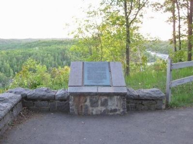
Near State Highway 210 3.9 miles east of State Highway 45, on the right when traveling east.
This point overlooks the St. Louis River Valley. The steeply inclined rocks in the river channel upstream are alternating beds of slates and graywackers of the Thompson Formation thousands of feet thick.
. . . — — Map (db m44627) HM
Near State Highway 210 3.9 miles east of State Highway 45, on the right when traveling east.
540 acres of land southwest of this point, embracing Silver Creek in Jay Cooke State Park are dedicated to the memory of this pioneer civic leader who made great contributions to the establishment and development of this park.
Lands donated by . . . — — Map (db m53599) HM
Near State Highway 210 3.9 miles east of State Highway 45, on the right when traveling east.
One half mile south of this point lie three islands, known as numbers 1, 2, & 3, in the St. Louis River, which were settled by Josiah Boardman Scovell, original U.S. patentee in 1881, who retained ownership for the balance of his life.
Islands . . . — — Map (db m53857) HM
On State Highway 73 at Automba Road (County Road 6 & 131), on the right when traveling north on State Highway 73.
In memory
of the Finnish pioneers who arrived here in the western part of Carlton County in 1872 and thereafter, and made their homes with courage and perseverance.
Erected 1952 by Minnesota Finnish American Historical Society Chapter No. . . . — — Map (db m3266) HM
On Main Street (State Highway 73) north of 1st Avenue South, on the right when traveling north.
On October 12, 1918, a massive forest fire raced through northeastern Minnesota from Sturgeon Lake to the shores of Lake Superior north of Duluth. When it was over, this region had suffered through one of Minnesota’s worst disasters.
Weather . . . — — Map (db m3031) HM
Near Interstate 35 at milepost 226, 5.3 miles north of County Road 6, on the right when traveling north.
One hundred miles north and west of Duluth lies the Iron Range. North America's largest iron ore region consists of three major iron ranges: the Vermillion, the Mesabi, and the Cuyuna. The Vermillion was the first to ship iron ore from Minnesota . . . — — Map (db m44038) HM
On Arrowhead Lane (State Highway 73) at Lakeshore Drive, on the right when traveling north on Arrowhead Lane.
Toward the end of the great ice ages about 10,000 years ago, the glacier, which had pushed its way along the trough of Lake Superior, retreated toward the northeast, and near Moose Lake crossed the divide between the Mississippi River and Lake . . . — — Map (db m205057) HM
On County Road 61 0.2 miles north of Arrowhead Lane (State Highway 27), on the right when traveling north.
The Forest Fires of October 12, 1918 devastated the area and 453 people perished. Because of the threat of infection, burials needed to be done quickly. 200 bodies of which 45 were not identified, were placed in a mass grave at this site. Numbered . . . — — Map (db m205013) HM
On Veterans Evergreen Memorial Drive (State Highway 23) at Line Road, on the right when traveling south on Veterans Evergreen Memorial Drive.
In grateful memory of all men and women from Carlton, Pine, and St. Louis Counties, who served in the armed forces of our country during the world wars. — — Map (db m205012) WM
On Veterans Evergreen Memorial Drive (State Highway 23) at Line Road, on the right when traveling south on Veterans Evergreen Memorial Drive.
Two kilometers northwest of here, the St. Louis River flows on its way to Lake Superior. Its broad river valley, visible from this point, is in a western extension of the Lake Superior basin. Over the last two million years, the Lake Superior basin . . . — — Map (db m205010)
Near Superior Hiking Trail north of Highway 61, on the right when traveling north.
So named in honor of Clarence R. Magney (1883-1962), lawyer, mayor of Duluth, district judge, justice of Minnesota’s Supreme Court, student of Minnesota history, defender of its wilderness areas, champion of their preservation.
As a young man . . . — — Map (db m232202) HM
Near South Gunflint Lake Road (County Highway 50) east of Gunflint Trail (County Highway 12).
Originally made from cedar and birch bark, the Canot du Nord functioned as the workhorse of the 18th and 19th century fur trade. These birch bark canoes could carry several tons of trade goods and between 4 and 6 voyageurs, the occupational . . . — — Map (db m235254) HM
On Gunflint Trail (County Route 12) south of Gunflint Lake Road, on the right when traveling north.
You are looking across Gunflint Lake at the Canadian shore. This was one of the international routes taken by the voyageurs in the late 1600's into the 1800's. — — Map (db m231493) HM
On Gunflint Trail (County Highway 12) south of Gunflint Lake Road, on the right when traveling north.
Gunflint Trail Area
The Gunflint Trail is one of Minnesota's most famous roads. Along its 56 miles are trails on old railroads, clear lakes, moose viewing areas, giant magnetic boulders, ancient meteor strikes, recovering fire areas, and . . . — — Map (db m235139) HM
On Gunflint Trail (County Route 12) south of Gunflint Lake Road, on the right when traveling north.
Wildfire!
At 11.44 am, May 5, 2007, a wildlife was reported in the vicinity of Ham Lake, near the Boundary Waters Canoe Area Wilderness and the Gunflint Trail. By the time the Ham Lake Fire was 100% contained fourteen days later, it had . . . — — Map (db m231835) HM
On North Shore Scenic Drive (State Highway 61) 0.8 miles east of Cascade Beach Road (County Road 97), on the right when traveling east.
Listen! Can you hear echoes from the 1930s, when 200 men of the Civilian Conservation Corps (CCC) used picks and shovels to construct the Cascade River Overlook?
The Overlook, where you stand today, is part of the 118-acre Cascade . . . — — Map (db m203021) HM
On North Shore Scenic Drive (State Highway 61) east of Old Shore Road, on the right when traveling east.
An Indian community of about 200 people was located in this area about 1915. An ancient Indian cemetery is located about two blocks northeast of this historic church — — Map (db m203254) HM
On State Highway 61 at milepost 117, 1.3 miles north of County Highway 14, on the right when traveling north.
In 1906 this community was named in honor of Colonel William Colvill, commander of the First Minnesota Regiment.
At the Battle of Gettysburg, July 2, 1863, this regiment was ordered to charge and advance of Confederates twenty times their . . . — — Map (db m232203) HM
When Newton H. Winchell, Minnesota's state geologist, and, Ulysses S. Grant II (the president’s son) surveyed this area in the 1890s, they concluded that a peak in the Misquah Hills was the state's highest point. Using an aneroid barometer, . . . — — Map (db m151362) HM
Near South 8th Avenue West 0.2 miles south of Voyageur Highway (State Highway 61), on the left when traveling south.
Native peoples harvested Lake Superior fish for thousands of years prior to 1835, when John Jacob Astor's American Fur Company established a commercial fishing post in Grand Marais. The company employed these same Native peoples, as well as former . . . — — Map (db m267409) HM
On North Shore Scenic Drive (State Highway 61) 2.3 miles east of County Road 7, on the right when traveling north.
The rocks of the North Shore of Lake Superior record the last period of volcanic activity in Minnesota. This volcanism occurred 1.1 billion years ago when the North American continent began to rupture along a great rift valley, which extended from . . . — — Map (db m203069) HM
On North Shore Scenic Drive (State Highway 61) at Wisconsin Street, on the right when traveling east on North Shore Scenic Drive.
The harbor of Grand Marais is the result of unequal weathering or erosion of two types of rock. One of these, called diabase, resulted from the cooling of molten material which was forced between two earlier lava flows. The dark, massive diabase, . . . — — Map (db m203155) HM
Near Voyageur Highway (State Highway 61) just east of 6th Avenue West, on the right when traveling east.
“I seek the power of the rock, the magic of the water, the religion of the tree, the color of the wind, and the enigma of the horizon.” ~George Morrison George Morrison was a visionary, modern artist from the North Shore. He was given two . . . — — Map (db m267438) HM
On Broadway Avenue 0.2 miles south of Wisconsin Street, on the right when traveling south.
Henry Mayhew, explorer, prospector, entrepreneur and county commissioner, was credited with developing Gunflint Trail and Grand Marais. Capitalizing on the North Shore's well-established commercial fishing and tourism industries, he constructed the . . . — — Map (db m203209) HM
Near Broadway Avenue 0.2 miles south of Wisconsin Street, on the left when traveling south.
Ancient Volcanoes
1.1 billion years ago, 500 million years before invertebrates appeared, a giant volcanic rift began to open where Lake Superior now lies. Huge lava flows erupted from the rift, spreading over hundreds of square miles . . . — — Map (db m203225) HM
On Broadway Avenue (County Highway 10) 0.1 miles south of Wisconsin Street, on the right when traveling south.
In 1972 Consolidated Papers, Inc., of Wisconsin Rapids, Wis., ended long distance rafting of pulpwood across Lake Superior. From 1923–1972, Consolidated rafted over two million cords of pulpwood from Minnesota and Canada to Ashland, Wis. Minnesota . . . — — Map (db m203083) HM
Near South 8th Avenue West 0.2 miles south of Voyageur Highway (State Highway 61), on the left when traveling south.
Built in the 1940s in Colvill, Minnesota by John and Randolph Samskar and donated to the Cook County Historical Society by the Randolph Samskar Estate. A number of fishermen along the North Shore had similar, but often smaller, smokehouses. Most . . . — — Map (db m267435) HM
On State Highway 61 east of Old Shore Road, on the right when traveling east.
From the 1700s until the early 1900s, itinerant missionaries braved extreme hardships to minister sporadically to North Shore settlers. In 1855, Jesuit missionaries from Fort Williams, Ontario, served Chippewa City, an Ojibwe community of about 100 . . . — — Map (db m200626) HM
Near South 8th Avenue West 0.2 miles south of Voyageur Highway (State Highway 61), on the left when traveling south.
In the winter of 1936-37, James Scott and his son, Roger, built the NeeGee — a commercial fishing tug used in the deep waters of Lake Superior. Grand Marais had a commercial harbor for many years, and the Scotts were among the earliest . . . — — Map (db m267412) HM
On North Shore Scenic Drive (State Highway 61) at Wisconsin Street, on the right when traveling east on North Shore Scenic Drive.
Lake Superior Indians recognized the unique nature of this bay long ago, naming it "Kitchi-Bitobig", meaning "double body of water." When white man first settled around this bay, in 1854, a few Indian families lived in tepees and cabins around the . . . — — Map (db m203151) HM
Near South 8th Avenue West 0.2 miles south of Voyageur Highway (State Highway 61), on the left when traveling south.
Or “Friend” in Ojibwe, was built at Grand Marais in 1936 by the Scott Family. While other fishing tugs fished from this harbor, only the Neegee was built here. A typical Lake Superior fishing tug, the Neegee was intended to fish off shore. In the . . . — — Map (db m267430) HM
Near Broadway Avenue 0.2 miles south of Wisconsin Street, on the left when traveling south.
Welcome!
The Point is a broad tombolo which defines the two natural harbors that have made Grand Marais an important spot on Lake Superior's shore for centuries. The 8.4 acre Point was conveyed to the federal government in 1942, and is part . . . — — Map (db m203216) HM
On County Route 60 at Gunflint Trail (County Route 12), on the left when traveling east on County Route 60.
Hedstrom Lumber Mill
This 6 acre site, bounded by the Gunflint Trail, County Road 60, and the Devil Track River, was home to the Hedstrom Lumber mill and office from 1914 to 1994. The 4 acre eastern portion, once boulder filled and rough, . . . — — Map (db m231483) HM
On Mile Creek Road (County Road 17) at Upper Road (County Road 17), on the right when traveling east on Mile Creek Road.
Ojibwe elders at Grand Portage still remember the little village along the lakefront of the early 20th century. Like the kids in the photograph, they might have ridden on the first road from Duluth to Thunder Bay — old US Highway 61 — after it . . . — — Map (db m267284) HM
Near Mill Creek Road 0.2 miles south of Store Road.
In the 1960s, archeologists discovered here remains of a structure used between 1785 and 1802, unusual because it was built on posts. They found artifacts that match the bills of lading from bales, kegs, and cassettes (small trunks) that were canoed . . . — — Map (db m152972) HM
On Voyageur Highway (State Highway 61) 1.5 miles north of Joes Road, on the right when traveling north.
First People Pieces of pottery found in this area show that humans have lived here for thousands of years. Archaeological evidence of ancient pits tell us that people mined copper from Isle Royale — visible on the horizon — some . . . — — Map (db m267378) HM
On Mile Creek Road (County Road 17) at Upper Road (County Road 17), on the right when traveling east on Mile Creek Road.
Voyageurs who did not want to buy things at the North West Company store inside the Depot had another option — or so it appeared. They could visit Boucher's Tavern, which once stood on the land before you. Operated by their fellow Frenchman, Jean . . . — — Map (db m267366) HM
Near Mill Creek Road 0.1 miles south of Store Road.
The Gates are shut always after sunset and...
there are two Sentries keeping a look out all
night chiefly for fear of accident by fire.
John Macdonell, Grand Portage, 1793
This gatehouse was not intended to . . . — — Map (db m152975) HM
Near Voyageur Highway (State Highway 61) 0.4 miles east of Ryden Road, on the left when traveling east.
High Falls and nearly 20 miles of other falls and rapids made river travel impossible for Indians and fur traders. The Indians developed “The Grand Portage” (meaning “the great carrying place”), a nine-mile trail bypassing the falls and rapids to . . . — — Map (db m267352) HM
On Upper Road (County Road 17) at Bay Road, on the left when traveling north on Upper Road.
The oldest existing log church in Minnesota. The log structure was built in 1865, during the pastorate of Father Dominic Du Ranquet from Canada. The Jesuit fathers served the mission until 1905. The tamarack logs were covered with siding in 1940. . . . — — Map (db m254467) HM
Near Voyageur Highway (State Highway 61) 0.4 miles east of Ryden Road, on the left when traveling east.
Early loggers sent all their logs down the Pigeon River. How did they get the logs over High Falls? The wooden structure that you can see on the Canadian side of the Pigeon River is the remains of a log flume. Constructed in 1899 to avoid log . . . — — Map (db m267337) HM
Near State Highway 61, on the left when traveling north.
Minnesota's Northern Border
Determining, surveying, and marking Minnesota’s border with Canada took 142 years and left the state with a tag end called the Northwest Angle standing isolated and alone on the Canadian side of Lake of the . . . — — Map (db m206879) HM
Near Mill Creek Road 0.6 miles north of Marina Road.
The Grand Portage, or "the great carrying place, Gichi Onigamiing, has been a meeting point for centuries: it was part of an extensive Native American trading network well before the first French trader arrived in 1731. Though the French formally . . . — — Map (db m152968) HM
"All the buildings within the Fort are sixteen in number...Six of these buildings are Store Houses for the company's Merchandise and Furs, etc., the rest are dwelling houses shops compting and Mess House..."
John Macdonell 1793
"June . . . — — Map (db m153048) HM
Near Mill Creek Road 0.2 miles south of Store Road.
The lever fur press, much like the reconstructed model before you, was frequently used at fur trading posts operated by the North West Company. It was simple to operate and could be constructed from wood found near the post. Fur pelts, with . . . — — Map (db m153042) HM
Near Mill Creek Road 0.1 miles south of Store Road.
American Indians developed the birchbark canoe hundreds or thousands of years ago. It would provide the technology that allowed the North West Company to span the continent.
"Canots du Nord"
The 24-foot north canoes could be portaged . . . — — Map (db m153049) HM
On Mile Creek Road (County Route 17) at Store Road (County Route 73), on the left when traveling south on Mile Creek Road.
The Grand Portage, or Great Carrying Place, was a key 18th century link between the Pigeon River and Lake Superior, making it also a vital connection between Montreal and the rich fur-bearing lands far to the northwest. Traveled for centuries before . . . — — Map (db m62049) HM
Near Mill Creek Road 0.2 miles south of Store Road.
Inside the Historic Depot in front of you are three of the sixteen buildings that once comprised the summertime headquarters of the North West Company. The depot was not a fort but instead a secure transshipment point for valuable furs and trade . . . — — Map (db m152973) HM
Near Mill Creek Road 0.2 miles south of Store Road.
Montreal canoemen were hired to paddle to Grand Portage. Once there, each man had to carry several 90-pounds (41-kg) bundles of trade goods and supplies up the Grand Portage to Fort Charlotte, where the bundles were repacked for canoe brigades . . . — — Map (db m153054) HM
Near Voyageur Highway (State Highway 61) 0.4 miles east of Ryden Road, on the left when traveling east.
The Treaty of Paris 1783 generally concluded the disputing of the boundaries between the U.S. and Canada. However, there was much controversy over the section of the treaty which provided that the dividing line for this area be the “usual water . . . — — Map (db m267334) HM
On Chicago Bay Road 0.1 miles east of Voyageur Highway (State Highway 61), on the right when traveling east.
In 1856 post offices were established at Grand Marais and Grand Portage on a mail route connecting Duluth, Minnesota, and Fort Williams, Canada. Since there were no roads, mail was carried in summer by boat on Lake Superior. In winter, dog teams . . . — — Map (db m254468) HM
Near State Highway 61, on the right when traveling north.
Father Frederic Baraga, learning of a possible
epidemic afflicting the Indians at Grand Portage in 1846, set out in a small boat from Madeline Island in Wisconsin with an Indian guide.
An unexpected storm threatened them, but their lives were . . . — — Map (db m98448) HM
This was the view of the bay in front of you in the 1950s. It was the heyday of resorts in a fisherman's paradise at the end of the Gunflint Trail. — — Map (db m232018) HM
On Sag Lake Trail (County Route 11) north of Gunflint Trail (County Route 12), on the right when traveling north.
Saganaga Lake is located along the Border Route, an ancient travel route between Lake Superior and the interior waters of Lac La Pluie (Rainy Lake) that is often referred to as The Voyageur's Highway.
Saganaga Lake was an . . . — — Map (db m231492) HM
On Moose Pond Drive (County Route 81) north of Gunflint Trail (County Route 12) when traveling west.
Saganaga Lake is located along the Border Route, an ancient travel route between Lake Superior and the interior waters of Lac La Pluie (Rainy Lake) that is often referred to as The Voyageur's Highway.
Saganaga Lake was an . . . — — Map (db m232520) HM
The word "portage" is French for "to carry."
Canoe rests were built between 1933 - 1942 in the Superior Roadless Wilderness Area, now known as the Boundary Waters Canoe Area Wilderness (BWCAW), by the Civilian Conservation Corp (CCC). . . . — — Map (db m232921) HM
You are standing near the former site of the Judge's Cabin built approximately 1934.
"American Plan" was a popular cabin rental option from the 1920s-1970s. American Plan cabins were furnished with beds, chairs, dressers, and a wash . . . — — Map (db m235864) HM
Trapper's lives were spartan and generally routine.
Before freeze-up, they brought in supplies, cut wood, and weather-proofed their cabins and shelters. Returning in November, they set trap lines along trails looping fifty miles or so through . . . — — Map (db m231548) HM
This log was taken from a dead red pine (Pinus resinosa) tree growing on Voyageurs Island in Lake Saganaga.
Through a process called crossdating, the growth rings of this tree have been matched to those of living trees growing elsewhere in . . . — — Map (db m231689) HM
Near State Highway 61 3 miles north of Blueberry Hill Road.
The scenery of the region between Split Rock and Beaver Bay is the direct result of important events of early geologic time.
Lava flows, which had accumulated in this region to a thickness of about 30,000 feet, were lifted and arched by a . . . — — Map (db m76280)
On North Shore Scenic Drive (Voyageur Highway) (State Highway 61) 0.8 miles south of Split Rock Lighthouse Road, on the left when traveling south.
The Lighthouse In 1855, Michigan's Sault Saint Marie Locks opened, linking the country's farthest "inland sea" with the lower Great Lakes. The North Shore quickly became busy with pleasure boats carrying wealthy easterners to cabins and ships . . . — — Map (db m266800) HM
No one knows for sure who built this fireplace, but it's thought that it was constructed in the early 1900s by a Duluth businessman.
Local legend has it that Frank Day was smitten by love and planned to marry. The fireplace was the first item . . . — — Map (db m231188) HM
This anchor was salvaged from the shipwreck of the 5000-ton steel barge, Madeira, which was tossed up against Gold Rock Point, about a quarter mile northeast of here, during the fierce storm of November 27-28, 1905. As the ship broke . . . — — Map (db m78751) HM
Near Split Rock Lighthouse Road 0.5 miles south of North Shore Scenic Drive (Voyageur Highway) (State Highway 61).
The first dock was built on this site in 1909. Supplies were loaded onto the dock from lighthouse “tenders,” or supply ships. Subjected to harsh weather, the dock was rebuilt many times. Water, Water Everywhere Lake water for drinking and . . . — — Map (db m254837) HM
Near Split Rock Lighthouse Road 0.5 miles south of North Shore Scenic Drive (State Highway 61).
Sound When Sight Fails
When bad weather obscured a lighthouse beacon, navigators relied on its fog signal. Swirling snow and pea-soup fog could even make Split Rock Lighthouse invisible during the day. Navigators aboard ore boats relied on . . . — — Map (db m203737) HM
Near Split Rock Lighthouse Road 0.5 miles south of North Shore Scenic Drive (State Highway 61).
Earth's Crust Ruptures
The geology of the shoreline between Split Rock and Little Marais is the direct result of cataclysmic events that occurred many kilometers* below the earth's surface. About 1.1 billion years ago, this continent began . . . — — Map (db m204164) HM
Near Split Rock Lighthouse Road 0.5 miles south of North Shore Scenic Drive (Voyageur Highway) (State Highway 61).
Looking northeast, the next major outcropping along the shoreline is Gold Rock (formerly Rust) Point. The Madeira sank at Gold Rock Point during the November, 1905, Mataafa Blow. On calm days boaters can see the wreckage, 40 feet below the . . . — — Map (db m254818) HM
Near Split Rock Lighthouse Road 0.5 miles south of North Shore Scenic Drive (State Highway 61).
The three houses you see here were built in 1909, and housed the lighthouse keeper, his assistants, and their families in 1910. The keepers lived in these homes until the shipping season ended in December, then wintered in other homes until the . . . — — Map (db m203745) HM
Near Split Rock Lighthouse Road 0.5 miles south of North Shore Scenic Drive (State Highway 61).
This lighthouse was built after a 1905 storm damaged 29 boats and resulted in more than three million dollars in damages.
Split Rock Lighthouse stands as a beacon to safety in the lake shipping industry. Construction began in 1909, with a . . . — — Map (db m203739) HM
Near Split Rock Lighthouse Road 0.5 miles south of North Shore Scenic Drive (Voyageur Highway) (State Highway 61).
In the early 1900s, a fishing village formed in the cove of Little Two Harbors, southwest of the lighthouse. More than a dozen men lived there, in log and tar paper shacks. The island you see is Ellingson Island. The next point south is Corundum . . . — — Map (db m254814) HM
Near Split Rock Lighthouse Road 0.5 miles south of North Shore Scenic Drive (State Highway 61).
Between the lighthouse's kerosene lantern and the fog signal's gasoline engines, Split Rock needed a ready supply of fuel. The sturdy, fire-resistant oil house was built to store that fuel safely. The 16-inch-thick walls are made from poured cement . . . — — Map (db m203741) HM
Near Split Rock Lighthouse Road 0.5 miles south of North Shore Scenic Drive (State Highway 61).
This concrete platform is all that's left of the building that housed the steam hoist engine used to build Split Rock Lighthouse.
Everything needed for building the light station in 1909-10 arrived by boat. The hoist engine powered a winch . . . — — Map (db m204161) HM
Near Split Rock Lighthouse Road. Reported permanently removed.
This concrete platform is all that remains of the building that housed the steam hoist engine that was used in constructing Split Rock Lighthouse.
Everything needed for building the light station in 1909-10 came by boat. The hoist engine . . . — — Map (db m78717) HM
Near Split Rock Lighthouse Road 0.5 miles south of North Shore Scenic Drive (State Highway 61).
The 3 storage barns were the first buildings constructed at the station. Keeping supplies safe and dry was essential. By the time road access was completed, the keepers had converted the barns from storage to garages for automobiles.
And then . . . — — Map (db m203744) HM
Near Split Rock Lighthouse Road. Reported permanently removed.
It's the early morning hours of November 28, 1905.
Imagine yourself standing right here in the middle of one of the worst storms in Great Lakes history—65-mile-per-hour winds, blinding snow, 30-foot waves crashing into the cliff.
The . . . — — Map (db m78716) HM
Near Split Rock Lighthouse Road 0.5 miles south of North Shore Scenic Drive (State Highway 61).
It's the early morning hours of November 28, 1905.
Imagine yourself standing right here in the middle of one of the worst storms in Great Lakes history: 65-mile-per-hour winds, blinding snow, and 30-foot waves crashing into the cliff. . . . — — Map (db m204163) HM
Near Split Rock Lighthouse Road 0.5 miles south of North Shore Scenic Drive (Voyageur Highway) (State Highway 61).
A tramway — a narrow railroad track with a small flatbed car — was built here in 1916. Everything the lighthouse keepers needed was unloaded at the base of this cliff. Supplies were then loaded into a tramcar and hauled up by a cable rigged to . . . — — Map (db m254832) HM
On Minnesota Route 61, on the left when traveling north.
As the new territory along the North Shore opened up and began to thrive after the signing of the 1854 Treaty of LaPointe, so too were the needs to access the area. In the late 1880's and through the 1890's a stage coach road was developed as a . . . — — Map (db m269470) HM
Near County Road 2 0.2 miles south of State Route 1.
You follow Old Sven into the smallest building. He opens a ledger on a desk.
"You'll be paid the standard rate, a dollar a day. That'll be $26.00 for the month. You work from dawn until dark. If there's an early moon you may work . . . — — Map (db m152959) HM
Welcome to the actual location of Camp #8 of the St. Croix Logging Company
- used in 1906 as a winter logging camp and for several more seasons as a spring camp for log drivers.
Early this morning, at the sawmill in Winton (3 miles east of . . . — — Map (db m153106) HM
On North Shore Drive (County Highway 61) 0.8 miles south of Old North Shore Road (County Road 290), on the left when traveling south.
This town site, named after President Buchanan, was laid out in October 1856. From September 1857 until May 1859 the place though little less than wilderness, was the seat of the U.S. Land Office for the Northeastern District of Minnesota. After the . . . — — Map (db m43806) HM
On West 5th Street 0.2 miles south of Central Avenue (County Road 103), on the left when traveling south.
So designated by the Minnesota State Legislature and enacted into State Law, April 20, 1961.
In recognition of the eminent leadership and outstanding contributions of Arthur V. Rohweder to the achievement by Minnesota of notable success and . . . — — Map (db m43830) HM
On Marina Drive 0.3 miles east of Bayside Park Road, on the left.
Pellet Island claims its third victim
Fierce winds and forceful waves prove undoing for modern, powerful vessel.
Thanksgiving Day, 1979 started out like any other day for Captain Clyde Trueax and his crew aboard the 600-foot bulk . . . — — Map (db m203366) HM
Near City Shop Road 0.3 miles south of Outer Drive, on the left when traveling east.
This city was originally built by Reserve Mining Company to house the employees of their taconite production facility. When construction began in 1951, the town was known as the Beaver Bay housing project and one of the first houses in town became . . . — — Map (db m203561) HM
On Marina Drive 0.3 miles east of Bayside Park Road, on the left.
Diver Discovery
The cold, clear waters of Lake Superior have preserved the remains of many important shipwrecks. In 1961, two divers located the wreck of the bulk freight steamer Hesper along the western breakwaters of the harbor. . . . — — Map (db m203364) HM
Near City Shop Road 0.3 miles south of Outer Drive, on the left when traveling east.
Photos courtesy of the Great Lakes Shipwreck Preservation Society
Hesper
May 5, 1905
The Hesper was lost when it was caught in a late spring snow storm in 1905. The storm's 60-mile-an-hour winds drove it well off its . . . — — Map (db m203554) HM
Near City Shop Road 0.3 miles south of Outer Drive, on the right when traveling east.
History
Northshore Mining Company, which originally operated as Reserve Mining, was the first taconite processing facility in North America when it opened in 1955. The plant's production capacity was doubled to 10 million tons in 1964. The . . . — — Map (db m203439) HM
On North Shore Scenic Drive (State Highway 61) 0.2 miles north of Midbrod Drive, on the right when traveling north.
Rising from the waves of Lake Superior, this cliff face serves as an awesome reminder of Minnesota's geological past. Eruptions of molten lava over a billion years ago, followed by eons of weathering and glacier scouring, created the spectacular . . . — — Map (db m203280) HM
On Marina Drive 0.3 miles east of Bayside Park Road, on the left.
Northshore Mining Company originally operated as Reserve Mining Company. It was the first taconite mining and processing facility in North America when it opened in 1955. The company currently employs nearly 500 people and produces about 5 . . . — — Map (db m203360) HM
On Marina Drive 0.3 miles east of Bayside Park Road, on the left.
Why Safe Harbors?
Minnesota contains 150 miles of Lake Superior shoreline. With few exceptions, the shore is rocky and inhospitable to boaters in an emergency. From the time of American Indians and French-Canadian Voyagers paddling their . . . — — Map (db m203370) HM
On 6th Street (County Route 20) at 2nd Avenue, on the right when traveling north on 6th Street.
In commemoration of the 50th anniversary of the first shipment of iron ore from the State of Minnesota, through the port of Two Harbors and to the memory of those men of vision and courage, who promoted the Duluth & Iron Range Railroad Co., this . . . — — Map (db m78823) HM
With the onset of WWII the nations demand for steel created the need for bigger ships. It was evident that the original harbor breakwater was too small to accommodate the newer ships that were often 600+ feet long.
The original breakwater. . . . — — Map (db m204331) HM
The "railroad tracks" on the shore before you are the last vestiges of a once vibrant commercial fishing village in Agate Bay. It was an easy transition for Scandinavian immigrants to begin fishing almost immediately upon arrival in America. The . . . — — Map (db m78851) HM
Near Waterfront Drive 0.1 miles south of South Avenue, on the left when traveling west.
Shortly after the first shipment of iron ore left Agate Bay, the U.S. Government developed a plan to improve the safety of the harbor. In 1887 construction began on the West breakwater. Also, one acre of land was purchased on which to build a light . . . — — Map (db m204339) HM
This boat the Crusader II was built in 1939 by Ruben and Charles Hill of Larsmont Minnesota. It was christened by Crown Prince Olav of Norway during a visit to Knife River.
The Hill family built over 200 boats used mostly by the commercial . . . — — Map (db m78820) HM
This sleigh was used by the Duluth and Iron Range Railroad Company to transport officials and employees between Duluth and Two Harbors, from 1882 to 1886, which period of time covered the construction of the road between Two Harbors and the . . . — — Map (db m78786) HM
On South Avenue at 6th Street (County Route 20), on the right when traveling east on South Avenue.
Two Harbors owes its very existence to the Duluth and Iron Range Railroad (D&IR), established in 1883 to transport iron ore from the Vermilion Range for shipping to steel mills via the the Great Lakes. The railroad chose Agate Bay, renamed Two . . . — — Map (db m78778) HM
On South Avenue at 6th Street (County Route 20), on the right when traveling east on South Avenue.
Central American Connection
The 3 Spot was built in 1883, by Philadelphia-based Baldwin Locomotive Works. The 3 Spot was originally built for the Tehuantepec Interoceanic Railway in Mexico. The Tehuantepec Interoceanic never took delivery, . . . — — Map (db m78787) HM
On 6th Street (County Route 20) at South Avenue, on the right when traveling south on 6th Street.
[Marker 1]
This locomotive is dedicated to the men, women, and families of the Duluth Missabe & Iron Range Railroad
[Marker 2]
DM&IR Yellowstone Mallet #229, which is displayed opposite the venerable Duluth & Iron Range Railroad 3 . . . — — Map (db m78785) HM
278 entries matched your criteria. The first 100 are listed above. Next 100 ⊳