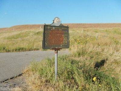
On U.S. 79 near County Route 101, on the right when traveling north.
First white man in the Black Hills, this courageous and brawny beaver trapper in 1823 led a dozen Mountain Men from Fort Kiowa to the Yellowstone. His party entered the Black Hills via the old bison trail through Buffalo Gap near here.
Born in . . . — — Map (db m89396) HM
The Black Hills and other forests within the Rocky Mountains region have suffered epidemic mountain pine beetle attacks in recent years. The beetles are native to the Black Hills and commonly infest a few trees throughout the forest. However, the . . . — — Map (db m278099) HM
On Avenue of the Chiefs 0.7 miles north of U.S. 385, on the right when traveling north.
This sculpture, entitled "Death Song" by sculptor, Ernest Berke, depicts a Western Lakota warrior, who was a member of the
Miwa'tani Society. This society was a branch of the highly developed military society, known as the Akicita, which . . . — — Map (db m277251) HM
On Badger Clark Road at Badger Hole, on the right when traveling south on Badger Clark Road.
Home of Charles Badger Clark (1883-1957)
Poet-Laureate
Author,
Lecturer and one of
South
Dakota's best known and beloved citizens.
For
approximately
thirty
years Badger
lived
alone
and wrote in
the cabin built with his own . . . — — Map (db m203436) HM
On Avenue of the Chiefs 0.7 miles north of U.S. 385, on the right when traveling north.
This memorial is placed in tribute to the
innocent victims and the heroic first
responders of the tragic events of
9-11-2001. We honor the lives lost in
New York, Washington D.C. and
Pennsylvania on that solemn day.
While the events of . . . — — Map (db m277259) WM
Badger's brilliant writing style found a place in the
hearts of the people of South Dakota. His words
painted a glowing picture of Western life. He breathed
life into the iconic image of the West: the prairies, the
mountains, the animals. . . . — — Map (db m212472) HM
Near U.S. 16A east of Lower French Creek Road, on the right when traveling east.
Between 1874-1876, thousands of citizens illegally entered the Black Hills in search of gold. Every gold panner, newspaper article, and frontier story told of great wealth and encouraged the onslaught of the region.
The military made vain efforts . . . — — Map (db m121400) HM
Throughout his life, Charles Badger Clark found that he disliked hectic urban areas. He craved the freedom and solitude offered by nature. For this reason, Badger chose to build his home in Custer State Park. Surrounded by ponderosa pines, solace, . . . — — Map (db m215802) HM
Near Mount Rushmore Road, on the right when traveling west.
You are standing near the edge of the largest wildfire ever recorded in the Black Hills. In 16 days during August and September 2000, the Jasper Fire consumed 83,508 acres of timber and meadows, leaving a blackened landscape in its wake.
Even as . . . — — Map (db m288688) HM
Near U.S. 16A east of Lower French Creek Road, on the right when traveling east.
Cultural conflicts erupted across the western Great Plains during the 1860s. Expanding railroads and frontier posts located in traditional hunting grounds impacted the various tribes in the northern plains. Restrictions on westward settlement . . . — — Map (db m121397) HM
Near U.S. 16A east of Lower French Creek Road, on the right when traveling east.
An economic crash in 1873 affected the entire nation. The government, pressured to boost the economy, needed to explore new land. Open land for settlement and rich resources would create markets and new jobs.
George A. Custer and his . . . — — Map (db m121398) HM
On Lower French Creek Road 0.2 miles south of Stockade Lake Drive (U.S. 16A), on the left when traveling south.
In Memory of
Anna Donna Tallent
Teacher and Author.
Born in New York State
April 12, 1827.
Died in Sturgis, S. Dakota
February 13, 1901.
The first white woman
to enter the Black Hills.
Arriving in Custer City
in December . . . — — Map (db m185226) HM
On Washington Street east of 6th Street, on the left when traveling east.
[Primarily recreational information except]
Gold Discovery
Image: The posthumous monument dedication in Way Park to the memory of Horatio N. Ross for his discovery of gold in the Custer area on July 27, 1874. Photo . . . — — Map (db m313104) HM
On French Creek Drive at 6th Street, on the right when traveling east on French Creek Drive.
[Primarily recreational information except]
Flyspeck Billy
[Photo inscribed]
Fly Speck Bill's Grave
Oct.17/97.
Campbell- Ford & Frank McLaughlin
Is this the site of a bit of frontier justice?
Fly Speck Billy, AKA . . . — — Map (db m313117) HM
On Stockade Lake Road (U.S. 16) close to County Route 346.
This picturesque valley was the site of the permanent camp of the Black Hills Expedition of 1874 under the command of General George A. Custer of the 7th Cavalry. Their 5 day stay was the longest stop made during the entire expedition and General . . . — — Map (db m180983) HM
On U.S. 16A 0.6 miles west of Wildlife Loop Road, on the left when traveling west.
The State Game Lodge was built by
Cecil C. Gideon Contractor-Builder in 1919-1922
A.R. Van Dyck - Architect Monroe Nystrom - Stonemason
All three were from the Minneapolis area. Gideon and his wife Elma Mary were the genial hosts . . . — — Map (db m202736) HM
On French Creek Drive at 6th Street, on the right when traveling east on French Creek Drive.
"In the morning when I walk barefoot upon it's soil, I can hear
the very heart of the holy earth."
Chief Sitting Bull 1875
Sitting Bull's great stature as a tribal leader stemmed in no
small part from his gift for simple, almost poetic . . . — — Map (db m313110) HM
On State Highway 87 0.5 miles north of Lame Johnny Road, on the left when traveling north.
Camp SP-3 (DSP-1 in 1934): NE 2 miles, end of CSP road on French Creek. Company: 2757 - 7/28/34-10/1/41.
The Civilian Conservation Corps was a federal work-relief program during the Great Depression. From 1933 to 1942, the CCC provided work for . . . — — Map (db m124589) HM
Near South Playhouse Road east of Needles Highway (State Highway 87).
Camp SP-4 (DSP-2):
Lodge: located in the buildings seen here.
Companies:
2755–7/16/34 - 10/21/35 795–10/29/35 - 1/13/36 1793–4/27/36 - 7/30/42
The Civilian Conservation Corps was a federal relief program during
1933 - 1942 gave jobless . . . — — Map (db m203658) HM
On Mt. Rushmore Road (U.S. 16) at Lightning Creek Road (Forest Road 288), on the right when traveling west on Mt. Rushmore Road.
Camp F-14 Lightning Creek: located 0.7 mile NW on road 288. Companies: 1783V--10/17/33-Spring 34 791--4/30/34-Fall 41
The Civilian Conservation Corps was a federal relief program during 1933-1942 that gave jobless men work renovating abused . . . — — Map (db m185227) HM
Comanche, an Indian mustang ridden by Captain Keogh,
Seventh U.S. Cavalry, was named for the Comanche Indians,
from whom he was captured. The buckskin horse proved
dependable under fire and was ridden by Keogh during
the ill-fated Battle of . . . — — Map (db m125088) HM
Near U.S. 385 south of Avenue of the Chiefs, on the left when traveling south.
The Crazy Horse mountain carving will be the world’s largest sculpture, measuring 563 feet high by 641 feet long, carved in the round. The nine-story-high face of Crazy Horse was completed on June 3, 1998. Work began on the 22-story-high horse’s . . . — — Map (db m155650) HM
On Washington Street at South 5th Street, on the right when traveling east on Washington Street.
United States of America Department of the Army • Department of the Navy • United States Marine Corps • United States Navy • Department of the Air Force • United States Coast Guard • Merchant Marine
"Aim High"
"Semper Paratus"
"This . . . — — Map (db m300673) WM
Charles Badger Clark was born on January 1, 1883, in
Albia, Iowa. His father was a Methodist minister, and
his mother was of Quaker faith. This family heritage
created close ties, and their home was a hub of activities.
Badger stated, "There was . . . — — Map (db m203440) HM
In 1874, George Armstrong Custer led a force of more than 1,000 men on an expedition to the Black Hills to explore and map this little-known area. The photographer with Custer, William H. Illingworth, was the first to take glass-plate photographs in . . . — — Map (db m155656) HM
Near Mount Coolidge Lookout Road near State Highway 87.
Found throughout the mountain west and perched high atop mountains, these manned towers
provide an excellent vantage point for spotting smoke columns and fires.
In Custer State Park fire detection
is a vital tool. The park's fire tower, Mount . . . — — Map (db m204234) HM
On Washington Street east of 6th Street, on the right when traveling east.
Commanded government-ordered
expedition of 1,200 men into
the Black Hills region: July 1874
Died: June 1876
Battle of the Little Bighorn
near Hardin Montana — — Map (db m313099) HM
On French Creek Drive at 6th Street, on the right when traveling east on French Creek Drive.
In July 1874 General George Armstrong Custer led an expedition
to explore the Black Hills, camping near what would later be known
as the town of Custer. Traveling with him were 1,000 soldiers,
100 Indian scouts, 2 famous white scouts, 2 . . . — — Map (db m313114) HM
Site of the first public school building in the Black Hills. Built by Ed Walsh, James Doran, and George Gundlach. Logs were hand hewn from nearby trees and hauled to the site by oxen. First school was held in summer of 1882. Teacher was Mr. . . . — — Map (db m168895) HM
On Mt. Rushmore Road (U.S. 16) 0.2 miles west of Road 282, on the left when traveling west.
Breaking the Records
On August 24, 2000, a carelessly dropped match started what would become the largest fire in the recorded history of South Dakota. By the time the inferno finished its race through the forest, it had consumed 83,508 . . . — — Map (db m37093) HM
On U.S. 16 at Jewel Cave National Monument Entrance Road, on the left when traveling west on U.S. 16.
The Jasper Fire started on August 24, 2000. It burned over 83,000 acres. This includes the entire surface above known parts of Jewel Cave. Will such a large, intense wildfire affect this unique national treasure? Now is our chance to find out. . . . — — Map (db m37095) HM
On Washington Street near South Fifth Street, on the right when traveling east.
L.Cpl. Cody Glenn Engen
1989-2017
2nd Light Armored Recon.
OIF-OEF 0311 USMC
"I have passed the mountain peak and my soul is soaring in the firmament of complete and unbounded freedom, I am in comfort, I am in peace."
Khalil . . . — — Map (db m277267) WM
Badger lived in his cabin until he passed away at the age
of 74. He died from lung cancer on September 26, 1957.
Badger extolled the cowboy way of life. His wording
captured the spirit of personal freedom and open spaces,
symbols of time long . . . — — Map (db m215807) HM
At age 22, after spending time in Mexico, Badger
returned to the Lead-Deadwood area. He thrived on the
notion of returning home and starting a new life in the
Black Hills. He worked as a reporter for the Lead Daily
Call. He also met and . . . — — Map (db m212474) HM
Whether they know it or not, black-tailed prairie dogs are wildlife managers. These ground squirrels are intricately connected to numerous plant and animal species and play a key role in the health and stability of the prairie.
The eating . . . — — Map (db m71076) HM
On Mount Rushmore Road (U.S. 16A) 0.3 miles east of State Highway 89, on the right when traveling east.
Historic Site
Miners Meet
The miners of the Black Hills
held their first meeting to
pass mining regulations at
this location in 1875
— — Map (db m119986) HM
On Needles Highway, on the right when traveling north.
In 1923, on this outlook, beneath Cathedral Spires, South Dakota State Historian Doane Robinson and his family stopped because the Model-T Ford he was driving overheated. He sent son Will down to a stream with a canvas water sack to get water for . . . — — Map (db m312331) HM
On Crook Street east of 6th Street, on the right when traveling east.
Moved from its original location across the street,
Wilber Todd - the builder - was its first occupant,
having gotten drunk & disorderly on the money paid
to him by the city for his work on the jail. — — Map (db m313131) HM
Peter Norbeck
9th Governor of South Dakota ~ 1917 to 1921
A Gift to the People of South Dakota by
Scott and Julia Jones
In Memory of the Norbeck Children:
Nellie, Ruth, Harold and Selma (Sally)
James Michael . . . — — Map (db m137126) HM
On U.S. 16 at Jewel Cave National Monument Entrance Road, on the left when traveling west on U.S. 16.
Did you notice that this forest burned? Some areas show no signs of fire. Blackened tree skeletons tell of crown fire in other areas. This is a typical burn mosaic of a western wildfire. How did the visitor center and nearby trees survive? Fire . . . — — Map (db m37096) HM
Near U.S. 16A east of Lower French Creek Road, on the right when traveling east.
Spurred by rumors of gold, many prospector groups attempted to enter the Black Hills in the 1870s. Without regard to the Fort Laramie Treaty, they planned to enter the region and exploit the untapped wealth.
A group of 28 people headed west from . . . — — Map (db m121399) HM
South Dakota
Game, Fish & Parks
This Property Has
Been Placed On The
National
Register of
Historic Places
By The United States
Department of the
Interior — — Map (db m137127) HM
On U.S. 16A 0.6 miles west of Wildlife Loop Road, on the left when traveling west.
South Dakota Game, Fish & Parks
This Property Has Been Placed on the
National Register of Historic Places
By the United States Department of the Interior — — Map (db m202734) HM
On Stockade Lake Drive 1 mile east of Lower French Creek Road, on the left when traveling east.
Originally Constructed by the
Civilian Conservation Corps (CCC)
Completed in April 1937
South Dakota National Guard
Completed in August 1988
The Bridge is 76 feet, 4 inches long and 26 feet wide. Three spans, each constructed of 10 . . . — — Map (db m121402) HM
Badger's career and lifestyle within Custer State
Park are almost legends of contentment and what he termed the "good life." He never made any conscious effort for fame; however, he became revered within the literary world. "My income would . . . — — Map (db m215928) HM
On Hearst Memorial Highway (U.S. 385) at Avenue of the Chiefs, on the right when traveling north on Hearst Memorial Highway.
George Hearst (1820-1891) United States Senator, mining engineer, sportsman, speculator. Starting with nothing, he developed three of the fabled mines in the American West -- The Ophir, the Anaconda, and the Homestake -- and founded one of the . . . — — Map (db m180982) HM
On Peter Norbeck Scenic Byway aka Needles Highway (State Highway 87) 1 mile east of State Highway 89, on the right when traveling west.
Geology provides the foundation of scenery in the Black Hills. From rocky outcroppings to towering spires, the northern portion of Custer State Park highlights the essence of the central core.
The central core is a region of rocks mainly . . . — — Map (db m34626) HM
On 6th Street at Washington Street, on the right when traveling north on 6th Street.
Custer is the oldest town in the Black Hills. It is the first known location that gold was discovered in 1874 by the Black Hills Expedition lead by Lt. Colonel George Armstrong Custer. In 1876 the city was almost abandoned as word spread of gold . . . — — Map (db m313095) HM
On U.S. 385 0.6 miles south of Medicine Mountain Road, on the left when traveling south.
Benefit You The landscape before you has been logged several times since the early 1900's. Besides the obvious benefits of timber for building many products, timber harvesting benefits the forest community. Benefit . . . — — Map (db m234599) HM
By 1890, there were less than 1000 bison remaining in North America. What once was a species that covered the Great Plains, bison were now scattered in small pockets along the northern Rocky Mountains. The foresight of a few conservation-minded . . . — — Map (db m279324) HM
Once revered as the symbol of the American West, the bison have come back from the brink of extinction. Currently, there are over 350,000 bison in public and private herds across North America.
Organizations like the National Buffalo Foundation . . . — — Map (db m280012) HM
Perhaps no other animal captures the essence of the American West like the bison. They symbolize a wild and powerful feature on the Great Plains. Without them, America's heritage would not be the same.
Also called buffalo, prehistoric bison . . . — — Map (db m280010) HM
When visitors think of Custer State Park, many of them envision bison. Even though the park contains a wealth of natural and cultural history, bison are often viewed as the icon of South Dakota's largest state park. The park is home to one of the . . . — — Map (db m278782) HM
Toward the mid-1800s, the picture of bison on the Great Plains began to change. Westward expansion by pioneers, cattle ranching, fashion fads, and development of railroad lines all impacted the bison.
Bison hides had many markets; they were . . . — — Map (db m280009) HM
Commonly called "buffalo", bison (Bison bison) are North America's largest land mammal, and one of Custer State Park's most valuable resources. Sometimes called "Lord of the Plains" the buffalo is a unique animal. A mature bull can stand up to six . . . — — Map (db m45354) HM
The Dakota, Lakota, Nakota, Cheyenne, Crow, and many other Indian tribes inhabited the Great Plains. Some tribes formed stable villages; however, most of them lived a nomadic life. All of them depended on one thing: buffalo.
No animal is more . . . — — Map (db m279372) HM
On West Main Street 0.3 miles west of Heartland Expressway (State Highway 79) when traveling west.
These historical cannons stood
in front of Dr. Mudd's cell on the
Dry Tortugas Key West, Fla.
Donated to Wm Stanley Post No. 148
G.A.R-SD by the Government
Oct. 11, 1901
T.L. Monaghan, Adjt.
J.G. Baker, Comdt.
Address by Col. W.V. . . . — — Map (db m113158) WM
On U.S. 385 3.5 miles north of 7-11 Road (County Road 101), on the right when traveling north.
Between 350 and 500 bison roam the grasslands of the national park — a token of the herds numbering 30 to 60 million that once inhabited the prairies of North America. The American bison, commonly called buffalo, became nearly extinct as settlers . . . — — Map (db m234632) HM
On U.S. 385 1.9 miles north of 7-11 Road (County Road 101), on the right when traveling north.
Camp NP-1 (DNP-1): located southeast of the cave entrance
in Wind Cave Canyon.
Companies: 2754 -- 7/16/34 - 11/1/39
2757 detachment -- 4/18/40 - 8/1/40
The Civilian Conservation Corps was a federal relief program during 1933-1942 that . . . — — Map (db m134564) HM
Few images evoke the mobile nature of the Plains Indians life like the tipi. Crafted from what the land would yield — a few young trees, bison hides, and wooden stakes for anchoring — the tipi provided a sturdy yet portable home for families that . . . — — Map (db m234631) HM
All Black Hills caves have formed in this layer 300 to 600 feet thick. Originally it was laid down on a shallow seabottom about 300 million years ago. Its name derives from the Lakota word meaning "Black Hills". — — Map (db m70978) HM
He laid the foundation of the National Park Service, defining and establishing the policies under which its areas shall be developed and conserved unimpaired for future generations. There will never come an end to the good that he has done. — — Map (db m234600) HM
The Civilian Conservation Corps established a camp here during the Great Depression of the 1930s to make improvements to the park. This camp employed 200 men at a time and provided much needed jobs and training. Over an eight-year period, the young . . . — — Map (db m70977) HM
On U.S. 385 3.9 miles north of 7-11 Road (County Road 101), on the right when traveling north.
Wind Cave National Park harbors a fragment of an endangered ecosystem, a remnant of the native grasslands that once stretched from Indiana to the Rocky Mountains, from southern Canada to the Gulf of Mexico. In fewer than 100 years, the Great Plains . . . — — Map (db m234694) HM
On Iron Mountain Road (U.S. 16A) near South Dakota Highway 244.
In 1932, Cecil Clyde Gideon, forged ahead with the design of the Pigtail Bridges when many felt it couldn’t be done. C.C., as he was called, was a pioneer in the Black Hills, making his mark as a master builder, architect, craftsman, lawman, . . . — — Map (db m89460) HM
On State Highway 89 0.7 miles north of Prairie Schooner Road (County Road 318), on the right when traveling north.
Left Panel:
National Forests ~ An American Legacy
In 1891, Congress passed legislation to establish Forest Reserves (now called National Forests) to restore eastern lands damaged by deforestation and disastrous floods; and to . . . — — Map (db m184800) HM
On Railway Street (County Road 313A) at Main Street (County Road 313A), on the right when traveling north on Railway Street.
A community memorial honoring the
Morgan and Zeimet Families.
These longtime community members
donated the land for the
Fire Department and Community Hall.
We the community thank you. — — Map (db m313134) HM
Pringle was known as Point of Rocks in earlier days. A lime mine and kiln
operated 1 mile south along the trail. The lime was used for mortar and
soil improvement. Pringle is now a small mining and lumbering town.
Loring Siding was 5 miles . . . — — Map (db m313133) HM
On U.S. 385 1 mile north of State Highway 87, on the right when traveling north.
The valley in front of you is the site of the Wind Cave National Game Preserve, which was established in 1912 to reintroduce bison to the area. About 4,000 acres were enclosed to receive 20 bison from the New York Zoological Society and Yellowstone . . . — — Map (db m234681) HM
On State Highway 87, on the right when traveling north.
If no erosion had occurred here over the eons, the Black Hills
would be 7,500 feet higher than they are today, and you would
not see this pinkish rock. This granite pegmatite was created
1.7 billion years ago as part of a large molten magma . . . — — Map (db m313129) HM
On East 1st Avenue (U.S. 212) at 1st Avenue East, on the right when traveling west on East 1st Avenue.
This area and culture was built upon the characteristics of determination and grit, honesty, integrity, and a high level of
respect for family, neighbors, and friends. This description couldn't be any better exemplified than through the life of Bud . . . — — Map (db m279951) HM
On 1st Street East (U.S. 212) east of East 1st Avenue, on the right when traveling east.
Where Highways US 212 and SD 73 meet, at the end of the Cheyenne Branch of the Milwaukee Road, we live, a half mile above sea level of the Fox Ridge Divide, our souls nourished by the picture sunsets.
Our Grass is unsurpassed anywhere, . . . — — Map (db m185219) HM
On West Fifth Street near South Fifth Avenue West, on the right when traveling north.
Small Town
By Badger Clark
The circling cones of bison hide
that made the village of the Sioux
Rose near as high, spread near as wide,
O little Western town, as you.
But small-town skylines all are great
And . . . — — Map (db m185220) HM
On East 1st Street (U.S. 212) west of 2nd Avenue East, on the right when traveling west.
This scrap iron sculpture was created to commemorate Sue, the largest, most complete and best preserved T-Rex found to date! Ninety percent of her original bones were found. Only a foot, an arm and a few ribs and vertebrae are missing. Sue was . . . — — Map (db m153969) HM
On Sheridan Street 0.1 miles east of 4th Street, on the right when traveling east.
The President of the United States
In the name of
The Congress
takes pleasure in presenting the
Congressional Medal of Honor
to
Roberts, Charles D.
Rank and organization: Second Lieutenant, U.S. . . . — — Map (db m174052) HM
On Sheridan Street 0.1 miles east of 4th Street, on the right when traveling east.
World War II ETO
Normandy
Northern France
Rhineland
Ardennes - Alsace
Central Europe
4th Cav Grp
24th Cav Rgn 4th Cav Rgn
[Honor Roll of Names] — — Map (db m173877) WM
On Sheridan Street 0.2 miles west of Custer Avenue, on the left when traveling west.
On this parade ground in 1892 "The Star Spangled Banner" got its impetus to become the National Anthem. Colonel Caleb Carlton of the Eighth Cavalry was Post Commander and with his wife discussed the need for a National Air. At her suggestion he . . . — — Map (db m185221) HM
On Cedar Canyon Road east of U.S. 212, on the right when traveling east.
The trail blazers
here on December 26, 1875
Ben Ash, S.C. Dodge,
Russ Marsh, Ed Donahue,
and Stimmy Stimson
on their trip from Bismarck
through the Indian country
first sighted the Black Hills. — — Map (db m185222) HM
Entered into the National
Register of Historic Places
June 19, 1973
Under the National Preservation
Act of October 15, 1966
Bear Butte was placed in the National
Register Because of its Spiritual value
To the Plains Indians . . . — — Map (db m172497) HM
On 206th Street (South Dakota Route 34) 0.2 miles west of 131st Street ( Route 79), on the left when traveling east.
This 4,422 foot high volcanic bubble rises 1,200 feet above the plains, a guide for centuries to Indians, fur traders, soldiers, cowboys, and travelers. It was visited or passed by Verendrye, 1743; Lt. G. K. Warren, 1855; Hayden, the scientist and . . . — — Map (db m177396) HM
On 206th Street (State Highway 34) near Custer Avenue, on the right when traveling west. Reported damaged.
This area, extending along Bear Butte Creek, was for centuries a select camp site for the Plains Indians, who found here mountain spring water, wood, protection from the bitter north winds, together with much game and wild fruit in season. Here, or . . . — — Map (db m184003) HM
On Junction Avenue at Harmon Street on Junction Avenue.
Sturgis City, as it was originally called, was laid out by Major Jeremiah Wilcox on August 16, 1878. it was positioned to take advantage of the recently established site of Fort Meade, 1.5 miles to the east, and named for the commander of that . . . — — Map (db m174066) HM
On Junction Avenue at Harmon Street on Junction Avenue.
The Fort Laramie Treaties of 1851 and 1868 held implications that would impact the destiny of the Lakota people for generations. The government promised in the 1868 treaty to care for them by building an agency on the reservation with commensurate . . . — — Map (db m174078) HM
On 130th Avenue (South Dakota Route 79) at 201st Street, on the right when traveling north on 130th Avenue.
Camp J.G. Sturgis
Named for Lt. J.G. Sturgis, killed June 25, 1876 at Battle of Little Big Horn. Established July 1, 1878 in this area by Cos. G.F.I.K., 1st US Infantry; D.G. 11th US Infantry; Hq. & Trs. A.C.D.E.G.I.K.M. 7th US Cavalry; Col. . . . — — Map (db m177387) HM
291 entries matched your criteria. The first 100 are listed above. Next 100 ⊳