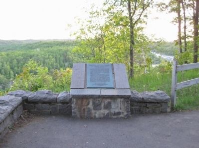
By K. Linzmeier, June 11, 2011
Geology of Minnesota Marker
| Near State Highway 210 3.9 miles east of State Highway 45, on the right when traveling east. |
| Near State Highway 210 3.9 miles east of State Highway 45, on the right when traveling east. |
| Near State Highway 210 3.9 miles east of State Highway 45, on the right when traveling east. |
| On State Highway 73 at Automba Road (County Road 6 & 131), on the right when traveling north on State Highway 73. |
| On Main Street (State Highway 73) north of 1st Avenue South, on the right when traveling north. |
| Near Interstate 35 at milepost 226, 5.3 miles north of County Road 6, on the right when traveling north. |
| On Arrowhead Lane (State Highway 73) at Lakeshore Drive, on the right when traveling north on Arrowhead Lane. |
| On County Road 61 0.2 miles north of Arrowhead Lane (State Highway 27), on the right when traveling north. |
| On Veterans Evergreen Memorial Drive (State Highway 23) at Line Road, on the right when traveling south on Veterans Evergreen Memorial Drive. |
| On Veterans Evergreen Memorial Drive (State Highway 23) at Line Road, on the right when traveling south on Veterans Evergreen Memorial Drive. |
| Near Superior Hiking Trail north of Highway 61, on the right when traveling north. |
| Near South Gunflint Lake Road (County Highway 50) east of Gunflint Trail (County Highway 12). |
| On Gunflint Trail (County Route 12) south of Gunflint Lake Road, on the right when traveling north. |
| On Gunflint Trail (County Highway 12) south of Gunflint Lake Road, on the right when traveling north. |
| On Gunflint Trail (County Route 12) south of Gunflint Lake Road, on the right when traveling north. |
| On Broadway Avenue at First Street, on the right when traveling north on Broadway Avenue. |
| On North Shore Scenic Drive (State Highway 61) 0.8 miles east of Cascade Beach Road (County Road 97), on the right when traveling east. |
| On North Shore Scenic Drive (State Highway 61) east of Old Shore Road, on the right when traveling east. |
| On State Highway 61 at milepost 117, 1.3 miles north of County Highway 14, on the right when traveling north. |
| Near Eagle Mountain Trail. |
| Near South 8th Avenue West 0.2 miles south of Voyageur Highway (State Highway 61), on the left when traveling south. |
| On North Shore Scenic Drive (State Highway 61) 2.3 miles east of County Road 7, on the right when traveling north. |
| On North Shore Scenic Drive (State Highway 61) at Wisconsin Street, on the right when traveling east on North Shore Scenic Drive. |
| Near Voyageur Highway (State Highway 61) just east of 6th Avenue West, on the right when traveling east. |
| On Broadway Avenue 0.2 miles south of Wisconsin Street, on the right when traveling south. |
| Near Broadway Avenue 0.2 miles south of Wisconsin Street, on the left when traveling south. |
| On Broadway Avenue (County Highway 10) 0.1 miles south of Wisconsin Street, on the right when traveling south. |
| Near South 8th Avenue West 0.2 miles south of Voyageur Highway (State Highway 61), on the left when traveling south. |
| On State Highway 61 east of Old Shore Road, on the right when traveling east. |
| Near South 8th Avenue West 0.2 miles south of Voyageur Highway (State Highway 61), on the left when traveling south. |
| On North Shore Scenic Drive (State Highway 61) at Wisconsin Street, on the right when traveling east on North Shore Scenic Drive. |
| Near South 8th Avenue West 0.2 miles south of Voyageur Highway (State Highway 61), on the left when traveling south. |
| Near Broadway Avenue 0.2 miles south of Wisconsin Street, on the left when traveling south. |
| On County Route 60 at Gunflint Trail (County Route 12), on the left when traveling east on County Route 60. |
| On Mile Creek Road (County Road 17) at Upper Road (County Road 17), on the right when traveling east on Mile Creek Road. |
| Near Mill Creek Road 0.2 miles south of Store Road. |
| On Voyageur Highway (State Highway 61) 1.5 miles north of Joes Road, on the right when traveling north. |
| On Mile Creek Road (County Road 17) at Upper Road (County Road 17), on the right when traveling east on Mile Creek Road. |
| Near Mill Creek Road 0.1 miles south of Store Road. |
| Near Voyageur Highway (State Highway 61) 0.4 miles east of Ryden Road, on the left when traveling east. |
| On Upper Road (County Road 17) at Bay Road, on the left when traveling north on Upper Road. |
| Near Voyageur Highway (State Highway 61) 0.4 miles east of Ryden Road, on the left when traveling east. |
| Near State Highway 61, on the left when traveling north. |
| Near Mill Creek Road 0.6 miles north of Marina Road. |
| On Mill Creek Road 0.1 miles south of Store Road. |
| Near Mill Creek Road 0.2 miles south of Store Road. |
| Near Mill Creek Road 0.1 miles south of Store Road. |
| On Mile Creek Road (County Route 17) at Store Road (County Route 73), on the left when traveling south on Mile Creek Road. |
| Near Mill Creek Road 0.2 miles south of Store Road. |
| Near Mill Creek Road 0.2 miles south of Store Road. |
| Near Voyageur Highway (State Highway 61) 0.4 miles east of Ryden Road, on the left when traveling east. |
| On Chicago Bay Road 0.1 miles east of Voyageur Highway (State Highway 61), on the right when traveling east. |
| Near State Highway 61, on the right when traveling north. |
| Near Moose Pond Drive (County Route 81). |
| On Sag Lake Trail (County Route 11) north of Gunflint Trail (County Route 12), on the right when traveling north. |
| On Moose Pond Drive (County Route 81) north of Gunflint Trail (County Route 12) when traveling west. |
| Near Moose Pond Drive (County Route 81). |
| Near Moose Pond Drive (Highway 81). |
| Near Moose Pond Drive (County Route 81). |
| Near Moose Pond Drive (County Road 81). |
| Near State Highway 61 3 miles north of Blueberry Hill Road. |
| On North Shore Scenic Drive (Voyageur Highway) (State Highway 61) 0.8 miles south of Split Rock Lighthouse Road, on the left when traveling south. |
| Near Split Rock Lighthouse Road. |
| Near Split Rock Lighthouse Road 0.5 miles south of North Shore Scenic Drive (Voyageur Highway) (State Highway 61). |
| Near Split Rock Lighthouse Road 0.5 miles south of North Shore Scenic Drive (State Highway 61). |
| Near Split Rock Lighthouse Road 0.5 miles south of North Shore Scenic Drive (State Highway 61). |
| Near Split Rock Lighthouse Road 0.5 miles south of North Shore Scenic Drive (Voyageur Highway) (State Highway 61). |
| Near Split Rock Lighthouse Road 0.5 miles south of North Shore Scenic Drive (State Highway 61). |
| Near Split Rock Lighthouse Road 0.5 miles south of North Shore Scenic Drive (State Highway 61). |
| Near Split Rock Lighthouse Road 0.5 miles south of North Shore Scenic Drive (Voyageur Highway) (State Highway 61). |
| Near Split Rock Lighthouse Road 0.5 miles south of North Shore Scenic Drive (State Highway 61). |
| Near Split Rock Lighthouse Road 0.5 miles south of North Shore Scenic Drive (State Highway 61). |
| Near Split Rock Lighthouse Road. Reported permanently removed. |
| Near Split Rock Lighthouse Road 0.5 miles south of North Shore Scenic Drive (State Highway 61). |
| Near Split Rock Lighthouse Road. Reported permanently removed. |
| Near Split Rock Lighthouse Road 0.5 miles south of North Shore Scenic Drive (State Highway 61). |
| Near Split Rock Lighthouse Road 0.5 miles south of North Shore Scenic Drive (Voyageur Highway) (State Highway 61). |
| On Minnesota Route 61, on the left when traveling north. |
| Near County Road 2 0.2 miles south of State Route 1. |
| Near Minnesota Route 1 at Forest Road 15. |
| On North Shore Drive (County Highway 61) 0.8 miles south of Old North Shore Road (County Road 290), on the left when traveling south. |
| On West 5th Street 0.2 miles south of Central Avenue (County Road 103), on the left when traveling south. |
| On Marina Drive 0.3 miles east of Bayside Park Road, on the left. |
| Near City Shop Road 0.3 miles south of Outer Drive, on the left when traveling east. |
| On Marina Drive 0.3 miles east of Bayside Park Road, on the left. |
| Near City Shop Road 0.3 miles south of Outer Drive, on the left when traveling east. |
| Near City Shop Road 0.3 miles south of Outer Drive, on the right when traveling east. |
| On North Shore Scenic Drive (State Highway 61) 0.2 miles north of Midbrod Drive, on the right when traveling north. |
| On Marina Drive 0.3 miles east of Bayside Park Road, on the left. |
| On Marina Drive 0.3 miles east of Bayside Park Road, on the left. |
| On 6th Street (County Route 20) at 2nd Avenue, on the right when traveling north on 6th Street. |
| Near 3rd Street 0.4 miles south of South Avenue. |
| Near Lighthouse Point Road. |
| Near Waterfront Drive 0.1 miles south of South Avenue, on the left when traveling west. |
| Near Lighthouse Point Road. |
| Near South Avenue. Reported missing. |
| On South Avenue at 6th Street (County Route 20), on the right when traveling east on South Avenue. |
| On South Avenue at 6th Street (County Route 20), on the right when traveling east on South Avenue. |
| On 6th Street (County Route 20) at South Avenue, on the right when traveling south on 6th Street. |
278 entries matched your criteria. The first 100 are listed above.
Next 100 ⊳
