150 entries match your criteria. The first 100 are listed. ⊳
Historical Markers and War Memorials
in Texas’ Big Bend Region
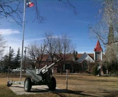
By Zacharias Beau T, February 22, 2012
105 Howitzer Marker
1 ► Texas, Brewster County, Alpine — 105 Howitzer —  |
| On North 6th Street south of West Sul Ross Avenue, on the right when traveling south. | |||
| 2 ► Texas, Brewster County, Alpine — 157 — Ancient Rocks Boundary — |
| On U.S. 90 at U.S. 67, on the right when traveling west on U.S. 90. | |||
| 3 ► Texas, Brewster County, Alpine — Big Bend Ranching: North — Big Bend Snapshot History — |
| On U.S. 90, on the right when traveling west. | |||
| 4 ► Texas, Brewster County, Alpine — 503 — Brewster County — |
| On U.S. 90 at U.S. 67, on the right when traveling west on U.S. 90. | |||
| 5 ► Texas, Brewster County, Alpine — Brewster County Jail WWII Monument — |
| On West Sul Ross Avenue 0.1 miles east of North 8th Street, on the left when traveling east. | |||
| 6 ► Texas, Brewster County, Alpine — 570 — Burgess' Water Hole — |
| Near N. Harrison St.. | |||
| 7 ► Texas, Brewster County, Alpine — 872 — City Building — |
| On East Sul Ross Avenue, on the right when traveling west. | |||
| 8 ► Texas, Brewster County, Alpine — 6404 — Colonel Henry P. Brewster — Texas In the Civil War — Brewster County — |
| On North 6th Street south of West Sul Ross Avenue, on the right when traveling south. | |||
| 9 ► Texas, Brewster County, Alpine — 1092 — Court House — |
| On North 6th Street at West Avenue E (U.S. 67/90), on the right when traveling south on North 6th Street. | |||
| 10 ► Texas, Brewster County, Alpine — Dedicated to the men and women who perished on September 11th, 2001 — |
| On Highway 90 (U.S. 90) 2 miles west of U.S. 118. | |||
| 11 ► Texas, Brewster County, Alpine — Early Human Habitation — Big Bend Snapshot History — |
| On South Walker Street (State Highway 118) 1.4 miles south of East Gallego Avenue, on the right when traveling south. | |||
| 12 ► Texas, Brewster County, Alpine — Early Spanish Entradas — Big Bend Snapshot History — |
| On U.S. 67/90 at Paso del Norte Road on U.S. 67/90. | |||
| 13 ► Texas, Brewster County, Alpine — 12989 — First Baptist Church of Alpine — |
| On North 4th Street at East Sul Ross Avenue, on the left when traveling north on North 4th Street. | |||
| 14 ► Texas, Brewster County, Alpine — 2093 — Gage-Van Sickle — 1886 — |
| On East Avenue E (U.S. 67) at North 3rd Street, on the left when traveling west on East Avenue E. | |||
| 15 ► Texas, Brewster County, Alpine — 2103 — Garcia-Valadez House — |
| On West Avenue F at South 6th Street, on the right when traveling east on West Avenue F. | |||
| 16 ► Texas, Brewster County, Alpine — 2509 — Holland Hotel Building — |
| On West Holland Avenue (U.S. 67/90), on the left when traveling east. | |||
| 17 ► Texas, Brewster County, Alpine — In Memoriam — |
| Near West Sul Ross Avenue at North 8th Street, on the right when traveling east. | |||
| 18 ► Texas, Brewster County, Alpine — 17697 — J. C. Bird — |
| On East Lockhart Avenue at North 3rd Street, on the right when traveling west on East Lockhart Avenue. | |||
| 19 ► Texas, Brewster County, Alpine — 2669 — J.C. Carr-Bob Slight House — |
| On North 5th Street (State Highway 118) north of East Lockhart Avenue, on the right when traveling north. | |||
| 20 ► Texas, Brewster County, Alpine — 15965 — John R. Holland — (1852 – 1922) — |
| On West Holland Avenue (U.S. 67/90) at North 6th Street, on the left when traveling east on West Holland Avenue. | |||
| 21 ► Texas, Brewster County, Alpine — 6411 — Lawrence Sullivan Ross — 1838 - 1898 — |
| On North Harrison Street, on the right when traveling north. | |||
| 22 ► Texas, Brewster County, Alpine — 3603 — Nolte-Rooney House — |
| On East Sul Ross Avenue at North 2nd Street, on the right when traveling west on East Sul Ross Avenue. | |||
| 23 ► Texas, Brewster County, Alpine — Nuestra Señora de Guadalupe — Our Lady of Guadalupe — |
| On West Gallego Avenue at South 5th Street, on the right when traveling east on West Gallego Avenue. | |||
| 24 ► Texas, Brewster County, Alpine — Old Brewster County Jail — |
| On West Sul Ross Avenue/West Avenue E at North 7th Street, on the right when traveling east on West Sul Ross Avenue/West Avenue E. | |||
| 25 ► Texas, Brewster County, Alpine — 3884 — Our Lady of Peace — |
| On West Gallego Avenue at South 5th Street, on the right when traveling east on West Gallego Avenue. | |||
| 26 ► Texas, Brewster County, Alpine — Our Lady of Peace Catholic Church — |
| On West Gallego Avenue at South 5th Street, on the right when traveling east on West Gallego Avenue. | |||
| 27 ► Texas, Brewster County, Alpine — Our Pioneers — |
| On North 6th Street at West Sul Ross Avenue, on the right when traveling south on North 6th Street. | |||
| 28 ► Texas, Brewster County, Alpine — Ranching in the Big Bend — Big Bend Snapshot History — |
| On U.S. 90, on the right when traveling west. | |||
| 29 ► Texas, Brewster County, Alpine — 4276 — Ritchey Hotel — 1886 — |
| On East Murphy Avenue at South 5th Street, on the right when traveling east on East Murphy Avenue. | |||
| 30 ► Texas, Brewster County, Alpine — Sul Ross "Art Colony" — 1932-1950 — |
| On W Ave E at N 5th Street on W Ave E. | |||
| 31 ► Texas, Brewster County, Alpine — The Late Spanish Entradas — Big Bend Snapshot History — |
| On U.S. 67/90 at Paso del Norte Road, on the left when traveling east on U.S. 67/90. | |||
| 32 ► Texas, Brewster County, Alpine — This Enduring Monument — |
| On West Avenue E (U.S. 67/90) at North 6th Street, on the right when traveling west on West Avenue E. | |||
| 33 ► Texas, Brewster County, Alpine — 5679 — W. W. Townsend Home — |
| On West Sul Ross Avenue at North 13th Street, on the right when traveling west on West Sul Ross Avenue. | |||
| 34 ► Texas, Brewster County, Big Bend National Park — A Vision for the Parks — George Meléndez Wright 1904-1936 — Big Bend National Park — |
| On Park Route 12 at Main Park Road, on the right when traveling east on Park Route 12. | |||
| 35 ► Texas, Brewster County, Big Bend National Park — Ancient Swamp Creatures — Big Bend National Park — |
| On Fossil Bone Exhibit Road 0.2 miles east of Main Park Road, on the right when traveling east. | |||
| 36 ► Texas, Brewster County, Big Bend National Park — Big Bend National Park — Program on Man and the Biosphere (MAB) — |
| On Main Park Road (U.S. 385) near Park Route 12. | |||
| 37 ► Texas, Brewster County, Big Bend National Park — Boquillas Canyon — |
| On Boquillas Canyon Overlook, on the right when traveling east. | |||
| 38 ► Texas, Brewster County, Big Bend National Park — Chihuahuan Desert — Big Bend National Park — |
| On Park Route 12. | |||
| 39 ► Texas, Brewster County, Big Bend National Park — 994 — Comanche Trail — |
| On U.S. 385. | |||
| 40 ► Texas, Brewster County, Big Bend National Park — Community — Big Bend National Park — |
| On Hot Springs Road 1.6 miles south of Rio Grande Road, on the left when traveling south. | |||
| 41 ► Texas, Brewster County, Big Bend National Park — Cool Mountains — Big Bend National Park — |
| On Rio Grande Road 0.2 miles north of Daniel Ranch Road, on the right when traveling south. | |||
| 42 ► Texas, Brewster County, Big Bend National Park — Grand Canyon Farms — Big Bend National Park — |
| On Santa Elena Canyon Road 2.3 miles east of Santa Elena Canyon Overlook Drive, on the right when traveling west. | |||
| 43 ► Texas, Brewster County, Big Bend National Park — Healing Waters — Big Bend National Park — |
| On Hot Springs Road 1.6 miles south of Rio Grande Road, on the left when traveling south. | |||
| 44 ► Texas, Brewster County, Big Bend National Park — Homer Wilson Ranch — Big Bend National Park — |
| Near Ross Maxwell Scenic Drive 8 miles south of Gano Springs. | |||
| 45 ► Texas, Brewster County, Big Bend National Park — Hot Springs Historic District — Big Bend National Park — |
| On Hot Springs Road 1.6 miles south of Rio Grande Road, on the left when traveling south. | |||
| 46 ► Texas, Brewster County, Big Bend National Park — If You Build It... — Big Bend National Park — |
| On Hots Springs Road 1.6 miles south of Rio Grande Road, on the left when traveling south. | |||
| 47 ► Texas, Brewster County, Big Bend National Park — Into the Canyon! — |
| Near Ross Maxwell Scenic Drive 0.8 miles west of Old Maxwell Road. | |||
| 48 ► Texas, Brewster County, Big Bend National Park — Luna's Jacal — |
| On Old Maverick Road 6.5 miles south of Maverick Drive (Texas Highway 118), on the left when traveling south. | |||
| 49 ► Texas, Brewster County, Big Bend National Park — Reminders of the Past — Big Bend National Park — |
| On Hot Springs Road 1.6 miles south of Rio Grande Road, on the left when traveling south. | |||
| 50 ► Texas, Brewster County, Big Bend National Park — River and Springs — Big Bend National Park — |
| On Rio Grande Road 0.2 miles north of Daniels Ranch Road, on the right when traveling south. | |||
| 51 ► Texas, Brewster County, Big Bend National Park — Rock Art at Hot Springs — |
| Near Hot Springs Road 1.5 miles Rio Grande Village Drive, on the left when traveling south. | |||
| 52 ► Texas, Brewster County, Big Bend National Park — Stephen Tyng Mather — July 4, 1867 - Jan. 22, 1930 — |
| Near Chisos Basin Road 6.5 miles south of Maverick Drive (U.S. 385). | |||
| 53 ► Texas, Brewster County, Big Bend National Park — Terlingua Abaja — |
| On Gaging Station 1.5 miles west of Old Maverick Road. | |||
| 54 ► Texas, Brewster County, Big Bend National Park, Castolon — Cavalry Post to Trading Post — Big Bend National Park — |
| Near River Road West at Santa Elena Canyon Road. | |||
| 55 ► Texas, Brewster County, Big Bend National Park, Castolon — Cotton Boom in Castolon — Big Bend National Park — |
| On River Road West at Santa Elena Canyon Road on River Road West. | |||
| 56 ► Texas, Brewster County, Big Bend National Park, Castolon — Floodplain Panorama — Big Bend National Park — |
| Near River Road West at Santa Elena Canyon Road. | |||
| 57 ► Texas, Brewster County, Big Bend National Park, Castolon — Garlick House — Big Bend National Park — |
| Near River Road West at Santa Elena Canyon Road. | |||
| 58 ► Texas, Brewster County, Big Bend National Park, Castolon — La Harmonia Store — Big Bend National Park — |
| On Santa Elena Canyon Road 0.7 miles west of River Road, on the right when traveling west. | |||
| 59 ► Texas, Brewster County, Big Bend National Park, Castolon — Magdalena's House — Big Bend National Park — |
| Near River Road West at Santa Elena Canyon Road. | |||
| 60 ► Texas, Brewster County, Lajitas — 18262 — Lajitas Cemetery — |
| On State Highway 170 west of Comanche Mesa, on the right when traveling west. | |||
| 61 ► Texas, Brewster County, Marathon — 17696 — Albion E. Shepard House — |
| On Avenue D at 2nd Street NE, on the right when traveling south on Avenue D. | |||
| 62 ► Texas, Brewster County, Marathon — 422 — Black Gap Wildlife Management Area — |
| On Farm to Market Road 2627 16.7 miles south of U.S. 385, on the left when traveling south. | |||
| 63 ► Texas, Brewster County, Marathon — 801 — Chambers Hotel — |
| On South 1st Street east of Avenue D, on the right when traveling east. | |||
| 64 ► Texas, Brewster County, Marathon — 964 — Colonel Lewis Given Harman — 1818-1902 — |
| On U.S. 90 1 mile east of U.S. 385, on the right when traveling east. | |||
| 65 ► Texas, Brewster County, Marathon — 1209 — Denuded Ouachita Rock Belt — |
| On U.S. 90 14 miles east of U.S. 385, on the right when traveling east. | |||
| 66 ► Texas, Brewster County, Marathon — 1258 — Double Mills — |
| On U.S. 385, on the right when traveling south. | |||
| 67 ► Texas, Brewster County, Marathon — 1862 — First School House |
| On North 3rd Street at Avenue E, on the right when traveling east on North 3rd Street. Reported missing. | |||
| 68 ► Texas, Brewster County, Marathon — 2003 — Fort Peña Colorado (Red Rock) — |
| On Post Road. | |||
| 69 ► Texas, Brewster County, Marathon — 3124 — Los Caballos — (In Core of the Ouachita Structural Belt) — |
| On U.S. 385 10.3 miles south of U.S. 90, on the right when traveling south. | |||
| 70 ► Texas, Brewster County, Marathon — 3201 — Marathon — |
| On U.S. 90. | |||
| 71 ► Texas, Brewster County, Marathon — 2092 — The Gage Hotel — |
| On North 1st Street (U.S. 90), on the right when traveling west. | |||
| 72 ► Texas, Brewster County, Marathon — The U.S. Army Camel Experiment — |
| On U.S. 385 3.7 miles north of Farm to Market Road 2627, on the left when traveling south. | |||
| 73 ► Texas, Brewster County, Study Butte-Terlingua — Big Bend Ranching: South — Big Bend Snapshot History — |
| On State Highway 118 at Farm to Market Road 170, on the right when traveling south on State Highway 118. | |||
| 74 ► Texas, Brewster County, Study Butte-Terlingua — E.E. Townsend — Big Bend Snapshot History — |
| On State Highway 118 2.9 miles south of Farm to Market Road 170, on the right when traveling south. | |||
| 75 ► Texas, Brewster County, Study Butte-Terlingua — Ranching in the Big Bend — Big Bend Snapshot History — |
| On State Highway 118 at Farm to Market Road 170, on the right when traveling south on State Highway 118. | |||
| 76 ► Texas, Brewster County, Terlingua — Chisos Mine and Terlingua — Big Bend Snapshot History — |
| On Terlingua Ghost Town at Ivey Road, on the left when traveling north on Terlingua Ghost Town. | |||
| 77 ► Texas, Brewster County, Terlingua — 17969 — Federico Villalba — |
| On Terlingua Ghost Town Road at Ivey Road, on the left when traveling north on Terlingua Ghost Town Road. | |||
| 78 ► Texas, Brewster County, Terlingua — Quicksilver — the Terlingua Mining District — |
| On Farm to Market Road 170 0.7 miles west of SE Longdraw, on the right when traveling west. | |||
| 79 ► Texas, Brewster County, Terlingua — 6478 — Terlingua — Famous Texas Ghost Town — |
| On Farm to Market Road 170 at Terlingua Ghost Town Road, on the left when traveling east on Route 170. | |||
| 80 ► Texas, Brewster County, Terlingua — Terlingua Cemetery — |
| On Terlingua Ghost Town at Ivey Road, on the left when traveling north on Terlingua Ghost Town. | |||
| 81 ► Texas, Jeff Davis County, Fort Davis — 10487 — Barry Scobee Mountain — 1 Mi. North 6300 Ft. Elev. — |
| On State Highway 17 at Espy Place, on the left when traveling north on State Highway 17. | |||
| 82 ► Texas, Jeff Davis County, Fort Davis — 10473 — Bloys Camp Meeting — |
| On State Highway 166 13.8 miles west of State Highway 17, on the left when traveling west. | |||
| 83 ► Texas, Jeff Davis County, Fort Davis — Commanding Officer's Quarters — Fort Davis National Historic Site — |
| Near Lt. Henry Flipper Drive at State Street (State Highway 17). | |||
| 84 ► Texas, Jeff Davis County, Fort Davis — 10474 — Confederate President Jefferson Davis — 1808-1889 — |
| On State Street (State Highway 17/118) 0.1 miles north of Musquiz Drive (State Highway 118), on the left when traveling north. | |||
| 85 ► Texas, Jeff Davis County, Fort Davis — 10476 — First Baptist Church of Fort Davis — |
| On Agave Street at Woodward Avenue, on the left when traveling north on Agave Street. | |||
| 86 ► Texas, Jeff Davis County, Fort Davis — First Contact — Fort Davis National Historic Site — |
| Near Lt. Henry Flipper Drive at State Street (State Highway 17). | |||
| 87 ► Texas, Jeff Davis County, Fort Davis — 10477 — First Rural School — West of Pecos River — (240 feet south) — |
| On State Highway 118 11.5 miles south of State Highway 17, on the right when traveling south. | |||
| 88 ► Texas, Jeff Davis County, Fort Davis — Food & Shelter — Fort Davis National Historic Site — |
| On Lt. Henry Flipper Drive at State Street (State Highway 17) on Lt. Henry Flipper Drive. | |||
| 89 ► Texas, Jeff Davis County, Fort Davis — Fort Davis — 1854-1862 — |
| Near Lt. Henry Flipper Drive at State Street. | |||
| 90 ► Texas, Jeff Davis County, Fort Davis — Fort Davis — 1854-1862 — |
| Near Lt. Henry Flipper Drive at State Street (State Highway 1097). | |||
| 91 ► Texas, Jeff Davis County, Fort Davis — Fort Davis — 1854-1862 — |
| Near Lt. Henry Flipper Drive at State Street (State Highway 17). | |||
| 92 ► Texas, Jeff Davis County, Fort Davis — Fort Davis — 1854-1862 — |
| Near Lt. Henry Flipper Drive at State Street (State Highway 17). | |||
| 93 ► Texas, Jeff Davis County, Fort Davis — 10478 — Fort Davis — |
| Near Lt. Henry Flipper Drive. | |||
| 94 ► Texas, Jeff Davis County, Fort Davis — 17051 — Fort Davis United Methodist Church — United Methodist Church Registered Historic Site No. 30 — |
| On South Front Street at Woodward Avenue, on the right when traveling north on South Front Street. | |||
| 95 ► Texas, Jeff Davis County, Fort Davis — 18197 — Granado Mountain — |
| On State Highway 17 N 1 mile north of State Highway 118 N. | |||
| 96 ► Texas, Jeff Davis County, Fort Davis — Hometown Heroes — |
| On State Street (State Highway 17) at Court Avenue, on the left when traveling south on State Street. | |||
| 97 ► Texas, Jeff Davis County, Fort Davis — 10479 — Hotel Limpia — |
| On Court Aveue at Limpia Street, on the left when traveling east on Court Aveue. | |||
| 98 ► Texas, Jeff Davis County, Fort Davis — 10475 — Jeff Davis County — |
| On State Street (State Highway 17) at Musquiz Dr. (State Highway 118), in the median on State Street. | |||
| 99 ► Texas, Jeff Davis County, Fort Davis — 12368 — Jeff Davis County Courthouse — |
| On Court Avenue at State Street (State Highway 17/118), on the left when traveling west on Court Avenue. | |||
| 100 ► Texas, Jeff Davis County, Fort Davis — 16485 — Jeff Davis County Jail — |
| On Woodward Avenue at State Street (Texas Highway 17), on the left when traveling west on Woodward Avenue. | |||
150 entries matched your criteria. The first 100 are listed above. The final 50 ⊳