THE HISTORICAL
MARKER DATABASE
“Bite-Size Bits of Local, National, and Global History”


1104 entries match your criteria. The first 100 are listed.                                               Next 100 ⊳


Historical Markers and War Memorials on the Georgia Coast and the Golden Isles Region

 
By Mike Stroud, 2008
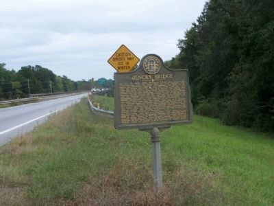
Jencks Bridge Marker, looking south along US 80
1 ► Georgia, Bryan County, Blitchton — 015-10 — Jencks Bridge —
On U.S. 80, on the right when traveling east.
2 ► Georgia, Bryan County, Blitchton — 015-5B — Old River Road —
On U.S. 80 near U.S. 280, on the right when traveling south.
3 ► Georgia, Bryan County, Ellabell — 015-11 — Sherman's Right Wing —
On U.S. 280 at Black Creek Church Road, on the left when traveling south on U.S. 280.
4 ► Georgia, Bryan County, Keller — 15-1 — Bryan Neck Presbyterian Church —
On Belfast-Keller Rd, on the left when traveling west.
5 ► Georgia, Bryan County, Pembroke — Bryan County —
On South College Street (Georgia Route 67) near Courthouse Street, on the right when traveling north.
6 ► Georgia, Bryan County, Pembroke — 015-1 — Bryan County —
On South College Street (Georgia Route 67) near Courthouse Street, on the right when traveling north.
7 ► Georgia, Bryan County, Pembroke — Old City Jail —
On W. Gibson St. at S. College St., on the right when traveling east on W. Gibson St..
8 ► Georgia, Bryan County, Richmond Hill — 015-8 — "Dead Town" of Hardwicke — »—8 mi.—→ —
On Ford Avenue (State Highway 144) at Coastal Highway (U.S. 17), on the right when traveling east on Ford Avenue.
9 ► Georgia, Bryan County, Richmond Hill — Antonio J. Waring, Jr. M.D. — Fort McAllister State Park —
Near Fort McAllister Road at Savage Island Road.
10 ► Georgia, Bryan County, Richmond Hill — Bryan Neck Missionary Baptist Church —
On Bryan Neck Road (Georgia Route 144) at Carver School Road, on the left when traveling south on Bryan Neck Road.
11 ► Georgia, Bryan County, Richmond Hill — Burnt Church Cemetery —
On Bryan Neck Road (Georgia Route 144) 0.1 miles south of Belfast River Road, on the right when traveling south.
12 ► Georgia, Bryan County, Richmond Hill — C.S.S. Nashville —
Near Fort McAllister Road.
13 ► Georgia, Bryan County, Richmond Hill — Canaan Church —
On Henry Ford Avenue (Georgia Route 144) at Pinecrest Avenue, on the right when traveling east on Henry Ford Avenue.
14 ► Georgia, Bryan County, Richmond Hill — Capt. John McCrady — Designer of Fort McAllister —
Near Fort McAllister Road, on the right when traveling east.
15 ► Georgia, Bryan County, Richmond Hill — Capt. Nicholas Clinch —
Near Fort McAllister Road.
Paid Advertisement
16 ► Georgia, Bryan County, Richmond Hill — Cheves' Rice Mill —
Near Fort McAllister Road.
17 ► Georgia, Bryan County, Richmond Hill — Columbiad —
Near Fort McAllister Road.
18 ► Georgia, Bryan County, Richmond Hill — Community House —
On Henry Ford Avenue (Georgia Route 144) at Hill Street, on the right when traveling south on Henry Ford Avenue.
19 ► Georgia, Bryan County, Richmond Hill — Confederate Land Mines —
On Fort McAllister Road.
20 ► Georgia, Bryan County, Richmond Hill — Courthouse Annex —
On Henry Ford Avenue (Georgia Route 144) at Ellis Drive, on the right when traveling south on Henry Ford Avenue.
21 ► Georgia, Bryan County, Richmond Hill — Damage From Naval Bombardments —
On Fort McAllister Road.
22 ► Georgia, Bryan County, Richmond Hill — Destruction of the C.S.S. Nashville —
Near Fort McAllister Road.
23 ► Georgia, Bryan County, Richmond Hill — Ford Plantation Bakery —
On Ford Avenue (Georgia Route 144) south of Ivey Street, on the right when traveling south.
24 ► Georgia, Bryan County, Richmond Hill — Ford Plantation Commissary —
On Ford Avenue (Georgia Route 144) at Cherry Street, on the right when traveling south on Ford Avenue.
25 ► Georgia, Bryan County, Richmond Hill — 015-9 — Fort Argyle —
On U.S. 144 at State Road 67, on the left when traveling south on U.S. 144.
26 ► Georgia, Bryan County, Richmond Hill — 015-5 — Fort McAllister — ← 4.5 mi.—«
On Fort McAllister Road (State Highway 144 Spur) at Bryan Neck Road (State Highway 144), on the right when traveling east on Fort McAllister Road. Reported permanently removed.
27 ► Georgia, Bryan County, Richmond Hill — 015-5A — Fort McAllister —
On Fort McAllister Road (State Highway 144 Spur) at Bryan Neck Road (State Highway 144) when traveling east on Fort McAllister Road.
28 ► Georgia, Bryan County, Richmond Hill — 015-6 — Fort McAllister — »— 10 mi. → —
On Ford Avenue (State Highway 144) at Coastal Highway (U.S. 17), on the right when traveling east on Ford Avenue.
29 ► Georgia, Bryan County, Richmond Hill — 015-3 — Fort McAllister The Assault From The Rear —
Near Fort McAllister Road.
30 ► Georgia, Bryan County, Richmond Hill — 015-4 — Fort McAllister The Naval Bombardments —
Near Fort McAllister Road.
31 ► Georgia, Bryan County, Richmond Hill — George W. McAllister —
On Bryan Neck Road (Georgia Route 144) 0.1 miles south of Belfast River Road, on the right when traveling south.
Paid Advertisement
32 ► Georgia, Bryan County, Richmond Hill — George Washington Carver School —
On Bryan Neck Road (Georgia Route 144) 0 miles north of Carver School Road, on the left when traveling south.
33 ► Georgia, Bryan County, Richmond Hill — Guale Village at Seven-Mile Bend —
Near Fort McAllister Road (Georgia Route 144 Spur) at Savage Island Road.
34 ► Georgia, Bryan County, Richmond Hill — Hardwicke —
On Fort McAllister Road (State Highway 144 Spur) 2.1 miles east of Bryan Neck Road (State Route 144), on the left when traveling east.
35 ► Georgia, Bryan County, Richmond Hill — 015-12 — Hazen's Division at the Canoochee River —
On State Highway 144 at County Route 67, on the right when traveling west on State Highway 144.
36 ► Georgia, Bryan County, Richmond Hill — Henry Ford at Richmond Hill —
On Richard Davis Drive at Henry Ford Avenue ( Route 144), on the right when traveling east on Richard Davis Drive.
37 ► Georgia, Bryan County, Richmond Hill — J. F. Gregory —
On Richard Davis Drive 0 miles east of Henry Ford Avenue ( Route 144), on the left when traveling east.
38 ► Georgia, Bryan County, Richmond Hill — Jack Fleming Gregory, Senior — 1888-1960 — Dedicated October 1999 —
On Unnamed Park Road 0.1 miles east of Cedar Street.
39 ► Georgia, Bryan County, Richmond Hill — 015-13 — Kilpatrick On Bryan Neck
On Fort McAllister Road (State Highway 144 Spur) at Bryan Neck Road (State Highway 144), on the right when traveling east on Fort McAllister Road. Reported permanently removed.
40 ► Georgia, Bryan County, Richmond Hill — 015-13 — Kilpatrick on Bryan Neck —
On Fort McAllister Road (State Highway 144 Spur) at Bryan Neck Road (State Highway 144), on the left when traveling east on Fort McAllister Road.
41 ► Georgia, Bryan County, Richmond Hill — Kindergarten Building —
On Henry Ford Avenue (Georgia Route 144) at Timber Trail, on the right when traveling south on Henry Ford Avenue.
42 ► Georgia, Bryan County, Richmond Hill — Machinery From The C.S.S. Nashville —
On Fort McAllister Road.
43 ► Georgia, Bryan County, Richmond Hill — Major Gallie's Gun —
Near Fort McAllister Road.
44 ► Georgia, Bryan County, Richmond Hill — Major John B. Gallie —
On Fort McAllister Road.
45 ► Georgia, Bryan County, Richmond Hill — Martha-Mary Chapel —
On Henry Ford Avenue (Georgia Route 144) 0 miles north of Constitution Way, on the right when traveling south.
46 ► Georgia, Bryan County, Richmond Hill — Obstruction of River —
On Fort McAllister Road.
47 ► Georgia, Bryan County, Richmond Hill — Position of the Monitors —
Near Fort McAllister Road.
Paid Advertisement
48 ► Georgia, Bryan County, Richmond Hill — Rice Cultivation on the Ogeechee River —
Near Richmond Hill Trail 0 miles south of City Center Parking Lot.
49 ► Georgia, Bryan County, Richmond Hill — Richard James Arnold —
On Fort McAllister Road (Georgia Route 144 Spur) at White Hall Lane, on the left when traveling east on Fort McAllister Road.
50 ► Georgia, Bryan County, Richmond Hill — Richmond Hill Veterans Monument — In God We Trust —
Near Cedar Street 0.1 miles north of Richard Davis Drive, on the right when traveling north.
51 ► Georgia, Bryan County, Richmond Hill — Robert E. Lee —
Near Cedar Street, on the right when traveling east.
52 ► Georgia, Bryan County, Richmond Hill — 015-7 — Sinking of the CSS "Nashville (Rattlesnake)" —
Near Fort McAllister Road.
53 ► Georgia, Bryan County, Richmond Hill — The "Bottom" Village —
On Mimosa Street at Henry Ford Avenue ( Route 144), on the right when traveling south on Mimosa Street.
54 ► Georgia, Bryan County, Richmond Hill — The Clay Family of Bryan Neck —
On Bryan Neck Road (Georgia Route 144) 0.1 miles south of Belfast River Road, on the right when traveling south.
55 ► Georgia, Bryan County, Richmond Hill — Tom Cat — Garrison Mascot —
On Fort McAllister Road.
56 ► Georgia, Bryan County, Richmond Hill — Ways Station —
Near Henry Ford Avenue (Georgia Route 144) 0 miles south of Edsel Drive.
57 ► Georgia, Bryan County, Richmond Hill — R25 — Ways Station — "...fortune of war..." — March to the Sea Heritage Trail —
Near Cedar Street 0.2 miles east of Richard Davis Drive.
58 ► Georgia, Camden County, Kings Bay — 020-12 — Tabby Sugar Works of John Houston McIntosh —
On Charlie Smith Sr. Highway (Georgia Route 40 Spur) 0 miles north of Kings Bay Road, on the left when traveling north.
59 ► Georgia, Camden County, Kings Bay — USS George Bancroft — Forty-one for Freedom Cold War Warrior Peace through Deterrance —
On Charlie Smith Sr Highway at USS Benjamin Franklin Drive on Charlie Smith Sr Highway.
60 ► Georgia, Camden County, Kingsland — Jacob Joseph — This was the market place where Jacob Joseph bought and sold his produce. —
On South Lee Street (U.S. 17) just north of West William Avenue, on the left when traveling north.
61 ► Georgia, Camden County, Kingsland — Joe H. Joseph / Hammond Roberts —
On South Lee Street (U.S. 17) just north of West William Avenue, on the left when traveling north.
62 ► Georgia, Camden County, Kingsland — 020-5 — Post Road —
On U.S. 17 at Old Jefferson Highway, on the right when traveling south on U.S. 17.
63 ► Georgia, Camden County, Kingsland — Tre Francesco Porfirio —
On East King Avenue at S Satilla Street, on the left when traveling west on East King Avenue.
Paid Advertisement
64 ► Georgia, Camden County, Kingsland — 20-1 — Treaty of Coleraine —
On Okefenokee Parkway (Georgia Route 40) 1 mile west of Ga. Hwy 110, on the left when traveling south.
65 ► Georgia, Camden County, St. Marys — Battle for Georgia — Fort Frederica National Monument —
Near St. Marys Road (at milepost 1) east of Interstate 95, on the right when traveling north.
66 ► Georgia, Camden County, St. Marys — Captain Lemuel Johnson Memorial and Park —
On Osborne Street (Georgia Route 40) at Stable Alley East, in the median on Osborne Street.
67 ► Georgia, Camden County, St. Marys — 020-10 — City of St. Marys —
On Osborne Street (Georgia Route 40) at Dillingham Street, in the median on Osborne Street.
68 ► Georgia, Camden County, St. Marys — Clark-Bessant House —
On Osborne Street at Conyers Street East, on the right when traveling north on Osborne Street.
69 ► Georgia, Camden County, St. Marys — Cumberland Island National Seashore —
Near Interstate 95 at milepost 1 south of St Marys Rd (Interstate 95), on the right when traveling north.
70 ► Georgia, Camden County, St. Marys — 020-4 — First Pecan Trees Grown Here About 1840 — ← —
On East Weed Street 0 miles east of Ready Street, on the right when traveling east.
71 ► Georgia, Camden County, St. Marys — 020-1 — First Presbyterian Church —
On Osborne Street (Georgia Route 40) 0 miles north of West Conyers Street, on the right when traveling south.
72 ► Georgia, Camden County, St. Marys — George Washington Oak Tree Site —
On Osborne Street (Georgia Route 40) near Conyers Street, in the median.
73 ► Georgia, Camden County, St. Marys — Georgia’s Coastal Gem: — Cumberland Island National Seashore — St. Marys History Walk —
Near Bartlett Street at St Marys Street West, on the left when traveling north.
74 ► Georgia, Camden County, St. Marys — Georgia’s Spanish Period — St. Marys History Walk —
Near Bartlett Street at St Marys Street West, on the left when traveling north.
75 ► Georgia, Camden County, St. Marys — Industry finds St. Marys — Logs to Lumber — St. Marys History Walk —
Near Bartlett Street at St Marys Street West, on the left when traveling north.
76 ► Georgia, Camden County, St. Marys — Industry finds St. Marys — Canning in Camden — St. Marys History Walk —
Near Bartlett Street at St Marys Street West, on the left when traveling north.
77 ► Georgia, Camden County, St. Marys — Industry finds St. Marys: — Riding the Rails — St. Marys History Walk —
Near Bartlett Street at St Marys Street West, on the left when traveling north.
78 ► Georgia, Camden County, St. Marys — Industry finds St. Marys: — Pine Gum to Turpentine to Paper — St. Marys History Walk —
Near Bartlett Street at St Marys Street West, on the left when traveling north.
79 ► Georgia, Camden County, St. Marys — International Border Town — St. Marys History Walk —
Near Bartlett Street at St Marys Street West, on the left when traveling north.
Paid Advertisement
80 ► Georgia, Camden County, St. Marys — Orange Hall — c. 1830 – c. 1838 —
On Osborne Street (Georgia Route 40) at Conyers Street West, on the right when traveling south on Osborne Street.
81 ► Georgia, Camden County, St. Marys — 020-8 — Point Peter —
On North River Causeway 0.1 miles west of New Point Peter Road, on the left when traveling east.
82 ► Georgia, Camden County, St. Marys — 20-2 — Point Peter Battery and the War of 1812 —
On Spinnaker Road at USS Kamehameha Avenue, in the median on Spinnaker Road.
83 ► Georgia, Camden County, St. Marys — Shipbuilding Launched in St. Marys — St. Marys History Walk —
Near Bartlett Street at St Mary Street West, on the left when traveling north.
84 ► Georgia, Camden County, St. Marys — Ships Under Sail: — Connecting St. Marys to the World — St. Marys History Walk —
Near Bartlett Street at St Marys Street West, on the left when traveling north.
85 ► Georgia, Camden County, St. Marys — Southern Signature — St. Marys History Walk —
Near Bartlett Street near St Marys Street West when traveling north.
86 ► Georgia, Camden County, St. Marys — Spanish Occupation of Georgia —
On Osborne Street (Georgia Route 40) at Dillingham Street, in the median on Osborne Street.
87 ► Georgia, Camden County, St. Marys — 020-11 — St. Marys Methodist Church Established 1799-1800 — Celebrated Sesqui-Centennial 1949 —
On Conyers Street 0 miles east of Osborne Street ( Route 40), on the left when traveling east.
88 ► Georgia, Camden County, St. Marys — St. Marys: A Military Town for 200+ Years — St. Marys History Walk —
Near Bartlett Street at St Marys Street West, on the left when traveling north.
89 ► Georgia, Camden County, St. Marys — Tall Ships in the Harbor — St. Marys History Walk —
Near Bartlett Street at St Marys Street West, on the left when traveling north.
90 ► Georgia, Camden County, St. Marys — The Birth of a City — St. Marys History Walk —
On Bartlett Street at St. Marys Street West, on the left when traveling north on Bartlett Street.
91 ► Georgia, Camden County, St. Marys — The Civil War Comes to St. Marys — St. Marys History Walk —
Near Bartlett Street at St Marys Street West, on the left when traveling north.
92 ► Georgia, Camden County, St. Marys — The Civil War: Local Landmarks — St. Marys History Walk —
Near Bartlett Street at St Marys Street West, on the left when traveling north.
93 ► Georgia, Camden County, St. Marys — The Civil War: Local People — St. Marys History Walk —
Near Bartlett Street at St Marys Street West, on the left when traveling north.
94 ► Georgia, Camden County, St. Marys — The Enduring Gullah — Geechee Culture — St. Marys History Walk —
Near Bartlett Street at St. Marys Street West, on the left when traveling north.
95 ► Georgia, Camden County, St. Marys — The Forgotten Battle — The War of 1812 — St. Marys History Walk —
Near Bartlett Street at St Marys Street West, on the left when traveling north.
Paid Advertisement
96 ► Georgia, Camden County, St. Marys — The Forgotten Battle’s — Black Refugees — St. Marys History Walk —
Near Bartlett Street at St Marys Street West, on the left when traveling north.
97 ► Georgia, Camden County, St. Marys — The Last Battles of The War of 1812 — St. Marys History Walk —
Near Bartlett Street at St Marys Street West, on the left when traveling north.
98 ► Georgia, Camden County, St. Marys — The Lost Native Americans — of the Southeast Coast — St. Marys History Walk —
Near Bartlett Street at St Marys Street West, on the left when traveling north.
99 ► Georgia, Camden County, St. Marys — The St Marys Peace Garden — Binational Heritage Peace Garden Trail — Dedicated Jul 4, 2012 —
On Bartlett Street at St. Marys Street west, on the left when traveling north on Bartlett Street.
100 ► Georgia, Camden County, St. Marys — The State Of Georgia Salutes —
Near St. Marys Rd. at I-95 North Exit 1 at I-95.

1104 entries matched your criteria. The first 100 are listed above. Next 100 ⊳
 
 
CeraNet Cloud Computing sponsors the Historical Marker Database.
This website earns income from purchases you make after using our links to Amazon.com. We appreciate your support.
Paid Advertisement
Nov. 10, 2026
