By Bill Kirchner, March 14, 2010
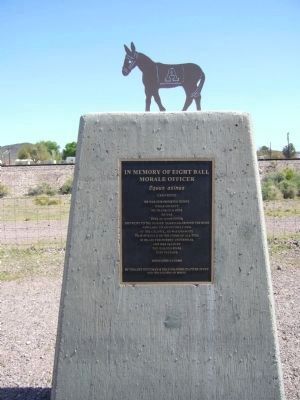
In Memory of Eight Ball - Morale Officer Marker
RANKED BY RELEVANCE, THEN GEOGRAPHICALLY
On Broad Street (Arizona Route 72 at milepost 27) south of Main Street, on the right when traveling west.
On Ben Hulse Highway (California Route 78) at 1st Street on Ben Hulse Highway.
On State Highway 127, 0.2 miles south of State Highway 190, on the right when traveling south.
On Red Rock Randsberg Road at Butte Avenue, on the left when traveling north on Red Rock Randsberg Road.
On U.S. 395 just north of Red Moutain Road, on the left when traveling north. Reported missing.
On U.S. 395, 0.2 miles south of Red Mountain Road, on the right when traveling south.
On Caprice Road north of California Route 79, on the right when traveling south.
On Juan Diego Flats Road, on the right when traveling east.
On West Hays Street at North 2nd Street, on the right when traveling west on West Hays Street.
On 38th Avenue, 1.5 miles east of South Neighbours Boulevard, in the median. Reported missing.
Near Wiley Well Road, 0.1 miles north of Interstate 10.
On Chiriaco Road, on the right when traveling west.
On Chiriaco Road, on the right when traveling west.
On Chiriaco Road near Summit Road, on the right when traveling west.
On Chiriaco Road, on the right when traveling east.
Paid Advertisement
On Box Canyon Road, on the right.
On Un-named Dirt Road south of Lawson Road, on the right when traveling south. Reported missing.
On Temescal Canyon Road near Interstate 15, on the right when traveling east.
On Temescal Canyon Road near Interstate 15, on the right when traveling north.
On Corn Springs Road near Interstate 10, on the right when traveling west.
On Rice Road (Route 177) at Coxcomb Monument Road, on the left when traveling south on Rice Road.
On Indio Boulevard east of Smurr Street, on the right when traveling south.
On Pines to Palms Highway (California Route 74) north of Forest Route 6S13, on the right when traveling south.
On Molino Way at Fort Drive, on the right when traveling east on Molino Way.
On National Trails Highway - Historic Route 66 near Old Amboy Road, on the right when traveling west.
On National Trails Highway at Cadiz Road, on the right when traveling west on National Trails Highway.
On National Trails Highway, on the right when traveling west.
On Rasor Road at Crucero Road / Yvonne Boulevard, on the right when traveling east on Rasor Road.
On Baker Boulevard (Business Interstate 15) east of Caltrans Boulevard, on the right when traveling west.
On Barstow Road (California Route 247), on the right when traveling south.
Paid Advertisement
On Barstow Road (California Route 247), on the left when traveling north.
On Holcomb Valley Road (Road 3N16) east of Van Dusen Canyon Road (Road 3N09), on the left when traveling east.
Near Holcomb Valley Road (Road 3N16) 0.5 miles east of Van Dusen Canyon Road (Road 3N09), on the right when traveling west. Reported missing.
On National Trails Highway (U.S. 66), on the right when traveling east.
On 2nd Street at King Street, on the right when traveling north on 2nd Street.
On Santa Fe Street at 4th Street, on the right when traveling east on Santa Fe Street.
On National Trails Highway west of Minneola Road, on the right when traveling west.
On Aqueduct Road (California Route 62) 0.1 miles west of Parker Dam Road, on the right when traveling east.
On Lanfair Road, 0.1 miles north of Goffs Road, on the left when traveling north.
On Lanfair Road, 0.1 miles north of Goffs Road, on the left when traveling north.
Near California Route 173, 2 miles east of California Route 138.
On Cajon Boulevard, on the right when traveling east.
On Essex Road at Black Canyon Road, on the right when traveling north on Essex Road. Reported missing.
On Arrowhead Villa Road, on the left when traveling north.
On Belfield Boulevard at Linn Road, on the right when traveling north on Belfield Boulevard.
On Cedar Canyon Road at New York Mountain Road, on the right when traveling east on Cedar Canyon Road.
Paid Advertisement
On Lytle Creek Road, on the right when traveling west.
On Mill Creek Road (California Route 38), on the right when traveling east.
On Interstate 15, 26 miles south of Primm, on the right when traveling south.
On Harvard Road at Mannix Road, on the right when traveling south on Harvard Road.
On National Trails Highway, on the right when traveling west.
On Nipton Road east of Nipton Moore Road, on the left when traveling west.
On Manada Road, on the right when traveling north.
On Mane Street east of Tom Mix Road, on the right when traveling east.
Near Arrowhead Avenue, on the left when traveling south.
On Trona Road (California Route 178) at Pinnacle Road, on the right when traveling east on Trona Road.
On Trona Road (California Route 178) at Pinnacle Road, on the right when traveling east on Trona Road.
On Utah Trail at National Park Drive, on the right when traveling south on Utah Trail.
On National Trails Highway (County Route 66) 1.3 miles north of Interstate 15, on the left when traveling north.
On Turner Road, 1 mile west of National Trails Highway, on the left when traveling west.
On Old Parker Road, 0.1 miles east of U.S. 95, on the right when traveling east.
On Crestview Drive east of Airway Avenue.
Paid Advertisement
Near South Casino Drive, on the right when traveling south.
On Utah Route 91, on the right when traveling north.
On Kelso Cima Road at Cedar Canyon Road, on the right when traveling south on Kelso Cima Road.
On Ave 64E near Interstate 8, on the left when traveling south.
On Trona Wildrose Road at Ballarat Road, on the right when traveling north on Trona Wildrose Road.
On Trona Wildrose Road at Ballarat Road, on the right when traveling north on Trona Wildrose Road.
On Pepper Avenue north of Merrill Avenue, on the right when traveling north.
On Broadway Avenue (Arizona Route 72 at milepost 27) south of Main Street, on the right when traveling west.
On Broadway Avenue (Arizona Route 72 at milepost 27) south of Main Street, on the right when traveling west.
On Broadway Avenue (Arizona Route 72 at milepost 27) south of Main Street, on the right when traveling west.
On Broadway Avenue south of Main Street, on the right when traveling north.
On Broadway Avenue (Arizona Route 72 at milepost 27) south of Main Street, on the right when traveling west.
On Broadway Avenue (Arizona Route 72 at milepost 27) south of Main Street, on the right when traveling west.
On Broadway Avenue (Arizona Route 72 at milepost 27) south of Main Street, on the right when traveling west.
On Broadway Avenue (Arizona Route 72 at milepost 27) south of Main Street, on the right when traveling west.
Paid Advertisement
On Broadway Avenue (Arizona Route 72 at milepost 27) south of Main Street, on the right when traveling west.
Near Cibola Road at Baseline Road. Reported missing.
Near Cibola Road at Baseline Road.
On Oatman -Topock Highway / Main Street (Old Route 66 at Rock Hound Road, on the left when traveling north on Oatman -Topock Highway / Main Street (Old Route 66.
On Ave 64E near Interstate 8, on the left when traveling south.
On California Route 178, on the right when traveling north.
On Trona Wildrose Road at Ballarat Road, on the right when traveling north on Trona Wildrose Road.
On Jawbone Canyon Road at Aerospace Highway (California Highway 14), on the right when traveling north on Jawbone Canyon Road.
On Silverado Canyon Road, on the right when traveling west.
Near Hobsonway Road, on the left when traveling east.
On U.S. 95 at milepost 10.5, on the right when traveling north.
On Midland Road, 10 miles north of Interstate 10, on the right when traveling north.
On Ragsdale Road east of Eagle Mountain Road, on the right when traveling west. Reported missing.
On Temescal Canyon Road near Interstate 15, on the right when traveling east.
On Ramona Bowl Road, on the right when traveling east.
On Iowa Avenue at Spring Street, on the right when traveling south on Iowa Avenue.
Paid Advertisement
On Big Rock Drive east of Overlook Drive, on the right when traveling east.
Near Deglet Noor Street north of Miles Avenue, on the right when traveling south. Reported missing.
Near Miles Avenue at Daglet Noor Street, on the right when traveling west.
On Wineville Avenue at Harrel Street, on the right when traveling south on Wineville Avenue.
139 entries matched your criteria. The first 100 are listed above.
The final 39 ⊳
* Inflectional forms of words are their plurals, singulars, and possessives as well as gramatical tenses and similar variations.