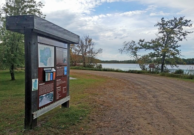
Settlement
In the late 1800s, the first white settlers came to the area that is now the refuge. They were loggers, ranchers and market hunters. Loggers cut the pine trees from the land and floated them down the Rice River to the Mississippi . . . — — Map (db m210313) HM
In late 1850, some 400 Ojibwe Indians perished because of the government’s attempt to relocate them from their homes in Wisconsin and Upper Michigan to Minnesota west of the Mississippi River. The tragedy unfolded at Sandy Lake where thousands of . . . — — Map (db m206878) HM
Early water transportation on the Upper Mississippi River from St. Paul to St. Louis was hindered by fluctuating water levels. In 1878, the Corp of Engineers studied the impact of a reservoir system on the river. The study resulted in the building . . . — — Map (db m207887) HM
This map shows the locations of some of the villages of the 19 Ojibwe Bands whose treaty annuities were paid at Sandy Lake in 1850. Today, these 19 Bands are succeeded by the 12 federally-recognized Bands whose present-day reservations also are . . . — — Map (db m207530) HM
To the native Anishinabe (Ojibwe) and to the white fur traders who bartered with them in the late 1700s and early 1800s, no Minnesota lake had a more strategic location than Big Sandy Lake, which stands at the intersection of two major trade . . . — — Map (db m210859) HM
The Dakota and Ojibwa people believed that the confluence of two great rivers was a sacred place.
The Point was used as an encampment and gathering place for several tribes. It was also a meeting place to form hunting parties going north . . . — — Map (db m70897) HM
Father Louis Hennepin, Belgian Recollect missionary accompanying Sieur de la Salle's expedition to the Mississippi River region, left Fort Crevecoeur, Illinois, on February 29, 1680, for an exploration of the upper Mississippi River. On April 11, he . . . — — Map (db m225175) HM
The Rum and the Mississippi were highways for the earliest recorded European explorers of Minnesota. Many explorers traveled past The Point and some may have camped here including Radission, Hennepin, Du Luth, Pike, Faribault and Nicollet.
. . . — — Map (db m70569) HM
Built in 1872 by W.D. Washburn & Co., the mill had an annual production of 16 million board feet of lumber. Combined with the planing mills, dry kilns, etc., the mill employed about 125 men. For 17 years logs from the headwaters of the Rum . . . — — Map (db m242327) HM
Native peoples and traders met at a trading post constructed across the Rum River from The Point in 1844 by Joseph Bellanger. The Ojibwa brought furs and skins to trade for copper cooking pots, cloth, blankets, decorative beads and iron . . . — — Map (db m70921) HM
Who Lived Here
Thousands of years ago, glaciers and inland seas covered much of North America. These early forces shaped the land to form lakes, rives, soil deposits, and land features. Sandy soil at the southern end of the Rum River . . . — — Map (db m236855) HM
Itasca grew up around an Indian trading post which was established 800 feet east of here in 1849 by Thomas A. Holmes and James Beatty. At the suggestion of Territorial Governor Alexander Ramsey, the settlement was named in honor of Lake Itasca, the . . . — — Map (db m69908) HM
This plot marks the site of the home of John Cook, pioneer settler, who with his wife Diantha J., and children Freddie W., Mary E., and John W., were murdered by Indians April 26, 1872. — — Map (db m227703) HM
Through woodland and prairie, along riverbanks and through sloughs, the mixed-blood American and Canadian buffalo hunters called Metis blazed trails with their oxen and squeaky-wheeled wooden carts. They carried buffalo robes and pemmican from . . . — — Map (db m206932) HM
This trail was used by early settlers and Indians to reach the maple sugar and wild rice campsite located at the north end of Tamarac Lake. It extended east to the Ottertail River and then branched to the south and north. The south branch followed . . . — — Map (db m226131) HM
This marker locates a part of the original trail which was cut out of the forest by the U.S. Army in 1868 to facilitate travel from Leech Lake to White Earth. Soldiers accompanied the paymasters along this road in the early days to provide . . . — — Map (db m8537) HM
The first Minnesota mission to be named for Saint Columba was built by James Lloyd Breck in 1852 at Gull Lake near the present-day Brainerd. It was the fourth Episcopal church established in Minnesota.
The initial group of Chippewa Indians . . . — — Map (db m207531) HM
Near this spot, archaeologists found evidence for a Native American fishing camp. Pottery from the camp indicates that people lived here at various times between 3,000 and 600 years ago during what is known as the Woodland Period.
Harvested . . . — — Map (db m135890) HM
Pieces of pottery and other artifacts tell archaeologists that Native Americans have lived along the shores of the Turtle River and Three Island Lake for thousands of years. Because the ways in which Native Americans decorated and made their pottery . . . — — Map (db m135881) HM
In 1891, government surveyors platted this area as "meadows." Travel was difficult until drainage ditch spoil piles provided a rough bed for the first road, present-day Highway 72. A road linking Baudette and Kelliher was completed in 1914. . . . — — Map (db m191359) HM
Minnesota Territory 1849-1858On March 3, 1849, during his last hours in office. President James K. Polk signed a bill adding a new name to the American political landscape — Minnesota Territory. A vast land, it stretched from the St. . . . — — Map (db m205213) HM
Philosophy.
Amos Owen was a Dakota elder and spiritual leader who wanted to preserve and restore traditional Dakota beliefs and practices. He believed that the suppression of Indian peoples had led to many parts of the culture being almost . . . — — Map (db m21588) HM
The last act of the Minnesota Dakota (Sioux) War took place here in Mankato on December 26, 1862 when thirty-eight Dakota Indians died in a mass execution on this site.
The Dakota War was a culmination of years of friction between Dakota and . . . — — Map (db m14195) HM
Through treaty negotiations, the Ho-Chunk or Winnebago moved their homes to Blue Earth County in 1855, and by 1863 they were gone. Parts of what would become Minnesota, Wisconsin and Illinois had been their homeland for centuries. European explorers . . . — — Map (db m14053) HM
Native Americans arrived in the area nearly 11,000 years ago, shortly after the glaciers receded. They lived in small, migratory, family-based groups and used plants and animals from the river valley and nearby uplands. Around 2,500 years ago, . . . — — Map (db m237583) HM
This memorial is to honor those Dakota who created the First Mahkato Wacipi in 1972.
The Wacipi is to remember the thirty-eight Dakota executed in Mankato in 1862 and to create a spirit of reconciliation between the people of Mankato and . . . — — Map (db m17506) HM
In 1850 the Minnesota Territory had a white population of about 6000. In 1858, a year before Minnesota became a state, the population was 150,000.
One of the reasons for this enormous growth was the opening of the “Suland,” land . . . — — Map (db m159781) HM
The Sioux Indians called this lake "minne hanska," meaning "long water." The basin of the lake was formed 11,000 to 15,000 years ago by the Wisconsin glacier; the original hard clay bottom is now about 50 feet below the present surface of the . . . — — Map (db m66454) HM
Brown County, an historic gateway on the Minnesota River, opened the fertile prairie lands of the Great Plains to the northern hardwoods of a continental divide. The U.S. Territorial Legislature organized the county in 1856 from lands ceded by the . . . — — Map (db m66749) HM
In 1851, leaders of the Dakota Nation signed the Treaty of Traverse des Sioux with the United States Government. This treaty opened new lands in Minnesota Territory for settlement. Two years later, German immigrants in Chicago, led by Frederick . . . — — Map (db m65452) HM
Sleepy Eyes, or Drooping Eyelids, was born about 1780 in a Sisseton Sioux Indian village at Swan Lake in Nicollet County. The Bureau of Indian Affairs commissioned him a chief in 1824. His fame was achieved not as a warrior or hunter but as a friend . . . — — Map (db m67658) HM
In the summer of 1851 the Dakota Indians, a group of Native Americans who lived in Southern Minnesota, sold their land, 35 million acres, to the United States for $3,000,000. The Dakota agreed to move to a reservation which included land ten miles . . . — — Map (db m67983) HM
City Square Park
City Square in Chaska has always been a gathering place and the heart of this community. The land was set aside for public purpose in 1852 in the original plat. Early settlers in Chaska found six earthen mounds on this . . . — — Map (db m63707) HM
Watertown is one of the oldest settlements in Minnesota’s south central region. Chief Little Crow of the Dakota Nation and his tribe often camped by the Crow River. At first the Chief and the settlers trusted each . . . — — Map (db m213030) HM
What is a burial mound?
Today, tombstones in cemeteries mark the burials of people from nearby towns and villages. They may tell us about the lifespan, disease, or other aspects of a person's life. The Gull Lake Mounds mark the burials of . . . — — Map (db m190007) HM
Grave Goods
Many cultures bury valued possessions, items of everyday life, or special burial items with a person. Archaeologists call these grave goods. At Gull Lake, archaeologists found a pottery cooking vessel, the bones and teeth of a . . . — — Map (db m190006) HM
Pottery Tells Us About Who Lived Here
The decorative patterns on pottery and vessel shapes change through time. By comparing the pottery found at Gull Lake to a regional sequence of pottery types based on pottery from other archaeological . . . — — Map (db m237142) HM
People have lived in the Leech Lake Area for over 10,000 years and artifacts have survived that tell us the story of their lives. Our Early Man is holding a tool made of siltstone, discovered by the Leech Lake Heritage Sites Program of the Leech . . . — — Map (db m237143) HM
Descendants of the early man in the Leech Lake Area consisted of contemporaries of the woolly mammoth. Artifacts of the huge ivory tusks have been found in their burial grounds around Leech Lake. A civilization of the native Americans known as the . . . — — Map (db m237144) HM
Missionaries were among the first to arrive in the Leech Lake Area and their work had a lasting impact on those who had settled there. Although their primary purpose was to spread the good news of salvation in Jesus Christ, they also served as . . . — — Map (db m235755) HM
Many physicians have served the medical needs of the Leech Lake Area, beginning with Maji Gabowi, a documented medicine man of the Ojibwe Tribe. When Henry Schoolcraft led his first expedition in search of the source of the Mississippi, Dr. Houghton . . . — — Map (db m235793) HM
The fur-trade industry began in our country in the 1600s and lasted into the 1800s. Fur hats and accessories became a symbol of success in Europe and created the demand which drove the fur trade. The original fur traders in the Leech Lake Area were . . . — — Map (db m235799) HM
On Leech Lake, Bugonaygeshig is celebrated as a symbol of resistance by both the Indian and white communities. He lived a long life, steadfast in his Indian ways and Bugonaygeshig School in Bena, MN is named in his honor. On September 15, 1898, he . . . — — Map (db m235754) HM
When a federal marshal with about 100 troops of the 3rd Infantry tried to arrest the Chippewa Chief Bugonaygeshig at Sugar Point opposite here on the northeast shore of the lake, a sharp fight occurred October 5, 1898. The whites lost 7 killed and . . . — — Map (db m124726) HM
"What is old is not good.
What is new is good.
Think only on the new.
In that way, by degrees
you will be able to attain
something. That is the way.
Among other peoples beyond
ours, men consider that alone....
The Dakotas are getting . . . — — Map (db m176416) HM
Tokanne (Mary Little Crow Renville) (1789-1840) was born a Kaposia
Bdewakantuŋwan toward the end of the 18th century when tribes
throughout the Midwest were actively developing kinship alliances via
marriage into the Canadian fur trade . . . — — Map (db m176989) HM WM
Fort Renville, the
headquarters of the fur
trade in this area during
the 1820s and 1830s, was
located at the bottom
of this hill.
Joseph Renville, son of a
French trader and a Dakota
woman, began trading for furs at
Lac qui Parle . . . — — Map (db m176307) HM
The first cabin built at the Lac qui Parle mission was
completed near this site by Alexander Huggins and
Thomas S. Williamson in October of 1835 for the Huggins
family. Originally a one-room 16-foot-square structure
chinked with mud, it was . . . — — Map (db m176336) HM
“Considering how different all their thoughts are from ours and how unlike
to everything which they have ever seen or heard would be the whole way
of salvation, it is not to be expected that we could make them understand
or believe much of what . . . — — Map (db m176400) HM
Lac qui Parle Mission was
established in 1835. Here Christian
missionaries founded one of the
earliest churches and schools in
Minnesota. You can visit a replica
of the chapel built with the help
of Dakota people in 1841, and
you can see the . . . — — Map (db m176311) HM
Thomas S. Williamson (1800-1879) and Margaret Poage Williamson
(1804-1872), the founding couple of the ABCFM mission to the Dakotas. With their
young daughter, Elizabeth, they arrived at Lac qui Parle on July 9,1835 from Ripley,
Ohio, . . . — — Map (db m176978) HM
And Jesus came and said to them,
“All authority in heaven and on
earth has been given to me.
Go therefore and make disciples
of all nations, baptizing them in
the name of the Father and of
the Son and of the Holy Spirit,
teaching them to . . . — — Map (db m176633) HM
The Dakota
Dakota
"These are territories that
we hold from no one but
the Master of Life who
gave them to us."
- Dakota chief to
French Diplomat
Joseph Marin, 1754 people were created in Mni Sota Makoçe. Minnesota has always been . . . — — Map (db m176408) HM
People Of The ValleyWe have evidence of many earlier users of the St. Croix River Valley. Why do you think they decided to come here?
People look for ways to make their lives better. Many people found what they needed along . . . — — Map (db m233090) HM
In the 1830's, logging companies from the eastern United States were running out of easily-harvested trees to supply the lumber for the growing population of this continent. Then they explored along the St. Croix River, and claimed the forests . . . — — Map (db m233405) HM
Before the arrival of the first French, English, or American explorers, people lived in the St. Croix River Valley. They were here before the Ojibwe came from the east, and before the Dakota and Mesquakie Indians guided and traded with the . . . — — Map (db m233179) HM
Acquiring a Homestead David S. Patterson came to Itasca in 1889. Patterson made claim to 152 acres, which included the Headwaters of the Mississippi. He purchased the land in 1891 for $191. Patterson's cabin was north of McMullen's cabin near . . . — — Map (db m155671) HM
The romantic 19th century quest for the source of the Mississippi river brought many explorers — among them Zebulon Pike, Lewis Cass, and Giacomo Beltrami — to northern Minnesota. The search ended when Ojibwe chief Ozawindib guided Henry . . . — — Map (db m155665) HM
Gunflint Trail Area
The Gunflint Trail is one of Minnesota's most famous roads. Along its 56 miles are trails on old railroads, clear lakes, moose viewing areas, giant magnetic boulders, ancient meteor strikes, recovering fire areas, and . . . — — Map (db m235139) HM
An Indian community of about 200 people was located in this area about 1915. An ancient Indian cemetery is located about two blocks northeast of this historic church — — Map (db m203254) HM
From the 1700s until the early 1900s, itinerant missionaries braved extreme hardships to minister sporadically to North Shore settlers. In 1855, Jesuit missionaries from Fort Williams, Ontario, served Chippewa City, an Ojibwe community of about 100 . . . — — Map (db m200626) HM
Lake Superior Indians recognized the unique nature of this bay long ago, naming it "Kitchi-Bitobig", meaning "double body of water." When white man first settled around this bay, in 1854, a few Indian families lived in tepees and cabins around the . . . — — Map (db m203151) HM
Welcome!
The Point is a broad tombolo which defines the two natural harbors that have made Grand Marais an important spot on Lake Superior's shore for centuries. The 8.4 acre Point was conveyed to the federal government in 1942, and is part . . . — — Map (db m203216) HM
In the 1960s, archeologists discovered here remains of a structure used between 1785 and 1802, unusual because it was built on posts. They found artifacts that match the bills of lading from bales, kegs, and cassettes (small trunks) that were canoed . . . — — Map (db m152972) HM
The Gates are shut always after sunset and...
there are two Sentries keeping a look out all
night chiefly for fear of accident by fire.
John Macdonell, Grand Portage, 1793
This gatehouse was not intended to . . . — — Map (db m152975) HM
The Grand Portage, or "the great carrying place, Gichi Onigamiing, has been a meeting point for centuries: it was part of an extensive Native American trading network well before the first French trader arrived in 1731. Though the French formally . . . — — Map (db m152968) HM
American Indians developed the birchbark canoe hundreds or thousands of years ago. It would provide the technology that allowed the North West Company to span the continent.
"Canots du Nord"
The 24-foot north canoes could be portaged . . . — — Map (db m153049) HM
Inside the Historic Depot in front of you are three of the sixteen buildings that once comprised the summertime headquarters of the North West Company. The depot was not a fort but instead a secure transshipment point for valuable furs and trade . . . — — Map (db m152973) HM
Father Frederic Baraga, learning of a possible
epidemic afflicting the Indians at Grand Portage in 1846, set out in a small boat from Madeline Island in Wisconsin with an Indian guide.
An unexpected storm threatened them, but their lives were . . . — — Map (db m98448) HM
People hunting game most likely traveled this ridge, which provided a dry route above the lake-dotted prairie for thousands of years.
The earliest inhabitants of this region hunted woolly mammoths and musk-ox. Beginning with the . . . — — Map (db m140821) HM
At this location, on July 23, 1872, a tragedy occurred and two American Indian brothers lost their lives to a vigilante group. These members of the White Earth Nation had been accused in the disappearance of a 22 year-old woman from Crow Wing . . . — — Map (db m213585) HM
Names from the fur traders' phrase "The Thousand Lakes Region." This lake is 1250 feet above sea level and covers about 200 square miles. It formerly included much low ground and several adjacent lakes. When visited by Du Luth in 1679, Sioux . . . — — Map (db m78405) HM
For thousands of years, fire was an important component of the health of natural areas including prairies, oak savannah, wetlands and forests. Fires were started by lightning and were also set by Native Americans as a planned landscape management . . . — — Map (db m237398) HM
Centuries of fire helped shape the forest we enjoy today. Scientists examining sediment cores from lakes in the Boundary Waters Canoe Area Wilderness found pollen and charcoal dating all the way back to the retreat of the glaciers. They noted that . . . — — Map (db m237396) HM
From 1856 to 1865, in its first decade of existence, the city of Hastings grew by 2,500 people, enjoying a boom of settlement also experienced by other cities along the Mississippi.
A steady flow of settlers, including many immigrants, . . . — — Map (db m48361) HM
A natural harbor on the great Mississippi River highway led to the early development of Hastings. The river brought explorers, traders, soldiers, speculators, businessmen, and settlers. It carried from here the products of the prairies and forests. . . . — — Map (db m199536) HM
The Mississippi River has provided a habitat for many species of fish and other aquatic creatures for millions of years. Human modifications of the river have had both positive and negative effects on fish populations here. Many types of fish thrive . . . — — Map (db m49277) HM
For more than 10,000 years, people have lived near the Mississippi River. The first cultures relied on hunting, fishing, and gathering for survival. As early as 1,000 years ago, however, Indian peoples were farming portions of the river valley near . . . — — Map (db m49801) HM
The confluence of the Mississippi and Minnesota rivers has always been important to the peoples of this region. Native American cultures moving into Minnesota as early as 12,000 years ago lived along these major rivers. Dakotan groups living here . . . — — Map (db m228716) HM
Native Americans of varying cultural traditions lived in the Upper Mississippi River Valley for thousands of years before European Americans entered the region. During the early years of Native American contact with European Americans (1650-1837), . . . — — Map (db m228763) HM
Called M'Dote or "the place where waters meet" by the Dakota, this area is central to many Dakota creation stories and is significant to Dakota people today. Just west of this site is Pilot Knob, which was used extensively for burials by the Dakota . . . — — Map (db m37659) HM
A National Scenic Byway
The Great River Road is the longest scenic byway in the nation, stretching nearly 3,000 miles through ten states from the Mississippi River's headwaters in Minnesota to the Gulf of Mexico. For thousands of years, the . . . — — Map (db m199537) HM
[symbol of the Daughters of the American Revolution]
Mendota
In the language of the Sioux means the mouth of a river. Was the earliest
permanent white settlement in southern Minnesota. A pioneer center of the fur trade. . . . — — Map (db m37534) HM
Mendota
This wide valley intersection between the two rivers known today as the Minnesota and Mississippi has been a meeting place for people for thousands of years.
The Dakota people lived on these prairielands by the 1700s. . . . — — Map (db m229001) HM
Welcome to the Sibley House Historic Site! This area had long been the center of travel and trade for the Dakota when it became the center for American Fur Company operations on the Upper Mississippi. It was also home to Minnesota's first governor, . . . — — Map (db m41238) HM
Ancient people lived in Minnesota as early as 12,000 years ago. These first inhabitants of the land left behind lasting clues about their cultures. They moved seasonally between camps while hunting and gathering. Often they chose camps near major . . . — — Map (db m229000) HM
1851 • 1922
[symbol of the D.A.R.]
To Commemorate The Treaty at Mendota
Negotiated on
Pilot Knob
Whereby the Sioux Indians ceded their lands
in the Territory of Minnesota and State of Iowa
to the . . . — — Map (db m37430) HM
Kaposia was first located on the east bank of the Mississippi River on a low terrace below the bluff in present-day St. Paul. It was established after 1750 by a group of Mdewakanton Dakota whose succession of chiefs were each known as Little Crow. . . . — — Map (db m151038) HM
Rice Lake and its surrounding area were popular among early Indians for the abundance of good hunting and the wild rice that grew in the shallow lake waters. Women of the Winnebago tribe harvested the rice even after the first white settlers . . . — — Map (db m196833) HM
Osakis was one of the stops on the Burbank Minnesota Stage Company Line to the Red River, established in the spring of 1859 upon the opening of the Fort Abercrombie Military Road. During the Sioux outbreak of 1862 the maintenance of this line of . . . — — Map (db m157797) HM
With the Louisiana Purchase in 1803, the United States acquired a vast area west of the Mississippi River. Eager for information about its new territory, the government dispatched a series of explorers to learn more about the land and the native . . . — — Map (db m178486) HM
"The most beautiful prospect that imagination can form," wrote 18th century explorer Jonathan Carver about the view from Barn Bluff. "Verdant plains, fruitful meadows, and numerous islands abound with the most varied trees.... But above all, . . . — — Map (db m24816) HM
This diverse landscape has always attracted a wide range of inhabitants. At one time, mammoths and mastodons roamed this area. Birds such as the marbled godwit and chestnut collared longspur once lived in the prairie. And people have inhabited this . . . — — Map (db m224645) HM
In 1885, T. H. Lewis mapped a mound group on a bluff top overlooking the confluence of the Cannon and Mississippi Rivers. Unlike other mound groups in the region, this set contained a flat-topped, rectangular mound. These types of mounds generally . . . — — Map (db m225107) HM
Minnesota has lost 99 percent of its native prairies and 92 percent of its old-growth forests. This 13-acre parcel seeks to recover part of that original landscape.
Susan Windgrow - Prairie Island resident. . . . — — Map (db m239615) HM
From its headwaters in the west, the Cannon River's course crosses broad, flat uplands dotted with lakes, and slowly transitions to rolling hills above the deep-cut valley as it nears its mouth. The watershed contains a wide variety of landscapes . . . — — Map (db m224528) HM
You are entering a river bluff environment that has been greatly altered over the last two centuries. The bluff top area was formerly oak savannah with prairie and woodland elements. Natural springs and shallow flood plain lakes in the river bottoms . . . — — Map (db m117485) HM
Many Dakotas consider the Minnesota River Valley to be their spiritual home. The Dakota Indians were the last group of native peoples to live in the valley near this site. Starting in the mid-1600s, they migrated here in successive waves from the . . . — — Map (db m117487) HM
286 entries matched your criteria. The first 100 are listed above. Next 100 ⊳