After filtering for Minnesota, 286 entries match your criteria. The first 100 are listed. ⊳
Native Americans Topic
By McGhiever, September 29, 2022
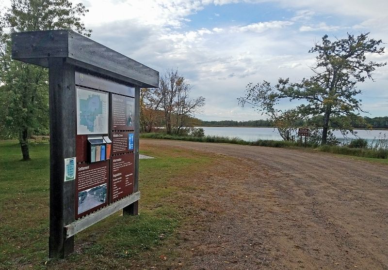
Marker at Mandy Lake in Rice Lake National Wildlife Refuge
| 1 ► Minnesota, Aitkin County, East Lake — Mandy Lake — Rice Lake National Wildlife Refuge — |
| On Mandy Lake Access at 363rd Lane, on the left when traveling west on Mandy Lake Access. | |||
| 2 ► Minnesota, Aitkin County, Libby — "Tell him I blame him for the children we have lost...." — Aish-ke-bo-go-ko-zhe (Flat Mouth), December 3, 1850 — |
| Near State Highway 65, 0.6 miles 224th Place, on the right when traveling north. | |||
| 3 ► Minnesota, Aitkin County, Libby — Big Sandy Lake Reservoir — |
| On State Highway 65, on the right when traveling north. | |||
| 4 ► Minnesota, Aitkin County, Libby — The Ojibwe's Sandy Lake Journey — |
| On State Highway 65, on the right when traveling north. | |||
| 5 ► Minnesota, Aitkin County, Libby — Where River Roads Met — |
| On Minnesota Route 65, 0.2 miles south of 528th Lane, on the right when traveling north. | |||
| 6 ► Minnesota, Anoka County, Anoka — Circle of Life — |
| Near South Ferry Road, 0.3 miles east of South Ferry Street (U.S. 169). | |||
| 7 ► Minnesota, Anoka County, Anoka — Father Louis Hennepin's Exploration in 1680 — |
| On 1st Avenue at East Main Street, on the right when traveling south on 1st Avenue. | |||
| 8 ► Minnesota, Anoka County, Anoka — Highway of Exploration — |
| Near South Ferry Road, 0.3 miles east of South Ferry Street (U.S. 169). | |||
| 9 ► Minnesota, Anoka County, Anoka — Washburn Saw Mill — |
| On 2nd Avenue south of Harrison Street, on the right when traveling south. | |||
| 10 ► Minnesota, Anoka County, Anoka — Where Cultures Meet — |
| Near South Ferry Road, 0.3 miles east of South Ferry Street. | |||
| 11 ► Minnesota, Anoka County, Anoka — Who Lived Here / Neighborhood Names / Building a Community — Akin Riverside Historic Promenade — |
| Near 2nd Avenue west of Rivers Pointe Court. | |||
| 12 ► Minnesota, Anoka County, Ramsey — AN-RMC-008 — Itasca Village Townsite — |
| On U.S. 10, 0.8 miles east of Cleveland Street, on the right when traveling east. | |||
| 13 ► Minnesota, Becker County, Audubon — Cook Homestead — |
| Near County Highway 11, 1.5 miles south of U.S. 10, on the left when traveling south. | |||
| 14 ► Minnesota, Becker County, Detroit Lakes — The Woods Trail — |
| On Frontage Road, on the right when traveling south. | |||
| 15 ► Minnesota, Becker County, Rochert — Old Indian Trail — |
| On County Road 29, 1 mile south of County Road 26, on the left when traveling south. | |||
| 16 ► Minnesota, Becker County, Tamarac National Wildlife Refuge — Old Government Road — |
| On County Route 143, 0.7 miles west of Egg Lake Trail. | |||
| 17 ► Minnesota, Becker County, Waubun — St. Columba Mission — |
| Near 370th Street, on the left when traveling east. | |||
| 18 ► Minnesota, Beltrami County, Turtle River — Native American Fishing on the Turtle River — A Fishing Camp — |
| Near Three Island Access. | |||
| 19 ► Minnesota, Beltrami County, Turtle River — Pottery Types of the Turtle River and Three Island Lake — Pottery of the Past Provides Clues — |
| 20 ► Minnesota, Beltrami County, Waskish — Ludlow Island History — |
| Near State Highway 72, 2 miles south of County Road 77, on the left when traveling north. | |||
| 21 ► Minnesota, Benton County, Sauk Rapids — Minnesota Territory 1849-1858 / Benton County Takes Shape — |
| On 1st Street North just south of 3rd Avenue North, on the right when traveling north. | |||
| 22 ► Minnesota, Blue Earth County, Mankato — Amos Owen Garden of American Indian Horticulture — |
| On Warren Street north of Stadium Road, on the left when traveling east. | |||
| 23 ► Minnesota, Blue Earth County, Mankato — Dakota (Sioux) Memorial – 1862 — |
| On East Main Street at North Riverfront Drive on East Main Street. | |||
| 24 ► Minnesota, Blue Earth County, Mankato — Ho-Chunk / Winnebago — |
| On Minnesota River Trail, on the right when traveling south. | |||
| 25 ► Minnesota, Blue Earth County, Mankato — Native Americans — Minnesota River Valley History Walk — |
| On Civic Center Plaza (Hickory Street) at S. 2nd Street, on the right when traveling west on Civic Center Plaza (Hickory Street). | |||
| 26 ► Minnesota, Blue Earth County, Mankato — The First Mahkato Memorial Wacipi — |
| Near Amos Owen Lane north of South Riverfront Drive (U.S. 169). | |||
| 27 ► Minnesota, Brown County, Essig — The Milford Reservation Line — |
| On 280th Street (County Highway 29) 0.1 miles east of 215th Avenue, on the right when traveling west. | |||
| 28 ► Minnesota, Brown County, Hanska — Lake Hanska — |
| Near County Road 11, 1.1 miles north of County Road 6, on the left when traveling north. | |||
| 29 ► Minnesota, Brown County, New Ulm — Brown County — 150 Years — 1856 • 2006 — |
| On South State Street south of Center Street, on the right when traveling south. | |||
| 30 ► Minnesota, Brown County, New Ulm — New Ulm — |
| On North Broadway (State Highway 15/68) north of 1st North Street, on the right when traveling north. | |||
| 31 ► Minnesota, Brown County, Sleepy Eye — Chief Sleepy Eyes — (Ish-tak-ha-ba) — |
| On 1st Avenue North at Oak Street Northwest on 1st Avenue North. | |||
| 32 ► Minnesota, Brown County, Sleepy Eye — Dakota Reservation and the Leavenworth Road — |
| On 280th Avenue, 1 mile south of U.S. 14, on the right when traveling south. | |||
| 33 ► Minnesota, Carver County, Chaska — City Square Park — |
| On North Walnut Street south of East 4th Street, on the right when traveling south. | |||
| 34 ► Minnesota, Carver County, Watertown — Early Watertown History — |
| Near Mill Avenue Northeast, 0.1 miles north of Carter Street Northeast, on the left when traveling north. | |||
| 35 ► Minnesota, Cass County, East Gull Lake — 1 — In Death, a Story of Life: The Gull Lake Burial Mounds — |
| On Gull Lake Drive at Gull Lake Dam Road, on the left when traveling east on Gull Lake Drive. | |||
| 36 ► Minnesota, Cass County, East Gull Lake — 2 — In Death, A Story of Life: The Gull Lake Burial Mounds — |
| Near Gull Lake Drive at Gull Lake Dam Road, on the left when traveling east. | |||
| 37 ► Minnesota, Cass County, East Gull Lake — 3 — In Death, a Story of Life: The Gull Lake Burial Mounds — |
| Near Gull Lake Dam Road (County Road 125) 0.1 miles south of Gull Lake Lane, on the left when traveling east. | |||
| 38 ► Minnesota, Cass County, Walker — "A Possible Discovery" — Circle of Time — |
| On Minnesota Avenue West (State Highway 200/371) at 3rd Street, on the right when traveling east on Minnesota Avenue West. | |||
| 39 ► Minnesota, Cass County, Walker — "Before the Ojibwe" — Circle of Time — |
| On Minnesota Avenue West (State Highway 200/371) at 3rd Street, on the right when traveling east on Minnesota Avenue West. | |||
| 40 ► Minnesota, Cass County, Walker — "Good News" — Circle of Time — |
| On Minnesota Avenue West (State Highway 200/371) at 3rd Street, on the right when traveling east on Minnesota Avenue West. | |||
| 41 ► Minnesota, Cass County, Walker — "Respect for Human Life" — Circle of Time — |
| On Minnesota Avenue West (State Highway 200/371) at 3rd Street, on the right when traveling east on Minnesota Avenue West. | |||
| 42 ► Minnesota, Cass County, Walker — "Stimulated Exploration" — Circle of Time — |
| On Minnesota Avenue West (State Highway 200/371) at 3rd Street, on the right when traveling east on Minnesota Avenue West. | |||
| 43 ► Minnesota, Cass County, Walker — "We Come Together" — Circle of Time — |
| On Minnesota Avenue West (State Highway 200/371) at 3rd Street, on the right when traveling east on Minnesota Avenue West. | |||
| 44 ► Minnesota, Cass County, Walker, Shingobee Township — Propeller of Chief of Duluth — (c. 1896) — |
| On Minnesota Avenue West (State Highway 200/371) at 3rd Street, on the right when traveling east on Minnesota Avenue West. | |||
| 45 ► Minnesota, Cass County, Whipholt — Sugar Point Battle — |
| On State Highway 200, 0.3 miles east of County Route 165, on the left when traveling east. | |||
| 46 ► Minnesota, Chippewa County, Churchill — Acculturation & Autonomy — |
| Near 140th Avenue Northwest (County Road 32) near 1st Street West (County Road 13). | |||
| 47 ► Minnesota, Chippewa County, Churchill — Dakotas at Lac qui Parle — Lac qui Parle Mission — |
| Near 140th Avenue Northwest (County Road 32) near 1st Street West (County Road 13). | |||
| 48 ► Minnesota, Chippewa County, Churchill — Fort Renville — Lac qui Parle Mission — |
| On 140th Avenue West near 10th Street Northwest, on the left when traveling north. | |||
| 49 ► Minnesota, Chippewa County, Churchill — Huggins Cabin — Erected 1835 — |
| Near 140th Avenue Northwest (County Road 32) near 1st Street West (County Road 13). | |||
| 50 ► Minnesota, Chippewa County, Churchill — Lac qui Parle Mission — |
| On 140th Avenue Northwest (County Road 32) near 1st Street West (County Road 13), on the right when traveling north. | |||
| 51 ► Minnesota, Chippewa County, Churchill — Lac qui Parle Mission & Fort Renville — |
| On 140th Avenue Northwest (County Road 32) north of 1st Street West (County Road 13), on the right when traveling north. | |||
| 52 ► Minnesota, Chippewa County, Churchill — Missionaries at Lac qui Parle — Lac qui Parle Mission — |
| Near 140th Avenue Northwest (County Road 32) near 1st Street West (County Road 13). | |||
| 53 ► Minnesota, Chippewa County, Churchill — The ABCFM — Lac qui Parle Mission — |
| Near 140th Avenue Northwest (County Road 32) near 1st Avenue West (County Road 13). | |||
| 54 ► Minnesota, Chippewa County, Churchill — The Dakota — |
| Near 140th Avenue Northwest (County Road 32) near 1st Street West (County Road 13). | |||
| 55 ► Minnesota, Chisago County, Almelund, Wild River State Park — Looking For A Better Life — |
| 56 ► Minnesota, Chisago County, Almelund, Wild River State Park — What Was It Like — In the Towering White Pine Forests of the St. Croix Valley? — |
| On Equestrian campground Road north of the main park road. | |||
| 57 ► Minnesota, Chisago County, Almelund, Wild River State Park — Who Was Here First? — |
| On the road to the boat launch, on the left when traveling east. | |||
| 58 ► Minnesota, Clearwater County, Shevlin — Patterson's Homestead — |
| Near County Road 117, 0.3 miles south of County Road 122. | |||
| 59 ► Minnesota, Clearwater County, Shevlin — Search for the Mississippi's Source — |
| Near County Road 117, 0.3 miles south of County Road 122. | |||
| 60 ► Minnesota, Cook County, East Cook — Gunflint Trail — |
| On Gunflint Trail (County Highway 12) south of Gunflint Lake Road, on the right when traveling north. | |||
| 61 ► Minnesota, Cook County, Grand Marais — Chippewa City — |
| On North Shore Scenic Drive (State Highway 61) east of Old Shore Road, on the right when traveling east. | |||
| 62 ► Minnesota, Cook County, Grand Marais — St. Francis Xavier Church — The Wild North in Northeast Minnesota — |
| On State Highway 61 east of Old Shore Road, on the right when traveling east. | |||
| 63 ► Minnesota, Cook County, Grand Marais — The Grand Marais Harbor — |
| On North Shore Scenic Drive (State Highway 61) at Wisconsin Street, on the right when traveling east on North Shore Scenic Drive. | |||
| 64 ► Minnesota, Cook County, Grand Marais — The Point Interpretive Site — Superior National Forest — |
| Near Broadway Avenue, 0.2 miles south of Wisconsin Street, on the left when traveling south. | |||
| 65 ► Minnesota, Cook County, Grand Portage — A Warehouse for Furs, Trade Goods, and Now—Canoes — |
| Near Mill Creek Road, 0.2 miles south of Store Road. | |||
| 66 ► Minnesota, Cook County, Grand Portage — Guard the Gate — |
| Near Mill Creek Road, 0.1 miles south of Store Road. | |||
| 67 ► Minnesota, Cook County, Grand Portage — Naming This Place — |
| Near Mill Creek Road, 0.6 miles north of Marina Road. | |||
| 68 ► Minnesota, Cook County, Grand Portage — The Birchbark Canoe — |
| Near Mill Creek Road, 0.1 miles south of Store Road. | |||
| 69 ► Minnesota, Cook County, Grand Portage — The North West Company — |
| Near Mill Creek Road, 0.2 miles south of Store Road. | |||
| 70 ► Minnesota, Cook County, Schroeder — Father Baraga 1846 — |
| Near State Highway 61, on the right when traveling north. | |||
| 71 ► Minnesota, Cottonwood County, Comfrey — Why did people come to this region? — |
| On 510th Avenue (County Road 2). | |||
| 72 ► Minnesota, Crow Wing County, Brainerd — Reconciliation — |
| On South 4th Street at Front Street, on the left when traveling north on South 4th Street. | |||
| 73 ► Minnesota, Crow Wing County, Garrison — Mille Lacs Lake — |
| On U.S. 169 at Central Street, on the left when traveling south on U.S. 169. | |||
| 74 ► Minnesota, Crow Wing County, Pequot Lakes — Prescribed Fire — |
| Near County Road 11, 0.3 miles east of State Highway 371, on the left when traveling east. | |||
| 75 ► Minnesota, Crow Wing County, Pequot Lakes — Traditional Landscape — |
| Near County Road 11, 0.3 miles east of State Highway 371, on the left when traveling east. | |||
| 76 ► Minnesota, Dakota County, Hastings — Hastings Grows — |
| Near 1st Street at Ramsey Street. | |||
| 77 ► Minnesota, Dakota County, Hastings — Hastings, Minnesota — Beginnings — |
| On 2nd Street at U.S. 61, on the right when traveling east on 2nd Street. | |||
| 78 ► Minnesota, Dakota County, Hastings — Living in the Water — |
| Near Lock and Dam Road, 0.3 miles north of 2nd Street West, on the right when traveling north. | |||
| 79 ► Minnesota, Dakota County, Hastings — Native Cultures — |
| Near Lock and Dam Road, 0.7 miles north of 2nd Street West, on the right when traveling north. | |||
| 80 ► Minnesota, Dakota County, Lilydale — Confluence of the Rivers — |
| 81 ► Minnesota, Dakota County, Lilydale — Dakotan Daily Life in the 1700s — |
| 82 ► Minnesota, Dakota County, Mendota — "Where the Waters Meet" — |
| On D Street, 0.2 miles north of 1st Street / Sibley Memorial Highway (State Highway 13). | |||
| 83 ► Minnesota, Dakota County, Mendota — A Great River's Road / Mendota, the Meeting Place — |
| On Sibley Memorial Highway (State Highway 13) south of D Street, on the right when traveling south. | |||
| 84 ► Minnesota, Dakota County, Mendota — Mendota / Sibley House — |
| On Sibley Memorial Highway (State Highway 13) 0.3 miles north of State Highway 110. | |||
| 85 ► Minnesota, Dakota County, Mendota — Mendota / Sibley House Association — |
| On D Street, 0.2 miles north of 1st Street / Sibley Memorial Highway (Minnesota Highway 13). | |||
| 86 ► Minnesota, Dakota County, Mendota — Sibley House Historic Site — |
| Near Sibley Memorial Highway (State Highway 13) west of D Street, on the right when traveling west. | |||
| 87 ► Minnesota, Dakota County, Mendota Heights — Native American Peoples and Clues to the Past — |
| 88 ► Minnesota, Dakota County, Mendota Heights — Oheyawahi "a hill much visited" — |
| Near Pilot Knob Road. | |||
| 89 ► Minnesota, Dakota County, Mendota Heights — Pilot Knob — |
| Near Pilot Knob Road (County Road 31) at Acacia Boulevard. | |||
| 90 ► Minnesota, Dakota County, South Saint Paul — Kaposia: Dakota Village on the Mississippi River — |
| 91 ► Minnesota, Dodge County, Claremont — Rice Lake--Old Village and Church — |
| On 585th Street (County Highway 20) 0.1 miles west of 105th Avenue, on the left when traveling west. | |||
| 92 ► Minnesota, Douglas County, Osakis — Stage Station — |
| On West Nokomis Street (County Road 82) at 2nd Avenue West, on the right when traveling east on West Nokomis Street. | |||
| 93 ► Minnesota, Faribault County, Blue Earth — Exploring Southwestern Minnesota — |
| On Interstate 90 at milepost 119, on the right when traveling east. | |||
| 94 ► Minnesota, Goodhue County, Red Wing — Barn Bluff — |
| Near East 5th Street, 0.5 miles east of Bluff Street, on the left when traveling east. | |||
| 95 ► Minnesota, Goodhue County, Red Wing — Early Inhabitants — The mastodon and passenger pigeon may be gone, but much wildlife remains — |
| Near Tower View Drive. | |||
| 96 ► Minnesota, Goodhue County, Red Wing — Red Wing Archaeological Preserve — (21GD158) — |
| Near the Cannon Valley Trail (at milepost 16) east of Cannon Bottom Road, on the right when traveling east. | |||
| 97 ► Minnesota, Goodhue County, Red Wing — Restoring the Land — |
| Near Cannon Bottom Road. | |||
| 98 ► Minnesota, Goodhue County, Welch — Cannon Valley Trail Archaeology — |
| Near 144th Avenue Way west of County 7 Boulevard. | |||
| 99 ► Minnesota, Hennepin County, Bloomington, East Bloomington — Changing Landscapes — |
| Near 104th St E. | |||
| 100 ► Minnesota, Hennepin County, Bloomington, East Bloomington — Dakota Life — |
| Near 104th St E. | |||
286 entries matched your criteria. The first 100 are listed above. Next 100 ⊳