The National Road and the Baltimore & Ohio Railroad came together at this spot in 1842 at Cumberland’s first railroad station. For a few years, it was necessary for passengers and freight to transfer from railroad cars to coach and wagon for the . . . — — Map (db m81402) HM
The Brush Tunnel was built in 1911, constructed of reinforced concrete, and designed for two tracks. The tunnel is located on the Connellsville Extension of the Western Maryland Railway in Cash Valley, four miles west of Cumberland.
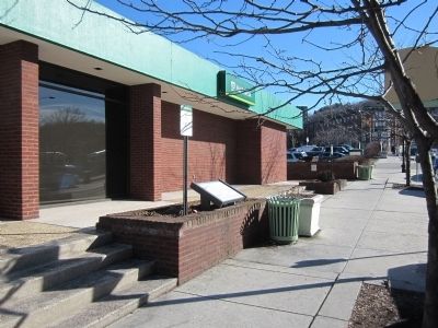
The . . . — — Map (db m171274) HM
About this sign
The outline drawing above represents the heritage-themed mural to your right. The mural is organized chronologically into sections. Each section is described here, with accompanying historic images..
Prior . . . — — Map (db m140051) HM
Downtown Cumberland
The Flood of March 29, 1924 inflicted almost $5 million worth of destruction in the City of Cumberland. Telephone, telegraph, roads and electric wires were washed away. Though not as bad, another flood occurred on May 12th . . . — — Map (db m139111) HM
Will's Creek Settlement, later known as Cumberland, served as a major gateway for trade, military campaigns against the French, and settlement beyond the mountains in our growing nation. "The New Storehouses" of the Ohio Company were across the . . . — — Map (db m17783) HM
In June 1863, Confederate Gen. Robert E. Lee ordered Gen. John D. Imboden to protect the army's left flank as it marched north through the Shenandoah Valley. Imboden was to draw Union forces into Hampshire County, West Virginia, and destroy . . . — — Map (db m139122) HM
Independence Day, July 4th, 1828, would be an important day for Cumberland, Maryland. On that day, far to the east, the Chesapeake and Ohio Canal and the Baltimore and Ohio Railroad both broke ground. The finish line of these companies' race was the . . . — — Map (db m67478) HM
Independence Day, July 4th, 1828, would be an important day for Cumberland, Maryland. On that day, far to the east, the Chesapeake and Ohio Canal and the Baltimore and Ohio Railroad both broke ground. The finish line of these companies' race was the . . . — — Map (db m140083) HM
Helmstetter's Curve remains one of the most favored and
photographed sites along the Western Maryland Railway.
Named for one of the early families that settled the area,
the "Curve” was constructed as part of the 1910-1912
86-mile railway . . . — — Map (db m170673) HM
This monument was erected in memory of the Irish laborers who died building the Chesapeake and Ohio Canal and the Baltimore and Ohio Railroad
1828 – 1850 — — Map (db m140190) HM
This great water - gap was discovered in 1755 by Lt. Spendelow, a naval officer with the ill - fated Braddock expedition. Cut by the stream now known as Wills Creek, widened by ages of frost and rain, and plunging down over 900 feet from the top of . . . — — Map (db m174246) HM
Opened July 1913
National Register of Historic Places
Listed June 1973
Presented by Preservation Society of Allegany County
September 1987 — — Map (db m60547) HM
Log Roll Overlook offers the hiker an enjoyable westward view of the Town Creek watershed and a view of three states. The overlook was named for logs that were rolled down the steep mountain slope in the late 1800s, to a sawmill on Town Creek. . . . — — Map (db m95911) HM
As seen on the right, the Cumberland and Pennsylvania Railroad Depot at Frostburg was constructed in 1891. The depot served as a passenger and freight station enroute between Cumberland, Maryland down the rich coal-mining region of Georges Creek to . . . — — Map (db m48853) HM
Years before St. Michael’s Church was built,
Meshach Frost and his wife Catherine purchased
this property in 1812. When the Frosts bought the
property, construction of the National Road was
already underway. They soon found they were
feeding . . . — — Map (db m3551) HM
Established: 1812
Elevation: 1820'
Population: 9,002
County: Allegany
Situated in the headwaters of the Georges Creek basin, Frostburg was settled in the early 1800's and served as a traveler's stop along the newly constructed National . . . — — Map (db m96390) HM
The National Road has sustained Frostburg for almost two centuries. As the road was being surveyed in 1811, Josiah Frost began laying out lots. Businesses, serving passing stagecoaches and wagons, soon lined a developing Main Street.
By the . . . — — Map (db m199906) HM
Years before St. Michael's Church was built, Meshach Frost and his wife Catherine purchased this property in 1812. When the Frosts bought the property, construction of the National Road was already underway. They soon found they were feeding and . . . — — Map (db m199913) HM
The Railroad had reached Frostburg in 1852 and by 1863, the Cumberland and Pennsylvania (C&P) line ran from Cumberland through Mt. Savage to Frostburg and down George's Creek across the Potomac River to Piedmont, West Virginia. This connected the . . . — — Map (db m96386) HM
Midway between the towns of Frostburg and Westernport stands the Lonaconing Iron Furnace - a mute reminder of a once important industry in the George's Creek valley.
The George's Creek Coal & Iron Company was founded in 1835. In 1836, an act of . . . — — Map (db m139083) HM
Robert Moses "Lefty" Grove was born in the Charlestown section of Lonaconing, Md., on March 6, 1900, to John and Emma Catherine (Beeman) Grove. Raised in a coal mining community during times of desperate poverty, young Grove had to abandon his . . . — — Map (db m167364) HM
In 1844, the first iron rails made in the United States were produced on this spot by the Mount Savage Iron Works. Erected in 1839, the iron works contributed extensviely to the development of the Mount Savage Community. — — Map (db m5846) HM
The first iron rails made in the United States were manufactured in 1844 at Mount Savage. Before that time all iron rails were imported from England. — — Map (db m445) HM
(preface) During the Civil War, retribution by one side for "atrocities” committed against civilians by the other quickly escalated. Confederate Gen. Jubal A. Early, during his 1864 Maryland invasion, demanded that several towns pay . . . — — Map (db m176330) HM
Herbert Edgar Sadler was born to a waterman's family in 1902. He began learning the trade at the age of 12, earning a penny for each fish he cleaned for a local seafood vendor. His experience led to a life's work on the water.
Cap'n Sadler . . . — — Map (db m170219) HM
During Parole's early years, the horse and wagon was a basic means of local transportation and livelihood. Many families sold vegetables from their horse-drawn wagons.
Gardening and farming were the main occupations for Camp Parole . . . — — Map (db m232511) HM
The Civil War
The Civil War had a major impact on the people of Anne Arundel County. As a border state, Maryland was home to both Confederate and Union sympathizers. Like Baltimore, Annapolis was occupied by Union troops during the Civil . . . — — Map (db m232510) HM
Iglehart
1708 Mansion Ridge Road
is listed on
National Register
of Historic Places
by the United States
Department of the Interior
c. 1811
— — Map (db m142375) HM
When Great Britain introduced tank warfare to the battlefields of World War I, the face of battle changed forever. By providing support to infantry attacks, the usefulness of tanks was proven. For this reason, on January 26, 1918, Brigadier General . . . — — Map (db m19703) HM
Named in 1921, formerly Wellham. Railroads have long been part of Ferndale’s history. The WB&A Railroad steamed through the neighborhood from 1888 to 1950, carrying as many as 1,750,000 passengers a year. With the historic spike pulling ceremony on . . . — — Map (db m3235) HM
This 19th century ticket booth, formerly known to local residents as "The Stoney Run Train Station," has been restored, preserved and re-dedicated by the Maryland Department of Transportation (MDOT) as a pedestrian gateway to the BWI Rail . . . — — Map (db m68389) HM
Built circa 1820, the Benson-Hammond House is the headquarters of the Ann Arundell County Historical Society and is open to the public.
Annapolis and Baltimore Short Line
Organized in 1880, the Annapolis and Baltimore Short Line ran its . . . — — Map (db m3161) HM
Growth of railways advanced the development of suburban communities in the early 20th century. Linthicum Heights was platted in 1908 along two interurban railroads by the Linthicum family to take advantage of direct transportation to Washington, . . . — — Map (db m8142) HM
WB&A Road was constructed on the right-of-way of the main line of the Washington, Baltimore & Annapolis Electric Railroad. Using the most advanced technology of the time, the high-speed line provided passenger and freight service between Baltimore . . . — — Map (db m35050) HM
In 1889, business partners Gustav T. Hetschel and Henry Frost established a general store and post office just steps away from the Annapolis and Baltimore Short Line Railroad. This new rail service connected the state's economic and political . . . — — Map (db m239533) HM
Jones Station was the eighth stop from Annapolis on the Baltimore & Annapolis Railroad and served as both a passenger and freight station. The railroad fueled growth in the Baltimore-Annapolis corridor by providing fast and frequent passenger . . . — — Map (db m76910) HM
Just a few yards from this spot on September 3, 1838, Frederick Bailey, later known to the world as Frederick Douglass, escaped from slavery in Baltimore by boarding a northern train. Frederick, 20 years old, was disguised as a sailor, carrying . . . — — Map (db m212892) HM
Through the efforts of the Canton Improvement Association this old and densely populated ethnic neighborhood was named to the National Register of Historic Places in 1978. The two-story red brick row houses are especially noteworthy for their hand . . . — — Map (db m184476) HM
Capitalist cooper purchased the captain John O'Donnell estate 3000 acres in Canton in 1920 and helped in funding the Canton Company of Baltimore that acted as a real estate and development company in transforming the Canton Company into a . . . — — Map (db m190368) HM
The Pennsylvania Railroad used this railroad transfer bridge to land cars that were transported on ferries between Locust Point and Canton. Known as "carfloating," this activity occurred in the Baltimore Harbor from 1871 to 1969. This two-story . . . — — Map (db m212895) HM
Capt. John O'Donnell, considered the founder of Canton, made his fortune trading in East Asia. Around 1875, he settled in the Canton area and named his plantation after the port city of Canton, China. Capt. O'Donnell became an enslaver, and the . . . — — Map (db m212897) HM
Canton Cove is directly in front of you. Here, schooners would wait before receiving the message to head to Fells Point to unload their cargo. The Inner Harbor, at that time, was a swamp and not navigable.
Fort McHenry is further out to the . . . — — Map (db m245857) HM
Douglass escaped slavery with a bold plan, a clever disguise, steady nerves, and help from his friends.
At the age of 20, Frederick Bailey (as he was called) lived under slavery in Fell's Point, one mile west of this marker. He was . . . — — Map (db m212894) HM
Baltimore’s Park Commission purchased portions of the Mount Clare estate between 1890 and 1907 to provide a large landscaped park for the city’s southwestern neighborhoods. The Olmsted Brothers firm helped the city develop plans to protect the . . . — — Map (db m41430) HM
Native Americans once traversed this stream where nearby at Gwynns Run in 1669, Richard Gwinn, the stream’s namesake, established a trading post. Next to the trail today is the nine-hole executive Carroll Park Golf Course, one of the five operated . . . — — Map (db m41426) HM
For more than one hundred years Carroll Park has served the historic Washington Village/Pigtown neighborhood, whose rowhouses once provided lodging for workers employed at the B&O Railroad, streetcar maintenance barns across the street (now used . . . — — Map (db m220061) HM
In the late 1760’s, the Mount Clare mansion was built by Charles Carroll, Barrister and his wife, Margaret Tilghman, as their summer home. The mansion was located on the grounds of the original plantation, Georgia, and included an orangery, . . . — — Map (db m2533) HM
Pennsylvania Station dates from the Gilded Age of architecture, when railroads were the economic force of the city and train stations were monuments of civic pride. This station, designed by Kenneth M. Murchison, opened the night of September 14, . . . — — Map (db m135066) HM
Recalling the elaborate rail system used during the Holocaust to transport millions of people to their deaths, the concrete monoliths symbolize two abandoned rail cars. Haunting messages, written by a survivor, are the only freight these rail . . . — — Map (db m183360) HM WM
Wendel Bollman, one of a handful of men who transformed bridge-building from an art into a science, was born on this site to German parents on January 21, 1814.
Largely self-educated, Bollman acquired his engineering knowledge and experience at . . . — — Map (db m7038) HM
This property was once known as City Dock, which was built in the early 1830s and used by ship and rail merchants. Living Classrooms Foundation, in partnership with Baltimore City, began to revitalize what is now the Living Classrooms East Harbor . . . — — Map (db m145577) HM
During the early 1800s, shipyards dotted Baltimore's harbor, drawing vessels in need of repair from waters up and down the Atlantic coast. Skilled shipwrights and carpenters performed a range of repairs from minor sail mending to complicated . . . — — Map (db m219640) HM
The Carrollton Viaduct carried the Baltimore & Ohio Railroad over the Gwynns Falls, its first malor stream crossing as it headed west from its Pratt Street terminus Completed in 1829, the 300-foot stone span is named for Charles Carroll of . . . — — Map (db m6391) HM
To escape the intolerable heat of Baltimore summers, Thomas Dekay Winans built this country house on land which he had purchased in 1855. Winans had recently returned from Russia, where he made a fortune supervising construction of the . . . — — Map (db m6404) HM
In the mid-1800s this meadow and hillside were part of Thomas Winans' country estate, the Crimea. After returning from Russia, where he helped build the St. Petersburg-Moscow railroad, Winans established this estate. He and his Russian-born wife, . . . — — Map (db m6336) HM
Orianda House, built in 1857 at a cost of $9,170.69, was designed by Niernsee and Neilson, architects. This country mansion was the summer home of Thomas de Kay Winans, a wealthy railroad entrepreneur, and his Russian-born wife, Celeste Louise . . . — — Map (db m61050) HM
The escape of Frederick Douglass in 1998 from slavery in Maryland was successfully carried out by Douglass jumping aboard the Philadelphia Wilmington and Baltimore train (PW&B RR) just as it was pulling out of the train depot in Canton. Douglass . . . — — Map (db m238123) HM
This land was once the magnificent estate of Thomas Dekay Winans, an engineer who made a fortune during the 1840's supervising the construction of the first Russian transcontinental railroad. The engineer named his estate "Alexandroffsky," in . . . — — Map (db m166997) HM
The Baltimore based artists selected for this exhibit were asked to reflect on the concept of connectivity as it relates to the railroad, our community, and our own identities. Each artwork responds to this idea from diverse perspectives, but . . . — — Map (db m243535) HM
The successive failures of the potato crops in the 1840’s, the inability or willingness of the British Parliament to respond to the ensuing famine, forced evictions of the peasants from their homeland by British landlords, epidemics and resulting . . . — — Map (db m101384) HM
In 1861, as the Civil War began, Baltimore secessionists hoped to stop rail transportation to Washington and isolate the national capital. On April 19, the 6th Massachusetts Regiment arrived here at the Philadelphia, Wilmington and Baltimore . . . — — Map (db m2418) HM
On April 19, 1861, Confederate sympathizers attacked the 6th Massachusetts Infantry Regiment as it changed trains en route to Washington, which the secessionists hoped to isolate. To learn more about the Baltimore Riot, the city's role in . . . — — Map (db m219588) HM
In 1861, as the Civil War began, Baltimore secessionists hoped to stop rail transportation to Washington and isolate the national capital. On April 19, the 6th Massachusetts Regiment arrived here at the Philadelphia, Wilmington and Baltimore . . . — — Map (db m219590) HM
On April 19, 1861, Confederate sympathizers attacked the 6th Massachusetts Infantry Regiment as it changed trains en route to Washington, which the secessionists hoped to isolate. To learn more about the Baltimore Riot, the city's role in . . . — — Map (db m247216) HM
A bubbling stream to hide their tracks. A boat upriver toward hope. Chesapeake waterways were vital to the Underground Railroad, a secret network of routes used to escape slavery. The same waters that carried captured Africans into ports for sale . . . — — Map (db m234755) HM
Baltimore was a late bloomer in colonial America. Chartered in 1729, the port grew rapidly after the Revolutionary War to become by 1800 the new nation’s third largest city. The harbor proved ideal for shipping grain from Central Maryland and flour . . . — — Map (db m102993) HM WM
Here on April 19, 1861 at 11 A.M. the Sixth Regiment of Massachusetts Infantry commanded by Colonel Edward F. Jones, detrained on its way to the relief of Washington City. The first nine cars were safely drawn to the Camden Street Station of the . . . — — Map (db m60937) HM
Completed in 1851, the President Street Station is an icon of railroad architecture, featuring Classical Revival elements and incorporating a barrel vault roof design—the first for a railroad station. Its history is also tied to significant . . . — — Map (db m145578) HM
Named for William Keyser who was the moving force behind the donation of the Homewood property to Johns Hopkins. He contributed 62 acres and also organized the donation of other land by Samuel Keyser, Francis M. Jencks, William H. Buckler, . . . — — Map (db m6122) HM
The Friends Meeting House is the oldest religious building in Baltimore. In 1781, the Patapsco Friends Meeting, formerly located on Harford Road two miles north of the Inner Harbor, moved to this site. In 1784 a group of Quakers established a school . . . — — Map (db m6282) HM
The development of the nation depended on transportation, and Baltimore led America in building the first long-distance railroad, one of the earliest commuter rail systems, and one of the first electric streetcar systems. Baltimore also contributed . . . — — Map (db m170976) HM
A monument to the golden era of rail travel, the Mount Royal Station enjoys a special place in the history of Baltimore and the nation—the home of the Baltimore & Ohio (B&O) Railroad and birthplace of American railroading. The history of the B&O . . . — — Map (db m208442) HM
By the middle of the twentieth century, the Mount Royal Station fell victim to the rise of the automobile and the decline of passenger rail service nationwide. The historic building’s deterioration threatened the future of the Mount Royal area, . . . — — Map (db m208444) HM
Hotel Revival stands in the historic district of Mount Vernon, a cultural hub and one of Baltimore's most iconic neighborhoods.
Formerly a private mansion, 101 W. Monument St. was the house of John W. Garrett, founder of the B&O Railroad, . . . — — Map (db m131341) HM
This imposing townhouse, built in 1853, was the home of Samuel Shoemaker, organizer of the Adams Express Company. The company that began in 1840 with one man and a satchel grew into a Goliath in the next few decades, serving every state and . . . — — Map (db m6015) HM
Railroads built office cars for officials directors, stockholders, and other wealthy patrons as early as the 1840s. Used for right-of-way inspection trips and other business travel, these rolling offices provided an observation platform, . . . — — Map (db m135963) HM
The
National Railway Historical Society
honors the
B&O Railroad Museum
on the 175th anniversary of beginning
construction of the
Baltimore & Ohio Railroad
on July 4, 1828
The museum is commended in its efforts to . . . — — Map (db m135945) HM
You are standing on the site of the Baltimore and Ohio Railroad’s Mount Clare Shops, a large industrial complex critical to maintaining every aspect of the railroad’s daily operations. Because of their strategic importance, the shops were among . . . — — Map (db m60965) HM
Located approximately one mile west along the B&O Railroad's right-of-way was the site of Baltimore's largest Civil War training camp. Known variously throughout the War as Camp Carroll and Camp Cheesebrough, it was located on property once owned . . . — — Map (db m135970) HM
This tablet is placed here in recognition of the enormous contribution made by
CSX Corporation
to the understanding and preservation of America's Railroad Legacy by its establishment of the B&O Railroad Museum as an independent and . . . — — Map (db m135947) HM
You are standing on the original right-of-way of the Baltimore & Ohio Railroad, the nations first commercial railroad to handle both freight and passenger service. This right-of-way stands on land donated to the railroad by James Carroll the . . . — — Map (db m135965) HM
This Stone presented by the Stone Cutters of Baltimore, in commemoration of the commencement of the Baltimore and Ohio rail road, was here placed on the Fourth of July, 1828, by the Grand Lodge of Maryland, assisted by Charles Carroll of Carrollton, . . . — — Map (db m243537) HM
On June 12, 1912, Luther G. Smith, a locomotive engineer for the Pennsylvania Railroad, founded the Brotherhood's Relief and Compensation Fund (BR&CF). The BR&CF, a non-profit corporation established in the Commonwealth of Pennsylvania, provides . . . — — Map (db m135949) HM
On 27 June 1895, at the nearby Howard Street Tunnel, the B&O demonstrated the first electrified main line railroad, and commercial operation began four days later. The electrification involved designing, engineering, and constructing electric . . . — — Map (db m135948) HM
The Mount Clare shops of the Baltimore and Ohio Railroad in front of you, built in the 1830s, were part of the B&O Railroad's nerve center during the Civil War, and the rail system was vital to Union victory. Imagine the shops shrouded in the . . . — — Map (db m243530) HM
During World War II, railroads quickly experienced a shortage of available coaches and sleeping cars as they moved an average of one million military personnel per month. In order to accommodate traffic, the federal government ordered durable . . . — — Map (db m135961) HM
For several decades in the early 1800s, thousands of Conestoga Wagons, “ships of inland commerce,” ruled the National Road. With their sloping bodies, wheels taller than a man and six-horse teams skillfully maneuvered with a single “jerk line,” . . . — — Map (db m5705) HM
Here in 1830, passengers on B&O horse-drawn cars stopped to eat at the Relay House.
Meanwhile, the relays of horses were changed for the remainder of the 13 mile journey between Baltimore and Ellicott’s Mills, hence the name Relay.
In 1835, a . . . — — Map (db m2502) HM
On the evening of March 31, 1969, America’s last Presidential funeral train-that of Dwight D. Eisenhower-rolled sadly out of Washington on its way to Abilene, Kansas. Its ten-car consist was undecorated in any way, and near its front, the body of . . . — — Map (db m101405) HM
“Steam’s finest hour” was one railroad writer’s summation of the superb locomotives built on the eve of the diesel era---and this sophisticated brute was one of the reasons why. An excellent example of “superpower” design, it was capable of . . . — — Map (db m60966) HM
The National Road was the first American highway funded by Congress. Construction began in 1811 for a 620-mile route starting at Cumberland, Maryland, and, by 1841, extending to Vandalia, IL. Designed for stagecoaches and Conestoga wagons taking . . . — — Map (db m243533) HM
The Underground Railroad was a network of American abolitionists who aided and sheltered 100,000 African Americans seeking freedom from enslavement in the South. These Freedom Seekers often journeyed north by land, and many crossed into the free . . . — — Map (db m243532) HM
African Americans played an integral role in American railroading from its inception. Slaves, and later freedmen, helped construct many of America's early southern railroads. By 1859, Baltimore had one of the highest populations of free African . . . — — Map (db m135950) HM
Prior to World War I, a small percentage of women worked for railroad companies as maids, car cleaners, and telegraph operators. The B&O hired its first women as car cleaners in 1855. As men left to fight overseas in the world wars however, the . . . — — Map (db m135944) HM
Remington shared its early history with other nearby communities that formed along the Jones Falls river. The mills build along the Falls, whose 260-foot drop powered grist mills, iron foundries and textile mills all played a key role in the . . . — — Map (db m166959) HM
Built in 1893 at a cost of $73,418.00, the Huntingdon Avenue Viaduct Bridge carried streetcar passenger on the Number 25 line, from pointes south through Remington, over Stony Run, and into Hampden. In 1859, then Baltimore Mayor Thomas Swann passed . . . — — Map (db m131339) HM
During the Baltimore Railroad Riots of 1877, the park served as an encampment for the MD 5th Regiment, where they helped guard the South Baltimore rail lines after assisting with the riots downtown. On August 1st the MD 5th put on an exhibition . . . — — Map (db m212920) HM
Is named for Baltimore's 19th Maror, Thomas Swann (1856-1860), who was the 33rd Governor of Maryland (1886-1869), and served in the U.S. House of Representatives (1869-1879). As a Congressman, he represented the 3rd and then the 4th Congressional . . . — — Map (db m212912) HM
The Gwynns Falls Trail follows a valley that has served as both a transportation avenue and an obstacle since the days of American Indians and European colonists. Early roads were privately owned turnpikes that charged tolls; they became public . . . — — Map (db m6352) HM
On April 19, 1861, Confederate sympathizers attacked the 6th Massachusetts Infantry Regiment as it changed trains en route to Washington, which the secessionists hoped to isolate. To learn more about the Baltimore Riot, the city’s role . . . — — Map (db m37538) HM
427 entries matched your criteria. The first 100 are listed above. Next 100 ⊳