After filtering for Minnesota, 312 entries match your criteria. The first 100 are listed. ⊳
Waterways & Vessels Topic
By McGhiever, September 29, 2022
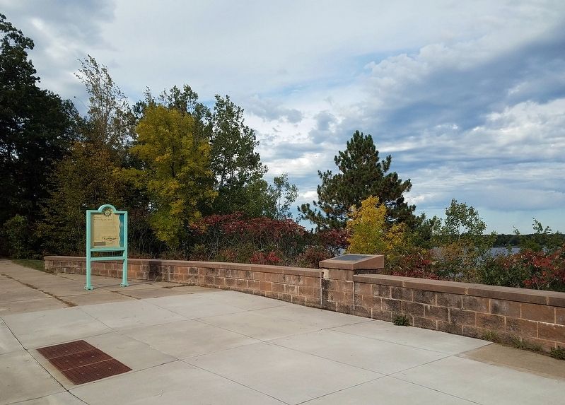
Markers at the Big Sandy Lake Wayside Rest scenic overlook
| 1 ► Minnesota, Aitkin County, Libby — Big Sandy Lake Reservoir — |
| On State Highway 65, on the right when traveling north. | |||
| 2 ► Minnesota, Aitkin County, Libby — The Ojibwe's Sandy Lake Journey — |
| On State Highway 65, on the right when traveling north. | |||
| 3 ► Minnesota, Aitkin County, Libby — Where River Roads Met — |
| On Minnesota Route 65, 0.2 miles south of 528th Lane, on the right when traveling north. | |||
| 4 ► Minnesota, Anoka County, Anoka — Bridging the Mississippi — |
| Near South Ferry Road, 0.3 miles east of South Ferry Street (U.S. 169). | |||
| 5 ► Minnesota, Anoka County, Anoka — Circle of Life — |
| Near South Ferry Road, 0.3 miles east of South Ferry Street (U.S. 169). | |||
| 6 ► Minnesota, Anoka County, Anoka — Highway of Exploration — |
| Near South Ferry Road, 0.3 miles east of South Ferry Street (U.S. 169). | |||
| 7 ► Minnesota, Anoka County, Anoka — Logbooms Meet Sawmills — |
| Near South Ferry Road, 0.3 miles east of South Ferry Street (U.S. 169). | |||
| 8 ► Minnesota, Anoka County, Anoka — River Highways — |
| Near South Ferry Road, 0.3 miles east of South Ferry Street (U.S. 169). | |||
| 9 ► Minnesota, Anoka County, Anoka — Rum River Dam — |
| Near North 2nd Avenue north of Jackson Street, on the left when traveling north. | |||
| 10 ► Minnesota, Anoka County, Anoka — Washburn Saw Mill — |
| On 2nd Avenue south of Harrison Street, on the right when traveling south. | |||
| 11 ► Minnesota, Anoka County, Anoka — Where Land and Water Meet — |
| Near South Ferry Road, 0.3 miles east of South Ferry Street (U.S. 169). | |||
| 12 ► Minnesota, Anoka County, Coon Rapids — Coon Rapids Dam Regional Park — Mississippi National River and Recreation Area-Partner Site — East Visitor Center — |
| On Egret Blvd. | |||
| 13 ► Minnesota, Becker County, Detroit Lakes — Detroit Lakes — A City with a Past — |
| On Frontage Road (U.S. 10) 0.1 miles south of North Shore Drive, on the right when traveling south. | |||
| 14 ► Minnesota, Beltrami County, Waskish — The Marina — |
| Near State Highway 72, on the left when traveling north. | |||
| 15 ► Minnesota, Beltrami County, Waskish — The Old Waskish Town Site — |
| Near Waskish Road NE (County Road 40) west of State Route 72. | |||
| 16 ► Minnesota, Big Stone County, Ortonville — A Glacial Wall of Water — |
| Near U.S. 12, 0.1 miles west of U.S. 75, on the left when traveling west. | |||
| 17 ► Minnesota, Blue Earth County, Mankato — Early European Explorers — Minnesota River Valley History Walk — |
| On Civic Center Plaza (Hickory Street) west of S. 2nd Street, on the right when traveling west. | |||
| 18 ► Minnesota, Blue Earth County, Mankato — Minnesota River Steamboating — |
| 19 ► Minnesota, Blue Earth County, Mankato — Native Americans — Minnesota River Valley History Walk — |
| On Civic Center Plaza (Hickory Street) at S. 2nd Street, on the right when traveling west on Civic Center Plaza (Hickory Street). | |||
| 20 ► Minnesota, Blue Earth County, Mankato — Navigating the River — Minnesota River Valley History Walk — |
| On Civic Center Plaza (Hickory Street) west of South 2nd Street, on the right when traveling west. | |||
| 21 ► Minnesota, Brown County, Hanska — Hanska — 1901 • 2001 — |
| On Broadway (State Highway 257) at 2nd Street East on Broadway. | |||
| 22 ► Minnesota, Brown County, Hanska — Lake Hanska — |
| Near County Road 11, 1.1 miles north of County Road 6, on the left when traveling north. | |||
| 23 ► Minnesota, Brown County, Hanska — Lake Hanska Pioneer / Lake Hanska County Park — A Tribute to Ole Synsteby 1856 – 1942 — |
| Near County Road 11, 1.1 miles north of County Road 6, on the left when traveling north. | |||
| 24 ► Minnesota, Brown County, Leavenworth — Jackson Crossing — |
| On County Road 24, 0.5 miles east of County Road 8, on the left when traveling east. | |||
| 25 ► Minnesota, Brown County, New Ulm — Harkin Store — |
| On County Road 21, 0.3 miles west of 661st Avenue, on the left when traveling west. | |||
| 26 ► Minnesota, Brown County, New Ulm — Upper Minnesota River Transportation — |
| On South Front Street north of 1st South Street, on the right when traveling north. | |||
| 27 ► Minnesota, Brown County, Sleepy Eye — Golden Gate Mill Stones — Millstones of Golden Gate, Minnesota — |
| On State Highway 4, 0.3 miles north of 295th Street, on the left when traveling north. | |||
| 28 ► Minnesota, Carlton County, Carlton — Henry C. Hornby — |
| Near State Highway 210, 3.9 miles east of State Highway 45, on the right when traveling east. | |||
| 29 ► Minnesota, Carlton County, Moose Lake — Geology of Minnesota — Moose Lake Region — |
| On Arrowhead Lane (State Highway 73) at Lakeshore Drive, on the right when traveling north on Arrowhead Lane. | |||
| 30 ► Minnesota, Carlton County, Wrenshall — Geology of the St. Louis River — |
| On Veterans Evergreen Memorial Drive (State Highway 23) at Line Road, on the right when traveling south on Veterans Evergreen Memorial Drive. | |||
| 31 ► Minnesota, Carver County, Watertown — Early Watertown History — |
| Near Mill Avenue Northeast, 0.1 miles north of Carter Street Northeast, on the left when traveling north. | |||
| 32 ► Minnesota, Cass County, Walker — "Big Enough to Keep" — Circle of Time — |
| On Minnesota Avenue West (State Highway 200/371) at 3rd Street, on the right when traveling east on Minnesota Avenue West. | |||
| 33 ► Minnesota, Cass County, Walker — "More Than Just A Fish Camp!" — Circle of Time — |
| On Minnesota Avenue West (State Highway 200/371) at 3rd Street, on the right when traveling east on Minnesota Avenue West. | |||
| 34 ► Minnesota, Cass County, Walker — Anchor of Northland Steamboat — |
| On Minnesota Avenue West (State Highway 200/371) at 3rd Street, on the right when traveling east on Minnesota Avenue West. | |||
| 35 ► Minnesota, Cass County, Walker, Shingobee Township — Paddlewheel of Leila D. — (c. 1895) — |
| On Minnesota Avenue West (State Highway 200/371) at 3rd Street, on the right when traveling east on Minnesota Avenue West. | |||
| 36 ► Minnesota, Cass County, Walker, Shingobee Township — Propeller of Chief of Duluth — (c. 1896) — |
| On Minnesota Avenue West (State Highway 200/371) at 3rd Street, on the right when traveling east on Minnesota Avenue West. | |||
| 37 ► Minnesota, Chippewa County, Granite Falls — A Witness to Time — |
| On U.S. 212, 2.1 miles east of State Highway 67, on the right when traveling east. | |||
| 38 ► Minnesota, Chisago County, Almelund, Wild River State Park — A Conservation Legacy — |
| 39 ► Minnesota, Chisago County, Almelund, Wild River State Park — End of an Era — |
| 40 ► Minnesota, Chisago County, Almelund, Wild River State Park — Looking For A Better Life — |
| 41 ► Minnesota, Chisago County, Almelund, Wild River State Park — The St. Croix River — |
| 42 ► Minnesota, Chisago County, Almelund, Wild River State Park — Timber! — |
| 43 ► Minnesota, Chisago County, Almelund, Wild River State Park — Who Was Here First? — |
| On the road to the boat launch, on the left when traveling east. | |||
| 44 ► Minnesota, Chisago County, Almelund, Wild River State Park — Wild River State Park — Minnesota State Parks — Windows on Minnesota's Landscapes — |
| 45 ► Minnesota, Chisago County, Harris — Minnesota's Arrowhead Region: A Tourist Mecca — |
| Near Interstate 35 at milepost 154,, 1.5 miles Stark Road (County Road 10), on the right when traveling north. | |||
| 46 ► Minnesota, Chisago County, Taylors Falls — First Settlement, buildings, steamboat — |
| On South Street at Traprock Street, on the left when traveling south on South Street. | |||
| 47 ► Minnesota, Chisago County, Taylors Falls — Saint Croix Falls Hydroelectric Project — "'Something is doing' that may be quite important." — |
| On St Croix Trail (State Highway 95) 0.3 miles south of Mulberry Street (County Highway 34), on the left when traveling south. | |||
| 48 ► Minnesota, Clay County, Georgetown — Old Georgetown Steamboats — |
| On County Highway 36, on the left when traveling west. | |||
| 49 ► Minnesota, Clay County, Hawley — Geology of Minnesota — Lake Agassiz — |
| Near Viking Trail (U.S. 10) at 5th Street, on the right when traveling east. | |||
| 50 ► Minnesota, Clay County, Moorehead — Bonanza Farms in the Red River Valley — Welcome to Minnesota — |
| On Interstate 94 at milepost 1 at 20th Street, on the right when traveling east on Interstate 94. | |||
| 51 ► Minnesota, Clay County, Moorhead — Douglas House — |
| On 4th Street S. close to U.S. 10, on the right when traveling west. | |||
| 52 ► Minnesota, Clay County, Moorhead — Red River Transportation / A Busy Port — |
| On U.S. 10, on the left when traveling west. | |||
| 53 ► Minnesota, Clay County, Moorhead — The First Bridge over the Red River — Historic Downtown Moorhead — |
| On 4th Street South just north of Main Avenue (U.S. 10), on the right when traveling north. | |||
| 54 ► Minnesota, Clearwater County, Shevlin — Itasca Lake — Source of the Mississippi River — |
| Near Park Drive, 0.5 miles County Highway 48. | |||
| 55 ► Minnesota, Clearwater County, Shevlin — Old Northwest Territory — The First Colony of the United States — |
| Near County Road 117, 0.3 miles south of County Road 122. | |||
| 56 ► Minnesota, Clearwater County, Shevlin — Patterson's Homestead — |
| Near County Road 117, 0.3 miles south of County Road 122. | |||
| 57 ► Minnesota, Clearwater County, Shevlin — Search for the Mississippi's Source — |
| Near County Road 117, 0.3 miles south of County Road 122. | |||
| 58 ► Minnesota, Cook County, East Cook — Canot du Nord (North Canoe) Replica — |
| Near South Gunflint Lake Road (County Highway 50) east of Gunflint Trail (County Highway 12). | |||
| 59 ► Minnesota, Cook County, East Cook — Gunflint Lake Scenic Overlook — Superior National Forest — |
| On Gunflint Trail (County Route 12) south of Gunflint Lake Road, on the right when traveling north. | |||
| 60 ► Minnesota, Cook County, Grand Marais — Cascade River Overlook — |
| On North Shore Scenic Drive (State Highway 61) 0.8 miles east of Cascade Beach Road (County Road 97), on the right when traveling east. | |||
| 61 ► Minnesota, Cook County, Grand Marais — Geology of Good Harbor Bay — |
| On North Shore Scenic Drive (State Highway 61) 2.3 miles east of County Road 7, on the right when traveling north. | |||
| 62 ► Minnesota, Cook County, Grand Marais — Grand Marais Harbor — The Wild North in Northeast Minnesota — |
| On Broadway Avenue, 0.2 miles south of Wisconsin Street, on the right when traveling south. | |||
| 63 ► Minnesota, Cook County, Grand Marais — Pulpwood Rafting — |
| On Broadway Avenue (County Highway 10) 0.1 miles south of Wisconsin Street, on the right when traveling south. | |||
| 64 ► Minnesota, Cook County, Grand Marais — The Grand Marais Harbor — |
| On North Shore Scenic Drive (State Highway 61) at Wisconsin Street, on the right when traveling east on North Shore Scenic Drive. | |||
| 65 ► Minnesota, Cook County, Grand Marais — The Point Interpretive Site — Superior National Forest — |
| Near Broadway Avenue, 0.2 miles south of Wisconsin Street, on the left when traveling south. | |||
| 66 ► Minnesota, Cook County, Grand Portage — The Grand Portage — |
| On Mile Creek Road (County Route 17) at Store Road (County Route 73), on the left when traveling south on Mile Creek Road. | |||
| 67 ► Minnesota, Cook County, Schroeder — Father Baraga 1846 — |
| Near State Highway 61, on the right when traveling north. | |||
| 68 ► Minnesota, Cook County, West Cook — History of Saganaga Lake — |
| On Sag Lake Trail (County Route 11) north of Gunflint Trail (County Route 12), on the right when traveling north. | |||
| 69 ► Minnesota, Cook County, West Cook — History of Saganaga Lake — |
| On Moose Pond Drive (County Route 81) north of Gunflint Trail (County Route 12) when traveling west. | |||
| 70 ► Minnesota, Cook County, West Cook — Portage Canoe Rest — |
| Near Moose Pond Drive (County Route 81). | |||
| 71 ► Minnesota, Crow Wing County, Garrison — Lake Mille Lacs Walleye — |
| On U.S. 169 near Central Street, on the left when traveling south. | |||
| 72 ► Minnesota, Crow Wing County, Garrison — Mille Lacs Lake — |
| On U.S. 169 at Central Street, on the left when traveling south on U.S. 169. | |||
| 73 ► Minnesota, Dakota County, Hastings — Enjoying the River — |
| Near Lock and Dam Road, 0.5 miles north of 2nd Street West, on the right when traveling north. | |||
| 74 ► Minnesota, Dakota County, Hastings — Geology of the Dakota County Region — |
| Near 11th Street West near Forest Street. | |||
| 75 ► Minnesota, Dakota County, Hastings — Going with the Flow — |
| Near Lock and Dam Road, 0.3 miles north of 2nd Street West, on the right when traveling north. | |||
| 76 ► Minnesota, Dakota County, Hastings — Hastings Grows — |
| Near 1st Street at Ramsey Street. | |||
| 77 ► Minnesota, Dakota County, Hastings — Living in the Water — |
| Near Lock and Dam Road, 0.3 miles north of 2nd Street West, on the right when traveling north. | |||
| 78 ► Minnesota, Dakota County, Hastings — Mississippi — |
| Near 1st Street near Ramsey Street. | |||
| 79 ► Minnesota, Dakota County, Hastings — Native Cultures — |
| Near Lock and Dam Road, 0.7 miles north of 2nd Street West, on the right when traveling north. | |||
| 80 ► Minnesota, Dakota County, Hastings — River Habitats — |
| Near Lock and Dam Road, 2 miles north of 2nd Street West. | |||
| 81 ► Minnesota, Dakota County, Hastings — Shaping the River — |
| On Lock and Dam Road, 1.2 miles north of 2nd Street West, on the left when traveling north. | |||
| 82 ► Minnesota, Dakota County, Hastings — Steamboats, Trains, and Barges — |
| Near 1st Street near Tyler Street. | |||
| 83 ► Minnesota, Dakota County, Lilydale — Changing Landscapes Through Time — |
| 84 ► Minnesota, Dakota County, Lilydale — Confluence of the Rivers — |
| 85 ► Minnesota, Dakota County, Lilydale — The Railroad and Mendota — |
| 86 ► Minnesota, Dakota County, Mendota — A Great River's Road / Mendota, the Meeting Place — |
| On Sibley Memorial Highway (State Highway 13) south of D Street, on the right when traveling south. | |||
| 87 ► Minnesota, Dakota County, Mendota Heights — Native American Peoples and Clues to the Past — |
| 88 ► Minnesota, Dakota County, South Saint Paul — Kaposia: Dakota Village on the Mississippi River — |
| 89 ► Minnesota, Dodge County, Claremont — Rice Lake--Old Village and Church — |
| On 585th Street (County Highway 20) 0.1 miles west of 105th Avenue, on the left when traveling west. | |||
| 90 ► Minnesota, Douglas County, Alexandria — Minnesota Watersheds — |
| On Interstate 94 at milepost 97 near State Highway 27, on the right when traveling east. | |||
| 91 ► Minnesota, Goodhue County, Frontenac — Frontenac — |
| On County 2 Boulevard (County Road 2) south of Garrard Avenue. | |||
| 92 ► Minnesota, Goodhue County, Frontenac — GD-FLC-054 — Lake Pepin's Shell Game / In Search of Summer — Great River Road Minnesota — |
| Near Great River Road (U.S. 61 / 63) at 315th Street, on the left when traveling south. | |||
| 93 ► Minnesota, Goodhue County, Red Wing — The Sea Wing Disaster / Victims of the Sea Wing Disaster — |
| Near Broad Street at Levee Road. | |||
| 94 ► Minnesota, Goodhue County, Welch, Vasa Township — The Belle Creek Watershed — |
| Near the Cannon Valley Trail east of County 7 Boulevard, on the right when traveling east. | |||
| 95 ► Minnesota, Goodhue County, Zumbrota — Zumbrota — |
| On Main Street, 0.1 miles south of Jefferson Drive, on the right when traveling north. | |||
| 96 ► Minnesota, Hennepin County, Bloomington, East Bloomington — Minnesota River Valley — |
| Near Clinton Avenue South. | |||
| 97 ► Minnesota, Hennepin County, Brooklyn Park — How the Dam Works — |
| Near Russell Avenue North / West River Road, 0.7 miles north of 97th Avenue North, on the right when traveling north. | |||
| 98 ► Minnesota, Hennepin County, Edina, Golf Terrace Heights — A Creek, a Cause and Some Cows: Add Together, What Do You Get? — |
| Near W. 50th Street east of Browndale Avenue, on the right when traveling east. | |||
| 99 ► Minnesota, Hennepin County, Fort Snelling — River Valleys Take Shape / A Strategic Advantage / Making a Safe Landing — Fort Snelling State Park — Where Rivers and People Come Together — |
| Near the Minnehaha Trail north of Snelling Lake Road, on the right when traveling north. | |||
| 100 ► Minnesota, Hennepin County, Fort Snelling — Welcome to Fort Snelling State Park — |
| On Minnehaha Park Drive at E. 54th Street, on the left when traveling south on Minnehaha Park Drive. | |||
312 entries matched your criteria. The first 100 are listed above. Next 100 ⊳