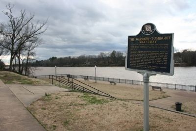
From 1887-1915, seventeen locks and dams were constructed on the Warrior - Tombigbee Rivers. The first 3 were built on the fall line in Tuscaloosa. This was the site of No. 3, later No. 12.
The Warrior - Tombigbee Development Association, . . . — — Map (db m28786) HM
Named for Thomas Bassett, a British Loyalist and native of Virginia. Migrated to Tombigbee area from near Augusta, Ga. circa 1772 to escape persecution by American patriots. Received in 1776, from King George III, a grant of 750 acres on the west . . . — — Map (db m122336) HM
Athabascans were highly nomadic, traveling in small groups to fish, hunt, and trap.
Athabascan territory, the largest area of all the Alaska Native peoples, was home to 11 different linguistic groups who lived along five major riverways: the . . . — — Map (db m72795) HM
Commercial farming of Atlantic salmon using ocean net pens is important to the economy in several areas of the Pacific Northwest, especially along the coast of British Columbia.
However, net pen fish farming has been banned in Alaska since 1990 . . . — — Map (db m70735) HM
James Cook was born in Yorkshire, England, on October 27, 1728. He was apprenticed to serve on sailing ships built in Whitby, near his birthplace, to carry coal along the English coast. At age 26, he joined the Royal Navy, took part in actions . . . — — Map (db m72493) HM
1 to 4 years in fresh water
Most coho migrate to sea after one or two years in fresh water.
Sept 1-Nov 15 The adult cohos are the last of the Pacific salmon to arrive in the river to spawn.
Nov 15-April 1 The eggs incubate over the winter. . . . — — Map (db m70734) HM
Captain E.T. Barnette, a passenger on the riverboat Lavelle Young, debarked near this site on August 26, 1901, and established a trading post which in 1902 became known as Fairbanks.
Alaska Centennial 1867-1967
State of Alaska
Governor Walter J. . . . — — Map (db m59831) HM
Dredges were brought in to mine gold-bearing deposits in the Fairbanks mining district after 1920. This bucket-line or ladder dredge has 68 buckets, each with a capacity of 6 cubit feet. The bucket line was driven by a 150 horsepower motor that . . . — — Map (db m144242) HM
On November 16, 1973, through Presidential approval of pipeline legislation, Alyeska Pipeline Service Company received permission to begin construction of the 800-mile trans Alaska pipeline, its pump stations and the Marine Terminal at Valdez. . . . — — Map (db m20215) HM
Because Juneau cannot be reached by road, the waterfront has always been Juneau's doorway to the outside world. Today travelers and freight continue to arrive at this waterfront by sea and air.
The first vessels on the Gastineau Channel were the . . . — — Map (db m181775) HM
The Cape Decision lighthouse was the last one built in Alaska. Need for it grew as ship traffic and the size of the ships increased. Southeast Alaska was booming with many salmon canneries, herring salteries and whale oil reduction plants. Large . . . — — Map (db m181646) HM
Facing the open Gulf of Alaska, Cape Saint Elias lighthouse stands on Kayak Island, where in 1741, Russian voyagers first set foot on North American soil. The Cape's bald pinnacle serves as a key landmark in daylight. The light provides guidance at . . . — — Map (db m181632) HM
Scotch Cap and Cape Sarichef lighthouses mark the north and south entrances to Unimak Pass in the Aleutian Islands. Both sites were declared to be too isolated for family life.
Scotch Cap was the first light on Alaska's outside coast and is the . . . — — Map (db m181636) HM
Cape Spencer lighthouse stands on a barren, isolated rock at the entrance to Cross Sound, where the sheltered Inside Passage meets the open Gulf of Alaska. The original lighthouse still stands. It is a single-story, reinforced concrete building that . . . — — Map (db m181631) HM
Eldred Rock is the oldest original lighthouse still standing in Alaska. It is a two-story building topped by a light tower. The ground floor was built of reinforced concrete, the first time that material was used for a lighthouse facing Alaska's . . . — — Map (db m181635) HM
Southeast Five Finger was the first name given this lighthouse site due to its location on the southeastern-most island of the Five Finger Islands group. The original, wood boathouse and carpenter shop remain.
A keeper thawing frozen water pipes . . . — — Map (db m181645) HM
The waterfront was the center of regional air transportation because float-planes were so well-suited for reaching the outlying places they served. There is little flat terrain in Southeast Alaska, and it was hard to find a place for a wheeled . . . — — Map (db m181803) HM
Although most materials needed by the historic mining industry came in downtown, one important commodity was off-loaded at the Dupont Dock, about 5 miles south of town. Dynamite was considered too much of a threat to deliver to the town's commercial . . . — — Map (db m181783) HM
A square, white wooden tower housed the Guard Islands light, with a separate keeper's house nearby. When a reinforced concrete building replaced the old light tower in 1922, a second house was built so two keepers could live there with their . . . — — Map (db m181640) HM
For more than 100 years, lighthouses have guided mariners through Alaskan waters.
Lighthouses capture our imagination as lonely sentinels of the sea. They played a vital role in Alaska's development because for more than 70 years, ships . . . — — Map (db m181647) HM
Widely spaced along Alaska's Inside Passage, these three lighthouses were among the first built, and the first discontinued.
The lighthouse on Lincoln Rock, near Ketchikan, was unusually difficult to build. The small, rocky pinnacle on which it . . . — — Map (db m181637) HM
Panel 1:
The City and Borough of Juneau Assembly Honors the Contributions of Filipinos in Juneau by naming this downtown location MANILA SQUARE
Juneau Assembly Members: Dale Anderson - Don Etheridge, Jr. - Jeannie Johnson - Ken . . . — — Map (db m68849) HM
Local ferries once plied a triangular route linking Juneau, Douglas, and Thane. These three communities, each centered on a major mine, eventually merged into one. In 1935, a bridge was constructed linking Douglas Island with the mainland.
In . . . — — Map (db m181794) HM
The lighthouse on Mary Island is the second one seen by ships heading up Alaska's Inside Passage. The beacon guides mariners into Revillagigedo Channel leading to Ketchikan. Like most of Alaska's lighthouses, it was built soon after the Klondike . . . — — Map (db m181642) HM
Steamships brought passengers as well as goods. During the heyday of steam travel, there was a ship at the dock almost every day. In 1918, the Canadian Pacific Line's Princess Sophia was bound for this harbor when the ship foundered on a reef . . . — — Map (db m181792) HM
Ships arriving in Juneau in the 1930's could count on being met at the dock by a small, white dog named Patsy Ann. A local dentist, Dr. E.H. Kaser, brought the English bull terrier as a puppy from Portland, Oregon in 1929. Although loved and . . . — — Map (db m181734) HM
Fifty years after Patsy Ann met her last ship, admirers led by June Dawson organized the Friends of Patsy Ann. The group raised funds and commissioned a statue so Patsy Ann could once again greet visitors on the dock.
Sculpted by Ann Burke . . . — — Map (db m69663) HM
The red-roofed, white buildings at Point Retreat are a familiar sight to local boaters and passengers on cruise ships sailing between Juneau and Glacier Bay. The original, wooden light tower at Point Retreat was only 6 feet tall, but it stood 19 . . . — — Map (db m181638) HM
Sentinel Island Lighthouse guards the entrance to Favorite Channel, linking Lynn Canal to Juneau's Auke Bay. The original, wood frame structures included a keeper's house with an attached light tower and out-buildings, including a wharf and . . . — — Map (db m181644) HM
Tree Point is Alaska's most southerly of the Southeast lighthouses. It marks the first landfall for northbound ships crossing Queen Charlotte Sound, 30 miles of coastal water open to the Pacific. Mariners used Tree Point Lighthouse to guide them . . . — — Map (db m181641) HM
The U.S. Navy's arrival in Juneau quickly followed the discovery of gold. Upon receiving word of the 1880 strike, the navy dispatched a steam launch, which anchored in the harbor. Disembarking here was a naval detachment under the command of Lt. . . . — — Map (db m181802) HM
Center Marker Panel: [Rendering of the cruiser USS Juneau(CL-52)]
'Lest We Forget'
The Naval Battle of Guadalcanal was as ferocious and decisive as any battle of World War II. It was not won cheaply. The night action of Friday . . . — — Map (db m77160) WM
Waterfront cold storage buildings supported the fishing industry while warehouses stored the freight that came and went. All goods coming into town — from the nuts and bolts of industry to walnuts and bolts of calico — were offloaded here. Outbound . . . — — Map (db m181784) HM
Pelton wheels are among the most efficient types of water wheels. It was invented by Lester Allan Pelton (1829-1908) in the 1870s, and is an impulse machine, meaning that it uses Newton’s second law to extract energy from a jet of fluid. It . . . — — Map (db m70762) HM
The Politics of Prohibition pitted the U. S. Constitution's well-meaning 18th Amendment — which banned the manufacture, sale or transportation of liquor — against the ingenuity of the moonshiners and bootleggers who found ways to satisfy the . . . — — Map (db m182102) HM
The Revenue Cutter McCulloch is docked near Northern Machine Works (left) and a Japanese barkentine is at anchor on the south end of the wharf near the Ketchikan Spruce Mills (right) to purchase fish. Also visible is St. John's Episcopal . . . — — Map (db m181984) HM
For thousands of years, water has been the common highway for all Northwest Coast Natives. Living at the edge of dense rain forests of great cedar, spruce, and hemlock along one of the world's richest sea coasts, their dependence upon seafood . . . — — Map (db m181977) HM
[Left side, top to bottom]
(Top photo) Illegible
The young city of Ketchikan (remainder illegible)
The Sideboard Saloon was operated by town co-founder Mike Martin from early in the century until 1917, when the . . . — — Map (db m181993) HM
Hundreds of proud sailing vessels once plied Alaskan waters, but the passing of the wail was swift & complete. As the new Era of the Steamship began to dominate the sea lanes in the late 1890's, Alaska's booming early salmon trade inspired the . . . — — Map (db m181943) HM
Prior to the 1870s, only a hardy handful of explorers, traders, whalers and sealers worked Alaska's rugged coastline. Following the 1867 purchase of the Territory from Russia, regular boat service from U.S. ports to Sitka began on a monthly . . . — — Map (db m181965) HM
Widely used today on the Yukon and Copper Rivers, the fishwheel was introduced in Alaska near the turn of the 20th century. It is thought to have been prominent in the Pacific Northwest, particularly the Columbia River, prior to making its way to . . . — — Map (db m173903) HM
has been designated a
National
Natural Landmark
This site possesses exceptional value
as an illustration of the nation's natural
heritage and contributes to a better
understanding of the environment
1972
National Park Service . . . — — Map (db m185282) HM
Pottery fragments found around Apache Spring suggest it was used by prehistoric Mogollon Indians before the Apache arrived. Journals of early Spanish explorers described Apache trails radiating from the spring. The Butterfield Trail was constructed . . . — — Map (db m100823) HM
The first Chief Topographic Engineer of the U.S. Geological Survey • 1919-1929 and the first President of the American Society of Photogrammetry • 1934 He headed a Geological Survey expedition through the Grand Canyon in 1923 to acquire information . . . — — Map (db m157000) HM
The Kolb Brothers: daring, persistent, Grand Canyon legends. Their studio stands before you.
Ellsworth Kolb arrived here in 1901, Emery in 1902. First located in a tent, their photo business grew with Grand Canyon tourism. They eventually . . . — — Map (db m39549) HM
”the Grand Canyon of the Colorado will give the best geological section on the continent.” —John Wesley Powell, 1868 The “geological section” described by John Wesley Powell is a vertical cross . . . — — Map (db m156995) HM
John Deering (Bih Bitoodnii Nez) born 1870 of the Deer Water Clan, his wife Susie Deering, born in 1878, of the Maii Deeshgiizhinii Clan, and their nine children, pioneered the areas of the Gap, Copper Mine, Cedar Ridge, Bitter Spring, Page, Marble . . . — — Map (db m189730) HM
From 1872 to 1929
principal route of travel
across the Colorado River
to Utah Settlements
First crossing made at the mouth of Paria Creek in 1864 by Jacob Hamblin. Regular ferry established by John Doyle Lee in 1872. Purchased by . . . — — Map (db m41998) HM
Because of long, deep canyons, Lees Ferry was the best crossing point along 500 miles (800 km) of the Colorado River.
In 1873, Mormon Church members opened a wagon road from Kanab, Utah, and built a ferryboat here. John D. Lee was the first . . . — — Map (db m41999) HM
Northern gateway to Arizona for 54 years - from 1873 to 1927 - is located six miles upstream from this bridge.
This monument erected to the founder
John Doyle Lee
who, with superhuman effort and in the face of almost insurmountable . . . — — Map (db m94892) HM
John D. Lee settled here in Dec. 1872 and established ferry service thirteen months later. After her husband's death, Warren M. Johnson ran the oar-driven ferry for Emma Lee, 1875 to 1879, when the Church of Jesus Christ of Latter-Day Saints . . . — — Map (db m41997) HM
Lewis Nez, born 1900 of the To’di’chi’i’nii (Bitter Water) Clan. He married twice, first to Fannie and second to Bessie Betoney. He had ten children. He was employed by the Cedar Ridge Trading Post. He was responsible for hauling supplies, U.S. . . . — — Map (db m189731) HM
Colorado River Storage Project
In recognition of the vision of the Colorado River Storage Project Act of 1956 and the significant contributions the act has made to the development of the Upper Colorado River Basin states, this plaque . . . — — Map (db m40350) HM
Concrete Bucket
This is one of several concrete buckets that poured the concrete in Glen Canyon Dam. Each bucket held 24 tons (22 metric tons) of concrete and it took over 400,000 buckets to complete the dam. The first pour of concrete . . . — — Map (db m40342) HM
A slightly larger, but reasonable replica of the 16 ft. pine rowboat in which Major John Wesley Powell first explored the canyons of the Colorado River in 1869. This craft was constructed by Walt Disney Productions and used in the river running . . . — — Map (db m40323) HM
Dedicated by
the First Lady
Mrs. Lyndon B. Johnson
September 22, 1966
United States Department of the Interior
Stewart L. Udall, Secretary
Bureau of Reclamation
Floyd E. Dominy, Commissioner
[The following marker is inside the . . . — — Map (db m40370) HM
Glen Canyon Dam and other dams along the Colorado River provide critical water and power resources for millions of Americans in the Southwest. Recreation at the reservoirs is enjoyed by visitors from around the world.
Turbine Runner
This . . . — — Map (db m40344) HM
The eight small "buildings" on the upstream face of the dam contain equipment to operate the penstock gates. Each penstock is 15 feet (4.6 meters) in diameter and carries water to one of the turbine generators in the powerplant. — — Map (db m40349) HM
Major John Wesley Powell 1834-1902 Explorer of the Colorado River 1869 and 1871-72 On August 3, 1869, Powell wrote in his journal: ”…we have a curious ensemble of wonderful features — carved walls, royal arches, glens, alcove . . . — — Map (db m155893) HM
Rock Bolts
Since Navajo sandstone tends to fracture vertically, rock bolts lock rock slabs together, thereby minimizing rock falls into the canyon. These bolts extend from 45 to 75 feet (14-23 meters) into the canyon wall. They are assembled . . . — — Map (db m40346) HM
This stainless steel turbine runner was removed in 1989 from the Bureau of Reclamation's Crystal Dam Powerplant in Montrose, Colorado. Weighing about 8½ metric tons, it is the rotating part of a Francis-type reaction turbine (named after its . . . — — Map (db m40371) HM
Hydroelectric power is produced when water under pressure flows through electrical generating equipment. Water entering the turbine flows through a series of louvers called wicket gates arranged in a ring around the turbine inlet. The amount of . . . — — Map (db m155898) HM
Perhaps people living here 800 years ago called this place Wupatupqa ("long canyon"), as it is known to some of their descendants, the Hopi. It was no doubt known as a place of abundance, given its wealth of plant and animal life and the . . . — — Map (db m61305) HM
During the spring thaw, snowmelt rumbled through the narrow passage below you. Water flowed again during the summer monsoon. Shaded pools held precious water after the flow ebbed. Walnut Creek was the lifeblood of the community.
Still, people . . . — — Map (db m61356) HM
This pass was used by Kearny's Army of the West in a march to California in 1846. Guided by Kit Carson it was described in a journal of the trip as "Carson's Old Trail”. The pass led around the impassable canyon on the Gila River where . . . — — Map (db m28045) HM
The Salt River begins high in the White Mountains as runoff from melting snow, finding its way into streams and creeks that eventually form the White and Black rivers. The confluence of the two rivers marks the beginning of the Salt.
Early . . . — — Map (db m34110) HM
Before dam modifications could begin, a $21.3 million bridge was built to relocate traffic off the top of Roosevelt Dam. Roosevelt Lake Bridge is the longest two-lane, single-span, steel-arch bridge in North America. The bridge, spanning 1,080 feet . . . — — Map (db m134161) HM
Over six million years ago, the mountains surrounding you were lifted skyward. As they rose, the land in between sank, creating the valley known as Tonto Basin.
Melting snow and summer rains drain from the vast Salt River watershed toward the . . . — — Map (db m34111) HM
Built by
The United States of America
Department of Interior
Bureau of Indian Affairs
Irrigation Service
Calvin Coolidge
President of the United States of America
Roy O. West Secretary of the Interior • Hubert Work Secretary of . . . — — Map (db m81530) HM
After nearly nine years of work, $430 million in construction cost, 450,000 cubic yards of concrete, and 849 miles of reinforcing steel, another vivid chapter in Arizona history has been rewritten. Modifications to Roosevelt Dam were required . . . — — Map (db m34107) HM
The construction of Roosevelt Dam involved several thousand people over the course of the project. Hiring was straightforward; a foreman would simply size up a man and decide if he could do the work. Jobs requiring diverse skills were plentiful. . . . — — Map (db m34108) HM
Main Marker - Side A:
The Historic Gillespie Dam Bridge spans the Gila River on Old US 80 Highway, between the communities of Arlington and Gila Bend. Built in 1927 as a Federal Aid Project, the bridge is a unique and elegant reminder of . . . — — Map (db m54936) HM
He knew no yesterdays
His living was for tomorrow
Founder of the town of Chandler
Built the San Marcos Hotel
Arizona’s first veterinarian
Father of modern irrigation system
Pioneer rancher and developer of the southside area of . . . — — Map (db m70990) HM
The water for Sahuaro Ranch came by gravity flow from the Arizona Canal, located about two miles to the north. It was carried from the canal by a ditch on 59th Avenue known as Lateral 18 and then flowed onto the ranch through smaller ditches such . . . — — Map (db m40706) HM
Born August 23, 1839 – New Harford, New York
Died April 17, 1923 – Phoenix, Arizona
Buried Greenwood Cemetery
Murphy came to Arizona from Illinois in 1880, to build a section of the Atlantic and Pacific (Santa Fe) Railroad. In . . . — — Map (db m30433) HM
In memory of the gallant men who gave their lives on December 7, 1941 on the Battleship U.S.S.
Arizona during the attack on Pearl Harbor
Dedicated December 7, 1976
The Honorable Raul H. Castro, Governor of Arizona
The contributions . . . — — Map (db m26425) HM
The upper 26 feet of the mast before you is the top
portion of the main mast of the U.S.S. Arizona and is
known as the signal mast or "pig-stick".
The battleship U.S.S. Arizona (BB 39) was sunk at Pearl
Harbor on December 7, 1941. The . . . — — Map (db m26610) HM
At this site
in the Spring of 1868
S. (Frenchy) Sawyer
Built the first farm dwelling and harvested the first cultivated crop (barley) in the Anglo-American occupation of the Salt River Valley. These same fertile acres had been irrigated . . . — — Map (db m30402) HM
This historic water tower for Producers Cotton Gin was first erected in 1952 on the corner of Ellsworth and Cloud Roads in Queen Creek. The landmark in Queen Creek was getting ready to be torn down but was quickly moved to Schnepf Farms in 1999 to . . . — — Map (db m94479) HM
Established in 1871, when the Salt River was a flowing stream and a barrier to travel the ferry was held on course by a wire cable taut across the river. It was an important link in settling the southwest.
Built and operated by
Charles . . . — — Map (db m27584) HM
A Memorial Tribute
to
Anson Smith
1860 - 1935
Editor and Publisher of the Mohave County Miner, acclaimed by President Herbert Hoover for his tireless efforts and support during construction of Boulder Canyon Project and the location of . . . — — Map (db m46819) HM
Commercial steamship transportation on the Colorado River was of great importance from 1852 through 1877. It served the mining communities of Northern Arizona. Cargo was unloaded at Hardyville, 1 ½ miles south of this point, sometimes returning . . . — — Map (db m29338) HM
Here on August 28 1869, Seneca Howland, O.G. Howland and William H. Dunn separated from the original Powell party, climbed to the north rim and were killed by the Indians.
For further authentic information see “Colorado River . . . — — Map (db m155772) HM
Pioneer in the path of empire hero of the War with Mexico, lieutenant in United States Navy. Appointed general by the Governor of California. Commanded exploration of wagon route to the Colorado River, with the only camel train in American History . . . — — Map (db m32208) HM
You are looking into Black Canyon and a narrow,
river-like portion of Lake Mohave. To your left, about 59
miles downstream, is Davis Dam. To your right, 11 miles
upstream, is Hoover Dam. The U.S. Government built
the dams to tame the periodic . . . — — Map (db m111185) HM
With its rugged mountains, deep canyons, stark deserts, and two large blue lakes, America's first national recreation area is a place of great contrasts. Lake Mead National Recreation Area (NRA) was established in 1964, well after the waters of the . . . — — Map (db m193366) HM
This crossing, first noted early in the 1850s in journals and maps of explorers along the 35th parallel, is the only convergence of major travel routes on the Little Colorado River. It lies on the trail used by Mormon immigrants journeying from Utah . . . — — Map (db m32722) HM
This date medallion is from the Winslow Bridge that once spanned the Little Colorado River on historic Route 66 just east of Winslow. Because the river had always proved a daunting impediment to travelers, this bridge crossing became a strategic . . . — — Map (db m32781) HM
You are looking at the San Pedro River Valley. The San Pedro River flows north to the Gila River, which ultimately meets the Colorado River and heads south to Mexico and the Gulf of California. The river supports riparian vegetation that provides . . . — — Map (db m131232) HM
[ Four markers are mounted on the four sides around the base of the monument. ]Side A:
Southern Pacific Railroad Map
Epes commanded the "Randolph Lines" that connected Phoenix and southern Arizona's outlying communities . . . — — Map (db m38936) HM
The bell in this clock tower is one of the two original ship's bells salvaged from the battleship U.S.S. Arizona following the attack on Pearl Harbor, December 7, 1941. In 1944, Wilber L. "Bill" Bowers, UA Class of 1927, discovered the bell . . . — — Map (db m31199) HM
On September 20, 1906 the first stone was laid in place. Over the next five years, 350,000 cubic feet of block would be cut, shaped, and fashioned into the Roosevelt Dam.
The blocks of stone were carved out of the canyon walls. They were . . . — — Map (db m34106) HM
This entrance marker is constructed of hand-hewn blocks which once made up the façade of Roosevelt Dam. They were given to the Superstition Mountain Historical Society by the United States Bureau of Reclamation. The larger blocks weigh upwards of . . . — — Map (db m34060) HM
Lifeline
Beaver Creek has always been a major focus of life in the Verde Valley. Prehistoric Sinagua farmers constructed Montezuma Castle and other structures near the creek. They dug ditches to carry creek water to irrigate the fields of . . . — — Map (db m40868) HM
American History in Arizona is quite recent, although the history of the Native American, Spanish and Mexican occupation periods are much older. Encampments of Native Americans were drawn to the creeks, which offered a fairly reliable source of . . . — — Map (db m33064) HM
The Water Table By March of 1881, fire wells like this one were hand-dug on the four corners of the Courthouse Plaza. At the time, the water table was high enough to allow bucketing of water for fire emergencies. These wells were abandoned . . . — — Map (db m157663) HM
The City of Prescott had its beginnings in the Spring of 1863 when a party of explorers and would-be gold miners led by the famed Joseph R. Walker arrived near the headwaters of the Hassayampa River. On May 10, 1863, at a location some six miles . . . — — Map (db m20623) HM
14551 entries matched your criteria. Entries 201 through 300 are listed above. ⊲ Previous 100 — Next 100 ⊳