14641 entries match your criteria. Entries 201 through 300 are listed.⊲ Previous 100 — Next 100 ⊳
Waterways & Vessels Topic
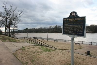
By Tim Carr, March 13, 2010
The Warrior-Tombigbee Waterway Marker
| 201 ► Alabama, Tuscaloosa County, Tuscaloosa — The Warrior-Tombigbee Waterway — |
| Near Jack Warner Parkway Northeast north of Hackberry Lane. | |||
| 202 ► Alabama, Tuscaloosa County, Tuscaloosa — U.S.S. Tuscaloosa (CA 37) — |
| On McFarland Boulevard East (U.S. 82), on the right when traveling north. | |||
| 203 ► Alabama, Washington County, Wagarville — Bassetts Creek — |
| On Jefferson Davis Highway (U.S. 43) 0.4 miles south of Sullivan Lane, on the right when traveling south. | |||
| 204 ► Alaska, Anchorage — Ancient Traditions of the Athabascan People — |
| Near Heritage Center Drive. | |||
| 205 ► Alaska, Anchorage — Atlantic Salmon-A Threat to the Chugach National Forest? — |
| On Portage Glacier Road. | |||
| 206 ► Alaska, Anchorage — Captain James Cook — R.N., F.R.S. — Navigator, Explorer, Chartmaker, Scientist, Humanist / 1728 – 1779 — |
| Near L Street. | |||
| 207 ► Alaska, Anchorage — Coho Salmon Life Cycle — |
| On Portage Glacier Road. | |||
| 208 ► Alaska, Fairbanks North Star Borough, Fairbanks — Barnette's Landing — |
| On 1st Avenue near Cushman Street. | |||
| 209 ► Alaska, Fairbanks North Star Borough, Fairbanks — 83 — Gold Dredge No. 8 — Gold Stream Valley 1928 - 1959 — National Historic Mechancial Engineering Landmark — |
| Near Old Steese Highway. | |||
| 210 ► Alaska, Fairbanks North Star Borough, Fairbanks — Pipeline History — |
| Near Steese Highway (at milepost 8.4), on the right when traveling north. | |||
| 211 ► Alaska, Juneau Borough, Juneau, Downtown Juneau — Beginnings — Sea & Sky: Juneau's Links to the World — |
| Near Marine Way. | |||
| 212 ► Alaska, Juneau Borough, Juneau, Downtown Juneau — Cape Decision — |
| Near Marine Way. | |||
| 213 ► Alaska, Juneau Borough, Juneau, Downtown Juneau — Cape Saint Elias — |
| Near Marine Way. | |||
| 214 ► Alaska, Juneau Borough, Juneau, Downtown Juneau — Cape Sarichef & Scotch Cap — |
| Near Marine Way. | |||
| 215 ► Alaska, Juneau Borough, Juneau, Downtown Juneau — Cape Spencer — |
| Near Marine Way. | |||
| 216 ► Alaska, Juneau Borough, Juneau, Downtown Juneau — Eldred Rock — |
| Near Marine Way. | |||
| 217 ► Alaska, Juneau Borough, Juneau, Downtown Juneau — Five Finger — |
| Near Marine Way. | |||
| 218 ► Alaska, Juneau Borough, Juneau, Downtown Juneau — Floating Hangars — Sea & Sky: Juneau's Links to the World — |
| Near Marine Way. | |||
| 219 ► Alaska, Juneau Borough, Juneau, Downtown Juneau — Gold Mining — Sea & Sky: Juneau's Links to the World — |
| Near Marine Way. | |||
| 220 ► Alaska, Juneau Borough, Juneau, Downtown Juneau — Guard Islands — |
| Near Marine Way. | |||
| 221 ► Alaska, Juneau Borough, Juneau, Downtown Juneau — Lighthouses of Alaska — |
| Near Marine Way. | |||
| 222 ► Alaska, Juneau Borough, Juneau, Downtown Juneau — Lincoln Rock, Fairway Island & Point Sherman — |
| Near Marine Way. | |||
| 223 ► Alaska, Juneau Borough, Juneau, Downtown Juneau — Manila Square — |
| On Marine Way (Alaska Route 7) at South Franklin Street (Alaska Route 7), on the left when traveling west on Marine Way. | |||
| 224 ► Alaska, Juneau Borough, Juneau, Downtown Juneau — Marine Highway — Sea & Sky: Juneau's Links to the World — |
| Near Marine Way. | |||
| 225 ► Alaska, Juneau Borough, Juneau, Downtown Juneau — Mary Island — |
| Near Marine Way. | |||
| 226 ► Alaska, Juneau Borough, Juneau, Downtown Juneau — Passenger Traffic — Sea & Sky: Juneau's Links to the World — |
| Near Marine Way. | |||
| 227 ► Alaska, Juneau Borough, Juneau, Downtown Juneau — Patsy Ann: her history — |
| Near Marine Way. | |||
| 228 ► Alaska, Juneau Borough, Juneau, Downtown Juneau — Patsy Ann: her statue — |
| Near Marine Way. | |||
| 229 ► Alaska, Juneau Borough, Juneau, Downtown Juneau — Point Retreat — |
| Near Marine Way. | |||
| 230 ► Alaska, Juneau Borough, Juneau, Downtown Juneau — Sentinel Island — |
| Near Marine Way. | |||
| 231 ► Alaska, Juneau Borough, Juneau, Downtown Juneau — Tree Point — |
| Near Marine Way. | |||
| 232 ► Alaska, Juneau Borough, Juneau, Downtown Juneau — U.S. Military Presence — Sea & Sky: Juneau's Links to the World — |
| Near Marine Way. | |||
| 233 ► Alaska, Juneau Borough, Juneau, Downtown Juneau — USS Juneau (CL-52) Memorial — 'Lest We Forget' — |
| On The 'Sea Walk' at the Cruise Ship Landing Pier west of South Franklin Street. | |||
| 234 ► Alaska, Juneau Borough, Juneau, Downtown Juneau — Waterfront Commerce — Sea & Sky: Juneau's Links to the World — |
| Near Marine Way. | |||
| 235 ► Alaska, Juneau Borough, Juneau, Twin Lakes — Pelton wheels — |
| 236 ► Alaska, Ketchikan Gateway Borough, Ketchikan — In Defiance of the Dry Squad — |
| Near Creek Street at Totem Way. | |||
| 237 ► Alaska, Ketchikan Gateway Borough, Ketchikan — Ketchikan Waterfront from Pennock Island, 1905 — Harriet Hunt Photo. Courtesy of Ketchikan Museums, Tongass Historical Society Collection — |
| Near Front Street at Mission Street, on the right when traveling south. | |||
| 238 ► Alaska, Ketchikan Gateway Borough, Ketchikan — Proud Canoes & Coastal Traders — |
| On Front Street at Mission Street, on the right when traveling south on Front Street. | |||
| 239 ► Alaska, Ketchikan Gateway Borough, Ketchikan — South Front Street — Ketchikan Grows Up Downtown — |
| On Front Street at Mill Street, on the right when traveling south on Front Street. | |||
| 240 ► Alaska, Ketchikan Gateway Borough, Ketchikan — Star-crossed Square Riggers — Majestic Tall Ships of the Great Star Fleet — |
| On Front Street at Mission Street, on the right when traveling south on Front Street. | |||
| 241 ► Alaska, Ketchikan Gateway Borough, Ketchikan — When 'Steam was Queen' — |
| On Front Street at Mission Street, on the right when traveling south on Front Street. | |||
| 242 ► Alaska, Valdez-Cordova Census Area, Copper Center — Ciisi nekeghalts´et — ´fishwheel´ — |
| Near Richardson Highway (at milepost 106.8). | |||
| 243 ► American Samoa, Vaifanua County, Vatia — Vai'ava Strait — |
| Near American Samoa Route 006. | |||
| 244 ► Arizona, Cochise County, Bowie — Apache Spring — |
| Near Fort Bowie Trail, 1.2 miles south of Apache Pass Road. | |||
| 245 ► Arizona, Coconino County, Grand Canyon National Park — Colonel Claude Hale Birdseye — 1878-1941 — Explorer • Geographer • Surveyor — |
| Near Hermit Road. | |||
| 246 ► Arizona, Coconino County, Grand Canyon National Park — Kolb Studio — Grand Canyon National Park — |
| 247 ► Arizona, Coconino County, Grand Canyon National Park — The Best Section — |
| Near Hermit Road at West Rim Trail. | |||
| 248 ► Arizona, Coconino County, Marble Canyon — Charles H. Spencer “Paddlewheel” Steamboat — |
| Near Lees Ferry Road. | |||
| 249 ► Arizona, Coconino County, Marble Canyon — John Deering — (Bih Bitoodnii Nez) — |
| Near U.S. 89A at milepost 537, on the right when traveling west. | |||
| 250 ► Arizona, Coconino County, Marble Canyon — Lee Ferry — |
| On U.S. 89A at milepost 538, on the right when traveling west. | |||
| 251 ► Arizona, Coconino County, Marble Canyon — Lees Ferry — |
| 252 ► Arizona, Coconino County, Marble Canyon — Lee's Ferry — |
| Near U.S. 89A at milepost 538. | |||
| 253 ► Arizona, Coconino County, Marble Canyon — 350 — Lee's Ferry — |
| Near U.S. 89A at milepost 539. | |||
| 254 ► Arizona, Coconino County, Marble Canyon — Lewis Nez — |
| Near U.S. 89A at milepost 537, on the right when traveling west. | |||
| 255 ► Arizona, Coconino County, Page — Colorado River Storage Project / Glen Canyon Dam — Reclamation: Managing Water in the West — |
| 256 ► Arizona, Coconino County, Page — Concrete Bucket / Concrete Core Sample — Reclamation: Managing Water in the West — |
| 257 ► Arizona, Coconino County, Page — Emma Dean — |
| On Lake Powell Boulevard at Navajo Drive, on the right when traveling north on Lake Powell Boulevard. | |||
| 258 ► Arizona, Coconino County, Page — Glen Canyon Dam — Colorado River Storage Project — |
| 259 ► Arizona, Coconino County, Page — Hydroelectric Power - A Green and Renewable Energy Source — Reclamation: Managing Water in the West — |
| 260 ► Arizona, Coconino County, Page — Intake Structures — Reclamation: Managing Water in the West — |
| 261 ► Arizona, Coconino County, Page — Major John Wesley Powell — 1834-1902 — |
| Near U.S. 89. | |||
| 262 ► Arizona, Coconino County, Page — Rock Bolts / High Scaling — Reclamation: Managing Water in the West — |
| 263 ► Arizona, Coconino County, Page — Turbine Runner — |
| 264 ► Arizona, Coconino County, Page — Wicket Gates — Reclamation: Managing Water in the West — |
| Near U.S. 89. | |||
| 265 ► Arizona, Coconino County, Walnut Canyon National Monument — A Ribbon of Life — |
| 266 ► Arizona, Coconino County, Walnut Canyon National Monument — The Quest for Water — |
| 267 ► Arizona, Gila County, Globe — El Capitan Pass — |
| On Arizona Route 77 at milepost 162, on the right when traveling north. | |||
| 268 ► Arizona, Gila County, Roosevelt — Salt River Before the Dam — |
| On The Apache Trail (Arizona Route 88 at milepost 242), on the right when traveling west. | |||
| 269 ► Arizona, Gila County, Roosevelt — The Bridge — 1987-1990 — Tonto National Forest — |
| On The Apache Trail (Arizona Route 88 at milepost 242) south of Route 188. | |||
| 270 ► Arizona, Gila County, Roosevelt — Tonto Basin — Roosevelt Lake's Watershed — Tonto National Forest — |
| On The Apache Trail (Arizona Route 88 at milepost 242), on the right when traveling west. | |||
| 271 ► Arizona, Gila County, San Carlos — The Coolidge Dam — |
| On Coolidge Dam Road (Route 3) 9 miles south of US 70 (U.S. 70), on the right. | |||
| 272 ► Arizona, Maricopa County, Apache Junction — Roosevelt Dam — 1989 – 1996 — Tonto National Forest — |
| Near The Apache Trail (Arizona Route 88 at milepost 241). | |||
| 273 ► Arizona, Maricopa County, Apache Junction — The People Who Made It Happen — The Building of a Dam — Tonto National Forest — |
| Near The Apache Trail (Arizona Route 88 at milepost 241). | |||
| 274 ► Arizona, Maricopa County, Arlington — Historic Gillespie Dam Bridge — |
| On Old US 80 Highway (U.S. 80), on the left when traveling west. | |||
| 275 ► Arizona, Maricopa County, Chandler, Downtown — Dr. A. J. Chandler — 1859 – 1950 — |
| Near South Marcos Place near West Commonwealth Avenue, on the right when traveling north. | |||
| 276 ► Arizona, Maricopa County, Glendale — Irrigation — at Sahuaro Ranch… — |
| 277 ► Arizona, Maricopa County, Glendale — William J. Murphy — Founder of Glendale — |
| On North 58th Avenue at West Glendale Avenue, on the right when traveling south on North 58th Avenue. | |||
| 278 ► Arizona, Maricopa County, Phoenix, Camelback East Village — Hunt Bass Hatchery — |
| On North Mill Avenue, 0.2 miles east of North Galvin Parkway, on the right when traveling west. | |||
| 279 ► Arizona, Maricopa County, Phoenix, Central City — Arizona's U.S.S. Arizona Memorial - In Memory of the Gallant Men — Who Gave Their Lives on December 7, 1941 on the Battleship U.S.S. Arizona — During the Attack on Pearl Harbor — |
| On Adams Street. | |||
| 280 ► Arizona, Maricopa County, Phoenix, Central City — U.S.S. Arizona Signal Mast — In Memory of the Crew of the U.S.S. Arizona (BB39) — |
| Near West Washington Street. | |||
| 281 ► Arizona, Maricopa County, Phoenix, Crestwood — S. (Frenchy) Sawyer — |
| Near East Washington Street, 0.1 miles east of South 24th Street. | |||
| 282 ► Arizona, Maricopa County, Queen Creek — Water Tower — |
| Near South Rittenhouse Road, on the right when traveling west. | |||
| 283 ► Arizona, Maricopa County, Tempe — Site of Hayden's Ferry — 1200 Feet Northeast of This Marker — |
| On West 1st Street, on the right when traveling east. | |||
| 284 ► Arizona, Mohave County, Boulder City — Anson Smith — 1860 – 1935 — |
| On Kingman Wash Access Road, on the left when traveling east. | |||
| 285 ► Arizona, Mohave County, Bullhead City — Commercial Steamship Transportation and Bullhead Community Park — |
| On Arizona Route 95 at milepost 247 north of Silver Creek Road, on the right when traveling south. | |||
| 286 ► Arizona, Mohave County, Grand Canyon National Park — Separation Canyon — |
| 287 ► Arizona, Mohave County, Kingman — Lt. Edward Fitzgerald Beale — 1822 - 1893 — |
| Near Andy Devine Road (Business Interstate 40) near Grandview Avenue. | |||
| 288 ► Arizona, Mohave County, Temple Bar Marina — Taming the Colorado — |
| Near U.S. 93 at milepost 13 when traveling north. | |||
| 289 ► Arizona, Mohave County, Willow Beach — Explore Lake Mead — National Recreation Area — Lake Mead National Recreation Area |
| On U.S. 93, 3 miles north of Willow Beach Road, on the right when traveling south. Reported damaged. | |||
| 290 ► Arizona, Navajo County, Winslow — Sunset Crossing — |
| On East Second Street/Old Route 66 (Arizona Route 66), on the left when traveling east. | |||
| 291 ► Arizona, Navajo County, Winslow — The Winslow Bridge — |
| On 2nd Street (Arizona Route 66), on the left when traveling east. | |||
| 292 ► Arizona, Pima County, Tucson, Butterfly Peak Natural Area — The San Pedro River Valley — On a clear day you can see the Gila National Forest in New Mexico from here! — |
| On Mt. Lemmon Highway (at milepost 17.4), 18 miles north of East Snyder Road, on the right when traveling north. | |||
| 293 ► Arizona, Pima County, Tucson, Colonia Solana — Epes Randolph — August 16, 1856 – August 22, 1921 — |
| On South Randolph Way at East Camino Campestre, on the right when traveling south on South Randolph Way. | |||
| 294 ► Arizona, Pima County, Tucson, University of Arizona — U.S.S. Arizona 1916 - Wilber L. "Bill" Bower U of A Outstanding Achievement Awards — |
| Near East University Boulevard. | |||
| 295 ► Arizona, Pinal County, Apache Junction — Roosevelt Dam — 1903-1911 — Tonto National Forest — |
| Near The Apache Trail (Arizona Route 88 at milepost 241). | |||
| 296 ► Arizona, Pinal County, Apache Junction — Superstition Mountain Historical Society — |
| On East Apache Trail (Arizona Route 88 at milepost 199), on the right when traveling east. | |||
| 297 ► Arizona, Yavapai County, Montezuma Castle National Monument — Lifeline / Prehistoric Produce — |
| 298 ► Arizona, Yavapai County, Prescott — Granite Creek — |
| On West Gurley Street. | |||
| 299 ► Arizona, Yavapai County, Prescott — Our Creeks are Alive! — |
| On South Cortez Street just north of West Goodwin Street, on the left when traveling north. | |||
| 300 ► Arizona, Yavapai County, Prescott — Prescott's Beginnings: The First Mining District in Yavapai County — |
| On South Montezuma Street (Arizona Route 89), on the right when traveling west. | |||
14641 entries matched your criteria. Entries 201 through 300 are listed above. ⊲ Previous 100 — Next 100 ⊳