The CM&StP: A New Route to the West
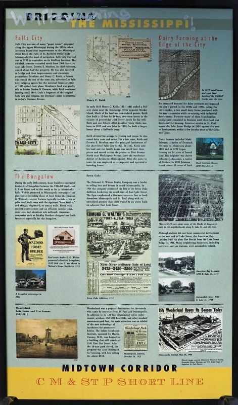
The CM&StP Railroad's Short Line bridge across the Mississippi River, completed in 1880, was the first of three important bridges in the vicinity. In 1888, crossing at Franklin Avenue and Lake Street also . . . — — Map (db m200507) HM
The Sheridan Veterans Memorial is in honor of all those who stepped forward to serve, a tribute to those whose lives were lost or forever altered, and a living reminder of our hope for a world with lasting peace.
State Representative Diane . . . — — Map (db m231905) HM WM
Do you know how many bandshells have been built at Lake Harriet?
Five, each built with a distinct style and features.
1888: The first bandshell was constructed by the Minneapolis Street Railway Company on their property near the rail . . . — — Map (db m211907) HM
1. Aerial photo of the West Bank before Professor Sibley's intervention, 1965
2. View of the grove shortly after the planting of trees, ca. 1971
3. Mulford Q. Sibley Grove, ca. 2018
4. Mulford Q. Sibley, . . . — — Map (db m233009) HM
Which were used on parkways first, bicycles or cars?
The first vehicles to use the new parkways were horses and carriages, but bicycles soon followed. In 1887 the Park Board formally approved the use of bicycles on parkways, which fed . . . — — Map (db m238441) HM
Highway 100 was a SLEEK NEW ROAD KNOWN AS 'LILAC WAY.' On sunny spring afternoons, families from Minneapolis piled into their Ford with a picnic lunch. The kids chattered excitedly as the car passed RURAL AREAS WITH OPEN LAND AND BLUE SKY. . . . — — Map (db m118001) HM
The Corps of Engineers dates back to the Revolutionary War. On June 16, 1775, the day before the Battle of Bunker Hill, the Continental Congress appointed a Chief Engineer and two assistants for the Grand Army; a few years later, in 1779, Congress . . . — — Map (db m189200) HM
When Daniel Delaney and a man named McLeod camped on the shores of the lake in 1855, they became the first white men of record to visit the area. John Masters, a land developer who came in 1856, gave the body of water its name.
Diamond has . . . — — Map (db m76925) HM
This historical inclosure and all of its adornments constitute a memorial to Victor E. Lawson (1871–1960) the pioneer historian of Kandiyohi County. It has been provided by the Tribune Printing Company, Inc. publishers of the West Central . . . — — Map (db m79397) HM
Rising from the waves of Lake Superior, this cliff face serves as an awesome reminder of Minnesota's geological past. Eruptions of molten lava over a billion years ago, followed by eons of weathering and glacier scouring, created the spectacular . . . — — Map (db m203280) HM
Why Safe Harbors?
Minnesota contains 150 miles of Lake Superior shoreline. With few exceptions, the shore is rocky and inhospitable to boaters in an emergency. From the time of American Indians and French-Canadian Voyagers paddling their . . . — — Map (db m203370) HM
Honoring The Dedication And Spirit Of Over 3 Million Young Men Across The United States And 86,000 Young Men In Minnesota Who Helped Create A Legacy For The Conservation Of Natural Resources And Inspired Future Generations. The Civilian Conservation . . . — — Map (db m204404) HM
One of the park's most impressive features is the highway concourse that was designed after a castle. It is over 300 feet long, 15-25 feet high and 12 feet wide at the base!
photographs:
Plans for the parking concourse. Dept. of . . . — — Map (db m204420) HM
With the onset of WWII the nations demand for steel created the need for bigger ships. It was evident that the original harbor breakwater was too small to accommodate the newer ships that were often 600+ feet long.
The original breakwater. . . . — — Map (db m204331) HM
This wall was built between 1936 and 1940 by the Civilian Conservation Corps enrollees as a retaining wall for the parking concourse.
It is 300 feet long, 15-25 feet high, 12 feet wide at the base, and was designed after a castle. . . . — — Map (db m204512) HM
Notice the area behind the waterfalls? This is where the CCC Boys lived.
Young Men...
As many as 200 young men at a time were living here. There was a hustle and bustle of activity as they built over 80 stone and log structures, buildings . . . — — Map (db m204410) HM
Cooperation Helps Build a Park
In 1910, residents were promoting government involvement in recreational facilities. By 1925, four Two Harbors men brought state officials to waterfalls and urged that the state purchase the land for future . . . — — Map (db m204430) HM
The classic steel arch bridge that spans this gorge is impressive for its simple beauty and elegance. Equally remarkable, but not as obvious to the onlooker, is the massive underground foundation that keeps this bridge sound and secure. To construct . . . — — Map (db m204424) HM
Take a Walk: Discover a Legacy
Wander through the park and see the skills used by the CCC boys to create these structures. Marvel at the detailed stonework of the Castle. Then, walk across the bridge to see the Falls View Shelter.
Boys . . . — — Map (db m204397) HM
Having Fun on the North Shore
In the late 1800s, the North Shore was becoming a popular recreational destination. Guidebooks from 1872 promoted the "recreational splendors of Lake Superior." By 1895, the North Shore recreation industry was . . . — — Map (db m204433) HM
[Text interspersed with photos]
Thomas Owens was affectionately known at "T.O.".
The White Houses located between 2nd and 3rd Avenues on Poplar Street were once owned by Railroad Superintendent George White. After his passing and by . . . — — Map (db m78857) HM
The Park was built on the location once occupied by the first two permanent buildings in Two Harbors. The Lakeview Hotel and the D&IR Office. Both buildings were moved inland and are still in use today.
Once called Voyagers Park and later Ore . . . — — Map (db m204345) HM
Wildlife: A walk along the beach can be a shorebirder's paradise. Shorebirds of all kinds stop to rest and feed on the sand beaches of this island during their annual migrations. Pelicans, cormorants, gulls and terns are all commonly seen on . . . — — Map (db m211230) HM
This riverfront park is named after James Green, a Pennsylvanian, who, with his wife, Isabella, and three children, came here in 1848 from the Selkirk colonies (Winnipeg). Their arrival marked the beginning of permanent settlement at Little . . . — — Map (db m78713) HM
After Charles Lindbergh took off on his motorcycle in 1920, headed for the University of Wisconsin, he rarely came back to Little Falls. He made one visit by airplane in 1923, landing his "Jenny" - the first plane he owned - in a field near here. . . . — — Map (db m78196) HM
A Home Becomes A Park
The landscape before you is the farm where Charles A. Lindbergh Jr., the famous aviator, spent his youth. Lindbergh completed the first solo, nonstop transatlantic flight on May 21, 1927.
This land was donated to . . . — — Map (db m78374) HM
Historic Treasures
During the Great Depression, President Franklin D. Roosevelt initiated federal programs aimed at putting people back to work. One of these programs was the Works Progress Administration (WPA), which focused on building . . . — — Map (db m78379) HM
Holding Up The H2O
The water tower was completed in 1939 by Works Progress Administration (WPA) workers. It stands three stories high.
Water towers use gravity to create pressure that moves water through supply pipes. Each foot of height . . . — — Map (db m78380) HM
The Little Elk River was known to the Ojibwe as Omushkoso-sibi, which translates to "Elk River." Elk were historically present in this area. The translation was modified to "Little Elk River" in the 1850s to avoid confusing it with another river . . . — — Map (db m225862) HM
Austin native Jon Erichson served the City of Austin as Assistant City Engineer from 1979-1992, and as City Engineer & Public Works Director from 1992-2013. During that time he developed and oversaw the comprehensive flood mitigation program which . . . — — Map (db m235494) HM
Larry Dolphin moved to Austin in 1988 to become the Director at the Jay C. Hormel Nature Center. As a self-proclaimed naturalist, he quickly became a leader on local environmental issues and worked with area science teachers to create a dedicated . . . — — Map (db m235437) HM
One of Austin's most helpful and prominent citizens, Lyman D. Baird served as mayor, city attorney, secretary of the Mower County Old Settlers' Association, an officer of the Mower County Fair Association and President of The Citizens' National Bank . . . — — Map (db m235480) HM
This site is the approximate location of a battle which occurred on August 20, 1862, between Dakota (Sioux) Indians and settlers fleeing to New Ulm from their cabins along Lake Shetek. This tragic encounter claimed the lives of at least two . . . — — Map (db m164718) HM
After the Armistice was signed on November 11, 1918, marking the end of World War I, Fulda's brave young men returned home.
The community felt that a memorial in their honor was appropriate. With the Fulda Reading Club taking the initiative, . . . — — Map (db m233116) HM
President Franklin D. Roosevelt Creates the CCC
During the early 1930s close to 40% of America's youth (16 to 24 years old) were unemployed and not in school. Twenty-five percent of adult men were unemployed. Out of this great economic . . . — — Map (db m71893) HM
"Life in a CCC camp is a different kind of life than most boys have known. An enrollee, as a CCC man is called, does not have his own private room. There is no one to pamper him. He lives with 200 other men of . . . — — Map (db m71888) HM
The legacy of the hard work by the young men of the CCC and veterans of the VCC during the five years the camp was here lives on in the structures we still use and enjoy today.
"The CCC has . . . — — Map (db m71918) HM
Although Fort Ridgely had been a state park since 1911, little development for recreation had occurred. Under the direction of the Department of Interior, the National Park Service (NPS) planned, designed, and supervised the . . . — — Map (db m71881) HM
In 1856, W. D. Lowery donated his cow pasture to establish Rochester's first park, Central Park. In the 1800s Central Park was the gathering place for picnics, band concerts and ice cream socials with a majestic fountain as the centerpiece.
In . . . — — Map (db m196421) HM
Silver Lake is a reservoir that was created in the 1930s by hand-digging a basin to hold water and then constructing a dam to back-up river water. It was built as a work relief project, providing work for over 400 unemployed men.
The land on . . . — — Map (db m178778) HM
The land on which this monument stands, consisting of a tract shown in the plat hereon, was presented to the city of Rochester, for use as a public park by Drs. William J and Charles H Mayo on June 15, 1907. — — Map (db m203229) HM
Twenty-five years after the deaths of the Doctors William James and Charles Horace Mayo the citizens of Rochester fittingly observed the Mayo Centennial Year - 1964 - to commemorate the approximate 100th anniversary of the birth dates of the Doctors . . . — — Map (db m196356) HM
For Minnesota's Nobel Prizewinning novelist Sinclair Lewis, Inspiration Peak more than lived up to its name. From its "bald top," he wrote, "there is to be seen a glorious, 20-mile circle of some 50 lakes scattered among fields and pastures, like . . . — — Map (db m120098) HM
So, you really want to see St. Croix State Park?
Climb 100 feet to the top of the fire tower for an incredible view. But imagine not being able to leave the cab for hours. You're not allowed to read books or magazines or take a lunch break. . . . — — Map (db m205649) HM
As Joseph Nicollet approached Pipestone on June 29, 1838, he wrote, "Traveling on this beautiful prairie, as pleasant and as uniform as the green carpet of royal salon, we lose a good half hour looking through the telescope… Charles A. Geyer, the . . . — — Map (db m169885) HM
American Indians have utilized the resources of the pipestone prairie for countless generations to sustain themselves during their stay at the quarries. The bison and elk that once roamed the area provided meat, clothing and tools. The prairie . . . — — Map (db m119087) HM
Lake Phalen has long been a magnet for people looking for a place to gather and connect with nature. As early as 1879, the Phalen Chain of Lakes was advertised as a resort area with excellent boating, fishing and hunting opportunities. The park was . . . — — Map (db m135563) HM
The intersection of Phalen Creek and the Frost Avenue Bridge is indicative of constructed change for social, economic, and recreational activity over the years. The waterways in this area that connect Gervais Lake, Keller Lake, and Lake Phalen have . . . — — Map (db m135839) HM
This landscape has changed many times over the 12,000 years since the glaciers. A thousand years after the glaciers retreated spruce forests dominated, with mastodons and other mega fauna common.
As time passed the climate warmed drying the . . . — — Map (db m138004) HM
This waterfall was originally constructed in the 1950's as a way to replenish the receding water level in Lake Phalen. Water was drawn from a well at the top of the falls which then flowed over a stone wall into the lake. Operation of the . . . — — Map (db m135561) HM
Established in 1893 on the grounds of the county almshouse and poor farm, the Ramsey County Cemetery was a "Potter's Field" for indigent persons, the homeless, and patients at Ancker Hospital who died without friends or relatives to pay funeral . . . — — Map (db m137610) HM
I was impressed by the natural beauty of the spot and thought it should be secured as a park to be enjoyed by all the people of the city.
William McMurray, President, William McMurray & Co., coffee and spice dealers, St. . . . — — Map (db m241223) HM
A longtime resident of the Hill District, Arthur J. McQuillan (1896-1954) was widely known as the "Mayor of Selby Avenue" for the many social, political, and civic causes he supported. During the 1940s, his plumbing and heating firm, McQuillan . . . — — Map (db m212846) HM
The area comprising this park was, for more than 40 years, used as a playground by the children of this neighborhood. It was presented to the City of St. Paul in 1923 by Emilie B. Cochran in memory of her husband, Thomas Cochran, who came to St. . . . — — Map (db m232309) HM
By 1913, the Park Commission realized there was no longer enough room to grow the numerous plants for Como Park. Because of this, they allocated $50 for new greenhouse blueprints. Nussbaumer's dream of a year-round display glasshouse became a . . . — — Map (db m242721) HM
In the 1840's, Charles Perry owned land around the then called "Sandy Lake". He was a farmer who grew potatoes on the land. He also renamed the lake "Como Lake" for the famous Lake Como in the Swiss-Italian Alps, his birth place.
Famed . . . — — Map (db m243050) HM
Creating the Park
Saint Paul set aside land for parks as early as 1849 but did little to develop these areas because green space was plentiful and accessible in the small metropolis. As the population grew, however, creating parks became a . . . — — Map (db m241849) HM
Como Zoo has seen decades of improvements from new animal habitats and updated facilities to advancements in animal care. In recent years, the successful public-private partnership between Como Friends and Como Park Zoo and Conservatory has . . . — — Map (db m242853) HM
Another visitor favorite from the 1950's era was Toby the Galapagos tortoise. Many school children rode on Toby's back during their visits to Como Zoo as he was allowed to wander throughout the Zoological Building and zoo grounds. Toby moved to . . . — — Map (db m243051) HM
From Horse Car to Streetcar
The Saint Paul City Railway used horse cars for its first route in 1872, but horses were expensive to feed and susceptible to disease and injury. As an alternative, the company tried cable cars in 1888, but an . . . — — Map (db m241851) HM
Como Zoo was informally founded in 1897 with the donation of three deer to the City of Saint Paul. The City fenced in a pasture for the deer. The deer were later joined by donated zebu cattle, elk, moose and fox. In 1915, visitors driving in . . . — — Map (db m243038) HM
Painting the Land
Britain's Industrial Revolution created gritty urban centers by the late eighteenth century. Nostalgia for the countryside and an increasing appreciation for nature gave rise to the "Picturesque" aesthetic, a term derived . . . — — Map (db m241848) HM
In 1936, the first major construction at Como Zoo took place through the Works Progress Administration (WPA). City architect Charles M. Bassford designed the Main Zoological Building that housed a majority of the animals at Como Zoo until the . . . — — Map (db m243048) HM
By the 1850s, the growth of Saint Paul was altering the landscape.
In the 1850s the Dakota were forced to leave, and Saint Paul's early settlers occupied the land. Immigrants established the North Star Brewery here, and . . . — — Map (db m231222) HM
When the land was a busy rail yard, lineal concrete pads were used for train maintenance. Most of the concrete on the site was removed to make way for restored habitat. Community members advocated for keeping five of the concrete pads to . . . — — Map (db m231323) HM
For nearly 100 years this land was part of a wide rail corridor that stretched along the Mississippi River and up the Trout Brook and Phalen Creek valleys. Many sets of railroad tracks and buildings — including an "unwheeling house" — existed . . . — — Map (db m181758) HM
The river banks are more than a hundred feet in height and covered with a dense growth of primeval forest. They are very steep, often precipitous and abounding in picturesque features of jutting crags clothed with wild vines and shrubbery from . . . — — Map (db m227980) HM
This gorge from the Falls of St. Anthony to St. Paul has become a classic spot to the geographer and geologist. It represents more concisely than any other river valley in America the difference in a gorge made in the morning of the earth's . . . — — Map (db m157260) HM
The nearness to St. Paul, where a ready market is found for all products, has induced many to engage in gardening, raising early vegetables and berries. In this branch they are successful. The dairy business is also carried on . . . — — Map (db m214392) HM
This is one of the most charming woodland possessions of the city.
Annual Report of the Board of Park Commissioners, 1902
Shadow Falls are hidden in a deep ravine north of Summit Avenue, where Shadow Falls Creek . . . — — Map (db m157142) HM
The scene of circuses, celebrations, and concerts, and seven years older than New York's famous Central Park, this land was designated a "public square" in 1849 by John R. Irvine, a territorial pioneer, and Henry M. Rice, territorial delegate . . . — — Map (db m42269) HM
"I will turn their mourning into joy and will comfort them and make them rejoice from their sorrow..." Jeremiah 31:13
With native stone and rock gathered from Civilian Conservation Corps camps in all states of the union, with stones from the . . . — — Map (db m156422) HM
Commissioner of Health 1899–1907
Founder of these baths and playgrounds,
"Mente concepit
opere complevit
munio dedit"
"In the health of the people lies the strength of a nation"
The Ohage Great Lawn surrounding this . . . — — Map (db m234601) HM
This park was originally the site of the Carpenter's Hotel, a towering wooden structure of the late 1850s, that sat on the east corner of the triangular lot defined by Summit Avenue, Ramsey Hill and the river bluff. The Victorian building . . . — — Map (db m41942) HM
Pioneer land developer John Irvine established the Upper Landing for steamboats where Chestnut Street meets the Mississippi River. In 1849 he deeded this square to the village of Saint Paul as a public park. Its earliest use as public grazing land . . . — — Map (db m134630) HM
The garden celebrates Duluth's sister city relationship with Ohara Isumi-City, Japan
ダルース市 日本の平和の鐘
Side 1:
The Peace Bell
During World War II, . . . — — Map (db m204681) HM
Texas artist Donna Dobberfuhl sculpted this freestanding brick relief mural as her interpretation of the history of Lake Superior's westernmost place. She chose to include historic and contemporary content, from the culture of indigenous people, . . . — — Map (db m204519) HM
Douglas Freeman's Fountain of the Wind is the artist's tribute to Lake Superior, a poem of honor, respect and gratitude. Here are some of Mr. Freeman's thoughts about this work:
Some of the images are literal. In the cascades we . . . — — Map (db m204517) HM
Located down the steps on bricked Buchanan Street Plaza, adjacent to the kiosk, Harper's five medallions show the Great Lakes and the links that connect them. Flags from the nautical alphabet spell out the lakes' names. Can you identify them? . . . — — Map (db m204518) HM
Sterling Rathsack's animated grouping, while representing figures, also has the abstract form of a totem. Perched on an authentic bollard as you enter Canal Park, Man, Child & Gull welcomes you to explore the character of Duluth's downtown . . . — — Map (db m204520) HM
This log playhouse was constructed about 1902 by Juha Tupanen Norha for nine year old Alma.
Alma, her mother, Maria, and her grandmother, Elizabeth, arrived in Embarrass from Finland in 1901 to join her father, Samuel, at his homestead cabin. . . . — — Map (db m107202) HM
The most characteristic feature of the Finnish homestead is the sauna (pronounced "sow-na"), a place for family and friends to share what they considered to be the "well spring" of life and health. To Finnish homesteaders, the sauna was more than . . . — — Map (db m127862) HM
This short trail leads you through the Voyageur Forest. The ups and downs of the landform create a diversity of forest types. On the dry rocky ridge tops and rocky shorelines, the forest is dominated by pines Lower on the hillside in soils . . . — — Map (db m154712) HM
Minnesota’s iron mining industry was born here in 1884, and the opening of this mine was one of the great commercial events of the nineteenth century. The first ore was shipped from the Breitung pit of the Soudan Mine on July 31, 1884, beginning . . . — — Map (db m143711) HM
As the first link of a multi-use recreational trail, Greenway Park lies on the eastern border of what was once known as "Frogtown", long a part of the Nicholas Daleiden farm, the property is directly north of what was once the Dr. E.E. Novak "Red . . . — — Map (db m210100) HM
Northside Park was originally part of the Vrtis Addition. Albert Vrtis, among the first group of Bohemian settlers who arrived in 1856, operated New Prague's first store from his log home on the present day corner of Main Street and Columbus Avenue. . . . — — Map (db m210099) HM
In 1856, Anton Philipp of Bavaria, New Prague's first settler, built a dugout log home along the banks of the tributary to Raven Stream. The first Bohemian settlers also built their first homes along the creek later in the same year. The site became . . . — — Map (db m210757) HM
When Charles Lindbergh landed his airplane on May 21, 1927, after becoming the first person to fly solo and non-stop from New York to Paris, he instantly became a national hero. His background and boyhood in Minnesota prepared him well for this . . . — — Map (db m85788) HM
Rice Lake was named for the wild rice that was harvested here until the late 1800s. Bountiful resources in the area provided a place Native Americans called home for thousands of years. The park was established in 1963 to meet the demand for local . . . — — Map (db m196839) HM
who came to Lake City in 1856 as territorial pioneers. They purchased an interest in the new townsite and selected the square comprising this park as the location of their future home. On this site, the same year, they built their residence and . . . — — Map (db m150709) HM
The bandstand, erected and dedicated in 1915, stands in memory of Ira C. Trowbridge, founder of Waseca. Ella Ward and Augusta Jenkins, his daughters, provided funds to build the bandstand in Trowbridge Park (formerly City Park) as a memorial to . . . — — Map (db m206261) HM
Stillwater Welcomes the Iron Horse
Imagine the excitement of a chilly December day in 1870. You watch as workers hammer in the last few spikes to complete Stillwater's first railroad. Area residents had much reason to celebrate—railroads . . . — — Map (db m233663) HM
The St. Croix River Valley Forming a long stretch of the border between Minnesota and Wisconsin, the St. Croix is one of America's most scenic Wild Rivers. Its valley is sometimes referred to as the "New England of the West."
Along with . . . — — Map (db m233414) HM
Lake Alice is named for Alice O'Brien. In 1945, Alice memorialized her father, lumber baron William O'Brien, by donating 180 acres of his former estate to establish the area as a State Park.
This 26-acre lake is as deep as nine feet in some . . . — — Map (db m230827) HM
William O'Brien State Park was established in 1945 with a donation to the State of Minnesota of 180 acres by Alice O'Brien. This gift was given in memory of her father William O'Brien, who was a pioneer lumberman.
This marker is dedicated to . . . — — Map (db m232285) HM
Putting America to Work
In 1929, the Great Depression swept America and millions were left without work. To help the country through these tough times, President Franklin D. Roosevelt created several federal work programs lasting from 1933 to . . . — — Map (db m201260) HM
A Trail for All Seasons
Opened in 2014, the Brown's Creek State Trail connects Stillwater with the Gateway State Trail. Nearly six miles long, the path travels along forests, ponds, Brown's Creek and the St. Croix River. Along the way . . . — — Map (db m233502) HM
198 entries matched your criteria. Entries 101 through 198 are listed above. ⊲ Previous 100