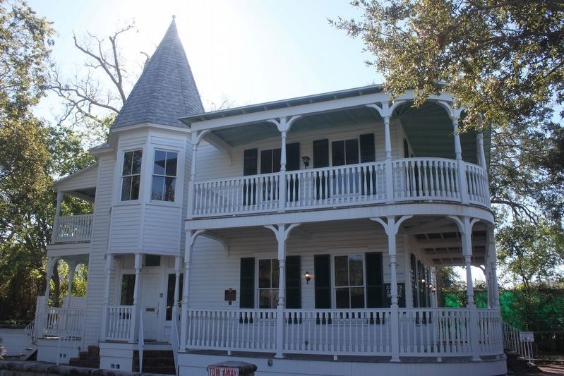
Xavier Lopez, descendant from a pioneer Minorcan family, succeeded as a merchant and public servant. He owned the house, passing it to his daughter upon his death. The house is significant as one of St. Augustine's best examples of Queen Anne . . . — — Map (db m111555) HM
This property is a significant example of Spanish, British and American architectural influences. The one story kitchen building is as old as the original rectangular two story house. An addition to the house, being used then as a boarding house, . . . — — Map (db m108341) HM
Blessed with communal origins, enthused former members of The First Baptist Church in Lincolnville who lived in West Augustine were inspired to establish what is today a unique edifice-built in 1921.
The heritage of the church echoes such . . . — — Map (db m152197) HM
Noted author Zora Neale Hurston (1891-1960) rented a room in this house in 1942. One of the few surviving buildings closely linked with Hurston’s life, it is an example of frame Vernacular construction, with cool, north-facing porches on both . . . — — Map (db m77257) HM
Through his love of baseball and through his love for St. Augustine and its people, Frederick G. (Fred) Francis took baseball out of the sandlots and lifted the St. Augustine Saints to four pennants while he was at the helm.
Fred Francis made it . . . — — Map (db m173972) HM
The dates of this arrival and departure are unknown. What is known is that the Calus (a) Indians were a very warlike tribe that did not want the Spanish in their territory, and so they fought with them and killed many. After two or three months of . . . — — Map (db m188797) HM
Don Pedro Menendez de Aviles was from the northern regions of Spain in a district known for its seafaring traditions and Celtic roots. In 1565, news reached Madrid that a group of French settlers, led by the explorer Jean Ribault, had established a . . . — — Map (db m188798) HM
In 1740, General James Oglethorpe of Georgia, vowed to "take St. Augustine or leave my bones before its walls." The Spanish Governor Manuel de Montiano vowed in turn to "shed his last drop of blood" in defense of the town. Neither had to keep their . . . — — Map (db m46349) HM
This anchor was purchased by Walter B. Fraser and placed here in 1933. The ship's name and site of the anchor's recovery are unknown, but Britain's Royal Navy used this size and type of anchor on their famous 74-gun ships of the line. First designed . . . — — Map (db m188998) HM
English: These cannons were recovered from various locations in Florida and the Caribbean, by wreck salvage operators. Artillery of this era, the 17th and 18th century, are rated by the weight of the projectile cannonball they fire. . . . — — Map (db m188692) HM
Gaar Scott & Company, established in 1895 in Richmond, Indiana, manufactured a long line of tractors, threshing machines, and steam engines from 1842 through 1911, including this 1902 model.
This enormous cast-iron and steel tractor, weighing some . . . — — Map (db m126113) HM
Bernard Street is one of three historically black residential streets in the North City area, dating back to the Flagler Era. At the west end of the street were a lumber yard, steam laundry, and ice plant that provided employment. Other residents . . . — — Map (db m17913) HM
Native Americans, known today as the Timucua, begin to occupy the region that spreads from present-day Central Florida to Southwest Georgia. The Timucua were a loosely knit confederation of tribes that shared a common language, but were not bound . . . — — Map (db m188792) HM
A part of the armament of historic Fort Marion (Castillo de San Marcos) before, during and after the Civil War Presented to the City of St. Augustine by the U.S. War Department June 12, 1900 — — Map (db m46800) HM
Introduction
St. Augustine's colonial downtown district exists as the most enduring location of European origin in the United States, having been settled since 1572. A diverse array of archaeological resources, the result of 400+ years of . . . — — Map (db m102336) HM
Built between 1803 and 1812 by Jorge Acosta (c.1764-1812), a native of Corsica, and husband of Margarita Villalonga, born in St. Augustine of Minorcan parents. — — Map (db m102394) HM
In 2011, archaeologists from the University of Florida made an unexpected discovery at this spot. Coquina and oyster shell foundations, outlining a building of at least 90 by 40 feet, were uncovered just inches under the sod. Artifacts associated . . . — — Map (db m146511) HM
In 1934, laborers at the Fountain of Youth began work to cultivate a citrus grove here on the property. Almost immediately, a shovel thrust unearthed a cluster of human bones. The sheriff was called and it was soon determined that neither the . . . — — Map (db m188866) HM
By the year 1870, a widowed Clarissa Fairbanks Anderson had built on her property, known as “Markland,” a gable-roofed, frame “winter cottage” for guests.
In 1885, her son, Dr. Andrew Anderson, Jr., sold part of the . . . — — Map (db m100592) HM
At this location on June 9th, 1964, Civil Rights Movement Leader Andrew Young led a march from Lincolnville to the Plaza de la Constitución where they met violent opposition. Young had been sent to St. Augustine by the Reverend Martin Luther King, . . . — — Map (db m107336) HM
Archaeologists from Flagler College and the University of Florida, in collaboration with the Diocese of St. Augustine, are excavating the remains of the Shrine built here in 1687 by the Governor of Florida in honor of Nuestra Señora de la Leche y . . . — — Map (db m146512) HM
Archaeological excavations at the Nombre de Dios Mission/Nuestra Señora de La Leche Shrine site have been undertaken by University of Florida archaeologists since 1985. The digs have been carried out in search of the earliest sixteenth century . . . — — Map (db m146513) HM
Spanish Buildings Some of the larger buildings constructed by the Spanish were constructed on mud sleepers — large logs split in half used as the foundation to build up from. This method of construction dates all the way back to . . . — — Map (db m188857) HM
The Arrivas House was built as a one-story, two-room coquina house shortly after 1702 on the ruins of a late 17th century tabby house. This property passed down through four successive generations of mothers to daughters as a marriage dowry. When . . . — — Map (db m237115) HM
If you visited St. Augustine at the turn of the century, you would have traveled to Florida aboard a steamboat on the St. Johns River to Tocoi, 18 miles west of St. Augustine.
At Tocoi, you boarded the St. Johns Railroad for a four hour ride in . . . — — Map (db m134497) HM
The Avero family lived on this property from 1712 until 1804 even before the existing building was constructed, with the exception of the British occupation period during 1763-1783. The restoration was undertaken to approximate the character of the . . . — — Map (db m111092) HM
From this balcony, Their Majesties Juan Carlos I and
Queen Sofia of Spain extended greetings to the
people of St. Augustine. April 1, 2001 — — Map (db m127491) HM
British hygiene practices were similar to the Spanish, and often included outdoor privies (outhouses).
Las costumebres higiénicas de los ingleses eran similares a las de los españoles, y a menudo incluían letrinas ubicadas funeral de las casas. . . . — — Map (db m188386) HM
During the American Revolution, St. Augustine was a base for British military activity in the South. The English added second floors in this and other rooms to make more space for storage and quarters. — — Map (db m46536) HM
Although the Castillo's high walls and moat were a substantial obstacle to anyone trying to capture the fort, the cannon here on the gundeck (or terreplein) were the were the real strength of the fort. With a range of over a mile, the cannon could . . . — — Map (db m46346) HM
Built 1749 - Restored 1979This shrine is dedicated to the memory of the 400 Greeks who arrived in St. Augustine in 1768, took on fresh supplies, then journeyed south to help settle the colony of New Smyrna, Florida. After ten difficult years, the . . . — — Map (db m46789) HM
Built ca. 1740 Reconstructed 1967
A house representative of the first Spanish period with minor British modifications. The reconstruction of this residence was made possible from contributions of
A.D. Davis and J.E. Davis
Winn Dixie . . . — — Map (db m107554) HM
Castillo de San Marcos (English)
Explore the oldest masonry fort in the continental United States. For hundreds of years Castillo de San Marcos has watched over St. Augustine. From the upper gun deck, see how this massive fort guarded . . . — — Map (db m127753) HM
This Spanish fort, begun in 1672, stood
firm against English attacks and helped
Spain to hold Florida for many years.
During the American Revolution it was a
British stronghold. Later it became a
U.S. Military Prison. — — Map (db m127652) HM
This Spanish fort, begun in 1672, stood firm against English attacks and helped Spain to hold Florida for many years. During the American Revolution, it was a British stronghold. Later it became a battery in the U.S. coastal defense system. — — Map (db m127654) HM
The Cathedral Basilica is a significant structure representing the oldest Roman Catholic parish in the United States, architectural designs by Mariano de la Rocque (1797) and James Renwick (following an 1887 fire), and the successes of historic . . . — — Map (db m112492) HM
The parish of St. Augustine. which dates from the celebration of a mass on September 8, 1565, by the Spaniard Pedro Menendez and his men, is the oldest Catholic parish within the present day United States. During Queen Anne's War, the English . . . — — Map (db m220570) HM
Following the Civil War and the reconstruction period the state of Florida found itself in debt. As a way to offset some of the state’s expenditures, newly elected governor George Drew put into practice the convict leasing system in 1877. Prisoners . . . — — Map (db m79584) HM
In time of danger, the chapel was a spiritual haven for both soldiers and townspeople. Before the altar, the priest offered mass. The walls were white, with a red band at floor level. The holy water fonts are still in place. — — Map (db m46538) HM
Saturiwa was chief of the Saturiwa tribe, a Timucua chiefdom centered at the mouth of the St. Johns River in Florida, during the 16th century. His main village, also known as Saturiwa, was located on the south bank of the river near its mouth, and . . . — — Map (db m188997) HM
This anchor is typical of early marine ship navigation, and weighs approximately one ton. A stock of oak would have been placed near the ring in the opposite direction of the flukes (also called hooks) to more easily secure them to the ocean floor. . . . — — Map (db m188999) HM
:
On March 19, 1812, the Spanish Parliament in Cadiz wrote the first Spanish Constitution and issued a Royal Decree for all Spanish towns throughout the empire to build monuments and rename their main plazas La Plaza de la Constitucion in . . . — — Map (db m143638) HM
You are Standing in the First Colony of St. Augustine On September 8th, 1565, Pedro Menéndez de Aviles came ashore here. At that time, this field was part of the Timucua town of Seloy — an easily defensible peninsula that would serve as the . . . — — Map (db m188860) HM
200 Million Years in the Making Coontie is a low and palm-like or fern-like plant that grows throughout Florida and the Caribbean. Coontie is a member of the Phylum cycadacaea. At roughly 200 million years old, this is one of the . . . — — Map (db m189123) HM
Copper cauldrons such as this had a wide variety of uses in Spain's New World Colonies. The rounded bottom indicates that this cauldron may have been used at a shore station in the making of whale oil, as most cauldrons on-board ships had flat . . . — — Map (db m188862) HM
Coquina in these Walls (English)
Special to the architecture of Government House and St. Augustine's defenses, churches, and residences is coquina, a rare native shell stone formed over a long period of geological time and quarried since . . . — — Map (db m127486) HM
The man-made hill around the fort, called the glacis (gla'sis), "covers" or protects this area from enemy fire. Capturing a fort's covered way usually involved a bloody assault. — — Map (db m46548) HM
Crumbling Coquina (English)
Castillo de San Marcos was built using coquina, a local limestone. This porous limestone is made from millions of seashells pressed together for thousands of years. The Spanish coated the fort walls . . . — — Map (db m127745) HM
Prior to the 1898 development of this land as a Waterworks Pumping Station, the area was undeveloped oak hammock north of the city limits close to the early railroad depot that converged with the Old Shell Road leading into the city. The 1880s . . . — — Map (db m208832) HM
The De Hita-González site originally contained two separate buildings. At the time when the Spanish evacuated Florida in 1763, Bernardo González owned a house of coquina and directly adjacent to the south was the tabby house of Juana de Avero and . . . — — Map (db m237114) HM
Deadly Crossfire (English)
The Spanish built the star-shaped Castillo de San Marcos in the late-1600s. The star design responded to the advent of a deadly new weapon: the cannon. The fort's complex shape meant a battery of cannons on the . . . — — Map (db m127750) HM
Defense in Depth (English)
Enemy troops would have encountered an obstacle course of rising slopes, low walls, and ditches before reaching the Castillo's walls. The Spanish built this extensive defensive system to help protect the fort. . . . — — Map (db m127289) HM
On March 3, A.D. 1513 Don Juan Ponce De Leon set sail from Porto Rico in search of “Bimini” and the “Fountain of Youth.” On Easter Sunday March 27 he sighted this land and named it “Florida.” April 3, A.D. 1513 he entered the harbor and landed . . . — — Map (db m188698) HM
The stone walls of this building date from before 1750 and were part of a house owned by the Royal Treasurer late in the First Spanish Period. During the British Period it served for a time as the home of Governor John Moultrie. In 1837 Dr. Seth S. . . . — — Map (db m46797) HM
Engulfed in Flames (English)
Spanish soldiers watch in horror as English troops set fire to their homes. They are helpless. The drawbridges are up. The soldier-settlers and their families are sheltered within the crowded fortress. Except . . . — — Map (db m127748) HM
One of the few Spanish Colonial buildings remaining in St. Augustine and among a smaller group from the First Spanish Period, this structure suffered two fires and underwent many major alterations. The first documented property owner, and possible . . . — — Map (db m111252) HM
In colonial times, water was difficult to obtain and precious. Fresh water is increasingly precious in our world today.
En la época colonial, el agua era valiosa y dificil de obtener. El agua dulce se está volviendo . . . — — Map (db m237065) HM
In Memory of
Father Pedro Camps
the spiritual leader of the
Minorcan Colony
This Statue Presented To
Most Reverend Paul F. Tanner
Bishop of St. Augustine by
Fernando A. Rubio of Minorca
and . . . — — Map (db m153919) HM
Bronze statue of Father Camps and a group of Minorcan colonists. It was erected in 1975 by Minorcan descendants in memory of their spiritual leader who kept the Catholic faith alive in Florida during the British occupation that ended in 1784. . . . — — Map (db m154557) HM
The first muster of militiamen in the Continental United States occurred on this site on September 16, 1565 Monument Dedicated by the National Guard Association of Florida July 2015 at the Fountain of Youth Archaeological Park Saint . . . — — Map (db m188700) HM
The first muster of Spanish militiamen in the newly-established presidio (fortified encampment) of St. Augustine took place in September of 1565. During the onset of the San Mateo hurricane Adelantado Pedro Menendez de Aviles assembled 500 regular . . . — — Map (db m92865) HM
St. Augustine had no Protestant church when it became an American town in 1821. At first a united Protestant church was favored. Many denominations sent missionaries such as Presbyterian Eleazer Lathrop, who first arrived in 1821. By October, . . . — — Map (db m106338) HM
This house was reconstructed on original foundations in 1965. It represents the "house of stone" that was the residence of Pedro de Florencia in 1763. Florencia, a merchant and store owner, came from a long line of native St. Augustinians.
In . . . — — Map (db m236970) HM
Henry M. Flagler built the Florida East Coast Railway (FEC) to link his resort empire and establish the east coast of Florida as “The American Riviera.” Flagler, partner with John D. Rockefeller in Standard Oil, developed the Atlantic . . . — — Map (db m77255) HM
In 1821, the United States assumed control of Florida and federal troops occupied the fort. It was renamed Ft. Marion, for the Revolutionary war hero Francis Marion, the "Swamp Fox." In order to modernize the fort's defensives, the east portion of . . . — — Map (db m46542) HM
Fortress Facelift (English)
Through treaty, Spain ceded Florida to the United States in 1821. Built to defend the city, the Castillo remained a defensive post when ownership changed. Renamed Fort Marion, the Americans made the Castillo . . . — — Map (db m127738) HM
The Fountain of Youth Park commemorates the 1513 arrival of Juan Ponce de Leon in Florida and the legend of the Fountain of Youth.
People have lived on this site for over 3,000 years, since the Archaic Period of Florida’s history.
In 1565 . . . — — Map (db m79574) HM
On this site, where the "Genovar Opera House" once stood, Frederick Douglass spoke to the residents of St. Augustine on Sunday, April 7, 1889. Born into slavery in 1818, Douglass rose in the pre-Civil War years to become a leading exponent of the . . . — — Map (db m46795) HM
The set of masks that decorate this fountain was a gift to the City of St. Augustine by its sister city in Spain, the City of Avilés, birthplace of Pedro Menéndez, founder of St. Augustine in 1565. Presented in 2005 to the people of St. Augustine . . . — — Map (db m46680) HM
Artilleryman Martin Martinez Gallegos lived on this property, which his wife Victoria brought into the marriage. In the 1960s crews used colonial building materials and colonial building techniques to replicate the original house, constructed of . . . — — Map (db m236912) HM
Gault Street was one of the historically black residential streets in North City. Many residents worked at the Florida School for the Deaf and the Blind, the Fountain of Youth, laundries and ice plants that were once located in the area. . . . — — Map (db m7580) HM
Here on this site, 42 St. George Street, stood the home of the nation's first Black general, Jorge Biassou, who came to St. Augustine from his native Haiti in 1796 as an officer of the Spanish military.
Biassou was one of the original leaders . . . — — Map (db m70944) HM
The Gómez House is representative of the board-and-batten structure on this lot at the end of the First Spanish Period (1565-1763). Such frame buildings comprised only 23 percent of all St. Augustine structures in 1763. Most buildings by the middle . . . — — Map (db m236949) HM
Government House & Plaza (English)
St. Augustine's Plaza is the city's heart and soul. Dominating the west end of the Plaza since the 16th century, with a view of all activities on the Plaza and in the harbor, the Governor's House was . . . — — Map (db m127546) HM
Government House: Changing of the Guard (English)
Until 1763, the Governor's House was Spanish Florida's capitol. When Spain ceded Florida to Great Britain, the British governors of East Florida made Governor's House their official . . . — — Map (db m128190) HM
Government House: Legacy of Authority (English)
Government House is a landmark in the history of our nation's government. From the 16th century, a building on this site served as an administrative center — as official governor's . . . — — Map (db m127476) HM
Government House is nationally significant as the first known Federal government restoration of a historic building to accommodate modern governmental functions. Today's Government House was restored and enlarged in 1935-1937 by the U.S. Treasury . . . — — Map (db m127484) HM
Designed by New York architecture firm Carrere and Hastings in the Spanish Renaissance Revival style, the building is an example of Henry Flagler's influence on the built environment of St. Augustine. Furthermore, the poured concrete construction . . . — — Map (db m112511) HM
Grace United Methodist Church is a reminder of the tremendous physical impact Henry M. Flagler had on St. Augustine. This complex of structures resulted from a compromise between Flagler and the congregation of Olivet Church. That group of northern . . . — — Map (db m47060) HM
Guarding the Back Door (English)
The Spanish built the Castillo de San Marcos along the winding, shallow channel of the Matanzas River. Any ships entering the inlet faced the fort head on, unable to deploy their guns broadside. The . . . — — Map (db m127749) HM
In 1876, tycoon Henry Flagler took his ailing wife to St. Augustine to get her away from Cleveland's cold winters. Although he was delighted by the magnificent orange groves, lodging was primitive, and the pace was too leisurely for his taste. . . . — — Map (db m134493) HM
Mission Nombre de Dios featured a stone chapel of La Leche as early as 1702. That chapel was damaged and subsequently dismantled, rebuilt, and destroyed in 1728. Another reconstruction was undertaken in 1875 by Bishop Augustin Verot that was . . . — — Map (db m111215) HM
Before Florida became a U.S. territory in 1821, this land was owned by Spain. In 1807 parcels of land to the north of the city gate were granted to residents interested in farming. However, as a defense measure, Governor Enrique White set out a . . . — — Map (db m46704) HM
The fort was a prison for several hundred Plains Indians in 1875-78 (Comanche, Kiowa, Arapahoes, and Cheyenne) and in 1886-87 (Chiricahua Apaches). Originally confined in these casemates, they were soon moved to the terreplein to live in wooden . . . — — Map (db m46535) HM
(English)Invincible?
After marching through miles of wilderness, the Castillo is within sight, seemingly close. But can it be taken? A treacherous obstacle course of rising slopes (glacis), low walls (covered way), and a . . . — — Map (db m127742) HM
It Begins (English)
After days of watching the British prepare, bursts of smoke signal their attack from Anastasia Island. The sentry in the San Carlos watchtower in front of you yells and rings the bell. His quick action alerts the . . . — — Map (db m127744) HM
In 1877, the governor of Florida instituted a convict leasing program to make money for the state. The program required road crews to be moved and housed. Mule pulled jail wagons provided both secure, though miserable, housing and transport. . . . — — Map (db m134489) HM
The Home "House of shell stone of Juan de Rib(v)era" (casa de piedra) - was built to replace a home within musket range of Castillo de San Marcos (750 feet) that was burned in 1702 to deprive English troops of protection for . . . — — Map (db m212640) HM
Juan Ponce was born in 1460 in the village of San Cervas in the province of Campos in northern Spain. Historians agree on the place but not the date. Some claim it to be 1470, one believes it was 1474. He was trained as a soldier and fought against . . . — — Map (db m188796) HM
The
Discoverer of
Florida
Juan Ponce de Leon
landed near
this spot
1513 Reverse:Presented to the City of St. Augustine by Andrew Anderson, M.D. 1923 — — Map (db m19432) HM
Born in Spain 1460 Governor of “San Juan”, now Puerto Rico, 1509-1511 ——————He made the first recorded sea voyage to what is now the United States of North America, making his first landing in the vicinity of Saint Augustine, first permanent . . . — — Map (db m188600) HM
Bronze statue of Ponce de Leon, who discovered Florida and landed near this spot in 1513. Dr. Andrew Anderson presented the sculpture to the city of St. Augustine in 1923. This is a replica of the statue located near the explorer’s grave in San . . . — — Map (db m153804) HM
The Man Five hundred years ago, a fleet of three small Spanish ships sighted the east coast of Florida on the 27th of March, 1513. They sailed along the coast to the north for a number of days and finally landed on the 3rd of April, naming this . . . — — Map (db m188602) HM
The Conquering of Española Beginning in March 1494, Columbus sent hundreds of soldiers into the gold-bearing region of the interior of Espanola to build and hold a fort called Santo Tomás. Given Ponce de León’s military experience, he was . . . — — Map (db m188604) HM
Beimeni: A New Land to the Northwest Indian Slaves on Española were dying off; the Spaniards needed this free labor force and raided the Lucayan Islands (the Bahamas and Turks & Caicos Islands) for more Taino Indian slaves. Between 1509 and . . . — — Map (db m188606) HM