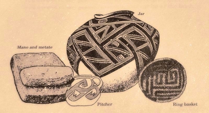
By 1286, Betatakin village had grown to fill even the most precarious shelves and niches in the alcove, and housed 100 to 125 people clustered into 20 to 25 households. Looking down at this sheltered site today you can still see most remnants of the . . . — — Map (db m144401) HM
You are standing in the oldest section of the pueblo, the Central Plaza. At one time, the rooms surrounding the plaza may have stood as high as three stories. Traditionally, the plaza area symbolized the Center of the Universe and played an integral . . . — — Map (db m187324) HM
In the distance, you can see several mesas. These are called Tuutukwi or the Hopi Buttes, sacred places in Hopi religion. Today, they are used as eagle gathering areas by certain Hopi clans.
Below you are the remains of the East Plaza. Like the . . . — — Map (db m187322) HM
Around A.D. 1330, a group of people arrived from the Hopi Mesas, 60 miles north, drawn by the lush flood plain of the Little Colorado River. These people built a 1200 room village; 750 to 1000 people lived in this pueblo.
The people farmed in . . . — — Map (db m187265) HM
These large holes, and others visible throughout the pueblo, are the result of illegal digging by treasure seekers and pot hunters. Such acts of careless vandalism not only destroy scientific information, but desecrate ancient and sacred burials. . . . — — Map (db m187267) HM
In the depression is a kiva. Kiva means "cellar" or "underground house". Men are primary users of kivas; women and children have access during certain ceremonies and seasons.
This kiva is 14 by 17 feet and 6 feet deep. The floor and benches were . . . — — Map (db m187268) HM
How the Burn was Born
Chevelon in a Nutshell
In the summers of 2003 through 2006, archaeologists from Arizona State Museum and volunteers from Earthwatch excavated the ancestral Hopi village of Chevelon which is located 9 miles . . . — — Map (db m185334) HM
On the horizon are the highest mountains in Arizona, the San Francisco Peaks (12,670 feet). The Hopi call them Nuvatukya'ovi and believe they are the home of the Katsina spirits. Katsina are supernatural beings with the power to bring the rain . . . — — Map (db m187271) HM
Below you is Paayu, the Hopi name for the Little Colorado River, a year round source of water. Even when dry, water can be found a few feet below the sand. Paayu supported a variety of plant and animal resources, including beaver, elk, antelope, . . . — — Map (db m187270) HM
A typical room used for domestic activities would have slab-lined floor pits for cooking and heating similar to those found here in the West Plaza. Storage rooms lacked such floor features.
To the left of these five rooms is an area that was . . . — — Map (db m187266) HM
Arizona State Parks preserved this vandalized kiva. It is the largest of the kivas in Homol'ovi II and measures 19.7 by 32.8 feet and is 6.6 feet deep. The pit near the south end of the structure is a hearth, and the small stone wall deflects and . . . — — Map (db m187269) HM
The earliest known occupation of Southern Arizona was by Paleo-Indian hunters from about 10,000 to 8,000 B.C. They were followed by Archaic period hunter-gatherers. Hohokam, "the people who have gone," is the name given to the prehistoric people . . . — — Map (db m250034) HM
In the 1700s and early 1800s, only a trickle of travelers came by the Casa Grande. First Spanish explorers, and then Mexican and American travelers wondered who built the ruin and why. More people visited after 1879 when the railroad first reached . . . — — Map (db m269157) HM
Archeologists don't know for sure: Its original purpose remains a puzzle. Here, there are still more questions than answers.
Was it an ancient astronomical observatory? Perhaps. Why do the walls line up north-south-east-west? Unknown. We can . . . — — Map (db m269110) HM
It is no coincidence that this diorama made its debut at the same time ladders were removed and access to the cliff dwelling ended.
Before the official end of guided tours of the cliff dwelling on October 1, 1951, park rangers had . . . — — Map (db m251673) HM
The abundant alcoves and rock shelters found in cliffs throughout the Verde Valley served as homes, storage units, and spiritual sites.
Wind and water have sculpted countless alcoves, holes, and crannies in the soft layers of the . . . — — Map (db m251679) HM
Water, shelter, building materials, arable land, and other environmental conditions made the Verde Valley an ideal place to live.
Montezuma Castle is the most obvious structure here, but it was part of a larger community that . . . — — Map (db m251684) HM
To construct their cliff home, residents made use of a naturally eroded alcove and fit 20 rooms into the shape of its contours.
Why build a home in a cliff face? There are many possibilities: proximity to water and farmland, to stay . . . — — Map (db m251687) HM
Between approximately 1100 and 1400, the Castle neighborhood also included a larger pueblo and numerous small alcove homes in the cliff face along Beaver Creek.
Nestled in a limestone cliff overlooking the creek, Montezuma Castle . . . — — Map (db m251691) HM
Around the year 1400, people began leaving their homes here. Five hundred years later, its walls were still largely intact.
The builders chose their home site wisely, taking advantage of the shelter that a natural alcove provided. . . . — — Map (db m251685) HM
While many details of life in this settlement will never be fully known, it is clear that farming, craft, and trade thrived here.
The space where you have been walking was a small part
of the farmland cultivated by the people of . . . — — Map (db m251677) HM
Around 1400, after centuries of settlement here, families began leaving their Verde Valley homes.
The archeological record suggests that from 1350 to 1400, people began to leave the valley and join larger pueblos to the north and . . . — — Map (db m251675) HM
This cliff may seem a featureless stone face with a few holes and broken walls, but look closely and the rocks reveal the outline of a once large and vibrant neighbor to Montezuma Castle.
Because Montezuma Castle suffered extensive . . . — — Map (db m251682) HM
Montezuma Castle invites us to pause in wonder at the ingenuity of the people who began building it over 700 years ago.
Ancestors of today's Puebloan peoples built and occupied the Castle. We can only speculate why they chose to . . . — — Map (db m251692) HM
From a few rooms on the hilltop to a 110-room pueblo, this dwelling transformed over centuries as increasing numbers of people came together to form a community.
The pueblo you see today was not built all at once or with a plan, but . . . — — Map (db m250272) HM
Since excavation exposed them to erosion, floors and wall segments have required ongoing preservation treatments.
A building held together with mud mortar requires regular upkeep. After the original residents moved on, the mortar eroded, . . . — — Map (db m250276) HM
We can learn a lot of information about the people who lived in the pueblo from what they left behind.
The hillside below you was a refuse site that yielded clues about the diet and daily life of the people of the village. We know they . . . — — Map (db m250274) HM
Although they shared similar lifestyles and cultures, the people living here held some traditions that differed from their Puebloan neighbors to the north.
In this room, excavators discovered a partial wall underneath the floor - people . . . — — Map (db m250273) HM
An exploration of Tuzigoot pueblo inspires questions, answering some while provoking others. The story along this trail recounts people both ancient and modern.
Along this 1⁄3-mile (0.5 km) loop trail, you will find the remains . . . — — Map (db m250267) HM
After calling Tuzigoot home for centuries, shifting circumstances heralded change for the people of the Verde Valley.
Tuzigoot and other pueblos throughout the Verde Valley were occupied for hundreds of years-longer than the United . . . — — Map (db m250281) HM
People have long been drawn to settle in the Verde Valley for its plentiful food sources, water, and natural shelters.
The earliest people to arrive here left behind fluted spear points that date to 13,000 years ago. About 1,500 years . . . — — Map (db m250270) HM
The mineral deposits hidden in this landscape sustained life in the Verde Valley in the past and today.
Just as minerals in the land sustained this prehistoric hilltop village, the copper beneath the earth provided the basis for founding . . . — — Map (db m250278) HM
At varying times in the past, local economies and people's cultural practices depended on the Verde Valley's mineral resources.
For the people of Tuzigoot, rocks were the source of material for paints, adornments, and stone carvings that . . . — — Map (db m250277) HM
If Tuzigoot's plaza served a role like those of pueblos today, this flat, open area between rooms would have been the hub of social and ceremonial activities.
In modern Hopi society, plazas are central to the pueblo community. The plaza . . . — — Map (db m250280) HM
Lifeline
Beaver Creek has always been a major focus of life in the Verde Valley. Prehistoric Sinagua farmers constructed Montezuma Castle and other structures near the creek. They dug ditches to carry creek water to irrigate the fields of . . . — — Map (db m40868) HM
Could This Stone Be The Opening to a Macaw Pen?
Where Did This Stone Come From?
Who Used It?
Why Is This Stone at Montezuma Castle?
Did the Ancient Sinaguans Possibly
Raise Macaws Here?
In the 15th century, near modern-day Casa . . . — — Map (db m40895) HM
A farming community of perhaps 200 people prospered here for more than three centuries. The Castle was home to 35 or so of these people. Archeologists suggest they may have fled what is today the Flagstaff area due to overpopulation around A.D. . . . — — Map (db m40840) HM
The Neighborhood
You can see Montezuma Castle and Castle A from here. If you look closely at the Cliffside, you might spot other ledges and caves used by the Sinagua.
The Sinagua people who made their homes here may have been a . . . — — Map (db m40869) HM
Here’s another “castle” – this one called “A” by the archeologists who excavated it in the 1930s.
Like neighboring Montezuma Castle, Castle A was occupied by Sinagua farmers between A.D. 1200 and 1450. However, with 45 rooms and an estimated . . . — — Map (db m40863) HM
The Way Up
How in the world do you build a structure large enough to house 35 people high up on a steep canyon wall? Sound impossible? Here’s how Montezuma Castle’s ingenious Sinagua farmers managed it.
Pause a few moments to enjoy this view of Montezuma Castle. Don't you suppose it must have stopped the settlers and soldiers who first saw the cliff-dwelling over a century ago?
The odd name came from a mistaken belief that the cliff-dwelling . . . — — Map (db m40819) HM
The prehistoric rock art in Rock House Cave is part of our heritage that can never be replaced. Once it is gone, it is gone forever. It is up to us to preserve these images for as long as possible until the endless forces of wind and water turn . . . — — Map (db m233671) HM
In North America, the Indians
were building mounds such as
these from before the time
of Christ until after DeSoto
explored this area. These are
believed to be villages of
the Aquixo or Pacaha, 1541. — — Map (db m221347) HM
Welcome to Northeast Arkansas Pick up your Discovery our guide in the part visitor for center.
From pre-history to today, people have come here for a variety of reasons. Settlers found a state rich in wildlife and wilderness. Ancient . . . — — Map (db m232112) HM
Ongoing warfare with other
Native American groups
led villagers to construct a
defensive ditch around their
town. The depression before
you was a formidable obstacle
to anyone trying to attack. You
will cross this ditch several
more times . . . — — Map (db m231813) HM
The Parkin archeological site was preserved better than most because it was reoccupied during most of the 20th century. The residents who lived on the ancient village site. In the 1900s came to call their neighborhood Sawdust Hill or simply “The . . . — — Map (db m231817) HM
In 1541 Chief Casqui
greeted Hernando
de Soto not far from.
where you are standing.
This trail highlights the unique
history of the archeological site.
The fully accessible 1/4 mile trail
will take you approximately 30
minutes to walk. . . . — — Map (db m233181) HM
This site was the year-round home to tribal leaders and their families, and it was the capital city of a large population living throughout the surrounding area. Daily routines here were interrupted when the site was transformed into a busy capital . . . — — Map (db m213788) HM
Just as pottery, stone tool, mounds are critical for understanding the Plum Bayou culture, so too are plants.
Through specialized techniques archeologist recover and analyze plant remains from archeological sites like Toltec Mounds. One . . . — — Map (db m213797) HM
• Caddo Indian burials were exposed accidentally during construction at this site in October, 1988. Subsequent archeological excavations by Ann Early identified 2 burials, a small cluster of residential features, and artifacts dating from the . . . — — Map (db m202077) HM
Plants affect every aspect of our lives. Without them, life would not be possible.
Crews working for the University of Arkansas Museum recovered this bag in the 1930s from a bluff shelter in Benton County, Arkansas.
Filled to the . . . — — Map (db m213906) HM
Why Excavate at Davidsonville?
Although there are surviving
documents to tell us about
Davidsonville, the town existed for
such a short period that many parts of
the story were not written down. Day-
to-day activities were too common
to . . . — — Map (db m170943) HM
Beneath the Ground
Remnants of this short-lived, but ambitious, town lie buried beneath the
soil surrounding you. Excavations and archival research by the Arkansas
Archeological Survey are beginning to reveal the layout of the town, . . . — — Map (db m170947) HM
People have hunted and fished in the rich Black River Basin at least since the Paleo Indian Period (beginning around 10,000 B.C.). More recently, Native American built villages and mounds across the Mississippi River valley (3000 B.C.-A.D.1650). . . . — — Map (db m170367) HM
Regiment of Riflemen 1817-1822 After serving with distinction in the War of 1812, the elite Regiment of Riflemen established Fort Smith in 1817. Their mission was to promote peace between the Cherokee and Osage. The regiment merged with the 7th . . . — — Map (db m156986) HM
Alson and Tuibun Ohlones called this place now known as the Fremont Plain home for countless generations. They managed the landscape in a way that increased the numbers and health of the plants and animals on which they relied for food, . . . — — Map (db m212661) HM
After a large earthquake in 1868 on the Hayward Fault, Dr. Lorenzo Gordon Yates, a dentist, discovered fossils on what is now Osgood Road in the Irvington District. Many were identified as extinct Pleistocene horses, camelids, and mammoths. In . . . — — Map (db m212655) HM
Tens of thousands of fossils, were excavated in what is now Sabercat Historical Park and nearby locations. This discovery was documented by Dr. Don Savage from the University of California, Berkeley. Because of this remarkable unearthing, that . . . — — Map (db m212658) HM
Welcome to the fossils of Sabercat.
Throughout the last Ice Age, mammoths, saber-toothed cats and other large animals lived here. Most of these animals are now extinct, but they left behind a treasure trove of fossils.
Local students, . . . — — Map (db m212644) HM
Overview of History
California Nursery Historical Park is 20 acres of prime agricultural land. People who inhabited the area included the Muwekma Ohlone, Spanish (Mission San Jose), Mexicans (Rancho Arroyo de la Alameda), and “Californios.” . . . — — Map (db m208723) HM
The Ohlones were the indigenous people of this area and had a village called Oroysom east of this site. As hunters and gatherers they ranged far and wide. They wove baskets using various roots and willow branches and had lively commerce with . . . — — Map (db m211573) HM
Long before there were supermarkets, pharmacies and hardware stores, Ohlone people found or made everything they needed from the natural world. They used the roots, stems, leaves, seeds and fruits of plants and trees in the making of food, . . . — — Map (db m204557) HM
This land has attracted people's interest for millennia. A network of ancient trade routes once linked indigenous people of these different regions: the Ohlone tribe of the San Francisco Bay Area, the Bay Miwoks of the Delta and Mt. Diablo, and . . . — — Map (db m197612) HM
Brushy Peak is a 1,702-foot landmark at the juncture of the San Francisco Bay Area, the California Delta, and the Central Valley. The peak and its environs have been recognized as sacred by generations of native Californians. Due to its . . . — — Map (db m198223) HM
In a village, the roundhouse served as the center of ceremonial and social life. Constructed in 1974, the Chaw Sé roundhouse continues this tradition. With its door facing the east, towards the rising sun, four large oaks are the focal point of this . . . — — Map (db m8720) HM
As you rest under the shade of this oak tree, you may notice several bowl shaped depressions in the rocks. These depressions, called mortars, were created over the last 2000 years by Maidu Indians. Each mortar was created for a specific purpose, . . . — — Map (db m146228) HM
A short walk from here you will find sandstone outcroppings on which the Bay Miwok people who settled in this area many centuries ago ground acorns and other seeds into meal, slowly forming cup shaped depressions used as mortar holes.
Oak tree . . . — — Map (db m199449) HM
These Native Americans lived in villages along the San Ramon Creek. They harvested Valley Oak acorns and seeds, fished for salmon and hunted birds, deer and rabbits. Evidence of their culture has been unearthed over the years including obsidian . . . — — Map (db m200174) HM
Within a three-foot thick sandstone bed, seen on both sides of the trail, is a layer of rock containing fossil Turritella aedificata snails. Note the slender tapered shape that has led to calling them “Tower Shells.” They are also . . . — — Map (db m200818) HM
Take a walk down the path and imagine what life might have been like here 200 years ago. Oak Creek would have provided fresh water and an abundance of plant material and wildlife for food and shelter. Houses would have been built with willow . . . — — Map (db m202104) HM
John Sutter’s mill was not used after 1850 and it deteriorated rapidly. The flood of 1862 destroyed what remained of the structure, but in 1924 the original mill site was discovered and the mill monument built. A major excavation in 1947 found these . . . — — Map (db m12222) HM
Archaeologists have helped bring Sutter’s Mill back to life!
Ghost of the Gold Rush
For decades, Sutter’s Mill was lost in time and the river. Then in 1924, waster levels dropped, revealing the mill’s foundation, saw blades, and other . . . — — Map (db m214629) HM
Before the Gold Rush these lands were home to the Miwok (Mewuk) and Maidu (My-due) tribes. Summer camps and villages were scattered throughout the area. The Miwok village of CHU'NI, also known as TGON'O by local Maidu, is today inundated by the . . . — — Map (db m261813) HM
A Sacred Gathering Place
Many generations of Washoe people spent summers here, living near the shores of Lake Tahoe. Known as da ow a ga by the Washoe, the lake provided a sacred meeting place, where summer gatherings were a focus of . . . — — Map (db m275491) HM
This statue represents and honors the Washoe Tribe of Nevada and California. As the original inhabitants of Lake Tahoe, the Washoe people's life cycles revolved around Lake Tahoe. For thousands of years the Washoe People have been the caretakers . . . — — Map (db m258674) HM
Conservationist, author, anthropologist, a founder of the Save-the-Redwoods League.
This area of 1600 acres, habitat of the last surviving herd in California of Roosevelt Elk is established as a memorial by
· De Forest Grant
· John D. . . . — — Map (db m32569) HM
A geoglyph is one type of earthen art that is created on a
massive scale across open stretches of desert land and
plateaus. Their placement connects them to the land in which
they're based. Geoglyphs can be hundreds to thousands . . . — — Map (db m193807) HM
The Imperial Valley College Desert Museum represents the creative vision of noted archaeologist and anthropologist Jay Crawford von Werlhof (1923-2009)
A prolific author, von Werlhof wrote many scholarly books and articles on the archaeology . . . — — Map (db m82451) HM
"California is one of the richest repositories of Native American rock art in North America.
Rock art - is an inclusive term for symbols created on natural rock surface.
pictograph - painted rock art.
petroglyph - . . . — — Map (db m205837) HM
This District possesses national significance in commemorating the history of the United States of America.
The Coso Rock Art District contains the largest concentration of unaltered prehistoric petroglyphs and associated sites in North . . . — — Map (db m196327) HM
In the Kawaiisu language, tomo-kahni means winter village. The site's location between the coast and desert allowed the site occupants to hold an important place for trade between these areas and the southern Central Valley. The sacred rock art . . . — — Map (db m92889) HM
Paul Bunyan has been the hero of lumberjack whopper tales that were handed down for generations in the camps of White Pine lumbermen in the north eastern forests of America. In 1913 the Walker family who owned the Red River Mill in Minnesota, moved . . . — — Map (db m56687) HM
Prior to European contact in the early 1700s, Tataviam ancestors lived here for over 1,300 years, with
archaeological evidence indicating human life here at least 4,500 years ago. We have knowledge of many
parts of their lives here, even . . . — — Map (db m263070) HM
This sculpture is called a Moai. It was carved on Rapa Nui (Easter Island)
by native artist Iovani Teave on white rock called Maea Tea Tea. Moai
translates to Aringa ora or "Living Face." The top knot is called a Pukao,
carved of red . . . — — Map (db m157993) HM
While their date of origin is unknown, synagogues were common
in the Land of Israel by the first century CE. With the destruction
of the Jerusalem Temple in the year 70, they emerged as the
nucleus of Jewish religious activity. . . . — — Map (db m183316) HM
All California State Parks must have either unique physical or historical assets. In 2000, the fate of this State Park hung partially on the question of whether physical traces of history could really be found here. The game-changing evidence was . . . — — Map (db m164332) HM
Archaeological evidence indicates that Indian villages were located in Ferndell Canyon.
Declared Historic Cultural Monument No. 112 by the Cultural Heritage Board, Municipal Arts Department, City of Los Angeles. — — Map (db m122444) HM
Here once stood the grandest of all sycamore (Sha’var) trees measuring 60 feet high with a canopy spreading 200 feet wide. The tree was given the Spanish name of El Aliso. The original inhabitants of this area, the Kizh (keech) or Gabrieleño were . . . — — Map (db m177327) HM
Buried Oil Makes Great Goo
This lake is actually a pit left over from asphalt mining operations in the
late 1800s. At that time, La Brea tar was mined to seal roofs and roads. The
pit has since collected rain and groundwater, . . . — — Map (db m253664) HM
The first museum in Los Angeles.
Dedicated to the Native Peoples of the Southwest.
Declared Historic-Cultural Monument No. 283 by the Cultural Heritage Commission, Cultural Affairs Department, City of Los Angeles. — — Map (db m114691) HM
Egyptian Hieroglyphics are a style of writing that uses symbols or pictures to represent an idea,
a word, or a sound. Many of these emblems were based on hand signs that were used as an unspoken language.
Scarab - Represents the Sun God . . . — — Map (db m198219) HM
Hieroglyphics are a style of writing that uses symbols or pictures to represent an idea, a word,
a symbol or a sound. Many of the Maya glyphs were based on hand signs that were used as an
unspoken language. The discovery that glyphs had . . . — — Map (db m198222) HM
The acorn granary was used to protect this important staple from the elements and animals. Additionally, the tribes dedicated a substantial amount of time for acorn collection, storage and processing. A basket was woven loosely and placed on a . . . — — Map (db m301104) HM
This board and batten, wood frame building was the living quarters for the Burdell
family cook. It was used for this purpose until the beginning of the 20th century.
The abundance of wire nails indicates
that this building may have been . . . — — Map (db m193882) HM
A Fishing Village on the Bay
For thousands of years the Huimen, a Coast Miwok group, lived here. Abundant food sources, proximity to fresh and salt water, and a natural landing area made this protected cove one of the best places to live on . . . — — Map (db m203488) HM
For thousands of years, the Cum-a-Lul Pa'Mu (Coastal Pomo) and neighboring Indian tribal groups have set up seasonal camps within a few hundred yards of this beach to gather the sea's valuable food resources.
Fishing
Pomo caught . . . — — Map (db m96677) HM
The Esselen, the native people of Big Sur, were one of the smallest tribes in California. Due to their small population and proximity to three Spanish missions they were severely impacted by European contact and domination. For many decades, the . . . — — Map (db m197531) HM
History
For thousands of years Native Americans from what is now Nevada called Summit Valley their summer home. They came to hunt, fish, gather food, and trade with Native Americans from what is now California. We can see evidence of their . . . — — Map (db m129595) HM
4166 entries matched your criteria. Entries 101 through 200 are listed above. ⊲ Previous 100 — Next 100 ⊳