Named for Charles Legge, a real estate man who came to Pasadena from Iowa in 1875. He donated land for the community's First Public Library, which was built in Memorial Park in 1887. Legge was a director of the First National Bank of Pasadena . . . — — Map (db m72642) HM
Named for the Pacific Electric Railway Company owned by Henry E. Huntington. The Pacific Electric System was the largest Electric Railway in the world, covering southern California with over 1,100 miles of track. By 1906, Pasadena was served by . . . — — Map (db m72684) HM
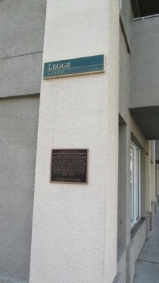
Named in 2010 for James Plotkin, the "Unoffical Mayor of Old Pasadena", and a well known businessman and community leader dedicated to the revitalization of Old Pasadena. As a founding member of the Pasadena Central Improvement Association, Plotkin . . . — — Map (db m72681) HM
Named for General Edwin Ward, a major real estate investor and owner of the Ward Block and the Grand Hotel at the southwest corner of Colorado Boulevard and Fair Oaks Avenue originally named "Grimes Alley" after Charles Grimes whose restaurant and . . . — — Map (db m151950) HM
Named for Dr. J. Carvasso Fraser, Physician for the Raymond Hotel in the 1890s. The Raymond Hotel, perhaps the finest of Pasadena's early grand resort hotels, was located on South Raymond Avenue on Raymond Hill, two miles south of Colorado . . . — — Map (db m151947) HM
Named for T.E. Martin who build The Webster Hotel in 1884 at the southwest corner of Colorado Boulevard and Fair Oaks Avenue. Later called The Grand Hotel, it was the scene of many social events in early Pasadena. — — Map (db m151948) HM
Named for E.L. McCormick, President of the American Bank & Trust Company from 1907-1910. The American Bank & Trust Company, organized in 1905, was located at the northeast corner of Colorado Street and Broadway at 135 East Colorado Street. A good . . . — — Map (db m151949) HM
Named for Alexander Fraser Mills, a nurseryman who planted a citrus grove on 7 1/2 acres at the northwest corner of Colorado Boulevard and Fair Oaks Avenue in 1878. Mills Place was originally named "Ward Alley." In 1885, a fire at this site . . . — — Map (db m151954) HM
Thornton Gardens
A Site of the
National Trust for
Historic Preservation.
Thornton Gardens
Katherine Emery House - 1928
Placed on the
National Register of Historic Places - 2011. — — Map (db m216051) HM
This site was the location of a combination store, post office, telegraph office, tavern, and stage depot accommodating travelers during the Kern River gold rush in the early 1850s. A regular stop for Butterfield and other early California stage . . . — — Map (db m154273) HM
In Placeritas Canyon, March 1842, Francisco Lopez y Arballo, while gathering wild onions from around an old oak, discovered gold particles clinging to the roots of the bulbs. It is estimated that $80,000 in gold was discovered as a result of this . . . — — Map (db m154260) HM
Francisco Lopez made California’s first authenticated gold discovery on March 9, 1842. While gathering wild onions near an oak tree in Placerita Canyon he found gold particles clinging to the roots of the bulbs. The San Fernando placers and nearby . . . — — Map (db m154261) HM
In 1875 the Star Oil Company, one of the predecessors of the Standard Oil Company of California, drilled its first Pico Canyon well, which yielded about one hundred barrels per day. The discovery resulted in the erection of the first commercial oil . . . — — Map (db m145418) HM
The Saugus Café, one of the most colorful and historical eating establishments in all
of Southern California and the longest operating restaurant in Los Angeles County, was
opened in 1888 by James Herbert Tolfree. The name of this historical . . . — — Map (db m208067) HM
Mentryville, named after Charles Alexander Mentry, who drilled California's first successful commercial oil well in 1876, was one of the first oil towns in the state. Mentry's restored home, barn and Felton School remain on the site where the . . . — — Map (db m165661) HM
In Placeritas Canyon, March 1842, Francisco Lopez y Arballo, while gathering wild onions from around an old oak, discovered gold particles clinging to the roots of the bulbs. It is estimated that $80,000 in gold was discovered as a result of this . . . — — Map (db m154259) HM
Approximately one-half mile south of this point was the adobe headquarters of Rancho San Francisco, originally built about 1804 as a granary of Mission San Fernando. The rancho was granted to Antonio de Valle in 1839. Here, in January 1850, William . . . — — Map (db m30667) HM
Harry Carey Sr. was an early silent-screen actor who starred in more than 200 films. In 1916 he took over the homestead rights of a previous settler and established his ranch of almost 2,000 acres. Carey, the first of many film actors to settle in . . . — — Map (db m146570) HM
The Santa Monica Pier was built in phases between 1908 and 1916. It originally consisted of a Municipal Pier for strolling and fishing and a Pleasure Pier for amusements. The Hippodrome was constructed in 1916 to house the Pleasure Pier's carousel, . . . — — Map (db m119675) HM
Dedicated 1952 to Will Rogers - Humorist - World Traveler - Good Neighbor.
This Main Street of America, Highway 66, was the first road he traveled in a career that led him straight to the hearts of his countrymen. — — Map (db m119616) HM
Population:
1912 = 419
2012 = 12,981
In the early years Oakhurst, or Fresno Flats as it was originally known, provided supplies to miners, ranchers, and lumber companies in the surrounding sierra foothills. One hundred years later and now . . . — — Map (db m149009) HM
"Gold Fever" hit the streams in Madera County in 1849. Grub Gulch got its name from the fact that "miners could always pan enough gold from the river to grubstake themselves into better times."
Grub Gulch developed after the Gambetta Mine opened . . . — — Map (db m33719) HM
Point Reyes Light has guided and cautioned mariners along this hazardous coast for over 100 years. Built by the U.S. Lighthouse Service in 1870, it came under management of the U.S. Coast Guard in 1939. Resident personnel operated the station until . . . — — Map (db m63502) HM
H. Dana Bowers (1903-1977)
Supervising landscape architect
for the California Division of Highways.
Created and nurtured California's
Highway beautification program from 1936 to 1964
This vista point, designed by Mr. Bowers, is one of many . . . — — Map (db m195734) HM
From a vista point near the 1,156 long, 130 foot high bridge, completed in 1966, the site of Bagby lies east under, and sometimes exposed beside, the back waters of Lake McClure. Bagby's history passed through three definite development eras. From . . . — — Map (db m5957) HM
From the crest of the ridge of a few hundred feet behind this point members of the Mariposa Battalion under the leadership of Major James D. Savage looked into Yosemite Valley on March 27, 1851.
Alarmed by the encroaching tide of California Gold . . . — — Map (db m47417) HM
After leading the first tourist party into Yosemite Valley in 1855, entrepreneur James Hutchings promoted the Valley’s “Scenes of Wonder and Curiosity” in his own .California Magazine. Not long after, a steadily increasing stream . . . — — Map (db m65506) HM
In 1869, innkeeper James Hutchings hired a young wilderness explorer named John Muir to rebuild and operate his sawmill. Muir worked here for almost two years, milling trees blown down in a storm to build improvements at Hutchings’ Yosemite Valley . . . — — Map (db m66101) HM
Established in this vicinity June 11, 1857 by 1st Lieutenant Horatio Gate Gibson, 3rd Artillery, later Brigadier General, US Army. Named by Gibson in honor of his former company commander, Braxton Bragg, later General, C.S.A. Abandoned in October . . . — — Map (db m10585) HM
The last remaining structure and once the original quartermaster’s storehouse and commissary of Fort Bragg Military Post 1857-1864, then located near Laurel and Redwood Avenues. — — Map (db m10586) HM
The strange and beautiful objects found along this beach started out as trash. Until 1959, this site was Fort Bragg's garbage dump. Years of smoldering fires and salt-water spray melted and twisted old cars, household trash, electric materials, . . . — — Map (db m96556) HM
This cemetery is dedicated to the memory of all the patriotic men and women who answered their country’s call to service. Their inspiring contribution will help preserve in the hearts and lives of all Americans the spirit of patriotism, the love . . . — — Map (db m38731) HM
This spot marks the convergence of two pioneer trails widely used by emigrants during the years 1846-1850. The Applegate Trail, established in 1846, led from the Humbolt River in Nevada to the Willamette Valley in Oregon. The Lassen Cut-Off, . . . — — Map (db m10174) HM
Founded in 1860 by A. Horteshorne, Coleville played a major roll in the development of Mono County. It was once known as Centerville, Double Town (due to the high prices charged for supplies) and Amonia. It was finally named as Coleville after . . . — — Map (db m11342) HM
Near this location, records show establishment of a post office at Topaz, Mono County, California, February 20, 1885. Discontinued in 1922, it was re-established in June, 1926. Nearby could also be found a school, way-station, blacksmith shop, and . . . — — Map (db m50086) HM
Even though Monterey cypress trees prefer this area's rugged bare granite headlands, the Lone Cypress is a testament to the hardiness of these trees. It has withstood Pacific storms and winds for roughly 250 years. Fences and cables now offer added . . . — — Map (db m8476) HM
Roofing contractor Charles L. Frost (top) supervises his crew hot mopping a Monterey cannery roof. Concentrated along the shoreline, the fish processing plants were subject to storm damage. In addition, changes were required to accommodate new . . . — — Map (db m55079) HM
In this building from September 1 to October 13, 1849 assembled the convention which drafted the constitution under which California was admitted to statehood, September 9, 1850. The forty-eight delegates met on the upper floor which ran the length . . . — — Map (db m196673) HM
Monterey's earliest pier of stone built in 1846 gave way to a commercial fishing wharf in the early 1900's when Monterey's multi-million dollar fishing industry was born. Despite many changes the wharf today retains the tone and flavor of the past . . . — — Map (db m30190) HM
From 1901 to 1941, much of the eastern portion of Cannery Row’s coastline was occupied by a single estate, Casa de Las Olas, which stretched 1,000 feet along Monterey Bay (top). San Francisco financier Hugh Tevis had it built in 1901 as a wedding . . . — — Map (db m55212) HM
The Del Mar Canning Company was established in 1927 on this site, the original location of the Bayside Fish & Flour Company, a Japanese-operated reduction plant established in 1916. The Del Mar quickly rose to prominence in the canning industry . . . — — Map (db m55164) HM
This mission, founded October 9, 1791 by Father Fermín Francisco de Lasuén, ministered to the Indians of the Salinas Valley. Governor José Joaquín de Arrillaga died here July 24, 1814 and was buried in the chapel. Prosperous in its early years, . . . — — Map (db m27217) HM
The town of Spreckels was established by Claus Spreckels in 1898 as a company town to provide a complete community (including store, school, hotel, church, theater, etc.) for employees of the Spreckels Sugar Company. When built, the Spreckels . . . — — Map (db m63625) HM
This historic grist mill known as the “Bale Mill” was erected by Dr. E.T. Bale, Grantee Carne Humana Rancho, in 1846. The mill with its surrounding land was deeded to the Native Sons of the Golden West by Mrs. W.W. Lyman. Restored . . . — — Map (db m18672) HM
The site of the City Hall originally held the Bedlam Opera House, named after a niece of Sam Brannan, founder of Calistoga. Burned to the ground at the turn of the Century, it was rebuilt and completed in 1902.
Originally built to house . . . — — Map (db m18560) HM
Founded in 1862 by Jacob Schram. This was the first hillside winery of the Napa Valley. Robert Louis Stevenson, visiting here in 1880, devoted a chapter of his “Silverado Squatters” to Schramsberg and its wines. Ambrose Bierce and Lilly . . . — — Map (db m52168) HM
Built by Frederick and Jacob Beringer, natives of Mainz, Germany. This winery has the unique distinction of never having ceased operations since its founding in 1876. Here, in the European tradition, were dug underground wine tunnels hundreds of . . . — — Map (db m18734) HM
The Hudson House, constructed in 1852, was residence of David Hudson, a California pioneer involved in the Bear Flag Revolt. That revolt is credited with the design of the California State Flag and established California as a republic.
In 1883, . . . — — Map (db m18702) HM
Departed this life February 1953
Located on the hill to the east and south of this point was a haven of comfort to many a man from the late 1800’s until closed in 1953. Condemned by certain elements of our society yet venerated by others that . . . — — Map (db m54583) HM
Established in 1884 by Mexican War Veterans and members of the Grand Army of the Republic who recognized the need for a home for California’s aged and disabled veterans. In January 1897 the Veterans Home Association deeded the home and its 910 acres . . . — — Map (db m18743) HM
It was at this location on the afternoon of June 5, 1880 that a fire erupted in John White’s Upholstery Shop. More than fifty buildings – including the nearby New York Hotel and most of the Chinese Quarter – were destroyed within an . . . — — Map (db m70882) HM
Nevada City, the “Queen City of the Northern Mines”, became a town of 16,000 in the early 1850’s following the discovery of gold on Deer Creek in 1849. Here is located the largest and best preserved historical downtown district in . . . — — Map (db m49875) HM
This cemetery was established in 1851 on a knoll, back of the First Methodist Church. This gave the site its name. Many noted citizens rest here. — — Map (db m11677) HM
Built in 1855 as the edifice of the Baptist Church, it was here that famed soprano Emma Nevada (Emma Wixom Palmer) made her debut at the age of three. In 1886 the church was remodeled as the residence of the E.T.R. Powell family — — Map (db m14824) HM
Headquarters for the largest network of water flumes and ditches in the state. The South Yuba Canal Water Company was the first incorporated to supply water for hydraulic mining. The original ditch was in use in May, 1850, and this company office . . . — — Map (db m10836) HM
This hotel, one of the oldest in continuous operation west of the Rockies, opened for business in August, 1856. Originally known as The “Bicknell Block”. The structure consists of three common-walled buildings of simple brick . . . — — Map (db m12891) HM
Built in the mid 1850’s by John Fippin and John Single. Fippin married Single’s daughter, Julia, in 1867, and they raised 10 children. Local legend has it that one of Lotta Crabtree’s earliest performances was atop the anvil here. The building . . . — — Map (db m10561) HM
Established in 1849 and named in honor of General Zachary Taylor, after the Rough and Ready Company of miners from Wisconsin, this was one of the principal towns of Nevada County. In 1850, articles of secession were drawn up establishing the . . . — — Map (db m10560) HM
On this site Joseph Delos Pollard constructed the first resort on the west end of Donner Lake. Between mid 1864 and early 1868 Pollard’s Station on the Dutch Flat and Donner Lake Wagon Road was office to the Pioneer Stage Co. and Wells, Fargo & Co. . . . — — Map (db m60506) HM
A natural glacier formation, or the work of an unknown tribe as a form of altar. It’s exact origin will never be known. The perfectly balanced stone until recently would rock at the touch of a finger.
C.F. McGlashan built the original tower in . . . — — Map (db m23527) HM
First known as Gray’s Toll Station, then Coburn’s Station, Truckee was established in 1863. Renowned for its lumber industry, Transcontinental Railroad, icehouses, saloons and red light district, Truckee has never been known for her laid back . . . — — Map (db m23520) HM
In 1863, Joseph Gray built Truckee’s first structure on this site for use as the Dutch Flat–Donner Lake Wagon Road’s Toll Station. The old log structure was moved in 1907 to the Englehart property on Church Street, one block east of this site, . . . — — Map (db m23545) HM
In August 1850 Washington was the highest point on the South Yuba River at which gold had been discovered with over 1,000 miners. In 1870 the Chinese out numbered the white population. The last try to strike it rich was in the 1890’s.
Washington . . . — — Map (db m43685) HM
In 1866, German Colonists established the Anaheim Cemetery as the first public cemetery in Orange County. Many of the early leaders of Anaheim and Orange County are interred here. The Community Mausoleum was built in 1914 as the first mausoleum on . . . — — Map (db m58908) HM
The original townsite of Anaheim was surrounded by a living fence of willow trees to keep out the livestock which roamed freely on the open range. This is the site of the gate that was opened to permit travel to and from San Pedro and Los Angeles. — — Map (db m49990) HM
The course of oil production was changed in 1899 when the Olinda area became the first site in California to use the technique of drilling with the hole full of water. Having been developed as a source of fuel oil for for the Santa Fe Railroad, . . . — — Map (db m50337) HM
As part of a four-city Orange County campaign tour, vice presidential candidate Richard Nixon made a 10-minute speech in City Hall Park on October 20, 1952, in front of 1,600 excited supporters. Brea's "country doctor” Glenn Curtis introduced . . . — — Map (db m199730) HM
Named for Richard Henry Dana, author of "Two Years Before the Mast", who visited here in 1835. El Embarcadero, the cove below, was used by hide vessels trading with Mission San Juan Capistrano. This trade reached its peak in 1830-1840. In 1818 . . . — — Map (db m149479) HM
The Hoffman family arrived here about 1910. A son Ed and his wife Elsa were very active during the City incorporation. Many meetings and City business were conducted in their home.
June 13, 1976 — — Map (db m79867) HM
A stylish two story Zigzag Moderne market was built and operated in 1926 by Roy de Britton and his son Bob.
The open air market contained a meat market, produce counters and the rainbow lunch counter, a popular meeting place. Night time . . . — — Map (db m51965) HM
The first post office, officially naming this settlement "La Habra," was granted in 1896 and was established in a corner of Coys Store, located on this site. El Camino Viejo, the old road between the missions, passed this corner, which became a . . . — — Map (db m50004) HM
This site is on the northern edge of the West Coyote oil field, one of the largest fields in the Los Angeles Basin. This field produced about 250 million barrels of oil from sandstone at a depth of about 3,000'. West Coyote was active from 1903 to . . . — — Map (db m58909) HM
The first sugar beet processing plant in Orange County was built here in 1897 on land donated by the Bixby Land Company. The industry brought jobs and development that created the new town of Los Alamitos. Although nematode infestation of the sugar . . . — — Map (db m50041) HM
The original wharf at this site was completed in the winter of 1888-89 and was connected by railroad with the hinterland in the winter of 1890-91. It served as a shipping and distributing point for Orange, San Bernardino, and Riverside counties . . . — — Map (db m146157) HM
Established in 1886, the plaza was for many years the local and commercial hub of Orange. The plaza historic district attained significance throughout the state as a historic landmark in 1981 and was placed on the National Register of Historic . . . — — Map (db m189682) HM
Historic Town Center Park
Today the San Juan Capistrano down town and Mission San Juan Capistrano are situated on the site of the Juaneño village of Acjachema. History explains that in 1769 the first Spanish exploratory expedition, led . . . — — Map (db m51947) HM
Antonio Valenzuela, early pioneer of the town of San Juan Capistrano, built the adobe in the early 1840s, probably on the ruins of a mission Indian adobe dating to the 1790s. Later Valenzuela family members worked as local cowboys or vaqueros. The . . . — — Map (db m149787) HM
The Los Rios Historic District was placed on the National Register of Historic Places April 4, 1983. This District includes 31 historic structures which line both sides of the street from Del Obispo to Mission Street. The District's registered . . . — — Map (db m149784) HM
The Santa Ana Mountains, which encompass the canyons of Silverado, Modjeska and Trabuco, provided one of the last refuges for the state symbol, the Grizzly Bear.
At the turn of the century, beekeeping was an important local industry, providing . . . — — Map (db m78516) HM
Andrew and Anna Hoffman raised their family and lived on this land for 20 years. The Hoffmans moved to Live Oak Canyon from Santa Ana in 1955 with their four youngest children. Their land spanned approximately ten acres and included a three bedroom . . . — — Map (db m195047) HM
On this land, portion of Santa Ana grant awarded by King of Spain 1810 to Jose Antonio Yorba, and additional grants to his son by Governor Jose Figueroa 1834, was created Hacienda of Don Bernardo Yorba. Greatest ranchero of golden age, Bernardo . . . — — Map (db m50305) HM
Erected in 1891 by the volunteer firemen of Auburn Hook and Ladder Company No.2 with funds raised by public subscription. Dedicated May 21, 1892. In continuous use until 1954 — — Map (db m11920) HM
An early hotel and stage station located on this site marked the junction of roads from Auburn to Foresthill and Illinoistown. In 1854, the home of “The Auburn Poetess,” Mary Eulalie Shannon, reputed to be California’s first woman poet. . . . — — Map (db m81604) HM
Fritz Beerman and his son, Charles, came to Lincoln in 1880 and worked together in the harness and saddle shop at 5th and F Streets. Charles served as Lincoln’s Town Treasurer after the election of 1892.
Dedicated in December of 1991
Lincoln . . . — — Map (db m17722) HM
1859: Charles Lincoln Wilson buys this site, previously patented by Theodore Judah.
1861: C.L. Wilson erects a wooden warehouse to serve railway terminal across 5th street.
1863: Used often as a community hall, “Roods . . . — — Map (db m17835) HM
Loomis
Named After
James Oscar Loomis
1830 – 1895
This community was founded in 1850 and originally named “The Grove” by gold miners who settled along Secret Ravine one mile east of here.
Forming . . . — — Map (db m91090) HM
(Original marker, which was stolen in 2012. See Photo #1)
Founded in 1849 as 'The Spanish Corral,' Area proved so rich that Biblical name of Ophir adopted in 1850. Most populous town in Placer County in 1852, polling 500 votes. Almost . . . — — Map (db m11922) HM
Founded June 1851 - Commonly called 'Virginia.' Over 2,000 miners worked rich deposits. Captain John Brislow built California's first railroad, 1852, to carry pay to Auburn Ravine, a distance of one mile. Site of Philip Armour's and George Aldrich's . . . — — Map (db m10973) HM
A Russian emigrant, surveyor and visionary, Von Schmidt established the present California-Nevada state line between Lake Tahoe and Oregon. He formed the San Fransico and Lake Tahoe Waterworks Company which proposed, during the 1870s, to build a . . . — — Map (db m169743) HM
Petroglyph Area
“Petro” means rock, “Glyph” means writing. Archeologists speculate that pre-historic cultures used petroglyphs to depict aspects of ceremonial significance. These petroglyphs, which are carved in . . . — — Map (db m23427) HM
The turn of the last century brought sweeping change to Tahoe City. Previously, only wealthy families could afford to travel to Lake Tahoe for an extended summer vacation. By the 1920s middle class families could afford to travel in their . . . — — Map (db m34522) HM
Most folks traveling to Tahoe City in the 1800s arrived by stagecoach from Truckee. By 1868, 25 people called Tahoe City home.
Some harvested hay on what is now Tahoe City’s Golf Course, some worked as fishermen on Lake Tahoe. Others found . . . — — Map (db m34864) HM
Stump Ranch, a stage stop on the Red Bluff – Susanville Wagon Road, was also the road’s caretaker. It may have changed hands in an 1890’s poker game. The name arose after 1880’s logging left a field of stumps. So it could be recorded as swamp . . . — — Map (db m56746) HM
This is the site of the
Old Lake House
Erected by Judge Charles F. Lott in 1870 in connection with the diversion of the lake water to his mine at Gravel Range.
This monument was built for his daughter, Cornelia Lott Sank by her husband, and . . . — — Map (db m175884) HM
In 1933, Dr. Sidney R. Garfield opened Contractors General Hospital thirteen miles east of here. This facility successfully delivered health care to Colorado River Aqueduct workers through an innovative prepaid insurance plan. Later, in association . . . — — Map (db m153949) HM
During the opening days of the World War II, more than 18,000 square miles of the Arizona and California desert were designated by the U.S. Army as a military training facility. The facility, conceived by General George Patton and referred to as the . . . — — Map (db m78512) HM
548 entries matched your criteria. Entries 201 through 300 are listed above. ⊲ Previous 100 — Next 100 ⊳