On Corral Road at Randolph Road, on the right when traveling west on Corral Road.
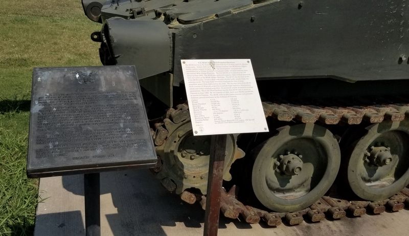
The M109 served in the Vietnam War with both the U.S Army and U.S. Marine Corps units. Armed with a powerful 155mm howitzer, the M109 was a highly mobile combat support weapon. After the development, a request was established for a 155mm howitzer . . . — — Map (db m216509) HM
On Corral Road at Randolph Road, on the right when traveling west on Corral Road.
The M109A2 and A3 were the Army's standard self-propelled howitzers during Operation Desert Storm in 1991. Both the M109A2 and A3 were virtually identical with the A2 being a newly manufactured vehicle while the A3 was an upgraded, older vehicle. . . . — — Map (db m216947) HM
On Corral Road at Randolph Road, on the right when traveling west on Corral Road.
This powerful howitzer served the U.S. Army and U.S. Marine Corps in three models for over thirty years. It originated with the requirement for air-transportable vehicles with interchangeable weapons in the late 1950s. First produced in August . . . — — Map (db m216945) HM
On Corral Road at Randolph Road, on the right when traveling east on Corral Road.
The M119 has served as the howitzer of U.S. Army airborne, mountain and light infantry units since 1989. The howitzer originated as the British L118 designed by the Royal Ordnance Factory. It entered service with the British Army in 1975 and first . . . — — Map (db m182395) HM
On Corral Road at Randolph Road, on the right when traveling west on Corral Road.
Introduced in 1978, the M198 replaced the World War II vintage M1/M114A2 155mm Howitzer for the U.S. Army and the Marine Corps. The howitzer has a split trail carriage and the wheels could be rotated up to allow the howitzer to rest on its firing . . . — — Map (db m217058) HM
On Corral Road at Randolph Road, on the right when traveling west on Corral Road.
The 240mm Howitzer, M1 and the 8-inch Gun, M1, were the heaviest American artillery weapons fielded in WWII. A new 240mm/8-inch transport wagon was designed suitable for high-speed towing, but took longer than anticipated to field. The first . . . — — Map (db m206509) HM
On Corral Road at Randolph Road, on the right when traveling east on Corral Road.
Introduced in July 1954, the Corporal was the first U.S. guided nuclear missile. The surface to surface, 46 foot long Corporal Missile was one of the a first liquid-fueled, rocket powered, ballistic weapon. The first Corporal was tested in 1947, but . . . — — Map (db m182392) HM
On Corral Road at Randolph Road, on the right when traveling west on Corral Road.
Introduced in 1953, the M21 was the Army's first new multiple rocket launcher since the end of World War II. It was also the last multiple rocket launcher in the Army until the introduction of the Multiple Rocket Launcher System (MLRS) in 1983. . . . — — Map (db m206531) HM
On Corral Road at Randolph Road, on the right when traveling west on Corral Road.
Developed as the T-10 Heavy Artillery Transporter by Kenworth Truck Company, this pair of trucks was standardized as the M249 for the front and M250 for the rear trucks in 1952. A total of sixty-six pairs were built in 1952-53, although only twenty . . . — — Map (db m217104) HM
On Corral Road at Randolph Road, on the right when traveling west on Corral Road.
The M2A1 was the standard U.S. divisional artillery piece of World War II and served in large numbers in both the Korean War and in the Vietnam War. It was the most commonly used American artillery piece of World War II. It equipped 264 field . . . — — Map (db m216911) HM
On Corral Road at Randolph Road, on the right when traveling west on Corral Road.
The M37 105mm Howitzer Motor Carriage (HMC) arrived too late for service in World War II, but the M37 did see considerable combat in the Korean War in the early 1950s. The M37 replaced the heavier and slower M7 105mm Howitzer Motor Carriage, known . . . — — Map (db m206526) HM
On Corral Road at Randolph Road, on the right when traveling west on Corral Road.
The Lacrosse was a short-range ballistic missile of the Cold War, which proved to be less than successful. Development began in 1947, but the missile did not enter service until July 1959. The M4 Lacrosse Missile System was designed to provide . . . — — Map (db m216440) HM
On Corral Road at Randolph Road, on the right when traveling west on Corral Road.
With the great success of the M12 155mm Gun Motor Carriage (GMC) in Western Europe, by 1944 the Army was convinced that a new self-propelled gun was needed as the supply of old 155m guns used on the M12 had been exhausted. The new vehicle used the . . . — — Map (db m206496) HM
On Corral Road at Randolph Road, on the right when traveling west on Corral Road.
With the great success of the M12 155mm Gun Motor Carriage (GMC) in Western Europe and the supply of the old World War I era 155mm guns used on the M12 was being exhausted, the Army was convinced by 1944 that a new self-propelled gun was needed. . . . — — Map (db m193501) HM
On Corral Road at Randolph Road, on the right when traveling west on Corral Road.
During the Korean War, the United States Army accepted the M44 155mm Howitzer Motor Carriage to replace the World War II, M41 155mm Howitzer Motor Carriage. The M44 was developed to provide fire support for fast-moving armored forces. It was . . . — — Map (db m216445) HM
On Corral Road at Randolph Road, on the right when traveling west on Corral Road.
Introduced in 1965, the M548 is the unarmored cargo carrier version of the M113 Armored Personnel Carrier. The M548 was used for carrying cargo, especially artillery ammunition to forward areas. Capable of carring up to 5.45 tons through rugged or . . . — — Map (db m217061) HM
On Corral Road at Randolph Road, on the right when traveling west on Corral Road.
The M56 Scorpion was developed to provide American Airborne forces with a mobile, self-propelled, anti-tank gun that could be transported by helicopter or dropped by parachute. A total of 325 Scorpions were manufactured from 1953 to 1959 by the . . . — — Map (db m216516) HM
On Corral Road at Randolph Road, on the right when traveling west on Corral Road.
This massive artillery piece was developed during the Cold War for use against the Soviet forces to fire atomic rounds if the Soviets attacked West Germany. The 280mm gun, an 11-inch caliber, was determined in 1949 as being the smallest gun capable . . . — — Map (db m217105) HM
On Corral Road at Randolph Road, on the right when traveling west on Corral Road.
The M981, known as the FIST-V, was the first U.S. Army specialized vehicle for the Fire Support Team or Forward Observer in the U.S. Army. Introduced in 1978, the FIST-V used a M113 Armored Personnel Carrier chassis and was identical in appearance . . . — — Map (db m217063) HM
On Corral Road at Randolph Road, on the right when traveling west on Corral Road.
The Sergeant Missile System, the first large U.S. solid-propellant missile, was designed to succeed the Corporal Missile. The first Sergeant Missile flew in 1956 and was fielded in 1962. Seven U.S. Army battalions and three West German battalions . . . — — Map (db m216518) HM
On Corral Road at Randolph Road, on the left when traveling east on Corral Road.
The Pershing I was the first of a family of powerful long-range nuclear missiles in service during the Cold War. The MGM-31A Pershing I Battlefield Support Missile entered service with the United States Army in 1964, replacing the aging Redstone . . . — — Map (db m182456) HM
On Corral Road at Randolph Road, on the right when traveling west on Corral Road.
In 1969, the Pershing IA Missile System was fielded as an upgrade of the existing Pershing I Battlefield Support Missile. The improved version utilized the existing missile; however, it was transported in an improved semi-trailer that carried . . . — — Map (db m216536) HM
On Carol Road at Randolph Road, on the right when traveling west on Carol Road.
The Pershing II was a powerful long-range strategic nuclear missile of the last decade of the Cold War. With a range of 1,100 miles, it was the longest range weapon in U.S. Army Field Artillery history. In 1983, the new Pershing II Missile System . . . — — Map (db m216916) HM
On Corral Road at Randolph Road when traveling west on Corral Road.
The Lance was a U.S. Army tactical surface to surface nuclear missile of the Cold War. The Lance entered service in June of 1972, replacing the Honest John artillery rocket that entered service in 1954 and the Sergeant Battlefield Support Missile of . . . — — Map (db m216915) HM
On Corral Road at Randolph Road, on the right when traveling west on Corral Road.
Development began in 1950 with testing of prototypes in 1951 and production in 1953. It was intended to replace super heavy field artillery pieces which were difficult and time-consuming to emplace. Honest John was a spin-stabilized, one stage . . . — — Map (db m216439) HM
On Corral Road at Randolph Road, on the right when traveling west on Corral Road.
The Little John was a small, highly mobile nuclear capable rocket of the Cold War. The MGR-3 Little John Rocket system was a smaller version of the Honest John Rocket System. It entered service in November 1961. It was designed as a light, very . . . — — Map (db m216441) HM
On Corral Road at Randolph Road, on the right when traveling east on Corral Road.
The Redstone was America's first large ballistic missile during the Cold War. Introduced in 1958, the Programmed Guided Missile-11 Redstone was the American version of the famous German V-2 Rocket used in World War II. In the early 1950s, the U.S. . . . — — Map (db m182391) HM
On Corral Road at Randolph Road, on the right when traveling west on Corral Road.
The T-162 was one of a number of American heavy, self-propelled artillery prototypes in the early Cold War. This artillery piece was envisioned to combine mobility with a high-powered, long-range gun. In 1950, the Army Equipment Development . . . — — Map (db m216446) HM
On Corral Road at Randolph Road, on the right when traveling west on Corral Road.
Development of the Crusader began in the 1980s as a replacement self-propelled artillery system to the M109 series, 155mm self-propelled howitzers. The program requirements drove significant enhancements in the areas of mobility, lethality and . . . — — Map (db m216960) HM
The Americal (23rd) Infantry Division is unique in the annuals U.S. Army history. It was the only modern Army division that began with a name and no number assigned to it. Each time it was activated in war it grew out of a Task Force first. All . . . — — Map (db m106243) HM WM
On Harry Road at Randolph Road, on the right when traveling east on Harry Road.
The US Army standardized the M1 90mm anti aircraft gun in 1940 and steadily improved its design in the first two years of the US involvement in WWII. By 1943, however it was determined that a more versatile weapon was needed. The M1 was a . . . — — Map (db m182454) HM
On Corral Road at Randolph Road, on the right when traveling west on Corral Road.
In 1955 the U.S. Army established a requirement for a direct support, self-propelled artillery piece that would combine the best features of a light howitzer and a heavy mortar. This new light self-propelled howitzer would also be small and light . . . — — Map (db m216447) HM
On Cache Meers Road (State Highway 49/115) 1.5 miles south of State Highway 49, on the left when traveling north.
For millennia, the rugged and ancient range of the Wichita Mountains has stood guard over a natural prairie.
The granite walls and canyons of the Wichita Mountains offered refuge to waves of people over many centuries, beginning with . . . — — Map (db m180346) HM
On State Highway 58 0.7 miles north of NW Wolf Road, on the right when traveling north.
Kiowa Chief Stumbling Bear who signed the Medicine Lodge Treaty, 1867, founded the first permanent settlement on Canyon Creek, southwest of here. First Government-built houses for Indians were erected in the settlement, 1877. — — Map (db m108856) HM
An advocate of peace and known for his eloquent words, Chief Ten Bears worked to negotiate harmony between the United States Government and his Comanche people. Tribal members held him in high regard and often chose him as their representative at . . . — — Map (db m98711) HM
Near Indian Trail Road north of NW Mission Boulevard, on the left when traveling north.
This bell was especially cast for the Comanche Reformed Church when the church was completed in 1905. The bell was used during the ministries of Reverend L.L. Legters, first missionary, and his successors, Reverends H. Sluyter, J. Dykema, R.H. . . . — — Map (db m60885) HM
On Cache Meers Road (State Highway 115) east of State Highway 49, on the left when traveling north.
The Ferguson family built this beautiful cobblestone home in 1927. Ben and Margaret Ferguson, along with their 10 children, grew hay and garden vegetables, raised cattle, and planted a small fruit orchard with the help of his oldest sons. Ben . . . — — Map (db m180339) HM
On Cache Meers Road (State Highway 115) 1 mile east of State Highway 49, on the left when traveling east.
This home and the Earl Ingram Homestead east of here were both built out of the round granite core stones that cover the hillsides of the refuge, and both were acquired during the 1901 land lottery held at Fort Sill. They reflect the hard work, . . . — — Map (db m180403) HM
On Cache Meers Road (State Highway 115) 1 mile east of U.S. 115, on the left when traveling east.
As unemployment reached 25% in 1933, President Roosevelt launched a series of work programs called the New Deal.
Two of these programs were the Works Progress Administration, or WPA, and the Civilian Conservation Corps, or CCC. Over ten . . . — — Map (db m180408) HM
"The Queen of the Frisco Railroad rolled into Lawton, Oklahoma on Friday, July 7, 1961 on her last journey."
Baldwin Locomotive Works in Philadelphia, Pennsylvania is one of the most successful builders of locomotives in the world. The . . . — — Map (db m204481) HM
Near Chatto Road west of Punch Bowl Road, on the left when traveling west.
This unique landmark at the eastern end of the Wichita Mountains was noted, described, and explored by all early expeditions and was held in deep reverence by the Indian tribes of this area from time immemorial. The four contiguous porphyry . . . — — Map (db m314044) HM
On West Missouri Avenue (Oklahoma Route 5) west of North 9th Street, on the right when traveling east.
At the opening of Kiowa-Comanche-Apache lands, the original townsite in old Comanche County was SW 1/4, T2S, R11W. The original name McKnight was rejected by the post office. The name Walter, for City Commissioner W.R. Walter, was then chosen Sept. . . . — — Map (db m119434) HM
On East 1380 Road 0.5 miles east of U.S. 287, on the right when traveling west.
Pioneers came to this area in the 1890's to homestead land. A diverse group settled in the Brinkman area with most coming from Texas, as well as a significant influx of immigrants from Lebanon. These hearty pioneers braved adversities including . . . — — Map (db m288715) HM
On Lake Creek Road (County Road 1370) at County Road N 2000, on the right when traveling west on Lake Creek Road.
Center Panel
This monument is dedicated to the pioneers who settled the community. Their strength and courage enabled them to survive adverse conditions, giving us a goodly heritage, for which we are grateful. Most of the land in the Lake . . . — — Map (db m288530) HM
On North Main Street north of W Parker Street, on the left when traveling north.
Center Panel
The 36th Infantry Division was organized by combining the Oklahoma and Texas National Guards. Sixty men who volunteered from Old Greer County were kept together and placed in the 132nd Machine Gun Battalion in that division. . . . — — Map (db m288525) HM WM
On West Mountain Avenue at Ada Street, on the right when traveling west on West Mountain Avenue.
Established in Wichita Falls, Texas by Dr. Dan and Eleanor Roberts. Their interest in cemetery memorials, their keen observations and sense of humor lead them to create this unique attraction. The cemetery was originally located at the Roberts' home . . . — — Map (db m287601) HM
Wichita Village in Devil's Canyon was scene of 1st. meeting between the U.S. and Plains Indians in Oklahoma to promote peace, July 21, 1834. U.S. Dragoon Regiment under command of Col. Henry Dodge accompanied by other noted officers and civilians . . . — — Map (db m146590) HM
On West Jefferson Street at S Commerce Alley, on the left when traveling west on West Jefferson Street.
Alice Florence Sheriff
Daughter of B.F.J. Davis and Margaret Lucinda Ray born July 24, 1885, Bell County, Texas. Came to Reed community, Greer County, 1900 with her parents, brothers, and sisters in a covered wagon. Attended business college . . . — — Map (db m288803) HM
On West Jefferson Street at S Commerce Alley, on the left when traveling west on West Jefferson Street.
Alice Gilstrap Ewalt
Alice Morning Gilstrap was born Mar. 22, 1862 at Bloomington, Il. One of eight children born to David Wilson Gilstrap and Permelia Frances Stillwell. The family moved to Texas and she married John Francis Ewalt on Sept. 5, . . . — — Map (db m289972) HM
On West Jefferson Street at S Commerce Alley, on the left when traveling west on West Jefferson Street.
Caledonia Armstrong Trench
Caledonia Armstrong, daughter of Martha Jane Isbell and George Armstrong, was born May 28, 1876, in Panola County, Mississippi. She married Daniel MacKay Trench in Waelder, Texas. They settled in Old Greer County in, . . . — — Map (db m289611) HM
On West Jefferson Street at S Commerce Alley, on the left when traveling west on West Jefferson Street.
Daniel Mackay Trench
Son of Francis Charlotte MacKay and Daniel Power Trench was born Kingston, Jamaica on Jan. 29, 1867. He was educated at Padcroft College, a boys boarding school near London, and at Glasgow Academy, Glasgow, . . . — — Map (db m289612) HM
On West Jefferson Street at S Commerce Alley, on the left when traveling west on West Jefferson Street.
Dr. Fowler Border
Born in San Augustine, Texas in 1871. He opened the first hospital in Old Greer County at S.E. corner of Court House Square in 1900. He was awarded a gold medal by the people of Snyder, Oklahoma for service above and beyond . . . — — Map (db m289530) HM
On West Jefferson Street at S Commerce Alley, on the left when traveling west on West Jefferson Street.
Edith Florence Kromer
Born July 21, 1900 10 a half-dug-out near Carl, Okla. Territory. Daughter of William Henry & Nora Bell Skaggs, pioneer settlers of this area. She attended the Carl School.
Married James Franklin Kromer Apr. 23, 1916 . . . — — Map (db m288711) HM
On West Jefferson Street at S Commerce Alley, on the left when traveling west on West Jefferson Street.
Frank Edward Powell
Born Feb. 17, 1907, 2 mi. east and 1 mi. north of Mangum. His parents, Wm. and Mallie Powell, came to Greer Co. in 1890. After the death of his mother, and re-marriage of his father, his older brother Hudson, made a home . . . — — Map (db m289979) HM
On West Jefferson Street at S Commerce Alley, on the left when traveling west on West Jefferson Street.
George Washington Boyd
Captain Boyd was born Sept. 12, 1859, in Coryell County, Texas. He was the son of James and Elizabeth Boyd.
He came to what was later Old Greer County in 1876 with buffalo hunters as a skinner. Two years later he . . . — — Map (db m290623) HM
On West Jefferson Street at S Commerce Alley, on the left when traveling west on West Jefferson Street.
George Washington Thomason
Born July 20, 1863, Mabank, Van Zandt, Co. Texas. Son of Frank and Martha Thomason. Married Katie Belle Waggoner, Mar. 24, 1898, in Pottawatomie Со., I.T. She was 2/8 Cherokee Indian. Dau. of Alice . . . — — Map (db m289528) HM
On West Jefferson Street at S Commerce Alley on West Jefferson Street.
Hugh Patrick Vaughan
Born Oct. 4, 1879 in McClellan Co., Tx. The youngest of ten children born to Jane and Patrick Vaughan. At the age of eleven, he moved to Old Greer County, Tx. where he grew to manhood.
He loved to work with livestock. . . . — — Map (db m289613) HM
On West Jefferson Street at S Commerce Alley, on the left when traveling west on West Jefferson Street.
James Franklin Kromer
Born Oct. 26, 1896, Grimes Co. Texas. Son of Mr. and Mrs. William Sherman Kromer at the age of 4, came to Greer Co. on a wagontrain. His father, Sherman, was the guide and wagonmaster of this caravan.
Married Edith . . . — — Map (db m288813) HM
On West Jefferson Street at S Commerce Alley, on the left when traveling west on West Jefferson Street.
John Francis Ewalt
John Francis Ewalt was born Jan. 15, 1859 at Monticello, Missouri. One of eight children born to Henry Dunkley Ewalt and Curilla Covington Ewalt. Brothers and sisters: Colman Covington 1849, Henry Richard 1851, William . . . — — Map (db m289970) HM
On West Jefferson Street at S Commerce Alley, on the left when traveling west on West Jefferson Street.
Lella I. (Drake) Pierson
Born june 1, 1900, Eastland, Texas, to Thomas B. and Rebecca Drake. Joining eleven brothers and sisters, moved to Mangum in a covered wagon soon after birth.
Married William (Bill) Pierson, Jan. 29, 1918, at . . . — — Map (db m289544) HM
On West Jefferson Street at S Commerce Alley, on the left when traveling west on West Jefferson Street.
Lillie Ketchum Vaughan
Born Oct. 5, 1893 in Garland, Tx. The eighth of twelve children born to Virginia Alice Williams and John Albert Ketchum. At an early age she moved to Blair, Ok. with her parents. Lillie was energetic, friendly, and loved . . . — — Map (db m289624) HM
On West Jefferson Street at S Commerce Alley, on the left when traveling west on West Jefferson Street.
Pearlene (Davis) Weston
Born March 14, 1896 at Graham, OK, daughter of M.E. and Elizabeth (Adams) Davis. As a small girl, moved with her parents by covered wagon, and homesteaded 2½ miles east of Russell & lived in a half dug-out. Her brothers . . . — — Map (db m289981) HM
On West Jefferson Street at S Commerce Alley, on the left when traveling west on West Jefferson Street.
Samuel D. Rude
Born 1865 in Farmersville, Collin County, Texas. The son of I.J. and Sarah Alexander Rude. Married Sarah Pyeatt in 1888, to which union was born five children - Hester, Lela, Ike, Myrtle and Dorothy.
Homesteaded N.E. of . . . — — Map (db m289126) HM
On West Jefferson Street at S Commerce Alley, on the left when traveling west on West Jefferson Street.
Thomas Arthur Sheriff
Son of John A. Sheriff and Melinda Burt, born June 9, 1871, Dawson, Co. Georgia farmer - Deacon - On State Board of Southern Baptist Convention & State Orphans Home for many years - 33rd Degree Mason - first Go Agent of . . . — — Map (db m288791) HM
On West Jefferson Street at S Commerce Alley, on the left when traveling west on West Jefferson Street.
Virginia Hamilton Boyle
Born June 12, 1896, one of six children of Mr. and Mrs. J.H. Hamilton, who came to Old Greer County in the early 1900s. Virginia married P.J. Boyle in 1919, and to this union was bora P.J. 3rd.
Mrs. Boyle was a . . . — — Map (db m289529) HM
On West Jefferson Street at S Commerce Alley, on the left when traveling west on West Jefferson Street.
William (Bill) Houston Pierson
Born March 6, 1896, to Ella and Bob Pierson in a half-dug-out, two miles north of Mangum. Orphaned at six, he was raised by Uncle Ervin and wife, Nancy Pierson. Had one brother, E.E. Pierson.
Charter member of . . . — — Map (db m289542) HM
On West Jefferson Street at S Commerce Alley, on the left when traveling west on West Jefferson Street.
William Jones Petty
Born 1885 in Tennessee. Brought to Waxahachie, Texas by his parents C.R. & Selassie Peevler Petty 1896.
In 1907 he stepped off the stage at Hollis seeing a hustling bustling town, and cast his lot to stay the rest of his . . . — — Map (db m288713) HM
On West Jefferson Street at S Commerce Alley, on the left when traveling west on West Jefferson Street.
William Rush Vaughan
Born in West Texas in 1875. Came with his family at age 15 to Greer County. Filed on land ten miles S.E. of Mangum. Later traded interest for land four, and one-half miles N.E. of Blair where he and Ida Wicker whom he . . . — — Map (db m288818) HM
On Highway 283 at Road E1370, on the right when traveling north on Highway 283.
During the 1930s severe drought plagued the states in the Great Plains and deepened the Depression. High winds caused dust storms which blackened the sky. In 1934, President Franklin Roosevelt initiated a program to help stabilize the blowing soil . . . — — Map (db m39805) HM
On U.S. 183 north of County Road E1420, on the right when traveling north.
On Dec. 24, 1924, 35 people lost their lives while attending a Christmas party in a one room frame school house. The fire was started by a candle on a Christmas tree. A school building was built here as a memorial and a model to point the way to . . . — — Map (db m120170) HM
On South Main Street north of East 4th Street, on the right when traveling north.
Hobart was named to honor Garret A. Hobart, 24th Vice President of the United States.
Hobart was the first town in Okla. to adopt a city flower 'the iris' In appreciation A birthday gift from the people of Hobart to their town on August 6, . . . — — Map (db m167255) HM
This park was created between 1937 and 1939 by member's of the Civilian Conservation Corps Company 2810. The park, surrounded by Lake Lugert serves as an outdoor recreational facility and source of agricultural water.
About 150 young men lived . . . — — Map (db m287576) HM
Austrian immigrant, Frank Lugert (1868-1958), founded the town of Lugert when the Kiowa-Comanche-Apache Reservation opened for settlement in 1901. Mr. Lugert ran the post office, train depot, and a general store. The town, with a peak population of . . . — — Map (db m287595) HM
On County Road E1580 west of U.S. 183, on the left when traveling west.
Established Sept., 1858, by four troops of crack 2nd Cav., under Major Earl Van Dorn. Named in memory of Lt. Charles Radziminski, a former member of the Regt. E. Kirby Smith, Cornelius Van Camp, Fitzhugh Lee, W. B. Royall all served there. Permanent . . . — — Map (db m119391) HM
On 9th Street north of Washington Street, on the left when traveling north.
This park is dedicated to J.B. Tolbert, M.D. In recognition of his many years of faithful service to the town of Mountain View.
J.B. Tolbert, M.D., practiced medicine in Mountain View from July 1947 until his death in July 1988. He graduated . . . — — Map (db m265947) HM
On State Highway 9/115 0.2 miles west of State Highway 115, on the right when traveling east.
Captured at age eighteen months in the Elm Creek Raid, No. Texas, Fall, 1864. Adopted by the Kiowa tribe and married a Kiowa named Goombi. True identity not known until three years before her death in 1934. Buried in the Old Rainy Mt. Cemetery . . . — — Map (db m210487) HM
On Oklahoma Route 115 south of North 2380 Road, on the right when traveling north.
Established in 1899, in what was thought to be Washita Co., the town was moved 2 mi. S.W. to Kiowa Co. in 1903 because an error in the original survey placed the first site outside of the legal authority of local officials. XXth Century Club. — — Map (db m266008) HM
On U.S. 62 0.6 miles west of County Road N2330, on the right when traveling west.
Quanah Parker, the last Comanche Chief,
was born in Elk Creek just below the Wichita mountains circa 1850. Quanah, the son of Petah Nocony and Cynthia Ann Parker who was captured by the Comanches, became a fierce warrior and skillfully . . . — — Map (db m120069) HM
In the summer of 1909 the Abernathy brothers set off alone on horseback, riding from their Cross Roads Ranch in Tillman County to Santa Fe, New Mexico and back. Louie (Bud) was nine years old. Temple was only five.
On April 5, 1919, with Bud and . . . — — Map (db m120036) HM
On North 9th Street at W Floral Ave on North 9th Street.
Horse Creek School built in 1902 four miles north and seven miles east of Manitou, Oklahoma, served as a school until 1946. For a while in the 1960's it became North Deep Red Baptist Church. In 1977 the building was given to the Frederick Rotary . . . — — Map (db m287555) HM
On East 1st Street (U.S. 70) at Main Street, on the left when traveling west on East 1st Street.
When Kiowa-Comanche-Apache lands in Oklahoma opened to white settlement 1901, there were 505,000 acres reserved as grazing lands. This area became known as Big Pasture. Most of region leased for cattle ranching. Because of soil’s fertility, white . . . — — Map (db m282381) HM
On State Highway 5 0.1 miles west of N 2330 Road, on the right when traveling east.
President Theodore Roosevelt arrived by train, in Frederick, Oklahoma, on April 5, 1905. The President came to join famed wolf hunter, Jack “Catch ‘em Alive” Abernathy, on a wolf hunting expedition. More than 5,000 excited citizens . . . — — Map (db m108858) HM
On Oklahoma Route 5 south of County Road E1770, on the right when traveling north.
On April 5, 1910, 9 year old Bud and 5 year old Temple Abernathy, left the Crossroads Ranch near Frederick, Oklahoma, and traveled alone on horseback to New York City. Their father, Jack Abernathy, a close friend of President Theodore Roosevelt, . . . — — Map (db m120033) HM
185 entries matched your criteria. Entries 101 through 185 are listed above. ⊲ Previous 100