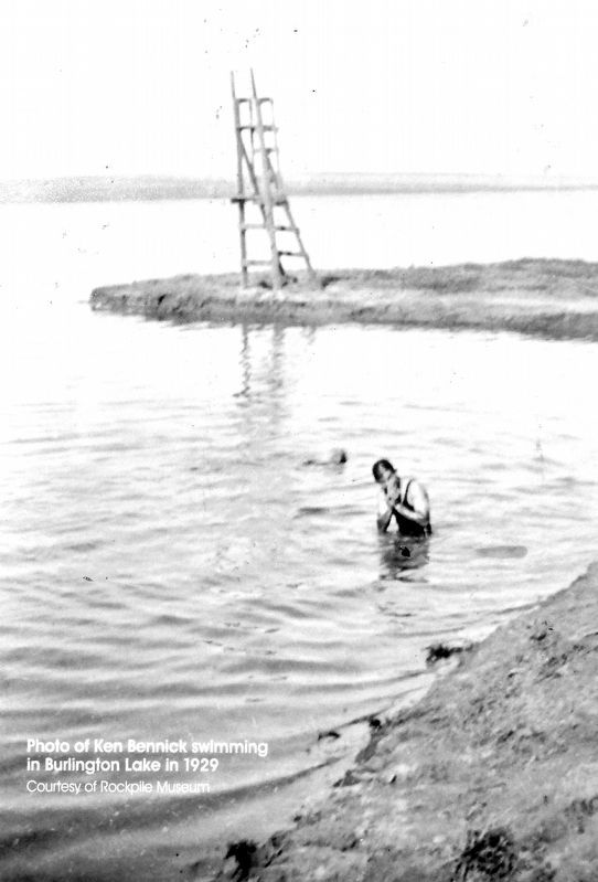
The Chicago, Burlington and Quincy Railroad proposed a canal system that diverted water from Donkey Creek to Stone Pile Creek and from Stone Pile Creek into Burlington Lake. Construction began in 1907 and was completed in 1908. During construction, . . . — — Map (db m306405) HM
Commemorating 100 years having been created from portions of Crook and Weston County by authority granted from the Eleventh Legislature of the State of Wyoming on February 13, 1911 and named after John Allen Campbell, the first Governor of the . . . — — Map (db m242840) HM
Model Twenty-two Horsepower 26 Year built 1937 Weight 6210 This caterpillar track-type tractor was equipped with a small blade and used extensively in the oilfields surrounding Gillette, WY. It was used for light construction, road building, and . . . — — Map (db m306589) HM
At the center of McManamen Park is a 10-acre lake, dredged in 1987 deep enough to hold water all year long. An additional 40-acres is dedicated to overflow that fills with water in wet years. Turning Burlington Lake into the McManamen Park “prairie . . . — — Map (db m306440) HM
By October 1943, negotiations were completed where the City of Gillette took over the CB&Q water ditch, according to Mayor Roy Montgomery. Under the terms of the agreement, the city received title to all the land through which the ditch ran, . . . — — Map (db m306292) HM
Height 7 ft. Width 10 ft. 6 in. Depth 10 ft. Capacity 14 yds. This bucket is off a Marion 190 Shovel, built in Marion, Ohio. It came to Campbell County in 1975 after working in Wales. The Marion Shovel was used to move overburden and coal. . . . — — Map (db m306596) HM
Commemorating the brave young men and women of Campbell County, who responding to duty and honor, paid the ultimate price by sacrificing their lives so their loved ones and neighbors could live free. — — Map (db m306299) WM
In September 1943, officials of the Chicago, Burlington and Quincy Railroad were negotiating with the City of Gillette for disposal of the Burlington Ditch. There was an original offer to the city that was turned down; details of the original offer . . . — — Map (db m306497) HM
In 2000, the Gillette City Council considered banning dogs from McManamen Park from March 1 to October 1 during the nesting season. The shallow water, which provides a source of food and the nesting habitat consisting of areas of relatively . . . — — Map (db m306468) HM
Wyoming's eastern Powder River Basin is a region of limited rainfall and high rolling grasslands, an area ideally suited for livestock grazing, but not large-scale crop production. Settlers emigrating to the region could obtain lands under several . . . — — Map (db m306295) HM
Built by General Electric Horsepower 3,000 Year built 1972 Weight 411,580 lbs. Length 67 ft. Height 15 ft. Miles traveled 2,400,000 Fuel 150 gal./hr. Engine 5802 was used to haul 11,680,000 tons of coal from Campbel County mines. It holds 4,000 . . . — — Map (db m306500) HM
Flood waters from the overflowing Burlington Ditch caused thousands of dollars in damage after rapidly melting snow overflowed between Kendrick and Carey Streets in January 1943. The ditch at this point was eight feet deep. Some of the heaviest . . . — — Map (db m306496) HM
Fred Grant Hicks, born in Ohio, emigrated to Wyoming in 1908 to work for the Burlington Railroad. The Hicks homestead was north of Burlington Lake. He was the roundhouse foreman for twelve years. In 1932 he and his wife Florence purchased the . . . — — Map (db m306470) HM
George Amos moved to Wyoming in the late 1800s to work as the foreman on the 4-J Ranch. A bachelor, he was a cowpuncher by day, and a voracious reader at night. In addition to a love for books, Amos subscribed to as many as 20 magazines and many . . . — — Map (db m203256) HM
Bede McCann was hired quite often in the summer time to use a team and scraper to clear the weeds and grass out of the Burlington Ditch. He also mowed the right-of-way along Highway 14-16 and planted the evergreen trees along the highway and train . . . — — Map (db m306494) HM
This building, constructed in 1936, was completely paid for by the City of Gillette, without bonds or increased taxation, a source of pride for this community. The mayor's office, clerk's office, and courtroom were on the first floor with fire . . . — — Map (db m203279) HM
Built in 1935 with funds from the Public Works Administration (PWA), this was the first federal building constructed in Gillette. It utilized a standard floor plan developed for post offices nationwide. This building was Gillette's Post Office . . . — — Map (db m203281) HM
In September 1945, with the conclusion of the war and the impending return of hundreds of men and women, the City administration made plans to improve Gillette and provide employment for all who wished to return and live here. The city was prepared . . . — — Map (db m306279) HM
Located in a corner of the Schneider Ranch and adjacent to the Highlight Road in central Campbell County, sat the Cowboy Bar which served as a watering hole for thirsty roughnecks and miners for 26 years. The bar began as an old outbuilding moved . . . — — Map (db m306300) HM
who served in the Persian Gulf during Desert Storm Sculptured by Patrick Love base donated by Gillette Energy Rotary Club constructed by Barton Construction — — Map (db m306298) HM WM
Built by Bridgestone Weight 8,400 lbs. Size 40:00-57 1991 cost $13,000 Height 12 ft. Width 4 ft. This tire was used on Unit Rig trucks to haul soil and coal in local coal mines. Each tire can carry a 137,500 lb. load. The tire is a 60 bias . . . — — Map (db m306543) HM
A concrete walkway was finished in 2013 around Burlington Lake at McManamen Park. The walkway was made of concrete to allow easier access for wheelchairs and to make the path easier to walk in poor weather. The walkway is10 feet wide and 7,400 . . . — — Map (db m306498) HM
Built by Allis Chambers Engine ED-40 Front tires 9x18” – 10 ply Height 50 ft. Rear tires 44x10” – 16” ply Year built 1935 Pulling units are now called workover rigs. Instead of having a permanent derrick left over a well, a pulling unit . . . — — Map (db m306574) HM
Year built 1975 Height 45 feet Model RR11 Serial # 1100-70-5E Built by Joy Manufacturing Co. (Robbins Division) This drill was used to drill large holes in conjunction with mining coal. The holes were drilled into the overburden (the dirt . . . — — Map (db m306598) HM
Weight 2,100 lbs. Material Granite Time Capsules 20 yr., 50 yr., 100 yr. Sundials were invented 3,500 years ago by the Babylonians. The base is marked with divisions of time and must be level. The gnomon, an upright indicator, casts the shadow. . . . — — Map (db m306599) HM
In 1908, the Chicago, Burlington & Quincy Railroad completed construction of an extensive canal system. It was designed to supply water for the railroad steam engines and to water the livestock waiting to be shipped out. The Burlington Ditch . . . — — Map (db m306294) HM
Model BD30HD Truck weight 235,000 lbs. Height 18 ft. Horsepower 1600 Width 23 ft. Year built 1978 Length 65 ft. Load capacity 170 tons This truck was assembled at the Jacobs Ranch Mine to haul coal. It has logged 20,000 operating hours to haul 10 . . . — — Map (db m306499) HM
In 1891 when Gillette was founded, day-to-day living revolved around the railroad and surrounding ranches. The northern boundary of the City at that time was Burlington Lake where cattle were led to drink when livestock was moved by railroads. From . . . — — Map (db m306371) HM
Model HBGG-6 Year built 1945 Horsepower 168 Cubic inch 4006 Kilowatt 113 These generators provided electrical power for a natural gas processing plant in the Ute oilfield north of Gillette, WY. They were taken out of service in approximately . . . — — Map (db m306582) HM
The fur industry ruled the northwest at the beginning of the 19th century; however, much of the interior of the western United States remained a mystery. The Lewis and Clark expedition constituted the only organized exploration, a fact which . . . — — Map (db m97954) HM
Gross weight empty 223,276 lbs. Gross weight loaded 563,276 lbs. Engine 16V149 Detroit 1600 hp Life to date: 30,000 hrs. Fuel consumption 20-gal. hr. Tires avg. cost $9,000 Engine rebuild avg. cost $35,000 143 was moved from Butte to the Black . . . — — Map (db m242992) HM
Trivia Question! Where did cattle originate that were trailed to Wyoming? Long-horned cattle were driven up from Texas on the Chisholm, Western and Goodnight Loving Trails. Herefords were shipped from the British Isles and cattle . . . — — Map (db m242990) HM
Soon after the retreat of the great Western Interior Seaway of. the Cretaceous Period, great coal swamps covered Eastern Wyoming. This fossilized tree stump was recovered from the Eagle Butte Coal Mine located about 48 miles to the North of here. . . . — — Map (db m203255) HM
"The lack of rail service in large areas of Wyoming did not prevent small coal mines from being opened. Throughout much of rural Wyoming wood was not readily available, and it was too valuable to be used as fuel on the plains and basins. Coal . . . — — Map (db m242967) HM
"By mid-century most corporations wished to place themselves at arms length from the "company town" concept, in some cases it was neither possible nor desirable. A need existed. Many employees opposed being on the road for hours; they wanted to be . . . — — Map (db m242991) HM
As with other emigrant trails in the west, the Bozeman Trail followed a route previously used by traders, trappers, and Native Americans. John Bozeman, along with John Jacobs, officially opened the Bozeman Trail to emigrants in 1863. This 500-mile . . . — — Map (db m210594) HM
"In the beginning when Wright was first taking shape and becoming its own place it was the spring of 1949 when the Wyoming Highway Department began constructing the Reno Junction Maintenance Camp. It was located about two and a half miles south of . . . — — Map (db m242956) HM
"In 1886 an explosion killed 2 boys, the territorial legislature took steps to ban children from working in coal mines. The coal mine safety law prohibited boys under the age of 14 and "women and girls of any age" from being employed "in or about . . . — — Map (db m242986) HM
To all that serve we salute you thanks for your sacrifice United States Navy ☆ United States Army United States Air Force ☆ United States Marine Corps United States Merchant Marine ☆ United States Coast Guard Wright, . . . — — Map (db m242962) WM
The historic Sierra Madre Range occupies the western-most section of the Medicine Bow National Forest. Historically, gold and copper mining, and later logging, were the big attractions to the area. But today, wildlife and related outdoor activities . . . — — Map (db m305590) HM
Established July 20, 1862. Located west of the Medicine Bow River at the north base of Elk Mountain. The site was selected by and the post built under the command of Major John O'Ferrall, 11th Ohio Cavalry. It was established to protect the . . . — — Map (db m95377) HM
The area near the Wagonhound Rest Area has played an important role in western transportation since the earliest days of human activity in the Rock Mountain west. The area has provided Wyoming's earliest inhabitants, explorers, westbound settlers, . . . — — Map (db m47142) HM
The stone circles of "Tipi Rings" as this site mark the location of a prehistoric Native American campsite. The stones were probably used to anchor the skins of conical tents known by the Sioux word "Tipi". the stones were placed around the base of . . . — — Map (db m47141) HM
This site lies at the northern-most extent of the Snowy Range Mountains, a spot where the high mountain peaks end and the winds begin. Winds here may exceed 70 miles per hour at times, blowing winter snows, leaving ridges and slopes bare, and . . . — — Map (db m47140) HM
Gateway to the sites of Ghost Towns of the Copper Country. Once a favorite hunting ground of Prehistoric man, later "Camp le Grand" became a noted rendezvous of Indians and trappers. In 1897 the townsite was laid out by Willis George Emerson and . . . — — Map (db m95468) HM
Camped near this spot in 1878,
while on a fishing trip.
It was here that his attention
was directed to the fiber
from his bamboo fishing pole
which he tested as a suitable
filament for his incandescent
electric lamp.
Born February . . . — — Map (db m107499) HM
"When you say that, smile"
Owen Wister
Whose writings acquainted the nation with pioneer Wyoming ranch life, made Medicine Bow the beginning of his most popular novel, "The Virginian," — — Map (db m89702) HM
Muddy Gap sits at a crossroads of many historic sites related to the Oregon and Mormon Trails. From Muddy Gap, Independence Rock is 18 miles northeast, Split Rock is 10 miles to the northwest; Devils Gate is 14 miles northeast, and Martin’s . . . — — Map (db m95472) HM
April 21, 1836, General Sam Houston and the Texian Army defeated Mexican President, General Antonio Lopez de Santa Anna. On May 14, 1836 the defeated Santa Anna signed the Treaty of Velasco, establishing The Republic of Texas, an independent . . . — — Map (db m283695) HM
In the summer of 1867, a survey partly led by General Grenville M. Dodge seeking a route for the Union Pacific Railroad, stopped one half mile south west of here.
General John A. Rawlins, a member of the party, spoke of the spring there as the . . . — — Map (db m89705) HM
The hills located to the south and west (your left) are part of the Rawlins Uplift, a 40 mile long, north trending fold in the earth's crust. The geologic feature rises a thousand feet above the surrounding plains. Granite rocks that range in age . . . — — Map (db m95470) HM
In the summer of 1867, a survey party led by General Grenville M. Dodge seeking a route for the Union Pacific Railroad stopped here.
General John A. Rawlins, a member of the party, spoke of the spring as "the most gracious and acceptable of . . . — — Map (db m67982) HM
The pioneer William Daley (1844-1922) built both the original 1866 Fort Phil Kearney flagstaff for the Bozeman Trail fort and this replica which is placed here in memory of the Daley Family in 1865. — — Map (db m89703) HM
The Wyoming State Penitentiary was constructed in different stages. The first construction occurred three years after statehood in 1893 following authorization by the Wyoming Territorial Legislature and the laying of a cornerstone in 1888. The . . . — — Map (db m89706) HM
These mountains, which are a portion of the Medicine Bow National
Forest, are called the Snowy Range. The latter is an appropriate name
since it can snow here at any time of the year. Ten foot drifts are not
uncommon in the winter, while . . . — — Map (db m285431) HM
World War II
US Army
Chorzelski, Michel Fl O • Hakeman, Lloyd N. 1st Lt • Simonson, Donald W. 2nd Lt • Sureson, James A. 1st Lt • Syler, Raymus M. Tec 5 • Kizzire, William L. Capt • Henningsen, Peter W. 1st Lt • Howard, Earl T. S Sgt • . . . — — Map (db m231292) WM
The wetland complex you see before you is a cooperative venture proposed and designed by the Wyoming Game and Fish Department, engineered by the Soil Conservation Service and funded by Peter Storer and the Storer Foundation through the Ducks . . . — — Map (db m107279) HM
In a before time, only the natural forces of wind, water, weather
and fire affected plant and animal life in Wyoming. In later times: native
Americans hunted, camped and lived in this basin. Since that time, the
natural wildness of the land has . . . — — Map (db m308070) HM
The old road bed & cut below are believed to be part of the rail road that was constructed in 1887 by the Union Pacific Railroad to connect Fort Steele to Denver, CO. It was to follow the North Platte to North Park, Colorado and down the Cache la . . . — — Map (db m89987) HM
The Fort Fred Steele sawmill had traveled thousands of miles by rail and wagon prior to its arrival and installation here, along the North Platte River. The Lane and Bodley 15 horsepower steam-driven sawmill began its journey through the military . . . — — Map (db m89818) HM
The bridge tender's house was constructed by the Union Pacific Railroad to serve as an employee surveillance point. The bridge tender could respond quickly to locomotive-caused fires and could remove flood debris which might damage the bridge and . . . — — Map (db m89754) HM
During construction of the Union Pacific Railroad land speculators and a large contingent of undesirables kept pace with or move ahead of the construction crews and their military escorts. Townsite speculators tried to anticipate depot locations, . . . — — Map (db m89755) HM
Construction of the Union Pacific Railroad stimulated the growth of the timber industry in southern Wyoming. Two companies began supplying ties to the railroad in 1868, but the firm of Coe and Carter was the leading supplier to the Fort Fred Steele . . . — — Map (db m89817) HM
The post cemetery served as a graveyard for soldiers, their dependents, and civilians during the army occupation of Fort Steele (1868-1886). Although some soldiers died during the Indian Wars of the 1860s and 1879s, most of the military deaths at . . . — — Map (db m89988) HM
Two cannons located at opposite ends of a meridian island each bear the same inscription.
This cannon of Civil War vintage was for many years an essential part of oil field tank farm equipment. It was used in making holes in a tank . . . — — Map (db m89707) HM
The Post Trader's House was "T" shaped in three sections. The stem of the "T" was built first and over time other rooms were added to the house. The small fireplace was actually designed to burn coal. Many houses of this time period included coal . . . — — Map (db m90004) HM
Two stone foundations and chimneys remain of the five enlisted men's barracks once at Fort Fred Steele. The walls were constructed of logs and boards and battens while a shingled roof protected pine floor boards. Tar paper covered interior walls. . . . — — Map (db m89949) HM
At age 18, Fenimore Chatterton arrived in Wyoming on September 12, 1878 to begin a lifelong career of service to Wyoming.
The young Fenimore came west on the Union Pacific to Fort Steele for a bookkeeping job at the J.W, Hugus Trading Post. . . . — — Map (db m89995) HM
The south central portion of Wyoming has long been a travel corridor for prehistoric and historic people. Native American tribes from the Great Basin region to the west crossed this area to hunt buffalo on the eastern plains.
From 1810 . . . — — Map (db m67988) HM
Officially abandoned in 1886, the fort came under the jurisdiction of the Department of the Interior in 1887. In 1892 and 1893 most of the buildings were sold a public auction. In 1897 the land, opened to homesteading, was patented by the Union . . . — — Map (db m89913) HM
Fort Fred Steele was established in 1868 to protect the North Platte River railroad crossing and the crews builting the Transcontinental Railroad. Named after Civil War hero Major Frederick Steele, the Fort and its soldiers provided vital services . . . — — Map (db m89997) HM
After the fort was decommissioned and the military buildings were sold at auction, the residents of the Fort Steele community converted some of the old structures into homes and businesses or built anew on top of bare foundations. The schoolhouse . . . — — Map (db m89948) HM
This Tranquil Image of Fort Fred Steele... (ca. June 1872), by its artistic commander Colonel Philippe Regis de Trobriand, 13th Infantry, belies the post's relatively brief, but dynamic history (1868-1886). This encampment on the south bank of . . . — — Map (db m89844) HM
General Steele commanded a division of the Union Army at Vicksburg. Later he commanded all Union forces on the line of the Arkansas, exercising President Lincoln's policy of conciliation and reconstruction. At the end of the war he served in Texas, . . . — — Map (db m89846) HM
commander of Fort Fred Steele from October, 1871 until September, 1873; was born an aristocrat in Tours, France, but came to America as a soldier of fortune to fight in the Civil War. Commissioned as Colonel in 31st Infantry, he commanded . . . — — Map (db m89845) HM
Major Thomas Tipton Thornburgh, 4th Infantry... left Fort Fred Steele on September 21, 1879 with his regiment's Company E, plus Company E, 3rd Cavalry and Companies D and F, 5th Cavalry, in response to a complaint by U.S. Indian Agent N.C. . . . — — Map (db m89828) HM
The collapsed sand stone building west of the sign is all that remains of the once imposing eight room, one and one-half story Commanding Officers quarters. Residences for staff officers were four, wood-framed double quarters with a captain in . . . — — Map (db m89946) HM
U.S. Army Officers Who Commanded Fort Fred Steele from it's Inception (1868) until its Abandonment (1886)
Baker, Eugene M. (Maj, 2 Cav) • Bartlett, Charles G. (Capt, 4 Inf) 1869 • Bascom, Gustavus, M. (1/Lt, 13 In) 1872 • Bisbee, . . . — — Map (db m89947) HM
The powder magazine housed the fort's munitions and therefore was located away from the main military complex. Ironically, it is one of the few fort structures remaining. It replaced the original magazine, a dugout constructed when the post was . . . — — Map (db m89994) HM
The Union Pacific Railroad and the North Platte River are important parts of the story of Fort Fred Steele. Located where these two great resources met, the fort and the local industries surrounding it would depend upon the rails and water for . . . — — Map (db m89759) HM
The cattle industry was also large in the area with some very large cattle companies that owned land in and around the area. One of the largest, the Swan Land & Cattle Co. owned by the Swan Brothers stretched from near present day Scottsbluff, NE to . . . — — Map (db m89970) HM
You are in Carbon County, an area central to Wyoming's past and present ranching industry. In the 1930s the county was populated by over one million sheep and annually shipped more pounds of wool than any other county in the United States.
. . . — — Map (db m67987) HM
Anglo-European Coal Miners Near Rock Springs, Wyoming... killed 26 Chinese on Thursday afternoon, September 3, 1885, and torched their nearby settlement. More than 550 other Orientals fled into the hills. Two days later, Fort Fred Steele's . . . — — Map (db m89829) HM
Sheep ranching came in to the Rawlins & Ft. Steele area in the 1880's with I.C. Miller being one of the earliest. He owned the first flock in 1875. In 1882, about 16 large sheep outfits were listed in the Rawlins area and numbers rapidly grew. . . . — — Map (db m89968) HM
The first authentic sheep wagon was built by James Candlish in Rawlins in 1884 from an idea given him by George Ferris. Caddish, a Canadian blacksmith, followed the Union Pacific construction to Fort Fred Steele and lived there until the troops . . . — — Map (db m89967) HM
Sheep were introduced to Wyoming in the 1850's near Fort Bridger, about 180 miles west of Fort Steele. By 1880 the number had grown to over 350,000 head ranging primarily along the route of the Union Pacific Railroad. The Cosgriff Brothers owned one . . . — — Map (db m89950) HM
plus other lines of transportation and communication - train, telegraph and telephone - bisected America while linking its east and west coasts during one of our nation's most remarkable eras of development. Those lifelines also sustained the . . . — — Map (db m89924) HM
The Parco Inn was built as the architectural highlight of Wyoming's most elegant company town. Frank Kistler, founder of the Producers and Refiners Oil Company (PARCO), hired the Denver-based architectural firm of Fisher and Fisher to design a . . . — — Map (db m89715) HM
Passenger travel on the Union Pacific Railroad began in July of 1868, with the first trans-continental service beginning just 10 days after the golden spike was driven on May 10, 1869 at Promontory Point in Utah. The first passenger trains were . . . — — Map (db m89915) HM
depicts a bustling military community astride the continental Union Pacific Railroad and flanked on the north and east by the Platte River.
Although the variety flora is limited, bitter cottonwood trees grown profusely with a smattering of pine . . . — — Map (db m89926) HM
Thornburgh's Command Defended Themselves Behind a Breastwork....
of barrels, sacks of flour, wagons and dead horses as Ute Indians rained bullets down bluffs along Milk Creek. The battle that raged from about noon on Monday, September 29, . . . — — Map (db m89824) HM
In 1901, the Fireman's Fund Insurance Company included a plat of Ft. Steel in its insurance rating of the town. The town had not grown as planned, probably due to the closeness of Rawlins and that the timber industry had started building its own . . . — — Map (db m89820) HM
Fort Fred Steele was established in 1868 as one of a group of military posts placed along the route of the Trans-Continental Railroad to protect and support the railroad construction. Today, except for the Powder Magazine (south of the Railroad . . . — — Map (db m71623) HM
In 1868 the Union Pacific Railroad was rapidly moving west with the short lived railhead towns leading the way. In early July, General Dodge ordered the citizens of Brownsville to move three miles from the river to the edge of the Dry Desert. . . . — — Map (db m89916) HM
1491 entries matched your criteria. Entries 101 through 200 are listed above. ⊲ Previous 100 — Next 100 ⊳