After filtering for Colorado, 169 entries match your criteria. The first 100 are listed. ⊳
Native Americans Topic
By Duane Hall, October 9, 2010
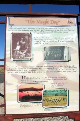
"The Magic Dog" Marker
| 1 ► Colorado, Alamosa County, Blanca — "The Magic Dog" — Los Caminos Antiguos Scenic & Historic Byway — |
| On State Highway 150, 0.2 miles north of U.S. 160, on the right when traveling north. | |||
| 2 ► Colorado, Alamosa County, Blanca — On Sacred Ground — Los Caminos Antiguos Scenic & Historic Byway — |
| On State Highway 150, 0.2 miles north of U.S. 160, on the right when traveling north. | |||
| 3 ► Colorado, Alamosa County, Blanca — Welcome "Caminante" to ... — Los Caminos Antiguos Scenic & Historic Byway — |
| On State Highway 150, 0.2 miles north of U.S. 160, on the right when traveling north. | |||
| 4 ► Colorado, Alamosa County, Mosca — Los Caminos Antiguos — Los Caminos Antiguos Scenic & Historic Byway — |
| On Lane 6N east of State Highway 17, on the left when traveling east. | |||
| 5 ► Colorado, Alamosa County, Mosca — Welcome "Caminante" to... — Los Caminos Antiguos Scenic & Historic Byway — |
| On Lane 6N east of State Highway 17, on the left when traveling east. | |||
| 6 ► Colorado, Archuleta County, Chimney Rock National Monument — Chimney Rock Artifacts — |
| 7 ► Colorado, Archuleta County, Chimney Rock National Monument — Pit House Site — |
| 8 ► Colorado, Archuleta County, Chimney Rock National Monument — The Great Kiva — |
| 9 ► Colorado, Archuleta County, Pagosa Springs — Pagosa Springs — |
| Near Hot Springs Blvd. | |||
| 10 ► Colorado, Archuleta County, Pagosa Springs — People and Place — The Wondrous Culture and Landscape of Chimney Rock National Monument — |
| On Chimney Rock Road (Forest Road 617) near State Highway 151, on the right when traveling west. | |||
| 11 ► Colorado, Archuleta County, Pagosa Springs — Welcome to Chimney Rock National Monument — An Ancestral Puebloan Cultural Landmark — |
| On Chimney Rock Road (Forest Road 617) east of State Highway 151, on the right when traveling west. | |||
| 12 ► Colorado, Baca County, Campo — Changing Hands --- Changing Lands — |
| Near S. Main Street (U.S. 287) at 6th Street, on the right when traveling north. | |||
| 13 ► Colorado, Bent County, Hasty — Santa Fe Trail — Travelers through Time — |
| Near County Highway HH near County Highway 24. | |||
| 14 ► Colorado, Bent County, Las Animas — Welcome to Bent County — |
| Near Carson Avenue (Colorado Route 101) north of 8th Street, on the right when traveling north. | |||
| 15 ► Colorado, Chaffee County, Buena Vista — Getting from There to Here — |
| On U.S. 24, 1 mile east of County Highway 397, on the left when traveling east. | |||
| 16 ► Colorado, Chaffee County, Salida — 130 — Christmas 1806 — |
| On U.S. 285, 5 miles north of U.S. 50, on the left when traveling north. | |||
| 17 ► Colorado, Chaffee County, Salida — Finding Our Roots / New Faces Along the River / Pike Explores the Valley — |
| On U.S. 285, on the right when traveling south. | |||
| 18 ► Colorado, Costilla County, Fort Garland — 16 — Fort Garland |
| On State Highway 159, 0.2 miles south of U.S. 160, on the left when traveling north. Reported permanently removed. | |||
| 19 ► Colorado, Costilla County, Fort Garland — 190 — Fort Garland / Buffalo Soldiers — |
| Near State Highway 159, on the right when traveling south. | |||
| 20 ► Colorado, Custer County, Greenwood — Frontier Pathways Scenic and Historic Byway — |
| On Colorado 96, 0.4 miles west of County Road 387, on the right when traveling west. | |||
| 21 ► Colorado, Custer County, Wetmore — Cuerno Verde |
| On Colorado 67 (at milepost 2) at County Road 19C, on the right when traveling south on Colorado 67. Reported unreadable. | |||
| 22 ► Colorado, Custer County, Wetmore — Hardscrabble — |
| On Colorado 67 (at milepost 2) at County Road 19C, on the right when traveling south on Colorado 67. | |||
| 23 ► Colorado, Delta County, Delta — Ute Council Tree — |
| On G96 Lane at 1550 Road, on the left when traveling west on G96 Lane. | |||
| 24 ► Colorado, Denver County, Denver, Auraria — Elephant Corral — |
| On Blake Street at 14th Court, on the left when traveling west on Blake Street. | |||
| 25 ► Colorado, Denver County, Denver, Central — Edward W. Wynkoop — |
| On Wynkoop Street south of 18th Street, on the left when traveling south. | |||
| 26 ► Colorado, Denver County, Denver, Central — 280 — Sand Creek Massacre — |
| On Colfax Avenue. | |||
| 27 ► Colorado, Denver County, Denver, Central — Wynkoop Street RR Bridge — 1908 — Lower Downtown Walking Tour — |
| On Wynkoop Street, 0.1 miles west of 15th Street, on the left when traveling south. | |||
| 28 ► Colorado, Denver County, Denver, Central Business District — 5e — All Washed Up — Wall Street of the Rockies — Seventeenth Street Denver, Colorado — |
| Near 17th Street at Arapahoe Street, on the left when traveling south. | |||
| 29 ► Colorado, Denver County, Denver, Central Business District — 6e — Arapahoe Street — Wall Street of the Rockies — Seventeenth Street Denver, Colorado — |
| Near 17th Street, on the left when traveling south. | |||
| 30 ► Colorado, Denver County, Denver, Central Business District — Silas S. Soule — |
| Near 15th Street near Arapahoe Street, on the right when traveling west. | |||
| 31 ► Colorado, Denver County, Denver, Central Business District — 9e — Take Your Pick — Wall Street of the Rockies — Seventeenth Street Denver, Colorado — |
| Near 17th Street at Champa Street, on the left when traveling south. | |||
| 32 ► Colorado, Denver County, Denver, Northwest — Gold Was Discovered — |
| Near Sheridan Boulevard (Colorado Route 95) just north of West 49th Avenue, on the left when traveling north. | |||
| 33 ► Colorado, Dolores County, Dove Creek — Community and Conflict — |
| On U.S. 491 at Guyrene Street, on the right when traveling west on U.S. 491. | |||
| 34 ► Colorado, Dolores County, Dove Creek — Dove Creek Country — |
| On U.S. 491 at Guyrene Street, on the right when traveling west on U.S. 491. | |||
| 35 ► Colorado, Dolores County, Dove Creek — Why East? / Who Were The Franciscans? — Dominguez y Escalante Expedition 1776 • 1976 — |
| On U.S. 491 at Guyrene Street, on the right when traveling west on U.S. 491. | |||
| 36 ► Colorado, Douglas County, Franktown — 57 — Franktown — |
| On State Highway 83, 0.1 miles south of State Highway 86, on the right when traveling south. | |||
| 37 ► Colorado, Douglas County, Parker — 54 — Twenty Mile House — |
| On Mainstreet at Victoria Drive, on the right when traveling east on Mainstreet. | |||
| 38 ► Colorado, El Paso County, Colorado Springs, West Colorado Springs — Indian Trail — |
| On Ridge Road, on the right when traveling north. | |||
| 39 ► Colorado, El Paso County, Colorado Springs, West Colorado Springs — Old Fort and Stockade — |
| On West Pikes Peak Avenue west of North 28th Street, on the right when traveling west. | |||
| 40 ► Colorado, El Paso County, Colorado Springs, West Colorado Springs — Rock Ledge Ranch Historic Site — |
| On Gateway Road, on the right when traveling east. | |||
| 41 ► Colorado, El Paso County, Colorado Springs, West Colorado Springs — Rock Ledge Ranch Historic Site — |
| Near North 30th Street at Gateway Road. | |||
| 42 ► Colorado, El Paso County, Colorado Springs, West Colorado Springs — Welcome to Garden of the Gods Park — |
| Near Juniper Way Loop, on the left when traveling west. | |||
| 43 ► Colorado, El Paso County, Manitou Springs, Cascade — 13 — Ute Pass — |
| On Manitou Avenue (Business U.S. 24), on the right when traveling north. | |||
| 44 ► Colorado, El Paso County, Monument — Old Stone Fort — |
| On Davidson Street south of Colorado Route 105. | |||
| 45 ► Colorado, El Paso County, United States Air Force Academy — Before the Academy — United States Air Force Academy — |
| 46 ► Colorado, Elbert County, Kiowa — 272 — Trail Under Siege / Rising to the Challenge — |
| On Colorado Street (County Route 86), on the right when traveling west. | |||
| 47 ► Colorado, Fremont County, Cañon City — First People, Explorers & Settlers — |
| On Main Street east of 4th Street, on the right when traveling east. | |||
| 48 ► Colorado, Fremont County, Cotopaxi — 269 — Rainbow Route / Western Fremont County — |
| On U.S. 50, on the right when traveling west. | |||
| 49 ► Colorado, Grand County, Grand Lake — Grand Lake — |
| Near Lake Avenue, 0.1 miles west of Hancock Street, on the right when traveling west. | |||
| 50 ► Colorado, Grand County, Grand Lake — Grand Lake — Elevation 8367 — |
| On Lake Avenue at Garfield Street, on the left when traveling west on Lake Avenue. | |||
| 51 ► Colorado, Grand County, Rocky Mountain National Park — People of Kawuneeche Valley — |
| Near Trail Ridge Road (U.S. 34) at Ditch Road, on the right when traveling south. | |||
| 52 ► Colorado, Hinsdale County, Lake City — Ute Homeland — |
| On County Highway 2 at County Highway 20, on the left when traveling north on County Highway 2. | |||
| 53 ► Colorado, Jackson County, Walden — Hunting in the "Bull Pen" — |
| Near Colorado Route 14, 3 miles south of Walden, on the right when traveling south. | |||
| 54 ► Colorado, Jefferson County, Golden — Native Americans on Clear Creek — |
| On Washington Avenue Bridge, on the right when traveling north. | |||
| 55 ► Colorado, Jefferson County, Golden — Winter Wind on the Mesa — |
| Near Washington Ave., on the right when traveling north. | |||
| 56 ► Colorado, Jefferson County, Golden, Lakota Hills — Buffalo Bill's Grave — Frequently Asked Questions — |
| Near Lookout Mountain Road (Lariat Loop). | |||
| 57 ► Colorado, Kiowa County, Chivington — A Chief’s Village — |
| Near County Highway W east of Chief White Antelope Way. | |||
| 58 ► Colorado, Kiowa County, Chivington — Attack and Pursuit — |
| Near County Highway W east of Chief White Antelope Way. | |||
| 59 ► Colorado, Kiowa County, Chivington — Chaos, Disorder, and Disgust — |
| Near County Highway W east of Chief White Antelope Way. | |||
| 60 ► Colorado, Kiowa County, Chivington — Cheyenne and Arapaho Village at Sand Creek — |
| Near County Highway W east of Chief White Antelope Way. | |||
| 61 ► Colorado, Kiowa County, Chivington — Conflict Within and Without — |
| Near County Highway W east of Chief White Antelope Way. | |||
| 62 ► Colorado, Kiowa County, Chivington — Dawn November 29, 1864 — |
| Near County Highway W east of Chief White Antelope Way. | |||
| 63 ► Colorado, Kiowa County, Chivington — Fort Lyon Reservation — |
| Near County Highway W east of Chief White Antelope Way. | |||
| 64 ► Colorado, Kiowa County, Chivington — Humans and the Prairie — |
| Near County Highway W east of Chief White Antelope Way. | |||
| 65 ► Colorado, Kiowa County, Chivington — Incredible Feats of Bravery — |
| Near County Highway W east of Chief White Antelope Way. | |||
| 66 ► Colorado, Kiowa County, Chivington — Returned to Sand Creek — |
| Near County Highway W just east of Chief White Antelope Way. | |||
| 67 ► Colorado, Kiowa County, Chivington — Sacred Memory — |
| Near County Highway W east of Chief White Antelope Way. | |||
| 68 ► Colorado, Kiowa County, Chivington — Sand Creek as Camp Site — |
| Near County Highway W east of Chief White Antelope Way. | |||
| 69 ► Colorado, Kiowa County, Chivington — The Big Head Fight — |
| Near County Highway W east of Chief White Antelope Way. | |||
| 70 ► Colorado, Kiowa County, Chivington — The Sand Creek Massacre — Sand Creek Massacre National Historic Site — |
| Near County Road W, 1.3 miles east of County Road 54. | |||
| 71 ► Colorado, Kiowa County, Chivington — Troops Approach the Village — |
| Near County Highway W east of Chief White Antelope Way. | |||
| 72 ► Colorado, Kiowa County, Chivington — Welcome to the Sand Creek Massacre National Historic Site — |
| On Unnamed entrance road north of County Road W, in the median. | |||
| 73 ► Colorado, Kiowa County, Chivington — Why A 33 Star Flag — |
| Near County Highway W east of Chief White Antelope Way. | |||
| 74 ► Colorado, Kiowa County, Eads — Eads Roadside Park Exhibit — |
| Near E 15th Street (U.S. 287) 0.1 miles east of Maine Street, on the left when traveling east. | |||
| 75 ► Colorado, Kiowa County, Eads — Healing — Sand Creek Massacre National Historic Site |
| Near County Road W, 1.3 miles east of County Road 54. Reported permanently removed. | |||
| 76 ► Colorado, Kiowa County, Eads — High Plains Country — |
| Near E 15th Street (U.S. 287) 0.1 miles east of Maine Street, on the left when traveling east. | |||
| 77 ► Colorado, Kiowa County, Eads — Pleas for Peace — Sand Creek Massacre National Historic Site |
| Near County Road W, 1.3 miles east of County Road 54. Reported permanently removed. | |||
| 78 ► Colorado, Kiowa County, Eads — Remains — Sand Creek Massacre National Historic Site |
| Near County Road W, 1.3 miles east of County Road 54. Reported permanently removed. | |||
| 79 ► Colorado, Kiowa County, Eads — Testimony — Sand Creek Massacre National Historic Site |
| Near County Road W, 1.3 miles east of County Road 54. Reported permanently removed. | |||
| 80 ► Colorado, Kiowa County, Eads — The Attack |
| Near County Road W, 1.3 miles east of County Road 54. Reported permanently removed. | |||
| 81 ► Colorado, Kiowa County, Eads — Why? — Sand Creek Massacre National Historic Site |
| On County Road W, 1.3 miles east of County Road 54. Reported permanently removed. | |||
| 82 ► Colorado, La Plata County, Breen — [Old] Fort Lewis College — |
| Near State Highway 140, 0.2 miles west of Colorado State Highway 140. | |||
| 83 ► Colorado, La Plata County, Durango — Baker's Bridge — |
| On County Highway 250, 0.5 miles east of U.S. 550, on the left when traveling east. | |||
| 84 ► Colorado, Lake County, Leadville — John B. "Texas Jack" Omohundro — 1846-1880 — |
| On North Poplar Street (U.S. 24) north of Sawmill Road, on the right when traveling south. | |||
| 85 ► Colorado, Larimer County, Estes Park — Ancient Paths, Ancient Peoples — Rocky Mountain National Park — |
| Near Hidden Valley Road, 0.4 miles west of Fall River Road (U.S. 34) when traveling west. | |||
| 86 ► Colorado, Las Animas County, Trinidad — Trinidad: A Place to Explore and Discover… Create and Recreate..... Innovate and Invent — |
| On Interstate 25, 8 miles State Route 72, on the right. | |||
| 87 ► Colorado, Lincoln County, Arriba — 245 — Arriba Country — Colorado — |
| Near County Road 63 at Interstate 70. | |||
| 88 ► Colorado, Logan County, Merino — 2 — Fort Wicked — |
| On Grand Army of the Republic Highway (State Highway 6) at County Road 2.5, on the right when traveling east on Grand Army of the Republic Highway. | |||
| 89 ► Colorado, Logan County, Sterling — 34 — Battle of Summit Springs — |
| On Colorado Route 63 north of County Road 16, on the left when traveling north. | |||
| 90 ► Colorado, Mesa County, Grand Junction — Rocky Roads — Colorado National Monument — |
| Near Rim Rock Drive. | |||
| 91 ► Colorado, Moffat County, Maybell — Fort Davy Crockett — |
| On 114, 1 mile south of State Highway 318, on the left when traveling south. | |||
| 92 ► Colorado, Montezuma County, Cortez — Canyons of the Ancients National Monument — |
| On Mildred Road north of Main Street (U.S. 160), on the left when traveling north. | |||
| 93 ► Colorado, Montezuma County, Cortez — Greening the Valley — |
| Near U.S. 160, 0.2 miles west of Road 30.1, on the right when traveling east. | |||
| 94 ► Colorado, Montezuma County, Cortez — Mesa Verde Administrative District — |
| Near State Highway 10. | |||
| 95 ► Colorado, Montezuma County, Cortez — Prehistoric Mesa Verde Reservoirs — |
| Near State Highway 10. | |||
| 96 ► Colorado, Montezuma County, Cortez — The Native Americans — 12,000 Years of History — |
| On Mildred Road north of Main Street (U.S. 160), on the left when traveling north. | |||
| 97 ► Colorado, Montezuma County, Cortez — Water is Our Story — |
| Near U.S. 160, 0.2 miles west of Road 30.1, on the right when traveling east. | |||
| 98 ► Colorado, Montezuma County, Cortez — Water Technology — |
| Near U.S. 160, 0.2 miles west of Road 30.1, on the right when traveling east. | |||
| 99 ► Colorado, Montezuma County, Cortez — Yucca House National Monument — |
| On County Route 20.5. | |||
| 100 ► Colorado, Montezuma County, Mancos — Cortez — |
| Near U.S. 160, on the right when traveling west. | |||
169 entries matched your criteria. The first 100 are listed above. The final 69 ⊳