After filtering for Texas, 645 entries match your criteria. The first 100 are listed. ⊳
Native Americans Topic
By QuesterMark, September 4, 2021
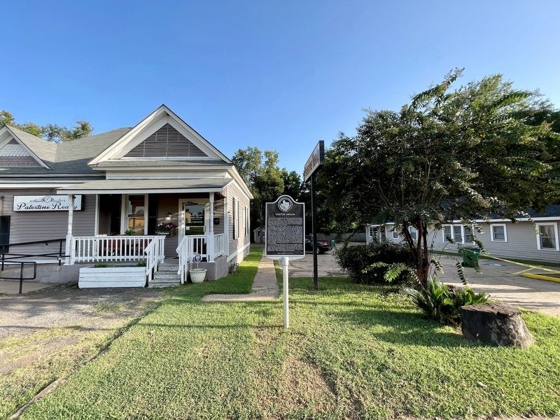
Osjetea Briggs Marker
| 1 ► Texas, Anderson County, Palestine — 20147 — Osjetea Briggs — |
| On East Palestine Avenue (State Highway 19) at North Laura Street, on the right when traveling east on East Palestine Avenue. | |||
| 2 ► Texas, Angelina County, Lufkin — Angelina — |
| On North Second Street at Howe Avenue on North Second Street. | |||
| 3 ► Texas, Archer County, Archer City — 2627 — In Vicinity of French Trading Area — |
| On Farm to Market Road 210, 0.7 miles east of Dugan Road, on the right when traveling west. | |||
| 4 ► Texas, Archer County, Megargel — 3861 — On Route of the Comanche Exodus — |
| On State Highway 114 at 5th Street, on the right when traveling west on State Highway 114. | |||
| 5 ► Texas, Armstrong County, Claude — 4366 — Route of Coronado Expedition — |
| On 1st Street (Highway 287) at Trice Street, on the left when traveling west on 1st Street. | |||
| 6 ► Texas, Armstrong County, Claude — 2263 — The Great Panhandle Indian Scare of 1891 — |
| On 1st Street (U.S. 287) at Trice Street, on the left when traveling west on 1st Street. | |||
| 7 ► Texas, Armstrong County, Goodnight — 55 — Quanah Parker Trail — Texas Plains Trail Region — |
| Near County Route 25, 0.2 miles south of U.S. 287. | |||
| 8 ► Texas, Armstrong County, Wayside — 69 — Quanah Parker Trail — Texas Plains Trail Region — |
| On Wayside, 0.1 miles east of Farm to Market Road 285. | |||
| 9 ► Texas, Armstrong County, Wayside — 17440 — The Battle of Red River |
| Near State Highway 207, 2.5 miles north of Farm to Market Road 285. Reported missing. | |||
| 10 ► Texas, Austin County, Industry — 1941 — Charles Fordtran — (May 7, 1801-Nov. 1, 1900) — |
| On SH 159 (State Highway 159) at Hofheinz Road, on the left when traveling west on SH 159. | |||
| 11 ► Texas, Bailey County, Enochs — 1103 — Coyote Lake — |
| On FM 746, on the left when traveling south. | |||
| 12 ► Texas, Bailey County, Muleshoe — 48 — Quanah Parker Trail — Texas Plains Trail Region — |
| On Taylor Street north of West American Boulevard, on the right when traveling north. | |||
| 13 ► Texas, Bandera County, Bandera — 293 — Bandera Pass — |
| On Hwy 173, 10.6 miles north of SR 16, on the left when traveling north. | |||
| 14 ► Texas, Bandera County, Bandera — Bandera, Texas USA — Cowboy Capital of the World — |
| On Main Street (State Highway 16) at Hackberry Street, on the left when traveling north on Main Street. | |||
| 15 ► Texas, Bandera County, Bandera — 718 — Captain Jack Phillips — (1839-1876) — |
| On Main Street (State Highway 16) at Pecan Street, on the right when traveling south on Main Street. | |||
| 16 ► Texas, Bandera County, Bandera — 3823 — Old Texas Ranger Trail — |
| On Main Street (State Highway 16) at Pecan Street, on the right when traveling south on Main Street. | |||
| 17 ► Texas, Bandera County, Tarpley — 1097 — Cow Camp Massacre on Hondo Creek — |
| On Farm to Market Road 462, 2 miles south of County Highway 211, on the left when traveling south. | |||
| 18 ► Texas, Bastrop County, Bastrop — 9151 — Early History of the City of Bastrop — |
| On Loop State Highway 150 at Park Road 1, on the right when traveling west on State Highway 150. | |||
| 19 ► Texas, Bastrop County, Bastrop — 9190 — The Gotier Trace — |
| On Park Road 1 at Loop State Highway 150, on the right when traveling east on Park Road 1. | |||
| 20 ► Texas, Bastrop County, Cedar Creek — Bluff Trail Overlook — |
| Near Hyatt Lost Pines Road north of Texas Highway 71, on the right when traveling north. | |||
| 21 ► Texas, Bastrop County, Elgin — 9171 — Site of the Home of Col. Robert M. Coleman — (1799 -1837) — |
| On Farm to Market Road 969, 0.2 miles west of Upper Elgin River Road (County Route 127), on the right when traveling east. | |||
| 22 ► Texas, Bee County, Beeville — 1359 — Early Trails in Bee County — |
| On Business U.S. 181J at U.S. 181, on the right when traveling south on U.S. 181JBusiness . | |||
| 23 ► Texas, Bee County, Pettus — 5536 — Town of Pettus — (Located 3 Miles South) — |
| On U.S. 181 south of Mineral Avenue, on the right when traveling south. | |||
| 24 ► Texas, Bell County, Nolanville — 990 — Comanche Gap |
| Reported missing. | |||
| 25 ► Texas, Bell County, Salado — 15828 — Salado — |
| On South Main Street (County Route 2268) at Royal Street, on the right when traveling south on South Main Street. | |||
| 26 ► Texas, Bexar County, Helotes, Far West Side — 2432 — Helotes — |
| On Old Bandera Road south of Floore Drive, on the right when traveling north. | |||
| 27 ► Texas, Bexar County, San Antonio — Wildlife Trail — |
| On Red Oak Road at Tuleta Drive, on the right when traveling south on Red Oak Road. | |||
| 28 ► Texas, Bexar County, San Antonio, Alamo Plaza — Founding of the Mission and Origin of Name — |
| Near Alamo Plaza. | |||
| 29 ► Texas, Bexar County, San Antonio, Alamo Plaza — Mission Mill (and Millstone) — |
| 30 ► Texas, Bexar County, San Antonio, Alamo Plaza — Mission San Antonio de Valero 1744 — |
| On Alamo Plaza at East Houston Street, on the right when traveling north on Alamo Plaza. | |||
| 31 ► Texas, Bexar County, San Antonio, Alamo Plaza — Mission San Antonio de Valero 1785 — |
| On Alamo Plaza at East Houston Street, on the right when traveling north on Alamo Plaza. | |||
| 32 ► Texas, Bexar County, San Antonio, Alamo Plaza — Mission San Antonio de Valero 1793-1835 — |
| On Alamo Plaza south of East Houston Street, on the right when traveling north. | |||
| 33 ► Texas, Bexar County, San Antonio, Alamo Plaza — Mission San Antonio de Valero Indian Quarters — |
| On Alamo Plaza, 0.2 miles north of East Commerce Street, on the right when traveling south. | |||
| 34 ► Texas, Bexar County, San Antonio, Alamo Plaza — Ruins of the Habitations of the Friars and Indians — |
| 35 ► Texas, Bexar County, San Antonio, Alamo Plaza — San Antonio River Indian Springs — |
| On N. Presa St. at Riverwalk Street on N. Presa St.. | |||
| 36 ► Texas, Bexar County, San Antonio, Alamo Plaza — Spanish Mission and Military Post — 1724 - 1821 — |
| 37 ► Texas, Bexar County, San Antonio, Alamo Plaza — The Alamo — A Story Bigger Than Texas — (Long Barrack) — |
| 38 ► Texas, Bexar County, San Antonio, Alamo Plaza — The Alamo 1836 — |
| On Alamo Plaza south of East Houston Street, on the right when traveling north. | |||
| 39 ► Texas, Bexar County, San Antonio, Alamo Plaza — The Alamo 1836-1846 — |
| On Alamo Plaza south of East Houston Street, on the right when traveling north. | |||
| 40 ► Texas, Bexar County, San Antonio, Alamo Plaza — The Alamo 1891 — |
| On Alamo Plaza south of East Houston Street, on the left when traveling south. | |||
| 41 ► Texas, Bexar County, San Antonio, Alamo Plaza — The Alamo in 1836 — |
| On Alamo Plaza north of East Commerce Street, on the left when traveling north. | |||
| 42 ► Texas, Bexar County, San Antonio, Alamo Plaza — The Mission Period — 1716 - 1793 — |
| Near Alamo Plaza at East Houston Street. | |||
| 43 ► Texas, Bexar County, San Antonio, Downtown — People of San Pedro Creek — |
| On Graham Avenue, 0.1 miles west of South Flores Street. | |||
| 44 ► Texas, Bexar County, San Antonio, Downtown — Quanah Parker — The Last Great Comanche War Chief — (circa 1845-1911) — |
| On West Market Street at South Presa Street, on the left when traveling west on West Market Street. | |||
| 45 ► Texas, Bexar County, San Antonio, Downtown — 4551 — San Pedro Creek — |
| On Camaron Street at North Santa Rosa Street, on the left when traveling north on Camaron Street. | |||
| 46 ► Texas, Bexar County, San Antonio, Downtown — 1 — San Pedro Creek and the Saga of a City — |
| Near Camaron Street at North Santa Rosa Street. | |||
| 47 ► Texas, Bexar County, San Antonio, Downtown — 3 — San Pedro Creek: A Crossroads of Cultures — |
| Near Camaron Street at North Santa Rosa Street. | |||
| 48 ► Texas, Bexar County, San Antonio, Downtown — 3911 — The Pajalache Acequia (Ditch) — |
| On North Presa Street, 0.1 miles south of West Market Street, on the right when traveling north. | |||
| 49 ► Texas, Bexar County, San Antonio, Downtown — The San Antonio River — |
| Near Lexington Avenue north of Avenue A, on the right when traveling north. | |||
| 50 ► Texas, Bexar County, San Antonio, Far North Central — 17579 — Scenic Loop - Boerne Stage - Toutant-Beauregard — Historic Corridor — |
| On Boerne Stage Road at Scenic Loop Road, on the right when traveling west on Boerne Stage Road. | |||
| 51 ► Texas, Bexar County, San Antonio, Harlandale — Indian Quarters / Habitaciones de los Indios — |
| 52 ► Texas, Bexar County, San Antonio, Harlandale — Mission San José / La Misión de San José — |
| 53 ► Texas, Bexar County, San Antonio, Harlandale — Rose Window / Ventana de Rosa — |
| 54 ► Texas, Bexar County, San Antonio, Harlandale — San Antonio Missions / Las misiones de San Antonio — |
| 55 ► Texas, Bexar County, San Antonio, Harlandale — The Church / La iglesia — |
| 56 ► Texas, Bexar County, San Antonio, Harlandale — The Convento / El convento — |
| 57 ► Texas, Bexar County, San Antonio, Hemisfair — The Confluence of Civilizations in the Americas — HemisFair'68 — San Antonio Fair, Inc — |
| 58 ► Texas, Bexar County, San Antonio, Inner West Side — 3021 — Moses Lapham — Near Here on October 20, 1838 — |
| On U.S. 90 Access Road, 1 mile east of Pinn Road, on the right when traveling west. | |||
| 59 ► Texas, Bexar County, San Antonio, Main/Military Plaza — Council House — |
| On Main Plaza just north of West Market Street, on the right when traveling north. | |||
| 60 ► Texas, Bexar County, San Antonio, Main/Military Plaza — Lasting Peace with the Apache Nation — The Hatchet Buried - Likewise a Horse, August 15, 1745 — Main Plaza — |
| Near Dolorosa at Main Plaza. | |||
| 61 ► Texas, Bexar County, San Antonio, Midtown — Archaeology in Brackenridge Park — |
| On East Mulberry Avenue at Red Oak Road, on the left when traveling west on East Mulberry Avenue. | |||
| 62 ► Texas, Bexar County, San Antonio, Midtown — Brackenridge Park Before 1899 — |
| On Tuleta Drive, 0.1 miles east of Brackenridge Drive, on the right when traveling west. | |||
| 63 ► Texas, Bexar County, San Antonio, North Central — 4960 — Jefferson Davis Smith — (1862 - 1940) — |
| Near East North Loop Road, 0.2 miles west of Wurzbach Parkway. | |||
| 64 ► Texas, Bexar County, San Antonio, Southside — A Sacred Place — |
| Near Graf Road at Mission Road. | |||
| 65 ► Texas, Bexar County, San Antonio, Southside — Bridging the Gulch — |
| On Espada Road at East Ashley Road, on the left when traveling south on Espada Road. | |||
| 66 ► Texas, Bexar County, San Antonio, Southside — Building Sanctuaries — |
| Near Espada Road at Camino Coahuilteca, on the right when traveling south. | |||
| 67 ► Texas, Bexar County, San Antonio, Southside — Community Life at Mission Espada — |
| Near Espada Road at Camino Coahuilteca. | |||
| 68 ► Texas, Bexar County, San Antonio, Southside — Defending the Faithful — |
| Near Espada Road at Camino Coahuilteca, on the left when traveling south. | |||
| 69 ► Texas, Bexar County, San Antonio, Southside — Espada Aqueduct — |
| On Espada Road north of East Ashley Road, on the right when traveling north. | |||
| 70 ► Texas, Bexar County, San Antonio, Southside — Espada Mission — |
| On Espada Road at Camino Coahuilteca, on the left when traveling south on Espada Road. | |||
| 71 ► Texas, Bexar County, San Antonio, Southside — Mastering New Mysteries — |
| Near Espada Road at Camino Coahuilteca, on the left when traveling south. | |||
| 72 ► Texas, Bexar County, San Antonio, Southside — Mission Concepción — |
| On Mission Road at Felisa Street, on the left when traveling south on Mission Road. | |||
| 73 ► Texas, Bexar County, San Antonio, Southside — Mission Espada: 1731-1824 — |
| Near Espada Road at Camino Coahuilteca. | |||
| 74 ► Texas, Bexar County, San Antonio, Southside — 3412 — Mission San Francisco de la Espada Dam, Ditch and Aqueduct — |
| On Espada Road north of East Ashley Road, on the right when traveling north. | |||
| 75 ► Texas, Bexar County, San Antonio, Southside — Mission San Juan Capistrano — |
| Near Graf Road at Mission Road. | |||
| 76 ► Texas, Bexar County, San Antonio, Southside — Missions Along the San Antonio River — |
| Near Espada Road at Camino Coahuilteca. | |||
| 77 ► Texas, Bexar County, San Antonio, Southside — San Antonio Missions — |
| On Espada Road at Camino Coahuilteca, on the left when traveling south on Espada Road. | |||
| 78 ► Texas, Bexar County, San Antonio, Southside — 18170 — Spanish and Mexican Land Grants — |
| Near University Way at Verano Parkway. | |||
| 79 ► Texas, Bexar County, San Antonio, Southside — The Church — |
| Near Espada Road at Camino Coahuilteca, on the left when traveling south. | |||
| 80 ► Texas, Bexar County, San Antonio, Southside — The Quarry — |
| On Mission Road at Felisa Street, on the left when traveling south on Mission Road. | |||
| 81 ► Texas, Bexar County, San Antonio, Southside — The San Antonio Missions World Heritage Site — |
| On Mission Road, 0.2 miles Mission Parkway, on the right when traveling east. | |||
| 82 ► Texas, Bexar County, San Antonio, Thelka — Concepción Park — |
| On East Theo Avenue, 0.4 miles west of Mission Road, on the right when traveling west. | |||
| 83 ► Texas, Bexar County, San Antonio, Thelka — 3414 — Mission San Francisco Xavier de Nájera — Approximate Location of — |
| On Mission Road, 0.1 miles south of Hansford street, on the left when traveling south. | |||
| 84 ► Texas, Bexar County, San Antonio, Thelka — Texas Live Oak Savannah — |
| On West Mitchell Street at King Roger Street, on the left when traveling west on West Mitchell Street. | |||
| 85 ► Texas, Bexar County, San Antonio, Thelka — The River Landscape — |
| On East Theo Avenue, 0.4 miles west of Mission Road, on the right when traveling west. | |||
| 86 ► Texas, Bexar County, San Antonio, Uptown — Comanche Lookout — |
| Near Nacogdoches Road (Farm to Market Road 2252) at Toepperwein Road, on the right when traveling west. | |||
| 87 ► Texas, Blanco County, Johnson City — 6386 — Thomas C. and Eliza V. Felps — |
| 88 ► Texas, Borden County, Gail — 18056 — Mushaway Peak — (4 miles southeast) — |
| On U.S. 180 at County Road 403, on the right when traveling west on U.S. 180. | |||
| 89 ► Texas, Bosque County, Walnut Springs — 717 — Captain J.J. Cureton, C.S.A. — (1826-1881) — |
| On Walnut Avenue at 3rd Street (Farm to Market Road 927), on the left when traveling east on Walnut Avenue. | |||
| 90 ► Texas, Brazoria County, Jones Creek — 9569 — Battle of Jones Creek — |
| On State Highway 36 at Gulf Prairie Road, on the right when traveling east on State Highway 36. | |||
| 91 ► Texas, Brazoria County, West Columbia — Problems Facing the New Republic — |
| On East Brazos Avenue (U.S. 35) at North 17th Street, on the right when traveling west on East Brazos Avenue. | |||
| 92 ► Texas, Brewster County, Alpine — 570 — Burgess' Water Hole — |
| Near N. Harrison St.. | |||
| 93 ► Texas, Brewster County, Alpine — Early Human Habitation — Big Bend Snapshot History — |
| On South Walker Street (State Highway 118) 1.4 miles south of East Gallego Avenue, on the right when traveling south. | |||
| 94 ► Texas, Brewster County, Alpine — Early Spanish Entradas — Big Bend Snapshot History — |
| On U.S. 67/90 at Paso del Norte Road on U.S. 67/90. | |||
| 95 ► Texas, Brewster County, Alpine — The Late Spanish Entradas — Big Bend Snapshot History — |
| On U.S. 67/90 at Paso del Norte Road, on the left when traveling east on U.S. 67/90. | |||
| 96 ► Texas, Brewster County, Big Bend National Park — 994 — Comanche Trail — |
| On U.S. 385. | |||
| 97 ► Texas, Brewster County, Big Bend National Park — Reminders of the Past — Big Bend National Park — |
| On Hot Springs Road, 1.6 miles south of Rio Grande Road, on the left when traveling south. | |||
| 98 ► Texas, Brewster County, Big Bend National Park — Rock Art at Hot Springs — |
| Near Hot Springs Road, 1.5 miles Rio Grande Village Drive, on the left when traveling south. | |||
| 99 ► Texas, Brewster County, Big Bend National Park, Castolon — Floodplain Panorama — Big Bend National Park — |
| Near River Road West at Santa Elena Canyon Road. | |||
| 100 ► Texas, Brewster County, Marathon — 1258 — Double Mills — |
| On U.S. 385, on the right when traveling south. | |||
645 entries matched your criteria. The first 100 are listed above. Next 100 ⊳