A famous tragedy of the 1830s. While able-bodied men were away fighting Indians, six or seven women, some young children, and four elderly men - most of them relatives – were at home of John Edens (2.4 mi. SW of here). Indians attacked, killing . . . — — Map (db m245625) HM
Civil War veteran Samuel Fisher Tenney, a Georgia native, graduated from the University of Georgia and from a South Carolina seminary in 1868. He moved to Crockett two years later, following a pastorate in Marshall, Texas. For 54 years Tenney served . . . — — Map (db m219492) HM
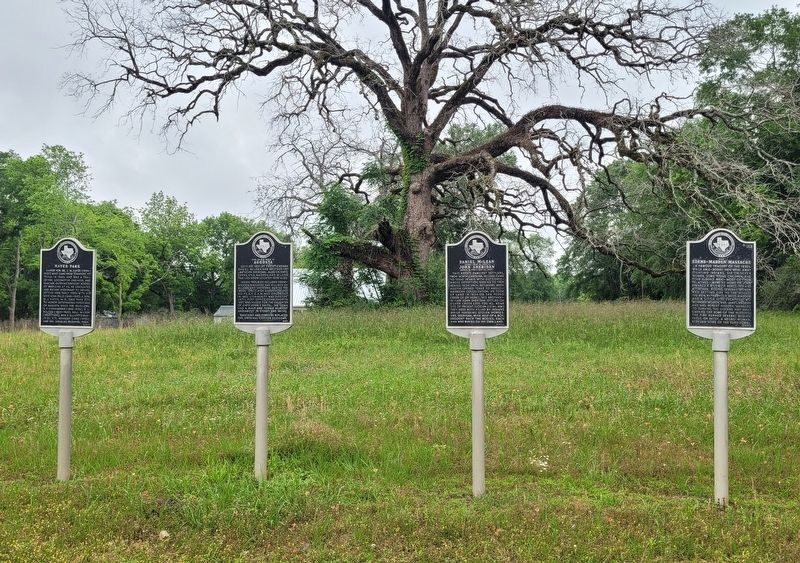
Congregation organized about 1870 in community of Red House (3 mi. East), where Indian Village had once stood. When Grapeland was founded with coming of railroad in 1872, church moved to town. At first held services in school house. Present . . . — — Map (db m161139) HM
Was founded near this marker
May 24, 1690,
at the Nabedache (Tejas) Indian Village
Erected, A. D. 1934, by DeZavala Chapter,
Texas Historical and Landmarks Association.
Located by: Dr. Albert Woldert, Tyler, Texas.
Miss . . . — — Map (db m121405) HM
First Spanish Mission in East Texas. Established in 1690 by Franciscan friars to convert the Tejas Indians. "Tejas", a Spanish rendition of the Indian word for "friend", was in time adopted as the state name.
The founding party was led by Capt. . . . — — Map (db m121406) HM
Was founded in this vicinity Summer 1690 "on the banks of the Arcangel San Miguel" (Neches) River. Erected A.D. 1934 by De Zavala Chapter, Texas Historical and Landmarks Association.
Located by: Dr. Albert Woldert, Tyler, Texas; Miss Adina De . . . — — Map (db m121255) HM
A favorite campsite of Tejas Indians in the years before European settlers arrived, this location was used in turn by explorers, Spanish missionaries, traders and armies. Travelers were attracted by abundant game, including deer and wild turkey, and . . . — — Map (db m121251) HM
For Comanche war parties, about 1750 to 1875, the Big Spring was an oasis. Here paths from northeast, north and northwest twined into the War Trail that led to San Antonio and other Texas points, and down into Mexico. At the Big Spring, parties from . . . — — Map (db m73315) HM
(English)
Over one million years ago a large, shallow lake occupied this area. Salt deposits left behind as the lake dried up became an extremely important resource to the people of the El Paso Valley.
Salt was considered sacred to . . . — — Map (db m128276) HM
One of the many fearless stage drivers who traveled on the Ben Ficklin Overland Mail Line from San Antonio to El Paso. On this dangerous route, threatened by wild Apaches, Fransal regularly drove his mule-drawn stage.
He served as a Texas . . . — — Map (db m60760) HM
Four hundred years ago, the valleys and tributaries of the Ouachita, Red, Sabine, and Neches rivers in what is today northeast Texas, northwest Louisiana, southwest Arkansas, and southeast Oklahoma were home to ancestors of the people known . . . — — Map (db m201966) HM
One of the largest lakes wholly within Texas. Completed 1960, it covers 36,700 acres. Impounded by 5.5-mile-long iron bridge dam on Sabine River, it has a shore line of 200 miles. Constructed and owned by the Sabine River Authority of Texas. . . . — — Map (db m244611) HM
Plains Village Native Americans occupied a series of
interconnected rock dwellings near here from about
1200-1500. Called "Texas' first apartment house," the
ruins have been the focus of numerous excavations
through the years. Made of native . . . — — Map (db m71822) HM
Here on June 27, 1874 about 700 picked warriors from the Comanche, Cheyenne and Kiowa Indian tribes were defeated by 28 brave frontiersmen:
James Hanbahan • Billy Tyler • “Bat” Masterson • Dutch Henry • Mike Welch • — Keeler • . . . — — Map (db m63864) HM
Largest Indian battle in Civil War. 15 miles east, at ruins of Bent's Old Fort, on the Canadian.
3,000 Comanches and Kiowas, allies of the South, met 372 Federals under Col. Kit Carson, famous scout and mountain man. Though Carson made a . . . — — Map (db m93248) HM
(Front)
Dove Creek Battle
On January 8, 1865 eight miles east of here Confederate troops and Texas militiamen engaged a large party of Kickapoo Indians. The Indians, formerly hostile to the South, had entered Texas without authority . . . — — Map (db m126176) HM
Situated in the present county of Jackson was the mission of Nuestra Señora del Espiritu Santo de Zuñiga. Established by Joseph de Azlor, Marquis of Aguayo, and Father Fray Agustin Patron, O.F.M. in 1722 for the civilizing and Christianizing of the . . . — — Map (db m120608) HM
Saturday, March 17, 1849 - The valley in which we were was narrow, the pack train was halted, but before any preparation could be made our scouts came galloping in from the front closely pursued by a large band of Apache. Simultaneously we were . . . — — Map (db m218359) HM
The lodges were generally built of willow withes (a tough flexible twig) stuck into the ground, and bent over to form together a round-topped hut... and about high enough for a man to sit upright in it. This willow framework is covered with skins . . . — — Map (db m218361) HM
Used from 1870s to 1914. Settlers buried here include: Mr. and Mrs. Diedrick Dutchover, immigrants from Belgium and Spain; their surname, coined by a recruiter in the Mexican War, is borne by many descendants. Dolores, who on her wedding eve . . . — — Map (db m178374) HM
In early days the Indian trail through these mountains followed the gorge below known as Limpia Canyon. To avoid the floods travelers over the San Antonio - El Paso Road, emigrants, U.S. troops and supply trains, and the mail chose this higher pass . . . — — Map (db m239563) HM
William Balch (1804-1870) claimed land around this site as a member of the Peters Colony in 1849. When he returned with his family in 1851, they found a group of Caddo Indians camping on one side of the springs. The Balch family built their cabin on . . . — — Map (db m220280) HM
Early Texas town. Near site where old ox-cart road from San Antonio to Indianola crossed the Ojo de Agua (Spanish name meaning "Eye of Water" or Spring) Creek. Here pioneer travelers found essentials of water, wood, and grass. Numerous Indian . . . — — Map (db m174609) HM
Beginning in the 1700s, the Camino Real de San Saba extended northwest from San Antonio through the Comanche and Apache - dominated Hill Country to the Spanish Fort on the San Saba River named Presidio San Luis de las Amarillas. A portion of the . . . — — Map (db m212877) HM
Probably formed during the Pleistocene epoch by the
underground passage of the Cibolo River, Cascade Cavern presents an interesting mix of geological, archeological,and historical features. It exhibits a combination of the joint and the dip and . . . — — Map (db m46924) HM
The Pinta Trail (Camino Pinta) was a natural pathway through the Hill Country, utilized by Native Americans and later linking to Spanish settlements to the southeast. The path extended about 180 miles northwest from San Antonio to the 1750s . . . — — Map (db m208671) HM
From 1821 to 1836, when Texas was a Mexican state, impresario land grants to Texas included territory between the Colorado River and the Guadalupe River. When Texas became a republic, Texas citizens claimed their land grants, and José Antonio de la . . . — — Map (db m188452) HM
A molder of world opinion. His theme: Greatness of Texas. Born in New Hampshire. Learned printing and worked in New York, Boston and Washington, D.C. With Francis A. Lumsden, in 1837 founded New Orleans Picayune. Joined the Texan-Santa Fe . . . — — Map (db m47507) HM
On Indian-infested frontier 125 miles beyond Fort Belknap and outer settlements. Northernmost business in Confederate Texas. Established at great risk, to obtain salt, scarce during Civil War and vitally needed to cure meat, season food, cure hides . . . — — Map (db m105239) HM
Comanches traveled trails in Kent
Co., NE to Croton Salt, S to Old
Mexico and to evade U.S. Cavalry.
Arrow sculptor: Charles A. Smith — — Map (db m105234) HM
The construction of the new Spur 98 bridge across the Guadalupe River in Kerrville in 2004 was the catalyst for an archeological investigation yielding an extensive ancient Native American site near this location. The site yielded an unusually . . . — — Map (db m162400) HM
The Penateka, or “honey eaters,” were the southernmost band of Comanches; their range extended from the Edwards Plateau to the beginnings of central Texas rivers. The nomadic Comanches followed buffalo as they migrated, depending on the . . . — — Map (db m93509) HM
Killed on this spot by Indians on Christmas Eve, 1876. He was 16 years old, and herding sheep for his father, Dr. E.K. Kountz.
A brother, Sebastian, aged 11, escaped. A posse and Texas Rangers chased the Indians to the Guadalupe River.
. . . — — Map (db m90733) HM
Established October 1877 as patrol base for Co. E, Frontier Battalion, Texas Rangers, on the lookout for Indians and outlaws along the Llano River. Area was popular refuge for cattle and horse thieves, murderers, mail robbers—and within a few . . . — — Map (db m201869) HM
Most direct road from San Antonio to Santa Fe, during Spanish era in Texas, 1519-1821. Charted for closer ties between Mexico City and New Mexico, after American explorer Zebulon Pike blazed trail from U.S. to New Mexico. Spanish road of 1808 was . . . — — Map (db m56492) HM
On Dec. 24, 1876, a band of Indians killed Sam Speer, only 17 years of age, who was driving in horses near here. A 50-caliber gun his brother was using failed to fire. This was the last Indian murder in Kimble County. Speer is buried in the North . . . — — Map (db m136241) HM
One of earliest Kimble County communities. Opened by James Bradbury, Sr., a frontiersman. Between 1850 and 1864 he moved here from Williamson County with six children, after death of his wife. He erected several picket or log buildings, and had . . . — — Map (db m90735) HM
When Fort Clark’s Seminole-Negro Indian Scout Detachment was disbanded by the U.S. Army on September 30, 1914, the Seminoles were required to relocate to Brackettville. They held school in their church until new grounds were purchased by the . . . — — Map (db m63227) HM
The early 19th century saw the emergence of the Comanche people as the undisputed lords of the Southwestern Plains of Texas. Comanches used Las Moras Spring Habitual resting place on their great eastern war trail during their annual migration . . . — — Map (db m218787) HM
A strategic installation in the U.S. Army's line of forts along the military road stretching from San Antonio to El Paso, Fort Clark was established in June 1852. Located near natural springs and Las Moras Creek, its site was considered a point of . . . — — Map (db m234646) HM
Born in Spanish Florida of a black mother and Seminole father in 1812, John Horse (also known as Juan Caballo, Juan Cavallo, or Gopher John) was a prominent leader of Seminole blacks during the 2nd Seminole War. After a valiant fight alongside . . . — — Map (db m186847) HM
As the ninth largest springs in Texas and the largest springs in Kinney County, Las Moras Spring is significant due to its location and invaluable natural resources. Moras, meaning “mulberries” in one Spanish translation, refer to the . . . — — Map (db m186813) HM
Burial site of heroic U.S. Army men, families, and heirs. These Seminoles came mainly from Florida about 1850; lived in northern Mexico or Texas; joined Lt. (later a general) John L. Bullis and Col. Ranald S. Mackenzie in ridding Texas of hostile . . . — — Map (db m55358) HM
Insignias of "Indian Wars", "USS (United States Scouts)" and "United States Army For Service" are included along the top of the marker
Fathers, sons, and brothers served side-by-side, each new generation becoming Scouts. Soldiering and . . . — — Map (db m55412) HM
"Damn the orders. Damn the authority. You are to go ahead on your own plan of action, and your authority shall be General Grant and myself." General Philip H. Sheridan to Colonel Ranald S. Mackenzie at Fort Clark, April 11, 1873.
Colonel . . . — — Map (db m240651) HM
Fifty-two years before the celebrated landing of English settlers at Plymouth Rock, in what is now Massachusetts, three Englishmen traveled this South Texas area. They were sailors who had gone to sea in 1567 with Sir John Hawkins, an admiral of . . . — — Map (db m201834) HM
First expedition to give detailed descriptions of Texas' offshore islands and to refer to Corpus Christi Bay by its present name.
The exploration was ordered by the viceroy of New Spain in the midst of rumors that the English planned to . . . — — Map (db m118050) HM
Centuries old, this burial ground was once used by the primitive Karankawa Indians. A little-known group, this coastal tribe cared for Spanish explorer Cabeza de Vaca when he was shipwrecked in Texas in 1528. Although previously looted, the site . . . — — Map (db m165583) HM
Comanches, Kiowas & Apaches used a
well-marked trail over “The Narrows”
that US 82/SH 114 follows today
Arrow Sculptor: Charles A. Smith
— — Map (db m105084) HM
This crest separates the drainage basins of the Wichita River, whose waters flow into the Mississippi, and the Brazos River, which winds through Texas to the Gulf of Mexico.
Known as good hunting grounds because of buffalo grass, fresh . . . — — Map (db m52150) HM
Home of Sam Bell Maxey Native Kentuckian, West Point graduate, brevetted for gallantry in Mexican War, District Attorney from Lamar County, Major General C. S. A. in Tennessee and Mississippi campaigns, commander of Indian Territory . . . — — Map (db m128204) HM
Before white men entered this region in late 19th century, nomadic Apache, Comanche, and Kiowa Indians followed the buffalo from water hole to water hole. A favorite Indian camp was at a spring (5 miles w), near which the Springlake . . . — — Map (db m104454) HM
Comanches followed Blackwater draw to camp by spring-fed Spring Lake and hunt in the Sand Hills south of Earth
Arrow Sculptor: Charles A. Smith — — Map (db m167655) HM
One of several routes used by traders dealing with Indians, primarily Comanches (hence name). Weapons, whiskey and trade goods were swapped for stolen Texas cattle, horses and captives.
Pursuit apparently begun in the 1760s, when Mexican hunters . . . — — Map (db m151356) HM
In 1877, Comanches hunting for bison skirmished with buffalo hunters and retreated to sand hills S of Olton
Arrow sculptor: Charles A.Smith — — Map (db m151436) HM
A natural landmark, this chain of sand dunes extends for 130 miles and is three to five miles wide. Archeological findings show that the area was inhabited 6,000 years ago. Comanches camped in the sand hills because of wild game, vegetation, . . . — — Map (db m151959) HM
Comanches used lush grassland in Sudan area as waypoint for trading horses & cattle with Comancheros
Arrow sculptor: Charles A. Smith — — Map (db m167652) HM
Scattered throughout this area, campsites, flint quarries, and rock paintings testify that primitive tribes lives here for centuries. Tonkawas, Comanches, and Lipan Apaches were the main inhabitants in the early 1800s. Typical of the sites was a . . . — — Map (db m69234) HM
West of here, on the Colorado. Brine Springs used by Indians as infirmary or health resort.
Increased operations in Civil War to make army supply for the men, cavalry horses and mule teams, and for general use for table and ranch purposes. . . . — — Map (db m175317) HM
William Ponton, Ponton's Creek, May 1834
O'Dougherty Family: Father and three
children, and John Douglas Family
Father, Mother and two children, Clark's
Creek, March 4, 1836. John Hibbens and
George Creath, Rocky Creek, March 1836 . . . — — Map (db m132427) HM
The community of Half Moon was first mentioned in a 1689 account from Gov. Alonso de Leon's expedition when the group encountered a Native American tribe that called Half Moon their home. The area was known as Half Moon due to the peculiar shape of . . . — — Map (db m68496) HM
Virginians William (1772 - 1834) and Isabella (Moreland) Ponton came to Texas in 1829 from Missouri. With them were their children Andrew, Sarah Ann, and Mary Jane and son-in-law James Patrick. Their son Joel Ponton arrived in 1834. The families . . . — — Map (db m227850) HM
Located along an old buffalo trail, this creek was once fed by a spring and was a favorite camping place for Indian hunting parties. It was named Indian Camp Branch by James Shaw (1808-1879), a veteran of the Battle of San Jacinto (April 21, 1836), . . . — — Map (db m205378) HM
Settled in 1837 in area then part of Burleson County; named for Massachusetts town where the American Revolution began. First inhabitants of the area were Tonkawa Indians. The first white settler was James Shaw (1808-1879), a young surveyor and . . . — — Map (db m205361) HM
Pioneers who settled in this area about 1840 included members of the Middleton, Byrns, Staley, Erwin, Jones, Capp, Bloodworth, Philpott, Easton, Howell, and Hinton families. Nearby Kichai and Kickapoo Indian camps afforded these early settlers . . . — — Map (db m119705) HM
With limited resources and many challenges, the Boggy Community was established in 1865 by Robert (Bob) Bowers, a former slave, and Celia North Bowers of the Keechi tribe. The Keechi Indians, until around 1835, maintained an agricultural village . . . — — Map (db m171602) HM
Soldier in Capt. William Logan's company, 2nd Regiment, Volunteers, Texas War for Independence, 1836.
Born in Highland County, Ohio, came to Texas with his father, Aaron Cherry, 1818. Settled near a Coushatta Indian village. In 1838 by . . . — — Map (db m179185) HM
Tennessee native Milton Hardin moved to Texas in 1828 with his parents, settling in present day Liberty County. In 1835 he fought at the Battle of Concepcion and the Siege of Bexar and secured a land grant for his service. He later sold the land . . . — — Map (db m195850) HM
Built 1834 for protection from Indians. Named for leaders who brought First Predestinarian Baptist Church body to Texas. Elder Daniel Parker, his father, Elder John, brothers Jas. W., Benjamin, Silas, John. Also here were Kellogg, Frost, Nixon, . . . — — Map (db m166812) HM WM
Site of the grave of victims of the massacre at Fort Parker by Comanche and Kiowa Indians on May 19, 1836, in which Cynthia Ann Parker and others were captured.
The trunk of the oak tree under which they were buried still stands, and the grave . . . — — Map (db m159048) HM
The stockade-blockhouse fortress that you see here today is a replica of the original fort built in 1834 by eight or nine Illinois families who had come to the Mexican state of Texas in 1832 and 1833. This structure, architecturally, is typical of . . . — — Map (db m186722) HM
Established as a 10-acre community burial ground in town plat dedicated Jan. 6, 1838, by Moses Herrin. Earliest graves probably never had stone markers because of primitive frontier living conditions. It is recorded that 12 families were driven . . . — — Map (db m161494) HM
Located at one of highest points (altitude 661 ft.) between Dallas and Houston. First noted in history by Philip Nolan's trading expedition, 1797. Home in early days of Tehuacana Indians, a Wichita tribe, who engaged in farming and peaceful pursuits . . . — — Map (db m92257) HM
Comanche, Kiowa & Cheyenne Indians frequented E.E. Polly's stations in era of 1874-75 Red River War
Arrow sculptor: Charles A. Smith — — Map (db m154125) HM
In Live Oak County, two generations of the Chapa family are remembered for their imprint on the land and the people. The family does not appear to have descended from aristocracy, yet those who knew them best bestowed the traditional honorific term . . . — — Map (db m220684) HM
The Native American bands that inhabited the southern Texas and northern Mexican gulf coast before European colonization were hunter-gatherers.
In this vicinity starting in 1973, Texas Highway Department (later Texas Department of Transportation) . . . — — Map (db m180852) HM
Located between Tow Valley and Old Bluffton, 15 mi. NE. Since 1935 under Lake Buchanan. During Civil War made salt for table, meat preserving, diet of cavalry horses, tanning hides. A day's boiling in 100 iron 250-gallon kettles produced 20 to 30 . . . — — Map (db m51150) HM
Arriving on the Texas coast from Potsdam, Germany, at the onset of the Mexican War in 1846, Emil Kriewitz began his Texas exploits by serving in the U.S. Army. He later was engaged by the Adelsverein to assist German settlement along the Llano . . . — — Map (db m237460) HM
Stretches between Llano and Colorado Rivers westward almost to the Pecos. An 1842 grant of 3,800,000 acres from the Texas Republic, purchased in 1844 by the German Emigration Society. Commissioner General John O. Meusebach founded Fredericksburg in . . . — — Map (db m31660) HM
By commission of the Governor of Spanish Texas, Bernardo de Miranda in 1756 examined Cerro del Almagre, a red ochre hill supposedly rich in silver. His party of 23 from San Antonio struck Honey Creek near here, then went to the junction of the . . . — — Map (db m20638) HM
From its summit, in the fall of 1841 Captain John C. Hays while surrounded by Comanche Indians who cut him off from his ranging company, repulsed the whole band and inflicted upon them such heavy loss that they fled. — — Map (db m71920) HM
Two and one half miles east on the Packsaddle Mountain in a battle fought August 4, 1873 Captain J. R. Moss, Stephen B. Moss William B. Moss, Eli Lloyd Arch Martin, Pink Ayers E. D. Harrington and Robert Brown routed a band of Indians . . . — — Map (db m20643) HM
Nomadic Indians gathered for food plants native to Yellow House Canyon hackberry · plum · grape · cactus fruit
Arrow Sculptor: Charles A. Smith — — Map (db m173858) HM
Known to Spanish explorers of the 17th and 18th centuries - Described by Albert Pike who visited the region in 1832 - The last battle in Lubbock County between White buffalo hunters and the red men who had called the plains their own occurred on . . . — — Map (db m106352) HM
Spanish explorers crossed this canyon, part of the larger Yellow House Canyon, perhaps as early as the 1540s. Jumano, Apache, and Comanche Indians camped here to take advantage of the canyon's protective walls, fresh water springs, trees, and . . . — — Map (db m168606) HM
Sculpted 2003 by Charles A. Smith for
Gid Moore to honor Longfellow’s
“The Arrow & the Song,” & Inspired 88
Quanah Parker Trail Arrows, 2011-18 — — Map (db m246394) HM
Comanches ascended the high plains at points NE and S of O'Donnell, using Mooar's draw and TJF draw. Arrow Sculptor: Charles A. Smith — — Map (db m174135) HM
Comanches traveling f/w on Tahoka Lake Trail camped in the canyons east of present-day O'Donnell. Arrow sculptor: Charles A. Smith — — Map (db m174093) HM
Known as Buffalo Soldiers, African American troops played vital role on the western frontier following the Civil War on July 26, 1877, Buffalo Soldiers of Company A, 10th Cavalry left Double Lakes in Lynn County in pursuit of a Comanche party. The . . . — — Map (db m162082) HM
Lynn County's lakes and playas once were favorite camp sites for Quanah Parker and nomadic Indians Arrow sculptor: Charles A. Smith — — Map (db m174085) HM
Home to the Caddo Indians for centuries, this area of Texas attracted Anglo-American colonists to settle here in the early 1800s. Founded in 1839, Jefferson developed along a double-grid pattern. Daniel Nelson Alley platted the townsite in a true . . . — — Map (db m110954) HM
Traces began as foot paths used by the Indians to mark their trails through wilderness areas. They later were used by surveyors in mapping early land grants.
In 1824 Nicholas Trammel (1780-1852), a government scout, began opening up the trace that . . . — — Map (db m110958) HM
At this site on February 5, 1847, seven or eight Penateka Comanches headed by Chief Ketumusua (also Ketumsee, Katemcy, Katemoczy) had their first encounter with an expedition of German immigrants led by John O. Meusebach. The group of about forty . . . — — Map (db m150347) HM
(front side)
Fort Mason, located 5 blocks south, was headquarters for the first regiment Texas Mounted Rifles 1861-62. These Confederate troops occupied the line of old U. S. forts to give protection against Indians.
215 . . . — — Map (db m118232) HM
German immigrants Moritz and Auguste Lehmann settled along Squaw Creek (4 mi. w) in the 1850s. After Moritz’s death, Auguste married Phillip Buchmeier. On May 16, 1870, two of the Lehmann children, Herman (age 10) and Willie (age 8) were captured by . . . — — Map (db m90986) HM
Named for family of George W. Todd, first Mason County clerk, which was attacked by Indians at this site while en route to Mason in late Dec. 1864.
A 12-year-old black servant girl was killed, 13-year-old Alice Todd taken captive, and Todd’s . . . — — Map (db m91934) HM
Early home of the Karankawa Indians. Landing place of LaSalle in 1685. Settled 1822-1836 by colonists of Stephen F. Austin. The municipality of Matagorda organized under the Mexican Government on March 6, 1834. Became on March 17, 1836, Matagorda . . . — — Map (db m120752) HM
650 entries matched your criteria. Entries 301 through 400 are listed above. ⊲ Previous 100 — Next 100 ⊳