After filtering for Washington, 143 entries match your criteria. The first 100 are listed. ⊳
Native Americans Topic
By Barry Swackhamer, August 16, 2020
Álpáwayma Village Marker
| 1 ► Washington, Asotin County, Clarkston — Álpáwayma Village — |
| Near Silcott Road near U.S. 12. | |||
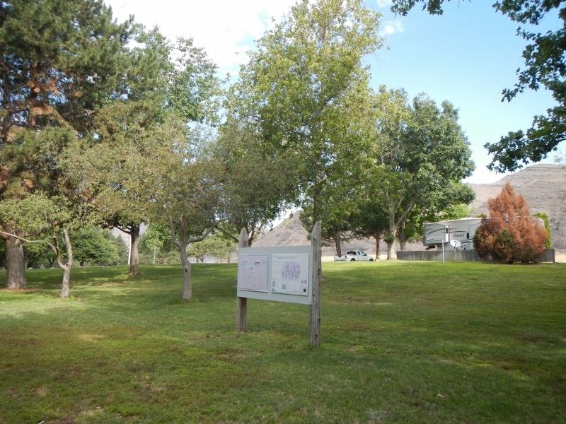
| 2 ► Washington, Asotin County, Clarkston — Granite Lake Park — |
| Near Port Way at 9th Street, on the left when traveling east. | |||
| 3 ► Washington, Asotin County, Clarkston — 36 — Lewis and Clark Enter Washington — |
| On Inland Empire Highway / Bridge Street (U.S. 12) 0.2 miles east of Elm Street, on the right when traveling east. | |||
| 4 ► Washington, Asotin County, Clarkston — Nimiipuu Homelands — "likeley men, handsom women" — |
| Near Granite Lake Drive, 0.2 miles east of 5th Street, on the left when traveling east. | |||
| 5 ► Washington, Asotin County, Clarkston — Snake River Passage & Columbia Plains Crossing — |
| Near Silcott Road near U.S. 12. | |||
| 6 ► Washington, Asotin County, Silcott — Temuut'su — (Chief Timothy) — |
| Near U.S. 12, 0.1 miles east of Westlake Drive, on the right when traveling east. | |||
| 7 ► Washington, Benton County, Plymouth — Strangers "from the clouds" — |
| Near Plymouth Park Road near Christy Road. | |||
| 8 ► Washington, Chelan County, Entiat — 26 — Earthquake Point — |
| On U.S. 97A, 1 mile north of North Lakeshore Drive, on the left when traveling north. | |||
| 9 ► Washington, Chelan County, Leavenworth — The History of Travel Over Stevens Pass — |
| Near U.S. 2 at Coulter Creek Road, on the right when traveling west. | |||
| 10 ► Washington, Clallam County, Forks — Makah Indian Tribe — |
| Near Upper Hoh Road, 0.1 miles east of Linder Creek Lane, on the left when traveling east. | |||
| 11 ► Washington, Clallam County, Port Angeles — Juan de Fuca — |
| On Olympic Highway (U.S. 101) at Laird Road, on the right when traveling west on Olympic Highway. | |||
| 12 ► Washington, Clark County, Ridgefield — Early Highway of the West — The Great Columbia River — |
| Near Interstate 5. | |||
| 13 ► Washington, Clark County, Vancouver, Columbia Way — A Busy Place Is This — |
| Near SE Columbia Way. | |||
| 14 ► Washington, Clark County, Vancouver, Columbia Way — Ilchee — |
| Near SE Columbia River Drive near Columbia Shores. | |||
| 15 ► Washington, Clark County, Vancouver, Esther Short — Esther Short — Esther Short Park — |
| On Columbia Street at W 6th Street, on the right when traveling south on Columbia Street. | |||
| 16 ► Washington, Clark County, Vancouver, Hudson Bay — First Japanese on the North American Continent — |
| On E. Evergreen Way, on the right when traveling east. | |||
| 17 ► Washington, Clark County, Vancouver, Hudson Bay — The O. O. Howard House — Officers Row — |
| On Fort Vancouver Way at Anderson Street, on the right when traveling south on Fort Vancouver Way. | |||
| 18 ► Washington, Columbia County, Dayton — "a good road" — |
| On East Main Street at North Front Street, on the right when traveling east on East Main Street. | |||
| 19 ► Washington, Columbia County, Dayton — Cayuse, Umatilla, and Walla Walla Homeland — |
| On East Main Street near North Front Street, on the right when traveling east. | |||
| 20 ► Washington, Columbia County, Dayton — Columbia County — Historical Points of Interest — |
| On East Main Street west of North 3rd Street, on the right when traveling west. | |||
| 21 ► Washington, Columbia County, Dayton — The Celilo Falls Trail — |
| On North 1st Street at East Commercial Street Avenue, on the right when traveling north on North 1st Street. | |||
| 22 ► Washington, Franklin County, Pasco — Sacagawea — |
| Near Sacajawea Park Road at U.S. 12, on the left when traveling east. | |||
| 23 ► Washington, Grant County, Coulee City — The Cariboo Cattle Trail — |
| On Washington Route 17 at milepost 88,, 0.1 miles south of Moore Road Northeast, on the right when traveling north. | |||
| 24 ► Washington, Grant County, Ephrata — Early Days in Ephrata — |
| On 1st Avenue Northwest west of C Street Northwest, on the right when traveling east. | |||
| 25 ► Washington, Grant County, Ephrata — History of the Rocky Ford Area — |
| On Washington Route 17 at milepost 67,, 0.2 miles south of Washington Route 282, on the right when traveling south. | |||
| 26 ► Washington, Grant County, Royal City — The Wanapums — |
| On Interstate 90. | |||
| 27 ► Washington, Grant County, Stratford — History of the Stratford Area — |
| On State Highway 28 at Road J Northeast, on the right when traveling east on State Highway 28. | |||
| 28 ► Washington, Grays Harbor County, Cosmopolis — Cosmopolis Treaty Grounds — February 25, 1855 — |
| On 1st Street (U.S. 101) at H Street, on the right when traveling north on 1st Street. | |||
| 29 ► Washington, Island County, Coupeville — Welcome — |
| On Front Street NW at NW Alexander Street, on the right when traveling west on Front Street NW. | |||
| 30 ► Washington, Island County, Coupeville — A Canoe Crossroads — |
| On NW Alexander Street at Front Street NW, on the right when traveling south on NW Alexander Street. | |||
| 31 ► Washington, Island County, Coupeville — Cross Built for Father Blanchet's Visit — |
| On NW Alexander Street south of Front Street NW, on the right when traveling south. | |||
| 32 ► Washington, Island County, Coupeville — Explore the Reserve — |
| On Front Street NW at NW Alexander Street, on the right when traveling west on Front Street NW. | |||
| 33 ► Washington, Island County, Coupeville — Northern Olympic Peninsula — Visitor Information Map — |
| On Engle Road (Washington Route 20), on the left when traveling west. | |||
| 34 ► Washington, Island County, Oak Harbor — The Skagit, a stately society — |
| On Penn Cove Road near Monroe's Landing Road. | |||
| 35 ► Washington, Jefferson County, Forks — Sv. Nikolai Mission — Storm at Sea, War on Land — |
| Near Upper Hoh Road, 0.1 miles east of Linder Creek Lane, on the left when traveling east. | |||
| 36 ► Washington, Jefferson County, Forks — Escape to the Hoh River Leads to Captivity — Makah Tribe Encounter & Rescue — |
| Near Upper Hoh Road, 0.1 miles east of Linder Creek Lane, on the left when traveling east. | |||
| 37 ► Washington, Jefferson County, Forks — Hoh Indian Tribe — |
| Near Upper Hoh Road, 0.1 miles east of Linder Creek Lane, on the left when traveling east. | |||
| 38 ► Washington, Jefferson County, Forks — Quileute Indian Tribe — |
| Near Upper Hoh Road, 0.1 miles east of Linder Creek Lane, on the left when traveling east. | |||
| 39 ► Washington, Jefferson County, Port Townsend — The čičməhán Trail — A Self Guided Tour of Historical Sites in Scenic Port Townsend, Washington — |
| On Water Street at Monroe Street, on the left when traveling east on Water Street. | |||
| 40 ► Washington, Jefferson County, Port Townsend — Bounty of the Bay — The Story of a Royal Repast, 1859 — |
| 41 ► Washington, Jefferson County, Port Townsend — Canoes Were Made Of Locally Available Materials — Coast Salish Canoe Culture — |
| On Water Street east of Monroe Street, on the right when traveling east. | |||
| 42 ► Washington, Jefferson County, Port Townsend — Chetzemoka — In Memory Of — |
| 43 ► Washington, Jefferson County, Port Townsend — Chief Chetzemoka — Coast Salish Canoe Culture — |
| On Water Street east of Monroe Street, on the right when traveling east. | |||
| 44 ► Washington, Jefferson County, Port Townsend — Chief Chetzemoka — |
| 45 ► Washington, Jefferson County, Port Townsend — Hudson Beach / Big Heart — The čičməhán Trail Stop 2 — |
| 46 ► Washington, Jefferson County, Port Townsend — InterTribal Canoe Journey — Coast Salish Canoe Culture — |
| On Water Street east of Monroe Street, on the right when traveling east. | |||
| 47 ► Washington, Jefferson County, Port Townsend — Intertribal Trade — Coast Salish Canoe Culture — |
| On Water Street east of Monroe Street, on the right when traveling east. | |||
| 48 ► Washington, Jefferson County, Port Townsend — Kah Tai Prairie Preserve — |
| 49 ► Washington, Jefferson County, Port Townsend — Partnering With The Northwest Maritime Center With A Shared Respect For The Sea — Coast Salish Canoe Culture — |
| On Water Street east of Monroe Street, on the right when traveling east. | |||
| 50 ► Washington, Jefferson County, Port Townsend — Point Hudson — |
| On Water Street at Jackson Street, on the left when traveling east on Water Street. | |||
| 51 ► Washington, Jefferson County, Port Townsend — Point Hudson — The čičməhán Trail Stop 3 — |
| On Hudson Street, on the right when traveling south. | |||
| 52 ► Washington, Jefferson County, Port Townsend — Point Hudson History — Rotary Centennial Path — |
| On Hudson Street north of Jefferson Street, on the right when traveling north. | |||
| 53 ► Washington, Jefferson County, Port Townsend — qatáy Prairie — The čičməhán Trail Stop 14 — |
| 54 ► Washington, Jefferson County, Port Townsend — Sentinel Rock — The čičməhán Trail Stop 13 — |
| 55 ► Washington, Jefferson County, Port Townsend — The S'Klallams, The Strong People — Coast Salish Canoe Culture — |
| On Water Street east of Monroe Street, on the right when traveling east. | |||
| 56 ► Washington, Jefferson County, Port Townsend — The Unique Coast Salish Design — Coast Salish Canoe Culture — |
| On Water Street east of Monroe Street, on the right when traveling east. | |||
| 57 ► Washington, Jefferson County, Port Townsend — The Welcome Totem Pole — at the Northwest Maritime Center — |
| On Water Street at Monroe Street, on the right when traveling east on Water Street. | |||
| 58 ► Washington, Jefferson County, Port Townsend — Trade With Newcomers — Coast Salish Canoe Culture — |
| On Water Street east of Monroe Street, on the right when traveling east. | |||
| 59 ► Washington, Jefferson County, Port Townsend — Union Wharf / Indian Island — The čičməhán Trail Stop 7 — |
| 60 ► Washington, Jefferson County, Port Townsend — Village at Memorial Field — The čičməhán Trail Stop 5 — |
| On Washington Street at Madison Street, on the left when traveling east on Washington Street. | |||
| 61 ► Washington, King County, Seattle, Broadview — Carkeek Park — |
| 62 ► Washington, King County, Seattle, Downtown Seattle — Bell Street Terminal, Pier 66 — Historical Point of Interest — |
| On Akaskan Way, on the right when traveling south. | |||
| 63 ► Washington, King County, Seattle, Downtown Seattle — Chief Seattle — |
| On Cedar Street at Denny Way on Cedar Street. | |||
| 64 ► Washington, King County, Seattle, Downtown Seattle — Indians Attack Seattle! Jan. 26, 1856 — Historical Point of Interest — |
| On Alaskan Way South near Yesler Way, on the right when traveling south. | |||
| 65 ► Washington, King County, Seattle, North Queen Anne — Fremont Bridge — |
| On 4th Avenue North, on the right when traveling north. | |||
| 66 ► Washington, King County, Seattle, West Seattle — Admiral Way Totem Pole — |
| On 61st Avenue SW at Southwest Strevens Street, on the right when traveling east on 61st Avenue SW. | |||
| 67 ► Washington, Kitsap County, Hansville — Hahd-Skus or Point No Point — |
| On Northeast Point No Point Road, 0.3 miles east of Hillview Lane Northeast, on the left when traveling east. | |||
| 68 ► Washington, Klickitat County, Dallesport — "the Great Mart" — |
| Near Columbia Hills Historical State Park Road near Lewis and Clark Highway (Washington Route 14) when traveling south. | |||
| 69 ► Washington, Klickitat County, Dallesport — Columbia River Indians — A Culture Lives On — |
| On Lewis and Clark Highway (Washington Route 14) near Columbia Hills State Park Road, on the right when traveling east. | |||
| 70 ► Washington, Klickitat County, Dallesport — Preparing to leave the River — |
| On Washington Route 14 at U.S. 197 on State Route 14. | |||
| 71 ► Washington, Klickitat County, Dallesport — Sheltered Homelands — |
| Near Columbia Hills Historical State Park Road north of Lewis and Clark Highway (Washington Route 14) when traveling south. | |||
| 72 ► Washington, Klickitat County, Wishram — 21 — Celilo Falls — An Ancient Fishery — |
| On Lewis and Clark Highway (State Highway 14) 0.8 miles west of Wishram Road, on the left when traveling west. | |||
| 73 ► Washington, Klickitat County, Wishram — Great Falls of the Columbia — "Indians assisted us over the portage" — |
| On Lewis and Clark Highway (State Highway 14) 0.8 miles west of Wishram Road, on the left when traveling west. | |||
| 74 ► Washington, Klickitat County, Wishram — Wyam — "This is the Great Mart" — |
| On Lewis and Clark Highway (State Highway 14) 0.8 miles west of Wishram Road, on the left when traveling west. | |||
| 75 ► Washington, Lewis County, Morton — Riffe Lake Overlook — East Lewis County — |
| On U.S. 12, 0.4 miles east of Mossyrock Dam, on the right when traveling east. | |||
| 76 ► Washington, Lewis County, Mossyrock — Mossyrock — East Lewis County — |
| On U.S. 12, 0.9 miles west of Williams Street, on the left when traveling west. | |||
| 77 ► Washington, Lewis County, Packwood — Traveling Over the Cascades: Past and Present — |
| Near U.S. 12, 0.1 miles east of Forest Service Road 1276, on the right when traveling east. | |||
| 78 ► Washington, Lincoln County, Fort Spokane — Fort Spokane — |
| Near Washington Route 25, 0.1 miles north of Miles Road, on the left when traveling west. | |||
| 79 ► Washington, Lincoln County, Fort Spokane — Fort Spokane History — |
| On Fort Spokane Road, 0.2 miles west of Washington Route 25. | |||
| 80 ► Washington, Lincoln County, Fort Spokane — Welcome to Fort Spokane — Army Fort and Indian Boarding School — |
| Near Washington Route 25, 0.1 miles north of Miles Road, on the left when traveling west. | |||
| 81 ► Washington, Okanogan County, Conconully — Scotch Creek Basin — |
| On Conconully Road, on the right when traveling north. | |||
| 82 ► Washington, Okanogan County, Okanogan — The Cariboo Trail — |
| On U.S. 97, 3.7 miles south of Osprey Drive (State Highway 20), on the right when traveling south. | |||
| 83 ► Washington, Okanogan County, Pateros — Methow Indians — |
| Near Commercial Avenue north of Lakeshore Drive, on the right when traveling north. | |||
| 84 ► Washington, Pacific County, Chinook — A Collision of Cultures / How Did They Live? — |
| Near U.S. 101, 1.7 miles west of State Highway 401, on the right when traveling west. | |||
| 85 ► Washington, Pacific County, Chinook — Columbia River Explorers |
| On U.S. 101, 0.6 miles State Highway 401, on the left when traveling west. Reported missing. | |||
| 86 ► Washington, Pacific County, Chinook — 11 — Fort Columbia — |
| On U.S. 101 at Columbia Lane, on the right when traveling south on U.S. 101. | |||
| 87 ► Washington, Pacific County, Chinook — How Do These Stories Continue? — |
| Near U.S. 101, 1.7 miles west of State Route 401, on the right when traveling west. | |||
| 88 ► Washington, Pacific County, Chinook — In Search of Recognition — |
| Near U.S. 101, 1.7 miles State Route 401, on the right when traveling west. | |||
| 89 ► Washington, Pacific County, Chinook — The Business of Trade — |
| Near U.S. 101, 1.7 miles west of State Route 401, on the right when traveling west. | |||
| 90 ► Washington, Pacific County, Chinook — Welcome to Middle Village — |
| On U.S. 101, 1.7 miles west of State Route 401, on the right when traveling west. | |||
| 91 ► Washington, Pacific County, Chinook — What Are the First Stories of This Place? — |
| Near U.S. 101, 1.8 miles west of State Route 401, on the right when traveling west. | |||
| 92 ► Washington, Pacific County, Ilwaco — An Evolving Playground — |
| On North Head Road, 1.6 miles north of Robert Gray Drive (Washington Route 100), on the left when traveling north. | |||
| 93 ► Washington, Pierce County, Gig Harbor — A Living History: the S'Homamish — |
| On Harborview Drive, on the left when traveling north. | |||
| 94 ► Washington, Pierce County, Gig Harbor — First Settlers — |
| On Harborview Drive at Rosedale Street NW, on the right when traveling north on Harborview Drive. | |||
| 95 ► Washington, Pierce County, Puyallup — 8 — South Hill Heritage Corridor — Historic Marker — |
| On Woodland Avenue East just north of 157th Street Court East, on the right when traveling north. | |||
| 96 ► Washington, Pierce County, Tacoma — Captain George Vancouver at Browns Point — |
| 97 ► Washington, Pierce County, Tacoma, North End — Margaret Meeker Davis — 1881-1960 — |
| On North 30th Street at McCarver Street, on the right when traveling east on North 30th Street. | |||
| 98 ► Washington, Pierce County, Tacoma, North End — Our First Settlers — |
| On North 30th Street west of North Carr Street, on the right when traveling east. | |||
| 99 ► Washington, Skagit County, La Conner — Old Time Skagit River Indian Canoes — Shovel Nose Type — |
| On Moore Street at Second Street, on the right when traveling north on Moore Street. | |||
| 100 ► Washington, Skamania County, Gifford Pinchot National Forest — Mount St. Helens — Fire Mountain of the Cascades — Mount St. Helens National Volcanic Monument — |
| Near Forest Road NF-99, 15 miles Forest Road NF-25. | |||
143 entries matched your criteria. The first 100 are listed above. The final 43 ⊳