Canal, rail and highway converge at Smiths Falls, the crossroads of the Rideau corridor. Each means of transport, built in turn, changed the face of the town, the Rideau River, and this lockstation. Canal construction first transformed the . . . — — Map (db m125889) HM
Launched in Kingston August 19, 1944 this Corvette (of the Flower Class) sailed under Pennant K345 commanded by Lt. CDR. Philip Taber Byers. The ship made 3 Atlantic crossings as a convoy escort, later transporting men to Quebec City who were . . . — — Map (db m124545) HM
The 3 locks here were designed to overcome a series of rapids with a total fall of over 7 metres (20 feet). A set like this is known as a flight of locks - each lock raises a vessel part of the way - rather like a stairway. Construction here . . . — — Map (db m124723) HM
Where are the Falls? The Town gets its name from a mile long series of rapids, which originally flowed from the water tower in Centennial Park, to the stone arch bridge on Beckwith Street. As boat traffic increased in the early . . . — — Map (db m142161) HM
Constructed 1826-32 by the British government for military purposes, but used principally for commerce, the Rideau waterway, together with the lower Ottawa River, was the first canalized route from Montreal to the Great Lakes. Although eastbound . . . — — Map (db m142082) HM
The Rideau Waterway stretches 202 kilometres through a chain of lakes, rivers and canals, linking Smiths Falls, the heart of the Rideau, to the historic city of Kingston on Lake Ontario and to Ottawa, Canada's capital. To follow the Rideau . . . — — Map (db m142166) HM
The locks before you, replaced by the automated lock in 1974, are the only non-operational locks on the Rideau Canal. Their preservation reflects Parks Canada's commitment to protect and present canal heritage. These locks provide us with an . . . — — Map (db m125621) HM
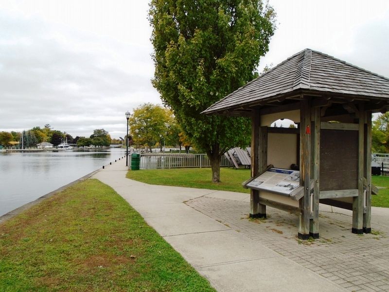
The current water system in Smiths Falls began in a three-story brick building in 1886 under the management of "Captain" Adam Foster. While it began on the east side of Beckwith Street to supply the water tanks in the CPR yards, it . . . — — Map (db m142155) HM
This lockstation is one link in the chain of rivers, lakes and waterway structures that make up the Rideau Canal. Built under the direction of the British military between 1826 and 1832 to serve as a supply route, the canal is an outstanding . . . — — Map (db m125638) HM
Originally built in 1830 under Abel Russell Ward, this site has changed faces and owners many times. Throughout the course of its history, it was an oatmeal and grist mill, and then rebuilt in 1887 under the new ownership of Alexander Wood. . . . — — Map (db m124632) HM
Astonishingly, Myles Jeffrey never made a boat for himself. Myles gained his knowledge working for Gilbert's in Brockville, Pyke in Lachine, PQ, and Chris-Craft in Michigan, USA. But he preferred working at his own pace and to his own high . . . — — Map (db m142028) HM
Muscallonge
GPS: 44° 36.246’ N. 75° 39.215' W.
The “Muscallonge” was a large wooden tugboat, measuring 39 m long by 7 m wide. This tug – later to be nicknamed the “Muskie” – was built in Port Huron, Michigan in 1896. In 1936, it . . . — — Map (db m141812) HM
This piece of waterfront land has not been a real island since 1860, when it was joined to the mainland by the Brockville & Ottawa Railway. This early railway company established their new terminus on Blockhouse Island, in conjunction with the new . . . — — Map (db m141824) HM
Regular ferry services linked Brockville to Morristown, N.Y., from the 1850s to the 1950s. Eventually, the opening of the Ogdensburg International Bridge and the Thousand Islands Bridge spelled the end of ferry services in . . . — — Map (db m141623) HM
As Brockville's oldest social club, the Brockville Rowing Club was founded in 1894. The present building replaced the old one in 1978, to continue Brockville's successful rowing tradition.
Fondée en 1894, le club d'aviron de . . . — — Map (db m141618) HM
During one of the annual Rowing Regattas
held by the BROCKVILLE ROWING CLUB
Near the turn of the century, some of the most popular sporting and social events of the summer season in Brockville were the regatta races held by the BROCKVILLE . . . — — Map (db m141763) HM
Canada's first underwater sculpture park was established in 2014 and dedicated to all those who tragically lost their lives in the St. Lawrence River. The first sculptures were part of the memorial circle that is the focal point of the underwater . . . — — Map (db m193826) HM
The mouth of Buell’s Creek was the location of an early sawmill built by Daniel Jones Sr. in the 1790s. This was followed by the gristmill, built by Robert Shepherd in the 1850s (still existing to the north).
From the position, looking across . . . — — Map (db m146935) HM
This river was named "Rivière de Saint Laurens"
by French explorers in honour of
Saint Lawrence, the Martyr
Laurentius or Lorenzo, Archdeacon of Rome
Executed in Rome, August 10, 258, by order of
Roman Emperor . . . — — Map (db m141693) HM
The steamer KINGSTON was a regular visitor to Brockville and other river communities from 1901 to 1949
The SS KINGSTON was built in 1901 for the RICHELIEU & ONTARIO NAVIGATION CO. LTD of Montreal. It was the second in a series of three new . . . — — Map (db m141815) HM
On the occasion of the
first port of call
The City of Brockville expresses tribute and
commemoration to the legendary H.M.S. Bounty
built in Lunenburg, Nova Scotia, Canada
Lost to the sea in November 2012
during Hurricane Sandy . . . — — Map (db m146969) HM
On Sunday May 21, 1933 the schooner Bluenose, "champion of the North Atlantic fishing fleet" visited Brockville on her way to the Chicago World's Fair. Towed into port by the Canadian Coast Guard vessel Grenville, the ship was visited . . . — — Map (db m141772) HM
Underwater explorers regularly gather about 500 yards offshore from the east-end park known as CENTEEN PARK and about a half-mile down stream from here. Below the water, about 65 feet down, lie the remains of the former two-masted wooden schooner, . . . — — Map (db m141820) HM
The St. Lawrence River was the major transportation route for natural and manufactured goods of all kinds in the 1800s. Many large rafts of hewn logs were assembled on the rivers of Upper Canada near where they were cut down. Oak timber, like the . . . — — Map (db m146975) HM
Darlingside is a rare surviving example of the wood depots which provided an essential fuelling service during the early phase of steamboat navigation on Lake Ontario and the upper St. Lawrence River. Thomas Darling, a Scottish immigrant, . . . — — Map (db m102088) HM
Long before roads penetrated the dense forests of the Thousand Islands, the St. Lawrence River was the highway to the interior of Canada.
Vessels of all types plied the waters. Bateaux and durham boats carried produce from nearby farms to be . . . — — Map (db m102092) HM
The Thousand Islands are the roots of an ancient Precambrian mountain range ground down by successive glaciations to granite bedrock. Over the centuries the bare, gnarled hills were covered with rich forests and carpets of wildflowers. Where the . . . — — Map (db m102090) HM
Half Moon Bay, so named because of its crescent moon shape, is on the south side of Bostwick Island in the Admiralty Group of the Thousand Islands, near Gananoque.
In 1887, a group of summer campers began to meet on Sunday in the bay for . . . — — Map (db m207424) HM
In 1806, Joel Stone was granted his petition to build a bridge, which would replace the ferry service he had initiated 5 years earlier. By 1810, as a direct consequence to Stone’s various enterprises, settlement at the mouth of the . . . — — Map (db m207622) HM
On this site stood the
"Thousand Island Railroad Station"
(circa 1906) combined with a steamboat
warehouse making a busy waterfront. — — Map (db m207513) HM
By the time Joel Stone took up residence in the area in 1792, a grist mill had been built adjacent to Stone’s land on the east bank of the Gananoque River and was operating by harnessing the power of the first of several rapids along . . . — — Map (db m207617) HM
This international bridge system links Canada and the United States across the St. Lawrence River and islands from Ivy Lea, Ontario, to Collins Landing, N.Y. It was opened on August 18, 1938, by William Lyon Mackenzie King, Prime Minister of . . . — — Map (db m124428) HM
English text: The barques "Iroquoise" and "Outaouaise", the last French ships of war that navigated Lake Ontario, were built on this point, then called Pointe Au Baril. On 17th August, 1760, the Outaouaise, commanded by Captain La Broquerie, . . . — — Map (db m87011) HM
During the War of 1812 the St. Lawrence was the life-line of Upper Canada along which virtually all military and civilian supplies were transported from Montréal to Kingston. Fear that the Americans might attempt to block the passage of materiel . . . — — Map (db m87163) HM
The Merrickville blockhouse is one of four blockhouses constructed on the Rideau Canal. Its architecture is a typical design utilized throughout British North America. The 3.5 foot (1.06 metres) walls were designed to be strong enough to . . . — — Map (db m142312) HM
Why the Canals are Twinned
These two canals were constructed in the early 19th century for military reasons. Both Canals grew into commercial highways, survived as recreational waterways and are now important heritage resources. . . . — — Map (db m142314) HM
In 1793 William Merrick (1760-1844), a Loyalist from Massachusetts, acquired from Roger Stevens a sawmill at the "Great Falls" on the Rideau River. Here he built new mills which formed the nucleus of a small community that grew up before 1816 and . . . — — Map (db m142241) HM
The arrangement of the locks here is unique along the waterway with a small basin set between each lock. These basins were built to allow the locks to follow a natural depression in the ground and therefore minimize the amount of . . . — — Map (db m142341) HM
This is one of four blockhouses which, with some twelve other "defensible buildings", were constructed along the Rideau Canal. The canal, built 1826-32 by Lieutenant-Colonel John By, Royal Engineers, was designed to serve as an alternative . . . — — Map (db m142181) HM
When construction of the Rideau Canal began, Merrickville was already an established village and was considered by the authorities to be a logical target for an invader. Consequently Colonel John By urged strong measures for the . . . — — Map (db m142194) HM
The Caledonian Canal of Scotland, engineered by Thomas Telford and completed in 1822, is twinned with the Rideau Canal to commemorate their historical link, purpose and function, and to recognize the enduring importance of canals to . . . — — Map (db m142184) HM
Prescott is a town on the north shore of the Saint Lawrence River in [the] province of Ontario, Canada. The town is a part of the United Counties of Leeds and Grenville. In 2021, it had a population of 4,078. The Ogdensburg-Prescott International . . . — — Map (db m242848) HM
Before the completion of the canals between here and Montreal in 1847, Prescott was the eastern terminus of Great Lakes navigation. Established at the head of Galops Rapids in 1810, it soon became a centre for the forwarding, or shipping, trade and . . . — — Map (db m221393) HM
Launched February 2, 1868 at
St. John, New Brunswick the Rothesay
is a 65 m. (178') long twin side-wheeler
that initially sailed between Fredericton
and St. John but was later relocated
to service the Montreal to Prescott
route . . . — — Map (db m227967) HM
Downstream from present day Spencerville, the Roebuck area was once home to 1,600 Indigenous people. Based upon research done by Augusta Township we understand that this park is on aboriginal land that was inhabited by Indigenous peoples for . . . — — Map (db m193865) HM
The construction of the Narrows blockhouse began in 1832 by William H. Tett,
a prominent Newboro merchant. This blockhouse is one of four constructed on the
Rideau Canal. Its architecture is a typical design utilized throughout . . . — — Map (db m207637) HM
Before the arrival of the Royal Engineers, Rideau Lake stretched unbroken
for 35 km (22 miles) between Newboro and the entrance to the Rideau
River, 29 km (18 miles) to the north. There was, and is, no reason for this
lock with its 1 . . . — — Map (db m207654) HM
The Rideau Canal is a series of rivers and lakes connected by man-made channels and locks. There are 18 miles of artificial cut and 47 locks grouped in 23 lock stations, as well as many water control structures. These make the Rideau . . . — — Map (db m207658) HM
The War of 1812 had shown that a successful defence of Canada against an American attack depended upon secure supply lines. The Rideau Canal was built as an alternate to the easily attacked St. Lawrence supply route. Blockhouses were . . . — — Map (db m207659) HM
Before the Rideau Canal was constructed The Narrows was but a shallow portion of one large lake. Original plans called for a channel to permit navigation. However, tough granite and malaria upstream at the Isthmus caused difficulties in . . . — — Map (db m207660) HM
English: In the early 1800's Kingston was a shipbuilding centre of note. The FRONTENAC, the first steamship to navigate Lake Ontario, was built here at Finkle's Point, Ernestown (now Bath), and launched September 7, 1816. Designed to carry . . . — — Map (db m83645) HM
Opposite here is the gap between Amherst Island and the eastern tip of Prince Edward County. On November 9, 1812, the British Corvette "Royal George" (22 guns), commanded by Commodore Hugh Earl(e), was intercepted off False Duck Islands by an . . . — — Map (db m83643) HM
Following the War of 1812 expeditions traversed the wilderness between Lakes Simcoe and Muskoka and the Ottawa River, seeking a route across Upper Canada less open to attack than by the St. Lawrence and Lake Ontario. In 1819 Lieut. J.P. Catty, R.E., . . . — — Map (db m144822) HM
Were originally constructed of hewn timbers during 1873-76 on the North Branch of the Muskoka River between Mary’s and Fairy Lakes. Length 88.5 ft., width 24 ft., lift 8 ft. The completion of these locks and the launching of the steamer . . . — — Map (db m147896) HM
• This swing bridge replaced the 1879 lift bridge built to cross the new channel separating the sawmill and lumberyard from Brunel Road. The swing bridge was easier to operate than the original lift bridge.
• The S.S. Dortha began traveling . . . — — Map (db m147897) HM
Originally conceived in 1818 by its promoter, William Hamilton Merritt, to divert trade from the Erie Canal and New York and built under private auspices, the canal was opened to traffic in 1829. After additional work in 1833, the canal with its 40 . . . — — Map (db m75850) HM
On the night of December 29-30, 1837, some 60 volunteers acting on the orders of Col. Allen Napier MacNab, and commanded by Capt. Andrew Drew, R.N., set out from Chippawa in small boats to capture the American steamer "Caroline". That vessel, which . . . — — Map (db m64651) HM
Over the centuries there have been many ferry landings along the Niagara River. Some were built by local merchants and some as government licenced landing points.
The longest operating ferry dock was here, near the foot of present-day Bertie . . . — — Map (db m75876) HM
Throughout the 1800s there were many ferry landings competing for business along the Niagara River. The map below is a compilation of some of these locations.
Ferry leases were granted to:
Col. John Warren Sr.,
John Warren Jr.,
Nelson . . . — — Map (db m75877) HM
From around 1830 to 1860, thousands of freedom seekers used the Underground Railroad to reach sanctuary in Canada - the “promised land”. Many crossed the Niagara River from the United State to Fort Erie, including Josiah Henson and his . . . — — Map (db m75878) HM
Grimsby Nature
Fisheries in Grimsby
The fish once caught in Lake Ontario help tell the story of settlement and growth around Forty Mile Creek. The Neutral Confederacy, Niagara's first inhabitants, were well established in the area, . . . — — Map (db m234100) HM
In 1786 John Burch, a United Empire loyalist, constructed a water-powered grist and sawmill on this site. He was the first to use the waters on the west bank of the Niagara River for industrial purposes. The mills were burned by the retreating . . . — — Map (db m79766) HM
The Niagara Falls Park and River Railway Powerhouse, built on this site in 1892, was the first hydraulic powerhouse to use water from the Canadian side of the Niagara River. It generated 2100 hp of direct current electricity for the electric . . . — — Map (db m66409) HM
On August 6, 1918, this dumping scow broke loose from its towing tug about 1.6 kilometres (1 mile) upriver, with Gustav F. Lofberg and James N. Harris aboard. The men opened the bottom dumping doors and the scow grounded in the shallow rapids. They . . . — — Map (db m79781) HM
"It is further agreed that the waters herein defined as boundary waters and waters flowing across the boundary shall not be polluted on either side to the injury of health or property of the other."
Widely regarded as the first . . . — — Map (db m64648) HM
This beautiful fountain takes its name from Samuel Zimmerman who came to Canada from Pennsylvania in 1842. He amassed a fortune through a series of lucrative contracts involving the building of the second Welland Canal and various Railway Lines, . . . — — Map (db m75881) HM
In 1833, four years after it had been opened, the Welland Canal was extended to Gravelly Bay to provide a more direct route between Lake Erie and Lake Ontario. The first ship to transit this extension was the schooner “Matilda” of Oakville. Its . . . — — Map (db m196333) HM
Bollards, used to secure ropes from a ship, are found all along the canal. Most were plain and serviceable. This bollard, made from polished carved limestone and placed on a base, was a prototype for possible use along the present canal. Though . . . — — Map (db m76086) HM
Bollards and Fairleads are used to control the lines (rope and cables) used to tie up a ship.
Bollards are steel or concrete posts, on land and on a ship, used to secure a vessel. Vessels travelling through the Welland Canal are tied up in each . . . — — Map (db m76088) HM
In 1960, the Lincoln Historical Society (now the St. Catharines Historical Society) recovered this cannon barrel from the banks of Twelve Mile Creek, formerly the route of the First and Second Welland Canals. It had been buried in the area under the . . . — — Map (db m76089) HM
The modern Welland Canal is actually the fourth version to be built since 1829. Unlike the later government-operated canals, the First Welland Canal was built by a private company.
The outline on the ground represents a typical lock from the . . . — — Map (db m76090) HM
A timber lock with inside dimensions of 33.7m (108 ft.) by 6.6m (22 ft.) was constructed on this site between 1824 and 1827. The lock walls consisted of earth filled cribs 5.2m (16 ft) thick and 7.6m (25 ft) deep. This was the 24th lock of 39 that . . . — — Map (db m75871) HM
A prominent Canadian shipbuilder, Shickluna was born in Malta, where he worked before emigrating to North America. By 1835 he was engaged in ship construction at Youngstown, NY. Three years later, attracted by the traffic stimulated by the Welland . . . — — Map (db m76272) HM
Shipbuilding has a long association with the Niagara Peninsula, and is especially linked to the Welland Canals. Russell Armington established this important industry with the launching in 1828 of the Welland Canal. St. Catharines quickly became . . . — — Map (db m76279) HM
St. Catharines became an important part of the shipping industry due to te building of the Welland Canals and its location between two Great Lakes. Louis Shickluna, a shipbuilder who emigrated to St. Catharines to Malta, began working as a builder . . . — — Map (db m76284) HM
Lock number 6 of the original Welland Canal lies in the adjacent watercourse about 213 metres southwest of here. This first or "wooden" canal, constructed 1824-33 by the Welland Canal Company, ran from Port Dalhousie on Lake Ontario to Port Colborne . . . — — Map (db m75874) HM
A tribute to Canadian engineering design and construction, the Fourth Welland Canal was built to permit passage of ships between Lakes Ontario and Erie, bypassing Niagara Falls. Constructed in the period 1913 - 1932 at a cost of $130 million, it . . . — — Map (db m76084) HM
The Welland Ship Canal is the fourth in a series of successively larger canals that were built to join Lakes Ontario and Erie - the first being completed in 1829. The present Canal was opened in 1932. It forms part of the St. Lawrence Seaway/Great . . . — — Map (db m76328) HM
has been erected by his grandson William Hamilton Merritt of the City of Toronto, son of William Hamilton Merritt Jr. of St. Catharines, as a tribute to the father of Canadian transportation who through initiatory steps in first waterways and . . . — — Map (db m76186) HM
Twenty vertical lift bridges were constructed to cross the Welland Canal at the time of its opening in 1932. Of the eleven original vertical lift bridges, only three remain in use.
This sheave (a grooved wheel that forms part of a pulley) was . . . — — Map (db m76326) HM
This plaque erected to mark the 40th anniversary of the opening of the Welland Ship Canal to world shipping on August 6, 1932, commemorates the significant role this historic waterway and our inland fleet play in Canadian national life.
This . . . — — Map (db m76344) HM
Born of a Loyalist family in the State of New York, Merritt became a pioneer merchant and industrialist on Upper Canada's Niagara frontier. In 1818 he began to promote construction of the Welland Canal, of which he became the first general manager . . . — — Map (db m76182) HM
A pioneer in the field of transportation, Merritt was born in Bedford, New York and settled at Twelve Mile Creek (St. Catharines) with his Loyalist family in 1796. He served with the provincial cavalry during the War of 1812, then operated . . . — — Map (db m76184) HM
During the construction of the original Welland Canal, 1824-1829, a number of communities sprung up along its length. Here, on land belonging to George Keefer, a village known as Thorold had developed by 1828. A large flouring mill was built on the . . . — — Map (db m54088) HM
[English] This bridge was built in 1927-1930 during the construction of the Fourth Welland Canal (1913-1933). It was one of the three largest vertical lift bridges on the canal and is unique because its towers are set at an angle to the . . . — — Map (db m196324) HM
Here, when the canoe was the principal means of travel, explorers, voyageurs, missionaries and others bound for the West, left the Ottawa River and followed the Mattawa River to Lake Nipissing, the French River and the upper Great Lakes. For over . . . — — Map (db m105630) HM
When west-bound voyageurs left the Ottawa here at Mattawa, "the forks," they faced 11 portages in the next 40 miles. The Mattawa, or Petite-Rivière, was a key link in the historic canoe route between Montréal and the upper Great Lakes and . . . — — Map (db m105631) HM
[English] The arrival of Samuel de Champlain on this site, on July 26, 1615, represents one of the first manifestations of the French language in this region of Ontario. "Continuing our way by land, after leaving . . . — — Map (db m215900) HM
The rivers and lakes of northern Ontario have been highways for travel and commerce for hundreds of years. Used extensively by first nations and European explorers, Lake Nipissing became a major highway with half the furs shipped to . . . — — Map (db m215897) HM
Born in France about 1598, this explorer, fur trader and interpreter came to Canada in 1608. Under orders from Samuel de Champlain, he spent the following two years with the Algonquins of Allumette Island. He was then sent to the Nipissing Indians . . . — — Map (db m107579) HM
The historic La Vase (Mud) Portages began at the head of the nearby pond. These three portages, connecting Trout Lake and the lower La Vase River, were linked by small navigable streams and ponds. They formed part of the great canoe route via the . . . — — Map (db m107582) HM
From this point the Canadian explorers and early fur-traders caught their first glimpse of Lake Nipissing as they paddled westward on their journey from Montreal by way of the Ottawa, Mattawa and French Rivers to the Great Lakes. Champlain viewed . . . — — Map (db m199966) HM
The vast body of water before you is a shining Northern gem. Known as Lake Nipissing, the name being derived from an Aboriginal term meaning "little water", it is one of the ten largest lakes in Ontario at roughly 65 km by 25 km. When . . . — — Map (db m215993) HM
North Bay citizens have long enjoyed a refreshing tankard and for a short time in the early 20th Century, residents were served by their own brewery. The New Ontario Brewing Company Ltd. was the area's first commercial brewery, producing . . . — — Map (db m215898) HM