Rocky Mountain Arsenal National Wildlife Refuge
Located just eleven miles northeast of downtown Denver, the Refuge is the largest contiguous open space in the Denver metropolitan area. A major environmental restoration program will be . . . — — Map (db m119390) HM
This Headquarters area is dedicated in honor of all the Rocky Mountain Arsenal employees who accomplished the production, demilitarization, and environmental restoration at the Arsenal from 1942 until 2012 — — Map (db m162066) HM WM
As the focus changed to environmental cleanup, Building 111 became the headquarters of this new mission-and of a public-private partnership among the U.S. Army, Shell Oil Co. and U.S. Fish and Wildlife Service. Years of
Partnership Called . . . — — Map (db m163885) HM
Arsenal Beginnings
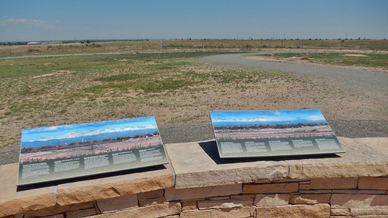
Building 111, also known as the “White House, "was located north of the flagpole area. The building was the U.S. Army's headquarters
from the time the Arsenal was established in 1942 until the building was . . . — — Map (db m163883) HM
In 1942, women and men of the U.S. Army built this Arsenal that helped achieve victory in WWII and the Cold War. With thanks to our partners, the U.S. Army, Shell Oil Company and their contractors, we dedicate this flagpole to the employees of . . . — — Map (db m119380) HM
The Fourteeners
There are 58 peaks in the Colorado Rocky Mountains that are above 14,000 feet in height. While 54 are generally acknowledged to be "14ers", most people who want to climb them want to climb all 58. They are contained in six . . . — — Map (db m119395) HM
Commerce City
Commerce City was incorporated as Commerce Town in 1952 and became Commerce City in 1970. In 2004 the Prairie Gateway, a 917-acre parcel of land located along the western edge of the Rocky Mountain Arsenal National Wildlife . . . — — Map (db m119381) HM
According to Outdoor Life (April, 2004),
Old Mose was the most famous grizzly ever to
appear in their publication. This one bear
was responsible for a myriad of depredations.
Known for his distinctive footprint
(he was missing two . . . — — Map (db m160761) HM
The first U.S. citizen known to have seen the site of present-day Alamosa, Lt. Zebulon M. Pike, was arrested nearby in 1807 for trespassing on Spanish soil. But the Spanish were trespassers themselves—the Utes occupied the land. The . . . — — Map (db m160914) HM
[Map captions, clockwise from top right, read]
• Penitente Canyon [informational]
• Great Sand Dunes National Park [informational]
• Stations of the Cross Shrine [informational]
• The Fort Garland Museum is a restored . . . — — Map (db m160927) HM
Colorado's first home railroad was begun in 1871. William J. Palmer, Civil War veteran and founder of the Denver and Rio Grande, felt that transportation was the key to success in this new, undeveloped land.
"Narrow gauge" railroad was a new . . . — — Map (db m160929) HM
Travel the route of these explorers and read Lt. Pike’s own words from his journal.
U.S. Army Expedition to explore the United States new southwest boundary with New Spain.
The men:
Lt. Zebulon M. Pike Dr. John H. Robinson Sgt. . . . — — Map (db m71882) HM
“We can see the Dunes and the Crestone Needles from all over our ranch. When we are lost, that’s what we navigate by.”
--local rancher
Whether traveling on foot, by horseback, Model A, or the . . . — — Map (db m71051) HM
"Totally Unique and Unexpected!"
—park visitor
Welcome to the high elevation desert that is Great Sand Dunes! Does this landscape strike you as amazing, bizarre or totally out of place. If so, you’re not . . . — — Map (db m71050) HM
Pioneer conservationist
and founding member
of the Moffat - Hooper - Mosca
Service League for his many years
of dedicated service to the
preservation of the natural beauty
of the San Luis Valley — — Map (db m160692) HM
Travel the route of these explorers and read Lt. Pike’s own words from his journal.
U.S. Army Expedition to explore the United States new southwest boundary with New Spain.
The men:
Lt. Zebulon M. Pike Dr. John H. Robinson Sgt. . . . — — Map (db m160680) HM
Different Life Zones Exist in the Mountains
Imagine climbing the mountain in front of you. You might notice it gets cooler as you ascend. As the temperature drops, moisture in the air condenses, precipitation increases, and creates different . . . — — Map (db m71056) HM
You are about to step into the Great Sand Dunes Wilderness. Its mood changes with the seasons, from the spacious solitude of winter, to spring and summer fun and play. Whatever the season of your visit, this unexpected wilderness offers . . . — — Map (db m71057) HM
Mountains and passes were important in the formation
of the sand dunes.
You are looking at the Sangre de Cristo Mountains. Prevailing southwesterly winds carrying sand across the San Luis Valley were blocked by the mountains.
As the . . . — — Map (db m71055) HM
As you travel through these sandy grasslands, notice the bright white surface deposits visible along the highway to the west. The sabkha forms where sand is seasonally saturated by rising ground water. When the water evaporates away in late . . . — — Map (db m160687) HM
(Left Panel)
Climbing -- A Longtime Boulder Passion
Scrambling, tramping, hiking, climbing, mountaineering...No matter the name, early Colorado Chautauquans reveled in their outings into the adjacent foothills. In 1908, . . . — — Map (db m88253) HM
Dominating the view to the west, the peaks of the Sawatch Range define the Continental Divide. Fifteen of the peaks in the Upper Arkansas River Valley are "fourteeners," boasting summits exceeding 14,000 feet.
Between the peaks, creeks flow . . . — — Map (db m158531) HM
Agriculture in the Upper Arkansas Valley was initially developed to meet the demand of area mining camps. The flood of fortune-seekers created a market for meat, flour, vegetables, and other foods.
French immigrant Frank Mayol, credited . . . — — Map (db m158536) HM
As trappers, miners, and settlers migrated west they encountered an arid environment. Early explorers referred to the West as the Great American Desert and many believed it could not be settled. Unlike the wetter eastern United States, . . . — — Map (db m158541) HM
Hardscrabble's rugged cliffs are perfect bighorn sheep habitat — wild, rocky, and open. Against the steep canyon walls, their brown coats blend into the vegetation and rocks. Scan the hillsides closely for their white rump patches or listen . . . — — Map (db m153186)
[Text blocks, counter-clockwise from top left, read]
• The Unaweep/Tabeguache Scenic and Historic Byway is a remarkable tour through western Colorado's remote canyon country. Copper, radium, vanadium, and uranium all enticed miners here; . . . — — Map (db m160155) HM
As goes sagebrush, so goes the Gunnison sage grouse. These highly adapted birds rely on this shrubby vegetation for food, camoflage, and nesting material. Sagebrush rangeland also provides the setting for the species' highly unusual . . . — — Map (db m160150) HM
Pikes Peak
You are at 13,380 feet, 4,078 meters
Feeling Spacey? In the United States you can not get much closer to outer space than this! Are you dizzy and short of breath? No wonder, you are 2.5 miles (4 kilometers) above sea level! There is 40% . . . — — Map (db m45815) HM
Without fires, forests grow dense with trees that compete for nutrients, sunlight and space. Competition and stress leave forests susceptible to disease, insects and fire. Many plants on the forest floor die competing for nutrients adding to the . . . — — Map (db m45935) HM
As you drive up Pikes Peak, you’ll feel it get colder. You’ll also notice that the plants change. See if you can pick out four different life zones on the way to and from the summit.
A life zone is a plant and animal community that exists at . . . — — Map (db m45929) HM
The foothills of Colorado’s eastern slope form the dramatic meeting place of the Great Plains and the Rocky Mountains. In this transition area between the prairie and the mountains, grasslands intermix with scrublands of mountain mahogany and scrub . . . — — Map (db m45925)
The granite that make up Pikes Peak was once molten (or liquid) rock. It slowly cooled and hardened miles beneath the earth’s surface, giving the crystals time to grow. Over the last 500 million years several tectonic plates (the earth’s outer . . . — — Map (db m45921) HM
J.W. Abert, a military explorer-naturalist of the American Southwest, is credited with discovering the squirrel named in his honor. The genus name Sciurus refers to tree-dwelling squirrels. It means "shade-tail" because of the way these animals . . . — — Map (db m158347) HM
Along the western boundary of the Academy, the Rampart Range consists primarily of Pikes Peak granite that was formed more than one billion years ago. These ancient rocks did not become prominent until the early Cenozoic Era (about 50 million . . . — — Map (db m158341) HM
Our 13,000 acres of forest provide a beautiful setting for the Academy. This landscape affords vital habitat for wildlife, abundant opportunities for outdoor recreation, and an essential backdrop for mission-related training. Our forests are a . . . — — Map (db m158294) HM
Wildfire behavior is influenced by three primary components. Two are non-negotiable: weather and terrain. The third component is wildland fuels, the only factor affording the opportunity to mitigate. Mechanical treatments such as brush removal and . . . — — Map (db m158342) HM
Prior to European settlement, the ponderosa pine forests of Colorado's Front Range experienced frequent fires. These were historically started by lightning strikes, and later by Native Americans. These low-intensity surface fires killed many small . . . — — Map (db m158301) HM
This diminuative oak of soutwestern foothills, canyons and mountainsides was discovered by and named for William Gambel, an American naturalist who lived from 1821-1849. The Latin genus name, Quercus, represents all oaks and means "beautiful . . . — — Map (db m158291) HM
This region is called the "Banana Belt of Colorado” for a reason. The climate is milder here year round than most counties in the state. Good weather creates the best environment for farming and raising livestock to feed the local economy. . . . — — Map (db m153091) HM
Florence Oil Field
Alexander Cassidy dug a twenty-three-foot-deep oil well near here in 1862, making this Colorado's first oil-producing region. Cassidy and others spent nearly two decades plumbing the hollows and seeps, sure that a major . . . — — Map (db m152994) HM
Clockwise, from top
• The Pioneer Museum in Florence highlights the town's industrial past. Ample coal and water made the town an optimal site fer processing ore shipped via the Florence and Cripple Creek . . . — — Map (db m153002) HM
The Rapid Growth
The second largest wildfire in Colorado history, the East Troublesome Fire, was first reported on October 14, 2020. Originating northeast of Kremmling, it continued to burn eastward for about two weeks. The peak spread . . . — — Map (db m242392) HM
"If I get through it will be a triumph-
but I must try at least and try I shall."
John W. Gunnison, 1853
1853 Gunnison Railroad Expedition
In 1853 Capt. John W. Gunnison (1812-1853) led a survey party through the Central Rockies . . . — — Map (db m158720) HM
With just a little help from a geologist, you can see what can't be seen — and travel through time for millions of years. These rocks reveal long-gone river valleys, open oceans, and enormous volcanoes.
Roll back the clock and geology shows . . . — — Map (db m158870) HM
The Coal Miners
Crested Butte's early miners were mostly Anglo-Saxons from Cornwall, Wales, Scotland, and Ireland. This changed in the 1890s when the mines were worked by cheap labor drawn from southern Europe—Slavs, Greeks, and . . . — — Map (db m158787) HM
Thunder in the Black Canyon
The Black Canyon thwarted explorer John W. Gunnison, and years later railroad engineers declared it impassable. But General William Jackson Palmer, president of the Denver & Rio Grande Railway, believed his men . . . — — Map (db m158726) HM
To the east stands Castle Rock, which is an outcropping of South Table Mountain. It is a frequently used symbol of Golden appearing on the city flag, as well as being an icon of the Coors Brewery for many years.
The top of Castle Rock was a . . . — — Map (db m111367) HM
This is part of the Morrison Formation accumulated around 150 million
years ago. Monsoonal (seasonal) rains caused flooding which dotted the terrain
with small lakes, ponds, and braided streams. These served as watering holes
in the drier times. . . . — — Map (db m125152) HM
Windy Saddle Park is named for the nearly constant wind currents that can be felt blowing through the foothills. Winds traveling across the plains are forced upward when they hit the Rocky Mountains, and as the air rises, it has enough force to lift . . . — — Map (db m46157) HM
Based on Late Cretaceous fossil evidence found along this trail, this area was a delta with lakes, streams and a mosaic of swamps, scrubby forests, palm tree thickets and small open areas. Impressions of logs, leaves and palm fronds suggest a . . . — — Map (db m111418) HM
Flowing water is the reason you see a canyon in front of you. As the Rocky Mountains lifted, water was forced to flow to either the east or the west, creating creeks and rivers. Clear Creek has been eroding this canyon for hundreds of thousands of . . . — — Map (db m46156) HM
Birds are descendants of theropod (meat-eating) dinosaurs and their tracks look similar:
three long narrow toes with claw marks. However, bird tracks are generally smaller than most
theropod tracks.
This print is wider than long and the . . . — — Map (db m114062) HM
Large palm fronds show that the climate was much warmer than that of today. Other plant and tree types found here, such as extinct relatives of sycamore, walnut, paddle-leafed ginger and an ancient relative of the avocado, lost their leaves . . . — — Map (db m114059) HM
Triceratops: 30 feet long, 6-12 ton Herbivore
Several tracks of Triceratops or a closely related horned dinosaur were discovered in this area. Among
horned dinosaurs, Triceratops is the most likely track maker because many of its bones have . . . — — Map (db m114058) HM
Residents of La Plata County came forward time and again to meet the challenges presented by the fires. Each person became a hero in his or her own way.
As days turned into weeks, La Plata County fell victim to the fire. Where you are now . . . — — Map (db m160441) HM
has been designated a
Registered National
Historic Landmark
under the provisions of the
Historic Sites Act of August 21, 1935
This site possesses exceptional value
in commemorating or illustrating
the history of the United . . . — — Map (db m160243) HM
Disturbances like fire, insects, and disease help maintain diversity in a forest by creating a mosaic of vegetation. Without disturbances, forest are less resilient and less healthy.
Fire helps create the scenic variety, particularly the aspen . . . — — Map (db m160444) HM
On the afternoon of June 9, 2002, a human-caused spark ignited the Missionary Ridge Fire, and a new chapter in the history of our community began.
On June 25, firefighters were further taxed when the Valley Fire started in the Falls Creeks . . . — — Map (db m160439) HM
This place has seen plenty of changes since Charles Senter discovered a deposit of molybdenum on Bartlett Mountain in 1879.
In the early days, Climax was a sleepy depot at the top of a railroad grade. But by World War I there was a . . . — — Map (db m122841) HM
Eighty years of mining operations on Fremont Pass disturbed more than five square miles of land and altered the course of a stream. As of 2009, Climax Molybdenum Company had spent nearly $50 million on land reclamation and water treatment. Not a . . . — — Map (db m122835) HM
This aerial photograph shows the Bellvue Laboratory in the 1920s. The US Department of Agriculture developed the site as a field laboratory for research on irrigation technology. Here former Colorado Agricultural College (now Colorado State . . . — — Map (db m176232) HM
What is a “Park?"
In the early 1800s, French-speaking trappers
called broad mountain meadows “parques,'
meaning enclosures. Later, ranchers used these
large, open basins to graze livestock. Today,
Rocky Mountain National . . . — — Map (db m164185) HM
This is one of the longest operating weather stations in the western U.S. monitoring temperature, humidity, precipitation (rain, hail and snow), evaporation, winds, solar radiation, clouds, visibility, barometric pressure and soil temperatures. . . . — — Map (db m98539) HM
He laid the foundation of the National Park Service. Defining and establishing the policies under which its areas shall be developed and conserved unimpaired for future generations. There will never come an end to the good that he has done. — — Map (db m88995) HM
[Left side historical photo captions read]
With his climbing partner Rae Kennedy, and photographer Whipple Chester, John Otto became the first person to summit Independence Monument.
Otto had been in the area five years by then. When he arrived . . . — — Map (db m159662) HM
Does the shape of Independence Monument help tell the park's erosional story? It depends on your viewpoint. From here the monolith appears to be shaped like a tower, but the sideview shows that it is the remaining piece of a rock wall between . . . — — Map (db m159647) HM
With around 20 switchbacks, this old road was once called the "crookedest road in the world." In 1961, the Serpents Trail was converted to a hiking trail, quickly becoming a local favorite. The scenic path curves back and forth through Wingate . . . — — Map (db m159612) HM
About the Diamond
The Dinosaur Diamond Prehistoric Highway (Dinosaur Diamond) is located in eastern Utah and western Colorado. Three-quarters of the 512-mile loop are within Utah. The segment within Colorado was designated the Dinosaur . . . — — Map (db m159772) HM
Adventure! Hiking the Continental Divide National Scenic Trail offers you an enormous challenge.
Beginning at Mexico’s border in southern New Mexico, the country’s longest National Scenic Trail wanders through Colorado, Wyoming, and Idaho, . . . — — Map (db m71661) HM
Canyons of the Ancients National Monument encompasses 164,000 acres of southwest Colorado. It was established on June 9, 2000, to protect the cultural and natural resources of the canyons and mesas.
For hundreds of years, the canyons and . . . — — Map (db m160230) HM
Community Connections
Welcome to the Four Corners! As you explore this area and visit the National Parks, Monuments, and National Forest lands or drive on the San Juan Skyway, you will be traveling through a number of communities... . . . — — Map (db m160181) HM
For more than 12,000 years, Native American people have inhabited this area. As the Ice Age ended, these nomadic people hunted bison and mastodons in the valleys, and gathered plants along the edges of glacial lakes and wetlands. . . . — — Map (db m160236) HM
Welcome to Cortez, Colorado, and the San Juan Skyway — a 232-mile loop drive that will take you into the heart of the San Juan Mountains on state-maintained, paved highways.
The San Juan Skyway was designated a Forest Service Scenic . . . — — Map (db m160180) HM
Sleeping Ute Mountain
Sprawling ten miles across the highlands west of here, Sleeping Ute Mountain comprises no fewer than seven separate peaks — and at least as many legends. According to one, the mountain took shape eons ago when a . . . — — Map (db m153394) HM
Dryland Farming
The first workable system for farming Colorado's dry southwestern plateau emerged near here some 2,000 years ago. Over the next twelve centuries, ancient farmers gradually developed a series of techniques — water storage, . . . — — Map (db m153389) HM
The rocks that house Mesa Verde's cliff dwellings have their own stories to tell.
Deposition
During the late Cretasceous period (about 90 million years ago) much of North America, including southwest Colorado and the present Rocky . . . — — Map (db m71530)
As you travel about Mesa Verde look for seep springs — ready sources of fresh water for the Ancestral Puebloans.
Where is the Water?
Moisture, in the form of rainfall or snowmelt, percolates through porous sandstone layers until it . . . — — Map (db m71531)
Promoters called this the "Scenic Line of the World" to entice travelers to see western Colorado by rail. The Denver & Rio Grande guidebook Around the Circle invited readers to join the trip: "Unlike many of the Colorado canyons, . . . — — Map (db m158937) HM
The Gunnison River carved Black Canyon through a 50-mile block of rock called the Gunnison Uplift. Look up to the slopes above to see the edge of the uplift. The Cimarron River cut through its walls and into the canyon creating a geographic . . . — — Map (db m158945) HM
Like a snarling dragon, the river kept an endless attack on the rail bed in the canyon. Slumping soils on the hills near Cerro Summit pushed tracks toward nearby creeks. Keeping the tracks east and west from Cimarron in good working shape was a . . . — — Map (db m158986) HM
They called themselves "Nuche," meaning "the people." The Ute Indian people lived in a land of diversity - from dry desert-scrub to verdant river valleys, from dense forests to high mountain meadows. To survive, they had to know where to find plants . . . — — Map (db m186957) HM
Take a few moments on this spot to explore the South Platte River and the riparian woodland that runs beside it. You'll discover that this ribbon of life is a great place for wildlife watching.Where the South Platte flows through prairie, farm, and . . . — — Map (db m47316) HM
The Arkansas River sustains a
tree-lined swath across the grasslands.
Making use of the trees and plants
available to them was key to the
survival of people on the Plains.
Groves of cottonwood trees offered shade for
people and . . . — — Map (db m180872) HM
Panel 1 This region was founded by gold and silver miners in the 1870s. This 17-square mile area has produced 4 million ounces of gold, 21 million ounces of silver, and 12 million tons of lead, zinc and copper. The natural resources from . . . — — Map (db m179088) HM
Before...
Many of the creeks in the Red Mountain Mining District are devoid of aquatic life due to the natural geologic setting and historic mining. Within the thirty-square mile district over one hundred historic mines have been located. . . . — — Map (db m179029) HM
A 900-square-mile grassland basin in the center of Colorado
In 1994 a group of local ranchers gathered to discuss the future of South Park's authentic landscape. From that meeting a vision emerged for preserving our abundant open spaces, . . . — — Map (db m152927) HM
Dubbed Bayou Salado by early European explorers, South Park is one of four high-altitude mountain parks in Colorado.
The view from Wilkerson Pass looks down to a great flat plain, perhaps the best-known mountain park in the state.
The name, . . . — — Map (db m153273)
Water is a precious commodity here and throughout the West.
Forests, fisheries, wetlands, waterfowl populations, and recreation all rely on healthy
watersheds. In addition, the Forest Service manages watersheds in this area that provide large . . . — — Map (db m153269) HM
Before European settlement, healthy stands of widely spaced ponderosa pines and Douglas-firs covered the montane ccosystem.
These open forests likely occurred because lightning caused and human-set fires eliminated some young trees, pine needles, . . . — — Map (db m153257) HM
Although Pikes Peak is not the highest peak in Colorado, it may be the best known, thanks to "America the Beautiful."
On Pikes Peak, Katharine Lee Bates was inspired to write a song that praises the natural beauty of this country. As you look . . . — — Map (db m153280) HM
Panning: Panning for gold is a manual technique in which a large shallow pan is used to swirl the water, sand and gravel around, letting the heavier gold nuggets drop to the bottom of the pan. This is the easiest way to find gold and, while not . . . — — Map (db m153208) HM
History
The Independence Pass Foundation (IPF) was founded in 1989 by Aspen teacher and biologist Bob Lewis (1921-2005). IPF is a tax-exempt nonprofit that is supported entirely by grants and private donations.
Mission
IPF's mission . . . — — Map (db m152917) HM
The Continental Divide is the topographic line that separates the Pacific and Atlantic Ocean drainages. The Divide in North America runs down the spine of the Rocky Mountains between Alaska and Mexico over the highest points between the drainages. . . . — — Map (db m152921) HM
The Independence Pass corridor is home to irreplaceable natural habitat, much of which is protected by federally-designated Wilderness Areas. Wilderness is off-limits to motorized recreation and mountain bikes but provides important low-impact . . . — — Map (db m152924)
Every drop of water has a destiny.
From its pristine headwaters, approximately
fifty miles west of Creede, the Rio Grande
travels 1,885-miles through three states
on its journey to the Gulf of Mexico.
The mighty Rio Grande humbly . . . — — Map (db m160576) HM
Taylor Grazing Act
It belonged to everyone—and to no one. It was called free land, and both sheepmen and cattle ranchers wanted a piece of it. In this high, dry plateau country where water and grass are scant, cutthroat competition . . . — — Map (db m116922) HM
What are Tailings?
In the Silverton region, ore generally contained. only about 5% valuable metals, typically a mixture of lead, zinc, copper, silver, and gold. Most mines sent their ore to a nearby processing plant, known as a mill, which . . . — — Map (db m177662) HM
124 entries matched your criteria. The first 100 are listed above. The final 24 ⊳