After filtering for Colorado, 124 entries match your criteria. The first 100 are listed. ⊳
Environment Topic
By Cosmos Mariner, June 27, 2018
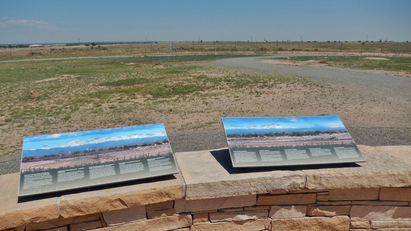
Habitat for Wildlife Marker (wide view; this marker on left; related marker on right)
| 1 ► Colorado, Adams County, Commerce City — Habitat for Wildlife - A Rich History — |
| Near Gateway Road, 0.7 miles north of Prairie Parkway (East 64th Avenue), on the left when traveling east. | |||
| 2 ► Colorado, Adams County, Commerce City — Headquarters Area — |
| On East 72nd Avenue near Kenton Street, on the left when traveling east. | |||
| 3 ► Colorado, Adams County, Commerce City — Headquarters for a New Mission — |
| On East 72nd Avenue, on the left when traveling east. | |||
| 4 ► Colorado, Adams County, Commerce City — On This Site Stood the "White House" — |
| On East 72nd Avenue, on the left when traveling east. | |||
| 5 ► Colorado, Adams County, Commerce City — Rocky Mountain Arsenal National Wildlife Refuge — |
| Near Havana Street (Wildlife Drive), 0.6 miles north of East 64th Avenue (Wildlife Drive), on the right when traveling north. | |||
| 6 ► Colorado, Adams County, Commerce City — The Fourteeners — |
| Near Gateway Road, 0.7 miles north of Prairie Parkway (East 64th Avenue), on the left when traveling east. | |||
| 7 ► Colorado, Adams County, Commerce City — Where's the Water? — |
| Near Gateway Road, 0.7 miles north of Prairie Parkway (East 64th Avenue), on the left when traveling east. | |||
| 8 ► Colorado, Alamosa County, Alamosa — "Old Mose" — The King of the Grizzlies — |
| On 1st Street at Edgemont Boulevard, on the left when traveling east on 1st Street. | |||
| 9 ► Colorado, Alamosa County, Alamosa — Alamosa — |
| 10 ► Colorado, Alamosa County, Alamosa — Alamosa County — |
| 11 ► Colorado, Alamosa County, Alamosa — All Aboard for Alamosa! — |
| On Denver Avenue/Broadway Avenue (U.S. 160) at 4th Street, on the left when traveling north on Denver Avenue/Broadway Avenue. | |||
| 12 ► Colorado, Alamosa County, Blanca — Lt. Zebulon Pike's Southwestern Expedition — 1806 - 7 — |
| On State Highway 150, 0.2 miles north of U.S. 160, on the right when traveling north. | |||
| 13 ► Colorado, Alamosa County, Great Sand Dunes National Park and Preserve — A Landmark for People — Great Sand Dunes National Park and Preserve — National Park Service, U.S. Department of the Interior — |
| Near Highway 150. | |||
| 14 ► Colorado, Alamosa County, Mosca — "Totally Unique and Unexpected" — Great Sand Dunes National Park and Preserve — National Park Service, U.S. Department of the Interior — |
| Near Highway 150 near Pinyon Circle. | |||
| 15 ► Colorado, Alamosa County, Mosca — L.B. "Bill" Casselman — Dedicated to — |
| On Lane 6N, 1.2 miles west of State Highway 150, on the left when traveling west. | |||
| 16 ► Colorado, Alamosa County, Mosca — Lt. Zebulon Pike's Southwestern Expedition — 1806-7 — |
| On Lane 6N east of State Highway 17, on the left when traveling east. | |||
| 17 ► Colorado, Alamosa County, Mosca — Sangre de Cristo Ecosystem — Great Sand Dunes National Park and Preserve — |
| Near Highway 150. | |||
| 18 ► Colorado, Alamosa County, Mosca — Stepping into Wilderness — Great Sand Dunes National Park and Preserve — National Park Service, U.S. Department of the Interior — |
| Near Highway 150. | |||
| 19 ► Colorado, Alamosa County, Mosca — The Mountain Barrier — |
| Near Highway 150. | |||
| 20 ► Colorado, Alamosa County, Mosca — Understanding the Great Sand Dunes System: the Sabkha — |
| On Lane 6N, 1.2 miles west of State Highway 150, on the left when traveling west. | |||
| 21 ► Colorado, Boulder County, Boulder — At the Foot of The Slabs — |
| On Bluebell Road, 0.1 miles south of Kinnikinic, on the right when traveling south. | |||
| 22 ► Colorado, Chaffee County, Nathrop — Peaks to Pastures — Collegiate Peaks Scenic and Historic Byway — |
| On U.S. 285, 2 miles south of Chalk Creek Drive, on the right when traveling south. | |||
| 23 ► Colorado, Chaffee County, Nathrop — Valley Ranching — |
| On U.S. 285, 2 miles south of Chalk Creek Drive, on the right when traveling south. | |||
| 24 ► Colorado, Chaffee County, Nathrop — Whose Water Is It? — |
| On U.S. 285, 2 miles south of Chalk Creek Drive, on the right when traveling south. | |||
| 25 ► Colorado, Custer County, Greenwood — Cliffhangers and Headbangers — |
| On Colorado 96, 0.4 miles west of County Road 387, on the right when traveling west. | |||
| 26 ► Colorado, Dolores County, Dove Creek — Dove Creek Country — |
| On U.S. 491 at Guyrene Street, on the right when traveling west on U.S. 491. | |||
| 27 ► Colorado, Dolores County, Dove Creek — Gunnison Sage Grouse — |
| On U.S. 491 at Guyrene Street, on the right when traveling west on U.S. 491. | |||
| 28 ► Colorado, El Paso County, Colorado Springs, Cascade — A Look From The Top — |
| On Pikes Peak Toll Road. | |||
| 29 ► Colorado, El Paso County, Colorado Springs, Cascade — Forests Without Fire — |
| On Pike's Peak Toll Road. | |||
| 30 ► Colorado, El Paso County, Colorado Springs, Cascade — Pick a Climate — |
| On Pike's Peak Toll Road. | |||
| 31 ► Colorado, El Paso County, Colorado Springs, Cascade — Take a Closer Look...Foothills Life Zone — |
| On Pike's Peak Toll Road. | |||
| 32 ► Colorado, El Paso County, Colorado Springs, Cascade — The Making of America's Mountain — |
| On Pike's Peak Toll Road. | |||
| 33 ► Colorado, El Paso County, United States Air Force Academy — 55th Reconnaissance Squadron — Long Range Weather — B-24s — |
| 34 ► Colorado, El Paso County, United States Air Force Academy — Abert's Squirrel — (Sciurus aberti) — |
| 35 ► Colorado, El Paso County, United States Air Force Academy — An Ancient Geologic Past — United States Air Force Academy — |
| 36 ► Colorado, El Paso County, United States Air Force Academy — Forest Management — United States Air Force Academy — |
| 37 ► Colorado, El Paso County, United States Air Force Academy — Fuel Hazard Mitigation — United States Air Force Academy — |
| 38 ► Colorado, El Paso County, United States Air Force Academy — Landscape Fire Ecology — United States Air Force Academy — |
| 39 ► Colorado, El Paso County, United States Air Force Academy — Scrub (Gambel's) Oak — (Quercus gambelii) — |
| 40 ► Colorado, Fremont County, Cañon City — The Banana Belt of Colorado — |
| On Main Street east of South 4th Street, on the right when traveling east. | |||
| 41 ► Colorado, Fremont County, Penrose — Arkansas River Valley |
| On U.S. 50, 0.2 miles east of Phantom Canyon Road, on the right when traveling west. Reported damaged. | |||
| 42 ► Colorado, Fremont County, Penrose — Arkansas Valley Country — |
| On U.S. 50, 0.2 miles east of Phantom Canyon Road (County Road 67), on the right when traveling west. | |||
| 43 ► Colorado, Grand County, Grand Lake — The East Troublesome Fire — |
| Near U.S. 34. | |||
| 44 ► Colorado, Gunnison County, Gunnison — Ho For The Gunnison! — |
| On Tomichi Avenue (U.S. 50) east of Teller Street, on the left when traveling east. | |||
| 45 ► Colorado, Gunnison County, Gunnison — If You Only Knew — |
| On U.S. 50, on the right when traveling west. | |||
| 46 ► Colorado, Gunnison County, Gunnison — King Coal — |
| 47 ► Colorado, Gunnison County, Gunnison — Two Great Trains — |
| On Tomichi Avenue (U.S. 50) east of Teller Street, on the left when traveling east. | |||
| 48 ► Colorado, Jefferson County, Golden — Castle Rock — |
| 49 ► Colorado, Jefferson County, Golden — Late Jurassic Time — |
| 50 ► Colorado, Jefferson County, Golden — Play in the Wind — |
| On Lariat Loop Road. | |||
| 51 ► Colorado, Jefferson County, Golden — Triceratops Trail — |
| On 6th Avenue (U.S. 6) 0.5 miles south of 19th Street, on the right when traveling north. | |||
| 52 ► Colorado, Jefferson County, Golden — Water Carves Canyons — |
| Near Lariat Loop Road. | |||
| 53 ► Colorado, Jefferson County, Golden, Lakota Hills — Bird Track — |
| 54 ► Colorado, Jefferson County, Golden, Lakota Hills — Palm Fronds — |
| 55 ► Colorado, Jefferson County, Golden, Lakota Hills — Triceratops Tracks — |
| 56 ► Colorado, La Plata County, Durango — Community of Heroes — |
| On Main Avenue (U.S. 550) at 26th Street, on the right when traveling north on Main Avenue. | |||
| 57 ► Colorado, La Plata County, Durango — Durango - Silverton Narrow Gauge Railroad — |
| On Main Avenue at 5th Street, on the right when traveling south on Main Avenue. | |||
| 58 ► Colorado, La Plata County, Durango — Seasons of Healing — |
| On Main Avenue (U.S. 550) at 26th Street, on the right when traveling north on Main Avenue. | |||
| 59 ► Colorado, La Plata County, Durango — Summer of Flames — |
| On Main Avenue (U.S. 550) at 26th Street, on the right when traveling north on Main Avenue. | |||
| 60 ► Colorado, Lake County, Climax — Climax — Where Colorado History is Still Being Made — |
| Near State Highway 91, 11 miles south of Interstate 70, on the right when traveling south. | |||
| 61 ► Colorado, Lake County, Climax — The Highest Compost Pile in the World — |
| Near State Highway 91, 11 miles south of Interstate 70, on the right when traveling south. | |||
| 62 ► Colorado, Larimer County, Bellvue — Bellvue Hydraulic Irrigation Laboratory — |
| On Rist Canyon Road, 1.5 miles west of US 287 B (U.S. 287 B), on the right when traveling west. | |||
| 63 ► Colorado, Larimer County, Estes Park — Rocky Mountain’s “Parks” — |
| On Fall River Road, on the left when traveling west. | |||
| 64 ► Colorado, Larimer County, Fort Collins — The Historic Fort Collins Weather Station — National Weather Service Cooperative Station 05-3005 — |
| Near North Drive, 0.1 miles east of Meridian Avenue. | |||
| 65 ► Colorado, Larimer County, Rocky Mountain National Park — Stephen Tyng Mather — July. 4. 1867. - Jan. 22. 1930. — |
| Near Moraine Avenue, 0.1 miles west of Mills Drive. | |||
| 66 ► Colorado, Mesa County, Colorado National Monument — Climbing Independence — |
| 67 ► Colorado, Mesa County, Colorado National Monument — John Otto — |
| 68 ► Colorado, Mesa County, Colorado National Monument — The Shape of Independence — |
| 69 ► Colorado, Mesa County, Colorado National Monument — Upper Serpents Trail — Serpents Trail to Devils Kitchen Trailhead — |
| On Rim Rock Drive, on the left when traveling west. | |||
| 70 ► Colorado, Mesa County, Fruita — Dinosaur Diamond — A Dual-State National Scenic Byway — |
| 71 ► Colorado, Mineral County, South Fork — Continental Divide Trail — |
| On U.S. 160, 0.2 miles west of County Road 402, on the left when traveling west. | |||
| 72 ► Colorado, Montezuma County, Cortez — Canyons of the Ancients National Monument — |
| On Mildred Road north of Main Street (U.S. 160), on the left when traveling north. | |||
| 73 ► Colorado, Montezuma County, Cortez — Four Corners Resettled — Community Connections — |
| On Mildred Road north of Main Street (U.S. 160), on the left when traveling north. | |||
| 74 ► Colorado, Montezuma County, Cortez — The Native Americans — 12,000 Years of History — |
| On Mildred Road north of Main Street (U.S. 160), on the left when traveling north. | |||
| 75 ► Colorado, Montezuma County, Cortez — Welcome to the San Juan Skyway — |
| On Mildred Road north of Main Street (U.S. 160), on the left when traveling north. | |||
| 76 ► Colorado, Montezuma County, Mancos — Cortez — |
| Near U.S. 160, on the right when traveling west. | |||
| 77 ► Colorado, Montezuma County, Mancos — Southwest Survival — |
| Near U.S. 160, on the right when traveling west. | |||
| 78 ► Colorado, Montezuma County, Mesa Verde National Park — A Monument to Time — |
| Near State Highway 10, 3 miles west of Moccasin Mesa Road, on the right when traveling west. | |||
| 79 ► Colorado, Montezuma County, Mesa Verde National Park — Natural Seep Springs — |
| Near State Highway 10, 3 miles west of Moccasin Mesa Road, on the right when traveling west. | |||
| 80 ► Colorado, Montrose County, Cimarron — All Aboard — |
| On Morrow Point Dam Road, 1 mile north of U.S. 50, on the left when traveling north. | |||
| 81 ► Colorado, Montrose County, Cimarron — Geography Sets the Stage — |
| Near Morrow Point Dam Road, 0.1 miles U.S. 50, on the right when traveling north. | |||
| 82 ► Colorado, Montrose County, Cimarron — Working on the Railroad — |
| On Morrow Point Dam Road, 0.1 miles north of U.S. 50, on the right when traveling north. | |||
| 83 ► Colorado, Montrose County, Montrose — The Ute Way of Life — Living in Harmony with Nature — |
| On Chipeta Road at U.S. 550, on the right when traveling north on Chipeta Road. | |||
| 84 ► Colorado, Morgan County, Fort Morgan — Watching River Wildlife — |
| On State Highway 52, 0.1 miles north of Interstate 76, on the right when traveling north. | |||
| 85 ► Colorado, Otero County, La Junta — A Ribbon Across the Plains — |
| Near State Highway 194 east of County Highway 35. | |||
| 86 ► Colorado, Ouray County, Ouray — Mine Reclamation Improves Water Quality — |
| On Million Dollar Highway (U.S. 550) 2 miles south of County Highway 30, on the right when traveling north. | |||
| 87 ► Colorado, Ouray County, Ouray — Reclaiming the Land — |
| On Million Dollar Highway (U.S. 550) 2 miles south of County Highway 31, on the left when traveling north. | |||
| 88 ► Colorado, Park County, Fairplay — Caring for a Great Place — South Park Heritage Resource Area — |
| Near 4th Street at Main Street (State Highway 9). | |||
| 89 ► Colorado, Park County, Lake George — Bayou Salado "Salt Marsh" — |
| Near U.S. 24. | |||
| 90 ► Colorado, Park County, Lake George — Enough Water for Everyone? — |
| Near U.S. 24. | |||
| 91 ► Colorado, Park County, Lake George — Fire Nature's Own Cleanser — |
| Near U.S. 24. | |||
| 92 ► Colorado, Park County, Lake George — Pikes Peak and National Forests — |
| Near U.S. 24. | |||
| 93 ► Colorado, Pitkin County, Aspen — Finding Gold — Surviving in Independence — |
| Near Colorado 82, 5.6 miles east of County Road 23. | |||
| 94 ► Colorado, Pitkin County, Aspen — Independence Pass Foundation — |
| On Colorado 82, on the left when traveling west. | |||
| 95 ► Colorado, Pitkin County, Aspen — The Continental Divide — |
| On Colorado 82, on the left when traveling west. | |||
| 96 ► Colorado, Pitkin County, Aspen — The Environment — |
| On Colorado 82, on the left when traveling west. | |||
| 97 ► Colorado, Rio Grande County, Del Norte — Fremont Campsite — |
| On Grand Avenue (U.S. 160) at Oak Street (State Highway 112), on the left when traveling east on Grand Avenue. | |||
| 98 ► Colorado, Rio Grande County, South Fork — Rio Grande — A River of Life — |
| 99 ► Colorado, Routt County, Hayden — Range Lands — |
| On U.S. 40 at milepost 100.5, on the right when traveling east. | |||
| 100 ► Colorado, San Juan County, Silverton — Mayflower Mill Tailing Ponds — |
| On County Highway 2, 0.4 miles west of County Highway 52, on the right when traveling east. | |||
124 entries matched your criteria. The first 100 are listed above. The final 24 ⊳