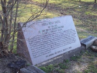
The Confederate Encampment here at Middle (or Muddy) Boggy Crossing on the Boggy Depot Road held by Lieut. Col. John Jumper's Seminole Battalion, Capt. Adam Nail's Company A of First Choctaw and Chickasaw Cavalry and a detachment of the Twentieth . . . — — Map (db m244746) HM
Armstrong Academy, established by Choctaw Nation and named for Wm. Armstrong, Indian Agt., was opened in 1845. Rev. R.D. Potts, Supt., under Baptist Miss. Soc. Post Office established Nov., 1850. Confederate Capitol during Civil War. Choctaw . . . — — Map (db m77938) HM
Site selected and named 1842, by Gen. Zachary Taylor, later Pres. of U.S. Fort established 1842 by 2nd Dragoons, occupied by several rifle, infantry, cavalry, and artillery companies. Built to protect the Chickasaw and Choctaw Indians from the . . . — — Map (db m81743) HM
"Kind and sympathetic by nature, generous to a fault, he was an honest man of noble impulses, and born and bred a gentleman." These were the words of a contemporary of General Douglas Hancock Cooper, C.S.A.
Cooper was appointed U.S. Agent to . . . — — Map (db m77935) HM
Earthworks 1.5 mi. S.E. constructed early in 1862 by Gen. Albert Pike, C.S.A. as major Confederate stronghold in southern Indian Territory. Named for Gen. Ben McCulloch, who fell at Pea Ridge. Fort had 18 pieces of artillery; 3,000 soldiers . . . — — Map (db m206451) HM
Beloved Southern Cherokee Chief
who served during Civil War as
brave Brigadier General. Last
Confederate leader to surrender.
Donors Frances Billingsley
Plains Indian Arts and Crafts — — Map (db m7719) HM
Established Oct. 1. 1859 by 1st Cavalry, U.S.A. under Major Wm. H. Emory. Post evacuated by Federal troops, May 1861, and occupied by Confederate garrison 1862. Hq. for Gen. W.B. Hazen, special Indian Agent, 1868. Gen. Phil H. Sheridan based here . . . — — Map (db m181533) HM
El Reno namesake born in Wheeling, West Virginia. Reno was a 1846 graduate of West Point Military and thrice decorated hero of 1846 war with Mexico. He was promoted to Brigadier General at the start of the Civil War. Reno is credited with saving the . . . — — Map (db m56899) HM
This site is at the north end of Main Street, called "Commercial Row," in this town begun in 1831. Name of nearby post office, "Fort Towson," was changed to Doaksville on Nov. 11, 1847. — — Map (db m52564) HM
Established May, 1824, under command of Col. Matthew Arbuckle to guard this region of Spanish border. Headquarters of Gen. S.B. Maxey, U.S. Army. Abandoned at end of Civil War. In the vicinity, Doaksville was important trading center and one time . . . — — Map (db m52576) HM
The Fort Towson Landing was south of here on the banks of the Red River. Also known as the Public Landing, from 1824 to 1854 it served as a receiving point for soldiers and supplies delivered by keelboats and steamboats. Traders from the Choctaw . . . — — Map (db m52578) HM
Here at Doaksville, June 23, 1865, Brigadier General Stand Watie, Cherokee Indian, was the last Confederate General to surrender. — — Map (db m151958) HM
To commemorate the history of Doaksville, the first historical marker was placed in 1960. A second commemorative marker was placed in 1965 to acknowledge the 100th anniversary of General Stand Watie's surrender. At the end of the Civil War on June . . . — — Map (db m238464) HM
To honor The Confederate Soldiers of the Battle of Cabin Creek Sept. 19, 1864 Erected by Okla. Division Daughters of the Confederacy June 1961
Reverse: Battle of Cabin Creek Sept. 19, 1864 Confederate Forces --
Brig. Gen. Stand Watie - . . . — — Map (db m52268) HM
Louis Rolston Jr., the cemetery's namesake, a Cherokee Indian, was born in Georgia September 10, 1838. He enlisted in the Federal Army in 1862 and served under Col. John D. Allen in Company K. of the 16th Regiment. He participated in the Battles of . . . — — Map (db m21239) HM
Established in autumn 1839 by Lt. Col. R.B. Mason and 1st Dragoons, U.S. Army, and named in honor of Gen. “Mad” Anthony Wayne. Abandoned on May 15, 1842. Here in July 1861 Col. Stand Watie established a Confederate army post and . . . — — Map (db m99747) HM
Stand Watie was only American Indian to attain rank of Brigadier General during Civil War and was last Confederate General to surrender. Born in Georgia, December 12, 1806. He spoke only the Cherokee language until he was twelve years of age. . . . — — Map (db m25557) HM
Site of Civil War naval battle. Confederate Indian forces led by Brig. Gen. Stand Watie, forced aground and captured Union Steamboat J.R. Williams with cargo worth $120,000, on June 15, 1864. Southern troops included Choctaws, Chickasaws, Creeks and . . . — — Map (db m64073) HM
This monument is dedicated to the thousands that lie forgotten in unmarked graves throughout present day Haskell County, Oklahoma, formally Sans Bois County, Choctaw Nation, Indian Territory. From the late 1840’s until the first days of the Civil . . . — — Map (db m165638) HM
On Sept. 1, 1863 Confederates under Brig. Gen. W.L. Cabell ambushed a Union force commanded by Maj. Gen. J.G. Blunt, but were driven off after a three hour battle. Later on July 24, 1864, the Choctaw Battalion led by Capt. Jack McCurtain defeated . . . — — Map (db m77951) HM
Established June 16, 1834, by 7th Inf., and named in honor of Gen. John Coffee of Tennessee. Abandoned by U.S. Army in November 1838. In 1842 site selected by Choctaw Council and established as Ft. Coffee Academy for Boys. During Civil War . . . — — Map (db m77873) HM
On Sept. 18, 1864, a Confederate force of 2,000, mainly Gen. Stand Watie's Indian Brigade, intercepted a Union supply train enroute from Kansas to Ft. Gibson. The convoy of 130 wagons with supplies worth $1.5 million was captured after a heavy . . . — — Map (db m68101) HM
Crossed here: Ft. Gibson (Est. 1824) to Ft. Leavenworth. Two Cabin Creek battles in Civil War fought at old ford 5 mi.; S.W. Ketchum is east 1.5 mi. The first store, 1860, and a stage stand were at Old Sulphur Springs campground near here, N.E. . . . — — Map (db m52553) HM
Federal troops suddenly attacked a Confederate camp along the ridge near here at dawn, July 2, 1862. The surprised Confederates hardly returned fire before their officers and heavy supplies were captured. Yet hot fighting in the woods lasted all day. — — Map (db m52269) HM
The First Kansas Colored Volunteer Infantry was the first Black unit to engage in battle in the Civil War. On July 2, 1863, while escorting a wagon train bound for Fort Gibson, the First Kansas Colored was attacked here by Stand Watie's . . . — — Map (db m52266) HM
On Sept. 18, 1864, a Confederate force of 2,000, mainly Gen. Stand Watie's Indian Brigade, intercepted a Union supply train enroute from Kansas to Ft. Gibson. The convoy of 130 wagons with supplies worth $1.5 millions was captured after a heavy . . . — — Map (db m141944) HM
Erected by the members
Mrs. Stonewall Jackson Chapter,
No. 550 U. D. C.
of Purcell Ind. Ter. Dec. 1906
To the memory of
those who
fought and
those who fell
in the
Confederate Army
1861—1865
But their memories ever . . . — — Map (db m144840) WM
Prior to the battle, Confederate
camps were located along either
side of Elk Creek and near the
Honey Springs Depot. Six
thousand men needed ample
room for themselves, their
equipment, tents, wagons, and horses.
With the battle and the . . . — — Map (db m243463) HM
Formerly a strong southerly bend in the Canadian River was located here. The course of the river was permanently changed after the construction of the Lake Eufaula Dam in 1964. It is thought that the bend is named for Cole Younger who served in the . . . — — Map (db m146401) HM
In 1861 the 1st Choctaw and Chickasaw Mounted Rifles was organized under
the command of Choctaw and Chickasaw Indian agent Douglas H. Cooper. After
his promotion to brigadier general, the regiment served under Choctaw Col.
Tandy Walker. The . . . — — Map (db m243458) HM
On July 17, 1863, at the Battle of Honey Springs, the 1st Kansas Colored Volunteers wrote a stirring page in American history, becoming one of the first Black units of the Civil War to play a key role in a Union victory as Major General James G. . . . — — Map (db m80514) HM
Those who died were quickly buried, often where they lie, as the
summer heat and the high humidity led to unbearable conditions.
In 1868 contractors were hired to open the graves and remove bodies
whose uniforms had US buttons. These were . . . — — Map (db m243460) HM
"Lord God of Hosts be with us yet, lest we forget, lest we forget" This commemorative marker is respectfully dedicated to honor the brave soldiers of the Confederate States of America who gallantly fought and died here on July 17, 1863. The Battle . . . — — Map (db m52289) HM
Order Of Battle (Indian Units)
Federal Forces:
First Indian Home Guard (Cherokee)
Second Indian Home Guard (Cherokee)
Confederate Forces:
First Choctaw Regiment
Second Choctaw Regiment
First Chickasaw and Choctaw Regiment . . . — — Map (db m52286) HM
The Texas Road was the main route traveled by settlers and traders from Missouri and
Kansas to Texas. The small community of Honey Springs, named for several natural springs in the area, developed near the road. There were a few buildings, among . . . — — Map (db m243450) HM
Many resources give us information on the Civil War, including battle reports,
diaries, letters, and on-the-spot reporting. Interviews with those who participated in or were affected by the war, as well as their memoirs, offer firsthand . . . — — Map (db m243454) HM
Following their overnight 20-mile
march from Fort Gibson and the day-long
battle, the Federal soldiers were exhausted.
The units camped on the battleground
on both sides of Elk Creek. The next day
part of the Federal Army marched back to
Fort . . . — — Map (db m243462) HM
Brig. Gen. Cooper held Scanland's and Gillette's cavalry squadrons in reserve to
guard the supply depot. As the battle progressed, he ordered the squadrons to join the
Creek regiments protecting his left flank. When the Confederate troops started . . . — — Map (db m243451) HM
The last organized Confederate resistance occurred here. As Federal troops pushed south along the Texas Road toward the Honey Springs Depot, they encountered the 1st Choctaw and Chickasaw Regiment. Armed largely with shotguns and antiquated weapons, . . . — — Map (db m243457) HM
The medical and surgical materials available in the field were
generally limited to what the surgeon carried in his case,
known as the surgeon's field companion. The regimental hospital steward
carried a hospital knapsack--a bulky, cumbersome . . . — — Map (db m243459) HM
"We here highly resolve that these dead shall not have fallen in vain" This commemorative marker is dedicated to the memory of the Union soldiers who bravely fought and died here on July 17, 1863. Major General James G. Blunt began moving 3,000 . . . — — Map (db m52288) HM
William Frederick McIntosh was the second son of Chilly McIntosh and
Leah Porter. He served under his uncle, Daniel Newnan McIntosh, as
Captain of the First Regiment of Creek Mounted Volunteers for the
Confederacy in the Civil War. He owned the . . . — — Map (db m243502) HM
Site of Manard Settlement on Bayou Menard. Named for Pierre Menard (1766-1844. Menard, an early day fur trader, merchant and member of the Chouteau family. Served as the first territorial governor of Illinois.
Springs at Manard identified as a . . . — — Map (db m52605) HM
Established Nov. 1861 by Gen. Albert Pike, C.S. Army. Named for Pres. Jefferson Davis, who had been stationed in the area when a Lieut. U.S. Army. Nearly one million dollares spent on this post by Confederates. In Second Federal Invasion Ft. Davis . . . — — Map (db m52277) HM
The infantry bore the brunt of the heaviest fighting. The
concentrated fire of disciplined, well-armed, and drilled
infantrymen proved devastating to the ill-equipped American
Indian and Texas Confederates. An infantry regiment
consisted of . . . — — Map (db m243492) HM
In 1861 there were two Confederate Cherokee regiments: the 1st Cherokee Mounted Rifles under the command of Col. John Drew and the 2nd Cherokee Mounted Rifles commanded by Col. Stand Watie. Confederate authorities promised both regiments they would . . . — — Map (db m243655) HM
The 1st Regiment of Creek Mounted Volunteers was organized in August 1861 under the command of Col. Daniel N. McIntosh. The regiment saw action at Cane Hill, Prairie Grove, and Van Buren in Arkansas, and Round Mountain, Chusto-Talasah, Chustenahlah, . . . — — Map (db m243649) HM
The Creek Indians loyal to the Union
were driven out of the Indian Territory
into Kansas in December 1861. They
suffered through the next winter with
little food and shelter. Following the
Battle of Pea Ridge, Arkansas, they were
anxious to . . . — — Map (db m243522) HM
The 1st Kansas was one of the first
African American units organized
in the Federal Army. Members were
recruited in August 1862 under the
authority of Kansas Senator James
Lane, but without permission of President
Lincoln. These soldiers were . . . — — Map (db m243516) HM
29th Texas Cavalry
This regiment was organized
in July 1862 by Clarksville, Texas,
newspaper publisher Charles
DeMorse, who served as its colonel.
In March 1863 Col. DeMorse
received orders to move his regiment
to Indian Territory . . . — — Map (db m243611) HM
These Federal soldiers, recruited in
the summer of 1862 from the Colorado
gold mining districts, were stationed
at Fort Lyons, Colorado; Forts Larned,
Scott, and Leavenworth, Kansas; and
Kansas City, Missouri, before marching
to Indian . . . — — Map (db m243521) HM
Organized along with the 1st Indian Home
Guard in May 1862, the 2nd Indian Home Guard
consisted of one company each of Delaware,
Kickapoo, Quapaw, Seneca, and Shawnee, two
companies of Osage, and two of Cherokee. It
took longer to organize, due . . . — — Map (db m243513) HM
The 3rd Indian Home Guard, composed of ten companies
of Federal Cherokee commanded by Col. William A. Phillips,
was organized at Fort Scott, Kansas, in the summer of 1862.
They saw action in several northwest Arkansas engagements. In
Indian . . . — — Map (db m243518) HM
The 3rd Wisconsin Cavalry was organized in January 1862.
The regiment marched to Fort Leavenworth, Kansas, and the three
battalions were stationed throughout the state. The battalion that
fought at Honey Springs was commanded by Capt. Edward . . . — — Map (db m243512) HM
The 9th Texas Cavalry Battalion and the 10th Texas
Cavalry Battalion consolidated to create the 5th Texas
on February 16, 1863, under the command of Col.
Leonidas M. Martin. Most of the companies had been at
Fort Washita in the Chickasaw Nation . . . — — Map (db m243604) HM
In July 1861 self-appointed Brig. Gen. James Lane
resigned from the US Senate and recruited a regiment to
guard the Kansas border towns against raids from Missouri
guerillas. The regiment was mixed cavalry and infantry but
called a cavalry . . . — — Map (db m243525) HM
The 6th Kansas Cavalry and 1st Indian Home Guard turned the
Confederate's right flank. Federal artillery and infantry fire devastated
the center units on the Texas Road. Confederate forces began a
withdrawal toward the bridge. Some soldiers . . . — — Map (db m244788) HM
In the confusion of battle, the 2nd Indian Home Guard on
the right crossed into the line of fire of the 1st Kansas. Lt. Col.
Bowles ordered the 1st Kansas to cease firing so they would
not kill fellow soldiers. Lt. Col. F. W. Schuarte of the . . . — — Map (db m243499) HM
An artillery barrage that lasted more than an hour dismounted
one of the four Confederate cannons and killed most of the gun crew.
After this initial bombardment, the Federal soldiers advanced upon
the Confederate positions. As the Confederate . . . — — Map (db m243637) HM
After the Confederates gave
way and the main line collapsed,
the fighting became frantic as they
made several stands at the bridge
and along the creek to halt or slow
the Federal advance. The remaining
three Confederate cannons retired
across . . . — — Map (db m243562) HM
Soldiers recruited at Quindaro, Kansas, in late
1861 were assigned to the 9th Kansas Cavalry and
stationed in Kansas. They joined Blunt's brigade
and fought in Missouri and Arkansas. Company B
was detached from the regiment and designated . . . — — Map (db m243527) HM
Newspapermen, sketch artists, and even photographers reported on the Civil War. Frank Leslie's Illustrated Newspaper was represented at the Battle of Honey Springs by James R. O'Neill, whose sketch and report on the battle appeared in that . . . — — Map (db m243557) HM
Many resources provide information including battle reports, diaries,
letters, and newspapers. Interviews with those who participated in or were
affected by the war, as well as their published memoirs, also provide firsthand
information. During . . . — — Map (db m243543) HM
The War of the Rebellion: A Compilation of the Official Records of the Union and
Confederate Armies is a series of books edited by former Union and Confederate officers. It consists of 128 thick volumes, published by the US Government . . . — — Map (db m243563) HM
In July 1863, Confederate troops commanded
by Brig. Gen. Douglas H. Cooper waited at
Honey Springs supply depot for Brig. Gen.
William L. Cabells 3,000 reinforcements from
Fort Smith, Arkansas. The combined forces
planned to capture the Federal . . . — — Map (db m244789) HM
Smith's Kansas Battery was organized in August 1862
as light artillery. The battery was equipped with two
12-pounder field howitzers and four 6-pounder guns,
all captured from Confederate units. First stationed at
Fort Scott, Kansas, the battery . . . — — Map (db m243514) HM
In January 1863, the 1st, 2nd, and 3rd Indian Home
Guard, consisting of Cherokee, Creek, Seminole,
Kickapoo, Quapaw, Seneca, Shawnee, Osage, and
Delaware soldiers, were organized into the Federal
Indian Brigade commanded by Col. William . . . — — Map (db m243509) HM
A field artillery unit was called a battery and consisted
of two or more sections, each section having two guns.
Seven or eight cannoneers were necessary to serve
a gun. It took 25 to 30 men to keep a single gun in
operating condition. At Honey . . . — — Map (db m243497) HM
After a brief rest, the Federal Army moved south toward the Confederate
forces concealed in the timber north of Elk Creek. They formed a battle line
about one mile wide centered on the Texas Road. Artillery opened the battle;
12 Federal guns . . . — — Map (db m244790) HM
Cavalry troops served as the army's "eyes," scouting
enemy troop movements. They formed the army's
advance guard, making first contact. When serving
with infantry and artillery, they dismounted and fought
as skirmishers on foot. The 20th Texas . . . — — Map (db m243493) HM
Brig. Gen. Cooper alerted his troops to the coming battle and
positioned his men to the left and right of the Texas Road with his
seasoned veterans in the center. Three cavalry regiments presented a front
about one-quarter mile in width. This . . . — — Map (db m243597) HM
Brig. Gen. Douglas H. Cooper alerted his troops to the coming battle
and positioned his men to the left and right of the Texas Road, with his
seasoned veterans in the center to oppose the Federal troops. On his right
were the men of the two . . . — — Map (db m243641) HM
Col. William Phillips, Federal Indian Brigade
commander, led the left wing of the attack east of the
Texas Road. His main force consisting of a battalion
of the 2nd Colorado Infantry and the 1st Indian Home
Guard engaged Confederate Texas and . . . — — Map (db m243500) HM
Col. William R. Judson, 6th Kansas
Cavalry, commanded the attacking
brigade on the right, west of the Texas
Road. His command consisted of the
1st Kansas Colored Volunteer Infantry
Regiment and 2nd Indian Home Guard
supporting Smith's Kansas . . . — — Map (db m243491) HM
Federal troops crossed the rain-swollen Arkansas
River on flatboats on the night of July 16, 1863. The
cavalry led the way as the column marched south on
the Texas Road toward Honey Springs. At daybreak on
July 17, advance units engaged rebel . . . — — Map (db m243510) HM
The timber and brush concealed the main Confederate force aligned on
either side of the Texas Road. The 20th and 29th Texas Cavalry, the 5th Texas
Partisan Rangers, and four guns of Capt. Roswell W. Lee's battery waited
to repel the advance of . . . — — Map (db m244793) HM
Settled in 1829, named for Walter Webber, Western Cherokee Chief, who had a trading post here. Home of "Rich Joe" Vann to 1844, owner of "Lucy Walker," quarter mile race horse, for which he named his Mississippi River steamboat. In Civil War battle, . . . — — Map (db m52567) HM
Dedicated to the young men of the Otoe Missouri Indians who served in the Civil War, World War I, World War II, Korean Campaign — — Map (db m201093) WM
Beginning in 1858, the Butterfield Overland Stage connected St. Louis, Missouri to Los Angeles, California. The route entered Indian Territory at Fort Smith, and coaches carried passengers and mail across 192 miles following the Texas Road and . . . — — Map (db m172956) HM
In 1861 the Civil War began between the North (Union) and the South (Confederacy). The South was determined to create a new country called the Confederate States of America. One of the generals in their army was Brigadier General Stand Watie, from . . . — — Map (db m172611) HM
Fifty miles west of Fort Towson in present-day Bryan County was the site of Chahte Tamaha, or "Choctaw Town." In 1844 the Armstrong Academy was founded there as a school for boys. The academy played an important role in the community, and by 1863 . . . — — Map (db m172949) HM
The Choctaw Nation flag was carried by the Choctaw troops of the second Indian Cavalry Brigade who fought for the Confederacy during the Civil War. They were the first US tribe to adopt a flag, and this particular style of flag was only flown during . . . — — Map (db m172577) HM
The first national flag of the Confederacy, also known as the Stars and Bars, flew over the forts of Oklahoma when Confederate Indian Forces and Texas troops occupied the forts at the beginning of the Civil War. Indian Territory was seen as a . . . — — Map (db m172578) HM
Established in 1824, Fort Towson is Oklahoma's second oldest fort. The original installation, located on the Red River near the mouth of the Kiamanchi River, was abandoned in 1829 and reactivated in 1830 on Gates Creek, just northeast of the . . . — — Map (db m172801) HM
An important Civil War innovation, the 3-inch ordnance rifle was produced from a complex build-up of wrought iron, roll welded and bored to create, at 816 pounds, a relatively light artillery piece, deadly accelerate to 1,850 yards or one mile and . . . — — Map (db m172635) HM
Named for Cherokee trader, scout, and guide Jesse Chisholm, the Chisholm Trail was the first post-Civil War cattle trails. Although named for Jesse Chisholm the trail was in fact started by Sucktumaquay, or Black Beaver, of the Delaware tribe. At . . . — — Map (db m174616) HM
This Union Soldier Cemetery is the final resting place of 63 army veterans, three veterans' wives and one veteran's daughter. Soldiers buried here served in army units from Kansas, Missouri, Illinois, Indiana, Pennsylvania, Wisconsin, Michigan, & . . . — — Map (db m172439) HM
This noted Creek leader, b. 1819, Ala., had attended old Asbury Mission before he came to Ind. Ty. He was a Methodist preacher for 32 years until his death, 1884. He served as Lieut. Col. of First Regt. Creek Mounted Vols., C.S.A., during the Civil . . . — — Map (db m76604) HM
This site, 3.5 miles N.W. is where Col. Jas. McIntosh, 2nd Ark. Mtd. Rifles, routed Loyal Union Indian forces, Dec. 26, 1861. The battle started with fire from the Indian line on Patriot's Hill, 2 Mi. S.W. The Loyal Indians finally fled into Kansas. — — Map (db m216344) HM
Here between the landmark known as Round Mountains to the south and a camp on Salt Creek three miles to the northwest was fought the first battle of the Civil War in Oklahoma.
When the five civilized tribes of the Indian Territory joined the . . . — — Map (db m209523) HM
Home of Gov. John F. Brown, for 34 yrs. Principal Chief, Seminole Nation, succeeding his father-in-law, Chief John Jumper, Col. 1st Regt. Seminole Mtd. Vols., Confederate Army in Civil War. Young Brown was Lieut., 1st Regt. Creek Mtd. Vols., C.S.A. . . . — — Map (db m181696) HM
This first battle of the Civil War in Indian Territory began 6 miles south, Nov. 19, 1861, when Col. D.H. Cooper's Confederate vanguard was repulsed by Little Captain's warriors from Opothleyahola's Indian allies moving to north of the Ark. River to . . . — — Map (db m52261) HM
This battle site is 9 miles NE., SE at the Caving Banks Bend on Bird Creek. Here Dec. 9, 1861 Opothleyahola's Union Indians forced the retreat of Col. D.H. Cooper's Confederate troops. Marker sponsored by the Tulsa Historical Society. — — Map (db m39564) HM
104 entries matched your criteria. The first 100 are listed above. The final 4 ⊳