4206 entries match your criteria. Entries 101 through 200 are listed.⊲ Previous 100 — Next 100 ⊳
Anthropology & Archaeology Topic
By Cosmos Mariner, May 24, 2016
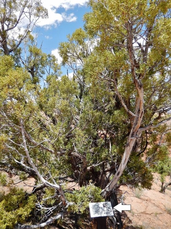
Utah Juniper Marker • tall view
(Utah Juniper in background)
(Utah Juniper in background)
101 ► Arizona, Navajo County, Shonto — Utah Juniper — Juniperus osteosperma —  |
| Near Arizona Route 564 at County Route 221. | |||
| 102 ► Arizona, Navajo County, Shonto — Voices in the Canyon — Navajo National Monument — |
| Near Arizona Route 564 at County Route 221. | |||
| 103 ► Arizona, Navajo County, Winslow — Central Plaza — Homol'ovi II Archaeological Site — |
| Near Homolovi State Park Entrance Road 5.4 miles north of Route 87. | |||
| 104 ► Arizona, Navajo County, Winslow — East Plaza — Homol'ovi II Archaeological Site — |
| Near Homolovi State Park Entrance Road 5.4 miles north of Route 87. | |||
| 105 ► Arizona, Navajo County, Winslow — Homol'ovi II — Homol'ovi II Archaeological Site — |
| Near Homolovi State Park Entrance Road 5.4 miles north of Route 87. | |||
| 106 ► Arizona, Navajo County, Winslow — Illegal Digging — Homol'ovi II Archaeological Site — |
| Near Homolovi State Park Entrance Road 5.4 miles north of Route 87. | |||
| 107 ► Arizona, Navajo County, Winslow — Kiva - Underground House — Homol'ovi II Archaeological Site — |
| Near Homolovi State Park Entrance Road 5.4 miles north of Route 87. | |||
| 108 ► Arizona, Navajo County, Winslow — Let It Burn — We built these rooms just to burn them down — Homol'ovi's Experimental Archaeology — |
| Near Homolovi State Park Entrance Road 2.1 miles west of Route 87. | |||
| 109 ► Arizona, Navajo County, Winslow — Nuvatukya'ovi — Homol'ovi II Archaeological Site — |
| Near Homolovi State Park Entrance Road 5.4 miles north of Route 87. | |||
| 110 ► Arizona, Navajo County, Winslow — Paayu — Homol'ovi II Archaeological Site — |
| Near Homolovi State Park Entrance Road 5.4 miles north of Route 87. | |||
| 111 ► Arizona, Navajo County, Winslow — Typical Room — Homol'ovi II Archaeological Site — |
| Near Homolovi State Park Entrance Road 5.4 miles north of Route 87. | |||
| 112 ► Arizona, Navajo County, Winslow — Vandalized Kiva — Homol'ovi II Archaeological Site — |
| Near Homolovi State Park Entrance Road 5.5 miles north of Route 87. | |||
| 113 ► Arizona, Pima County, Tucson — Prehistoric People — Saguaro National Park — National Park Service, U.S. Department of the Interior — |
| On Signal Hill Road at Golden Gate Road on Signal Hill Road. | |||
| 114 ► Arizona, Pinal County, Coolidge — 10 — Disrespected, Then Protected — Casa Grande Ruins National Monument — |
| On West Ruins Drive. | |||
| 115 ► Arizona, Pinal County, Coolidge — Why Build the Casa Grande? — Casa Grande Ruins National Monument — |
| On West Ruins Drive. | |||
| 116 ► Arizona, Yavapai County, Camp Verde — A Piece of Modern Monument History — |
| On Montezuma Castle Road 1 mile east of Beaver Creek Estates Road. | |||
| 117 ► Arizona, Yavapai County, Camp Verde — Alcoves and Cavates — |
| On Montezuma Castle Road 1 mile east of Beaver Creek Estates Road. | |||
| 118 ► Arizona, Yavapai County, Camp Verde — Aloft but not Alone — |
| On Montezuma Castle Road 1 mile east of Beaver Creek Estates Road. | |||
| 119 ► Arizona, Yavapai County, Camp Verde — Creating a Home — |
| On Montezuma Castle Road 1 mile east of Beaver Creek Estates Road. | |||
| 120 ► Arizona, Yavapai County, Camp Verde — Creekside Community — |
| On Montezuma Castle Road 1 mile east of Beaver Creek Estates Road. | |||
| 121 ► Arizona, Yavapai County, Camp Verde — Cycles of Care — |
| On Montezuma Castle Road 1 mile east of Beaver Creek Estates Road. | |||
| 122 ► Arizona, Yavapai County, Camp Verde — Growing a Livelihood — |
| On Montezuma Castle Road 1 mile east of Beaver Creek Estates Road. | |||
| 123 ► Arizona, Yavapai County, Camp Verde — On the Move — |
| On Montezuma Castle Road 1 mile east of Beaver Creek Estates Road. | |||
| 124 ► Arizona, Yavapai County, Camp Verde — People Next Door — |
| On Montezuma Castle Road 1 mile east of Beaver Creek Estates Road. | |||
| 125 ► Arizona, Yavapai County, Camp Verde — Timeless Beauty — |
| On Montezuma Castle Road 1 mile east of Beaver Creek Estates Road. | |||
| 126 ► Arizona, Yavapai County, Clarkdale — An Evolving Village — |
| On Tuzigoot Road east of Sycamore Canyon Road. | |||
| 127 ► Arizona, Yavapai County, Clarkdale — Caring for Traces of the Past — |
| On Tuzigoot Road east of Sycamore Canyon Road. | |||
| 128 ► Arizona, Yavapai County, Clarkdale — Clues From Life and Death — |
| On Tuzigoot Road east of Sycamore Canyon Road. | |||
| 129 ► Arizona, Yavapai County, Clarkdale — Clues in Architecture — |
| On Tuzigoot Road east of Sycamore Canyon Road. | |||
| 130 ► Arizona, Yavapai County, Clarkdale — From Rubble to Reconstruction — Tuzigoot National Monument — National Park Service, U.S. Department of the Interior — |
| On Tuzigoot Road east of Sycamore Canyon Road. | |||
| 131 ► Arizona, Yavapai County, Clarkdale — Moving On — |
| On Tuzigoot Road east of Sycamore Canyon Road. | |||
| 132 ► Arizona, Yavapai County, Clarkdale — People of the Verde — |
| On Tuzigoot Road east of Sycamore Canyon Road. | |||
| 133 ► Arizona, Yavapai County, Clarkdale — Rich in Minerals — |
| On Tuzigoot Road east of Sycamore Canyon Road. | |||
| 134 ► Arizona, Yavapai County, Clarkdale — Rocks, Rituals, and Resources — |
| On Tuzigoot Road east of Sycamore Canyon Road. | |||
| 135 ► Arizona, Yavapai County, Clarkdale — The Pueblo's Plaza — |
| On Tuzigoot Road east of Sycamore Canyon Road. | |||
| 136 ► Arizona, Yavapai County, Montezuma Castle National Monument — Lifeline / Prehistoric Produce — |
| Near Montezuma Castle Road. | |||
| 137 ► Arizona, Yavapai County, Montezuma Castle National Monument — Macaw Pen Stone? |
| Near Montezuma Castle Road. Reported missing. | |||
| 138 ► Arizona, Yavapai County, Montezuma Castle National Monument — The Community |
| Near Montezuma Castle Road. Reported permanently removed. | |||
| 139 ► Arizona, Yavapai County, Montezuma Castle National Monument — The Neighborhood / Mysterious Departures |
| Near Montezuma Castle Road. Reported permanently removed. | |||
| 140 ► Arizona, Yavapai County, Montezuma Castle National Monument — The People Next Door |
| Near Montezuma Castle Road. Reported permanently removed. | |||
| 141 ► Arizona, Yavapai County, Montezuma Castle National Monument — The Way Up / Construction Sequence |
| Near Montezuma Castle Road. Reported permanently removed. | |||
| 142 ► Arizona, Yavapai County, Montezuma Castle National Monument — Welcome to The Castle |
| Near Montezuma Castle Road. Reported permanently removed. | |||
| 143 ► Arkansas, Conway County, Winrock — Rock House Cave: Rock Art — A glimpse of Arkansas's Prehistoric Heritage — |
| Near Red Bluff Drive. | |||
| 144 ► Arkansas, Crittenden County, West Memphis — Indian Mounds — |
| On Dacus Road 0.1 miles east of County Route 27, on the right when traveling east. | |||
| 145 ► Arkansas, Cross County, Parkin — Northeast Arkansas Discovery Tour — |
| On State Highway 184 at U.S. 64 on State Highway 184. | |||
| 146 ► Arkansas, Cross County, Parkin — Protecting Casqui's Capital — |
| On State Highway 184 0.2 miles north of U.S.64, on the left when traveling north. | |||
| 147 ► Arkansas, Cross County, Parkin — The Sawdust Hill Community — |
| On State Highway 184 0.2 miles U.S. 64, on the left when traveling north. | |||
| 148 ► Arkansas, Cross County, Parkin — Welcome to the Village Trail — |
| On Ark. State Hwy 184 0.1 miles Us Hwy 64, on the left. | |||
| 149 ► Arkansas, Lonoke County, Scott — Home to Some; Capitol City to All — Toltec Mounds Archeological State Park — |
| On Toltec Mounds Rd 1 mile south of Ar. Rd 165 (State Road 165), on the right. | |||
| 150 ► Arkansas, Lonoke County, Scott — Plants Tell a Human Story — |
| On Toltec Mounds Road 1 mile Ar. Rd 165 (State Road 165), on the right when traveling south. | |||
| 151 ► Arkansas, Montgomery County, Norman — Archeological Analysis of Norman Caddo Indian Burial Ground — Site Map of Norman Indian Burial Ground — prepared by Mary Beth Trubitt Arkansas Archeological Survey Henderson Research Station — |
| On East Main Street south of Polk Creek Road, on the left when traveling north. | |||
| 152 ► Arkansas, Pulaski County, Scott — Not For Human Consumption — |
| On Toltec Mounds Road, on the right when traveling south. | |||
| 153 ► Arkansas, Randolph County, Black Rock — Archeology Uncovers the Past — Davidsonville Historic State Park — |
| Near Arkansas Route 166 0.6 miles south of Route 361 when traveling south. | |||
| 154 ► Arkansas, Randolph County, Black Rock — Davidsonville Town Site — 1815 - 1830 — Davidsonville Historic State Park — |
| Near Arkansas Route 166 south of Route 361 when traveling south. | |||
| 155 ► Arkansas, Randolph County, Pocahontas — Native American Culture — |
| On U.S. 62/67 north of South Bettis Street, on the right when traveling north. | |||
| 156 ► Arkansas, Sebastian County, Fort Smith — Who Served Here? — Fort Smith National Historic Site — National Park Service, U.S. Department of the Interior — |
| Near Parker Avenue at South 3rd Street. | |||
| 157 ► California, Alameda County, Fremont, Cameron Hills — Gathering and Cooking Acorns — |
| Near Via Orinda near Castillejo Way. | |||
| 158 ► California, Alameda County, Fremont, Cameron Hills — In Search of Fossils — |
| Near Via Orinda near Castillejo Way. | |||
| 159 ► California, Alameda County, Fremont, Cameron Hills — Land Mammals of the Irvingtonian Age — |
| Near Via Orinda near Castillejo Way. | |||
| 160 ► California, Alameda County, Fremont, Cameron Hills — Sabercat Historical Park — City of Fremont — Via Orinda Entrance — |
| On Via Orinda at Castillejo Way, on the right when traveling east on Via Orinda. | |||
| 161 ► California, Alameda County, Fremont, Niles — California Nursery Historical Park — |
| Near Nursery Avenue near Niles Avenue. | |||
| 162 ► California, Alameda County, Fremont, Vineyards - Avalon — The Ohlones and the Mission San Jose — Rancho Higuera Historical Park — |
| On Rancho Higuera Road south of Curtner Road, on the left when traveling south. | |||
| 163 ► California, Alameda County, Livermore — A Natural Supermarket and Hardware Store — Sycamore Grove Park — |
| Near Wetmore Road. | |||
| 164 ► California, Alameda County, Livermore — Brushy Peak Regional Preserve — |
| On West Side Loop Trail west of Laughlin Road, on the right when traveling west. | |||
| 165 ► California, Alameda County, Livermore — Brushy Peak Regional Preserve — |
| Near Laughlin Ranch Loop south of Laughlin Road, on the right when traveling south. | |||
| 166 ► California, Amador County, Volcano — 1001 — Chaw Sé Roundhouse — |
| Near Pine Grove Volcano Road. | |||
| 167 ► California, Butte County, Oroville — Native Food Preparation — |
| Near Bryant Ravine Road (Forest Road 21N35Y) 1.6 miles north of Lumpkin Road when traveling north. | |||
| 168 ► California, Contra Costa County, Danville — Indian Grinding Holes — A Gathering Place for Food Preparation — |
| Near Grotto Road north of Upper Rock City Road, on the right when traveling north. | |||
| 169 ► California, Contra Costa County, Danville — Tatcan Bay Miwok Indians — |
| Near Front Street south of Diablo Road. | |||
| 170 ► California, Contra Costa County, Danville — Turritella Snail Bed — Fossil Snails Tell Their Story in These Rocks — |
| Near Wall Point Road, on the left when traveling south. | |||
| 171 ► California, Contra Costa County, San Ramon — First People of the East Bay — |
| Near San Ramon Valley Boulevard south of Pine Valley Road, on the right when traveling south. | |||
| 172 ► California, El Dorado County, Coloma — Sutter Mill Timbers — |
| Near State Highway 49 north of Mt Murphy Road. | |||
| 173 ► California, El Dorado County, Coloma — Uncovering History — |
| Near Coloma Road (California Route 49) north of Mt Murphy Road. | |||
| 174 ► California, El Dorado County, Pollock Pines — The Miwok and Maidu Peoples — |
| On Pony Express Trail, on the left when traveling west. | |||
| 175 ► California, El Dorado County, South Lake Tahoe — Da ow a ga – Lake Tahoe — |
| Near Emerald Bay Road (State Highway 89), on the right when traveling west. | |||
| 176 ► California, El Dorado County, South Lake Tahoe — Washoe Woman — |
| On Wildwood Avenue, on the right when traveling west. | |||
| 177 ► California, Humboldt County, Orick — Madison Grant Forest and Elk Refuge — Dedicated to the Memory of Madison Grant — 1865-1937 — |
| On Newton B. Drury Scenic Parkway, on the left when traveling north. | |||
| 178 ► California, Imperial County, Ocotillo — Geoglyphs — Imperial Valley Desert Museum — Español: Geoglifos — Kumeyaay: Matt Uumall — |
| On Frontage Road 0.3 miles west of Imperial Highway, on the left when traveling west. | |||
| 179 ► California, Imperial County, Ocotillo — Imperial Valley Desert Museum — Jay C. von Werlhof — |
| Near Frontage Road 0.3 miles west of Imperial Highway. | |||
| 180 ► California, Imperial County, Seeley — Rock Art — California and Baja California Rock Art — |
| Near Kumeyaay Highway (Interstate 8) 3 miles west of Forester Road (County Road S30), on the right when traveling east. | |||
| 181 ► California, Inyo County, Ridgecrest — Coso Rock Art District — Big and Little Petroglyph Canyons — National Historic Landmark — |
| Near China Lake Boulevard. | |||
| 182 ► California, Kern County, Tehachapi — 1054 — Tomo-Kahni — |
| Near Basalt Road 1 mile south of Tranquility Road. | |||
| 183 ► California, Lassen County, Westwood — Paul Bunyan — The Legend Lives On — |
| On 3rd Street (County Highway A21) east of Birch Street, on the right when traveling east. | |||
| 184 ► California, Los Angeles County, Agua Dulce — How Do We Know What We Know? — Tataviam Ancestors — Vasquez Rocks — |
| Near Escondido Canyon Road 0.5 miles east of Agua Dulce Canyon Road, on the right when traveling east. | |||
| 185 ► California, Los Angeles County, Long Beach, Waterfront — Easter Island Moai — |
| On Aquarium Way just south of Shoreline Drive. | |||
| 186 ► California, Los Angeles County, Los Angeles, Brentwood — Hammat Tiberias — Skirball Museum — |
| Near Sepulveda Boulevard at Skirball Center Drive, on the left when traveling north. | |||
| 187 ► California, Los Angeles County, Los Angeles, Chinatown — 5 — Zanja Madre — “Mother Ditch and the History Slugs” — Los Angeles State Historic Park — |
| On Spring Street at Sotello Street, on the left when traveling north on Spring Street. | |||
| 188 ► California, Los Angeles County, Los Angeles, Hollywood — 112 — A Gabrielino Indian Site — Fern Dell Canyon — |
| On Fern Dell Drive at Black Oak Drive, on the left when traveling north on Fern Dell Drive. | |||
| 189 ► California, Los Angeles County, Los Angeles, Little Tokyo — El Aliso — Kizh-Gabrieleño Sacred Sycamore Tree — Sha’var — |
| On Commercial Street at Vignes Street, on the left when traveling east on Commercial Street. | |||
| 190 ► California, Los Angeles County, Los Angeles, Miracle Mile — La Brea Tar Pits — Lake Pit — |
| On Wilshire Boulevard at Curson Avenue, on the right when traveling west on Wilshire Boulevard. | |||
| 191 ► California, Los Angeles County, Los Angeles, Mount Washington — 283 — Southwest Museum — |
| Near Museum Drive at Marmion Way. | |||
| 192 ► California, Los Angeles County, Los Angeles, South Los Angeles — 36 — Egyptian Obelisk — |
| On 103rd Street at Graham Avenue, on the right when traveling east on 103rd Street. | |||
| 193 ► California, Los Angeles County, Los Angeles, South Los Angeles — Maya Obelisk — |
| On Santa Ana Boulevard North at Wilmington Avenue, on the right when traveling east on Santa Ana Boulevard North. | |||
| 194 ► California, Madera County, Oakhurst — Acorn Granary — Suunanu (Mono) — |
| On School Road at Indian Springs Road, on the right when traveling west on School Road. | |||
| 195 ► California, Marin County, Novato — Cook House — |
| Near Redwood Highway. | |||
| 196 ► California, Marin County, San Anselmo — Indiana Jones — |
| On San Anselmo Avenue. | |||
| 197 ► California, Marin County, Tiburon — First Occupants of the Cove — |
| Near North Ridge Trail. | |||
| 198 ► California, Mendocino County, Cleone — Harvesting the Shore — |
| Near Mill Creek Drive near Route 1. | |||
| 199 ► California, Monterey County, Big Sur — Esselen: We Are Still Here — Man-tah-i-te "That is the Truth" — |
| On Carbillo Highway (State Highway 1 at milepost 37), 1.6 miles south of Partington Ridge Road, on the right when traveling south. | |||
| 200 ► California, Napa County, Napa — Communal Mortar Rock — |
| On Brown Street at 3rd Street, on the right when traveling south on Brown Street. | |||
4206 entries matched your criteria. Entries 101 through 200 are listed above. ⊲ Previous 100 — Next 100 ⊳