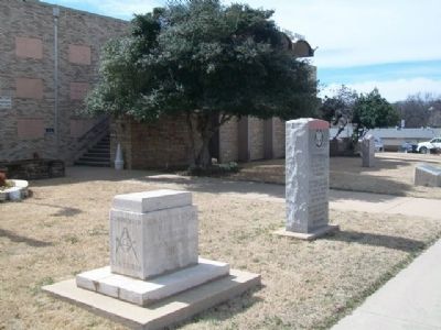
On Court Street east of Delaware Avenue, on the right when traveling east.
By Concurrent Senate and House Resolution No. 93 adopted April 20, 1988 by the Oklahoma State Legislature and which was approved by the Oklahoma Transportation Commission on May 2, 1988, Oklahoma Highway 3 between Ada and Broken Bow, Oklahoma . . . — — Map (db m72490) HM
On South Park Lane 1.5 miles north of W Boggy Depot Rd, on the left when traveling north.
Cyrus Harris, who would become the first elected Chickasaw Governor, arrived with one of the first parties to reach Boggy Depot. He built the first log cabin on the ridge between Clear Boggy and Sandy Creeks.
Harris was born August 22, 1817, near . . . — — Map (db m284165) HM
On Court Street east of Delaware Avenue, on the right when traveling east.
Born about 1792
Died during Civil War
Signed Treaty of
Dancing Rabbit Creek
in 1830.
Led Band of Choctaws to this area,
settling near Crystal in 1834.
Capt. Atoka was a noted
athlete, Choctaw subchief
and respected leader. . . . — — Map (db m72492) HM
On South Park Lane 1.5 miles north of W Boggy Depot Rd, on the left when traveling north.
The American Civil War took place a little more than a generation after removal. Although none of the tribes had a direct stake in the crisis, the tribes were unable to stay out of the conflict entirely. Virtually all of the tribes were split on . . . — — Map (db m284163) HM
On South Park Lane 1.5 miles north of W Boggy Depot Rd, on the right when traveling north.
Chief Wright had many notable accomplishments. Cyrus Kingsbury, co-founder of Boggy Depot's church, sponsored Wright's education at Pine Ridge Mission School near Doaksville. He then entered Spencer Academy in 1844. He was one of five Choctaw boys . . . — — Map (db m284164) HM
Near North Mississippi Avenue (U.S. 69) 0.8 miles north of West Liberty Road (U.S. 75), on the right when traveling north.
On September 16, 1857, the John Butterfield Company received a Federal contract to transport mail from Missouri to San Francisco in under 25 days. Semiweekly service began a year later. Twelve relay stations lined the Butterfield Trail in Indian . . . — — Map (db m64072) HM
The Confederate Encampment here at Middle (or Muddy) Boggy Crossing on the Boggy Depot Road held by Lieut. Col. John Jumper's Seminole Battalion, Capt. Adam Nail's Company A of First Choctaw and Chickasaw Cavalry and a detachment of the Twentieth . . . — — Map (db m244746) HM
On South Mississippi Avenue 0.1 miles north of W Chicken Fight Road, on the right when traveling south.
St. Patrick's Church of Atoka was built in 1872. Fr. Michael Smythe from Ft. Smith served here. Fr. Isidore Robot, O.S.B. was 1st resident' priest. He later was 1st Prefect Apostolic of Ind. Ter., and founded Sacred Heart Mission west of Atoka, 1876. — — Map (db m284167) HM
On Park Drive 1.5 miles north of W Boggy Depot Rd, on the left when traveling north.
Before the arrival of white settlers, much of Oklahoma was covered by a thick blanket of native grasses. Big and little bluestem, Indian grass and switchgrass were among the plants which covered the vast prairie. Wild fire kept Nature's forest . . . — — Map (db m284160) HM
On Court Street east of Delaware Avenue, on the right when traveling east.
In honor of the men and women
that served their country
in Vietnam and to those that
made the supreme sacrifice,
we dedicate this memorial
in their behalf
Dean Armstrong • Larry Culverson • Sam Daily
John C. Deaton • Forbes P. . . . — — Map (db m72491) WM
On Court Street at Reba McIntire Street, on the right when traveling east on Court Street.
In memory of all veterans
of all wars of the
United States of America
especially to those veterans
who paid the supreme sacrifice
for the freedom that you enjoy. — — Map (db m72488) WM
On Lake Road 0.5 miles south of Lake Shore Drive, on the right when traveling south.
Here was located a stage stand of the Butterfield Overland Mail Route, under Act of Congress, March 3, 1857. First mail stage arrived here in September, 1858, enroute to San Francisco. Service continued until the outbreak of the War between the . . . — — Map (db m284215) HM
On North Mississippi Avenue (U.S. 69) south of Ash Street, on the right when traveling south.
Near this place on Aug. 5, 1932, Atoka County Sheriff C.G. Maxwell and Deputy Sheriff Eugene Moore were involved in a shoot-out with Clyde Barrow, Raymond Hamilton, and Everett Milligan. The incident occurred when the two lawmen tried to arrest the . . . — — Map (db m64070) HM
On State Highway 7 0.1 miles west of South Park Road, on the left when traveling west.
Site of town noted for distinguished citizens in state history. 1st house built 1837 by Cyrus Harris, later Chickasaw Governor. Later Choctaw Capital and Overland Mail stage stand to San Francisco (1858-61). Home of Principal Chief Allen Wright, . . . — — Map (db m284166) HM
On U.S. 70 0.1 miles east of Ballpark Road, on the right when traveling west.
Armstrong Academy, established by Choctaw Nation and named for Wm. Armstrong, Indian Agt., was opened in 1845. Rev. R.D. Potts, Supt., under Baptist Miss. Soc. Post Office established Nov., 1850. Confederate Capitol during Civil War. Choctaw . . . — — Map (db m77938) HM
On Ford Washita Entrance Road north of State Highway 199 when traveling north.
As a memorial to Charley Colbert, his wife Abbie Davis Colbert, and their children, this monument is erected.
Charley Colbert was born May 20, 1863 at Colbert, Indian Territory, died June 13, 1955. His wife Abbie, born January 10, 1877, died . . . — — Map (db m206669) HM
On Buffalo Street (State Highway 22) west of Main Street, on the right when traveling east.
Ben Siegel at age 14 came to America from Lithuania. He established a business in Caddo, Indian Territory in 1895. One of Bryan County's first merchants, he was an important part of the early trade area. — — Map (db m73423) HM
On Buffalo Street (State Highway 22) west of Main Street, on the left when traveling east.
Lieutenant Governor 1955-1959
State Treasurer 1963-1967
Born: April 9, 1892 at Newberry, SC
Died: April 1, 1976 at Caddo, OK
Building erected: 1900 — — Map (db m73425) HM
On Buffalo Street (State Highway 22) west of Main Street, on the right when traveling east.
In 1955 the Craighead family purchased this store which for over four decades has served and intrigued children as well as adults:
Partial records show previous owners as:
E. F. Nichols - original site - 1905
Boone Styron Dry Goods - . . . — — Map (db m73424) HM
On Buffalo Street (State Highway 22) at Main Street, on the right when traveling east on Buffalo Street.
John S. Hancock and his young son Clement Allen Hancock followed the MKT Railroad to Caddo in 1872. They established a business at this location and became two of Caddo's founding businessmen and community leaders. — — Map (db m73410) HM
On Buffalo Street (State Highway 22) west of Main Street, on the right when traveling east.
Built by Woodmen of the World, this site has served businesses as well as Caddo schools as a classroom. One of its most famous occupants was John L. "Judge" Boland, opening a law office in 1910. He served as city attorney and a civic leader . . . — — Map (db m73426) HM
On Burney Street at South Franklin Street, on the right when traveling north on Burney Street.
Ferry owned by B.F. Colbert, at old crossing on Red River 3 miles south, was noted on the Butterfield Overland Mail line, organized, 1857; first U.S. mail route by stage between cities of St. Louis and San Francisco. Colbert post office was . . . — — Map (db m189885) HM
On Timothy Drive north of Moore Avenue, on the right when traveling north.
North span first free bridge across Red River erected 1931, replaced 1996. Oklahoma Gov. "Alfalfa" Bill Murray defied Federal Court injunction plowed up road to "toll" bridge forcing opening of "free" bridge linking Texas & Oklahoma hwy's. Gov. . . . — — Map (db m189824) HM
On River Road 0.5 miles east of McGee Road, on the right when traveling east.
Here was located a stage stand of the Butterfield Overland Mail Route, under Act of Congress, March 3, 1857. First mail stage arrived here in September, 1858, enroute to San Francisco. Service continued until the outbreak of the War between the . . . — — Map (db m284094) HM
On Alternate U.S. 69/75 north of Uptown West River Road, on the right when traveling north.
Before Oklahoma was a state, this tree gained the title of “The Message Tree”. Everyone in this area who needed to communicate with a loved one or business partner knew to nail a message to this tree.
This area where the travel center is . . . — — Map (db m244745) HM
Near Hina Hanta Way east of Cale Switch Road, on the right when traveling south.
Our ancestors enjoyed a rich spiritual and ceremonial life. The dance ground, located at a town's center, was the venue where Choctaw religious and social life converged. The stealing partners dance, drink water dance, friendship dance, war . . . — — Map (db m242790) HM
On West Evergreen Street at N 4th Ave, on the left when traveling east on West Evergreen Street.
In Honor of All American Men and Women Veterans of All Wars
Where Eagles Soar
U.S. Army •
U.S. Air Force •
U.S. Navy •
U.S. Coast Guard •
U.S. Marine •
U.S. Merchant Marine — — Map (db m284099) WM
On West Evergreen Street at N 4th Ave, on the left when traveling east on West Evergreen Street.
Killed or Missing in Action
"Lest we forget, freedom is not free. Remember our Bryan County veterans for the sacrifice they made."
World War I
James E. Andrews •
Calvin R. Bryant •
John H. Green •
Charles J. Porter •
John F. . . . — — Map (db m284098) WM
Near State Highway 199 3.5 miles west of State Highway 78, on the right when traveling west.
During the late 1830s and early 1840s, Chickasaw Indians removed by the United States Government from Alabama and Mississippi passed near here on their way to a new home in present-day south-central Oklahoma. In 1837 alone, an estimated 6,000 . . . — — Map (db m77936) HM
On West Beech Street just west of North 3rd Avenue, on the left when traveling west.
Home of Robert Lee Williams, one of Oklahoma’s foremost citizens. Member Constitutional Convention; Chief Justice State Supreme Court; and Governor, 1915-19. Later, was Judge on U.S. District Court, and Judge on U.S. Appeals Court, 10th Circuit at . . . — — Map (db m277469) HM
On North 1st Avenue (State Highway 78) at Armstrong Road, on the right when traveling north on North 1st Avenue.
Home of Robert Lee Williams, one of Oklahoma's foremost citizens. Member Constitutional Convention Chief Justice State Supreme Court; and governor, 1915-19. Later was judge on U. S. District Court; and judge on U.S. Appeals Court, 10th Circuit at . . . — — Map (db m284101) HM
On North 1st Avenue (State Highway 78) just south of Evergreen Street, on the right when traveling south.
The Choctaw people traveled the “Long Walk” Trail of Tears from their eastern homes to settle in new Choctaw Nation in Indian Territory. The first home in Durant belonged to Fisher Durant and was located on the site of Northside or Dixon Durant . . . — — Map (db m286674) HM
On State Highway 199 3.5 miles west of State Highway 78, on the left when traveling east.
Site selected and named 1842, by Gen. Zachary Taylor, later Pres. of U.S. Fort established 1842 by 2nd Dragoons, occupied by several rifle, infantry, cavalry, and artillery companies. Built to protect the Chickasaw and Choctaw Indians from the . . . — — Map (db m81743) HM
Near State Highway 199 3.5 miles west of State Highway 78, on the right when traveling west.
"Kind and sympathetic by nature, generous to a fault, he was an honest man of noble impulses, and born and bred a gentleman." These were the words of a contemporary of General Douglas Hancock Cooper, C.S.A.
Cooper was appointed U.S. Agent to . . . — — Map (db m77935) HM
On North 1st Avenue (State Highway 78) just south of Evergreen Street, on the right when traveling south.
An aviation pioneer and American hero, was educated at Southeastern. The 1917 graduate set numerous flying records in the 1920’s. As General of the United States Army Air Forces, he commanded the Eighth Air Force during World War II. Eaker was . . . — — Map (db m286633) HM
On North 6th Avenue just north of University Boulevard, on the right when traveling south.
On April 1st, 1928, Oklahoma Governor Henry S. Johnston visited campus and delivered a speech opening Southeastern’s new library. Built at a cost of $114,000, the Greco-Roman structure consisted of three floors and a mezzanine. After a fire in 1934 . . . — — Map (db m276997) HM
On North 5th Avenue just north of University Boulevard, on the left when traveling north.
The first building, which anchors Southeastern’s Magnolia-lined campus mall, was constructed in 1910 on the site of Dr. J. L. Schuler’s peach orchard at a cost of $94,385. Opened in January 1911, the facility greatly enhanced Southeastern Normal . . . — — Map (db m276995) HM
On U.S. 70 at Berry Street, on the left when traveling west on U.S. 70.
In 1835 Ramsey Potts and his wife came to the Choctaw Nation as missionary teachers. On October 5, 1837 he constituted the first Baptist church in the Choctaw Nation with 4 charter members. First named Ramsey in honor of Potts, it was originally . . . — — Map (db m287516) HM
On North 1st Avenue (State Highway 78) just south of Evergreen Street, on the right when traveling south.
He was a lawyer, a judge, and politician who served as the third Governor of the State of Oklahoma from 1915-1919. He moved to Durant in 1896 and served as the first town attorney in 1899. Williams helped draft the State’s Constitution, served as . . . — — Map (db m286678) HM
On Fisher Station Road near County Road 3685, on the left when traveling south.
Here was located a stage stand of the Butterfield Overland Mail Route, under Act of Congress, March 3, 1857. First mail stage arrived here in September, 1858, enroute to San Francisco. Service continued until the outbreak of the War between the . . . — — Map (db m284096) HM
On North 6th Avenue at University Boulevard, on the right when traveling south on North 6th Avenue.
In 1917, Governor Robert L. Williams sent an executive request to the legislature asking for funds to build campus homes for the presidents of Oklahoma’s six regional normal schools. Williams was successful, and by the Spring of 1918, President T. . . . — — Map (db m276998) HM
On North 5th Avenue just north of University Boulevard.
Reflecting a decade of growth and progress, in 1921 President Henry Garland Bennett hosted the formal dedication of Southeastern’s new education building. The James Earl Russell Memorial Building was named in honor of Bennett’s major professor at . . . — — Map (db m276996) HM
On North 1st Avenue (State Highway 78) just south of Evergreen Street, on the right when traveling south.
The Square Cafe was constructed in the early 1900’s as public restrooms since the area of town was the hub of trade for Bryan County. As the Square became a destination, a cafe was operated in the building for many years. Market Square was one of . . . — — Map (db m286778) HM
On Main Street west of 4th Street, on the left when traveling east.
Hendrix School served the Bryan County community of Hendrix, Oklahoma, well for many years and was a vital part of the lives of people that lived here. Records indicate that the school was one of two high schools in the county to be labeled as a . . . — — Map (db m309666) HM
On State Highway 22 2.3 miles west of State Highway 48, on the right when traveling west.
Earthworks 1.5 mi. S.E. constructed early in 1862 by Gen. Albert Pike, C.S.A. as major Confederate stronghold in southern Indian Territory. Named for Gen. Ben McCulloch, who fell at Pea Ridge. Fort had 18 pieces of artillery; 3,000 soldiers . . . — — Map (db m206451) HM
Near Nails Crossing Road, on the right when traveling west.
Butterfield Overland Mail site of Nail's CrossingHere was located a stage stand of the Butterfield Overland Mail route, under act of Congress, March 3, 1857. First mail service arrived here in September 1858, enroute to San Francisco, service . . . — — Map (db m40707) HM
Near Red Road 1 mile north of U.S. 70, on the right when traveling north.
"Doaksville is a small but pleasant looking village. There are a number of neat, if not tasteful dwelling houses, and two stores, which I found contained a little of almost everything from hoops to hunting shirts. It has a respectable looking . . . — — Map (db m237362) HM
Near Red Road 0.8 miles north of Tram Road, on the right when traveling north.
This is one of three wells known in Doaksville; one is a short distance to the north while the other is in the vicinity of the hotel. At this location, archaeologists found that a stone pavement surrounded the well. Archaeological evidence . . . — — Map (db m238724) HM
Near Red Road 0.8 miles north of Tram Road when traveling north.
The building that was once at this location is very different from other excavated at Doaksville. Here, a rock-walled cellar defines the footprint of a small building with a large fireplace. The cellar, which was excavated by archaeologists and . . . — — Map (db m238332) HM
Near Red Road 0.8 miles north of Tram Road, on the right when traveling north.
Archaeologists found the partial remains of two different buildings when this site was excavated in 1995 and 1996. All that remained of one building was a section of stone foundation. The construction of this wall showed that it was the northwest . . . — — Map (db m238985) HM
Near Red Road 1.2 miles north of U.S. 70, on the right when traveling north.
Despite the importance of Doaksville prior to the Civil War, there is very little information about what the town looked like at that time. In order to have a better understanding of the town, archaeologists excavated the remains of a mercantile . . . — — Map (db m238238) HM
On East 2060 Road 0.2 miles west of North 4375 Road, on the right when traveling west.
The Soldier's Home
In 1843 and later, four new barracks to house one hundred men each were constructed, two each on opposite sides of the parade ground. The lower story was a stone basement that contained a mess hall, kitchen, and pantry. . . . — — Map (db m239623) HM
On Red Road 1 mile north of U.S. 70, on the right when traveling north.
Dedicated to veterans who served during World War I · World War II · Korean War · Vietnam War To honor men and women who bravely served their country during war and peace resting here in the Doaksville
Ft. Towson Cemetery Erected in the year of our . . . — — Map (db m236991) WM
This site is at the north end of Main Street, called "Commercial Row," in this town begun in 1831. Name of nearby post office, "Fort Towson," was changed to Doaksville on Nov. 11, 1847. — — Map (db m52564) HM
On Red Road 1 mile north of U.S. 70, on the right when traveling north.
Established in the early 1800's, and in continuous use, its name was taken from the now vanished town of the same name, just East of these grounds.
Marble Tombstones, brought by steamboat from New Orleans, show the high regard frontier . . . — — Map (db m237045) HM
On Red Road 0.9 miles north of Tram Road, on the right when traveling north.
Doaksville is a small place, containing fifty or sixty people, consisting mostly of traders and mechanics. It has six stores, two saddler shops, one tailor, one blacksmith, one cabinet, and one shoemaker shop, also a drug store and a public . . . — — Map (db m239334) HM
Near North 4375 Road 0.7 miles north of U.S. 70, on the left when traveling north.
Dorothy Jane Orton was the prime mover in urging the restoration of Old Fort Towson. Due to her untiring efforts her home community and the entire state became aware of the important of preserving Fort Towson as a part of Oklahoma's Historic . . . — — Map (db m239411) HM
Near Red Road 0.8 miles north of Tram Road, on the right when traveling north.
Archaeologists spent the summers of 1995, 1996, and 1997 digging to unravel the mysteries of this area. All that was visible before they began was a small, low, earth mound with a few protruding rocks and brick fragments. The archaeologists . . . — — Map (db m238283) HM
Near U.S. 70 west of State Route 209, on the right when traveling east.
Established May, 1824, under command of Col. Matthew Arbuckle to guard this region of Spanish border. Headquarters of Gen. S.B. Maxey, U.S. Army. Abandoned at end of Civil War. In the vicinity, Doaksville was important trading center and one time . . . — — Map (db m52576) HM
On U.S. 70 east of State Route 209, on the right when traveling east.
The Fort Towson Landing was south of here on the banks of the Red River. Also known as the Public Landing, from 1824 to 1854 it served as a receiving point for soldiers and supplies delivered by keelboats and steamboats. Traders from the Choctaw . . . — — Map (db m52578) HM
On East 2060 Road 0.2 miles west of North 4375 Road, on the right when traveling west.
The post hospital consisted of the main structure and a kitchen. A large, central fireplace heated the log building. Inside was a waiting room, office, large wardroom, smaller wardroom for the seriously ill, and a "dead room" or mortuary. The . . . — — Map (db m239662) HM
On East 2060 Road 0.2 miles west of North 4375 Road when traveling east.
Memorial
To three Native American patriots who died in the vicinity of Fort Towson. Col. George Colbert was buried in this cemetery with military honors. The other two were buried also with military honors, but their graves are unknown, . . . — — Map (db m241589) WM
Near Red Road 0.8 miles north of Tram Road, on the right when traveling north.
Many whites had settled in what is today southeastern Oklahoma prior to the removal of the Choctaws to Indian Territory following the Treaty of Dancing Rabbit Creek in 1830. This unauthorized settlement was a problem during the initial . . . — — Map (db m238771) HM
Near North 4375 Road 0.7 miles U.S. 70, on the left when traveling north.
The three houses of "Officers' Row" were the domain of Army officers and their families. The commanding officer lived in the larger, middle house flanked by quarters for other officers on either side. The houses were built of hewn logs covered . . . — — Map (db m239532) HM
On Red Road 0.1 miles north of Tram Road, on the right when traveling north.
My father and mother are both buried in the old cemetery at Doaksville. It is more than one hundred and twenty-five years old and many of our family are buried there. Clemmie G. Sacra, 1937
The Doaksville cemetery has served the . . . — — Map (db m239285) HM
Near Red Road 0.8 miles north of Wilson Street, on the right when traveling north.
"The famous old military road came in from Arkansas to Fort Towson near Doaksville, thence in a westerly direction to Armstrong Academy to Washita, Tishomingo, thence west to Fort Arbuckle." Matthew Walton James, 1937
[In 1879] . . . — — Map (db m237791) HM
Here at Doaksville, June 23, 1865, Brigadier General Stand Watie, Cherokee Indian, was the last Confederate General to surrender. — — Map (db m151958) HM
Near North 4355 Road 0.7 miles north of U.S. 70, on the left when traveling north.
The post's sutler was a civilian storekeeper permitted by the Federal government to operate a trading house on or near a fort. His general merchandise business provided goods and services not regularly supplied by the military. It was also open to . . . — — Map (db m239504) HM
Near Red Road 0.1 miles Tram Road when traveling north.
The public house is owned by Col. David Folsom one of the principal men in the Choctaw Nation. He keeps an excellent house on strictly temperance principles. He also owns the blacksmith shop. Rev. P.P. Brown, 1847
Hotels during the . . . — — Map (db m238382) HM
Near Red Road 0.8 miles north of Tram Road, on the right when traveling north.
Economic and political changes to the region surrounding Doaksville caused this community to decline rapidly in late 1860s and 1870s. There is little archaeological evidence of sustained activity at this place after about 1870.
In 1854, Fort . . . — — Map (db m239198) HM
Near Red Road 0.8 miles Tram Road, on the right when traveling north.
I remember the old stone jail at Doaksville, just a one-room affair with iron-barred slits for windows. I wondered when and by whom it was built. That old place was so interesting to me. Charles Washington Ervin, 1937
The Choctaw . . . — — Map (db m239185) HM
Near Red Road 0.8 miles Tram Road, on the right when traveling north. Reported unreadable.
To commemorate the history of Doaksville, the first historical marker was placed in 1960. A second commemorative marker was placed in 1965 to acknowledge the 100th anniversary of General Stand Watie's surrender. At the end of the Civil War on June . . . — — Map (db m238464) HM
Near Red Road north of U.S. 70, on the right when traveling north.
Prior to 1830, Mississippi was the Choctaw homeland. The Choctaw migration to a new western homeland began shortly after the Treaty of Dancing Rabbit Creek was signed in 1830. The Choctaw people relocated to Indian Territory, traveling overland . . . — — Map (db m238148) HM
On Fort Towson Historic Site Road (County Road E2060) 0.5 miles west of County Road N4375.
During the early 1800's, present Southeastern Oklahoma was a major transportation crossroads. Roads connected Fort Towson in the Choctaw Nation to military installations to the North, South and West. On the Texas side of the Red River, Jonesboro was . . . — — Map (db m52580) HM
Near Red Road 0.8 miles north of Tram Road, on the right when traveling north.
The mounds at Doaksville were once thought to have formed when masonry buildings or chimneys collapsed. Over time, it was thought the resulting pile of rubble became covered with soil. However, when archaeologists excavated this site and the jail, . . . — — Map (db m239134) HM
On Valliant Avenue (U.S. 70) just east of Main Street, on the right when traveling east.
Dedicated to these young men of Fort Towson who died to preserve our heritage, our freedom, and our way of life. You Will Be Remembered Argonne Forrest Campbell 1923-1944 Glenn L. Reding 1921-1943 Finnice C. Wallace 1925-1944 Paul . . . — — Map (db m288396) WM
On North 4th Street at East Jackson Street (Business U.S. 70), on the right when traveling south on North 4th Street.
For those who died in that terrible war: we bestow our highest honor, respect, and appreciation for they gave the supreme sacrifice.
For those who are still missing: we hope and pray for their return home.
To those who still suffer, . . . — — Map (db m61963) WM
On North 4200 Road west of Old Spring Road, on the left when traveling west.
Begun 1848 by Rev. John Lathrop of American Bd. of Foreign Miss. Rev. O.P. Stark, Supt. (1850), built 1st church. Mrs. Stark opened 1st school here. Others in the service through 100 years include W.J.B. Lloyd, J.P. Gibbons, Bella M. Gibbons, Silas . . . — — Map (db m160362) HM
On Oklahoma 271A east of County Road 4200, on the right when traveling west.
Established in 1848 by Presbyterian Church as a mission among the Choctaw and Chickasaw Indians. Organized through the efforts of Rev. Cyrus Kingsbury, Ebenezer Hotchkin, Alfred Wright, Cyrus Byington, and C. C. Copeland. Today it is the oldest . . . — — Map (db m269162) HM
Near North 4260 Road 1.5 miles south of U.S. 70, on the left when traveling south.
Representative from the Choctaw Nation in the Congress of the Confederate States of America. Oklahoma Historical Society R.L. Williams, W.B. Morrison, A.N. Leecraft, G.E. Harris, W.A. Loftin, Committee John R. Arernathy Grand Master W.S. Key, . . . — — Map (db m268857) WM
On U.S. 70 east of N4310 Road (State Route 147), on the right when traveling west.
Noted school for boys, established by Choctaw Nation 1841; named for John C. Spencer, U.S. Sec. of War. Students who were later prominent leaders included Coleman E. Nelson, Allen Wright, Jackson McCurtain, Charles S. Vinson, B. F. Smallwood, . . . — — Map (db m147475) HM
On South Main Street at West Clay Avenue, on the right when traveling north on South Main Street.
A bond issue totalling $454,323.56 was voted on by the taxpayers of Coal County to construct a new courthouse. The bond was issued on June 1, 1968 and was supported by a tax levy of 1/2 mil. the debt was paid for on June 1, 1990.
Architect . . . — — Map (db m181749) HM
On Oklahoma 31 0.8 miles east of Old 75 Road, on the left when traveling west.
This bridge dedicated to Sergeant John O. Linton, Coalgate, Oklahoma, wounded and captured in action on 30 December 1943 in Italy during the Naples-Foggia Campaign in WWII while member of Company M, 3rd Battalion, 180th Infantry Regiment, 45th, . . . — — Map (db m264209) WM
On State Highway 9 at Garland-Tamaha Road, on the right when traveling west on State Highway 9.
Site of Civil War naval battle. Confederate Indian forces led by Brig. Gen. Stand Watie, forced aground and captured Union Steamboat J.R. Williams with cargo worth $120,000, on June 15, 1864. Southern troops included Choctaws, Chickasaws, Creeks and . . . — — Map (db m64073) HM
On East Main Street (Oklahoma Route 9) east of SE 2nd Street, on the right when traveling east.
Honoring all who served and in everlasting memory of those who made the supreme sacrifice in World War I and in World War II To keep forever living the freedom for which they fought we dedicate this memorial to our war dead of both World Wars . . . — — Map (db m165639) WM
On East Main Street (Oklahoma Route 9) east of SE 2nd Street, on the right when traveling east.
The signing of the Treaty of Dancing Rabbit Creek on Sept. 27, 1830, was the final negotiation to remove the Choctaws from their ancestral homelands in Mississippi and Alabama to Indian Territory. The trip covered 600 miles. Many small groups had . . . — — Map (db m165637) HM
On State Highway 9 at Tamaha Road, on the right when traveling west on State Highway 9.
One of the earliest port towns and trading centers in Choctaw Nation, I.T. Choctaws brought from Mississippi up Arkansas River to Tamaha on steamboats as early as 1831. Tamaha developed as port and ferry crossing around 1836. Post office built 1884 . . . — — Map (db m76457) HM
On East Main Street (Oklahoma Route 9) just east of SE 2nd Street, on the right when traveling east.
This monument is dedicated to the thousands that lie forgotten in unmarked graves throughout present day Haskell County, Oklahoma, formally Sans Bois County, Choctaw Nation, Indian Territory. From the late 1840’s until the first days of the Civil . . . — — Map (db m165638) HM
On Grant Street west of Main Street, on the right when traveling west.
Memorial to one of the earliest port towns and trading centers in the Choctaw Nation, I.T. Choctaws brought from Mississippi up Arkansas River to Tamaha on steamboats as early as 1831. Tamaha developed as port and ferry crossing around 1836. Post . . . — — Map (db m77875) HM
On State Highway 48 0.3 miles south of Old Highway 12 (County Route D138), on the right when traveling south.
Est., 1834, by Lieut. T.H. Holmes, later Lt. Gen., C.S.A. This post was visited~June, 1834~by Gen. Henry Leavenworth on his expedition to the Plains tribes. Edwards' Store, site 1 mile west of here, was the last trading post until Santa Fe on the . . . — — Map (db m64074) HM
On U.S. 270 at McCabe Road, on the right when traveling north on U.S. 270.
This French Explorer, seeking trade with the Wichita Indians, came north from Louisiana, on August 25, 1719, he camped three miles east of Hartshorne and the next day, following Gains Creek, passed here on his way to the Canadian River and the . . . — — Map (db m29928) HM
On Emerald Vista Road north of Talimena National Scenic Byway. (Scenic Highway 1), on the right when traveling north.
Look for Stapp, Oklahoma beside Highway 270 in the valley below. The Buschow Lumber Company operated a mill and railroad here during the early 1900s. At that time the timber industry was primarily nomadic and the average life of a mill was 20 . . . — — Map (db m196082) HM
On Emerald Vista north of Talimena National Scenic Byway (Scenic Highway 1), on the right when traveling north.
See all the green? Imagine this landscape without it!
In 1930, government appraisers said this land had "no commercial value." Described as lightly to severely burned over, there were too few trees left from logging and fires to re-seed the . . . — — Map (db m195998) HM
On County Road E805 east of N4790, on the left when traveling east.
"Warrior who perseveres" Born 1770 "Chief Moshulatubbee of Northern District, Choctaw Nation in Mississippi, received his name as a young warrior. He was dignified in bearing, of fine physique, steady and thoughtful in disposition. As Chief he . . . — — Map (db m190228) HM
On Oklahoma Route 112 0.4 miles north of Old Highway 112, on the left when traveling north.
On the hill to the east was home of Capt. J.E. Reynolds a
Confederate veteran, a pioneer rancher and merchant. Built
of native stone, like a castle, complete with turrets and
walls two feet thick. Reynolds was a delegate to the Sequoyah . . . — — Map (db m217639) HM
The Civilian Conservation Corps during the Great Depression and the Roosevelt Administration The Civilian Conservation Corps provided employment for thousands of deserving men Company 810 came to Stapp Oklahoma from Fort Sill on May 24 1933. The . . . — — Map (db m202673) HM
On Cedar Lake Road Spur to Equestrian Campground 1 mile Equestrian Campground road, on the right.
Don Hoyt held his first trail ride in 1951 with tireless effort and great vision. From the 1950's through the 1990's he pioneered the development of many trails and trail riding in Arkansas and Oklahoma he was also instrumental in the development . . . — — Map (db m202793) HM
On North US Highway 259 at State Highway 63, on the right when traveling south on North US Highway 259.
While President of the United States John F. Kennedy gave the dedicatory address at this site, he was a guest of Senator Robert S. Kerr who has led the way for the development of his native state of Oklahoma. "Land Wood Water Space" — — Map (db m172002) HM
191 entries matched your criteria. The first 100 are listed above. The final 91 ⊳