By William Fischer, Jr., March 7, 2014
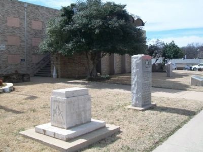
45th Infantry Division Memorial Highway Marker
| On Court Street east of Delaware Avenue, on the right when traveling east. |
| On South Park Lane 1.5 miles north of W Boggy Depot Rd, on the left when traveling north. |
| On Court Street east of Delaware Avenue, on the right when traveling east. |
| On South Park Lane 1.5 miles north of W Boggy Depot Rd, on the left when traveling north. |
| On South Park Lane 1.5 miles north of W Boggy Depot Rd, on the right when traveling north. |
| On Court Street at Reba McIntire Street, on the right when traveling east on Court Street. |
| Near North Mississippi Avenue (U.S. 69) 0.8 miles north of West Liberty Road (U.S. 75), on the right when traveling north. |
| On South Mississippi Avenue 0.1 miles north of W Chicken Fight Road, on the right when traveling south. |
| On Park Drive 1.5 miles north of W Boggy Depot Rd, on the left when traveling north. |
| On Court Street east of Delaware Avenue, on the right when traveling east. |
| On Court Street at Reba McIntire Street, on the right when traveling east on Court Street. |
| On Lake Road 0.5 miles south of Lake Shore Drive, on the right when traveling south. |
| On North Mississippi Avenue (U.S. 69) south of Ash Street, on the right when traveling south. |
| On State Highway 7 0.1 miles west of South Park Road, on the left when traveling west. |
| On U.S. 70 0.1 miles east of Ballpark Road, on the right when traveling west. |
| On Ford Washita Entrance Road north of State Highway 199 when traveling north. |
| On Buffalo Street (State Highway 22) west of Main Street, on the right when traveling east. |
| On Buffalo Street (State Highway 22) west of Main Street, on the left when traveling east. |
| On Buffalo Street (State Highway 22) west of Main Street, on the right when traveling east. |
| On Buffalo Street (State Highway 22) at Main Street, on the right when traveling east on Buffalo Street. |
| On Buffalo Street (State Highway 22) west of Main Street, on the right when traveling east. |
| On Burney Street at South Franklin Street, on the right when traveling north on Burney Street. |
| On Timothy Drive north of Moore Avenue, on the right when traveling north. |
| On River Road 0.5 miles east of McGee Road, on the right when traveling east. |
| On Alternate U.S. 69/75 north of Uptown West River Road, on the right when traveling north. |
| Near Hina Hanta Way east of Cale Switch Road, on the right when traveling south. |
| On West Evergreen Street at N 4th Ave, on the left when traveling east on West Evergreen Street. |
| On West Evergreen Street at N 4th Ave, on the left when traveling east on West Evergreen Street. |
| Near State Highway 199 3.5 miles west of State Highway 78, on the right when traveling west. |
| On N 4th Ave at W Evergreen Street, on the left when traveling north on N 4th Ave. |
| On West Beech Street just west of North 3rd Avenue, on the left when traveling west. |
| On North 1st Avenue (State Highway 78) at Armstrong Road, on the right when traveling north on North 1st Avenue. |
| On North 1st Avenue (State Highway 78) just south of Evergreen Street, on the right when traveling south. |
| On State Highway 199 3.5 miles west of State Highway 78, on the left when traveling east. |
| Near State Highway 199 3.5 miles west of State Highway 78, on the right when traveling west. |
| On North 1st Avenue (State Highway 78) just south of Evergreen Street, on the right when traveling south. |
| On North 6th Avenue just north of University Boulevard, on the right when traveling south. |
| On North 5th Avenue just north of University Boulevard, on the left when traveling north. |
| On U.S. 70 at Berry Street, on the left when traveling west on U.S. 70. |
| On North 1st Avenue (State Highway 78) just south of Evergreen Street, on the right when traveling south. |
| On Fisher Station Road near County Road 3685, on the left when traveling south. |
| On North 6th Avenue at University Boulevard, on the right when traveling south on North 6th Avenue. |
| On North 5th Avenue just north of University Boulevard. |
| On North 1st Avenue (State Highway 78) just south of Evergreen Street, on the right when traveling south. |
| On Main Street west of 4th Street, on the left when traveling east. |
| On State Highway 22 2.3 miles west of State Highway 48, on the right when traveling west. |
| Near Nails Crossing Road, on the right when traveling west. |
| Near Red Road 1 mile north of U.S. 70, on the right when traveling north. |
| Near Red Road 0.8 miles north of Tram Road, on the right when traveling north. |
| Near Red Road 0.8 miles north of Tram Road when traveling north. |
| Near Red Road 0.8 miles north of Tram Road, on the right when traveling north. |
| Near Red Road 1.2 miles north of U.S. 70, on the right when traveling north. |
| On East 2060 Road 0.2 miles west of North 4375 Road, on the right when traveling west. |
| On Red Road 1 mile north of U.S. 70, on the right when traveling north. |
| Near Red Road 1.5 miles U.S. 70. |
| On Red Road 1 mile north of U.S. 70, on the right when traveling north. |
| On Red Road 0.9 miles north of Tram Road, on the right when traveling north. |
| Near North 4375 Road 0.7 miles north of U.S. 70, on the left when traveling north. |
| Near Red Road 0.8 miles north of Tram Road, on the right when traveling north. |
| Near U.S. 70 west of State Route 209, on the right when traveling east. |
| On U.S. 70 east of State Route 209, on the right when traveling east. |
| On East 2060 Road 0.2 miles west of North 4375 Road, on the right when traveling west. |
| On East 2060 Road 0.2 miles west of North 4375 Road when traveling east. |
| Near Red Road 0.8 miles north of Tram Road, on the right when traveling north. |
| Near North 4375 Road 0.7 miles U.S. 70, on the left when traveling north. |
| On Red Road 0.1 miles north of Tram Road, on the right when traveling north. |
| Near Red Road 0.8 miles north of Wilson Street, on the right when traveling north. |
| Near Red Road 1.5 miles north of U.S. 70. |
| Near North 4355 Road 0.7 miles north of U.S. 70, on the left when traveling north. |
| Near Red Road 0.1 miles Tram Road when traveling north. |
| Near Red Road 0.8 miles north of Tram Road, on the right when traveling north. |
| Near Red Road 0.8 miles Tram Road, on the right when traveling north. |
| Near Red Road 0.8 miles Tram Road, on the right when traveling north. Reported unreadable. |
| Near Red Road north of U.S. 70, on the right when traveling north. |
| On Fort Towson Historic Site Road (County Road E2060) 0.5 miles west of County Road N4375. |
| Near Red Road 0.8 miles north of Tram Road, on the right when traveling north. |
| On Valliant Avenue (U.S. 70) just east of Main Street, on the right when traveling east. |
| On North 4th Street at East Jackson Street (Business U.S. 70), on the right when traveling south on North 4th Street. |
| On North 4200 Road west of Old Spring Road, on the left when traveling west. |
| On Oklahoma 271A east of County Road 4200, on the right when traveling west. |
| Near North 4260 Road 1.5 miles south of U.S. 70, on the left when traveling south. |
| On U.S. 70 east of N4310 Road (State Route 147), on the right when traveling west. |
| On South Main Street at West Clay Avenue, on the right when traveling north on South Main Street. |
| On Oklahoma 31 0.8 miles east of Old 75 Road, on the left when traveling west. |
| On State Highway 9 at Garland-Tamaha Road, on the right when traveling west on State Highway 9. |
| On East Main Street (Oklahoma Route 9) east of SE 2nd Street, on the right when traveling east. |
| On East Main Street (Oklahoma Route 9) east of SE 2nd Street, on the right when traveling east. |
| On State Highway 9 at Tamaha Road, on the right when traveling west on State Highway 9. |
| On East Main Street (Oklahoma Route 9) just east of SE 2nd Street, on the right when traveling east. |
| On Grant Street west of Main Street, on the right when traveling west. |
| On U.S. 270 at McCabe Road, on the right when traveling north on U.S. 270. |
| On Emerald Vista Road north of Talimena National Scenic Byway. (Scenic Highway 1), on the right when traveling north. |
| On Emerald Vista north of Talimena National Scenic Byway (Scenic Highway 1), on the right when traveling north. |
| On County Road E805 east of N4790, on the left when traveling east. |
| On Oklahoma Route 112 0.4 miles north of Old Highway 112, on the left when traveling north. |
| Near Cedar Lake Road west of Cedar Lake Road. |
| On Cedar Lake Road Spur to Equestrian Campground 1 mile Equestrian Campground road, on the right. |
| On North US Highway 259 at State Highway 63, on the right when traveling south on North US Highway 259. |
| On Texas Avenue south of Ivy Street, on the left when traveling north. |
190 entries matched your criteria. The first 100 are listed above.
The final 90 ⊳
