By Jason Armstrong, July 3, 2022
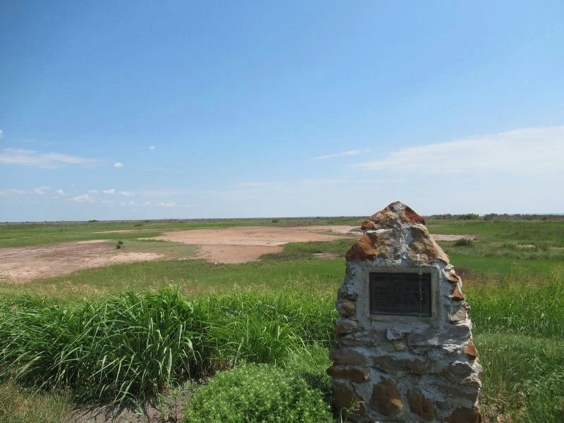
George C. Sibley Expedition Marker
| On State Highway 11 6 miles east of U.S. 64, on the left when traveling west. |
| On State Highway 11 west of County Road 630, on the left when traveling west. |
| On State Highway 8 at E0374 Road, on the right when traveling north on State Highway 8. |
| On Main Street (U.S. 64) at 1st Street, on the right when traveling west on Main Street. |
| On Harper Road 1 mile west of State Highway 38, on the right when traveling west. |
| On State Highway 23 8 miles south of U.S. 412, on the left when traveling south. |
| On Main Street, on the right when traveling east. |
| On U.S. 64, on the left when traveling west. |
| On U.S. 64 at State Highway 23, on the right when traveling east on U.S. 64. |
| On U.S. 64 at N1680 Road, on the right when traveling east on U.S. 64. |
| On Mendenhall Street (County Route 12) 0.1 miles north of Panhandle Street (U.S. 64), on the right when traveling north. |
| Near State Highway 58 south of County Highway 990. |
| On N2660 Road, on the right when traveling north. |
| Near Local Road P20 0.4 miles State Highway 8A, on the right. |
| On State Highway 8A 3 miles north of State Highway 8, on the left when traveling north. |
| Near P10 Road 1 mile west of 8A. |
| On Main Street (State Highway 325) at Cimarron Avenue (U.S. 385), on the right when traveling west on Main Street. |
| On U.S. 287 3.1 miles north of E0130 Road, on the left when traveling north. |
| On Main Street (State Highway 325) at Cimarron Avenue (U.S. 385), on the left when traveling west on Main Street. |
| On U.S. 287 3.1 miles north of E0130 Road, on the left when traveling north. |
| Near Black Mesa Road 5 miles north of Oklahoma Highway 325, on the left when traveling north. |
| Near Black Mesa Trail 0.5 miles west of Black Mesa Road, on the right when traveling west. |
| Near Black Mesa Road 5 miles north of Oklahoma Highway 325. |
| Near Black Mesa Road 5 miles Oklahoma Highway 325, on the left when traveling north. |
| On 325 Highway 3.5 miles north of E0190 Road, on the left when traveling north. |
| On State Highway 325 3.6 miles north of E0190 Road, on the left when traveling north. |
| On 325 3.6 miles north of E0190 Road, on the left when traveling north. |
| On State Highway 34 - 0.5 miles north of Road N2050, on the right when traveling south. |
| On N2280 Road 0.2 miles south of U.S. 270, on the right when traveling south. |
| On U.S. 183, on the left when traveling south. |
| On U.S. 60 0.5 miles west of U.S. 270, on the right when traveling west. |
| On U.S. 60 3 miles west of State Highway 34, on the left when traveling west. |
| On U.S. 283 at E0270 Road, on the left when traveling north on U.S. 283. |
| On E0440 Road 0.2 miles State Highway 15, on the left when traveling west. |
| On 1st Street (State Highway 15), on the right when traveling east. |
| On U.S. 81 0.2 miles south of County Road E0550, on the right when traveling south. |
| On U.S. 81 0.4 miles north of County Road E 590, on the left when traveling north. |
| On U.S. 81 0.4 miles north of County Road E0590, on the right when traveling south. |
| On South 5th Street 0.1 miles south of East Oklahoma Avenue, on the left when traveling south. |
| Near Gott Road 0.7 miles south of West Southgate Road, on the right when traveling south. |
| On West Randolph Avenue at Business U.S. 64, on the left when traveling west on West Randolph Avenue. |
| On U.S. 60 at Carrier Road (Oklahoma Highway 45), on the right when traveling south on U.S. 60. |
| On U.S. 60 at Cottonwood Lane, on the right when traveling north on U.S. 60. |
| Near South 4th Street north of Business U.S. 64, on the right when traveling north. |
| On North Main Street (U.S. 60) at Washington Avenue, on the left when traveling north on North Main Street. |
| On Guthrie Street just west of 1st Street, on the right when traveling west. |
| On Guthrie Street just west of 1st Street, on the right when traveling west. |
| On U.S. 64 at County Highway N2010, on the right when traveling east on U.S. 64. |
| On South Main Street (U.S. 177) just south of West Padon Avenue, on the right when traveling south. |
| On South Main Street (U.S. 177) south of East Padon Avenue, on the right when traveling south. |
| On South Main Street (U.S. 177) at West Padon Avenue, on the right when traveling south on South Main Street. |
| On South Main Street at West College Avenue, on the right when traveling south on South Main Street. |
| On South Main Street (U.S. 177) just north of East Coolidge Avenue, on the right when traveling north. |
| On Broadway Avenue (U.S. 177) south of Main Street, on the right when traveling south. |
| On U.S. 177 north of West Home Road, on the left when traveling north. |
| On U.S. 77 at Judo Road, on the left when traveling north on U.S. 77. |
| On U.S. 77 at State Line Road, on the right when traveling south on U.S. 77. |
| On U.S. 77 at State Line Road, on the right when traveling south on U.S. 77. |
| On U.S. 77 at State Line Road, on the right when traveling south on U.S. 77. |
| On Brill Road west of Washunga Drive, on the right when traveling west. |
| On Brill Road north of Washunga Drive, on the right when traveling west. |
| On Main Street (U.S. 77) at 8th Street, on the right when traveling north on Main Street. |
| On Main Street (U.S. 77) at 7th Street, on the left when traveling north on Main Street. |
| On West 7th Street just west of South Main Street (U.S. 77), on the left when traveling west. |
| On West 7th Street just west of South Main Street (U.S. 77), on the left when traveling west. |
| Near North Main Street (U.S. 77) just south of West 6th Street, on the right when traveling south. |
| On Main Street (U.S. 77) at 7th Street, on the right when traveling north on Main Street. |
| On Main Street (U.S. 77) at 7th Street, on the left when traveling north on Main Street. |
| On Main Street (U.S. 77) south of 7th Street, on the right when traveling north. |
| On Main Street (U.S. 77) at 8th Street, on the left when traveling north on Main Street. |
| On Main Street (U.S. 77) at 8th Street, on the left when traveling north on Main Street. |
| On Main Street (U.S. 77) at 7th Street, on the left when traveling north on Main Street. |
| On North Main Street (U.S. 77) just south of West 6th Street, on the right when traveling south. |
| On Main Street (U.S. 77) at 7th Street, on the right when traveling north on Main Street. |
| On North Main Street (U.S. 77) just south of West 6th Street, on the right when traveling south. |
| On Main Street (U.S. 77) at 7th Street, on the right when traveling north on Main Street. |
| On West 7th Street just west of South Main Street (U.S. 77), on the left when traveling west. |
| On South Main Street (U.S. 77) at East 8th Street, on the left when traveling north on South Main Street. |
| On Main Street (U.S. 77) north of 7th Street, on the left when traveling north. |
| On South Walnut Avenue just south of West 8th Street, on the right when traveling south. |
| On North Main Street (U.S. 77) just south of West 6th Street, on the right when traveling south. |
| On Ranch Road (State Highway 156) 0.5 miles south of White Eagle Road, on the right when traveling south. |
| On Grand Avenue East (Business U.S. 60) at North 4th Street, on the right when traveling west on Grand Avenue East. |
| Near Ranch Road (State Highway 156) 0.5 miles south of White Eagle Road. |
| On Ranch Road (State Highway 156) 0.5 miles south of White Eagle Road, on the right when traveling south. |
| On West Grand Avenue (Business U.S. 60) just west of North Union Street, on the right when traveling west. |
| Near Ranch Road (State Highway 156) 0.5 miles north of White Eagle Road. |
| On West Grand Avenue (Business U.S. 60) just west of South 1st Street, on the left when traveling west. |
| On Grand Avenue East (Business U.S. 60) at North 2nd Street, on the right when traveling west on Grand Avenue East. |
| On Grand Avenue East at North 3rd Street, on the right when traveling west on Grand Avenue East. |
| On North 3rd Street at Grand Avenue East (Business U.S. 60), on the right when traveling south on North 3rd Street. |
| On Grand Avenue East (Business U.S. 60) just east of South 5th Street, on the right when traveling east. |
| On East Grand Avenue at South 5th Street, on the left when traveling west on East Grand Avenue. |
| On Grand Avenue East (Business U.S. 60) at 3rd Street South, on the right when traveling east on Grand Avenue East. |
| On Grand Avenue East (Business U.S. 60) at South 2nd Street, on the right when traveling east on Grand Avenue East. |
| On East Lake Road north of U.S. 62, on the left when traveling south. |
| On South 3rd Street at Grand Avenue East (Business U.S. 60), on the left when traveling north on South 3rd Street. |
| On North 2nd Street at East Cleveland Avenue, on the left when traveling north on North 2nd Street. |
| On East Grand Avenue at South 6th Street, on the left when traveling west on East Grand Avenue. |
| On South 4th Street at Grand Avenue East (Business U.S. 60), on the right when traveling north on South 4th Street. |
229 entries matched your criteria. The first 100 are listed above.
Next 100 ⊳
