On East Central Avenue at Langlade Street, on the right when traveling west on East Central Avenue. Reported permanently removed.
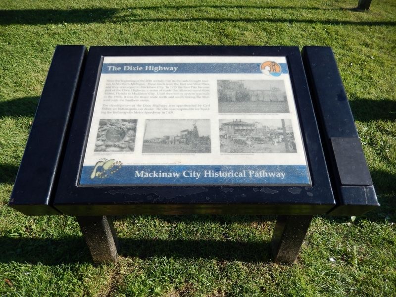
Since the beginning of the 20th century, two main roads brought tourists to Northern Michigan.
These roads were the East and West Pikes and they converged in Mackinaw City.
In 1915 the East Pike became part of the Dixie Highway, a series of . . . — — Map (db m125535) HM
On East Central Avenue at Langlade Street, on the right when traveling west on East Central Avenue.
Since the beginning of the twentieth century, two main roads, the East and West Pikes, brought tourists to Northern Michigan and specifically Mackinaw City. In 1915 the East Pike, US-27, became part of the Dixie Highway, a series of roads connecting . . . — — Map (db m213907) HM
On North Huron Avenue at East Sinclair Street, on the right when traveling north on North Huron Avenue. Reported permanently removed.
Mackinaw's economy was originally built on the fur trade. When that faltered in the 1840s it was supplanted by fising, lumbering, and today's tourism.
The summer of 1871 was hot, dry, and windy, resulting in devastating fires across the . . . — — Map (db m140869) HM
Near South Huron Avenue north of Railroad Avenue, on the right when traveling north.
The Meneely bell atop this tower helped guide the train ferries Chief Wawatam and Sainte Marie in foggy weather to the New York Central Railroad Dock in Mackinaw City.
The bell, cast in 1890 in Troy, N.Y., was in service until 1952 and . . . — — Map (db m138340) HM
Mackinac Bridge ends the car ferry era
November 1, 1957 marked the beginning of the end for the car ferry business in the Straits. After a 20-year battle to finalize the plans and finances, construction of the Mackinac Bridge began May 7, . . . — — Map (db m214017) HM
On East Central Avenue at Ducharme Street, on the left when traveling east on East Central Avenue.
Before the railroads were extended to Mackinaw City in 1881, the Straits area remained isolated. Its activities were limited to commercial pursuits such as lumbering and serving the expanding shipping industry. Once land routes were cut through . . . — — Map (db m273951) HM
On East Central Avenue at Ducharme Street, in the median on East Central Avenue. Reported permanently removed.
Before the railroads were extended to Mackinaw City in 1881, the Straits area remained isolated and its activities were limited to commercial pursuits such as lumbering and serving the expanding shipping industry. Once land routes were cut . . . — — Map (db m273834) HM
On South Huron Avenue at Railroad Avenue, on the right when traveling north on South Huron Avenue.
Whereas, Ray and Cidney Roth are Leaders in bringing arts and culture to the community, and
Whereas, the Roth's vision were instrumental in the development of the Village's performance shell at Conkling Heritage Park; and
Whereas, the Roths . . . — — Map (db m273929) HM
Mackinaw City is one of the windiest places in Michigan
Step aside, Chicago. Michigan is harnessing its wind to generate electricity in many locations throughout the state, including Mackinaw City. The eight wind turbines located at the east . . . — — Map (db m214019) HM
On East Central Avenue at Henry Street, in the median on East Central Avenue.
Recreation has always been an important part of life in Mackinaw City. From hunting and fishing, to ice boating, or just enjoying the amazing blue ice that sometimes piles up on short, winter can be a time of delight.
A ferry carried people, . . . — — Map (db m254574) HM
On East Central Avenue at Henry Street, on the left when traveling west on East Central Avenue. Reported permanently removed.
When the gales of November blow into Mackinaw City, its residents prepare for the long, hard winter that will bury the beautiful sand beaches in deep snowdrifts and freeze the Straits from shore to shore. Northern Michigan winters more closely . . . — — Map (db m135221)
Near North Huron Avenue at Henry Street, on the right when traveling west.
Long, strong and within budget.
When built the Mackinac Bridge was the longest suspension bridge in the world
if you count all three segments, but today the longest is in Japan. Mighty Mac
was designed to withstand crushing ice and at . . . — — Map (db m255094) HM
On South Huron Avenue at Railroad Avenue, on the right when traveling north on South Huron Avenue.
Edgar Conkling, Mackinaw City's founding father, platted the town in 1857 in anticipation of the arrival of a railroad.
Born in New York in 1812, his family moved to Ohio where he met and married his wife, Belinda. They moved to Illinois . . . — — Map (db m273928) HM
Fort Michilimackinac has been designated a Registered National Historic Landmark under the provisions of the Historic Sites Act of August 21, 1935 this site possesses exceptional value in commemorating and illustrating the history of the . . . — — Map (db m279161) HM
On North Huron Avenue north of East Etherington Street, on the right when traveling north.
The earth started as a swirling body of molten
rock that, over tens of millions of years,
cooled. A crust formed on top and with more
cooling, the crust wrinkled like a dried apple
resulting in 17 shallow basins and 290 . . . — — Map (db m254990) HM
Near North Huron Avenue at Henry Street, on the right when traveling west.
The Straits of Mackinac have claimed many a ship
blown off course onto dangerous shoals submerged
outside narrow shipping lanes. Fog, swift currents,
and crushing winter ice also have taken their toll.
In 1983 the Straits were designated a . . . — — Map (db m255144) HM
"Guardian Spirit" is a self-explanatory piece that depicts wildlife in Michigan's winter season, according to artist Dan Feldhauser.
Dan Feldhauser is an artist in every sense of the word. He grew up on the banks of the Au Sable River and spent . . . — — Map (db m256075)
On North Huron Avenue near East Central Avenue, on the right when traveling north.
Waterfront downtown originally.
Mackinaw city’s main business district has shifted location over the decades. In the early 1880s it consisted of the first two blocks of Main St., now called N. Huron Ave. The retail stores, hotels and docks . . . — — Map (db m254695) HM
On South Huron Avenue south of East Central Avenue, on the right when traveling north.
These cannons are famous
Admiral David Farragut made these guns famous in the Civil War during the Battle of Mobile Bay. Tied to the mast of the USS Hartford to see over
the smoke the cannons created, he is quoted as saying "Damn . . . — — Map (db m216774) HM
On North Huron Avenue at East Depeyster Street, on the right when traveling north on North Huron Avenue.
Stimpson Started a Business.
The Marine & Weather Reporting Service,
established in 1877 by Forest Simpson,
served passing ships and the ships’
owners. He made daily reports on the
weather and ship locations to owners
using the Western . . . — — Map (db m255062) HM
On North Huron Avenue at Ducharme Street, on the right when traveling west on North Huron Avenue.
Welcome to
Michilimackinac State Park
Established in 1909, it is Michigan's second state park and offers stunning views of the Mackinac Bridge, picnic
areas and, is home to two historic sites: Old Mackinac Point Lighthouse and Colonial . . . — — Map (db m278170) HM
Near Henry Street south of East Sinclair Street, on the right when traveling south.
This is the former site of the Mackinaw City Elementary and High School. The school was built in 1926 by the Mackinaw City Public Schools. The school served the community needs well until 1984 when it was determined that the building . . . — — Map (db m278178) HM
On Henry Street, on the right when traveling south. Reported permanently removed.
Perry Darrow was a special person in our community; wherever he went, he had a smile and willing hands to help anyone.
He was born in Kniffenville, a small settlement of Mackinaw City near Drydock Lake. His parents, Glen (Slim) and Bea . . . — — Map (db m278175) HM
On Henry Street south of East Sinclair Street, on the right when traveling south.
Perry Darrow, through his work, touched every square inch of Mackinaw soil. But Perry was more than an excavating contractor. He liked people, listened to people, and built bridges between people.
He was loved enough that volunteers turned out . . . — — Map (db m278176) HM
Radio technology improved Old Mackinac Point's role as a beacon for sailors. The lighthouse Service installed a radio beacon at the station in late 1937. The beacon which entered service in 1938, automatically transmitted a unique radio signal . . . — — Map (db m228524) HM
"Shepler's Ferry" is artist Mallory Curtis's tribute to the Shepler family. Mackinac Island is a unique destination that brings its visitors back in time. It is rich in Northern Michigan history. Shepler's has been a mainstay in island . . . — — Map (db m256076)
On East Central Avenue west of Henry Street, on the right when traveling west.
Built in 1951 by R. Dale & Patricia Barnett
This was originally the Barnett Insurance Agency and The Santa Claus Shop with a living area in the back. In 1972, the living area became Antique Alley. Now a rental property, it is still owned by . . . — — Map (db m232255) HM
On North Huron Avenue at Langlade Street, on the right when traveling north on North Huron Avenue.
Mackinaw’s economy was originally built
on the fur trade. When that faltered in the
1840s, it was supplanted by fishing,
lumbering, and today’s tourism.
The hot, dry, and windy summer of 1871 fanned the
flames of devastating fires . . . — — Map (db m255045) HM
Straits of Mackinac - a juncture in travel
Transportation through the Straits of Mackinac has changed dramatically over the centuries. The earliest inhabitants travelled by boat and found the Straits a convenient east-west highway linking . . . — — Map (db m232261) HM
On North Huron Avenue north of East Etherington Street, on the right when traveling north.
Summer sailors know that high clouds float over land.
Lakeshore residents know that winter winds bring lake-effect snow.
June — In spring and summer, the air over the land
is warmer than the water in the lakes. Warm damp
air rises . . . — — Map (db m254994) HM
We (the Voyageurs) travel west from Montreal to Lake Huron. We can go about fifty miles each day. It takes about a month to reach Michilimackinac. There are thirty-six PORTAGES or “carrying places,” between Montreal and Michilimackinac. At each . . . — — Map (db m279145) HM
The fur trade stretched from the forests far north of Lake Superior to Europe. Michilimackinac was an important stop on the long journey. Merchants from the east and traders from the west “rendezvoused” (“came together”) here every summer. . . . — — Map (db m279157) HM
What is this NOAA building for?
This building houses the equipment that records water levels at Mackinaw City. The Center for Operational Oceanographic Products and Services (CO-OPS), part of NOAA's National Ocean Service, operates 53 water . . . — — Map (db m256025)
Those British soldiers who manned artillery pieces belonged to the Royal Regiment of Artillery. At Michilimackinac, their duties included guarding, maintaining, and repairing the post’s heavy weapons, firing salutes, drilling with the cannons and . . . — — Map (db m279141) HM
The indigenous people of Mackinac are the Anishnaabek. Their name translates as “the good humans” or “the real people,” reflecting the belief that they were the first people created. Oral traditions relate that the Anishnaabek originated in the . . . — — Map (db m279059) HM
The mound to your right is the powder magazine. Originally built in the mid-1730s by French civilians, the magazine provided a safe place to store gunpowder, musket balls, gun flints, and other ammunition. British soldiers repaired the structure . . . — — Map (db m279138) HM
Before and after contact with the Europeans, the northern Anishnaabek utilized the land in a seasonal pattern. They viewed the land as a common resource to be shared amongst a band or clan. Occasionally Anishnaabek bands fought together to drive . . . — — Map (db m279131) HM
On Depot Street at East Main Street (County Highway 58), on the right when traveling south on Depot Street.
In 1881, John M. Sanborn surveyed land owned Daniel McKillop and platted the village of Torrey. That year a post office opened here under the name "Wolverine." In 1882 the village was replatted as Wolverine. By the turn of the century, lumbering . . . — — Map (db m138106) HM
On Depot Street south of East Main Street (County Highway 58), on the right.
In the northern Lower Peninsula, the first railroads were built to move lumber from station to mill and from mill to cities. Later, their main business became moving passengers from one town to another. Many northern counties quadrupled their . . . — — Map (db m138120) HM
On East Main Street (County Route 58) at Ballard Street on East Main Street.
The Michigan Department of Natural Resources and Environment welcomes you to the 62-mile Gaylord to Mackinaw City Railway. The multipurpose recreational trail, which is 10 feet wide, has been upgraded to a surface of crushed limestone to provide a . . . — — Map (db m213612) HM
Bay View
Bay View comprises one of Michigan's most spectacular collections of Victorian era architecture. Sweeping verandas and stately turrets characterize the Queen Anne style evident in the cottages and public buildings. Planned during . . . — — Map (db m97487) HM
On Encampment Avenue at Beech Street, on the right when traveling south on Encampment Avenue.
A Historic Place on the National Register
Originally dedicated, July 23, 1891
Restored and rededicated
on its 99th anniversary
July 23, 1990 — — Map (db m97562) HM
A Historic Place on the National Register
Evelyn Hall is considered one of the finest examples of Queen Anne architecture in the State of Michigan. It was dedicated on July 24, 1890 as a summer home of the Woman's Christian Temperance . . . — — Map (db m97489) HM
John M. Hall, a young attorney from Flint, was elected as superintendent of the Chautauqua Educational Department of Bay View in 1885. After nearly three decades as superintendent of the Bay View assembly, the Bay View University and . . . — — Map (db m97486) HM
On Woodland Avenue (U.S. 31) at Reed Avenue, on the left when traveling east on Woodland Avenue.
J. W. Howard completed this spacious inn in 1887, naming it the Woodland Avenue House because of its proximity to that street. Later he called the hotel the Howard House. In 1923 the popular resort became the Roselawn in honor of Horace Rose, . . . — — Map (db m97565) HM
On Glendale Avenue east of Knapp Avenue, on the left when traveling east.
When the Terrace Inn opened in 1911, its owners billed it as Bay View's "newest and most modern hotel." One of only two remaining hotels among the resort's four hundred Victorian houses and public buildings, it was built to accommodate the growing . . . — — Map (db m97485) HM
On Headlands Road at Wilderness Park Drive, on the right when traveling west on Headlands Road.
School Privy
The bathrooms in early schools were outside, away from the building, but not too far. Typical of the day, it seated more than one person simultaneously. The odor was often masked with fragrant plants, like lilacs or hollyhocks, . . . — — Map (db m274030) HM
Near Headlands Road north of McGulpin Point Road, on the right when traveling north.
How Did the Odawa Survive? When the Odawa were living on the waterfront in the Straits what was their life like? What did they eat? What did they do? And wouldn't it be wonderful if we could ascertain what they thought? Here are the few answers . . . — — Map (db m154599) HM
Near Headlands Road north of McGulpin Point Road, on the right when traveling north.
Native families settle in the Straits area Following the glacial retreat 11,000 years ago, Anishnaabek people began to populate Lower Michigan, drawn here by plentiful natural resources. This land holds tremendous cultural value to the local . . . — — Map (db m154601) HM
Near Headlands Road north of McGulpin Point Road, on the right when traveling north.
Old and cold, the Bradley broke into two pieces and sank in a severe storm. Sister ship to the Cedarville, they both now lie on the bottom within 35 miles of each other. It was the end of the season and the Bradley departed . . . — — Map (db m154689) HM
Near Headlands Road north of McGulpin Point Road, on the right when traveling north.
Ice in April, Fog in May Poor visibility, poor communications, and poor decisions sank the Cedarville. The 604-foot Cedarville set out from near Rogers City, midway up Lake Huron, with a load of 14,400 tons of limestone headed for . . . — — Map (db m154690) HM
Near Headlands Road north of McGulpin Point Road, on the right when traveling north.
Worlds collide in Mackinac’s “Middle Ground” Charles Michel de Langlade was an Odawa war chief, diplomat, fur trader and a French officer. He was one of the most influential people in the Great Lakes during the 1700s, due to his reputation as . . . — — Map (db m154700) HM
On Headlands Road at Wilderness Park Drive, on the right when traveling west on Headlands Road.
Over the next two years, the picture you see of a barn being raised in the 1890s could become the real fulfillment of a dream that started when Heritage Village was created in 2004. We needed a barn!
Pat and Martin Jahn, enthusiastic . . . — — Map (db m274032) HM
Near Headlands Road north of McGulpin Point Road, on the right when traveling north.
At the end of this trail, "Chi-Sin" rests on the shoreline of the Straits of Mackinac.
In Anishnaabek, the language of the indigenous people, the Odawa Indians, Chi-Sin means literally "Big Rock." The Big Rock at the McGulpin Point shoreline . . . — — Map (db m154699) HM
The central location of the Straits of Mackinac on the water highway system and the proximity of numerous Native tribes made it an ideal home base for the Upper Great Lakes fur trade. The Straits of Mackinac functioned as a fur trade summer depot . . . — — Map (db m273830) HM
Near Headlands Road north of McGulpin Point Road, on the right when traveling north.
Eber Ward hit ice, sank quickly Entering the Straits from the west the captain saw what he thought was slush ice. He reported that he slowed the boat and completely stopped the engines before hitting the ice pack that ripped open the . . . — — Map (db m285373) HM
From 1715 to 1761, the pure white flag of France flew over Michilimackinac. The Fleur-de-lis, although part of the official royal flag of France, was rarely used on flags in French Canada. The white flag, flown over all ships and coastal forts, . . . — — Map (db m273832) HM
This fort, built about 1715, put French soldiers at the Straits for the first time since 1701. French authority ceased in 1761 when the British troops entered the fort. On June 2, 1763, during Pontiac's uprising, Chippewa Indians seized the fort, . . . — — Map (db m7670) HM
On Headlands Road at Wilderness Park Drive, on the right when traveling west on Headlands Road.
This one-room school was built in 1885 as "Mackinaw District #2" school. It was located off of US-23, about three miles south of Mackinaw City, in the town of Freedom. The school provided primary education, grades 1 - 8, for local farming and . . . — — Map (db m274019) HM
On Headlands Road at Wilderness Park Drive, on the right when traveling west on Headlands Road.
The Stimpson family built this shed for use on their farm just south of town. The tar paper exterior was durable and inexpensive. This style was common in the 1880s for creating cheap, temporary buildings from work sheds to homes.
This . . . — — Map (db m274038) HM
On West Central Avenue east of Louvigny Street, on the right when traveling west.
Hattie Stimpson was one of the founding members of the Mackinaw Woman's Club some 90 years ago.
On Saturday, March 6, 2004, ninety-two people attended Mackinaw Area's Historical Society's first annual Cabin Fever Dinner at Audie's Restaurant . . . — — Map (db m273836) HM
On Headlands Road at Wilderness Park Drive, on the right when traveling west on Headlands Road.
In 1883, six bold German immigrant families settled in the area of Brutus, Michigan about 20 miles south of Mackinaw City. They raised their families, carved out a living, worked the soil, and in 1895 built this church on Red School Road just 1/4 . . . — — Map (db m274004) HM
On Headlands Road at Wilderness Park Drive, on the right when traveling west on Headlands Road.
Cutting and storing ice was called Ice Harvesting because it was viewed as the gathering of the cold weather crop. In Northern Michigan, ice was harvested in January and February.
Snow was cleared from the surface of the ice.
The ice depth . . . — — Map (db m274040) HM
On North Nicolet Street south of East Etherington Street, on the right when traveling south.
The Woodland Indians of the Northern Midwest are believed to be remnants of the prehistoric Middle Mississippian people. The common ancestry of various tribes is evident in their similar languages. The Huron tribe spoke an Iroquois language. The . . . — — Map (db m135127) HM
Near Headlands Road north of McGulpin Point Road, on the right when traveling north.
Tuesday, Nov. 14, 1876Two 16-year-old boys among the five scalded to death on the tug Bennett A cold November night in 1876 the James W. Bennett ran hard aground near Epoufette. The crew had to spend the . . . — — Map (db m154687) HM
On Headlands Road at Wilderness Park Drive, on the right when traveling west on Headlands Road.
Home grown fresh fruits and vegetables were a summer treat in the 1880s. Be kitchen garden supplied rich tasting, highly nutritious food for the farmer's table. It also supplied the raw material for canning the food reserves for winter. We built . . . — — Map (db m274034) HM
On Headlands Road at Wilderness Park Drive, on the right when traveling east on Headlands Road.
As the Odawa became less nomadic, their lifestyle changed dramatically. Women assumed new duties that previously had little relevance, including creating baskets for tourists. Even though these women were wearing modern clothing, they were still . . . — — Map (db m274017) HM
Near North Huron Avenue, on the right when traveling west.
1954 – 1958
State of Michigan
Hon. G. Mennen Williams · Governor
Mackinac Bridge Authority
Prentiss M. Brown · Chairman
Charles T. Fisher, Jr. · Deceased;
George A. Osborn
Mead L. Bricker; Murray D. Van Wagoner
William J. . . . — — Map (db m1995) HM
On North Huron Avenue at Bostwic Street, on the right when traveling west on North Huron Avenue.
Historic Mill Creek
Have an Adventure.
Step into one of the oldest industrial sites on the Upper Great Lakes. Smell the sawdust as sawyers demonstrate the pit saw method of cutting lumber, feel the power of the creek used to cut timber . . . — — Map (db m274044) HM
On Headlands Road at Wilderness Park Drive, on the right when traveling west on Headlands Road.
Mackinaw City's school system started with two school districts. The first was in the center of town and the second on the road to Cheboygan, about four miles south. The first district school moved and grew into today's school on W. Central Ave. . . . — — Map (db m274020) HM
On Headlands Road at Wilderness Park Drive, on the right when traveling west on Headlands Road.
In 1884 this fire insurance map was created to show all the structures in town and their fire risk. The wood planing mill and the railroad were the economic base of Mackinaw City. The town, then as now, was populated by residents and visitors, . . . — — Map (db m274008) HM
On Bostwic Street at North Huron Avenue, on the right when traveling south on Bostwic Street.
DePeyster - Warrior, Diplomat, Poet
British Captain Arent DePeyster, with his wife Rebecca, was deployed to Fort Michilimackinac in 1774. The couple remained here for five years before being transferred to Detroit.
First the Warrior . . . — — Map (db m274042) HM
On Headlands Road at Wilderness Park Drive, on the right when traveling west on Headlands Road.
The Stimpson family (George, Elvira and six children) came to Mackinaw City in 1869 to construct a dock and sell cord wood to steamers passing through the Straits of Mackinac. Their eldest son, Charles, built the home this replica is patterned . . . — — Map (db m274039) HM
Near Headlands Road north of McGulpin Point Road, on the right when traveling north.
Post-war life at McGulpin Point With the turn into the 1800s, the social and economic systems in the Mackinaw area become more predictable. During this period Patrick McGulpin, now 60 years old, stopped having children and became a grandfather . . . — — Map (db m154820) HM
Ezekiel Solomon, a native of Berlin, Germany, who had served with the British army, arrived at Michilimackinac in the summer of 1761.
He is Michigan’s first known resident of the Jewish faith.
Solomon was one of the most active Mackinac fur . . . — — Map (db m107159) HM
Near Headlands Road north of McGulpin Point Road, on the right when traveling north.
One of the 19 boats rushing from Chicago to provide grains to the east coast markets. One of two boats to sink in the icy water of the Straits. Pulling two schooners, the steam-powered Minneapolis was slow to arrive in the Straits. By the . . . — — Map (db m154686) HM
On North Nicolet Street north of East Etherington Street, on the left when traveling north.
Roman Catholicism came to the Straits of Mackinac through the self-sacrificing efforts of seventeenth-century Jesuit Missionaries. In 1670 Father Jacques Marquette established a mission for Huron Indians on Mackinac Island. An . . . — — Map (db m135112) HM
On Headlands Road at Wilderness Park Drive, on the right when traveling east on Headlands Road.
Before 1880 most Anishinaabe people, the first local indigenous people, lived in wigwams or long houses. By the 1880s, hunting could no longer support an Anishinaabe family and many took wage jobs and began a more sedentary life in more permanent . . . — — Map (db m274018) HM
On Headlands Road at Wilderness Park Drive, on the right when traveling east on Headlands Road.
A waganogan is a domed, native lodge. These were still being used in the late 1940s.
Serving as a single family winter dwelling, it could be covered in canvas or bark. In summer, the Anishinaabe people would have traveled with a more portable . . . — — Map (db m274016) HM
On Headlands Road at Wilderness Park Drive, on the right when traveling east on Headlands Road.
Disease was an ominous, evil force around 1900. Successful treatment and vaccination were unavailable. Isolation worked best. Contagious victims were removed to the dreaded place of disease, the pest house, located in a remote corner of town away . . . — — Map (db m274011) HM
Treasures from the past come to life at Colonial Michilimackinac, an 18th century fort and fur trading village. As you walk through the site, your are stepping back in time to the American Revolution. Reconstructed based on historic maps and more . . . — — Map (db m273831) HM
On Headlands Road at Wilderness Park Drive, on the right when traveling east on Headlands Road.
From 1880-1920 lumbering was the main economic activity of the Mackinaw area. At various times local mills made roof shingles, barrel staves, excelsior (packing material), railroad ties, hard-wood flooring and toothpicks.
This sawmill was . . . — — Map (db m274010) HM
Near Headlands Road north of McGulpin Point Road, on the right when traveling north.
European soldiers stay and become land owners For thousands of years, generations before the arrival of the French in the 1600s, the Anishnaabek nation established villages along the Straits of Mackinac, including near where you are standing . . . — — Map (db m154819) HM
On Headlands Road at Wilderness Park Drive, on the right when traveling west on Headlands Road.
This 2-room hand-hewn log home is typical of the struggling farms of Northern Michigan in the 1880s. A Mennonite religious leader, his wife, seven children and one grandchild lived in this small, simple house.
In 1882 the government offered . . . — — Map (db m274035) HM
On Headlands Road at Wilderness Park Drive, on the right when traveling east on Headlands Road.
The circle is a powerful force within First Nations cultures. It is the belief of many First Nations people that the life force of all existence moves in a circle. The circular pattern is woven through all things and is a reflection of the . . . — — Map (db m274015) HM
On Headlands Road at Wilderness Park Drive, on the right when traveling west on Headlands Road.
This icehouse was built by Oliver C. Cope to serve his hotel, dining hall, and other businesses in Carp Lake, a small town seven miles south of Mackinaw City on US-31.
In 1865, Oliver C. Cope (OC) left Pennsylvania at age 21 to join the Civil . . . — — Map (db m274041) HM
On Headlands Road at Wilderness Park Drive, on the right when traveling west on Headlands Road.
Early years to 1811
McGulpin
"You can't buy it until we survey it," government tells
The first permanent residents of this land probably arrived around 9,000 years ago. Then Europeans arrived from France about 300 years ago, and from . . . — — Map (db m274005) HM
On Headlands Road at Wilderness Park Drive, on the right when traveling west on Headlands Road.
1854
Edgar Conkling's Business Ventures
Development brings greed and disputes
In 1854 Edgar Conkling, a businessman from Cincinnati, Ohio saw the potential in the land of the northern tip of Michigan's Lower Peninsula and bought . . . — — Map (db m274007) HM
395 entries matched your criteria. Entries 101 through 200 are listed above. ⊲ Previous 100 — Next 100 ⊳