790 entries match your criteria. Entries 101 through 200 are listed.⊲ Previous 100 — Next 100 ⊳
Canada, Ontario Heritage Trust Historical Markers
"The Provincial Plaque Program is the [Ontario Heritage] Trust’s oldest and perhaps best-known activity, with nearly 1,300 familiar blue and gold plaques in communities across Ontario..." [from the Trust's website]. This series includes the blue and gold markers previously sponsored by the Ontario Archaeological and Historic Sites Board and other name derivatives.
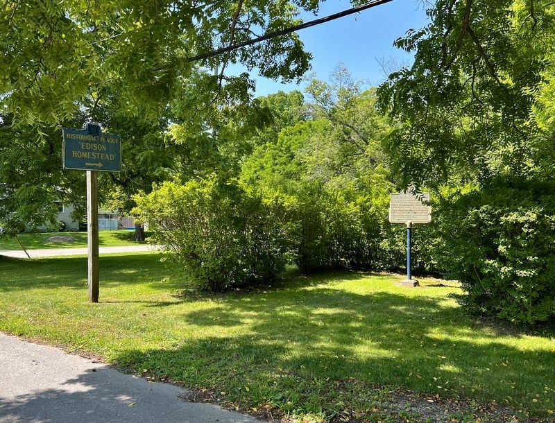
On Plank Road at Water Street, on the right when traveling south on Plank Road.
On this site stood the home of Samuel Edison, a Loyalist from New Jersey who had moved to Nova Scotia in 1783 and settled here in 1811. During the War of 1812 he served as a captain in the 1st Middlesex Militia. Tradition maintains that this . . . — — Map (db m283492) HM
On Lakeview Line (County Road 8) at Currie Road, on the right when traveling west on Lakeview Line (County Road 8).
Born and educated in Walllacetown, Sifton joined the 18th Battalion, Canadian Expeditionary Force, in October, 1914. During the Canadian attack on Vimy Ridge on April 9, 1917, his company was held up by the fire of a German machine gun. . . . — — Map (db m253504) HM
On Lakeview Line (County Road 8) 0.7 kilometers east of Currie Road, on the right when traveling west.
A fine example of early Gothic Revival-architecture, this
Anglican church lies in the midst of the original Talbot
Settlement. The nave was erected by the congregation in 1827.
The belfry and tower, added in 1845 to accommodate a bell
donated by . . . — — Map (db m253500) HM
On Dalhousie Street, on the left when traveling south.
This house, one of the finest remaining examples of domestic Georgian architecture in Ontario, was commenced in 1816 and completed about 1819, by Robert Reynolds, the commissary to the garrison at Fort Malden. Bellevue was also the home of his . . . — — Map (db m103677) HM
On Front Road South (County Route 20) south of Dalhousie Street, on the left when traveling south.
On January 9, 1838, a force of Canadians and Americans sympathizing with Mackenzie's rebellion, sailed from United States territory and landed on Bois Blane Island. The schooner "Anne," supporting the invasion, cruised along the Canadian mainland . . . — — Map (db m37246) HM
On Ramsay Street 0.1 kilometers north of Park Street, on the right when traveling north.
This church was built in 1818-19 on land donated by Col. William Caldwell. One of the earliest Anglican places of worship in western Upper Canada, it was constructed through the efforts of the Reverend Richard Pollard, an itinerant missionary . . . — — Map (db m300326) HM
On Front Road South (County Route 20) close to Dalhousie Street, on the left when traveling south.
Near this site stood the house erected in 1784 by Matthew Elliott. Born in Ireland, he emigrated to the American Colonies in 1761, and during the Revolution served with the British forces as a captain in the Indian Department. He was an Indian agent . . . — — Map (db m37286) HM
On Ramsay Street south of Gore Street, on the left when traveling south.
Born about 1750 in Fermanagh County, Ireland, Caldwell emigrated to Pennsylvania in 1773. During the American Revolution he served with the British forces as a captain in Butler's Rangers at Niagara and Detroit. In 1784 he obtained land near the . . . — — Map (db m37291) HM
On North Townline Road at South Riverview Street, on the left when traveling north on North Townline Road.
River Canard Bridge
Built in 1937 as part of the Ontario government's Depression-era public works program, the construction of this bridge was funded jointly by the Province and Essex County and provided essential unemployment . . . — — Map (db m300234) HM
On Front Street North (Provincial Highway 20) north of North Side Road, on the right when traveling south.
English:
Skirmishes at the Canard River
In the War of 1812, the first engagement in Canada involving British and American forces in significant numbers occurred here on the Canard River. On July 12, 1812, Brigadier-General . . . — — Map (db m34336) HM
On Dalhousie Street north of Richmond Street, on the right when traveling south.
Part of an ancient network of Indian paths, the Great Sauk Trail, as it came to be known, extended from Rock Island in present-day Illinois to the Detroit River. It played a significant role in the communications between the native peoples in the . . . — — Map (db m36976) HM
On Puce Road 0.6 kilometers south of County Road 42, on the left when traveling south.
First Baptist Church, Puce
The origins of First Baptist Church go back to the 1840s,
when black settlers from the United States began to form
a farming community in this area. Their numbers increased
during the 1850s when the . . . — — Map (db m299914) HM
On County Road 42 0.7 kilometers east of Puce Road, on the left when traveling east.
While the first Blacks arrived in the Puce River area during the 1830s, the community owed its existence largely to the Refugee Home Society. This abolitionist organization led by Henry and Mary Bibb offered support to escaped slaves who travelled . . . — — Map (db m299913) HM
On South Street (County Road 27) at St. Peter Street, on the left when traveling south on South Street (County Road 27).
The Founding of Belle River
The settlement of this area began following the survey in
1793 of the lots fronting on the Belle River. Among the early settlers were many French Canadians from the vicinity of the Detroit River. When . . . — — Map (db m299911) HM
On Olinda Side Road at Road 5 East, on the right when traveling south on Olinda Side Road.
Unitarian Universalist Church of Olinda. The Universalist faith developed in New England in the late 1700s and reached Canada in the early 1800s. Its central doctrine of universal salvation made it more liberal and inclusive than . . . — — Map (db m300505) HM
On Tecumseh Road 0.1 kilometers west of Comber Sideroad, on the right when traveling west.
The Foundation of Stoney Point
French-speaking settlers from the Detroit-Sandwich area and Lower Canada (Quebec) were the first to locate in Tilbury West Township after it was surveyed in 1824. They established farms along Lake . . . — — Map (db m299874) HM
On Laurier 0.3 kilometers Front Road, on the right when traveling west.
On the night of February 23-24, 1838, a small force of “Patriots" was ferried from Detroit to Fighting Island, opposite here, whence an attack against Sandwich was planned. They were joined the following day by "General” Donald McLeod, a British . . . — — Map (db m300223) HM
On Erie Street North 0.1 kilometers south of Wilkinson Drive, on the right when traveling south.
Parts of Mersea Township were surveyed in the 1790's, but it
was not until 1833 that Alexander Wilkinson, who had acquired land elsewhere in the township by 1810, obtained his patent for a lot now located in the heart of Leamington. A settlement . . . — — Map (db m300508) HM
On Banwell Rd 1.4 kilometers north of County Rd 42, on the left when traveling north.
Beginning in the 1830s, at least 30 families fleeing enslavement and racial oppression in the United States settled in the Banwell Road area in Sandwich East. They had the opportunity to purchase land through two Black-organized land settlement . . . — — Map (db m90183) HM
On Sandwich Street West just north of Brock Street, on the right when traveling north.
When the British withdrew from Detroit in 1796, they transferred the courts of the Western District to Sandwich (Windsor). An abandoned blockhouse, relocated from Chatham, served briefly as the court house and gaol until fire destroyed it in 1797. . . . — — Map (db m282917) HM
On 2072 Riverside Drive East west of Walker Road, on the left when traveling east.
On July 4, 1812, Brigadier-General William Hull, commander of the North Western Army of the United States, landed with about 2,000 men near this site. He issued a proclamation stating that he came here to liberate Canada from oppression. The British . . . — — Map (db m34302) HM
On Riverside Drive West at Huron Church Road, on the right when traveling south on Riverside Drive West.
In 1728 a mission to the Huron Indians was established near Fort Pontchartrain (Detroit) by Father Armand de la Richardie, S.J. The mission was moved to Bois Blane Island and the adjacent mainland in 1742. In 1747 it was destroyed by disaffected . . . — — Map (db m37386) HM
On Sandwich Street near Brock Street, on the left.
Following the cession of Detroit to the United States in 1794, and the withdrawal of the British garrison two years later, many residents moved to the Canadian side of the river where they founded the community of Sandwich. Early Anglican services . . . — — Map (db m278959) HM
On 254 Pitt Street West 0.2 kilometers east of Dougall Avenue, on the right when traveling west.
Early on December 4, 1838 a force of about 140 American and Canadian supporters of William Lyon MacKenzie crossed the river from Detroit and landed about one mile east of here. After capturing and burning a nearby militia barracks, they took . . . — — Map (db m37172) HM
On Viale Udine at Ouellette Ave, on the left when traveling east on Viale Udine.
The main line of “The Great Western”, from Niagara Falls through Hamilton and London to Windsor, was opened in 1854. The company extended its line from Hamilton to Toronto in 1855, from Komoka to Sarnia in 1858, and from Glencoe to Fort Erie (the . . . — — Map (db m100728) HM
On Sandwich Street south of Brock Street, on the left when traveling south.
Alexander Grant, son of the seventh Laird of Glenmoriston, was born in Inverness-shire, Scotland. During the Seven Years’ War, he served with Montgomery’s Highlanders, eventually commanding a sloop on Lake Champlain. In 1776, Grant became . . . — — Map (db m278958) HM
Shortly after the founding of Detroit in 1701 a village of Ottawa Indians was established on the south shore of the river in this vicinity and its inhabitants lived on friendly terms with the French garrison and settlers. However after the British . . . — — Map (db m36944) HM
On Sandwich Street north of Brock Street, on the left when traveling south.
The first professionally trained lawyer appointed a judge in what is now Ontario, Powell was born in Boston and educated abroad. He opened a legal practice in Montreal in 1779 and quickly gained a reputation as a brilliant advocate able to conduct . . . — — Map (db m278961) HM
On Ouellette Avenue at Viale Udine, on the right when traveling north on Ouellette Avenue.
Front - In English
Windsor is the oldest known site of continuous settlement in Ontario. The government of New France, anxious to increase its presence on the Detroit River, offered land agricultural settlement on the south shore in 1749. . . . — — Map (db m37343) HM
On Park Street East at Goyeau Street, on the right when traveling east on Park Street East.
The Catholic Coloured Mission of Windsor The first Roman Catholic mission for Blacks in Canada was established in Windsor in St. Parish in 1887 under the leadership of the Very Reverend Dean James Theodore Wagner. The "Catholic . . . — — Map (db m299975) HM
On Drouillard Road at Riverside Drive East, on the right when traveling north on Drouillard Road.
The Windsor Ford Strike of 1945
As wartime labour shortages eased in 1945, contract talks between Ford of Canada and the United Auto Workers in Windsor stalled. The 10,000 members of Local 200 went on strike on September 12 to win . . . — — Map (db m299974) HM
On Mill Street at Russel Street, on the left when traveling north on Mill Street.
The first member of Upper Canada's French community to
gain prominence in government circles, Baby was born in
British-controlled Detroit, the son of a well-established trader. He was educated in Quebec and, after returning to this area, . . . — — Map (db m300168) HM
On Peter Street south of Watkins Street, on the right when traveling south.
Sandwich First Baptist Church
Eleven freedom-seekers from the American South formed
the congregation of Sandwich First Baptist Church about
1840, calling themselves the Close Communion of Baptists.
It was one of three founding . . . — — Map (db m300172) HM
On Riverside Drive West 0.1 kilometers west of Bridgeman Avenue, on the left when traveling west.
Born in Montreal, Rankin moved to this province about 1830 and qualified as a deputy provincial surveyor in 1836. The next year he was commissioned as an ensign in the Queen's Light Infantry and captured the enemy's flag in the "Battle of Windsor . . . — — Map (db m300094) HM
On Sunset Avenue at University Avenue West, on the right when traveling south on Sunset Avenue.
The University of Windor
The University takes its origin from Assumption College (Roman Catholic) established here in 1857, and directed by the Congregation of St. Basil after 1870. From 1919 to 1953 it was affiliated with the . . . — — Map (db m300098) HM
On Frontenac Road at Ferguson Road, on the right when traveling south on Frontenac Road.
Surveyed in 1852-53 by Thomas Fraser Gibbs, Provincial Land Surveyor, this route was opened as part of a network of "colonization roads" planned by the government to encourage settlement in the southern region of the Precambrian Shield. Under the . . . — — Map (db m273701) HM
On Notre Dame Avenue (Regional Road 80) at Kathleen Street (Regional Road 58), on the left when traveling north on Notre Dame Avenue (Regional Road 80).
[English] The Society of Jesus opened a classical college at this site in 1913. The next year, the province granted Sacred Heart College a charter giving it degree-granting powers. At first, the college was . . . — — Map (db m254873) HM
On Beech Street at Durham Street (Regional Road 42), on the left when traveling east on Beech Street.
[Français] Important centre de l'église catholique du Nord-Est de l'Ontario, la mission de Sainte-Anne-des-Pins fut créée par les Jésuites en 1883. Une église en rondins, aujourd'hui le presbytère, servait d'école, . . . — — Map (db m261691) HM
On Minto Street just north of Brady Street (Regional Road 49), on the left when traveling north.
[English] The establishment of a Canadian Pacific Railway work camp here in 1883 stimulated the growth of a frontier community. Within a year a bustling settlement containing boarding houses, stores and a hospital . . . — — Map (db m255200) HM
Near Ramsey Lake Road (County Highway 39) just east of Paris Street (County Highway 80), on the left when traveling east.
[English] Austin Airways, a pioneering aviation firm, played a leading role in the economic development of the Ontario north in the mid-twentieth century. At first its main business was flying Toronto mining . . . — — Map (db m261300) HM
Near University Road 1.3 kilometers south of Ramsey Lake Road (Greater Sudbury Road 39).
[English] On petition of the University of Sudbury, the United Church of Canada and the Anglican Diocese of Algoma, supported by prominent citizens, this non-denominational, bilingual institution of higher learning . . . — — Map (db m261696) HM
On Manitou Road just south of University Road, on the right when traveling south.
[English] The Franco-Ontarian Flag was first raised at the University of Sudbury on September 25, 1975, at a time when Sudbury was experiencing unprecedented growth in Franco-Ontarian arts and culture. Conceived by . . . — — Map (db m261800) HM
Near Elizabeth Street just south of McNaughton Terrace, on the right when traveling south.
A ring of low hills, with Sudbury on the south rim, follows the outline of the “Sudbury Nickel Irruptive”, a unique and remarkably complex geological structure. The mines situated around the outer rim of this boat-shaped basin produce most of the . . . — — Map (db m261695) HM
On Toronto Sydenham Street (highway 10) at Crawford Street, on the right when traveling north on Toronto Sydenham Street (highway 10).
This outstanding suffragette, author and teacher was born south of Chatsworth, in 1873 and moved with her family to Manitoba in 1880. Ten years later she commenced her teaching career in Manitou, where she became an active member of the Women's . . . — — Map (db m311581) HM
On Garafraxa Street (Highway 6) 0.1 kilometers south of Sideroad 1, on the right when traveling south.
The northern terminus of this early "colonization road" was located near here at its junction with the "Garafraxa Road". In 1848 the government ordered Charles Rankin, P.L.S, to survey a road from Melancthon Township through the present counties of . . . — — Map (db m311577) HM
On 11th Avenue at 11th Street, on the right when traveling south on 11th Avenue.
Noah Brusso was born near Hanover in 1881. He took up professional boxing under the name of Tommy Burns, and although standing only 5 feet 7 inches and rarely heavier than 170 pounds, was a leading heavyweight. In 1906 by defeating Marvin Hart, he . . . — — Map (db m278310) HM
Born in Waterloo County, Daniel Knechtel came to Hanover
in 1864. Two years later, he began producing handcrafted
furniture and in 1874 opened a factory on this site. By
using local timber resources and applying the latest
techniques . . . — — Map (db m278306) HM
On 10th Street 0.1 kilometers east of 10th Avenue, on the right when traveling west.
The Founding of Hanover
A tavern established here about 1849 by Abraham Buck
provided the nucleus around which a small settlement began
to develop. Strategically located at the intersection of the
Durham Road and a branch of . . . — — Map (db m278247) HM
On Tom Thomson Lane, on the right when traveling south.
One of Canada's most distinguished painters, Thomson was born at Claremont, Ontario County but two months later moved with his parents to Leith where he lived until the age of twenty-one. After working in Toronto as a commercial artist until 1913, . . . — — Map (db m158761) HM
On Munsee Street North 0.2 kilometers north of Echo Street West, on the left when traveling north.
Following the American Revolution Sir Frederick Haldimand,
Governor-in-Chief of Canada, granted to the Six Nations of
the Iroquois a tract of land extending for six miles on both sides of the Grand River from its source to Lake Erie. This grant . . . — — Map (db m234947) HM
On Rainham Road (Haldimand Road 3) at Cheapside Road, on the left when traveling east on Rainham Road (Haldimand Road 3).
Wilson MacDonald, born here at Cheapside, established his
reputation as a poet with the publication, in 1926, of "Out
of the Wilderness", a collection of poems which received wide acclaim. This success followed many years of struggling
for . . . — — Map (db m254884) HM
On Main Street West at Church Street, on the left when traveling west on Main Street West.
The Founding of Dunnville
The construction of a dam and canal designed to feed water
from the Grand River to the new Welland Canal fostered the
development of a settlement here during the late 1820s. A
town plot, named Dunnville . . . — — Map (db m255042) HM
On Port Maitland Road 0.1 kilometers south of Dover Street, on the left when traveling south.
In 1815 the Royal Navy began building a depot on the
present site of Port Maitland. Though intended in the event of war to accommodate three frigates and 1,000 men, the base actually supported only the four schooners which then made up the . . . — — Map (db m231010) HM
On Port Maitland Road 3.9 kilometers east of Rainham Road (Haldimand Road 3), on the right when traveling east.
With the outbreak of hostilities in 1939, one of Canada's
major responsibilities was to provide air training facilities far removed from the theatre of war and so on December 17, 1939, the British Commonwealth Air Training Plan was inaugurated. The . . . — — Map (db m254917) HM
On Nelles Road (County Road 9) 0.1 kilometers east of Front Street North (Haldimand Highway 54), on the left when traveling east.
After receiving lands on the Grand River in 1784, the Six
Nations Indians invited Captain Hendrick Nelles, a Loyalist from the Mohawk Valley, to settle there with five of his sons. He and Robert, the eldest, established farms in what is new . . . — — Map (db m234914) HM
On Main Street North (Highway 70 at River Street, on the right when traveling north on Main Street North (Highway 70.
Methodist preachers Ezra and Zenas Adams and their brother
Rufus settled on the west branch of the Credit River in the
1820s. A community of pioneer families grew around the Adams
family farms. Nicklin's saw and grist mill and Nelles' . . . — — Map (db m280981) HM
On Lakeshore Road 0.4 kilometers west of Brant Street, on the right when traveling west.
St Luke's Church was built in 1834 on land originally patented by Chief Joseph Brant. Consecrated in 1838 by the Right Reverend C. J. Mountain, Anglican Bishop of Quebec, the church was a simple two-storey, frame building, with tower plain Gothic . . . — — Map (db m233233) HM
On Lakeshore Road at North Shore Boulevard East, on the right when traveling south on Lakeshore Road.
The original house on this site was built about 1800 by the famous Mohawk chief Joseph Brant (Thayendanegea). Two years previously Captain Brant had been granted some 3500 acres of land in this area for his military services to the Crown during . . . — — Map (db m233215) HM
On Brant Street at Ontario Street, on the right when traveling south on Brant Street.
In 1798 Joseph Brant, the celebrated Mohawk War Chief, was given a Crown grant of 3,450 acres in this area. James Gage purchased land from the Brant Tract in 1810, and laid out a town site at the northern end of Burlington Beach from Brant Street . . . — — Map (db m221366) HM
On Tuck Drive 0.1 kilometers north of Spruve Avenue, on the right when traveling north.
At the 1954 Royal Agricultural Winter Fair in Toronto,
William E. Breckon of Burlington won the World Wheat
Championship with grain grown on his Nelson Township farm
about two miles north-east of here. He led the white winter
wheat class seven . . . — — Map (db m243606) HM
Near North Shore Boulevard at Las Salle Park Boulevard.
LA SALLE AT THE HEAD OF THE LAKE
In 1669 René-Robert Cavelier de La Salle, intent on reaching the Ohio River in order "not to leave to another the honour of finding the way to the Southern Sea, and thereby the route to China”, set out on . . . — — Map (db m221304) HM
On Church Street at Market Street, on the right when traveling east on Church Street.
Founding of Georgetown
After British officials acquired a block of land from the Mississaugas in 1818, the initial survey of Esquesing Township was undertaken in 1819. A township surveyor, Charles Kennedy, and several of his . . . — — Map (db m281194) HM
Near Main Street South south of Maple Avenue (Ontario Route 11), on the right when traveling north.
The Armenian Boys’ Farm Home, Georgetown
On July 1, 1923, a group of 50 Armenian boys arrived at this farm site from an orphanage in Corfu, Greece. The 'Georgetown Boys,' as they came to be known, arrived in Canada between 1923 and . . . — — Map (db m281556) HM
On Bronte Street North 0.3 kilometers north of Victoria Street, on the right when traveling north.
The first firm in the world to produce socket-head screws, the P. L. Robertson Manufacturing Company was formed in Hamilton in 1907 and relocated here the following year. It was established by an Ontario inventor Peter Lymburner Robertson . . . — — Map (db m282053) HM
On Guelph Line 2.5 kilometers north of 25 Sideroad, on the right when traveling north.
Electric railway service on routes radiating from Toronto began
in 1889. Within 20 years, the Toronto and York Radial Railway
Company operated lines north on Yonge Street to Sutton, with
a branch to Schomberg; from the east end of Toronto to . . . — — Map (db m280886) HM
On Navy Street 0.1 kilometers south of King Street, on the left when traveling south.
The founder of Oakville was born in Nova Scotia of
Loyalist parents who moved to Burlington Bay in 1793.
William served with distinction in the militia during the
War of 1812. He settled in Nelson Township in 1816 and
became a successful . . . — — Map (db m237075) HM
On Sheridan College Drive 0.4 kilometers west of Trafalgar Road, on the right when traveling west.
Verner was born at Sheridan, Halton County, and educated at
Guelph. In 1856 he went to England to study art. Returning
to Toronto he established his first studio in 1862. Like his
older contemporary, Paul Kane, Verner travelled through the
West, . . . — — Map (db m305353) HM
On Wilson Street East 0.1 kilometers east of Sulphur Springs Road, on the right when traveling west.
During the War of 1812 marauding bands of renegade settlers, many of whom had defected to the United States from the Niagara and London Districts, were active in southwestern Upper Canada. A number were captured and in May, 1814, nineteen . . . — — Map (db m220198) HM
On Wilson Street East 0.1 kilometers west of Sulphur Springs Road, on the right when traveling east.
In 1791 James Wilson in partnership with Richard Beasley built a sawmill and a grist-mill on the site of this community. The mills were sold to Jean Baptiste Rousseaux (known as St. John) in 1794 and developed into a thriving pioneer enterprise. . . . — — Map (db m220193) HM
On James Street North 0.1 kilometers north of Cannon Street East, on the right when traveling north.
"Jock" Rennie was awarded the George
Cross posthumously in May 1944 for an
instinctive, selfless act of heroism. Born
in Aberdeen, Scotland, he came to
Ontario with his family as a child and
grew up in Kirchener. Rennie . . . — — Map (db m233165) HM
On James Street North 0.3 kilometers north of Cannon Street East, on the right when traveling north.
CHRIST'S CHURCH CATHEDRAL
An important ecclesiastical centre for the Niagara Peninsula, Christ's Church was erected in stages, its form altered as the size and prominence of the congregation increased. Begun in 1835 as a parish church, . . . — — Map (db m218769) HM
On Main Street East (Highway 8) 0.2 kilometers east of James South and Main East, on the right when traveling east.
Born at Queenston, George Hamilton was the son of a prosperous merchant, the Hon. Robert Hamilton. He followed his father's career as a merchant in the Niagara District until the War of 1812, in which he served as a Captain of Light Dragoons. . . . — — Map (db m218241) HM
On James Street North 0.1 kilometers north of Cannon Street East, on the right when traveling north.
Lieutenant Charles Davidson Dunbar, D.C.M.
1870-1939
An internationally renowned piper, Dunbar was born in
Halkirk, Scotland. In 1886 he joined the British army,
embarking upon a distinguished career as a military
piper. . . . — — Map (db m233560) HM
On Palmer Road at Reno Avenue, on the left when traveling south on Palmer Road.
Born in Ireland, Kerr came to Canada in 1887 with his parents who settled in Hamilton two years later. He earned civic recognition at the 1902 Coronation Games where he won sprint and middle distance races. His exceptionally quick start placed . . . — — Map (db m223839) HM
On Sheaffe Street at Park Street North, on the right when traveling east on Sheaffe Street.
ST. MARY'S PRO-CATHEDRAL
One of the few Roman Catholic churches in Ontario retaining its pre-Confederation character, St. Mary's was erected in 1859-60 during the episcopate of Bishop John Farrell to replace a building destroyed by . . . — — Map (db m218828) HM
On Concession Street 0.2 kilometers west of Upper Wellington Street, on the right when traveling west.
THE NIAGARA ESCARPMENT
Hamilton Mountain is part of the Niagara
Escarpment, a height of land extending 725
km across Ontario from Niagara Falls to
Manitoulin Island. Over 450 million years
ago, a tropical sea covered most of . . . — — Map (db m219256) HM
On Governor’s Road at Ogilvie Street when traveling west on Governor’s Road.
By 1799 the Morden family had a sawmill near this site on Spencer Creek north of Dundas Street. They sold this property in 1800 to Edward Peer who built a grist-mill about 300 yards south-east, close to Dundas Street, and adopted the name "Dundas . . . — — Map (db m284011) HM
On East Street at Cootes Drive, on the right when traveling north on East Street.
In pioneer days waterways provided the essential means
of transportation. Dundas, located at the head of navigation on Lake Ontario and the eastern terminus of the Governor's Road", was thus in a favoured position. However, in 1823 the . . . — — Map (db m219998) HM
On Main Street at Dundas Street (County Road 99), on the left when traveling north on Main Street.
Dundas was incorporated as a town in 1847 by a special Act of the legislature of the Province of Canada. The following year the town council accepted a tender from a local builder, James Scott, to erect a stone town hall and voted £2000 to cover the . . . — — Map (db m196237) HM
On East Street at Cootes Drive, on the right when traveling north on East Street.
THE FOUNDING OF DUNDAS
In 1793 Lieutenant-Governor Simcoe authorized a townplot in this vicinity at the then eastern terminus of Dundas Street. Its original name, "Coote's Paradise", was derived from that of the adjoining marsh, a haunt of . . . — — Map (db m219992) HM
On Crook’s Hollow Road 1.5 kilometers west of Brock Road, on the right when traveling west.
The province's first paper mill began operations in 1826.
Situated about 150 yards downstream from here, it was owned by James Crooks (1778-1860), one of Upper Canada's most successful entrepreneurs. On four hundred acres of land purchased here . . . — — Map (db m223079) HM
On York Boulevard 1 kilometer east of Plains Road West, on the right when traveling west.
Over a 30-year career, Hamilton lawyer and politician Thomas Baker McQuesten presided over a remarkable array of public works and beautification projects. Starting in his hometown of Hamilton, McQuesten led multiple park development . . . — — Map (db m259273) HM
On York Boulevard north of Dundurn Street North, on the right when traveling north.
On the morning of September 28, 1813, a powerfully-armed United States fleet comprising ten ships under the command of Commodore Isaac Chauncey appeared off York (Toronto). The smaller British fleet of six vessels, commanded by Commodore Sir James . . . — — Map (db m56759) HM
On Charlton Ave. West at Caroline Street South, on the left when traveling west on Charlton Ave. West.
Erected to serve a thriving congregation established in 1841, Central Presbyterian Church was built in 1907-08 after an earlier building was destroyed by fire. It is reputedly the only church designed by renowned architect John M. Lyle, . . . — — Map (db m284010) HM
On Hunter Street West at Bay Street South, on the left when traveling west on Hunter Street West.
This school, built to accommodate 1,000 students, was the largest graded school in Upper Canada, and became the only public school in Hamilton, at the time of its opening in 1853. Among the earliest examples of an institution inspired by the . . . — — Map (db m220407) HM
On James Street South at Jackson Street West, on the right when traveling south on James Street South.
Begun in 1854 and completed three years later, this Presbyterian church was designed in the Gothic Revival style by architect William Thomas. The elegant eighty-foot spire set atop a hundred-foot tower marks the building as an outstanding example . . . — — Map (db m221813) HM
On Jackson Street West at MacNab Street South, on the left when traveling west on Jackson Street West.
This stately mansion is a finely crafted and well preserved
example of Hamilton's early stone architecture. Built no
later than 1850 for city clerk and attorney Richard Duggan, it was purchased in 1852 by Calvin McQuesten, M. D. (1801-85), a . . . — — Map (db m221805) HM
On Eastport Drive 0.5 kilometers north of Beach Boulevard, on the left when traveling north.
BURLINGTON BAY CANAL
The first public work undertaken with the financial backing of the provincial government, Burlington Bay Canal was
proposed as one of a series of waterways to provide uninterrupted navigation from Lake Erie to the . . . — — Map (db m222843) HM
The Honourable William McMaster (1811-1887), a
prominent banker and member of the first Senate of Canada, bequeathed funds which enabled Baptists of Ontario and Quebec to found this university. Incorporated in 1887, it was the culmination of . . . — — Map (db m219428) HM
On Airport Road West 1.2 kilometers west of Upper James Street, on the right when traveling west.
Canada's first licensed woman pilot, Eileen Vollick was born in Wiarton and came to Hamilton about 1911. She was fascinated by aviation and in 1927 enrolled in the flying school established near her home on Hamilton Bay by Jack V Elliot, a . . . — — Map (db m228685) HM
On Burlington Street West at MacNab Street North, on the right when traveling west on Burlington Street West.
The Burlington Glass Works, formerly situated here, was one of the most important 19th century glass houses in Canada in terms of the variety and quality of its production. From 1874 to about 1897 skilled artisans produced lamps, tablewares and . . . — — Map (db m220301) HM
On Arcade Crescent at Claremont Drive, on the right when traveling north on Arcade Crescent.
This gate lodge was built for the Hon. Isaac Buchanan (1810-1883) who was born in Glasgow. He emigrated to Toronto in 1830, became a successful wholesale merchant, represented Toronto in the first Legislative Assembly of the Province of Canada, . . . — — Map (db m219592) HM
On Mountain Park Avenue at Upper Wentworth Street, on the right when traveling west on Mountain Park Avenue.
Comedian, actor and theatrical manager, George Summers
established the Mountain Park Theatre here in 1902. It
was one of the earliest theatres of its kind in Ontario. For
twelve successful seasons, "Geo. H. Summers . . . — — Map (db m246517) HM
Near King Street West east of Centennial Parkway South.
On June 5, 1813, an invading United States army of about 3,000 men, commanded by Brigadier - General John Chandler, camped in this vicinity. That evening some 700 British regulars of the 8th and 49th Regiments, under the command of Lieutenant - . . . — — Map (db m56720) HM
On Ridge Road 0.4 kilometers east of Third Road East, on the right when traveling east.
The worlds first Women's Institute was organized at Squire's Hall, Stoney Creek, in 1897. Erland Lee, a founder of the Farmers Institute, assisted by his wife, arranged the meeting.
About 100 women from the Saltfleet Township district attended and . . . — — Map (db m299188) HM
On York Boulevard just north of Dundurn Street North, on the right when traveling north.
This mansion was built 1832-35 by Allan Napier MacNab (1798-1862) and named after the family ancestral seat in Scotland. Enlisting at fifteen, MacNab distinguished himself by his bravery in the War of 1812. He subsequently entered politics and was . . . — — Map (db m66129) HM
On York Boulevard north of Dundurn Street North, on the right when traveling north.
From these heights, Lieutenant-Colonel John Harvey set out with about 700 men on the night of June 5, 1813, to launch a surprise attack on an invading United States force of some 3,000 men camped at Stoney Creek. His rout of the troops commanded by . . . — — Map (db m56743) HM
On King Street West at Locke Street North, on the right when traveling west on King Street West.
In the mid-nineteenth century industrial workers laboured ten to twelve hours a day, six days a week. Inspired by British and American examples, Hamilton unionists launched a crusade for a shorter workday in January of 1872. The workingman, they . . . — — Map (db m220361) HM
On Hamilton Street North at White Oak Drive on Hamilton Street North.
Born near Waterdown, Ontario, Leo Clarke moved to Winnipeg
in 1903. He enlisted with the 27th Battalion, C. E. F. in
February 1915 and transferred to the 2nd Canadian Battalion later that year. On September 9, 1916, on the Somme battlefront, . . . — — Map (db m243636) HM
On Church Street 0.2 kilometers north of Victoria Avenue, on the right when traveling north.
[English] A commanding figure in Canadian Methodism during the late 19th and early 20th centuries, Carman was born in Iroquois and educated at Victoria College, Cobourg. He worked briefly as a teacher and was then . . . — — Map (db m255699) HM
790 entries matched your criteria. Entries 101 through 200 are listed above. ⊲ Previous 100 — Next 100 ⊳