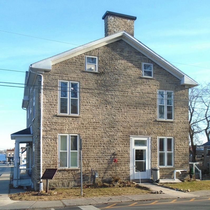
788 entries match your criteria. Entries 401 through 500 are listed.⊲ Previous 100 — Next 100 ⊳
Canada, Historic Sites and Monuments Board Historical Markers
Mandated to advise the Government of Canada, through the Minister of the Environment, on the commemoration of nationally significant aspects of Canada's history, the Board authorizes Parks Canada to install plaques inscribed with a bilingual text describing the historic significance of the subject. They are sometimes also written in a third language, particularly when the commemorated subject is linked to the history of Aboriginal peoples or ethnocultural communities.
On Edwards Street South at Dibble Street West, on the right when traveling south on Edwards Street South.
English:
Born at Prescott, Scott was admitted to the bar in 1848 and practiced law in Ottawa. As a member of the legislature of United Canada (1857-63) he sponsored the Separate School Act of 1863. Subsequently, he represented Ottawa in . . . — — Map (db m83364) HM
On Windmill Road close to Leeds and Grenville Road (County Route 2), on the right when traveling east.
English: After the 1837 Rebellions many rebels fled to the United States where a few joined American sympathizers in a new attempt to overthrow British rule in Canada. On 12 November 1838 they landed 190 men here and seized this windmill and . . . — — Map (db m83433) HM
On Loyalist Parkway (Provincial Highway 33), on the right when traveling east.
English: In the early 1800's Kingston was a shipbuilding centre of note. The FRONTENAC, the first steamship to navigate Lake Ontario, was built here at Finkle's Point, Ernestown (now Bath), and launched September 7, 1816. Designed to carry . . . — — Map (db m83645) HM
On South Shore Road 2.5 kilometers Hastings County Road 18, on the right when traveling east.
Old Hay Bay Church
This simple church, built in 1792 by United Empire Loyalists, recalls the early days of Upper Canadian
settlement. The Methodists’ evangelical zeal was expressed not only in religious practice but also in their . . . — — Map (db m308110) HM
On Longwoods Road (Provincial Highway 2) close to Pratt Siding Road, on the right when traveling east.
English
Here was fought the Battle of Longwoods, 4th March, 1814. United States troops were entrenched on this hill. The British losses were Captain D. Johnson and Lieutenant P. Graeme and twelve men of the Royal Scots Light Company and . . . — — Map (db m78370) HM
On Longwoods Road 1.2 kilometers east of Taits Road, on the right when traveling east.
Born near Appin Upper Canada, McArthur attended the University of Toronto and worked briefly for the Toronto Mail before moving to New York in 1890. In 1896 he became editor of Truth and as such encouraged both Canadian and . . . — — Map (db m274125) HM
On Adelaide Street at Queens Avenue, on the right when traveling north on Adelaide Street.
Here, in the early morning hours of October 31, 1920, Dr. Frederick Banting conceived an idea for research that led to the discovery of insulin. He believed that diabetes, then a fatal disease, could be treated by a substance extracted from a dog's . . . — — Map (db m18975) HM
On Ridout Street North at Dundas Street, on the left when traveling north on Ridout Street North.
[English Translation]
Erected in 1830, this building was modelled after Malahide Castle, near Dublin, Ireland, the ancestral home of Colonel Thomas Talbot, founder of the Talbot Settlement. The site was a part of the town plot set aside . . . — — Map (db m18962) HM
On Ridout Street North, on the right when traveling south.
This streetscape includes several of London's earliest buildings and provides a capsule view of the appearance of mid-19th century Ontario cities. These buildings, the earliest of which was begun in 1835, include residential, industrial and . . . — — Map (db m18972) HM
Born in London, Ontario, Peel became one of the most prominent Canadian painters of the French academic school of painting and among the first to gain an international reputation. He studied art in Philadelphia, London, England, and . . . — — Map (db m285113) HM
Cobalt Teletherapy Unity
In 1951 Canadian scientists, here and in Saskatoon, opened a new front in the battle against cancer. Through a pioneering partnership, the two teams of physicists, physicians and engineers, working . . . — — Map (db m296470) HM
On Lakeshore Road south of Dominion Road, on the right when traveling south.
On the night of 12 August 1814, as a prelude to a British attack on Fort Erie, an expedition was mounted against three armed American schooners anchored off the fort. Captain Alexander Dobbs, R.N., embarked with 70 seamen and marines in six batteaux . . . — — Map (db m48913) HM
Near Lakeshore Road south of Dominion Road, on the right when traveling south.
Three fortifications occupied this site. The first (1764-1779) and second (c. 1783-1803), located at lower levels, were abandoned when ice and water inundated the works. The third Fort Erie, built between 1805 and 1808, was repaired in January 1814 . . . — — Map (db m48912) HM
On Niagara Parkway north of Anger Avenue, on the left when traveling south.
In an effort to regain the initiative lost at Queenston, the Americans planned a general invasion for 28 November 1812. Before dawn advance parties crossed the Niagara River to cut communications between Fort Erie and Chippawa and to . . . — — Map (db m279097) HM
Point Abino Lighthouse
This proud beacon overlooking Lake Erie is a rare
example of a reinforced concrete lighthouse built in
a late neoclassical style. It was constructed in
1917-1918, and was in use for almost . . . — — Map (db m281810) HM
On Garrison Road (Highway 3) 0.3 kilometers east of Ridge Road, on the left when traveling east.
Ridgeway Battlefield
Pro Patria
In abiding memory of the officers and men of the Queens Own Rifles, 13th Hamilton Battalion, Caledonia
and York Rifle Companies of Haldimand who fought here in defence of their country against . . . — — Map (db m281913) HM WM
On Elizabeth Street just north of Lakeside Drive, on the left when traveling north.
Here at the Forty Mile Creek, on 8th June, 1813, American forces, retreating after the Battle of Stoney Creek, were bombarded by a British flotilla under Sir James Lucas Yeo.
Indians and groups of the 4th and 5th Regiments Lincoln . . . — — Map (db m282940) HM
On Mountain Street at Beam Street, on the right when traveling south on Mountain Street.
Born at Beamsville and educated at Victoria College and the University of Toronto, Locke taught at Toronto, Chicago and Harvard Universities and was Dean of Education at Chicago and at MacDonald College before becoming Chief Librarian of . . . — — Map (db m284017) HM
Near Lundy's Lane at Hanan Avenue, on the right when traveling east.
This was the site of the bloodiest battle of the War of 1812. On the afternoon of 25th July, 1814, Lieutenant-General Gordon Drummond with about 2800 men engaged the invading American army which had recently been victorious at Chippawa. . . . — — Map (db m279198) HM
On Portage Road at Stamford Green Drive, on the left when traveling north on Portage Road.
Following the cession of the east bank of the Niagara River to the United States in 1783, the British authorities felt compelled to transfer the portage road around Niagara Falls to the west bank of the river. Opened in 1789 by a . . . — — Map (db m283072) HM
Near 14004 Niagara River Pkwy, on the right when traveling south.
Queenston-Chippawa Hydro-Electric Development
This generating station, built between 1917 and 1922, was considered the world's first true hydroelectric megaproject. Its massive scale requires the use of construction equipment, . . . — — Map (db m277609) HM
On Peer Street at Grey Avenue, on the right when traveling east on Peer Street.
R. Nathaniel Dett Chapel, British Methodist Episcopal Church
An important community icon, this chapel bears witness to
the early black settlement of the Niagara region and marks
the role of the church in assisting newly . . . — — Map (db m279181) HM
On Lundy's Lane 0.03 kilometers south of Hanan Avenue, on the right when traveling east.
[Front Side of Monument]:
Erected by the
Canadian Parliament
in honour of the victory
gained by the
British & Canadian Forces
on this field on the
25th day of July, 1814
and in grateful remembrance . . . — — Map (db m49790) WM
On Niagara Parkway, on the right when traveling north.
Opened in 1906 to supply the Toronto market, this generating station was the first wholly Canadian-owned hydro-electric facility at Niagara Falls. Engineers adapted advanced European and American technologies to a difficult site in a . . . — — Map (db m283692) HM
On Niagara River Parkway north of Willick Road, on the left when traveling south.
The British used Navy Island from 1761 to 1764 as a shipyard in which to build the first British decked vessels to sail the upper lakes. These were essential in maintaining the supply lines westward during Pontiac's uprising, 1763-4. Thereafter the . . . — — Map (db m49052) HM
On Niagara River Parkway north of Edgworth Road, on the right when traveling south.
Here, on 5 July 1814, an American army under Major-General Jacob Brown launched the last major invasion of Canada during the War of 1812. The Americans defeated a British and Canadian force commanded by Major-General Phineas Riall consisting of . . . — — Map (db m49050) HM
On Butler Street west of John Street West when traveling west.
On the 8th of July, 1813, an outpost of the invading force, encamped near Fort George, was defeated by a band of Six Nations and Western Indians led by Chiefs John Norton and Blackbird and interpreters Michel Brisebois, Louis Langlade and Barnet . . . — — Map (db m48747) HM
Butler's Barracks
Named after Colonel John Butler, a hero
of the Revolutionary War, this complex
was an integral component of the military
facilities built in the Niagara region to
replace those destroyed during the War
of . . . — — Map (db m283247) HM
On Byron Street at Melville Street, on the right when traveling west on Byron Street.
In 1777 John Butler of New York raised a force of Rangers who, with their Iroquois allies, raided the frontiers of New York, Pennsylvania and New Jersey throughout the American Revolutionary War. From their base at Fort Niagara they . . . — — Map (db m283075) HM
Near King Street north of Picton St, on the right when traveling north.
The first session of the Legislative Assembly held at Newark (Niagara-on-the-Lake) from 17 September to 15 October 1792, introduced a limited form of representative government to the newly created colony of Upper Canada. The . . . — — Map (db m283803) HM
Constructed by order of Lieutenant-Governor Simcoe 1796-99, Fort George served as the headquarters for Major-General Brock in 1812. In May, 1813, it was bombarded and captured by the Americans who constructed fortifications of their own on the site. . . . — — Map (db m48743) HM
Near Simcoe Street north of Front Street, on the left when traveling east. Reported missing.
This tower and earthwork are all that survive of the barracks, guardroom, and cells of Fort Mississauga. Built between 1814 and 1816 to replace Fort George as the counterpoise to the American Fort Niagara immediately opposite, it was . . . — — Map (db m278808) HM
On Ricardo Street 0.3 kilometers south of Nelson Street, on the right when traveling north.
Simcoe was born in Northamptonshire and educated at Oxford. He joined the British army in 1771, and from 1777-81 commanded the Queen's Rangers, a Loyalist corps in America. After the Loyalist influx had led to the creation of a . . . — — Map (db m283081) HM
On Queen Street at King Street, on the right when traveling south on Queen Street.
Acquired by the Ontario Heritage Foundation in 1969, the Niagara Apothecary is a fine example of a Confederation era commercial establishment and pharmacy. Although the building probably dates to the 1820's. It was extensively renovated in 1866 when . . . — — Map (db m24609) HM
On Queen Street 0.08 kilometers east of Regent Street, on the right when traveling east.
[English] This is the third and only surviving court house erected for the former Niagara District. Constructed between 1846 and 1848, it was designed by the prominent Toronto architect, William Thomas, in the fashionable . . . — — Map (db m282936) HM
On Castlereagh Street just west of Davy Street, on the right when traveling west.
To obtain land on which to settle Loyalists and dispossessed members of the Six Nations of the Iroquois, Guy Johnson in May 1781 and John Butler in May 1784 negotiated treaties with representatives of the Mississauga and Chippewa of . . . — — Map (db m283089) HM
On Queen Street, on the right when traveling east.
Niagara-on-the-Lake Historical District
In 1778, Loyalist refugees began crossing from Fort Niagara to settle the west bank of the Niagara River. A town was laid out in a grid pattern of four-acre blocks and grew quickly, gaining . . . — — Map (db m282930) HM
The first lighthouse on the Great Lakes was built of stone at Point Mississauga in 1804 by John Symington, under orders from Lieutenant-Governor Peter Hunter. Demolished in 1814 to make room for this fort, its materials with debris from . . . — — Map (db m278810) HM
On Queen Street north of Newark Street, on the right when traveling north.
On the 25th May, 1813, the American Fleet and the Batteries at Fort Niagara across the river began a devastating two-day bombardment of Fort George. On the 27th a large American force was landed and after a brief engagement in which his outnumbered . . . — — Map (db m48628) HM
The Scouting Movement In Canada
Brought to Canada in 1908, the Scout
Movement, originally known as the Boy
Scouts, became one of the largest and
most influential youth organizations
in the country, its membership
reaching more . . . — — Map (db m274536) HM
On Mississagua Street just north of John Street West, on the right when traveling north.
Inspired by the abolitionist sentiment emerging in the late 18th century, Lieutenant-Governor J.G. Simcoe made Upper Canada the first British territory to legislate against slavery, which had defined the conditions of life for most . . . — — Map (db m283087) HM
On Niagara Parkway north of Line 8 Road, on the right when traveling north.
Manned by Captain Samuel Hatt's 5th Lincoln (Militia) Regiment and a small party of the Lincoln Militia Artillery under Lieutenant John Ball, and consisting of one 24-pounder cannon mounted within a crescent-shaped earthwork, this Battery was . . . — — Map (db m48750) HM
On Queen Street 0.05 kilometers north of King Street.
In English:
Born in England, Kirby came to Canada in 1839 and began work as a tanner in the vicinity of Niagara-on-the-Lake. There he developed his literary talents and soon after moving into the town in 1848 embarked on a long and . . . — — Map (db m34915) HM
This small redoubt, or square fortification, and the U-shaped advance battery, named in honour of Sir Gordon Drummond, were built in the late spring of 1814 to defend the main portage road from Chippawa to Queenston. The earthworks . . . — — Map (db m282939) HM
Near Niagara Parkway, on the left when traveling north.
[Front side of Monument]:
This monument has been
erected by the
Government of Canada,
to
Laura Ingersoll Secord
who saved her husband's life
in the battle on these heights,
October 13th. 1812,
and . . . — — Map (db m283090) HM
Black Militia Units In Upper Canada, 1812-1850
Through their service in the militia,
Upper Canadians of African descent
showed their determination to share
in the duties and rights of British
subjects. During the War of . . . — — Map (db m277496) HM
On Niagara River Parkway, on the right when traveling south.
In March 1793 Chloe Cooley, an enslaved
woman of African descent living in
Queenston, was violently seized, bound,
and transported against her will across the
Niagara River to be sold in New York State.
She screamed and resisted . . . — — Map (db m277492) HM
On Queenston Street at Partition Street on Queenston Street.
The celebrated heroine of the war of 1812 is a renowned figure in Canadian History. Determined to warn the British of an impending attack on Beaver Dams, Secord set out from her home on June 22, 1813, on a dangerous mission. She traveled . . . — — Map (db m282093) HM
Near Niagara River Parkway, on the left when traveling north.
This British officer, “the hero of Upper Canada,” led the successful defense of the province early in the War of 1812. Appointed commander of military forces in 1810, he organized the militia and prepared the colony for possible war . . . — — Map (db m283870) HM
In the early morning of 13 October 1812, American troops under Major-General Stephen Van Rensellaer crossed the Niagara River and took possession of Queenston Heights. Major-General Isaac Brock hurried from Fort George to lead a small force against . . . — — Map (db m48908) HM
Near Niagara River Parkway at Dee Road, on the right when traveling north.
Named after the magnificent willow
trees that once graced its grounds,
Willowbank is an elegant example of the
great rural estates of early 19th-century
Upper Canada. Built for local businessman
Alexander Hamilton between 1834 . . . — — Map (db m277488) HM
Near Welland Canals Parkway north of Rockwood Avenue, on the right when traveling north.
Born of a Loyalist family in the State of New York, Merritt became a pioneer merchant and industrialist on Upper Canada's Niagara frontier. In 1818 he began to promote construction of the Welland Canal, of which he became the first . . . — — Map (db m283516) HM
On Geneva Street just north of North Street, on the right when traveling north.
Born on a Maryland plantation, Harriet Tubman escaped slavery to become one of the great heroes of the 19th century. The most famous "conductor" on the Underground Railroad, she courageously led many of the people she rescued from . . . — — Map (db m281284) HM
On Geneva Street just north of North Street, on the right when traveling north.
Salem Chapel, built in 1855, was an important centre of 19th-century abolitionist and civil rights activity in Canada. Harriet Tubman, the famous Underground Railroad "conductor", lived near here from 1851 to 1858 and is . . . — — Map (db m281304) HM
Near Sullivan Avenue south of Towpath Road, on the right when traveling east.
Following their repulse at Stoney Creek the Americans sent a force from Fort George to destroy a British advanced post at Beaver Dams. Warned of their approach by an Indian scout and by Laura Secord, a force of Indians from Caughnawaga . . . — — Map (db m276498) HM
On Chapel Street South near Service Road West, on the right when traveling north.
Construction of the Welland Canals
The Welland Canals have long provided an important navigation link between Lake
Ontario and Lake Erie, which helped foster the growth of trade, industry, and cities around the Great Lakes. . . . — — Map (db m284320) HM
On Lyons Creek Road at Matthews Road, on the right when traveling west on Lyons Creek Road.
In October 1814 an American army advanced from Fort Erie toward the British line along the Chippawa River. Lieutenant-General Drummond ordered a reconnaissance towards Cook's Mills on his right flank in hopes of finding the Americans . . . — — Map (db m282938) HM
On East Main Street (Niagara Road 27) at Cross Street, on the right when traveling west on East Main Street (Niagara Road 27).
Born in Bertie Township, Cruikshank worked as a journalist and translator before being commissioned in the 44th Welland Battalion in 1871. Rising to the rank of Brigadier-General in 1915, he commanded Military District 13 before becoming . . . — — Map (db m284454) HM
On Water Street at Main Street (County Highway 533), on the right when traveling north on Water Street.
When west-bound voyageurs left the Ottawa here at Mattawa, "the forks," they faced 11 portages in the next 40 miles. The Mattawa, or Petite-Rivière, was a key link in the historic canoe route between Montréal and the upper Great Lakes and . . . — — Map (db m105631) HM
Established in 1893, Algonquin was the first provincial park in Canada and the forerunner of Ontario’s extensive park system. Many methods now used across Canada to administer multi-purpose parks and explain nature to the public were developed . . . — — Map (db m59998) HM
On Mill lane 0.1 kilometers south of Front Road, on the left when traveling south.
Normandale Blast Furnace
One of Upper Canada's most important industrial
enterprises, the Normandale ironworks and its blast furnace played a significant role in the early economic
development of the province. Built in . . . — — Map (db m234325) HM
On Old Hill Road 0.2 kilometers south of Front Road, on the left when traveling south.
As early as 1798, Lieutenant Governor Simcoe planned to fortify this point. By 1813 nothing had yet been done, and following Procter’s retreat from Amherstburg the British decided to construct a navy yard and covering fort here. . . . — — Map (db m258149) HM
On Brown Street 0.1 kilometers west of John Street, on the right when traveling west.
Near this spot, March 23rd,
1670, was erected a cross with
arms of France and inscription claiming sovereignty in
the name of King Louis XIV
over the Lake Erie region, as
shown in procès-verbal reproduced on this memorial
placed . . . — — Map (db m236355) HM
On Donjon Boulevard at Somerset Drive, on the right when traveling west on Donjon Boulevard.
Here, 1669-1670, wintered Dollier and Galinée with seven other Frenchmen, the first Europeans
known to have ascended the
Great Lakes to Sault Ste. Marie.
The earthen mounds are the remains
of their hut, which was at . . . — — Map (db m236329) HM
The Capture of Detroit
To counter the American invasion of the Detroit frontier,
Major General Isaac Brock mustered a force of about 50
regulars and 250 militia here at Port Dover. They embarked
on 8 August 1812 and, proceeding . . . — — Map (db m237003) HM
On Main Street (County Highway 6) at Park Street, on the right when traveling north on Main Street.
Major General Isaac Brock with 40 men of His Majesty’s 41st Regiment and 260 of the York, Lincoln, Oxford and Norfolk militia, set out from Port Dover on the 8th August, 1812, to relieve the invaded western frontier. His brilliant capture of . . . — — Map (db m199073) HM
On King Street West (Provincial Highway 2) east of 3rd Street, on the right when traveling east.
This building, designed by the architect Kivas Tully in a Victorian version of the Palladian style, is representative of the finer public buildings of mid-nineteenth century Canada. One of the most impressive town halls in Ontario, it reflects the . . . — — Map (db m90086) HM
On County Road 2 at Barnum house Road, on the right when traveling west on County Road 2.
Built ca. 1820 for Colonel Eliakim Barnum, an American emigrant, this timber-framed home is recognized as an outstanding example of Neoclassic domestic architecture in Canada. While retaining a Palladian composition of centre block and . . . — — Map (db m275433) HM
On Queen Street 0.1 kilometers south of Walton Street, on the right when traveling south.
Port Hope Capitol Theatre
Constructed in 1930 and designed by Canadian architect Murray Brown, this theatre was one of the first cinemas in Canada to be created specifically for the presentation of "talkies." Its twilight sky . . . — — Map (db m275007) HM
To the men and women of Canada's Armed Forces
who have served their nation with distinction
in war and in peace
Aux hommes et femmes des Forces Armees du Canada
qui ont servi leur nation avec distinction
en temps . . . — — Map (db m234851) WM
On Rideau Street (Ontario Route 34) at Elgin Street ( Route 91), on the right when traveling west on Rideau Street.
English:
Designed by the architectural firm of Ross and MacFarlane this hotel was built between 1908 and 1912 and enlarged in the 1920s. It was the first in a chain of Château style hotels constructed by the Grand Trunk Railway . . . — — Map (db m140226) HM
On Mackenzie Avenue (Route 93) 0.2 kilometers south of Murray Street (Route 44), on the left when traveling south.
English:
Part of a grand design for the national capital in the early 20th century, this imposing building is a tangible expression of Prime Minister Sir Wilfrid Laurier’s vision for Ottawa. The eclectic combination of Gothic and . . . — — Map (db m140195) HM
On Sussex Drive at George Street, on the right when traveling north on Sussex Drive.
Former Geological Survey of Canada Building
This mid-19th century hotel was remodeled in 1881 as the first
Ottawa home of the Geological Survey of Canada. The Survey,
established in 1842 to map the country's natural . . . — — Map (db m306188) HM
On Sussex Drive (Route 93) just north of St. Patrick Street (Route 44), on the right when traveling north.
English:
First planned as a parish church in 1839, Notre-Dame was transformed as it achieved the status of cathedral for the new Catholic Diocese of Bytown in 1847, mother church of the Archdiocese of Ottawa, and basilica in 1879. . . . — — Map (db m140471) HM
On King Edward Avenue at Sussex Drive (Highway 93), on the right when traveling west on King Edward Avenue.
The Canadian Role In The Defence Of Hong Kong
In late 1941, 1,975 Canadians arrived in
Hong Kong to reinforce the garrison. They
fought with courage and determination
against overwhelming odds after the
Japanese attacked on . . . — — Map (db m198937) HM
Near Sussex Drive (Route 93) at Bruyere Street, on the left when traveling north.
English: Constructed in 1905-1908 to house a branch of the British Royal Mint, this building was one of several designed in the late gothic style by the Department of Public Works in the first part of this century. The building combines the . . . — — Map (db m137734) HM
Irreverently known as the "Diefenbunker," this structure is a powerful symbol of Canada's response to the Cold War. Designed in the 1950s to withstand all but a direct hit by a nuclear weapon, it was intended to shelter key political and . . . — — Map (db m75715) HM
Diamond Jenness was born in New Zealand and educated there and at Oxford. After field work in New Guinea he joined the 1913
Canadian Arctic Expedition, embarking on the career that made him the dean of Canadian anthropologists. Although . . . — — Map (db m218240) HM
Near O'Connor Street (Route 87) at Argyle Avenue, on the left when traveling south.
English:
This field naturalist and botanist was the first to survey, document, and categorize Canadian flora in a systematic manner. After Confederation, he travelled west for the Canadian Pacific Railway with surveying parties . . . — — Map (db m139504) HM
On Metcalfe Street at MacLaren Street, on the left when traveling north on Metcalfe Street.
This refined and elegant Queen Anne Revival house is as impressive now as when it was built in 1909 for lumber baron John R. Booth. Hallmark features of this style, popular from the 1880s to the 1910s, are displayed in the two main . . . — — Map (db m177977) HM
On Elgin Street at Lisgar Street, on the right when traveling north on Elgin Street.
Ottawa Teachers’ College
The Ottawa Teachers' College, or Normal School, designed by the
architect W. R. Strickland and built in 1875 by J. Forin, was the
second institution of its type to be established in Ontario. The
rear . . . — — Map (db m305451) HM
After the burning of the Parliament Buildings on the night of 3rd February, 1916, The House of Commons assembled in this building on the 4th and The Senate on the 8th February. Parliament met here for the last time on 10th November, . . . — — Map (db m217816) HM
On Somerset Street West, on the right when traveling east.
The Gouzenko Affair brought the realities of the emerging
Cold War to the attention of the Canadian public. On
September 5, 1945, cipher officer Igor Gouzenko left the
Soviet Embassy with more than 100 documents which
exposed the existence of a . . . — — Map (db m226596) HM
On Wellington Street (County Route 34) at Metcalfe Street, on the right when traveling west on Wellington Street.
After the union of the two Canadas in 1841 Kingston, Montréal, Toronto and Québec were in succession the seat of government. During the 1850's these cities contended for designation as the permanent capital of Canada. When called upon, . . . — — Map (db m83312) HM
Near Elgin Street close to Rideau Street, on the right when traveling north.
English:
Built between 1826 and 1832, the Rideau Canal is the best preserved, fully operational example of North America’s great canal building era. Lieutenant-Colonel John By’s innovative deign was based on a “slackwater” system that . . . — — Map (db m83361) HM
Journalist, poet, Irish patriot, Canadian statesman and Father of Confederation, McGee was born in Ireland, where he was involved in nationalist politics. Forced to flee to America in 1848, he worked for several years in the United States before . . . — — Map (db m75714) HM
On Wellington Street (Route 34) at Lyon Street North (Route 81), on the right when traveling east on Wellington Street.
English:
A programme of innovative social legislation, known collectively as the Veterans Charter, provided an unprecedented level of benefits to those who served in the Second World War. Advanced by the Canadian government, the . . . — — Map (db m140225) HM
On Dow's Lake Road at Madawaska Drive, on the right when traveling south on Dow's Lake Road.
Canada was a refuge for Princess Juliana during the
Second World War. She arrived in June 1940 with her
two children, Princesses Beatrix and Irene. The family
rented a house in Rockcliffe Park, attended by a small
household staff. Juliana's . . . — — Map (db m274130) HM
On Dow's Lake Road at Madawaska Drive, on the right when traveling south on Dow's Lake Road.
By the "Hunger Winter" of 1944-1945, food rations
were so slim that people were eating tulip bulbs and
potato peelings. With the threat of 3.5 million people
dying of starvation, Canadian forces negotiated a truce
to deliver food relief in . . . — — Map (db m274221) HM
On Dow's Lake Road at Madawaska Drive, on the right when traveling south on Dow's Lake Road.
Look around you. You can see that many of the beds are
planted in large blocks of colour. In the 1950s, when the
car was king, the NCC pioneered a new style of massed
plantings best viewed from the comfort of a passing
automobile. Today, many . . . — — Map (db m274279) HM
On Dow's Lake Road at Madawaska Drive, on the right when traveling south on Dow's Lake Road.
The tulip has become the symbol of friendship
between the Netherlands and Canada. It celebrates
Canada's dual role as liberator of the country and safe
haven for Princess Juliana during the Second World War.
In thanks, Princess Juliana gave . . . — — Map (db m274122) HM
On Dow's Lake Road at Madawaska Drive, on the right when traveling south on Dow's Lake Road.
Every year, the National Capital Commission (NCC)
plants thousands of bulbs in tulip beds throughout
Canada's Capital Region. Different varieties are selected -
for colour, shape, height, texture and symbolic significance
-and planted in the . . . — — Map (db m274271) HM
On Dow's Lake Road at Madawaska Drive, on the right when traveling south on Dow's Lake Road.
Princess Margriet has returned to Ottawa numerous
times. On her first trip, she visited the Ottawa Civic
Hospital, where she talked to nurses who attended
her birth. The Princess has also unveiled plaques and
monuments, and been a guest of . . . — — Map (db m274224) HM
On Dow's Lake Road just south of Madawaska Drive, on the right when traveling south.
Princess Juliana travelled extensively as a representative
of the Netherlands, encouraging support for the war.
In Canada, she hosted foreign dignitaries at her home,
and visited the Royal Netherlands Army, stationed in
Stratford, Ontario. . . . — — Map (db m274136) HM
On Dow's Lake Road at Madawaska Drive, on the right when traveling south on Dow's Lake Road.
The Armenian-born photographer had a
great love for both Canada and tulips, and
sought to re-create scenes that reflected
their beauty. On Parliament Hill in 1946,
Malak photographed the first blooms sent
by Princess Juliana. In 1951, he . . . — — Map (db m274225) HM
On Dow's Lake Road just south of Madawaska Drive, on the right when traveling south.
Princess Margriet was born on January 19, 1943, at the
Ottawa Civic Hospital. Her name means "daisy," a flower
that symbolized hope and resistance in the Netherlands
during the war. In order for the baby to be born with full
Dutch . . . — — Map (db m274143) HM
On Dow's Lake Road at Madawaska Drive, on the right when traveling south on Dow's Lake Road.
Canadians did their part at home, as well as abroad
during the Second World War. The Queen Wilhelmina
Fund collected donations for the Dutch by advertising
through posters and pamphlets. Small pieces of
jewellery, such as pins made from Dutch . . . — — Map (db m274140) HM
On Dow's Lake Road at Madawaska Drive, on the right when traveling south on Dow's Lake Road.
Princess Margriet's baptism, on June 29, 1943, was a joyful
occasion. That morning, Princess Juliana had picked a large
spray of marguerite daisies, which decorated the high pulpit
in the church. The congregation included important . . . — — Map (db m274211) HM
On Dow's Lake Road at Madawaska Drive, on the right when traveling south on Dow's Lake Road.
After Nazi Germany invaded the Netherlands on
May 10, 1940, the Dutch faced a brutal occupation.
Young men, Jews and other vulnerable people went into
hiding for months and even years. Those caught by the
Nazis were imprisoned and deported to . . . — — Map (db m274126) HM
On Alexandra Bridge (Saint Patrick Street) 0.4 kilometers west of Sussex Drive (Route 93), on the left when traveling west.
English: This bridge was built by the Dominion Bridge Company of Lachine, Quebec, and H.J. Beemer, contractor, for the Pontiac Pacific Junction Railway and the Ottawa Gatineau Railway. Construction began in February, 1898; the . . . — — Map (db m150911) HM
788 entries matched your criteria. Entries 401 through 500 are listed above. ⊲ Previous 100 — Next 100 ⊳