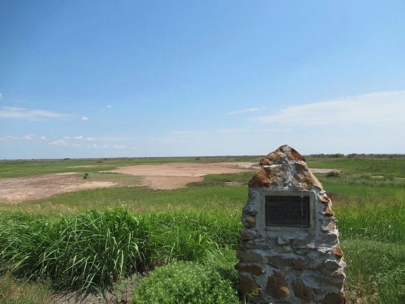
First white men to see Salt Plains. In summer of 1811 group composed of 8 white men and 6 Osage passed here after crossing north portion of Salt Plains from east to southwest. — — Map (db m216882) HM
Buildings near here from 1897. Under auspices of Friends Church, the Academy was noted for high moral, spiritual and scholastic standards. Closed 1922. Named for the teacher of first school (1893) in this vicinity, a sod house near Stella Church . . . — — Map (db m216941) HM
Built by Marshal McCully who staked land on which house stands during Cherokee Strip Run, September, 1893.
Plowed sod for and erected house August 1894. Used as McCully home until large frame house constructed 1909.
Of the many . . . — — Map (db m311809) HM
Declaration This Memorial Honors Men and Women Who Served Our Country in Time of War. In Time of Conflict or Peace. And Especially Those Who Lost Their Lives. Who Were Wounded or Maimed. And Who Were Held as Prisoners of War. These Stones . . . — — Map (db m181753) WM
The National Wildlife Refuge system is broken down into regions of the United States. The southwest region of the National Wildlife Refuge System encompasses Oklahoma, Texas, New Mexico and Arizona. Oklahoma has nine national wildlife refuges across . . . — — Map (db m216689) HM
You Are Now Entering Old
No Man's Land
Colorado Kansas 37th Parallel
Called "No Man's Land" until 1890
Known Then as
Beaver County
Became the Panhandle of Okla. Statehood 1907
Texas State Line 36° 30" Parallel
The . . . — — Map (db m93483) HM
Tales of bravery, mischief and morals make up the popular children's book series
"Hank the Cowdog"
What you may not know is that the lively main character in these books was inspired by a real cowdog named Hank who lived and worked on . . . — — Map (db m162469) HM
This 168 mile trail from Mobeetie, Texas, to Dodge City, Kansas,
was laid out by Ed Jones and Joe Plummer in 1874, originally as a
freight trail for hauling buffalo hides purchased from the Buffalo
Hunters in the Texas Panhandle for sale at . . . — — Map (db m162472) HM
You are now entering old ”No Man’s Land”
Colorado/Kansas • 37th Parallel Texas State Line • 36° 30’ parallel New Mexico • 103rd Meridian Cherokee Outlet • 100th Meridian
Called “No Man’s Land” until 1890 Known then . . . — — Map (db m131421) HM
Eureka was established in 1908 with 18 square miles. The high school was started in 1919 when Center, Lincoln, and one half of Pleasant View were consolidated. In 1923, the Nabisco, Happy Flat, and East Banner districts were added and a new building . . . — — Map (db m78816) HM
On a late fall afternoon in 1903, a stranger with a new
wagon, fine team and money (something the local people
had little of) arrived at the store in Craig located in the NW/4 of Section 24 T19N R10W. He wore nice, but foreign clothes, and spoke . . . — — Map (db m160285) HM
Chief Henry Roman Nose, for whom this park is named, was one of forty-four chiefs of the Southern Cheyenne tribe. He was a council chief from 1897 until his death in 1917. Born in 1856, Roman Nose (Woqini in the Cheyenne language) grew up during . . . — — Map (db m184807) HM
One of Oklahoma's original seven state parks, the vision of Roman Nose State Park was realized through the combined efforts of the Civilian Conservation Corps, the National Park Service, community leaders, and the State of Oklahoma.
Work . . . — — Map (db m185621) HM
The Civilian Conservation Corps begun construction of Roman Nose State Park on September 10, 1935, bringing the vision of the local community to life. While the community gathered the land, the design, supervision, and funding of the project came . . . — — Map (db m185579) HM
Surveyed by J.C. Brown 1826-27
Heaviest traffic during California Gold Rush 1849
Abandoned on completion of A.T.&S.F. railroad in 1880 — — Map (db m106477) HM
From September 23 through 27, 1846, the Mormon Battalion crossed the northwestern portion of the Oklahoma panhandle. The little army's 500-plus volunteers, recruited for the Mexican War, were enlisted near Council Bluffs, Iowa, from among the first . . . — — Map (db m55260) HM
(Left Panel)
The Santa Fe Trail
A Bridge Between the United States and Mexico
Before you is a portion of the historic Santa Fe Trail. Established as a wagon route by William Becknell in 1822, the Santa Fe Trail became the . . . — — Map (db m106478) HM
How did Black Mesa become a Preserve?
The Land was acquired in parcels over many years, beginning in 1959 when the State of Oklahoma purchased 100 acres on the top of the Mesa.
In 1989, the Nature Conservancy acquired 1500 acres on the . . . — — Map (db m246882) HM
A rich cultural history of the Old West
The famed Santa Fe Trail, a wagon route linking the eastern United States and Mexico, cut through this corner of Cimarron County. From the 1820s until the construction of the railroads in the 1860s, . . . — — Map (db m246993) HM
Highest point in Oklahoma 4972.97 feet above the sea as determined by a survey ordered by Governor Johnston Murray and completed May 9, 1954 by Oklahoma Highway Department under direction of C.A. Stoldt Director, G.H. Bittle Chemical Engineer, and . . . — — Map (db m247159) HM
Imagine the Black Mesa as a giant book lying on its side.
Each layer of rock is a different chapter in geologic history. The basalt cap on top is the most recent chapter - it's less than 5 million years old. As you go down, each deeper . . . — — Map (db m247123) HM
Established in May 1865, by Kit Carson, hero of Valverde and Brig. Gen., New Mexico Volunteers, to guard Santa Fe Trail and furnish escorts for caravans engaged in Santa Fe trade. Santa Fe Trail crossed this highway here and was first traveled by . . . — — Map (db m39798) HM
(left panel) A Bridge Between the United States and Mexico
Before you is a portion of the historic Santa Fe Trail. Established as a wagon route by William Becknell in 1822, the Santa Fe Trail became the first major trade link between . . . — — Map (db m131308) HM
Near here on May 28, 1849, was the camp of a large party of gold seekers en route to California with a military escort under the command of Captain R. B. Marcy. The California Road was used by travelers for over 50 years. East of here about 4 miles . . . — — Map (db m39802) HM
Famous Civilian Indian Scout for the U.S. Army, was born in 1839 and died in 1925. He was one of the five survivors of the 1874 Buffalo Wallow Fight, and was awarded the Congressional Medal of Honor for his efforts. Chapman married a Cheyenne woman . . . — — Map (db m62310) HM
A log cabin on this quarter-section was the home of the
nationally known Carry Nation and
husband David. Carry worked in
the church, sometimes preaching
in her husband's stead. She would
frequently load her buggy with
bricks and go on her . . . — — Map (db m298982) HM
Seiling's first half-mille oval was built at the Northeast edge of town early in the 1900s. The races became bigger and better. A grandstand was built and people from coast to coast were talking about "Little Louisville." Races were held twice a . . . — — Map (db m249656) HM
In 1874, the cattle ranchers of the San Antonio Texas area began blazing a trail with their large herds of Longhorn Cattle through Western Indian Territory to the railhead at Dodge City, Kansas and to markets beyond into Canada and the Northwest . . . — — Map (db m249511) HM
On Now. 13, 1892, Grand was established as county seat of Day County, Oklahoma Ter. This was County "E" when organized at the opening of Cheyenne and Arapaho lands, April 19, 1892. Day County and county seat were abolished at statehood in 1907. Many . . . — — Map (db m181526) HM
In 1874 Texas ranchers began driving large herds of Longhorn cattle to the railhead at Dodge City, Kansas. For the butcher markets back east and to stock newly opened rangelands in the northern U.S. Territories and Canada. The hooves of some . . . — — Map (db m190719) HM
Here, between 1874 and 1890, supply wagons, a daily stage coach and the U.S. Mail moved over this earliest known trail from Dodge City, Kansas, to Fort Elliott, Texas. The Fort, first known as "Cantonment on Sweet water" was established after the . . . — — Map (db m190717) HM
From this noted watering place came the name of "Bison," 1 mi. so., "Buffalo Springs" was the camp site of Pat Hennessey and his men just before they were massacred, 7 mi. so., July 4, 1874. Next day, a war band of Indians was stood off by ranchmen . . . — — Map (db m39801) HM
Opened by Run, Sept. 16, 1893. On line here, 15,000 waited for carbine signal fired by cavalryman at High Noon. Lt. C.A. Hedekin, commanding Troop A, U.S. Cav. Race for land started from post on knoll half mile west, by wagon, buggy. bicycle, horse . . . — — Map (db m284582) HM
At the opening of "Old Oklahoma", April 22, 1889, this was the north line for the Run starting at 12 o'clock noon. Prairies and hills in the 2,000,000 acre tract, south, were peopled by tens of thousands, homes were planted and tent cities sprang up . . . — — Map (db m39796) HM
A section of the famed Chisholm Trail (1867-1885), which was used to drive cattle from Texas to the rail heads in Kansas after the Civil War, crosses a portion of Vance AFB near the entrance to the Armed Forces Reserve Center. The trail was named . . . — — Map (db m89793) HM
This sculpture is a tribute to the pioneers of Oklahoma. The farmer, "Boomer" Sooner represents the spirit of the pioneers who settled the frontier during the 1893 Land Run. The WWII aviator is Lt. Col. Leon Vance, Medal of Honor recipient, Enid . . . — — Map (db m216181) HM
Here passed the Old Cattle Trail, blazed by Jesse Chisholm, which finally stretched for eight hundred miles from San Antonio, Texas to Abilene, Kansas over which cowboys from the pasture-lands of the great southwest drove their herds to the . . . — — Map (db m55715) HM
This marker sits on the Missouri Compromise line which by an Act of Congress on March 6, 1820, enabled Missouri to be admitted to the Union as a Slave State. But, the Act forbade slavery in the rest of the Louisiana Purchase North of the 36° 30' . . . — — Map (db m55714) HM
This is the only remaining United States Land Office from the six Oklahoma land runs (1889-1896) and other Oklahoma land openings. This office was built in Enid for the registration of claims in County O, later named Garfield County, for the land . . . — — Map (db m215978) HM
The M-110 is a heavy but highly mobile and maneuverable self-propelled artillery piece designed to provide artillery support to infantry or armor over a wide range of terrain conditions. It can be airlifted in large cargo aircraft. The M-110 . . . — — Map (db m265577) HM
The east-west section line one mile south of this marker was formerly Locust Street, in Charleston, Okea. The first post office was established June 18, 1901. Approximately one and one half mile south and one half mile west of here near the center . . . — — Map (db m181525) HM
This monument is dedicated to the settlers who on September 16, 1893 made the last run when the Cherokee Outlet was opened to homesteaders, and to the pioneers whose courage and toil shaped a barren prairie into a flourishing land for generations to . . . — — Map (db m205994) HM
In honor of the employees of
Blackwell Zinc Company, Inc.
who served our country during World War II
and in memory of those
who made the supreme sacrifice
Keith M. Abshire
Rex U. Abshire
Clyde H. Adams
Charles E. . . . — — Map (db m223515) WM
Dedicated to the Homesteaders of Kay County in recognition of their courage, faith, and fortitude in settling this portion of the Cherokee Outlet. Nearly 100,000 eager land seekers raced for claims in the greatest land run in history on September . . . — — Map (db m205718) HM
Located six blocks west Founded 1899 by Oklahoma Baptist Convention. Formally opened September 4, 1901.
Presidents
J.A. Beauchamp 1901-03 ·
A.P. Stone 1904-08 ·
J.R. Jester 1908-09 ·
J.H. Moore 1909-11 ·
A.E. Baten 1911-13
1911 . . . — — Map (db m206004) HM
With the faith and courage of their forefathers who made possible the freedom of these United States The Boy Scouts of America dedicate this copy of the Statue of Liberty as a pledge of everlasting fidelity and loyalty The Crusade to . . . — — Map (db m258900) HM
Front
Braman
When the Santa Fe Railroad was extended from Hunnewell, Kansas to Tonkawa, a railroad promoter named J.W. Whistler chose the midway point as a good location for a town. With B.J. Templeton he bought the . . . — — Map (db m96590) HM
First newspaper printed in the Cherokee Strip, June 14, 1884. Published at tent town of Rock Falls, 2.5 miles N.W. of here by Capt. David L. Payne, leader of Oklahoma "Boomers". Printing office was burned and "Boomers" disbanded by U.S.
Troops, . . . — — Map (db m96589) HM
September 11, 1893
Thousands of Americans gathered in this township preparing to make the run for homesteads in the Cherokee Strip, a tract of land 58 miles wide, opening 6,500,000 acres for White settlement bought from the Cherokee . . . — — Map (db m60480) HM
Academic, agricultural, vocational training for Indian youth from over U.S. Established by Act of Cong. 1882. Jasper M. Hadley 1st Superintendent. Handsome buildings of stone erected, and first pupils - Kiowa, Comanche children - entered Jan. . . . — — Map (db m60484) HM
The original town of Kaw City was established in Oklahoma Territory in the Ox Bow Bend of the Arkansas River by the Kaw City Townsite Company. The company consisted of William M. Jenkins, fifth territorial governor of O.T., N.F. Frazier, C.W. . . . — — Map (db m206269) HM
Kenneth W. Brill, reared and schooled in old Kaw City, branched out as a young man in the energy field. His knowledge and personality carried him far. He joined Continental Oil Company in 1930 and in time became Vice President and Regional Manager . . . — — Map (db m206224) HM
From the beginning, African-Americans settled and lived in Newkirk -- although this was not true in most of the towns in Kay County. They settled primarily on the east side of town, building their own community which included churches, . . . — — Map (db m60443) HM
Newkirk owes its existence not simply to the opening of the Cherokee Outlet to homesteaders, but to the twenty-one allotments taken by the Cherokees in Kay County prior to the opening. The Outlet comprised eight million acres of prairie which . . . — — Map (db m60457) HM
Cherokee Strip or Cherokee Outlet — the two titles have been used interchangeably for a hundred years now. They are not synonymous, however. The Outlet was the area given to the Cherokees in partial trade for their homelands to be used as an . . . — — Map (db m263976) HM
Nehemiah M. Tubbs built the City Hall and Opera House in 1901 for $5,838.29. Councilmen at this time were W.D. Ezel - mayor, E.F. Korns, J.C. Columbia, George Midgley, John S. Miller, W.M. Ferguson, J.S. Thomas, F.M. Morrison, and C.F. Rogers. The . . . — — Map (db m263993) HM
David Roy, a former Junior Main Street member and Eagle Scout, was the guiding force behind the “Hole in the Wall” park. When it was time for David to begin working on his Eagle Scout project, he considered many possibilities, finally deciding on a . . . — — Map (db m263994) HM
The entire east side of the 100 block of North Main burned to the ground November 15, 1901. Some of the citizens (obviously not the ones whose businesses were destroyed) thought this was a blessing in disguise. The block consisted of frame . . . — — Map (db m60460) HM
This Roman Classic structure with a corner recessed entry and simple columns was built in 1899. The building was originally known as the Dilday building and is constructed with native limestone secured a few miles east of Newkirk. John Pierce . . . — — Map (db m60456) HM
Dick Sherbon of Ponca City received the bid to erect this building for the Kay County Abstract Company in 1926. The bids for the building ranged from $4,400 to $5,700.
This red brick structure was limited to one story because of the . . . — — Map (db m60479) HM
"...that from these honored dead we take increased devotion to that cause which they gave the last full measure of devotion -- that we here highly resolve that these dead shall not have died in vain -- that this nation, under God, shall have a . . . — — Map (db m60450) HM
This statue, "Land of Hope," depicts the courageous pioneers who staked their land claim in the "Land Run of the Cherokee Outlet" in 1893. This was created by sculptor, Bernadette Hess Carman, a native daughter, who generously donated her time . . . — — Map (db m60449) HM
Newkirk was originally platted as the townsite of Lamoreux by the United States Land Office in 1893 as the county seat of "K" county. It was named after Silas W. Lamoreaux who was the head of the General Land Office in Washington, D.C., at the . . . — — Map (db m60455) HM
Newkirk's Junior Main Street program was organized March 27, 1997 with four middle school students — Michael Bannister, Jed Hartley, Sarah Speanburg, and Crystal Robinson. Michael, Sarah, and Crystal were all eighth grade students in Laura Ross's . . . — — Map (db m263996) HM
The Newkirk Kay County Fair was organized in 1896. Five dollar shares were sold in order to purchase property for the facilities, build a race track, grand stands and sheds. The share also gave free admittance to all shows and fairs for three . . . — — Map (db m60459) HM
Oil and gas were discovered in the Newkirk area as early as the spring of 1894 when Mart McClaskey struck gas while digging a water well. McClaskey kept his find a secret until he had secured his claim. In the meantime his family quietly used the . . . — — Map (db m263995) HM
A centennial tribute to the people who shared this land at the turn-of-the-century, and who still call it home today. They faced opportunties and obstacles together and were woven together in time. The spirit that fueled the dream then, and the . . . — — Map (db m60458) HM
The Newkirk Red Rose Garden Club, organized May 21, 1951 with nineteen charter members, is a member of the National, State and Northwest District Councils of Garden Clubs. The purpose of the club is to promote the study of soil conservation, . . . — — Map (db m263998) HM
This marker commemorates the men and women who achieved American independence. These Patriots, believing in the noble cause of liberty, fought valiantly to found a new nation. — — Map (db m258404) HM
William S. Cline had this building constructed in 1925. This was the same year that the Kay County Courthouse and the Masonic Temple were constructed in Newkirk. The Cline Building is illustrative of the influence of the Art Deco style. . . . — — Map (db m60478) HM
was established in 1907, N.E. of Newkirk Oklahoma. In 1963 it merged with the First Presbyterian Church of Newkirk. The bell was placed to honor the Grey Noret Church and all of its faithful members. — — Map (db m263997) HM
These two story native limestone buildings were constructed in 1901. The Vogele building had a rock faced coursed ashlar finish visible below and above the two arched bays each with stone relieving round arches. A stone checkerboard pattern . . . — — Map (db m263999) HM
Although nothing remains but the ruins of its foundation, the Miller family Mansion once stood here. Constructed in 1909 after the first stately wood frame home of Col. G.W. Miller, wife Molly, sons Joe, George, Zach and daughter Alma, burned in . . . — — Map (db m188215) HM
Named for its cattle brand '101,' this ranch was begun by Col. Geo. W. Miller on his claim at opening of Cherokee Strip, Sept. 16, 1893. Operated by sons, George, Joe and Zach Miller, the ranch covered 100,000 a. by 1926, world famous for its "White . . . — — Map (db m188167) HM
101 Ranch and Wild West Show Colonel George W. Miller founded the 101 Ranch in northern Oklahoma following the 1893 Cherokee Strip Land Run. He and his wife Molly, sons Joe, Zack and George Jr. along with daughter, Alma, helped establish what . . . — — Map (db m263798) HM
A fertilizer spreader from the 1920's that would have been used on the 101 Ranch.
Donated by
Mr. Kenneth Evans of Marland, Oklahoma. It was used by Mr. Evans father in the 1920's. — — Map (db m188252) HM
Arcade Hotel The Arcade Hotel began as a small wood frame structure. The hotel building, a so-called "house of ill-repute", was moved to Ponca City in 1897 from the city of Cross after Ponca City received a stop on the Santa Fe Railroad. Cross . . . — — Map (db m263799) HM
When Louis S. Barnes constructed this building in 1911 he wanted his customers to know exactly what they were buying. He proudly called this the "Daylight Store" and had the structure specially designed to allow lots of light inside. Many of the . . . — — Map (db m263794) HM
Vision When B.S. Barnes came to Oklahoma Territory prior to the 1893 Land Run, he had a vision to start a city. He selected the site of Ponca City for its ample water, a river crossing and access to the railroad. He organized the “Ponca . . . — — Map (db m263672) HM
Pioneer Oil Developer
Philanthropist & Humanitarian
Leader in Developing the Economy
Culture and Beauty of Ponca City
Donor of Pioneer Woman Statue
Governor of Oklahoma
United States Congressman — — Map (db m55712) HM
Pioneer oil developer — Leader in developing the economy, culture & beauty of Ponca City — U.S. Congressman — Donor of Pioneer Woman Statue — Governor of Oklahoma — — Map (db m263599) HM
First National Bank and Trust has a long tradition of serving Ponca City. It opened for business on Feb. 1, 1902, as the Farmer's National Bank. That same month the bank's financial statement showed deposits in the amount of $33,390. By 1907 the . . . — — Map (db m263712) HM
This observation point is named in honor of Fred G. Fellows, consulting engineer of Ponca City, Oklahoma, whose vision, exploration and sustained efforts for water resources pointed out to the public the great potential of this area for the Kaw . . . — — Map (db m206145) HM
Mrs. Catron was Supervisor of Music in the Ponca City Schools 1910-1947 and founded the Ponca City Music Club March 19, 1921. Charter member 20th Century Club and helped establish the Ponca City Library in 1910. President Oklahoma Federation of . . . — — Map (db m263771) HM
In 1901 M.G. Gill came to Ponca City to work for J.M. Hayden's furniture and undertaking business. Four years later he married Eudora Bonham, a spunky lady who had staked a claim west of the present airport during the Cherokee Outlet land run. In . . . — — Map (db m263881) HM
Philanthropist
Oil Man
Donor:
Wentz Camp,
Wentz Pool
Wentz Municipal Golf Course
Ponca City, Oklahoma
Founder:
The Society For Crippled Children
University of Oklahoma Student Loan Fund
Oklahoma State University Student . . . — — Map (db m55711) HM
Philanthropist Oil Man Donor Wentz Camp & Pool — Builder Oklahoma Society for Crippled Children — Established student loan fund University of Oklahoma and Oklahoma State University “He always gave” — — Map (db m263597) HM
229 entries matched your criteria. The first 100 are listed above. Next 100 ⊳