75 entries match your criteria.
Historical Markers and War Memorials in Stormont, Dundas and Glengarry United Counties, Ontario
By Kevin Craft, May 19, 2017
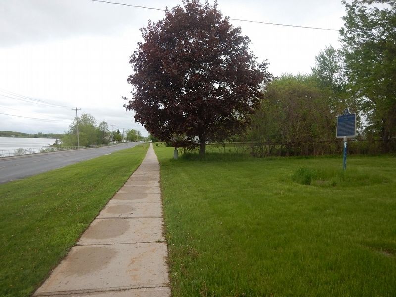
Wideview of Captain Samuel Anderson Marker
| 1 ► Ontario, Stormont, Dundas and Glengarry United Counties, Cornwall — Captain Samuel Anderson — 1736-1836 — |
| On Montreal Road (County Highway 2) 0.5 kilometers east of Dunbar Avenue, on the right when traveling west. | |||
| 2 ► Ontario, Stormont, Dundas and Glengarry United Counties, Cornwall — Co-Cathedral of the Nativity of the Blessed Virgin Mary — Cocathédrale de la Nativité de la Bienheureuse Vierge Marie — |
| On Montreal Road, on the left when traveling east. | |||
| 3 ► Ontario, Stormont, Dundas and Glengarry United Counties, Cornwall — Cornwall & S.D.G. 1784-2009 — |
| On Water Street West. | |||
| 4 ► Ontario, Stormont, Dundas and Glengarry United Counties, Cornwall — Cornwall Canal — |
| On Water Street West (County Highway 2) 0.1 kilometers west of Pitt Street, on the right when traveling east. | |||
| 5 ► Ontario, Stormont, Dundas and Glengarry United Counties, Cornwall — Cornwall Grammar School — |
| On Sydney Street, 0.1 kilometers north of Fourth Street East, on the right when traveling north. | |||
| 6 ► Ontario, Stormont, Dundas and Glengarry United Counties, Cornwall — Cornwall's Historic Waterfront — Swing Bridge b/ Pont Tournant — |
| 7 ► Ontario, Stormont, Dundas and Glengarry United Counties, Cornwall — District Court-House and Gaol 1833 — |
| On Water Street West, on the right when traveling west. | |||
| 8 ► Ontario, Stormont, Dundas and Glengarry United Counties, Cornwall — Electric Locomotive No. 17 / Locomotive électrique No. 17 — |
| Near Brookdale Avenue (Route 2) just south of Ninth Street West, on the right when traveling north. | |||
| 9 ► Ontario, Stormont, Dundas and Glengarry United Counties, Cornwall — Inverarden — |
| On Montreal Road (County Highway 2) 0.5 kilometers west of Boundary Road, on the right when traveling west. | |||
| 10 ► Ontario, Stormont, Dundas and Glengarry United Counties, Cornwall — Ivy Hall — |
| On York Street at Water St W, on the right when traveling south on York Street. | |||
| 11 ► Ontario, Stormont, Dundas and Glengarry United Counties, Cornwall — John Baker — |
| On Water Street West, on the right when traveling east. | |||
| 12 ► Ontario, Stormont, Dundas and Glengarry United Counties, Cornwall — Lieutenant-Colonel John Macdonell — (Aberchalder) — c. 1750-1809 — |
| On County Highway 2 at Stonehouse Point Road, on the right when traveling east on County Highway 2. | |||
| 13 ► Ontario, Stormont, Dundas and Glengarry United Counties, Cornwall — New York Cafe / Le Café New York — |
| On Pitt Street just north of Urquhart Lane, on the right when traveling south. | |||
| 14 ► Ontario, Stormont, Dundas and Glengarry United Counties, Cornwall — Right Reverend John Strachan — 1778-1867 — |
| On Sydney Street, 0.1 kilometers north of Fourth Street East, on the right when traveling north. | |||
| 15 ► Ontario, Stormont, Dundas and Glengarry United Counties, Cornwall — The Cornwall Canal / Le canal de Cornwall — |
| Near County Road 2, on the right when traveling east. | |||
| 16 ► Ontario, Stormont, Dundas and Glengarry United Counties, Cornwall — The Cornwall Orphanage / L'orphelinat de Cornwall — |
| On Second Street East at Sydney Street, on the left when traveling east on Second Street East. | |||
| 17 ► Ontario, Stormont, Dundas and Glengarry United Counties, Cornwall — The Flying Frenchmen — |
| On Newsy Lalonde Way, on the right when traveling east. | |||
| 18 ► Ontario, Stormont, Dundas and Glengarry United Counties, Cornwall — The Founding of Cornwall — |
| On Water Street West (County Highway 2) 0.1 kilometers west of Pitt Street, on the right when traveling east. | |||
| 19 ► Ontario, Stormont, Dundas and Glengarry United Counties, Cornwall — The French Presence in Cornwall — |
| On Montreal Road (County Highway 2) 0.2 kilometers west of McConnell Avenue, on the right when traveling west. | |||
| 20 ► Ontario, Stormont, Dundas and Glengarry United Counties, Cornwall — The Glengarry Fencibles — |
| On Fourth Street East, 0.1 kilometers east of Marlborough Street North, on the left when traveling east. | |||
| 21 ► Ontario, Stormont, Dundas and Glengarry United Counties, Cornwall — The Rev. John Strachan in Cornwall — |
| On Second Street West, 0.1 kilometers west of Augustus Street, on the right when traveling west. | |||
| 22 ► Ontario, Stormont, Dundas and Glengarry United Counties, Cornwall — The Rossmore House / La Maison Rossmore — |
| On Pitt Street just north of Urquhart Lane, on the right when traveling south. | |||
| 23 ► Ontario, Stormont, Dundas and Glengarry United Counties, Cornwall — The Stone House — La Maison En Pierre — |
| On Montreal Road (Ontario Route 2), on the right when traveling west. | |||
| 24 ► Ontario, Stormont, Dundas and Glengarry United Counties, Cornwall — United Counties of Stormont Dundas and Glengarry — United Counties Courthouse and Jail — |
| On Water Street West, on the right when traveling west. | |||
| 25 ► Ontario, Stormont, Dundas and Glengarry United Counties, Cornwall — United Empire Loyalists — |
| On Second Street East at Sydney Street, on the left when traveling east on Second Street East. | |||
| 26 ► Ontario, Stormont, Dundas and Glengarry United Counties, Cornwall — War of 1812 — St. John's Presbyterian Church — |
| On Second Street East, 0.1 kilometers east of Pitt Street, on the right when traveling east. | |||
| 27 ► Ontario, Stormont, Dundas and Glengarry United Counties, Dalkeith — MacLeod Settlement — |
| On Laggan-Gleneig Road, 3.1 kilometers east of Old Military Road, on the right when traveling east. | |||
| 28 ► Ontario, Stormont, Dundas and Glengarry United Counties, Ingleside — Aultsville — Lost Villages Historical Society — |
| On Aultsville Road (County Highway 2), on the left when traveling west. | |||
| 29 ► Ontario, Stormont, Dundas and Glengarry United Counties, Ingleside — Farran's Point — Lost Villages Historical Society — Farran's Point Canal and Pavilion — |
| On County Road 2 at Killarney Road, on the right when traveling east on County Road 2. | |||
| 30 ► Ontario, Stormont, Dundas and Glengarry United Counties, Ingleside — Holstein Friesian Cattle in Ontario — |
| On Morrison's Road, on the left when traveling east. | |||
| 31 ► Ontario, Stormont, Dundas and Glengarry United Counties, Long Sault — Corn Crib — |
| On Fran LaFlamme Drive (Ault Park Road), on the left when traveling east. | |||
| 32 ► Ontario, Stormont, Dundas and Glengarry United Counties, Long Sault — Dickinson's Landing — Lost Villages Historical Society — |
| On Stormont, Dundas and Glengarry County Road 2 (County Highway 2), on the left when traveling west. | |||
| 33 ► Ontario, Stormont, Dundas and Glengarry United Counties, Long Sault — Ernest (Ernie) McDonald Blacksmith Shop / Forgeron — |
| On Fran LaFlamme Drive (Ault Park Road), on the right when traveling west. | |||
| 34 ► Ontario, Stormont, Dundas and Glengarry United Counties, Long Sault — Forbes Memorial Reading Room / Salle de Lecture Commémorative Forbes — |
| On Fran LaFlamme Drive (Ault Park Road), on the right when traveling west. | |||
| 35 ► Ontario, Stormont, Dundas and Glengarry United Counties, Long Sault — Lake St. Lawrence / Lac Saint-Laurent — Lost Villages Historical Society — |
| On Stormont, Dundas and Glengarry County Road 2 (County Highway 2) just east of Long Sault Parkway, on the left when traveling west. | |||
| 36 ► Ontario, Stormont, Dundas and Glengarry United Counties, Long Sault — MacLeod Log House / Maison en Bois MacLeod — |
| On Fran LaFlamme Drive (Ault Park Road), on the left when traveling east. | |||
| 37 ► Ontario, Stormont, Dundas and Glengarry United Counties, Long Sault — Manson / LaPierre General Store — |
| On Fran LaFlamme Drive (Ault Park Road), on the left when traveling east. | |||
| 38 ► Ontario, Stormont, Dundas and Glengarry United Counties, Long Sault — Mille Roches — Lost Villages Historical Society — |
| On Waterfront Trail (County Highway 2), on the right when traveling east. | |||
| 39 ► Ontario, Stormont, Dundas and Glengarry United Counties, Long Sault — Moulinette — Lost Villages Historical Society — |
| On Algonquin Avenue (County Highway 2) close to Avonmore Rd, on the left when traveling west. | |||
| 40 ► Ontario, Stormont, Dundas and Glengarry United Counties, Long Sault — Moulinette Station — |
| On Fran Laflamme Drive (Ault Park Road) just south of County Road 2, on the left when traveling east. | |||
| 41 ► Ontario, Stormont, Dundas and Glengarry United Counties, Long Sault — S.S. #17 - Roxborough Township School / S.S. #17 - L'Ecole du Canton de Roxborough — |
| On Fran LaFlamme Drive (Ault Park Road), on the right when traveling west. | |||
| 42 ► Ontario, Stormont, Dundas and Glengarry United Counties, Long Sault — Sandtown Advent Christian Church — |
| On Fran LaFlamme Drive (Ault Park Road), on the right when traveling west. | |||
| 43 ► Ontario, Stormont, Dundas and Glengarry United Counties, Long Sault — The Stuart House / La Maison Stuart — |
| On Fran LaFlamme Drive (Ault Park Road), on the right when traveling west. | |||
| 44 ► Ontario, Stormont, Dundas and Glengarry United Counties, Long Sault — Wales — Lost Villages Historical Society — |
| On Stormont, Dundas and Glengarry County Road 2 (County Highway 2), on the left when traveling west. | |||
| 45 ► Ontario, Stormont, Dundas and Glengarry United Counties, Long Sault — Zina Hill Barber Shop / Le Salon de Barbier de Zina Hill — |
| On Fran LaFlamme Drive (Ault Park Road), on the left when traveling east. | |||
| 46 ► Ontario, Stormont, Dundas and Glengarry United Counties, Maxville — Glengarry Congregational Church — 1837 — |
| On Kenyon Concession 19, 0.1 kilometers west of Highland Road (County Route 20), on the right when traveling west. | |||
| 47 ► Ontario, Stormont, Dundas and Glengarry United Counties, Maxville — Sir Edward Robert Peacock, G.C.V.O. — 1871-1962 — |
| On Kenyon Concession 19, 0.1 kilometers west of Highland Road (County Route 20), on the right when traveling west. | |||
| 48 ► Ontario, Stormont, Dundas and Glengarry United Counties, Maxville — The Rev. Charles W. Gordon — 1860-1937 — |
| On Highland Road (County Route 20) 0.1 kilometers south of Kenyon Concession 19, on the right when traveling south. | |||
| 49 ► Ontario, Stormont, Dundas and Glengarry United Counties, Morrisburg — Aultsville Train Station and Locomotive 1008 — La Gare Aultsville et la Locomotive No. 1008 — |
| On Stormont, Dundas and Glengarry County Road (County Route 2) close to Upper Canada Village, on the left when traveling west. | |||
| 50 ► Ontario, Stormont, Dundas and Glengarry United Counties, Morrisburg — Battle of Crysler’s Farm — Bataille de la ferme Crysler — |
| Near Stormont, Dundas and Glengarry County Road (County Route 2) near Upper Canada Village, on the left when traveling west. | |||
| 51 ► Ontario, Stormont, Dundas and Glengarry United Counties, Morrisburg — Battle of Crysler’s Farm 1813 — |
| Near Stormont, Dundas and Glengarry County Road (County Route 2) close to Upper Canada Village, on the left when traveling west. | |||
| 52 ► Ontario, Stormont, Dundas and Glengarry United Counties, Morrisburg — Battlefield of Crysler’s Farm — Pro Patria — |
| On Stormont, Dundas and Glengarry County Road (County Route 2) close to Upper Canada Village, on the left when traveling west. | |||
| 53 ► Ontario, Stormont, Dundas and Glengarry United Counties, Morrisburg — Churches of South Dundas — Dundas Murals — |
| On County Road 2 at County Road 8, on the right when traveling east on County Road 2. | |||
| 54 ► Ontario, Stormont, Dundas and Glengarry United Counties, Morrisburg — George H. Challies — |
| Near County Road 2 at Battle of Crysler's Farm National Historic Site, on the right when traveling east. | |||
| 55 ► Ontario, Stormont, Dundas and Glengarry United Counties, Morrisburg — Sir James Pliny Whitney — 1843-1914 — |
| On Riverside Drive, on the right when traveling west. | |||
| 56 ► Ontario, Stormont, Dundas and Glengarry United Counties, Morrisburg — The Rev. Johann Samuel Schwerdtfeger — 1734 - 1803 — |
| On Riverside Drive, on the right when traveling west. | |||
| 57 ► Ontario, Stormont, Dundas and Glengarry United Counties, Morrisburg — The Williamsburg Canals — |
| 58 ► Ontario, Stormont, Dundas and Glengarry United Counties, Morrisburg — 5 — W.W. II Homecoming — Dundas Murals — |
| On Saint Lawrence Street just south of County Road 2, on the right when traveling south. | |||
| 59 ► Ontario, Stormont, Dundas and Glengarry United Counties, South Dundas — Loyalist American Regiments / Loyalists of the Indian Nations / Sir John Johnson — |
| Near Upper Canada Village south of Canada Route 2. | |||
| 60 ► Ontario, Stormont, Dundas and Glengarry United Counties, South Glengarry — "Cariboo" Cameron — 1820-1888 — |
| On County Highway 2, 0.2 kilometers west of Summerstown Road (County Highway 27), on the right when traveling west. | |||
| 61 ► Ontario, Stormont, Dundas and Glengarry United Counties, South Stormont — Lost Villages of the St Lawrence — |
| On Fran LaFlamme Drive (Ault Park Road), on the right when traveling west on Fran LaFlamme Drive (Ault Park Road). | |||
| 62 ► Ontario, Stormont, Dundas and Glengarry United Counties, St. Andrews West — Captain Miles Macdonell — |
| On Provincial Highway 138 close to County Highway 18, on the right when traveling east. | |||
| 63 ► Ontario, Stormont, Dundas and Glengarry United Counties, St. Raphael's — Bishop Alexander Macdonell — (1762-1840) — |
| On County Road 18 (County Highway 18), on the right when traveling east. | |||
| 64 ► Ontario, Stormont, Dundas and Glengarry United Counties, St. Raphael's — St. Raphaels' Ruins — |
| On County Road 18, on the right when traveling east. | |||
| 65 ► Ontario, Stormont, Dundas and Glengarry United Counties, St. Raphael's — The Blue Chapel — |
| On County Road 18 (County Highway 18), on the right when traveling east. | |||
| 66 ► Ontario, Stormont, Dundas and Glengarry United Counties, St. Raphael's — The College of Iona / Le College d'Iona — |
| Near Frog Hollow Road, on the left when traveling east. | |||
| 67 ► Ontario, Stormont, Dundas and Glengarry United Counties, St. Raphael's — The Glengarry Emigration of 1786 — |
| On County Highway 18, on the right when traveling east. | |||
| 68 ► Ontario, Stormont, Dundas and Glengarry United Counties, St. Raphael's — The Parish of St. Raphael — |
| On County Road 18 at Frog Hollow Road, on the right when traveling east on County Road 18. | |||
| 69 ► Ontario, Stormont, Dundas and Glengarry United Counties, Williamsburg — Dr. Locke Story — Dr. Mahlon Locke (1880-1942) — |
| On Route 31 just north of County Road 18, on the right when traveling north. | |||
| 70 ► Ontario, Stormont, Dundas and Glengarry United Counties, Williamsburg — Dr. Mahlon W. Locke — 1880-1942 — |
| On County Route 18 at Locke Lane, on the right when traveling west on County Route 18. | |||
| 71 ► Ontario, Stormont, Dundas and Glengarry United Counties, Williamsburg — John McIntosh — 1777-1846 — |
| On Dundela Road at McIntosh Road, on the right when traveling west on Dundela Road. | |||
| 72 ► Ontario, Stormont, Dundas and Glengarry United Counties, Williamsburg — The McIntosh Apple / La Pomme McIntosh — |
| On Dundela Road (County Highway 18). | |||
| 73 ► Ontario, Stormont, Dundas and Glengarry United Counties, Williamsburg — The Original McIntosh Red Apple Tree — |
| On Dundela Road (County Highway 18) at McIntosh Road, on the right when traveling west on Dundela Road. | |||
| 74 ► Ontario, Stormont, Dundas and Glengarry United Counties, Winchester — The Big Store — Sweet Corner Park — |
| Near Winchester Main Street (Main Street West) (County Route 3) at Saint Lawrence Street (County Route 38), on the right when traveling east. | |||
| 75 ► Ontario, Stormont, Dundas and Glengarry United Counties, Winchester — Winchester District Memorial Hospital — |
| Near Winchester Main Street (Main Street West) (County Route 3) at Saint Lawrence Street (County Route 38), on the right when traveling east. | |||