A career Imperial civil servant, Anthony Musgrave served as governor of Newfoundland (1864 - 69) and British Columbia (1869 - 71). Both terms of office were marked by a strong personal effort to encourage the two colonies to unite with the new . . . — — Map (db m72882) HM
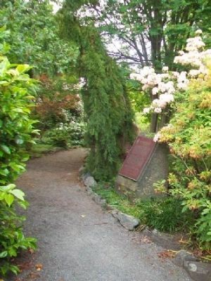
First Governor of British Columbia
Unveiled by
The Honourable Steven L. Point, OBC
Lieutenant Governor of British Columbia
in honour of
Her Majesty Queen Elizabeth II’s Diamond Jubilee
21 May 2012 — — Map (db m74992) HM
A stone boundary marker set by the Royal Engineers 1859-60 as part of the original survey of Government House grounds and Fairfield Farm. — — Map (db m75001) HM
In addition to carrying out constitutional responsibilities, the Lieutenant Governor plays an important role in celebrating, inspiring and connecting British Columbians. Many organizations invite the Lieutenant Governor to act as their . . . — — Map (db m74878) HM
The Lieutenant Governor is the Queen's representative in British Columbia, appointed by the Governor General for a term of at least five years. The Lieutenant Governor plays an important constitutional role, opening and closing sessions of . . . — — Map (db m74940) HM
This imposing brick roundhouse is a particularly fine example of an industrial structure associated with the steam railway era in Canada. Built in 1913, the ten-stall roundhouse with attached machine, boiler and blacksmith's shops is part of a . . . — — Map (db m72877) HM
Near Island Highway at Admirals Road, on the right when traveling north.
An original homestead representing the Hudson's Bay Company's efforts to farm and thereby stimulate settlement in the region through their subsidiary, the Puget's Sound Agricultural Company. Begun by the company and completed by the farm's first . . . — — Map (db m187873) HM
On Provincial Highway 97, 23.3 kilometers south of 150 Mile House, on the right when traveling south.
In the 1860s, the fabulous Cariboo goldfields were a lure to thousands. Miners, traders, and adventurers, many afoot, some with wheelbarrows, shared the pioneer route with mule trains, plodding oxen, freight wagons, and swaying stage-coaches. . . . — — Map (db m8857) HM
English:
A search for the source of placer gold found on lower parts of the Fraser River led to discoveries of lode mines in the Cariboo, of which Williams Creek, is said to have yielded $19,000,000. As a centre of population in the . . . — — Map (db m42712) HM
On Barkerville Highway (Provincial Highway 26) 1 kilometer south of Reduction Road, on the left when traveling south.
This rare example of a 19th century Chinese benevolent society hall conformed to a Chee Kung Tong tradition that placed services to members on the ground floor and formal functions above. With its hostel, kitchen, and meeting and ceremonial spaces, . . . — — Map (db m42533) HM
This overshot water wheel is 16 feet in diameter. It is modeled after wheels and pumps used in the tin mines of Cornwall. The early miners found that the pay gravel often lay 40 to 100 feet under the surface. The wheels were used to pump the water . . . — — Map (db m42710) HM
Built in 1882, this is British Columbia’s oldest surviving courthouse, replacing one which stood here from 1862-1882. By 1918, declining population in Richfield led to the building’s closure. Designated a Provincial historic object in 1945, it was . . . — — Map (db m42763) HM
On Kwah Road West, 0.3 kilometers west of Stewart Lake Highway (British Columbia Highway 27), on the right when traveling west.
English:
Simon Fraser and John Stuart established Fort St. James among the Carrier Indians in 1806. Originally a North West Company post, it passed to the Hudson’s Bay Company in 1821. From the beginning an important centre of trade and . . . — — Map (db m42736) HM
On Chilcotin-Bella Coola Highway (Provincial Highway 20) 8.2 kilometers east of Hanceville Cut Off Road, on the right when traveling east. Reported missing.
Norman Lee left his ranch in this valley in 1898 with 200 head on a 1500-mile "beef" drive to the Klondyke gold camps. Five months later, winter forced him to butcher the herd. He loaded the meat on scows, which were lost on Teslin Lake, 500 miles . . . — — Map (db m187944) HM
On Cariboo Highway (Provincial Highway 97) 1.1 kilometers south of Spur Road, on the right when traveling south.
Down river lay the perilous and unnavigable canyon. Up-river the Fraser was swift and strong, but sternwheelers could travel for 400 miles from Soda Creek. Men and supplies embarked here in the 1860's for the fabulous Cariboo goldfields. Later, as . . . — — Map (db m187977) HM
On Front Street (Provincial Highway 97) at Carson Street, on the left when traveling north on Front Street.
Promoted by Perry Collins, the U.S. Commercial Agent in Russia, and dependent on the Western Union Telegraph Company’s money, men and technology for its execution, this early telegraph line roused the enthusiasm of the white residents of British . . . — — Map (db m8853) HM
For over half a century the Boyd family operated this haven for man and beast. Here weary travellers found lodging, food, and drink. Here fresh horses were hitched to stage-coaches and miners bought supplies.
This historic road-house, built in 1864 . . . — — Map (db m42766) HM
Near Cariboo Highway (Provincial Highway 97) 2.2 kilometers south of Unity Road, on the left when traveling south. Reported missing.
Plans to complete the Pacific Great Eastern Railroad to Prince George in 1921 failed because instable ground prevented use of the proposed bridge site on the Cottonwood River. Thus construction stopped at Quesnel. As northern expansion continued, . . . — — Map (db m188026) HM
On Nelson Nelway Highway (Provincial Highway 3A) 0.2 kilometers east of South Slocan Village Road, on the right when traveling east. Reported missing.
When hydro-electric power was first delivered from No. 1 plant to Rossland's mines in 1898, the 32-mile transmission lines were the longest on the continent. Utilizing the 360-foot drop from Kootenay Lake to the Columbia River, additional . . . — — Map (db m187946) HM
On Brilliant Road, 0.5 kilometers east of Gorkoff Road, on the right when traveling east.
[English] This historic Bridge commemorates an achievement of the Doukhobors of Canada in establishing communal settlements in the Kootenay Boundary region of British Columbia during the early 20th century. Built in 1913 by community labour, . . . — — Map (db m197114) HM
On British Columbia 6, 0.2 kilometers south of Crescent Valley Road, on the right when traveling south.
Sawmill pilings and a burner are the only reminders of the former Patrick Lumber Co., established in 1907. By 1911, the Patricks sold the mill to the British Canadian Lumber Corporation. Joseph and sons Frank and Lester risked the proceeds to . . . — — Map (db m187882) HM
On Highway 3A, 0.3 kilometers south of View Road, on the right when traveling south.
It was the dream, in the 1880's of W.A. Baillie-Grohman, British sportsman and financier, to reclaim these fertile flats from the annual river floods. His canal at Canal Flats diverted part of the Kootenay into the Columbia but was abandoned. The . . . — — Map (db m188032) HM
On Nelson Nelway Highway (Provincial Highway 3A) 0.2 kilometers west of Government Road, on the right when traveling west.
As this community prospered in the 1890s, tent hotels and log stores gave way to ornate edifices, and Nelson changed from a crude mining camp into the "Queen City of the Kootenays." The gully that divided Baker Street in two was bridged in 1890, . . . — — Map (db m187922) HM
On Vernon Street at Ward Street, on the right when traveling east on Vernon Street.
The 1902 opening of Nelson's new Dominion of Canada offices for postal, customs and inland revenue at 502 Vernon street was a huge step up from the tent that first housed Nelson's postal service. The building, constructed of Spokane brick and local . . . — — Map (db m197112) HM
On Eastman Avenue at Davis Street, on the left when traveling north on Eastman Avenue.
The orebody, known to Indians as
a source of lead for musket balls,
was staked in 1882 by Bob Sproule,
later restaked by Tom Hamill. The
resulting lawsuit cost Sproule
the property, and in revenge he
murdered his rival; was convicted
and . . . — — Map (db m187919) HM
On Crowsnest Highway (Provincial Highway 3) 3 kilometers south of Salmo Ski Hill Road, on the left when traveling south.
In the the early 1860s placer gold drew prospectors from all parts of the West to the Salmo River valley, and the Dewdney Trail from the west coast soon opened the region to increased travel. Development increased dramatically in 1893, when Daniel . . . — — Map (db m187931) HM
On Slocan Star Street, 0.3 kilometers east of Sandon Road, on the left when traveling east.
Silver was the key that opened the Slocan. Discovery in 1891 of the rich outcrops of the "Slocan Star" and "Payne" touched off the wildest lode excitement in our history. The silver-lead ore was easily and cheaply mined, speeding development, and . . . — — Map (db m187952) HM
On Benvoulin Road, 0.1 kilometers north of Casorso Road, on the right when traveling north. Reported missing.
Father Pandosy, an Oblate priest, ministered to natives and white in widely separated parts of British Columbia for over 30 years, until his death in 1891.
His mission, with its church, school and farms established in 1859-60 on this site, formed . . . — — Map (db m187909) HM
On Okanagan Highway (Provincial Highway 97) 0.2 kilometers south of Hardy Street, on the left when traveling south.
Directly across Lake Okanagan, on August 16, 2003, lightning struck a tree at Squally Point. The ensuing blaze consumed over 25,000 hectares as it spread to Kelowna, Myra Canyon, and Naramata. More than 33,000 people were evacuated and 238 homes . . . — — Map (db m187982) HM
Near Trans-Canada Highway (Provincial Highway 1) 0.8 kilometers north of Lybarger Road, on the right when traveling north.
[English] While exploring these mountains in the summer of 1865, Walter Moberly, assistant surveyor-general of British Columbia, noted the flight of eagles through a break in the Gold Range (Monashees), thereby discovering Eagle Pass. After . . . — — Map (db m198549) HM
Near Trans-Canada Highway (Provincial Highway 1) 0.8 kilometers north of Lybarger Road, on the right when traveling north.
A nebulous dream was a reality: an iron ribbon crossed Canada from sea to sea. Often following the footsteps of early explorers, nearly 3000 miles of steel rail pushed across vast prairies, cleft lofty mountain passes, twisted through canyons, and . . . — — Map (db m187955) HM
Near Trans Canada Highway (Route 1) west of Whispering Wood Lane.
[English]
Baldwin #7717 Steam Locomotive
This Baldwin 2-6-0 mogul steam engine – builders #7717 – road #6 – 36" gauge locomotive, was built for the North Western Coal & Navigation Co. in 1885. It was originally used . . . — — Map (db m44339) HM
On Transcanada Highway (National Route 1), on the right when traveling west.
First recorded in the report of the Palliser expedition of 1857-60, this pass takes its name from an incident in which Dr. James Hector, surgeon in the expedition, was kicked by his horse while exploring in this vicinity. The pass was virtually . . . — — Map (db m74545) HM
Near Trans-Canada Highway (Provincial Highway 1) at Field Access Road.
[English] Take a look across the river. A century ago, an elegant hotel dominated this view. Now just a memory, Mount Stephen House was the first in a series of “Grand Hotels” built by the Canadian Pacific Railway. The CPR . . . — — Map (db m203580) HM
Near Trans-Canada Highway (Provincial Highway 1) at Field Access Road.
[English] In 1901, Mount Stephen Reserve was enlarged and became Yoho Park Reserve. The following year, Mount Stephen House was also expanded and now featured a rotunda, a huge dining room, a theatre and 60 rooms. Word got out . . . — — Map (db m203581) HM
Near Trans-Canada Highway (Provincial Highway 1) at Field Access Road.
[English] It was not my intention to have passed any great time at Field, yet I was detained there by the force of its attraction… the views from Field are fine and the excursions that can be made in the neighbourhood are . . . — — Map (db m203582) HM
Near Golden View Road, 0.2 kilometers south of Lafontaine Road, on the right when traveling south.
The first Sikhs arrived in Golden in 1902 to work in the mill of the Columbia River Lumber Company. Their Gurdwara (temple), one of the earliest in BC, became a focus of cultural identity and religious ceremony for the Sikh community.
Their . . . — — Map (db m188006) HM
Near Trans-Canada Highway (Provincial Highway 1) 11.5 kilometers east of Provincial Highway 95, on the left when traveling east.
Naming the Kicking Horse In the mid-1850s, an expedition was sent out by the Imperial Government to locate a feasible route west through the Canadian Rockies that would give good access to settlers in search of rich farming soil and . . . — — Map (db m203579) HM
Near Big Bend Highway (Provincial Highway 23) 2.6 kilometers north of Pearkes Drive, on the left when traveling north.
For 1200 miles, in two countries, the Columbia carves its way to the Pacific Ocean. Named after Robert Gray's ship the "Columbia", it was first mapped in 1811 by David Thompson. This "highway" for traders, missionaries and gold miners later became a . . . — — Map (db m187966) HM
Near Trans-Canada Highway (Provincial Highway 1) 85 kilometers west of Provincial Highway 95.
A ninety room hotel complete with bowling alley and observation tower once stood in this quiet clearing!Operated by the Canadian Pacific Railway from 1887 to 1925, it was used as a base by mountaineers, adventurers and sightseers from all over the . . . — — Map (db m108665) HM
On Trans-Canada Highway (Provincial Highway 1), on the right when traveling east.
For many years steam locomotives on the mainline of the Canadian Pacific Railway rumbled across these stone pillars.
Construction of the railway through these rugged mountains was a constant struggle. In this area, steep-sided valleys and . . . — — Map (db m110556) HM
Near Minto Road, 0.5 kilometers east of Comox Valley Parkway/Cumberland Road, on the right when traveling west.
Cumberland was a coal mining centre from 1888 until the 1960's.
Union Bay was the coal port that shipped Cumberland's coal to the rest of the world. At least 260 people, most of them recent immigrants from China, Japan, Britain & Europe, died in . . . — — Map (db m187940) HM
Near Drinkwater Road east of Trans-Canada Highway (Provincial Highway 1), on the right when traveling east.
Spars cut for Capt. Cook's ships in 1778; logs skidded by oxen in 1860; whistles blown on “steam-pots” and “locies” in 1900; countless products made by complex machines; all recall the continued use of B.C.'s forests and growth of the industry. . . . — — Map (db m187995) HM
On 1st Avenue at Roberts Street, on the right when traveling south on 1st Avenue.
An “instant” town of the past. In 1898 James Dunsmuir, the coal baron, moved buildings by rail from Wellington to establish this coal shipping port. Nearby copper mines added a smelter in 1902, but only pilings mark that site. Railroad logging aided . . . — — Map (db m187985) HM
On 1st Avenue at Symonds Street, on the right when traveling south on 1st Avenue.
The Oregon Treaty of 1846 set the United States and British North American border at the 49th parallel from Lake of the Woods, Ontario westward to Vancouver, British Columbia. Vancouver Island, which is intersected by the 49th parallel at Ladysmith . . . — — Map (db m187891) HM
On Kootenay Highway (Provincial Highway 93/95) 1.3 kilometers north of Burns Avenue, on the left when traveling north.
In 1808 David Thompson named this flat “McGillivary's Portage” as he crossed from Columbia Lake to the Kootenay River. In 1889 W.A. Baillie-Grohman joined the two waterways by a canal with a single lock. Regulations aimed at preventing Columbia . . . — — Map (db m188022) HM
On Van Horne Street South (Provincial Highway 3) south of 5th Avenue South, on the right when traveling south.
The Canadian Pacific Railway helped open up south-east British Columbia with a strategic line through the Rocky Mountain Crowsnest Pass. It also helped maintain Canadian sovereignty over Kootenay mineral wealth which had been flowing south to . . . — — Map (db m187918) HM
On Provincial Highway 93/95 close to St. Mary's Street.
Gold miners poured into this area in the 1860’s crossing the Kootenay River at the foot of this street. The settlement that grew up here was first called Galbraith’s Ferry.
In 1887 the N.W.M.P. established a post here when friction developed . . . — — Map (db m100115) HM
On Kootenay Highway (Provincial Highway 3) 0.8 kilometers east of Ha Ha Creek Road, on the left when traveling south.
A colourful steamboat era preceded the railways. During mining boom days of 1893-98 a fleet of sternwheelers ran north from the railway at Jennings, Mont., to Ft. Steele and vicinity.
Carrying prospectors, freight, and ore they battled . . . — — Map (db m187987) HM
On Crowsnest Highway (Provincial Highway 3/95) 0.4 kilometers south of Half Moon Avenue, on the right when traveling south.
Kootenay gold discoveries attracted thousands of prospectors from Washington Territory in the late 1850s and 1860s. In those years all trails led south into Washington and Idaho and the vast bulk of the treasure and commerce enriched those regions. . . . — — Map (db m187913) HM
On Crowsnest Highway (Provincial Highway 3/95) 0.3 kilometers south of Half Moon Avenue, on the right when traveling south.
In 1893 a Kootenay Indian, Pierre,
found a rich galena outcrop in
the hills nearby. Father Coccola
of St. Eugene Mission arranged
sale of the claims, and with the
proceeds built a new home for
Pierre and a new mission church.
Development of . . . — — Map (db m187928) HM
On Kootenay Highway (Provincial Highway 93) 2.2 kilometers south of Stanley Street, on the right when traveling south.
In 1841, Sinclair guided 200 Red River settlers from Fort Garry through the Rockies to Oregon in an attempt to hold the territory for Great Britain. By 1854 he had recrossed the mountains several times by routes which later were followed by trails . . . — — Map (db m187991) HM
On Crowsnest Highway (Provincial Highway 3) 0.8 kilometers north of British Columbia-Alberta boundary line, on the left when traveling west.
Rivers born in Canada's Rockies
carved passes eastward to Hudson
Bay or westward to the Pacific.
This one was long used by Indians,
but not shown on maps until the
Palliser Expedition of 1860, and
then only from hearsay. Michael
Phillipps . . . — — Map (db m187912) HM
On Crowsnest Highway (Provincial Highway 3) 3.3 kilometers south of Douglas Fir Road, on the right when traveling south.
Dr. Dawson was one of the most renowned of the early mapmakers of the Pacific Slope. In 1883 Dr. Dawson explored the Crow's Nest Pass for the Geological Survey of Canada. His report demonstrated his extraordinary ability to provide not only . . . — — Map (db m187904) HM
On Crowsnest Highway (Provincial Highway 3) 0.4 kilometers west of Elk Valley Coal Road, on the right when traveling west.
Gone but still remembered — no formal boundaries
divided the communities of Natal, Michel and Middletown —
“home” to thousands of coal miners for generations. Workers
came from many parts of Europe and North America to toil
in these mines. . . . — — Map (db m187935) HM
On Kootenay Highway (Provincial Highway 93) 0.7 kilometers south of Simpson River Trailhead, on the right when traveling north.
[English] Born in the Scottish Highlands, Simpson joined the Hudson's Bay Company in 1820. In 1821 he became governor of the Northern Department, and in 1826 governor-in-chief in Rupert's Land. An energetic administrator with a . . . — — Map (db m201674) HM
On Laurier Street, 0.2 kilometers south of Daly Street, on the left when traveling south.
Timber in abundance, woodsmen ready to work, a river to float logs, and a railway to transport products: ingredients critical to the emergence of early twentieth century mills in the Kootenay River basin. The Crows Nest Pass Lumber Company at . . . — — Map (db m187939) HM
On South Fraser Way at Fairlane Street, on the right when traveling west on South Fraser Way.
From 1908-1911, determined Sikh Settlers laboured to build this Gurdwara in the face of much racial discrimination. The temple served as a place of solace for new immigrants in difficult times. A National Historic Site, today it stands as a . . . — — Map (db m187881) HM
Near Cole Road just south of South Parallel Road, on the right when traveling south.
In 1924, by a system of stream diversions, dams, dykes, canals and pumps, 33,000 acres of fertile land were reclaimed from Sumas Lake. Few areas in B.C. have such rich soil with transportation and markets in close proximity. Produce of the mixed . . . — — Map (db m187960) HM
On Sumallo River Road south of Crowsnest Highway (Provincial Highway 3), on the right when traveling south.
In 1942, over 21,000 Japanese Canadians were unjustifiably removed from British Columbia's coast. Tashme internment camp held over 2,644 men, women, and children who lived in 347 crude tarpaper shacks. Despite horrible living conditions, the . . . — — Map (db m187902) HM
Near Crowsnest Highway, on the right when traveling west.
Early Saturday morning, January 9, 1965, an enormous landslide descended into this valley of the Nicolum Creek, destroying about 3 km of the Hope-Princeton Highway.
Apparently triggered by a minor earthquake, the slide, consisting of more than 46 . . . — — Map (db m161724) HM
Near Crowsnest Highway (Provincial Highway 3) 12.7 kilometers east of E.C. Manning Provincial Park's west entrance gate, on the left when traveling east.
A bold venture, this trail crossed the mountains of southern B.C., and kept the wealth of a new land from flowing to the U.S.A. Planned by the Royal Engineers, and built in 1860-61 by Edgar Dewdney, a young engineer, it led over the mountains to . . . — — Map (db m188017) HM
On Emory Creek Park Road, 0.8 kilometers south of Trans-Canada Highway (Provincial Highway 1), on the left when traveling south.
With the first wave of impetuous gold seekers in 1858, the Chinese came to B.C. Following the roving white miners, these industrious and patient people gleaned the gold that others failed to mine. With baskets and hand tools they helped to build the . . . — — Map (db m187906) HM
Near Douglas Street east of Victoria Street, on the left when traveling east.
This was the head of navigation on the Fraser River. Founded in 1848, as a Hudson's Bay Company fur post, Fort Yale later became a roaring gold-rush town and for 20 years was the starting point of the famous Cariboo Wagon Road. Yale faded with the . . . — — Map (db m187996) HM
Near Trans-Canada Highway (Provincial Highway 1) south of Anderson River Mainline Road, on the right when traveling south.
Construction of the Alexandra suspension bridge was the greatest achievement of one of British Columbia's first civil engineers, Joseph Trutch. Chief Commissioner of Lands and Works after 1864, he sat on the colony's Legislative Council. He led the . . . — — Map (db m187990) HM
Near Douglas Street east of Victoria Street, on the left when traveling east.
By 1868, the gold rushes that had founded British Columbia were over, the public debt was soaring and many were dissatisfied with the colonial government. On September 14, 1868, 26 delegates from all over the colony met at Yale for a convention of . . . — — Map (db m187945) HM
On Southern Yellowhead Highway (Provincial Highway 5) 2.4 kilometers south of Bear Road, on the left when traveling south.
On Nov. 21, 1950, a westbound
train carrying Canadian troops
en route to the Korean War
collided with an eastbound train
near Canoe River, killing 21
people. A telegraph operator
was charged with manslaughter
for the miscommunication and
was . . . — — Map (db m187887) HM
Near Yellowhead Highway (Provincial Highway 16) at British Columbia-Alberta boundary line, on the right when traveling west.
Named after “Tete Jaune”, blond fur trader at Jasper House, this low pass was favoured by Sandford Fleming in his railway surveys of the 1870's. Rejected by the C.P.R., the route was later used by the Grand Trunk Pacific and the Canadian Northern . . . — — Map (db m187943) HM
On Yellowhead Highway (Provincial Highway 16) 24.8 kilometers west of Icefields Parkway (Provincial Highway 93), on the right when traveling west.
[English] This pass was used for brief periods from the mid-1820s to the early 1850s by the Hudson's Bay Company, principally to transport leather, especially moosehides, from the Saskatchewan District to its posts in New Caledonia. . . . — — Map (db m202600) HM
Near Viewpoint Road, 0.2 kilometers east of Kinney Lake Road, on the left when traveling east.
In 1942, over 21,000 Japanese Canadians were unjustifiably removed from British Columbia's coast. Despite their protests many men aged 19 to 60+ were torn from their families and sent to road camps like Red Pass. Internees gave 290,238 man-days of . . . — — Map (db m187875) HM
On Caine Drive, 0.5 kilometers from Connaught Drive.
Simon Fraser's men cut the first spruce logs near the junction of the Nechako and Fraser Rivers in 1807 to construct Fort George. Starting near the original fort a century later, Prince George became in the 1940's the centre of the white spruce . . . — — Map (db m187962) HM
On Carnavon Street at McKenzie Street, on the left when traveling east on Carnavon Street.
This plaque was unveiled on October 21, 2000 as part of the New Westminster Public Library's celebration of 135 years of service to the community. It commemorates the Carnegie Library which opened on March 5, 1905 on this site and continued to . . . — — Map (db m32130) HM
On Columbia Street at 4th Street on Columbia Street.
On September 10 & 11, 1898,
fire destroyed the
downtown portion of
the City. After the
conflagration only these two
major buildings in this area remained:
the Burr Block
and the Queens Hotel.
This marker is placed in
recognition . . . — — Map (db m32209) HM
The New Westminster Court House
The Court House was designed by architect George William Grant and opened on June 3, 1891 by the first colonial judge and Chief Justice for British Columbia, Sir Matthew Baillie Begbie.
On September 10, . . . — — Map (db m33185) HM
The Pacific Great Eastern Railway Station was built to service a rail link between North Vancouver westward along Howe Sound to the interior of the province. The foot of Lonsdale became a busy transportation hub in the early days of the community as . . . — — Map (db m31979) HM
On Esplanade West, 0.1 kilometers south of Mission Road, on the left when traveling south.
{In English:} The oldest surviving mission church in the Vancouver area has long been a focal point of the Mission Reserve. Chief Snat, a renowned Squamish leader, assisted by the Oblate missionaries, was largely responsible for building the . . . — — Map (db m32481) HM
Preparing the Land
When John Stewart acquired this land in 1880, only basic land clearing had occurred. The blackberry bushes and hardhack marsh provided hospitable habitat for birds and small animals, but was not suitable for successful . . . — — Map (db m61051) HM
Community Building
The first permanent structure in Elgin was the Elgin Hotel (1870). It was built as a convenient stop-over point for travellers between New Westminster and Blaine.
In 1875, four years before the incorporation of the . . . — — Map (db m60900) HM
River Routes
Located near the intersection of the King George VI Highway and the Nicomekl River, the Port Elgin area has been a crossroads for various forms of traffic for thousands of years. For centuries prior to the arrival of the first . . . — — Map (db m63715) HM
Settlement History
First Nations settlements and seasonal hunting and fishing camps existed at the mouths of rivers and along the coastal shoreline for thousands of years before Europeans reached the West Coast. These sites were near . . . — — Map (db m60901) HM
On 0 Avenue (Interstate 5), on the left when traveling south.
Upper marker:
This unfortified boundary line between the
Dominion of Canada
and the
United States of America
should quicken the remembrance of the more than century old friendship between these countries
A lesson of peace . . . — — Map (db m27450) HM
This trail was an ancient Indian travel-way linking tribal villages in the south to salmon grounds of the Fraser River.
The first white explorers, lead by Chief Trader James McMillan of the Hudson’s Bay Company passed here in December of 1824. . . . — — Map (db m60820) HM
A Trading Post on the Fraser
In 1824, James McMillan of the Hudson’s Bay Company and a party of forty-seven passed this shore on an exploratory trip from Fort George (Astoria) at the mouth of the Columbia River to the Fraser River. They . . . — — Map (db m61525) HM
On Powell Street at Carrall Street on Powell Street.
John Deighton was born in Hull, England. He was an adventurer, river boat pilot and captain, but best known for his "gassy" monologues as a saloonkeeper. His Deighton House Hotel, erected here on the first subdivided lot, burned in the Great . . . — — Map (db m40204) HM
On West Pender Street close to Hamilton Street, on the right when traveling east.
This building is an integral part of the Victory Square area dating back to 1929. The facade was renovated in 1948 by architect W.H. Birmingham. It was given Neo-classical treatments including a decorative cornice installed below the original . . . — — Map (db m54517) HM
On Beatty Street at Dunsmuir Street, on the right when traveling north on Beatty Street.
In 1878 on the approach of an enemy cruiser squadron these 64 pounder muzzle-loading naval guns were hastily shore mounted to protect Esquimault. Subsequently they were issued to No. 5 Battery B.C. Brigade of Garrison Artillery, the first citizen . . . — — Map (db m53894) HM
On Burrard Street at Nelson Street, on the right when traveling north on Burrard Street.
This landmark building, completed in 1957 as the head office for BC Electric Company, is a significant example of the Internationalist style of modern architecture. Floors are cantilevered from a central load bearing concrete core and supported by . . . — — Map (db m32348) HM
On West Pender Street near Hamilton Street, on the right when traveling east.
This small scale but well-executed example of Beaux-Arts classicism was designed by Thomas Hooper (the architect of Shaughnessy's Hycroft Mansion) and Elwood Watkins. Built in 1907 for Thomas Talton Langlois' BC Permanent Loan Company, after 1935 it . . . — — Map (db m54523) HM
On Granville Street close to West Hastings Street.
In the early 20th century, bank buildings were designed to recall classical temples and evoke a sense of permanence and dignity. The Neo-Classical design, imposing Ionic columns, decorative stonework, and prominent roof cornice of this building make . . . — — Map (db m33025) HM
This eclectic 1903 building was one of 2,507 public libraries paid for by the Scottish-American industrialist Andrew Carnegie, the richest person in the world when he retired in 1901. Carnegie believed in the "Gospel of Wealth" and gave away 90% of . . . — — Map (db m32318) HM
On West Pender Street at Carrall Street, on the right when traveling west on West Pender Street.
The Chi Kung Tong, later the Chinese Freemasons, purchased this building in 1907. It included meeting rooms, a male dormitory and a Chinese school - uses common to Chinese Society Buildings. The Chi Kung Tong assisted early immigrants from China who . . . — — Map (db m53798) HM
On Seymour Street just south of Dunsmuir Street, on the left when traveling north.
This unusual building is one of the few surviving Art Deco buildings in downtown Vancouver. Its roofline an exuberant crenelated cornice built in cast concrete and designed in a curvilinear waterfall theme. Downing is best known as the architect of . . . — — Map (db m41926) HM
On West Hastings Street at Cambie Street, on the right when traveling west on West Hastings Street.
This ornate Beaux-Arts skyscraper was commissioned by Imperial Trust in 1906 but opened in 1910 as the Dominion Trust Building after this company assumed the debt and completed construction. It was the tallest building in the British Empire at that . . . — — Map (db m54360) HM
On Beatty Street at Dunsmuir Street, on the right when traveling north on Beatty Street.
This fortress-like building has served as the drill hall and armoury for the British Columbia Regiment since its opening by HRH the Duke of Cornwall and York in 1901. The solid building with three-foot thick walls, was constructed of Gabriola Island . . . — — Map (db m54225) HM
On Stanley Park Drive, on the right when traveling south.
This area was the site of a coast defence fort manned during WW II
1939-1945
by The Royal Canadian Artillery
Batteries
31st Heavy
58th Heavy
85th Heavy — — Map (db m54578) HM
On West Hastings Street at Cambie Street, on the right when traveling west on West Hastings Street.
Thomas Flack commissioned this landmark commercial building in 1898, following his return from a prosperous venture to the Klondike gold fields. Completed in 1900, it framed one of the city's most prominent intersections, facing the first provincial . . . — — Map (db m53619) HM
Here stood
Hamilton
First Land Commissioner
Canadian Pacific Railway
1885
in the silent solitude
of the primeval forest
He drove a wooden stake
in the earth and commenced
to measure an empty land
into the streets of . . . — — Map (db m40645) HM
On Granville Street at West Hastings Street, on the right when traveling north on Granville Street.
Since 1907, generations of Vancouverites have arranged downtown rendevous with one simple phrase - "meet you under the Birks clock!"
Erected as "a public convenience for the people of Vancouver", this stalwart timepiece has stood in front of . . . — — Map (db m32970) HM
Near Stanley Park Drive, 1 kilometer east of West Georgia Street.
This gun is a naval type twelve pound muzzle-loader. Cast in 1816 at Woolwich, England, it was brought to Vancouver around 1894. The crests of King George III and of the Earl of Mulgrave, Master General of Ordnance are on the barrel.
Gun . . . — — Map (db m33868) HM
On Granville Street just south of Robson Street, on the left when traveling north.
This rare example of an art deco exterior employing colourful terra cotta with Egyptian overtones was designed by the architects of Vancouver's city hall as part of a 1929 building renovation. The interior structure dates from built in 1888 for . . . — — Map (db m42010) HM
462 entries matched your criteria. Entries 201 through 300 are listed above. ⊲ Previous 100 — Next 100 ⊳