By Cosmos Mariner, May 25, 2022
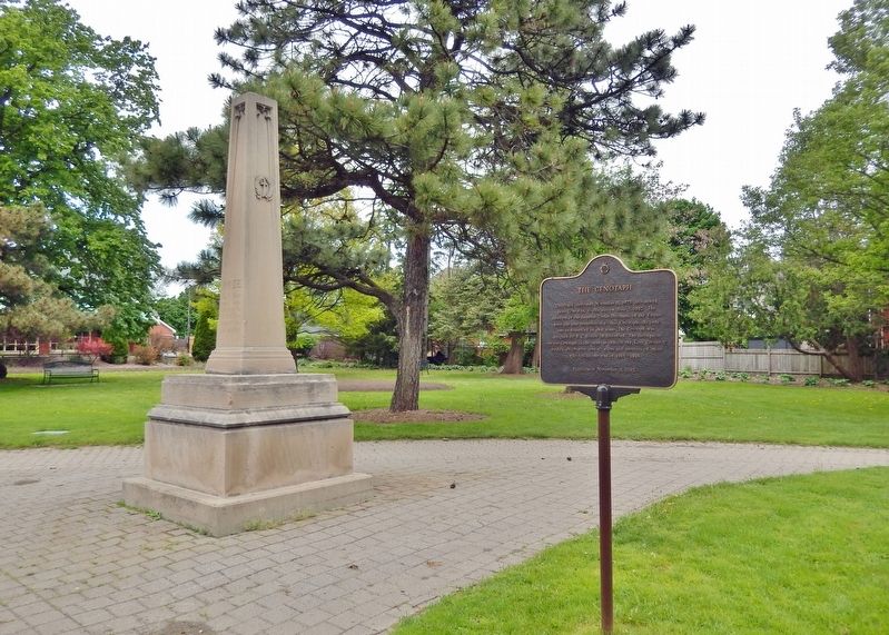
The Cenotaph Marker
| On Brant Avenue at Scarfe Avenue, on the right when traveling north on Brant Avenue. |
| On Wellington Street just east of George Street, on the left when traveling east. |
| On Tutela Heights Road, 0.8 kilometers east of Mount Pleasant Road, on the left when traveling east. |
| On Mohawk Street, on the right when traveling west. |
| On Fordview Court, on the right. |
| Near Mohawk Street close to Morrison Road, on the left. |
| Near Darling Street just west of George Street, on the right when traveling west. |
| On West Street just north of Wellington Street, on the right when traveling north. |
| Near Myrtleville Drive, 0.3 kilometers west of Balmoral Drive, on the right when traveling west. |
| Near George Street just north of Wellington Street, on the right when traveling north. |
| On Saint Paul Avenue at Palmerston Avenue, on the right when traveling south on Saint Paul Avenue. |
| On Oakland Road (County Route 4) at King Street South (County Route 24), on the right when traveling west on Oakland Road. |
| Near County Highway 54 just east of Chiefswood Road, on the right when traveling east. |
| On 4th Line close to Chiefswood Road, on the left when traveling west. |
| Near County Highway 54 just east of Chiefswood Road, on the right when traveling east. |
| Near County Highway 54 just east of Chiefswood Road, on the right when traveling east. |
| Near 4th Line close to Chiefswood Road, on the left when traveling west. |
| Near 4th Line close to Chiefswood Road, on the left when traveling west. |
| On 4th Line close to Chiefswood Road, on the left when traveling west. |
| Near Fourth Line Road at Chiefswood Road, on the left when traveling east. |
| On Simcoe Street at Talbot Street, in the median on Simcoe Street. |
| On Oakland Road (County Road 4) just east of Simcoe Street (County Road 16), on the right when traveling east. |
| On Blue Lake Road (County Road 35) 0.6 kilometers west of Brant Road (Provincial Highway 24), on the right when traveling west. |
| On Blue Lake Road (County Road 35) 0.6 kilometers west of Brant Road (Provincial Highway 24), on the right when traveling west. |
| On Blue Lake Road (County Road 35) 0.7 kilometers west of Brant Road (Provincial Highway 24), on the right when traveling west. |
| On Beverly Street East (Nixon Way) (County Highway 5) 0.2 kilometers east of Tolhurst Avenue (Reid Street), on the right when traveling east. |
| On Main Street South (County Road 13) at High Street, on the right when traveling north on Main Street South. |
| On Main Street South (County Road 13) at High Street, on the right when traveling north on Main Street South. |
| On Cedar Trail at Lighthouse Road, on the right when traveling south on Cedar Trail. |
| On Water Street at Goldie Street (Provincial Highway 11), on the right when traveling north on Water Street. |
| On Goldie Street (Provincial Highway 11) at Queen Street South, on the right when traveling west on Goldie Street. |
| On Perth Street just west of Huntley Road, on the right when traveling west. |
| On McBean Street at Strachan Street, on the right when traveling south on McBean Street. |
| On Perth Street just west of Huntley Road, on the right when traveling west. |
| On McBean Street just south of Martin Street, on the left when traveling south. |
| On Perth Street at McBean Street, on the right when traveling east on Perth Street. |
| On Riverview Line just west of Bloomfield Road, on the left when traveling east. |
| Near William Street North at Murray Street, on the left when traveling north. |
| On River Line (County Route 39) just east of Communication Road (Ontario Highway 40), on the left when traveling east. |
| Near William Street North at Murray Street, on the left when traveling north. |
| Near William Street North just north of Colborne Street (County Route 39), on the left when traveling north. |
| Near William Street North at Murray Street, on the left when traveling north. |
| On Riverview Line (County Route 36) 2 kilometers west of Bloomfield Road, on the left when traveling east. |
| On King Street East just east of Prince Street South, on the left when traveling east. |
| On Stanley Avenue at 7th Street, on the left when traveling east on Stanley Avenue. |
| On Riverview Line (County Route 36) 2 kilometers west of Bloomfield Road, on the left when traveling east. |
| On Riverview Line (County Route 36) close to County Route 36, on the left when traveling east. |
| Near William Street North at Murray Street, on the left when traveling north. |
| Near William Street North at Murray Street, on the left when traveling north. |
| Near William Street North at Murray Street, on the left when traveling north. |
| On King Street East just east of Prince Street South, on the left when traveling east. |
| Near William Street North just west of Murray Street, on the left when traveling north. |
| On River Line (Route 39) just east of Communication Road (Ontario Highway 40), on the left when traveling east. |
| Near Uncle Tom's Road (County Route 40) close to Park Street, on the right when traveling north. |
| Near Uncle Tom's Road close to Park Street, on the right when traveling north. |
| On Uncle Tom's Road at Park Street, on the right when traveling north on Uncle Tom's Road. |
| Near Uncle Tom's Road (County Route 40) close to Park Street, on the right when traveling west. |
| Near Uncle Tom's Road close to Park Street, on the right when traveling north. |
| On Uncle Tom's Road at Park Street, on the right when traveling west on Uncle Tom's Road. |
| On Main Street at St. George Street, on the left when traveling east on Main Street. |
| On Gardiner Avenue at Lakeshore Road, on the left when traveling east on Gardiner Avenue. |
| Near Longwoods Road (Provincial Highway 2) 4.2 kilometers east of Victoria Road (Provincial Highway 21), on the right when traveling east. |
| On Longwoods Road (County Route 2), on the right when traveling east. |
| On Longwoods Road (Provincial Highway 2) east of Victoria Road (Provincial Highway 21), on the right when traveling east. |
| On Longwoods Road south of County Highway 18, on the right when traveling east. |
| Near Longwoods Road (Provincial Highway 2) 4.2 kilometers east of Victoria Road (Provincial Highway 21), on the right when traveling east. |
| Near Longwoods Road (Provincial Highway 2) 4.2 kilometers east of Victoria Road (Provincial Highway 21), on the right when traveling east. |
| Near Longwoods Road (Provincial Highway 2) 4.2 kilometers east of Victoria Road (Provincial Highway 21), on the right when traveling east. |
| Near Longwoods Road (Provincial Highway 2) 4.2 kilometers east of Victoria Road (Provincial Highway 21), on the right when traveling east. |
| Near Longwoods Road (Provincial Highway 2) 4.2 kilometers east of Victoria Road (Provincial Highway 21), on the right when traveling east. |
| Near Longwoods Road (Provincial Highway 2) 4.2 kilometers east of Victoria Road (Provincial Highway 21), on the right when traveling east. |
| Near Longwoods Road (Provincial Highway 2) 4.2 kilometers east of Victoria Road (Provincial Highway 21), on the right when traveling east. |
| On Longwoods Road (Provincial Highway 2) 4.2 kilometers east of Victoria Road (Provincial Highway 21), on the right when traveling east. |
| Near Longwoods Road (Provincial Highway 2) 4.2 kilometers east of Victoria Road (Provincial Highway 21), on the right when traveling east. |
| On Longwoods Road (Provincial Highway 2) east of Victoria Road (Provincial Highway 21), on the right when traveling east. |
| Near Longwoods Road (Provincial Highway 2) 4.2 kilometers east of Victoria Road (Provincial Highway 21), on the right when traveling east. |
| Near Longwoods Road, 4.2 kilometers east of Victoria Road, on the right when traveling east. |
| On Railway Street, 0.1 kilometers east of 7th Avenue South, on the right when traveling east. |
| On Trans-Canada Highway (Provincial Highway 11) at Beadman Road (Zucks Road), on the right when traveling west on Trans-Canada Highway. |
| On Railway Street, 0.1 kilometers east of 7th Avenue South, on the right when traveling east. |
| On Frederick House Lake Road, 1.6 kilometers east of Connaught Road, on the right when traveling east. |
| On Anson Drive at Devonshire Avenue, on the right when traveling west on Anson Drive. |
| On Cambridge Avenue just south of Fyfe Street, on the right when traveling south. |
| On Anson Drive at Essex Avenue, on the right when traveling west on Anson Drive. |
| On Cambridge Avenue at Synagogue Avenue, on the left when traveling north on Cambridge Avenue. |
| On Park Street just west of Cambridge Avenue, on the left when traveling west. |
| On Anson Drive just west of Cambridge Avenue, on the right when traveling west. |
| On Trans-Canada Highway (Provincial Highway 11) 1 kilometer south of Provincial Highway 67, on the left when traveling south. |
| Near Railway Street just west of 4th Avenue (Provincial Highway 101), on the left when traveling west. |
| Near Fourth Avenue (Provincial Highway 101) just north of 2nd Street, on the left when traveling north. |
| Near Railway Street just west of 4th Avenue (Provincial Highway 101), on the left when traveling west. |
| Near Railway Street just west of 4th Avenue (Provincial Highway 101), on the left when traveling west. |
| On King Street (Provincial Highway 101) at Bellemare Street, on the right when traveling west on King Street. |
| On Main Street at Bloor Avenue, on the left when traveling south on Main Street. |
| Near Bloor Avenue, 0.2 kilometers east of Crawford Street. |
| On Bloor Avenue at Main Street, on the right when traveling west on Bloor Avenue. |
| On Algonquin Boulevard East (Provincial Highway 101) just east of Brunette Road, on the right when traveling east. |
| On Riverside Drive (Algonquin Boulevard West) (Provincial Highway 101) 0.2 kilometers east of Craig Street, on the left when traveling east. |
| Near 2nd Avenue at Brunette Road, on the right when traveling south. |
| On 3rd Avenue just west of Spruce Street South, on the left when traveling east. |
2102 entries matched your criteria. Entries 101 through 200 are listed above.
⊲ Previous 100 —
Next 100 ⊳