Near Old Post Road, 0.7 miles south of State Route 169.
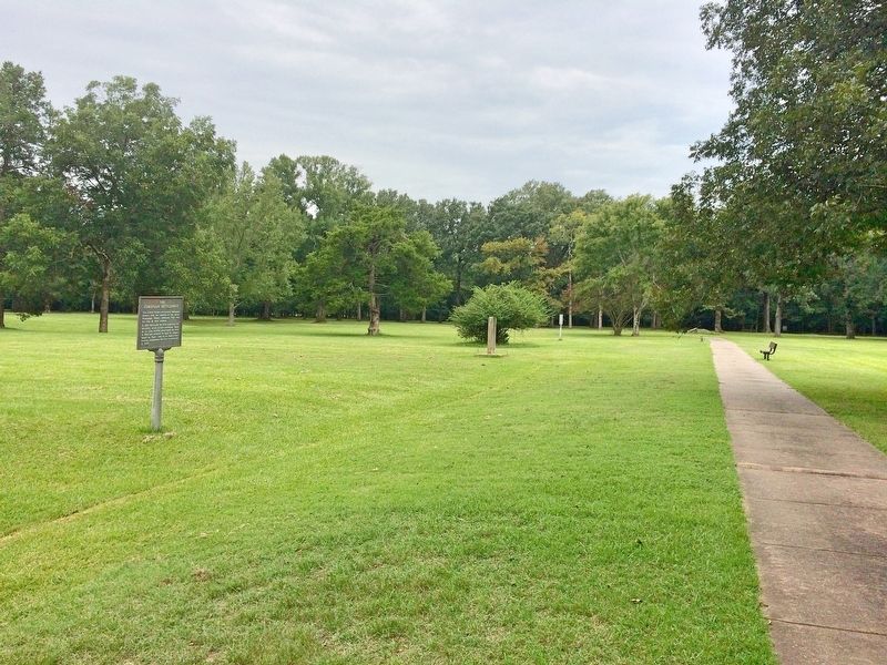
This Stone Was Taken
from
Ruins of Old Bank, built
at
Arkansas Post, 1839.
Arkansas Post State Park.
Created by Act of Legislature 1929.
Introduced by Ballard Deane,
Representative, Arkansas County.
Act . . . — — Map (db m108550) HM
On Arkansas Route 153, on the right when traveling north.
Named for resident William Finley Crockett, son of frontiersman Davy Crockett, this community was once a flourishing river port during the second half of the 19th century and into the early years of the 20th century. Steamboats loaded with cotton, . . . — — Map (db m201389) HM
On Broadway Avenue at Main Street, on the right when traveling east on Broadway Avenue.
J. Deane and Son was a hardware store that
served this area beginning in 1890. During the
steamboat era, St. Charles was a thriving river
boat community and this was its largest retail
outlet.
Founded by Joe Deane, who arrived here . . . — — Map (db m108563) HM
On Cedar Crest Drive at Cunningham Drive, on the right when traveling west on Cedar Crest Drive.
This native stone tank was built in 1927 by the Linebarger brothers, under the supervision of Willard Braithwaite, to store water for summer cottages on the west side of Lake Bella Vista and later the Sunset Hotel. From 1927 to 1952, water from the . . . — — Map (db m224956) HM
Following the sneak attack on Pearl Harbor on December 7, 1941, the massive American production might was mobilized. After that attack the production of most non-essential consumer goods was halted or curtailed, and manufacturing facilities were . . . — — Map (db m92187) HM
On Central Avenue (State Highway 72) near Main Street, on the right when traveling west.
Benton County Hardware, circa 1893, W.J. Doke proprietor. First Motor Co. and first gas station in alley beside store. Recently housed Bentonville Furniture. — — Map (db m54310) HM
Near South Walton Boulevard (Business U.S. 71) 0.1 miles north of Southwest I Street, on the left when traveling north.
Col. Samuel W. Peel House
Built 1876
has been placed on the
National Register
of Historic Places
by the United States
Department of the Interior
— — Map (db m167937) HM
On West Central Avenue, on the left when traveling north.
Peoples Bank circa 1887. Robbed in 1893 by Henry Starr and his gang. Bullet holes can be seen in the building across the street — — Map (db m236882) HM
On North Main Street at East Central Avenue (State Highway 72), on the right when traveling north on North Main Street.
The Osage Nation first used the area now known as Bentonville for their hunting grounds. The Osage would leave their settlements to hunt in present day Benton County for months at a time before returning to their families. Settlers first . . . — — Map (db m237837) HM
On 4th Avenue Southeast just south of Atlanta Street Southeast (State Highway 72), on the right when traveling south.
The Arkansas & Oklahoma Railroad, owned by John Bayless and William Felker, was the train route west from Bentonville to Gravette from 1898 to 1900. Besides transporting passengers, this route played a major role in the growth of the Ozark fruit . . . — — Map (db m167938) HM
On Monroe Avenue east of Lincoln Street, on the left when traveling east.
January 1936, Tom Farish & Joe Steele started building a canning factory using a lot of donated labor. The first run of green beans was June 26, 1936, tomatoes July 22, 1936, followed by spinach and other products later on.
After Tom Farish . . . — — Map (db m93283) HM
On Jackson Street south of McClure Avenue (County Road 923), on the right when traveling south.
This evaporator dried apples over wooden racks with wood fired furnace heat. After drying, the peeled, sliced apples were sprinkled with powdered sulphur as a preservative. They were shipped out in big barrels by railroad cars. This work was . . . — — Map (db m93259) HM
On McClure Avenue (County Road 923) at Jackson Street, on the right when traveling east on McClure Avenue.
In 1881 J. W. Phillips owned and operated an evaporator (fruit dryer) here. Later it was operated by Mr. Adams.
Hundreds of bushels of apples were peeled, sliced, dried on wooden racks and sprinkled with sulphur as a preservative. Wood-fired . . . — — Map (db m224837) HM
On Jackson Street at Johnson Avenue, on the right when traveling north on Jackson Street.
John W. Looney built the IOOF/Masonic Lodge building here in 1913 after the wooden store burned. The Masonic Lodge was upstairs. The Post Office was in one end downstairs.
Looney sold groceries, feed, and general merchandise at this store. He . . . — — Map (db m224842) HM
On Jackson Place at McClure Avenue, on the left when traveling north on Jackson Place.
The original Lowell Garage, owned by Thurman Moody, was located on the corner of what is now Lincoln Street and McClure Avenue. The old 71 Highway used to run along Lincoln Street so it was right on the highway, when the new Highway 71 was located . . . — — Map (db m224826) HM
On Jackson Street south of McClure Avenue (County Road 923), on the left when traveling south.
Humphrey Barr, brother of Mrs. L. P. Davis, was an early banker. We know Henry Neal was the banker in 1918. He loaned Elza Tucker's mother $75 to buy a family sewing machine. He charged 10% interest and had a loan limit of $100. Elza has the . . . — — Map (db m93279) HM
On Jackson Street south of McClure Avenue (County Road 923), on the right when traveling south.
The St. Louis & San Francisco Railroad was established
in 1881. Lowell was a village at that time. The 1889 Goodspeed's History of Benton County says greens, fruits, poultry, timber and railroad ties shipped extensively from the depot. The . . . — — Map (db m93263) HM
On Walnut Street (State Highway 12) at 2nd Street (State Highway 12), on the right when traveling west on Walnut Street.
The American National Bank built a new building on this corner in 1962. Prior to that year, it was located at 114 S. First Street and was the only bank in Rogers from 1931 until 1956. The bank was under the leadership of T.E. Harris, and his . . . — — Map (db m93332) HM
On South 1st Street south of West Walnut Street, on the right when traveling south.
114 South First Street
A.O. Clarke, Architect
Built 1905-1907
The Bank of Rogers building opened in 1907. By 1918, the building was home to the Farmers State Bank. In 1937, the American National Bank moved to this location, followed by the . . . — — Map (db m224882) HM
On 2nd Street (State Highway 12) at Walnut Street (State Highway 12), on the right when traveling south on 2nd Street.
Charles Juhre built this building in 1894 for the Rogers Grocery Company. In 1900, the building was occupied by the J.W. Ford Grocery and Feed Store. In 1918, McGill's Drug Store was here and then, in 1925, it became The Corner Drug Store, which . . . — — Map (db m93335) HM
On State Highway 12, 0.1 miles west of Van Winkle Place Road, on the left when traveling west.
Peter Van Winkle’s saw mill cut lumber for Confederate soldiers’ winter quarters at Cross Hollow and Oxford Bend in early 1862. Gen. Earl Van Dorn’s Confederates used the mill to grind corn after their March 1862 defeat at Pea Ridge, and wounded men . . . — — Map (db m90738) HM
On 2nd Street south of Walnut Street (Arkansas Highway 12), on the right when traveling south.
The Rogers Victory Theater
Opened Monday, December 5, 1927, to a packed crowd of 750.
First Production: "American Beauty"
Notable Performers Over the Years:
Will Rogers, Conway Twitty
Designed by A.O. Clarke
Built by John Myler
It . . . — — Map (db m90740) HM
On War Eagle Road (County Route 98) at Bettis Hill Road (County Route 1059), on the left when traveling west on War Eagle Road.
In 1832, Sylvanus Blackburn left Tennessee with a wagon and four oxen, and came to the War Eagle River valley in Arkansas. He spent the winter building a log home and clearing the land of his homestead. He brought his wife from Tennessee the next . . . — — Map (db m50367) HM
On War Eagle Road, on the right when traveling east.
The Ozark Arts and Crafts Fair was founded on War Eagle Mills Farm by Lester and Blanche Elliott and friends in October 1954 for the purpose of giving recognition to Ozark artists and craftsmen who work with their hands and hearts to preserve the . . . — — Map (db m52066) HM
On North Willow Street north of West Stepenson Avenue, on the left when traveling north.
This building, made up of two parts, has had a variety
of businesses including Capitol Café (the owners lived
upstairs), Oklahoma Tire, Bee Discount, Rowlands
Store, Fashion Lane and Unlimited Outlet. It is now
Beautiful You and Harness Boots . . . — — Map (db m225285) HM
On West Ridge Avenue west of North Main Street (Business U.S. 65), on the left when traveling west.
Built in the early 1930s by Phillips Petroleum, it was the city's first full-service garage. West of the gas station, it was brick with a wood-framed vaulted ceiling. It was leased to "Hoot" Gipson who operated an auto repair shop and 24-hour . . . — — Map (db m141852) HM
On West Ridge Avenue at North Main Street (Business U.S. 65), on the left when traveling west on West Ridge Avenue.
One of the city's earliest gas stations, built in 1927 by W.H. Lewis, it was purchased in 1929 by Independent Oil (became Phillips 66). They remodeled it from a frame structure with rubblestone veneer to Tudor Revival Style. Independent . . . — — Map (db m141850) HM
On North Walnut Street at East Rush Avenue, on the right when traveling north on North Walnut Street.
It is the former location of Hammerschmidt Lumber Co. and the First National Bank. It is now home of the Harrison flood of May 1961 mural (located inside) hand painted by Louis Fruend. This historic event commanded both national and international . . . — — Map (db m141869) HM
On North Main Street (Business U.S. 65) at West Ridge Avenue, on the left when traveling north on North Main Street.
The hotel opened on October 5, 1929 and was erected at a cost of $135,000. The Spanish Moorish design is built of brick, cement & steel making it virtually fire proof. Scaracenic Arches mark the front entries The Seville served for years as . . . — — Map (db m141854) HM
On North Willow Street south of West Rush Avenue, on the right when traveling south.
HH Jackson opened the Lyric in 1913 as the first indoor theatre in Harrison.
In 1918 Ed & Lulu (Garvin) Fitton purchased the business which featured
silent films until the “New Lyric” opened on the North side of the square
in 1929. At that time . . . — — Map (db m225284) HM
On West Rush Avenue west of North Main Street, on the right when traveling west.
It was originally operated as a silent movie theater located on the West side of the square and owned by DE & Lulu Fitton. In 1929 JW Bass built a state of the art theater for talkies, leasing it back to the Fittons as the "New" Lyric. A mix of . . . — — Map (db m141840) HM
On North Willow Street south of West Rush Avenue, on the right when traveling south.
It was built in 1929 and was occupied by Ward's for 50 years. Notice the attractive facade that was added featuring the Goddess of Liberty and adopted as the corporate symbol. Fraley's Furniture and Appliances currently occupies the building. In . . . — — Map (db m225269) HM
On North Willow Street south of West Rush Avenue, on the right when traveling south.
116 N. Willow, constructed in the early 20s, served
Harrison as a town store. ‘Spike’ and Katherine
Cavender, and son, Steve, operated The Well-Worth
Dime Store during the 50s. The store was destroyed
by the Crooked Creek flood on May 7, 1961. . . . — — Map (db m225272) HM
On West Stephenson Avenue at South Willow Street, on the left when traveling west on West Stephenson Avenue.
It was constructed shortly after 1900. Henry Starr, a well known outlaw & nephew of Belle Starr, attempted to rob the bank here in 1921. He was shot & killed by JW Myers, a former bank president, with a rifle hidden inside the vault. It was recorded . . . — — Map (db m141629) HM
On North Main Street (Business U.S. 65) at East Stephenson Avenue, on the right when traveling north on North Main Street.
It was constructed in 1912. It originally housed Walter's Dry Goods on
the ground level & Fountaine Hall located upstairs. The Hall hosted the
Masons and also a play house of questionable character. The building is
located on what is known as . . . — — Map (db m225287) HM
On Spring Street west of Hillside Avenue, on the right when traveling west.
The buildings, the bluffs, the spring and The Boulevard all make this a special place in Eureka Springs which has kept a peaceful beauty of earlier times.
The front of the McLaughlin Block has changed little since it was built in 1900 to . . . — — Map (db m80138) HM
On Main Street (State Highway 23) north of Armstrong, on the right when traveling north.
Bank of Eureka Springs was established in May, 1912, in the Klock and Clark Building at 75 Spring Street. In 1946 it was relocated to 40 Spring Street.
In 1966, the bank purchased the McGinnis property at 70 South Main Street. The old livery . . . — — Map (db m90573) HM
On Main Street (State Highway 23) south of Benton Street, on the left when traveling north.
Ellis Murphy established Murphy's Firestone Tire Service at this site about 1923. Called "Murphy the Tire Man", his services were frequently required to patch inner tubes and repair tires for hundred[s] of automobiles bringing tourists to Eureka . . . — — Map (db m90706) HM
On Main Street (State Highway 23) at Spring Street, on the right when traveling east on Main Street.
Richard H. James and Charles S. Beck built the three story brick and limestone Beck and James Building in the year 1888 to house a clothing and apparel store.
F. H. and Avarilla James and their family resided in the upper rooms and C. S. Beck . . . — — Map (db m79738) HM
On Spring Street, 0.2 miles north of Main Street (Arkansas Highway 23), on the left when traveling north.
Ornate brick and limestone structure built after Great Fire of 1888 for Citizen's Bank established 1887 by J.T. Waddell. The bank failed in 1907. First National Bank occupied building until 1931 when it failed due to Great Depression. Bank of Eureka . . . — — Map (db m79736) HM
On North Main Street (Arkansas Route 23) at Mill Hollow Road, on the right when traveling south on North Main Street.
North Main Street was a busy area dedicated to the basic necessities of life in early Eureka Springs: mills, wagon yards, feed stores, blacksmiths, stables, small groceries, rags and old iron with the occasional manufacturer of soap, brooms, yeast, . . . — — Map (db m225177) HM
On Spring Street at Pine Street, on the right when traveling north on Spring Street.
The neighborhood above the current First Baptist Church burned in the Great Fire of 1883, the first of four Great Fires which destroyed most of the town's early wooden structures. New commercial buildings were built of more fire-resistant . . . — — Map (db m131739) HM
On Spring Street at Mountain Street / Owen Street, on the left when traveling north on Spring Street.
Kentucky House Hotel established on this site 1880, Mrs. E.D. Andrews, proprietor. Building survived Great Fire 1888, disappeared by 1900. Street work 1915 created stone wall. Sharp’s Continental Oil Company gas station constructed 1928. Epley and . . . — — Map (db m79756) HM
On Flint Street at Steele Street, on the left when traveling south on Flint Street.
The site of this spring was outside the area included in the 1879 survey. Known as East Mountain, this area was crowded with wood structures by 1885. The spring, which flowed from a small cave lined with projections of onyx stone, was already . . . — — Map (db m80152) HM
On Spring Street at Pine Street, on the left when traveling east on Spring Street.
Sweet Spring Hotel
The Sweet Spring Hotel was established about 1887 at the corner of Pine Street and Spring, then known as Rice Street, with A.S. Capps as proprietor. The spacious three-story frame structure was painted white with dark . . . — — Map (db m80112) HM
On Main Street at Spring Street (State Highway 23), on the right when traveling north on Main Street.
Basin Bath House was established 1879 adjacent to Basin Spring by Dr. Alvah Jackson's son, Thomas. John S. Tibbs succeeded Jackson about 1880, operated bath house and Eureka Water Shipping Company. Building was destroyed by Great Fire of 1888, . . . — — Map (db m59969) HM
On Prospect Avenue, 0.1 miles north of Crescent Drive, on the right when traveling north.
May 20, 1886...
America's newest and most luxurious hotel built at a cost of $294,000.
It was two years ago that Powell Clayton and his associates chose the site of the new Crescent Hotel... twenty seven acres at the north end of West . . . — — Map (db m80116) HM
On Spring Street north of Main Street (Arkansas Highway 23), on the left when traveling north.
1884 - Cutter's Guide
The Eureka Springs of Arkansas
The hotels and boarding houses of Eureka Springs are numerous. The Perry House is the only real first-class hotel in the city; and we say this with no disparagement of the . . . — — Map (db m79733) HM
On Hillside Avenue south of North Main Street (Arkansas Route 23), on the left when traveling south.
The Round House stands on land first claimed by timber entrepreneur William Evans. By 1884, this land was subdivided into building lots as the new city of Eureka Springs boomed. William and Mahala Evans and their partners David and Precious Bays . . . — — Map (db m225161) HM
On Spring Street north of Main Street (Arkansas Highway 23), on the left when traveling north.
The Southern was built in the year 1880 adjacent to Basin Spring and some 25 feet above it on the hillside. L.M. Rainey of Missouri, its original owner, sold the hotel to W. E. Beatty in 1886, at which time it was acclaimed to be one of the city's . . . — — Map (db m59970) HM
On Spring Street, on the left when traveling north.
"It is sometimes called The Basin Springs, and is invariably the first resort for visitors. If there is any one in the city you desire to find, if no other way, go to the Basin Springs, seat yourself comfortable, and await his coming."
Prof. . . . — — Map (db m63300) HM
On North Main Street (Arkansas Route 23) at Magnetic Drive, on the right when traveling south on North Main Street.
“… After his cure was an established fact, the news soon spread, passing from tongue to tongue, and other afflicted mortals, hearing this good news in the wilderness, at once turned their eyes and footsteps in the direction of the . . . — — Map (db m225170) HM
On Spring Street at Center Street, on the right when traveling north on Spring Street.
The original Flat-Iron Building was constructed within sight of Basin Springs in the year 1880. It housed the town's first banking establishment and was the first structure made of brick among hundreds of wood buildings. The unusual three-sided, . . . — — Map (db m63302) HM
On Main Street (State Highway 23) 0.1 miles north of Magnetic Drive, on the left when traveling north.
First by horseback, wagons or on foot, invalids from all over this region flocked to Eureka Springs in 1879 to seek cures from the miraculous healing springs. But soon there were easier ways to arrive - stagecoaches, then trains. This laid a base . . . — — Map (db m80211) HM
On Grand Lake Loop (Arkansas Route 8) at Cariola Road when traveling south on Grand Lake Loop.
From the close of
the Civil War to
the beginning of the twentieth century, Cariola
Landing at Grand Lake was one of the largest
shipping points on the Mississippi River south
of Helena, Arkansas. Cotton from a large area
west and south of . . . — — Map (db m159402) HM
On East Lee Street, 0.5 miles south of South Main Street, on the right when traveling south.
Site of the Eudora settlement's first business district. After a ferry across Bayou Macon was established in 1846, Cariola Landing was accessible to Arkansas Communities to the west and Louisiana towns to the south. Merchants built stores along the . . . — — Map (db m158053) HM
Near State Highway 142, 0.9 miles east of Robert Mazzanti Road (Parish Road 505).
When Arkansas went to war in 1861, Lycurgus and Lydia Johnson and their family stayed with their home at Lakeport. By 1862, U.S. gunboats were common on the Mississippi River, and on Sept. 6, 1862, Confederate troops burned 158 bales of cotton at . . . — — Map (db m89797) HM
On Court Street south of Clay Street, on the right when traveling south.
Indians in primeval times, DeSoto in 1541, and pioneers in the 1800s and Confederates during the Civil War obtained salt from the creek and old well here. John Hemphill in 1812 opened one of the first manufactories in Arkansas, a salt refinery. — — Map (db m200778) HM
On Valley Street (U.S. 67) 0.1 miles south of Malvern Road, on the left when traveling south.
Confederate Manufacturing
Arkadelphia was a manufacturing center for Confederate Arkansas early in the Civil War. Gen. Thomas Hindman established a powder works and an arsenal in 1862, producing guns, cannon, bullets, shells, wagons and . . . — — Map (db m96557) HM
On County Road 11E at County Road 25, on the right when traveling west on County Road 11E.
One of the very oldest settlements of this county. Here in 1840–1850 settled the Bakers, Barnetts, Booths, Couches, Deeses, Dixons, Garretts, McDonalds, McWilliams, and other pioneer families Near this point Harvey Crowley Couch, Arkansas . . . — — Map (db m121240) HM
On Stouts Point, on the right when traveling east.
During the "roaring twenties" and the following decade of the Great Depression, this location on Petit Jean Mountain,
known as Stout's Point, saw changes that would influence the history of Petit Jean State Park.
In 1920, the Morrilton Chamber . . . — — Map (db m233668) HM
Following the stock market
crash of 1929, the United States
plunged into the depths of the
Great Depression. By 1932, the
unemployment rate was a
staggering 23%. Over 13 million
Americans had lost their jobs.
In a landslide victory, . . . — — Map (db m233673) HM
On Main Street at Fayetteville Road, on the right when traveling west on Main Street.
By a natural turn in the Arkansas River, Van Buren began at
the water's edge in 1818, straight down this hill. So, the first
muddy trail from the river came directly and in directly to this
spot - and became the hub of activity for Van Buren and . . . — — Map (db m243972) HM
On East Military Road at Cypress Drive, on the right when traveling east on East Military Road.
The Crittenden Bank & Trust, the town’s third bank, began operation January 9, 1909, replacing the Bank of Marion which had failed in 1908. Three other short-lived banks were housed in this building. The last banking operation here was that of . . . — — Map (db m116727) HM
On Cypress Drive, on the right when traveling north.
The original Delta was a land of enormous stands of oak, gum, cottonwood, hickory, pecan, elm, pine and cypress, some of which had stood for perhaps 500 years. Cypress and tupelo could be found in the bottoms, along with water-tolerant oaks, . . . — — Map (db m234414) HM
On Military Road east of Cypress Drive, on the right when traveling east.
Designed and built by Major Moore for Thomas Koser, the building was completed December of 1911. The building, which is constructed of native hardwoods, brick and concrete, had pressed tin ceilings and hardwood floors. The hotel had its own water . . . — — Map (db m116726) HM
On Court Street north of East Military Road, on the left when traveling north.
One of the city's biggest fires occurred
in the early 1900's when a series of
businesses in frame buildings on the
east side of Court Street were destroyed
by fire. Volunteer firefighters brought
water from Harvard yards by train to
help . . . — — Map (db m116545) HM
On East Broadway Avenue (U.S. 70) near Arkansas Route 38, on the left when traveling east.
In 1943, Morris Berger opened his legendary Plantation Inn
nightclub on this site in a former West Memphis gambling hall.
Billed as having the largest dance floor in the South, it became an
electrifying live-music destination for the region until . . . — — Map (db m221350) HM
Near State Highway 184, 0.6 miles north of U.S. 64, on the left when traveling north.
As northern timberlands were depleted,
timber buyers looked to the dense forests in
the south. In March 1902, S.W. Sterling, a
timber buyer for a firm in Grafton, Ohio,
was buying timber in Missouri when he
heard about the fine timber at . . . — — Map (db m221310) HM
Near State Highway 184, 0.6 miles north of U.S. 64, on the left when traveling north.
As the Northern Ohio Cooperage and Lumber
Company expanded, so did the need for housing and
services for its workers. Out of this came the Sawdust
Hill community. At its peak, over 60 structures,
including shotgun-style houses, a Baptist church, . . . — — Map (db m221309) HM
Near State Highway 184, 0.6 miles north of U.S. 64, on the left when traveling north.
Arkansas experienced a number of economic
advances in the first quarter of the 20th
Century. Extensive railroad building in the
late 1800s set the stage for economic growth.
Although the Delta's popular economic image
is King Cotton, . . . — — Map (db m221313) HM
On Front Street just north of Main Street, on the left when traveling north.
Named in honor of Simon’s Grocery & Bakery and the Simon family who owned and operated the store for over 52 years on Front Street. Brothers George and Fritz Simon, along with other family members and employees, helped make the store a special part . . . — — Map (db m237134) HM
Near U.S. 63 at Main Street (State Route 9), on the right when traveling north.
This building was constructed by the Arkansas-Missouri Power Company in 1927. The generator and equipment inside are all original, with the exception of the oil circuit breaker which was replaced in 1956. At a cost of $11,000, the generator was . . . — — Map (db m192092) HM
Near U.S. 63 at Main Street (State Route 9), on the right when traveling north.
The dam seen here was constructed in 1887 & 1888 for the Mammoth Spring Milling Company. Each stone was hand-quarried and fit into place using no mechanical equipment. The concrete structure, to your left on the far side of the dam, is all that . . . — — Map (db m192074) HM
Near U.S. 63 at Main Street (State Route 9), on the right when traveling north.
How has the spring helped the development of Mammoth Spring? The constant flow of water provided a reliable source of power as early as 1835, when a grist mill was located on the banks of the river. As the city flourished, the dam was . . . — — Map (db m192165) HM
On Central Avenue (Arkansas Route 7) at Fountain Street, on the right when traveling north on Central Avenue.
Today's Arlington Lawn gets its name from the fact that the first two versions of the luxury hotel you see across Fountain Street to the north were located here on government property. The first, a 150-room wooden structure completed in 1875, was . . . — — Map (db m211040) HM
Near Central Avenue (Arkansas Route 7), on the right when traveling south.
Hot Springs was truly
“The American Spa” during the 1920s,
1930s and early 1940s. The popular
slogan “We Bathe the World” was
indeed, appropriate. The bathing
industry reached its peak in 1946,
giving over one million baths. — — Map (db m211195) HM
On Central Avenue (State Highway 7), on the right when traveling south.
Constructed 1891 in as dry goods and grocery store until 1915. Utah Apts above and restaurant below. Became the Apple Apts and Dixie Coffee Shop in 1840's. Recently was Magnolia Gift and Night Train Lounge. Remodeled apartments 1992.
Wheatley . . . — — Map (db m102704) HM
On Central Avenue (State Highway 7), on the right when traveling south.
Constructed in 1891 as a clothing store by Simon Meyer, one of the most successful merchants in the late 1890's. In 1923 Rosa Meyer opened a dry goods store and later the Walkowitz General Store. Most recently the Oyster Bar restaurant.
Wheatly . . . — — Map (db m102708) HM
The buildings along Bathhouse Row are the latest stage in a succession of bathhouses. In the 1830s Hot Springs’ earliest facilities were makeshift shelters perched over individual springs. Later, elaborate Victorian bathhouses flourished along . . . — — Map (db m61774) HM
On Central Avenue (Arkansas Route 7) south of Fountain Street, on the left when traveling south.
A stroll along Bathhouse Row evokes the Golden Age of Bathing, when “taking the waters” was a fashionable form of recreation. The present structures date from 1911 to 1939. Though the same waters were piped to all the bathhouses, the owners competed . . . — — Map (db m211036) HM
On Central Avenue (Arkansas Route 7) south of Bath, on the right when traveling south.
The health benefits of “taking the baths” were
a primary reason for baseball coming to Hot
Springs. The players tended to drink heavily,
and believed the hot bath regimen could “boil
out” the impurities in their system.
The Buckstaff, still . . . — — Map (db m211193) HM
224 entries matched your criteria. The first 100 are listed above. Next 100 ⊳